Category:Gunnislake
Ir a la navegación
Ir a la búsqueda
Localidad inglesa  | |||||
| Cargar multimedia | |||||
| Instancia de | |||||
|---|---|---|---|---|---|
| Ubicación | Calstock, Cornwall, Cornualles, Sudoeste de Inglaterra, Inglaterra | ||||
 | |||||
English: Gunnislake is one of the first villages in Cornwall, England, United Kingdom after crossing the River Tamar from Devon. Sprawled over the picturesque steep sides of the Tamar Valley, the village has a rich history in copper & tin mining.
Subcategorías
Esta categoría contiene las siguientes 6 subcategorías, de un total de 6.
G
- Gunnislake New Bridge (4 F)
- Gunnislake railway station (17 F)
M
- Minerals of Gunnislake Area (5 F)
O
- Old Gunnislake Mine (5 F)
S
Archivos multimedia en la categoría «Gunnislake»
Los siguientes 26 archivos pertenecen a esta categoría, de un total de 26.
-

-
 A390 in Gunnislake - geograph.org.uk - 5038991.jpg 640 × 426; 83 kB
-
 A390 in Gunnislake - geograph.org.uk - 5038993.jpg 640 × 426; 70 kB
-
 A390 outside Gunnislake Station - geograph.org.uk - 5032020.jpg 640 × 426; 84 kB
-
 Barn in Gunnislake - geograph.org.uk - 5034730.jpg 640 × 426; 83 kB
-
 Gunnislake Primary School - geograph.org.uk - 1383184.jpg 640 × 480; 66 kB
-
 Gunnislake, Weir - geograph.org.uk - 1211325.jpg 640 × 480; 188 kB
-
 North Dimson - geograph-4567199.jpg 1920 × 1411; 622 kB
-
 Paddle Steamer "Alexandra" Gunnislake.jpg 1572 × 977; 157 kB
-
 Public Hall, Gunnislake - geograph.org.uk - 1383102.jpg 640 × 480; 75 kB
-
 River Tamar from New Bridge, Gunnislake - geograph.org.uk - 196284.jpg 480 × 640; 108 kB
-
 Sculpture of a miner, Gunnislake - geograph.org.uk - 1383153.jpg 640 × 480; 68 kB
-
 Sylvia's Meadow - geograph.org.uk - 34657.jpg 640 × 480; 108 kB
-
 The Rising Sun Inn - geograph.org.uk - 677785.jpg 640 × 480; 89 kB
-
 The Rising Sun Inn, Hatches Green - geograph.org.uk - 1383064.jpg 640 × 480; 107 kB
-
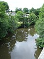
 The River Tamar - geograph.org.uk - 32092.jpg 640 × 480; 139 kB
-
 View to Gunnislake from Devon Great Consols (5015).jpg 4288 × 2848; 6,24 MB
-

-
 Chilsworthy - geograph.org.uk - 32069.jpg 640 × 480; 95 kB
-
 Containers on the Hillside - geograph.org.uk - 317701.jpg 640 × 427; 84 kB
-
 Down through Clitters Woods - geograph.org.uk - 317007.jpg 480 × 640; 155 kB
-
 Farmland above Gunnislake village - geograph.org.uk - 32063.jpg 640 × 480; 85 kB
-
 Gunnislake Clitters Mine - geograph.org.uk - 32078.jpg 640 × 480; 123 kB
-
 Gunnislake village centre - geograph.org.uk - 32097.jpg 640 × 480; 78 kB
-
 Ribbon Housing - geograph.org.uk - 317714.jpg 640 × 426; 84 kB
-
 Ruined Engine House - geograph.org.uk - 317008.jpg 640 × 480; 110 kB


.jpg)


