Category:Gunnison River
Zur Navigation springen
Zur Suche springen
Nebenfluss des Colorado River   | |||||
| Medium hochladen | |||||
| Ist ein(e) | |||||
|---|---|---|---|---|---|
| Benannt nach | |||||
| Ort |
| ||||
| Länge |
| ||||
| Höhe über dem Meeresspiegel |
| ||||
| Quelle des Wasserlaufs | |||||
| Mündet in | |||||
| Einzugsgebiet |
| ||||
| Anrainerstaat | |||||
| Nebenfluss |
| ||||
| See im Verlauf | |||||
 | |||||
English: Media related to the Gunnison River, a tributary of the Colorado River that is located in western Colorado, United States.
Unterkategorien
Es werden 21 von insgesamt 21 Unterkategorien in dieser Kategorie angezeigt:
In Klammern die Anzahl der enthaltenen Kategorien (K), Seiten (S), Dateien (D)
C
D
- Delta Bridge (Delta, Colorado) (19 D)
E
G
- Gunnison River Bridge I (2 D)
- Gunnison River Bridge II (3 D)
L
M
- Middle Bridge (Colorado) (7 D)
- Morrow Point Boat Tour (30 D)
N
O
- Orchard City, Colorado (6 D)
- Orchard Mesa, Colorado (3 D)
P
- Pine Creek Trail (12 D)
R
- Roubideau Bridge (17 D)
S
- Saxton Bridge (Delta, Colorado) (22 D)
T
U
Medien in der Kategorie „Gunnison River“
Folgende 85 Dateien sind in dieser Kategorie, von 85 insgesamt.
-
 Argenta Falls, Lake Fork, Gunnison River. Hinsdale County, Colorado. - NARA - 517113.jpg 1.833 × 3.000; 1,78 MB
-
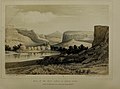
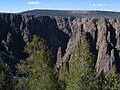
 The Black Canyon of the Gunnison, Colorado (NYPL b12647398-75716).tiff 2.360 × 1.572; 10,62 MB
-
 Black Canyon and Gunnison River 2008.jpg 3.456 × 2.013; 7,12 MB
-
 Black Canyon of the Gunnison 01.jpg 3.456 × 5.184; 5,32 MB
-
 Black Canyon of the Gunnison 03.jpg 5.184 × 3.456; 3,73 MB
-
 Black Canyon of the Gunnison National Park, Colorado (28485906347).jpg 3.000 × 4.000; 2,7 MB
-
 Black Canyon of the Gunnison National Park, Colorado (29485121458).jpg 3.000 × 4.000; 2,84 MB
-
 Black Canyon of the Gunnison National Park, Colorado (29485122118).jpg 4.000 × 3.000; 10,41 MB
-
 Black Canyon of the Gunnison National Park, Colorado (29485122438).jpg 4.000 × 3.000; 12,26 MB
-
 Black Canyon of the Gunnison National Park, Colorado (29485122848).jpg 4.000 × 3.000; 13,04 MB
-
 Black Canyon of the Gunnison National Park, Colorado (41546339610).jpg 4.000 × 3.000; 11,49 MB
-
 Black Canyon of the Gunnison National Park, Colorado (43306493062).jpg 3.000 × 4.000; 2,77 MB
-
 Black Canyon of the Gunnison National Park, Colorado (43306542032).jpg 4.000 × 3.000; 13,56 MB
-
 Black Canyon of the Gunnison National Park, Colorado (43306542552).jpg 4.000 × 3.000; 10,88 MB
-
 BlackCanyon.JPG 4.320 × 3.240; 2,28 MB
-
 Confluence of the Gunnison and Colorado rivers.JPG 5.792 × 3.849; 16,26 MB
-
 Confluence of the Gunnison and Uncompahgre rivers.JPG 5.786 × 3.651; 14,12 MB
-
 Confluence of the North Fork Gunnison River and the Gunnison River.JPG 5.695 × 3.662; 13,6 MB
-
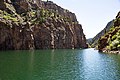
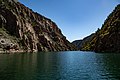
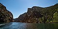
 Curecanti National Recreation Area (00b704d2-2ecf-499d-9449-8e7e904a4946).jpg 4.032 × 3.024; 3,15 MB
-
 Curecanti National Recreation Area (211d8436-9e5f-468f-9cc2-c7689590b2a0).jpg 5.760 × 3.840; 2,33 MB
-
 Curecanti National Recreation Area (3a32f121-ef70-44ec-a337-7c3c94f1bc66).jpg 5.597 × 3.731; 2,32 MB
-
 Curecanti National Recreation Area (7284d0c1-da66-4b9b-9eed-e9a1b6799654).jpg 3.840 × 5.282; 2,4 MB
-
 Curecanti National Recreation Area (74397579-52ed-49f6-ace2-403cab2ea314).jpg 5.760 × 3.840; 2,92 MB
-
 Curecanti National Recreation Area (848e4523-04f9-487b-860f-fe17cc5c340d).jpg 3.840 × 5.127; 1,64 MB
-
 Curecanti National Recreation Area (860e1fe6-8677-4e42-8052-e56dd2d52916).jpg 5.760 × 1.883; 1,64 MB
-
 Curecanti National Recreation Area (9b32055d-fec7-40d5-9d7d-86ffc9bfc0fa).jpg 5.572 × 2.767; 2,28 MB
-
 Curecanti National Recreation Area (9cf141a3-48cd-4ab2-8a04-c677488cf8cf).jpg 5.640 × 3.760; 2,63 MB
-
 Curecanti National Recreation Area (9ec16113-7a33-44e9-8918-05baff9757a7).jpg 4.032 × 3.024; 2,04 MB
-
 Curecanti National Recreation Area (a74ece4e-3a72-4a0e-af6c-4c108bf7e401).jpg 5.760 × 3.840; 2,54 MB
-
 Curecanti National Recreation Area (a960abc1-2edc-4a7a-b7ef-17e5f90f577d).jpg 5.759 × 3.392; 4 MB
-
 Curecanti National Recreation Area (ab4427b0-0f66-4fd8-87ad-b29410e61683).jpg 5.703 × 3.802; 2,87 MB
-
 Curecanti National Recreation Area (ace4ef34-95e7-450b-8f03-0097c5cd8178).jpg 5.760 × 2.857; 1,98 MB
-
 Curecanti National Recreation Area (c45cb24f-7531-4b18-bdee-0e6018d42064).jpg 3.840 × 5.259; 2,99 MB
-
 Curecanti National Recreation Area (ce43c6b8-082a-4105-9e6d-58bab3f90d33).jpg 2.435 × 1.786; 427 KB
-
 Curecanti National Recreation Area (da346ba5-df07-4353-b405-278e41c7a3e1).jpg 5.760 × 3.840; 3,18 MB
-
 D&RGW 168 in 1904.jpg 452 × 640; 39 KB
-
 Dominguez-Escalante NCA (8930993249).jpg 5.616 × 3.744; 11,06 MB
-
 Dominguez-Escalante NCA (8931031355).jpg 5.616 × 3.744; 8,99 MB
-
 Dragon Point (3339ed1d-3857-41bb-bad1-ffda772a6dd3).jpg 5.760 × 3.326; 1,87 MB
-
 Dragon Point (36e8eb7a-ce2b-456b-9c1e-2b98d8b18f8f).jpg 5.619 × 2.192; 1,43 MB
-
 Fishing on the Gunnison River (5455399562).jpg 3.072 × 1.728; 4,88 MB
-
 Gunnison Beach Entrance Sign.jpg 2.048 × 1.536; 787 KB
-
 Gunnison Gorge Wilderness.jpg 410 × 276; 28 KB
-
 Gunnison Jet Formation Colorado (29032003440).jpg 3.404 × 2.356; 4,86 MB
-
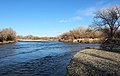
 Gunnison River (1) (5932697990).jpg 2.751 × 1.834; 2 MB
-
 Gunnison River (2) (5932698150).jpg 2.287 × 2.092; 1,86 MB
-

-

-

-
 Gunnison River Aerial.jpg 3.600 × 2.400; 4,29 MB
-
 Gunnison river basin map.png 1.684 × 1.416; 4,04 MB
-

-

-
 Gunnison River, Black Canyon, Colorado (28795235600).jpg 4.880 × 3.286; 15,28 MB
-
Gunnison.webm 14 s, 1.920 × 1.080; 12,51 MB
-
 GunnisonRiver from SunsetView.jpg 609 × 720; 46 KB
-
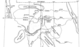
 Gunnisonrivermap.jpg 565 × 521; 426 KB
-
 GunnisonRvr.JPG 4.320 × 3.240; 2,37 MB
-
 Ken, South Rim, Black Canyon of the Gunnison National Park, Colorado (68128480).jpg 2.048 × 1.536; 1,4 MB
-
 Redlands Diversion Dam (51249650913).jpg 4.500 × 3.375; 8,61 MB
-
-
-
 River landscape with rocks and trees.jpg 4.608 × 3.456; 3,62 MB
-
 Rocky Mountain Views - Black Canyon.jpg 4.209 × 3.217; 1,79 MB
-
 Smith Fork.JPG 4.000 × 6.000; 17,03 MB
-
 South Rim, Black Canyon of the Gunnison National Park, Colorado (66825800).jpg 2.048 × 1.536; 1,82 MB
-
 South Rim, Black Canyon of the Gunnison National Park, Colorado (68128479).jpg 2.048 × 1.536; 2,77 MB
-
 South Rim, Black Canyon of the Gunnison National Park, Colorado (68128481).jpg 2.048 × 1.536; 1,56 MB
-
 South Rim, Black Canyon of the Gunnison National Park, Colorado (68128483).jpg 2.048 × 1.536; 1,85 MB
-
 South Rim, Black Canyon of the Gunnison National Park, Colorado (68128485).jpg 2.048 × 1.536; 2,39 MB
-
 South Rim, Black Canyon of the Gunnison National Park, Colorado (68132947).jpg 2.048 × 1.536; 2,05 MB
-
 South Rim, Black Canyon of the Gunnison National Park, Colorado (68132949).jpg 2.048 × 1.536; 1,98 MB
-
 South Rim, Black Canyon of the Gunnison National Park, Colorado (68132950).jpg 2.048 × 1.536; 1,72 MB
-
 Sunset offers spectacular views of the canyon. (69ce15ab-06f2-4154-979f-470143d93fa6).jpg 5.760 × 3.840; 2,31 MB
-
 The canyon at sunset offers spectacular views. (5fd31c6e-efcf-4220-942e-ee8abbf79e1a).jpg 5.759 × 1.913; 1,35 MB
-
 The canyon at sunset offers spectacular views. (a957a008-1144-4d4b-b2a3-e131c1e1810e).jpg 5.760 × 3.840; 2,52 MB
-
 The canyon at sunset offers spectacular views. (ca9bba03-6f24-4758-a3d7-c87a2e144399).jpg 5.574 × 3.678; 2,66 MB
-

-

-

-
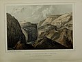
 Turning a river into the heart of a mountain and out the other side LOC 3608709982.jpg 2.048 × 2.981; 956 KB
-
 Uinta Basin map.png 976 × 561; 77 KB
-
 Under the turquoise sky of Colorado (1908) (14574249288).jpg 1.818 × 2.244; 787 KB
-

-
 Wpdms nasa topo gunnison river.jpg 300 × 300; 60 KB


.jpg)
.jpg)
.jpg)
.jpg)
.jpg)
.jpg)
.jpg)
.jpg)
.jpg)


.jpg)
.jpg)
.jpg)
.jpg)
.jpg)
.jpg)
.jpg)
.jpg)
.jpg)
.jpg)
.jpg)
.jpg)
.jpg)
.jpg)
.jpg)
.jpg)

.jpg)
.jpg)
.jpg)
.jpg)


.jpg)
_(5932697990).jpg)
_(5932698150).jpg)
_1_(19684583350).jpg)
_2_(19684576380).jpg)
_3_(19684551778).jpg)


.jpg)


.jpg)
.jpg)
_(14572977998).jpg)
_(14572983898).jpg)


.jpg)
.jpg)
.jpg)
.jpg)
.jpg)
.jpg)
.jpg)
.jpg)
.jpg)
.jpg)
.jpg)
.jpg)
.jpg)
.jpg)


_(14574249288).jpg)

.jpg)
.jpg)
.jpg)