Category:Guntramsdorf
Zur Navigation springen
Zur Suche springen
Marktgemeinde im Bezirk Mödling, Niederösterreich   | |||||
| Medium hochladen | |||||
| Ist ein(e) | |||||
|---|---|---|---|---|---|
| Ort | Bezirk Mödling, Niederösterreich, Österreich | ||||
| Einwohnerzahl |
| ||||
| Fläche |
| ||||
| Höhe über dem Meeresspiegel |
| ||||
| offizielle Website | |||||
 | |||||
Deutsch: Guntramsdorf
Unterkategorien
Es werden 33 von insgesamt 33 Unterkategorien in dieser Kategorie angezeigt:
In Klammern die Anzahl der enthaltenen Kategorien (K), Seiten (S), Dateien (D)
!
*
A
- Assmannmühlen, Guntramsdorf (3 D)
B
- Bahnhof Guntramsdorf-Thallern (11 D)
- BORG Guntramsdorf (3 D)
E
- Eichkogel (71 D)
F
G
- Guntramsdorfer Druckfabrik (5 D)
H
- Hauptstraße 59, Guntramsdorf (4 D)
- House numbers in Guntramsdorf (17 D)
I
K
- Kaiserbrücke (Guntramsdorf) (9 D)
- Kronprinz-Werke (5 D)
M
- Müllumladestation Mödling (3 D)
N
O
P
- Pestsäule Guntramsdorf (3 D)
- Pfarrkirche Guntramsdorf (8 D)
- Plaques in Guntramsdorf (8 D)
R
- Rathauszentrum Guntramsdorf (5 D)
- Rinketeich, Guntramsdorf (3 D)
S
T
Medien in der Kategorie „Guntramsdorf“
Folgende 79 Dateien sind in dieser Kategorie, von 79 insgesamt.
-
De-Guntramsdorf.ogg 2,1 s; 20 KB
-
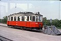 055R11240679 Guntramsdorf, Badner Bahn Strecke, Typ M 4081 24.06.1979.jpg 1.064 × 720; 151 KB
-
 20221105-bücherzelle-rathaus-viertel-öffentliche-bücherei-guntramsdorf.jpg 3.060 × 4.080; 7,44 MB
-
 5W.WasserwegDenkmal.JPG 2.560 × 1.440; 2,75 MB
-
 6W.WasserwegDenkmal.jpg 2.560 × 1.440; 2,64 MB
-
 A2 Knoten Guntramsdorf 1.JPG 3.534 × 2.651; 1,76 MB
-
 A2 Knoten Guntramsdorf 2.JPG 3.309 × 2.482; 1,58 MB
-
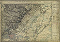 Aufnahmeblatt 4756-4d Baden, Gruntramsdorf.jpg 10.299 × 7.318; 62,95 MB
-
 AUT Guntramsdorf COA.jpg 274 × 314; 27 KB
-
 Baden in 1-25.000, Stand 1901 in 600 dpi.jpg 19.332 × 14.545; 94,98 MB
-
 Baden in 1-25.000, Stand 1901 kleine Datei.jpg 9.519 × 7.286; 18,91 MB
-
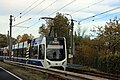 Badner Bahn-TW500 2574.jpg 6.960 × 4.640; 3,22 MB
-
 BMM - Römerstein 3.jpg 2.778 × 2.695; 5,09 MB
-
 Brequin 6 Mödling Neudorf Guntramsdorf.jpg 19.395 × 13.357; 69,38 MB
-
 CD-RJ als EC 73.jpg 4.393 × 2.969; 10,55 MB
-
 Christopherus, Hauptstraße 38, Guntramsdorf.jpg 2.188 × 4.040; 6,7 MB
-
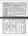 Fahrpläne Liesing Mödling Hinterbrühl Forts Sommer 1934.jpg 4.148 × 5.199; 15,1 MB
-
 Fahrpläne Mödling Laxenburg Guntramsdorf Gumpoldskirchen Winter 1937-38.jpg 3.693 × 4.575; 12,2 MB
-
 Frajta trajno en Guntramsdorf.JPG 4.539 × 2.762; 8,14 MB
-
 Gartendeko-Guntramsdorf 5501.JPG 5.184 × 3.456; 9,24 MB
-
 Grenzen Laxenburg Wr Neudorf im IZ Süd.jpg 626 × 766; 154 KB
-
 Guntramsdorf 0505.JPG 5.184 × 3.456; 7,56 MB
-
 Guntramsdorf 0548.JPG 3.456 × 5.184; 9,81 MB
-
 Guntramsdorf 0549.JPG 5.184 × 3.456; 8,04 MB
-
 Guntramsdorf 0553.JPG 5.184 × 3.456; 8,57 MB
-
 Guntramsdorf 6259.JPG 5.184 × 3.456; 7,36 MB
-
 Guntramsdorf 6265.JPG 5.184 × 3.456; 7,75 MB
-
 Guntramsdorf 6267.JPG 5.184 × 3.456; 5,91 MB
-
 Guntramsdorf 7273.jpg 3.456 × 5.184; 8,55 MB
-
 Guntramsdorf 8816.jpg 3.888 × 2.592; 925 KB
-
 Guntramsdorf 8837.jpg 2.592 × 3.888; 2,42 MB
-
 Guntramsdorf 8838.jpg 3.888 × 2.592; 2,18 MB
-
 Guntramsdorf 8844.jpg 3.888 × 2.592; 1,75 MB
-
 Guntramsdorf DHL 5044.JPG 5.184 × 3.456; 6,35 MB
-
 Guntramsdorf Hauptstraße Kanalbrücke Schild.jpg 1.700 × 2.280; 2,33 MB
-
 Guntramsdorf im Bezirk MD.PNG 645 × 623; 10 KB
-
 Guntramsdorf in MD.PNG 846 × 561; 22 KB
-
 Guntramsdorf Rathaus.jpg 2.592 × 1.944; 2,5 MB
-
 Guntramsdorf-Kanaldeckel 0172.jpg 4.214 × 4.214; 2,95 MB
-
 Guntramsdorf-Kanaldeckel 0550.JPG 5.184 × 3.456; 14,95 MB
-
 Guntramsdorf-Lagerhaus 2230.JPG 5.184 × 3.456; 6,33 MB
-
 Guntramsdorf-Musikschule 0504.JPG 5.184 × 3.456; 5,77 MB
-
 Guntramsdorf-Mühlbach 8479.JPG 3.456 × 5.184; 9,68 MB
-
 Guntramsdorf-Schule 0507.JPG 5.184 × 3.456; 7,82 MB
-
 Guntramsdorf-Schule 0537.JPG 5.184 × 3.456; 6,67 MB
-
 Guntramsdorf-Schule 0542.JPG 5.184 × 3.456; 7,79 MB
-
 Guntramsdorf-Schule 0543.JPG 5.184 × 3.456; 6,46 MB
-
 Guntramsdorf-Südbahn-L2087 2354.JPG 5.184 × 3.456; 2,24 MB
-
 Guntramsdorf-Südbahn-L2087 2355.JPG 5.184 × 3.456; 2,25 MB
-
 Guntramsdorf-Südbahn-L2087 2356.JPG 5.184 × 3.456; 1,94 MB
-
 Guntramsdorf-Südbahn-L2087 2357.JPG 5.184 × 3.456; 2,15 MB
-
 Guntramsdorf-Südbahn-L2087 2358.JPG 5.184 × 3.456; 5,54 MB
-
 Guntramsdorf-Südbahn-L2087 2359.JPG 5.184 × 3.456; 1,68 MB
-
 Guntramsdorf-Südbahn-L2087 2360.JPG 5.184 × 3.456; 2,35 MB
-
 Hauptstraße 65, Guntramsdorf (01).jpg 4.801 × 3.047; 6,96 MB
-
 Hauptstraße 65, Guntramsdorf (02).jpg 4.928 × 3.264; 7,79 MB
-
 Hauptstraße 65, Guntramsdorf (03).jpg 4.648 × 3.048; 6,6 MB
-
 Hauptstraße Guntramsdorf.jpg 4.730 × 3.096; 6,3 MB
-
 In The Vineyards (32275451).jpeg 2.048 × 1.280; 759 KB
-

-
 Landhotel Jagdhof, Guntramsdorf.jpg 4.437 × 3.064; 6,18 MB
-
 Map at guntramsdorf.png 400 × 240; 3 KB
-
 Orgelbau M. Walcker-Mayer 01, Guntramsdorf.jpg 4.746 × 2.651; 5,35 MB
-
 Orgelbau M. Walcker-Mayer 03, Guntramsdorf.jpg 3.883 × 2.432; 4,23 MB
-
 Philipp1.jpg 4.032 × 3.024; 8,1 MB
-
 Second-Hand-Botique.jpg 4.928 × 3.264; 5,76 MB
-
 Südautobahn-A2-Guntramsdorf 2229.JPG 5.184 × 3.456; 9,97 MB
-
 Südautobahn-A2-Guntramsdorf 2231.JPG 5.184 × 3.456; 6,7 MB
-
 Südautobahn-A2-Guntramsdorf 2232.JPG 5.184 × 3.456; 6,96 MB
-
 Südautobahn-A2-Guntramsdorf 2233.JPG 5.184 × 3.456; 7,61 MB
-
 Südautobahn-A2-Guntramsdorf 2234.JPG 5.184 × 3.456; 6,56 MB
-
 Südbahn-Mödling 5243.JPG 5.184 × 3.456; 8,03 MB
-
 Südbahn-Mödling 5248.JPG 5.184 × 3.456; 8,22 MB
-
 TO4025 VIE-ORY 2018 11.jpg 3.024 × 4.032; 2,8 MB
-
 Volucella zonaria 148490652.jpg 2.048 × 1.536; 371 KB
-
 Volucella zonaria 148490667.jpg 2.048 × 1.536; 331 KB
-
 Weinbau Ludwig Hofstädter, Hauptstraße 45, Guntramsdorf.jpg 4.735 × 2.998; 10,88 MB
-
 Zeitkarte.jpg 1.275 × 790; 255 KB
-
 ÖBB 1216 249 2176 Mö1997.jpg 5.184 × 3.456; 13,3 MB


.jpg)
.jpg)
.jpg)

.jpeg)


