Category:Gutsbezirk Münsingen
Vai alla navigazione
Vai alla ricerca
unincorporated area in Germany  | |||||
| Carica un file multimediale | |||||
| Istanza di |
| ||||
|---|---|---|---|---|---|
| Luogo | circondario di Reutlingen, Distretto governativo di Tubinga, Baden-Württemberg, Germania | ||||
| Popolazione |
| ||||
| Superficie |
| ||||
| Altezza sul mare |
| ||||
| Distinto da | |||||
 | |||||
Sottocategorie
Questa categoria contiene le 8 sottocategorie indicate di seguito, su un totale di 8.
File nella categoria "Gutsbezirk Münsingen"
Questa categoria contiene 107 file, indicati di seguito, su un totale di 107.
-
 Araschnia levana MichaD.jpg 3 504 × 2 332; 1,34 MB
-
 Backhaus in Breithülen.jpg 4 000 × 3 000; 2,46 MB
-
 Biosphärengebiet Schwäbische Alb - Schild.jpg 1 456 × 2 592; 811 KB
-
 BREITHÜLEN - GEMEINDE HEROLDSTATT - ALB-DONAU-KREIS - ORTSEINGANSSCHILD.JPG 4 000 × 2 250; 2,46 MB
-
 BREITHÜLEN - GEMEINDE HEROLDSTATT - ALB-DONAU-KREIS.jpg 4 000 × 2 250; 787 KB
-
 BREITHÜLEN - LEBENSGEFAHR IM EHEM. TRUPPENÜBUNGSPLATZ.JPG 4 000 × 2 250; 1,65 MB
-
 Breithülen Blechhallen.jpg 2 979 × 1 839; 3,15 MB
-
 Breithülen Gasthaus.jpg 3 008 × 2 000; 4,01 MB
-
 Breithülen im Biosphärengebiet Schwäbische Alb.jpg 2 000 × 3 008; 3,39 MB
-
 Breithülen Reiterhof.jpg 3 008 × 2 000; 4,09 MB
-
 Breithülen Remonte-Depot.jpg 3 008 × 2 000; 3,45 MB
-
 Breithülen, Eingang Remonte-Depot.jpg 3 008 × 2 000; 4,69 MB
-
 Breithülen.jpg 2 706 × 1 878; 3,55 MB
-
 BRIEFKASTEN DER DEUTSCHEN POST in BREITHÜLEN.JPG 4 000 × 2 250; 1,65 MB
-
 Bundeswehr 1982 (4063724361).jpg 1 024 × 683; 109 KB
-
 Distel - panoramio.jpg 1 342 × 1 007; 697 KB
-
 Disteln - panoramio.jpg 800 × 627; 605 KB
-
 Ehemalige Kommandantenvilla Remontedepot Breithülen.jpg 5 184 × 3 888; 6,34 MB
-
 FPK-WK-1-Muensingen-1.jpg 3 187 × 2 045; 8,49 MB
-
 FPK-WK-1-Muensingen-2.jpg 3 191 × 2 066; 8,87 MB
-
 Gasthaus Breithuelen.JPG 4 000 × 3 000; 1,97 MB
-
 GASTHAUS BREITHÜLEN III.JPG 4 000 × 2 250; 2,35 MB
-
 Grenzstein Gutsbezirk Muensingen.JPG 3 000 × 4 000; 2,16 MB
-
 Gruorn - panoramio.jpg 958 × 1 280; 629 KB
-
 Gruorn Kriegerdenkmal.JPG 933 × 700; 296 KB
-

-

-
 Gutsbezirk Münsingen Beobachtungsbunker.jpg 1 873 × 1 111; 1,15 MB
-
 Gutsbezirk Münsingen Kreuz.jpg 2 789 × 1 757; 3,47 MB
-
 Gutsbezirk Münsingen Wasserfässer.jpg 3 008 × 2 000; 3,68 MB
-
 Gutsbezirk Münsingen, Geführte Exkursion mit TrÜP-Guides.jpg 3 008 × 2 000; 2,84 MB
-
 Gutsbezirk Münsingen, Geführte Tour mit TrÜP-Guides.jpg 2 298 × 1 692; 2,62 MB
-
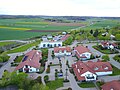 Heroldstatt Ortsmitte Blick nach Norden.jpg 4 000 × 3 000; 4,43 MB
-
 Heroldstatt Ortsmitte Blick nach Südosten.jpg 4 000 × 3 000; 4,45 MB
-
 Heroldstatt Sontheim Blick nach Norden.jpg 4 000 × 3 000; 4,57 MB
-
 Heroldstatt Sontheim Blick nach Süden.jpg 4 000 × 3 000; 4,99 MB
-
 Heroldstatt Sontheim Blick nach Westn.jpg 4 000 × 3 000; 4,35 MB
-

-

-

-

-

-

-

-

-

-

-

-

-

-

-
-

-

-

-

-

-

-

-

-

-

-

-

-

-

-
 Landappbw 242702 1818 Turm Falkenhausen Münsingen.jpg 960 × 1 280; 269 KB
-
 Landappbw 242706 1818 Turm Lenné Münsingen.jpg 960 × 1 280; 277 KB
-
 Landappbw 242707 1818 Turm Lindequist Münsingen.jpg 1 279 × 959; 184 KB
-
 Landappbw 242717 1820 Stephanus-Kirche Gruorn.jpg 1 279 × 959; 158 KB
-
 Landappbw 242718 1819 Schulhaus Gruorn.jpg 1 279 × 959; 161 KB
-
 Landappbw 357958 1818 Turm Falkenhausen Münsingen.jpg 1 279 × 959; 144 KB
-
 Landappbw 739502 1818 Sternenbergturm Münsingen.jpg 1 440 × 1 919; 351 KB
-
 Landappbw 739503 1822 Kalkofen Münsingen.jpg 1 440 × 1 919; 791 KB
-
 Lebensgefahr! - Gutsbezirk Muensingen.JPG 3 000 × 4 000; 1,59 MB
-
 Melanargia galathea top MichaD.jpg 3 392 × 2 264; 1,27 MB
-
 Muensinger Hardt.png 1 396 × 898; 74 KB
-
 Museumsbau - Altes Lager - panoramio.jpg 1 600 × 1 067; 1,13 MB
-
 Münsingen - panoramio.jpg 1 600 × 1 200; 1,81 MB
-
 Münsingen Hardt - Barriere durch Felsbrocken im ehemaligen Truppenübungsplatz.jpg 3 261 × 2 279; 1,15 MB
-
 Münsingen Hardt - Ehemaliger Truppenübungsplatz.jpg 3 264 × 2 448; 1,97 MB
-
 Münsingen Hardt - Fahrradparkplatz vor dem Alten Schulhaus Gruorn.jpg 3 264 × 2 448; 1,13 MB
-
 Münsingen Hardt - Gruorn ehemaliger Truppenübungsplatz.jpg 3 189 × 1 956; 796 KB
-
 Münsingen Hardt - Verkehrsschild im ehemaligen Truppenübungsplatz.jpg 3 203 × 2 245; 1,02 MB
-
 Ortshinweistafel Breithülen, Gemeinde Heroldstatt, Alb-Donau-Kreis, 2011.jpg 4 000 × 2 250; 2,23 MB
-
 Panorama Hurschturm-pjt.jpg 28 220 × 3 021; 14,59 MB
-
 Panorama Waldgreutturm-pjt.jpg 3 000 × 651; 2,15 MB
-
 Russischer Gefangenenfriedhof Gänsewag.jpg 2 272 × 1 704; 2,73 MB
-
 Schwaebische alb 2008 040.jpg 2 048 × 1 536; 1,19 MB
-
 Schwaebische alb 2008 041.jpg 2 048 × 1 536; 1,15 MB
-
 Schwaebische alb 2008 042.jpg 2 048 × 1 536; 1,14 MB
-
 Schwaebische alb 2008 043.jpg 2 048 × 1 536; 1,22 MB
-
 Schwaebische alb 2008 044.jpg 2 048 × 1 536; 1,25 MB
-
 Schwaebische alb 2008 045.jpg 2 048 × 1 536; 1,14 MB
-
 Schwaebische alb 2008 046.jpg 2 048 × 1 536; 1,11 MB
-
 Schwaebische alb 2008 047.jpg 2 048 × 1 536; 1,2 MB
-
 Schwaebische alb 2008 048.jpg 2 048 × 1 536; 1,31 MB
-
 Schwaebische alb 2008 049.jpg 2 048 × 1 536; 1,37 MB
-
 Tor bei der Stephanus-Kirche in Gruorn - panoramio.jpg 4 594 × 2 304; 6,35 MB
-
 TrUebPl Muensingen.jpg 800 × 325; 32 KB
-
 Truppenuebungsplatz Muensingen Waldpartien b. d. Offiziersspeiseanstalt.jpeg 1 631 × 1 003; 2,62 MB
-
 TruppenübungsplatzMünsingen-pjt1.jpg 15 822 × 3 604; 13 MB
-
 WaldfriedhofGänsewag-pjt1.jpg 6 144 × 4 088; 6,85 MB
-
 Wappen TrÜbPl Münsingen.png 427 × 496; 7 KB
-
 Wegweiser Auffahrt Merklingen -Bundesautobahn 8 + Bundesstraße 28.jpg 5 184 × 3 888; 7,55 MB
-
 Wegweiser im Gutsbezirk Münsingen.jpg 500 × 375; 70 KB
-
 Wegweiser zum Ehem. Tr.-Üb.-Platz.JPG 4 000 × 3 000; 3,11 MB


.jpg)


_und_Schelklingen_(Munitionsdepot_Ingstetten).png)
.png)


.jpg)
.jpg)
.jpg)
.jpg)
.jpg)
.jpg)
.jpg)
.jpg)
.jpg)
.jpg)
.jpg)
.jpg)
.jpg)
.jpg)
.jpg)
.jpg)


.jpg)

.jpg)
.jpg)
.jpg)


