Category:Hacheston
Aller à la navigation
Aller à la recherche
localité britannique du comté anglais de Suffolk  | |||||
| Téléverser des médias | |||||
| Nature de l’élément | |||||
|---|---|---|---|---|---|
| Lieu |
| ||||
 | |||||
Sous-catégories
Cette catégorie comprend 4 sous-catégories, dont les 4 ci-dessous.
Média dans la catégorie « Hacheston »
Cette catégorie comprend 166 fichiers, dont les 166 ci-dessous.
-
 A row of poplar trees on the edge of a reservoir - geograph.org.uk - 4439881.jpg 1 024 × 768 ; 470 kio
-
 A wall in a woodland - geograph.org.uk - 4439877.jpg 1 024 × 768 ; 672 kio
-
 A12 near Wickham Market - geograph.org.uk - 3863061.jpg 640 × 480 ; 250 kio
-
 A12 Wickham Market Bypass - geograph.org.uk - 1961283.jpg 3 072 × 2 304 ; 1,27 Mio
-
 A12 Wickham Market Bypass - geograph.org.uk - 2348472.jpg 3 072 × 2 304 ; 1,42 Mio
-
 A12 Wickham Market Bypass Bridge - geograph.org.uk - 2412783.jpg 3 072 × 2 304 ; 1,38 Mio
-
 A12 Wickham Market Bypass ^ the footpath to the B1078 Main Road - geograph.org.uk - 2464778.jpg 3 072 × 2 304 ; 1,36 Mio
-
 A12, Bridge (B1078) at Lower Hacheston - geograph.org.uk - 3863070.jpg 640 × 480 ; 252 kio
-
 Afternoon ride - geograph.org.uk - 2034979.jpg 640 × 480 ; 111 kio
-
 Approaching the roundabout at Lower Hacheston - geograph.org.uk - 4409320.jpg 1 024 × 768 ; 330 kio
-
 Ashe Road sign - geograph.org.uk - 2412797.jpg 3 072 × 2 304 ; 1,46 Mio
-
 B1078 Ash Road - geograph.org.uk - 2383004.jpg 3 072 × 2 304 ; 1,23 Mio
-
 B1078 Ash Road - geograph.org.uk - 2383006.jpg 3 072 × 2 304 ; 1,22 Mio
-
 B1078 Main Road - geograph.org.uk - 2407628.jpg 3 072 × 2 304 ; 1,31 Mio
-
 B1078 with road sign for Lower Hacheston - geograph.org.uk - 4052069.jpg 1 536 × 1 153 ; 1 020 kio
-
 B1116 approaches roundabout junction with B1078 - geograph.org.uk - 3598739.jpg 3 357 × 2 354 ; 981 kio
-
 B1116 The Street - geograph.org.uk - 2346608.jpg 3 072 × 2 304 ; 1,23 Mio
-
 B1116 The Street - geograph.org.uk - 2346615.jpg 3 072 × 2 304 ; 1,33 Mio
-
 B1116 The Street - geograph.org.uk - 2346623.jpg 3 072 × 2 304 ; 1,26 Mio
-
 B1116 The Street - geograph.org.uk - 2464766.jpg 3 072 × 2 304 ; 1,22 Mio
-
 B1116 The Street - geograph.org.uk - 2464768.jpg 3 072 × 2 304 ; 1,32 Mio
-
 B1116 The Street ^ The Street Postbox - geograph.org.uk - 2353531.jpg 3 072 × 2 304 ; 1,51 Mio
-
 B1116 The Street ^ The Street Postbox - geograph.org.uk - 2353562.jpg 3 072 × 2 304 ; 1,49 Mio
-
 B1116 The Street, Hacheston - geograph.org.uk - 2632947.jpg 640 × 480 ; 164 kio
-
 Bridge Farm Cottages - geograph.org.uk - 4479756.jpg 3 648 × 2 736 ; 2,82 Mio
-
 Bridleway to Easton Road - geograph.org.uk - 2412827.jpg 2 304 × 3 072 ; 1,49 Mio
-
 Bridleway to Hatcheston Lodge ^ B1116 The Street - geograph.org.uk - 2412856.jpg 3 072 × 2 304 ; 1,4 Mio
-
 Bridleway to Hatcheston Lodge ^ B1116 The Street - geograph.org.uk - 2412857.jpg 3 072 × 2 304 ; 1,29 Mio
-
 Bridleway to Main Road - geograph.org.uk - 2346619.jpg 3 072 × 2 304 ; 1,34 Mio
-
 Bridleway to the B1078 Ash Road - geograph.org.uk - 2382101.jpg 3 072 × 2 304 ; 1,19 Mio
-
 Bridleway to the B1078 Ash Road - geograph.org.uk - 2382103.jpg 3 072 × 2 304 ; 1,28 Mio
-
 Bridleway to the B1078 Main Road - geograph.org.uk - 2346599.jpg 3 072 × 2 304 ; 1,17 Mio
-
 Bridleway to the B1078 Main Road - geograph.org.uk - 2346604.jpg 3 072 × 2 304 ; 1,24 Mio
-
 Bridleway to the B1078 Main Road - geograph.org.uk - 2412820.jpg 3 072 × 2 304 ; 1,37 Mio
-
 Bridleway to the B1078 Main Road - geograph.org.uk - 2412821.jpg 3 072 × 2 304 ; 1,49 Mio
-
 Bridleway to the B1078 Main Road - geograph.org.uk - 2412824.jpg 3 072 × 2 304 ; 1,51 Mio
-
 Bridleway to the B1078 Main Road - geograph.org.uk - 2412825.jpg 2 304 × 3 072 ; 1,49 Mio
-
 Bridleway to the B1116 The Street - geograph.org.uk - 2347129.jpg 3 072 × 2 304 ; 1,48 Mio
-
 Bridleway to the B1116 The Street - geograph.org.uk - 2407627.jpg 3 072 × 2 304 ; 1,28 Mio
-
 Bridleway to the B1116 The Street - geograph.org.uk - 2407629.jpg 3 072 × 2 304 ; 1,28 Mio
-
 Bridleways to Easton Road ^ the B1116 The Street - geograph.org.uk - 2407626.jpg 3 072 × 2 304 ; 1,32 Mio
-
 Church Farm - geograph.org.uk - 1748435.jpg 1 600 × 1 200 ; 485 kio
-
 Claas Tractor - geograph.org.uk - 1755028.jpg 1 600 × 1 200 ; 424 kio
-
 Cut Mark Hacheston All Saints Church - geograph.org.uk - 5674810.jpg 2 231 × 2 231 ; 3,67 Mio
-
 Deben Mill - geograph.org.uk - 2412801.jpg 3 072 × 2 304 ; 1,43 Mio
-
 Deben Mills, Wickham Market (listed buildings) - geograph.org.uk - 4003733.jpg 3 648 × 2 052 ; 2,22 Mio
-
 Easton Lane - geograph.org.uk - 2591413.jpg 3 072 × 2 304 ; 1,29 Mio
-
 Easton Road - geograph.org.uk - 2412829.jpg 3 072 × 2 304 ; 1,45 Mio
-
 Easton Road approaches junction with B1116 - geograph.org.uk - 3598723.jpg 3 214 × 2 305 ; 1,11 Mio
-
 Easton Road junction - geograph.org.uk - 2412832.jpg 3 072 × 2 304 ; 1,63 Mio
-
 Easton Road Postbox - geograph.org.uk - 2353456.jpg 2 304 × 3 072 ; 1,66 Mio
-
 Easton Road, Hacheston - geograph.org.uk - 2412412.jpg 3 072 × 2 304 ; 1,39 Mio
-
 Farm Cafe off the A12 Main Road - geograph.org.uk - 2383077.jpg 3 072 × 2 304 ; 1,39 Mio
-
 Farmhouse beside the B1116, Hacheston - geograph.org.uk - 2632951.jpg 640 × 480 ; 195 kio
-
 Field entrance off Easton Lane - geograph.org.uk - 2591541.jpg 3 072 × 2 304 ; 1,38 Mio
-
 Fields beside the B1116, Hacheston - geograph.org.uk - 2632950.jpg 640 × 480 ; 138 kio
-
 Fields next to the footpath to Quill Farm - geograph.org.uk - 2412789.jpg 3 072 × 2 304 ; 1,32 Mio
-
 Fields ^ Wood next to the footpath to Quill Farm - geograph.org.uk - 2412792.jpg 3 072 × 2 304 ; 1,32 Mio
-
 Flush Bracket G 1575 Wickham Market Bridge Farm - geograph.org.uk - 4969617.jpg 1 920 × 1 920 ; 557 kio
-
 Footpath Gate on footpath to the A12 Main Road - geograph.org.uk - 2382113.jpg 2 304 × 3 072 ; 1,46 Mio
-
 Footpath to Brick Kiln Cottages - geograph.org.uk - 2383002.jpg 3 072 × 2 304 ; 1,3 Mio
-
 Footpath to Easton Lane - geograph.org.uk - 2464763.jpg 3 072 × 2 304 ; 1,62 Mio
-
 Footpath to Marlesford Road - geograph.org.uk - 2347118.jpg 3 072 × 2 304 ; 1,37 Mio
-
 Footpath to Marlesford Road - geograph.org.uk - 2347120.jpg 3 072 × 2 304 ; 1,35 Mio
-
 Footpath to Marlesford Road - geograph.org.uk - 2383029.jpg 2 304 × 3 072 ; 1,43 Mio
-
 Footpath to Marlesford Road - geograph.org.uk - 2383072.jpg 2 304 × 3 072 ; 1,37 Mio
-
 Footpath to Marlesford Road - geograph.org.uk - 2464750.jpg 3 072 × 2 304 ; 1,43 Mio
-
 Footpath to Quill Farm - geograph.org.uk - 2407616.jpg 3 072 × 2 304 ; 1,54 Mio
-
 Footpath to Quill Farm - geograph.org.uk - 2407618.jpg 3 072 × 2 304 ; 1,3 Mio
-
 Footpath to Quill Farm - geograph.org.uk - 2412768.jpg 3 072 × 2 304 ; 1,32 Mio
-
 Footpath to Quill Farm - geograph.org.uk - 2412770.jpg 3 072 × 2 304 ; 1,29 Mio
-
 Footpath to Quill Farm - geograph.org.uk - 2412772.jpg 3 072 × 2 304 ; 1,42 Mio
-
 Footpath to Quill Farm - geograph.org.uk - 2412776.jpg 3 072 × 2 304 ; 1,45 Mio
-
 Footpath to Quill Farm - geograph.org.uk - 2412778.jpg 3 072 × 2 304 ; 1,48 Mio
-
 Footpath to the A12 Main Road - geograph.org.uk - 2382110.jpg 2 304 × 3 072 ; 1,33 Mio
-
 Footpath to the A12 Main Road - geograph.org.uk - 2382115.jpg 3 072 × 2 304 ; 1,3 Mio
-
 Footpath to the A12 slip road ^ Ash Corner - geograph.org.uk - 2408156.jpg 3 072 × 2 304 ; 1,37 Mio
-
 Footpath to the A12 slip road ^ Ash Corner - geograph.org.uk - 2408171.jpg 2 304 × 3 072 ; 1,33 Mio
-
 Footpath to the A12 Wickham Market Bypass - geograph.org.uk - 2383034.jpg 3 072 × 2 304 ; 1,24 Mio
-
 Footpath to the B1078 Ash Road - geograph.org.uk - 2348536.jpg 3 072 × 2 304 ; 1,57 Mio
-
 Footpath to the B1078 Ash Road - geograph.org.uk - 2348539.jpg 3 072 × 2 304 ; 1,69 Mio
-
 Footpath to the B1078 Main Road - geograph.org.uk - 2464779.jpg 3 072 × 2 304 ; 1,68 Mio
-
 Footpath to the B1116 The Street - geograph.org.uk - 2353526.jpg 3 072 × 2 304 ; 1,32 Mio
-
 Footpath to the B1116 The Street - geograph.org.uk - 2464746.jpg 3 072 × 2 304 ; 1,46 Mio
-
 Footpath to the B1116 The Street - geograph.org.uk - 2464747.jpg 3 072 × 2 304 ; 1,46 Mio
-
 Footpath to the Bridleway to Easton Road - geograph.org.uk - 2346721.jpg 3 072 × 2 304 ; 1,64 Mio
-
 Footpath to the Bridleway to Easton Road - geograph.org.uk - 2346727.jpg 3 072 × 2 304 ; 1,65 Mio
-
 Garnett's Garden Centre, Hacheston - geograph.org.uk - 2632944.jpg 640 × 480 ; 163 kio
-
 Glevering Bridge - geograph.org.uk - 2412382.jpg 3 072 × 2 304 ; 1,53 Mio
-
 Glevering Mill Golf Course - geograph.org.uk - 2412399.jpg 3 072 × 2 304 ; 1,48 Mio
-
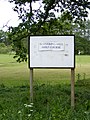
 Glevering Mill Golf Course sign - geograph.org.uk - 2412398.jpg 2 304 × 3 072 ; 1,47 Mio
-
 Glevering Mill Golf Course sign - geograph.org.uk - 2412407.jpg 2 304 × 3 072 ; 1,47 Mio
-
 Glevering North Park - geograph.org.uk - 1748394.jpg 1 600 × 1 200 ; 325 kio
-
 Hacheston church - geograph.org.uk - 5863414.jpg 1 024 × 768 ; 156 kio
-
 Hacheston Road to the B1078 Ash Road - geograph.org.uk - 2382137.jpg 3 072 × 2 304 ; 1,29 Mio
-
 Hacheston Village Hall - geograph.org.uk - 1227538.jpg 3 072 × 2 304 ; 1,28 Mio
-
 Hacheston Village Hall - geograph.org.uk - 5863410.jpg 1 024 × 768 ; 179 kio
-
 Hacheston War Memorial - geograph.org.uk - 5432870.jpg 2 340 × 2 340 ; 1,46 Mio
-
 Hacheston, Suffolk - geograph.org.uk - 43626.jpg 640 × 480 ; 83 kio
-
 Honeysuckle Cottage - geograph.org.uk - 5863383.jpg 1 024 × 768 ; 224 kio
-
 House by the side of the River Deben - geograph.org.uk - 2034940.jpg 640 × 480 ; 95 kio
-
 Houses in Spring Lane - geograph.org.uk - 2412795.jpg 3 072 × 2 304 ; 1,3 Mio
-
 Houses on Spring Lane - geograph.org.uk - 2412794.jpg 3 072 × 2 304 ; 1,29 Mio
-
 Ivy House Farm Cottages off the A12 Main Road - geograph.org.uk - 2383074.jpg 3 072 × 2 304 ; 1,43 Mio
-
 Lay-By - geograph.org.uk - 1756764.jpg 1 600 × 1 200 ; 452 kio
-
 Lodge House sign - geograph.org.uk - 2346714.jpg 3 072 × 2 304 ; 1,46 Mio
-
 Looking towards Bridge Farm - geograph.org.uk - 2412790.jpg 3 072 × 2 304 ; 1,24 Mio
-
 Main Road (slip road) - geograph.org.uk - 2347133.jpg 3 072 × 2 304 ; 1,32 Mio
-
 Main road (slip road) - geograph.org.uk - 2347136.jpg 3 072 × 2 304 ; 1,38 Mio
-
 Maize Crop in Easton Lane - geograph.org.uk - 2591418.jpg 3 072 × 2 304 ; 1,3 Mio
-
 Marlesford Road - geograph.org.uk - 2464752.jpg 3 072 × 2 304 ; 1,34 Mio
-
 Marlesford Road - geograph.org.uk - 2464755.jpg 3 072 × 2 304 ; 1,26 Mio
-
 Marlesford Road ^ the footpath to the B1116 The Street - geograph.org.uk - 2464744.jpg 3 072 × 2 304 ; 1,38 Mio
-
 Marsh House sign - geograph.org.uk - 2407623.jpg 3 072 × 2 304 ; 1,45 Mio
-
 Memorial to Private Thomas Foskett Walker - geograph.org.uk - 4619224.jpg 1 716 × 1 776 ; 1,65 Mio
-
 Milepost in Hacheston - geograph.org.uk - 923432.jpg 3 072 × 2 304 ; 1,48 Mio
-
 Minor Road - geograph.org.uk - 1754941.jpg 1 600 × 1 200 ; 683 kio
-
 Northbound A12, Exit at Lower Hacheston - geograph.org.uk - 3863067.jpg 640 × 480 ; 276 kio
-
 Old mill on the River Deben - geograph.org.uk - 2034971.jpg 640 × 480 ; 73 kio
-
 Pigs - geograph.org.uk - 1748359.jpg 1 600 × 1 200 ; 595 kio
-
 Pond off the A12 Wickham Market Bypass - geograph.org.uk - 2414319.jpg 3 072 × 2 304 ; 1,67 Mio
-
 Post Office The Street George V Postbox - geograph.org.uk - 2347103.jpg 2 304 × 3 072 ; 1,38 Mio
-
 Post Office The Street George V Postbox - geograph.org.uk - 2347109.jpg 3 072 × 2 304 ; 1,4 Mio
-
 Queen's Cottage in The Street, Hacheston - geograph.org.uk - 4439889.jpg 1 024 × 768 ; 331 kio
-
 River Crossing And Pillbox - geograph.org.uk - 1748559.jpg 1 600 × 1 200 ; 637 kio
-
 River Deben at Glevering Bridge - geograph.org.uk - 2412386.jpg 3 072 × 2 304 ; 1,68 Mio
-
 River Deben at Glevering Bridge - geograph.org.uk - 2412387.jpg 3 072 × 2 304 ; 1,63 Mio
-

-
 River Deben ^ Deben Mill - geograph.org.uk - 2412804.jpg 3 072 × 2 304 ; 1,37 Mio
-
 Road signs on B1116 - geograph.org.uk - 3567893.jpg 640 × 449 ; 110 kio
-
 Road to Marlesford Road - geograph.org.uk - 2382135.jpg 3 072 × 2 304 ; 1,29 Mio
-
 Roadsign on Easton Road - geograph.org.uk - 2412435.jpg 2 304 × 3 072 ; 1,65 Mio
-
 Roadsign on the A12 Wickham Market Bypass - geograph.org.uk - 1961281.jpg 3 072 × 2 304 ; 1,33 Mio
-
 Slip-road onto the A12 at Lower Hacheston - geograph.org.uk - 4409326.jpg 1 024 × 768 ; 268 kio
-
 Southbound A12 near Marlesford - geograph.org.uk - 3866552.jpg 640 × 480 ; 257 kio
-
 Stile on the footpath to the A12 Wickham Market Bypass - geograph.org.uk - 2348563.jpg 2 304 × 3 072 ; 1,6 Mio
-
 Stile on the footpath to the B1078 Ash Road - geograph.org.uk - 2348561.jpg 3 072 × 2 304 ; 1,38 Mio
-
 Sunset across fields - geograph.org.uk - 5863384.jpg 1 024 × 768 ; 69 kio
-
 Surface Water Collection off the A12 Wickham Market Bypass - geograph.org.uk - 2414318.jpg 3 072 × 2 304 ; 1,43 Mio
-
 Surface Water collection under the A12 Wickham Market Bypass - geograph.org.uk - 2412780.jpg 3 072 × 2 304 ; 1,57 Mio
-
 The A12 looking towards Marlesford - geograph.org.uk - 2544646.jpg 3 072 × 2 304 ; 1,33 Mio
-
 The bus stop shelter on a roundabout - geograph.org.uk - 4409323.jpg 1 024 × 768 ; 150 kio
-
 The entrance to Glevering Mill Golf Course - geograph.org.uk - 2412405.jpg 3 072 × 2 304 ; 1,53 Mio
-
 The former Post Office ^ Post Office The Street George V Postbox - geograph.org.uk - 2347095.jpg 3 072 × 2 304 ; 1,44 Mio
-
 The outflow or tail race from under Deben Mill - geograph.org.uk - 4409294.jpg 1 024 × 768 ; 505 kio
-
 The Street Postbox - geograph.org.uk - 2353533.jpg 2 304 × 3 072 ; 1,68 Mio
-
 The Street Postbox - geograph.org.uk - 2353535.jpg 2 304 × 3 072 ; 1,63 Mio
-
 The Street Postbox - geograph.org.uk - 2353563.jpg 3 072 × 2 304 ; 1,64 Mio
-
 The Street, Hacheston - geograph.org.uk - 4439893.jpg 1 024 × 768 ; 349 kio
-
 The Street, Hacheston - geograph.org.uk - 4439919.jpg 1 024 × 768 ; 361 kio
-
 The Street, Hacheston - geograph.org.uk - 4439923.jpg 1 024 × 768 ; 351 kio
-
 Timber-framed building - geograph.org.uk - 2034986.jpg 640 × 480 ; 68 kio
-
 Timber-framed building in The Street, Hacheston - geograph.org.uk - 4439884.jpg 1 024 × 768 ; 349 kio
-
 Twilight field view near Hacheston - geograph.org.uk - 5863385.jpg 1 024 × 768 ; 136 kio
-
 Under the A12 Wickham Market Bypass - geograph.org.uk - 2412785.jpg 3 072 × 2 304 ; 1,42 Mio
-
 Underpass beneath the A12 - geograph.org.uk - 4479330.jpg 3 648 × 2 736 ; 3,73 Mio
-
 View across the River Deben - geograph.org.uk - 3571130.jpg 1 600 × 1 064 ; 780 kio
-
 Wickham Market Road at Glevering Bridge - geograph.org.uk - 2412396.jpg 3 072 × 2 304 ; 1,66 Mio
-
 Wickham Market Road ^ Easton Road Postbox - geograph.org.uk - 2353455.jpg 3 072 × 2 304 ; 1,64 Mio
-
 Wickham Market Road ^ Easton Road Postbox - geograph.org.uk - 2353461.jpg 3 072 × 2 304 ; 1,44 Mio
-
 Wickham Market Road, Hacheston - geograph.org.uk - 2353475.jpg 3 072 × 2 304 ; 1,46 Mio
-
 Wickham Market Road, Hacheston - geograph.org.uk - 2353477.jpg 3 072 × 2 304 ; 1,69 Mio
-
 Wickham Market Road, Hacheston - geograph.org.uk - 2412410.jpg 3 072 × 2 304 ; 1,54 Mio
-
 Wickham Market Road, Hacheston - geograph.org.uk - 2412426.jpg 3 072 × 2 304 ; 1,66 Mio
-
 Wickham Market Road, Hacheston - geograph.org.uk - 2412428.jpg 3 072 × 2 304 ; 1,55 Mio
-
 Wickham Market Road, Hacheston - geograph.org.uk - 2412437.jpg 3 072 × 2 304 ; 1,49 Mio


_at_Lower_Hacheston_-_geograph.org.uk_-_3863070.jpg)


_-_geograph.org.uk_-_4003733.jpg)


_-_geograph.org.uk_-_2347133.jpg)
_-_geograph.org.uk_-_2347136.jpg)


