Category:Hadleigh, Suffolk
Vai alla navigazione
Vai alla ricerca
town in Babergh, Suffolk, England  _Cropped.jpg) | |||||
| Carica un file multimediale | |||||
| Istanza di | |||||
|---|---|---|---|---|---|
| Luogo | Babergh, Suffolk, Est dell'Inghilterra, Inghilterra | ||||
 | |||||
English:
Voce principale su Wikipedia: Hadleigh, Suffolk.
Sottocategorie
Questa categoria contiene le 27 sottocategorie indicate di seguito, su un totale di 27.
4
9
B
- Barclays Bank, Hadleigh (1 F)
- Benton End House (6 F)
- Hadleigh Bridge (2 F)
- Broom Hill, Hadleigh (7 F)
C
- Chapel to Almshouses (2 F)
- Coffee Tavern, Hadleigh (4 F)
- Corn Exchange, Hadleigh (1 F)
D
- Deanery Tower, Hadleigh (13 F)
- Deanery, Hadleigh (5 F)
G
- The Gables, Hadleigh (3 F)
- Guildhall, Hadleigh (7 F)
H
- Hadleigh railway station (5 F)
- Hadleigh Town Hall (2 F)
- Hadleigh High School (1 F)
L
- Hadleigh Library, Suffolk (5 F)
M
P
R
- Railway Walk, Hadleigh (11 F)
- Riverside Walk, Hadleigh (8 F)
S
- Sun Court, High Street (1 F)
T
- Toppesfield Bridge (8 F)
W
- Wolves Wood (11 F)
Pagine nella categoria "Hadleigh, Suffolk"
Questa categoria contiene un'unica pagina, indicata di seguito.
File nella categoria "Hadleigh, Suffolk"
Questa categoria contiene 200 file, indicati di seguito, su un totale di 324.
(pagina precedente) (pagina successiva)-
 102, 102a and 102b High Street, Hadleigh - geograph.org.uk - 5472991.jpg 5 184 × 3 456; 7,1 MB
-
 103 Taverton House and 105 High Street, Hadleigh - geograph.org.uk - 5471441.jpg 5 184 × 3 456; 5,81 MB
-
 106 High Street, Hadleigh - geograph.org.uk - 5472732.jpg 4 882 × 3 254; 5,29 MB
-
 111 and 113 High Street, Hadleigh - geograph.org.uk - 5471582.jpg 5 184 × 3 456; 6,59 MB
-
 114 High Street, Hadleigh - geograph.org.uk - 5472557.jpg 5 184 × 3 456; 6,37 MB
-
 116 High Street, Hadleigh - geograph.org.uk - 5472525.jpg 4 857 × 3 238; 7,79 MB
-
 120 and 122 High Street, Hadleigh - geograph.org.uk - 5472485.jpg 5 184 × 3 456; 6,28 MB
-
 13 Bridge Street Hadleigh Geograph-2941926-by-JThomas.jpg 640 × 480; 67 KB
-
 13-15 Bridge Street, Hadleigh (Suffolk) - geograph.org.uk - 6151986.jpg 1 600 × 1 018; 269 KB
-
 21 Bridge Street, Hadleigh (Suffolk) - geograph.org.uk - 6151987.jpg 1 600 × 979; 487 KB
-
 3 and 5 George Street, Hadleigh - geograph.org.uk - 5471292.jpg 5 184 × 3 456; 6,45 MB
-
 53 and 55 High Street, Hadleigh - geograph.org.uk - 5471268.jpg 5 184 × 3 456; 7,02 MB
-
 57 High Street, Hadleigh - geograph.org.uk - 5471316.jpg 3 209 × 4 814; 5,52 MB
-
 62 to 66 High Street, Hadleigh - geograph.org.uk - 5478304.jpg 5 000 × 3 425; 5,94 MB
-
 77-81 Benton Street, Hadleigh (Suffolk) - geograph.org.uk - 6151980.jpg 1 600 × 1 149; 371 KB
-
 79 to 89 High Street, Hadleigh - geograph.org.uk - 5471360.jpg 5 184 × 3 456; 6,8 MB
-
 8, Church Street, Hadleigh.jpg 2 304 × 3 456; 3,12 MB
-
 8. Church Street, Hadleigh - geograph.org.uk - 5606089.jpg 640 × 480; 127 KB
-
 84 and 82 High Street, Hadleigh - geograph.org.uk - 5478229.jpg 5 184 × 3 456; 5,89 MB
-
 87 and 89 High Street, Hadleigh - geograph.org.uk - 5471408.jpg 5 137 × 3 425; 5,73 MB
-
 A corner house, Hadleigh - geograph.org.uk - 5605843.jpg 640 × 428; 85 KB
-
 A1071 Coram Road, Hadleigh Heath - geograph.org.uk - 3700039.jpg 3 072 × 2 304; 1,15 MB
-
 A1071 Coram Road, Kersey - geograph.org.uk - 3699840.jpg 3 072 × 2 304; 1,41 MB
-
 A1071 Ipswich Road, Aldham, Hadleigh - geograph.org.uk - 3698545.jpg 3 072 × 2 304; 1,74 MB
-
 A1071 Ipswich Road, Aldham, Hadleigh - geograph.org.uk - 3699120.jpg 3 072 × 2 304; 1,31 MB
-
 A1071 Ipswich Road, Aldham, Hadleigh - geograph.org.uk - 3699183.jpg 2 914 × 2 189; 1,06 MB
-
 A1071 Ipswich Road, Aldham, Hadleigh - geograph.org.uk - 3699196.jpg 3 072 × 2 304; 1,45 MB
-
 A1071 Ipswich Road, Aldham, Hadleigh - geograph.org.uk - 3699824.jpg 3 072 × 2 304; 1,39 MB
-
 A1071 Ipswich Road, Aldham, Hadleigh - geograph.org.uk - 3699826.jpg 3 072 × 2 304; 1,61 MB
-
 A1071 Ipswich Road, Hadleigh - geograph.org.uk - 3699067.jpg 2 965 × 2 228; 1,17 MB
-
 A1071 Ipswich Road, Hadleigh - geograph.org.uk - 3699832.jpg 3 072 × 2 304; 1,26 MB
-
 A1071 Ipswich Road, Hadleigh - geograph.org.uk - 3699838.jpg 2 872 × 2 158; 1,17 MB
-
 A1071 Lady Lane, Aldham - geograph.org.uk - 3698268.jpg 3 072 × 2 304; 1,55 MB
-
 A1071 near Hadleigh - geograph.org.uk - 1438793.jpg 640 × 460; 98 KB
-
 A1071 north of Hadleigh Enterprise Park - geograph.org.uk - 3585185.jpg 3 334 × 2 309; 1,05 MB
-
 A1071 south of Wolves Wood - geograph.org.uk - 3585198.jpg 3 562 × 2 696; 1,56 MB
-
 A1071 southwest of Wolves Farm - geograph.org.uk - 3585192.jpg 3 429 × 2 617; 1,39 MB
-
 A1071 towards Ipswich - geograph.org.uk - 2941901.jpg 640 × 480; 54 KB
-
 A1071, Hadleigh - geograph.org.uk - 3858180.jpg 640 × 480; 329 KB
-
 A1071, Hadleigh Bypass - geograph.org.uk - 3858169.jpg 640 × 480; 322 KB
-
 A1071, North of Hadleigh - geograph.org.uk - 3858186.jpg 640 × 427; 299 KB
-
 A1141 junction with A1071 - geograph.org.uk - 3585020.jpg 3 548 × 2 690; 1,41 MB
-
 A1141 meets the Hadleigh Bypass (A1071) - geograph.org.uk - 3858128.jpg 640 × 427; 315 KB
-
 A1141 towards Hadleigh - geograph.org.uk - 2941876.jpg 640 × 480; 89 KB
-
 Abbotts Countrywide Hadleigh.jpg 2 500 × 2 000; 620 KB
-

-
 Aldham Mill - geograph.org.uk - 2785744.jpg 1 024 × 768; 307 KB
-
 Aldham Mill - geograph.org.uk - 2785750.jpg 1 024 × 768; 288 KB
-
-
 Barley crop on the edge of Hadleigh - geograph.org.uk - 6173076.jpg 6 000 × 4 000; 6,68 MB
-
 Beech House, 104 High Street, Hadleigh - geograph.org.uk - 5472829.jpg 5 184 × 3 456; 6,11 MB
-
 Benton Street, Hadleigh (B1070) - geograph.org.uk - 2941958.jpg 640 × 480; 75 KB
-
 Benton Street, Hadleigh (B1070) - geograph.org.uk - 2941975.jpg 640 × 480; 59 KB
-
 Benton Street, Hadleigh - geograph.org.uk - 5605964.jpg 640 × 480; 118 KB
-
 Benton Street, Hadleigh - geograph.org.uk - 5605980.jpg 640 × 480; 119 KB
-
 Benton Street, looking south - geograph.org.uk - 628144.jpg 640 × 480; 78 KB
-
 Bridge over the River Brett, in Hadleigh - geograph.org.uk - 3407063.jpg 3 648 × 2 736; 2,69 MB
-
 Bromley and Fitch, 50 High Street, Hadleigh - geograph.org.uk - 5479235.jpg 5 184 × 3 456; 6,01 MB
-
 Bus Stop on Ipswich Road - geograph.org.uk - 3858196.jpg 640 × 480; 312 KB
-
 Car park near Magdalen Road - geograph.org.uk - 622822.jpg 640 × 480; 83 KB
-
 Castle Road, Hadleigh - geograph.org.uk - 2268182.jpg 2 592 × 1 936; 1,67 MB
-
 Cedic Morris gravestone.JPG 1 567 × 2 549; 1,62 MB
-
 Chapel building, Hadleigh - geograph.org.uk - 1370638.jpg 640 × 480; 61 KB
-
 Cheaper Than An N.C.P. Car Park - geograph.org.uk - 1438394.jpg 640 × 480; 122 KB
-
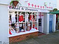 "Chest and drawers", Hadleigh - geograph.org.uk - 185894.jpg 640 × 480; 72 KB
-
 Church Street, Hadleigh - geograph.org.uk - 4859328.jpg 2 048 × 1 536; 800 KB
-
 Church Street, Hadleigh - geograph.org.uk - 5606074.jpg 640 × 480; 118 KB
-
 Conran Street - geograph.org.uk - 2116591.jpg 1 200 × 1 600; 597 KB
-
 Coram Road, Kersey - geograph.org.uk - 3699846.jpg 3 072 × 2 304; 2,01 MB
-
 Coram Road, Kersey - geograph.org.uk - 3700030.jpg 3 072 × 2 304; 1,59 MB
-
 Coram Street sign - geograph.org.uk - 3699844.jpg 3 072 × 2 304; 4,15 MB
-
 Coram Street west of Hadleigh - geograph.org.uk - 1439043.jpg 640 × 457; 88 KB
-
 Corner Shop - geograph.org.uk - 1438478.jpg 480 × 640; 89 KB
-

-
 Cottage near Toppesfield Bridge - geograph.org.uk - 5432491.jpg 4 000 × 3 000; 4,61 MB
-
 Cottages on Benton Street, Hadleigh - geograph.org.uk - 2941971.jpg 640 × 480; 59 KB
-
 Country Lane - geograph.org.uk - 2789566.jpg 1 024 × 768; 195 KB
-
 Country Road - geograph.org.uk - 2789021.jpg 1 024 × 768; 237 KB
-
 Country Road And Bridleway - geograph.org.uk - 2789022.jpg 1 024 × 768; 206 KB
-
 Cricket Pavilion, Hadleigh - geograph.org.uk - 1014163.jpg 640 × 480; 56 KB
-
 Crockatt Road, Hadleigh - geograph.org.uk - 3699805.jpg 3 072 × 2 304; 1,41 MB
-
 Cross Farm House, Hadleigh - geograph.org.uk - 5605850.jpg 640 × 428; 142 KB
-
 Daffodil, Hadleigh - geograph.org.uk - 5337922.jpg 640 × 480; 156 KB
-
 Daffodil, Hadleigh - geograph.org.uk - 5337929.jpg 640 × 480; 155 KB
-
 Deanery and churchyard, Hadleigh - geograph.org.uk - 4859314.jpg 2 048 × 1 536; 738 KB
-
 Derelict Houses on Benton Street - geograph.org.uk - 628136.jpg 640 × 480; 56 KB
-
 Detail of plastic kerb - geograph.org.uk - 1438614.jpg 640 × 480; 100 KB
-
 Distant View - geograph.org.uk - 3495526.jpg 1 024 × 768; 189 KB
-
 Driveway to Wolves Farm - geograph.org.uk - 6173057.jpg 6 000 × 4 000; 6,72 MB
-
 Duke Street, Hadleigh - geograph.org.uk - 1439106.jpg 640 × 610; 104 KB
-
 Edge Hall, High Street, Hadleigh - geograph.org.uk - 5605981.jpg 640 × 428; 104 KB
-
 End of Hadleigh Railway Walk - geograph.org.uk - 5605852.jpg 640 × 480; 200 KB
-
 End Of The Road - geograph.org.uk - 2116600.jpg 1 200 × 1 600; 703 KB
-
 Entering Hadleigh on the B1070 - geograph.org.uk - 2941904.jpg 640 × 480; 70 KB
-
 Entrance to Cobbold's Farm - geograph.org.uk - 3698448.jpg 2 983 × 2 241; 1,34 MB
-
 Entrance to Coram Street and Coram Street Farm - geograph.org.uk - 6173091.jpg 6 000 × 4 000; 6,69 MB
-
 Entrance to Wolves Wood Nature Reserve - geograph.org.uk - 3698273.jpg 3 072 × 2 304; 2,38 MB
-
 Essex and Suffolk Hunt kennels - geograph.org.uk - 5605010.jpg 640 × 428; 95 KB
-
 Farming Activity - geograph.org.uk - 2116535.jpg 1 600 × 1 200; 467 KB
-
 Farmland Gate - geograph.org.uk - 628161.jpg 640 × 480; 108 KB
-
 Farmland near the River Brett - geograph.org.uk - 2941976.jpg 640 × 480; 59 KB
-
 Farmland north of Layham Park - geograph.org.uk - 5606638.jpg 640 × 480; 128 KB
-
 Farmland off the A1071 - geograph.org.uk - 2941897.jpg 640 × 480; 74 KB
-
 Fenced Footpath - geograph.org.uk - 2116596.jpg 1 200 × 1 600; 868 KB
-
 Field and hedges near Ashbrook House - geograph.org.uk - 5606631.jpg 640 × 480; 149 KB
-
 Field Boundary - geograph.org.uk - 3604708.jpg 1 024 × 768; 237 KB
-
 Field Boundary And Footpath - geograph.org.uk - 2116547.jpg 1 600 × 1 200; 591 KB
-
 Fields adjacent Wolves View - geograph.org.uk - 3299191.jpg 640 × 480; 74 KB
-
 Fields towards the A1071 - geograph.org.uk - 1439034.jpg 640 × 480; 106 KB
-
 Flooded farmland by the River Brett - geograph.org.uk - 2941880.jpg 640 × 480; 89 KB
-
 Flower-rich field margin on the edge of Wolves Wood - geograph.org.uk - 6172983.jpg 6 000 × 4 000; 7,04 MB
-
 Footbridge - geograph.org.uk - 2785747.jpg 1 024 × 768; 252 KB
-
 Footbridge - geograph.org.uk - 2789602.jpg 1 024 × 768; 349 KB
-
 Footbridge And Stile - geograph.org.uk - 2789015.jpg 768 × 1 024; 308 KB
-

-
 Footpath - geograph.org.uk - 2116533.jpg 1 200 × 1 600; 510 KB
-
 Footpath - geograph.org.uk - 2789020.jpg 1 024 × 768; 262 KB
-
 Footpath - geograph.org.uk - 3495531.jpg 1 024 × 768; 217 KB
-
 Footpath And Blue Skies - geograph.org.uk - 2116532.jpg 1 600 × 1 200; 469 KB
-
 Footpath And Bridge - geograph.org.uk - 2116566.jpg 1 200 × 1 600; 467 KB
-
-
 Footpath Junction - geograph.org.uk - 2116568.jpg 1 200 × 1 600; 523 KB
-
 Footpath Junction - geograph.org.uk - 2789575.jpg 1 024 × 768; 229 KB
-
 Footpath Sign - geograph.org.uk - 2116555.jpg 1 200 × 1 600; 771 KB
-
 Footpath To The Sky - geograph.org.uk - 2116569.jpg 1 200 × 1 600; 512 KB
-
 Fording the River Brett - geograph.org.uk - 2941862.jpg 640 × 480; 89 KB
-
 Former mill stream, Toppesfield Mill - geograph.org.uk - 5605632.jpg 640 × 480; 124 KB
-
 Friars Hall Farm, Hadleigh - geograph.org.uk - 6173087.jpg 6 000 × 4 000; 6,24 MB
-
 Friars Road Cemetery - geograph.org.uk - 2268189.jpg 2 592 × 1 936; 2,32 MB
-
 Friars Road Cemetery - geograph.org.uk - 2268193.jpg 2 592 × 1 936; 1,86 MB
-
 Friars Road heading west - geograph.org.uk - 2941914.jpg 640 × 480; 126 KB
-
 Frost ^ Partners, 76 High Street, Hadleigh - geograph.org.uk - 5478263.jpg 3 456 × 5 184; 7,37 MB
-
 Gatehouse, Friars Road Cemetery - geograph.org.uk - 2268197.jpg 2 592 × 1 936; 1,8 MB
-
 George Street, Hadleigh - geograph.org.uk - 1438713.jpg 640 × 472; 79 KB
-
 Green Footpath - geograph.org.uk - 2116530.jpg 1 600 × 1 200; 537 KB
-
 Green Path - geograph.org.uk - 2789607.jpg 768 × 1 024; 302 KB
-
 Groves Garage, Hadleigh - geograph.org.uk - 622813.jpg 640 × 480; 67 KB
-
 Guildhall, Hadleigh - geograph.org.uk - 5606253.jpg 640 × 480; 120 KB
-
 Hadleigh - Angle Street - geograph.org.uk - 5232755.jpg 4 608 × 3 456; 5,25 MB
-
 Hadleigh - Angle Street - geograph.org.uk - 5232760.jpg 4 608 × 3 456; 6,45 MB
-
 Hadleigh - High Street - geograph.org.uk - 5232742.jpg 4 608 × 3 456; 6,88 MB
-
 Hadleigh 02.jpg 2 772 × 1 689; 2,27 MB
-
 Hadleigh 03.jpg 2 476 × 2 019; 2,73 MB
-
 Hadleigh 06.jpg 3 264 × 2 448; 3,54 MB
-
 Hadleigh 07.jpg 3 264 × 2 448; 4,4 MB
-
 Hadleigh 09.jpg 2 615 × 2 121; 3,01 MB
-
 Hadleigh 10.jpg 2 448 × 3 264; 3,67 MB
-
 Hadleigh 11.jpg 2 084 × 2 271; 2,49 MB
-
 Hadleigh 12.jpg 2 658 × 2 286; 2,63 MB
-
 Hadleigh by-pass near Red Hill Road - geograph.org.uk - 6173069.jpg 5 637 × 3 759; 3,13 MB
-

-
 Hadleigh Bypass, A1071 - geograph.org.uk - 3858176.jpg 640 × 480; 322 KB
-
 Hadleigh cemetery - geograph.org.uk - 5216556.jpg 2 592 × 1 944; 2,95 MB
-
 Hadleigh church yard - geograph.org.uk - 3797555.jpg 2 816 × 2 112; 1,29 MB
-
 Hadleigh Community Primary School - geograph.org.uk - 623455.jpg 640 × 480; 75 KB
-
 Hadleigh fire station - geograph.org.uk - 1910397.jpg 640 × 427; 281 KB
-
 Hadleigh from the air - geograph.org.uk - 3367289.jpg 640 × 480; 128 KB
-
 Hadleigh High Street - geograph.org.uk - 1439126.jpg 640 × 480; 90 KB
-
 Hadleigh High Street - geograph.org.uk - 1439134.jpg 640 × 457; 77 KB
-
 Hadleigh High Street - geograph.org.uk - 3888953.jpg 3 648 × 2 736; 2,1 MB
-
 Hadleigh High Street - geograph.org.uk - 5605984.jpg 640 × 428; 105 KB
-
 Hadleigh High Street - geograph.org.uk - 623375.jpg 640 × 480; 81 KB
-

-
 Hadleigh new fire station - geograph.org.uk - 1910403.jpg 640 × 427; 193 KB
-
 Hadleigh Post Office - geograph.org.uk - 622788.jpg 640 × 480; 76 KB
-
 Hadleigh town sign on the A1071 - geograph.org.uk - 1438754.jpg 640 × 480; 123 KB
-
 Hadleigh United Reformed Church - geograph.org.uk - 1370604.jpg 640 × 476; 92 KB
-
 Hadleigh, Stone Street - geograph.org.uk - 3858117.jpg 640 × 480; 309 KB
-
 Hadleighbuilding.jpg 220 × 148; 16 KB
-
 High Street, Hadleigh - geograph.org.uk - 2735659.jpg 1 024 × 768; 193 KB
-
 High Street, Hadleigh - geograph.org.uk - 5606064.jpg 640 × 428; 117 KB
-
 House in Kersey Vale - geograph.org.uk - 3802581.jpg 1 600 × 1 000; 612 KB
-
 House on Hadleigh High Street - geograph.org.uk - 628164.jpg 640 × 480; 63 KB
-
 Houses, Duke Street, Hadleigh - geograph.org.uk - 4859241.jpg 2 048 × 1 536; 797 KB
-
 Industrial Fencing - geograph.org.uk - 2789594.jpg 1 024 × 768; 308 KB
-
 Jim Lawrence offices and warehouse - geograph.org.uk - 3797531.jpg 2 816 × 2 112; 1,12 MB
-
 Lady Industrial Estate, Aldham, Hadleigh - geograph.org.uk - 3699807.jpg 3 072 × 2 304; 1,51 MB
-
 Lady Industrial Estate, Hadleigh - geograph.org.uk - 3699789.jpg 3 049 × 2 290; 974 KB
-
 Lady Lane - geograph.org.uk - 2481009.jpg 1 024 × 768; 133 KB
-
 Lady Lane Businesses and Car Park - geograph.org.uk - 5232788.jpg 4 608 × 3 456; 5,91 MB
-
 Lady Lane towards Hadleigh town centre - geograph.org.uk - 1439026.jpg 640 × 480; 105 KB
-
 Late summer meadow - geograph.org.uk - 1438738.jpg 640 × 480; 118 KB
-
 Lay-by off Ipswich Road - geograph.org.uk - 3299193.jpg 640 × 480; 119 KB
-

-
 Layham Road Sports Ground - geograph.org.uk - 2116438.jpg 1 600 × 1 200; 385 KB
-
 Lett-Haines grave 2.jpg 1 510 × 2 074; 1,46 MB
-
 Lett-Haines grave1.jpg 1 275 × 1 946; 1,12 MB
-
 Lloyds TSB, Hadleigh - geograph.org.uk - 623420.jpg 640 × 480; 56 KB
-
 Looking To The High Street - geograph.org.uk - 1438441.jpg 480 × 640; 88 KB
-
 M W Partridge ^ Co Ltd, 60 High Street, Hadleigh - geograph.org.uk - 5478336.jpg 5 184 × 3 456; 5,61 MB
-
 Magdalen Road - geograph.org.uk - 622820.jpg 640 × 480; 65 KB
-
 Malyon Road sign - geograph.org.uk - 3699797.jpg 3 072 × 2 305; 3,94 MB
-
 Malyon Road, Hadleigh - geograph.org.uk - 3699793.jpg 3 072 × 2 304; 1,63 MB
-
 Malyon Road, Hadleigh - geograph.org.uk - 3699798.jpg 3 072 × 2 172; 1,41 MB
-
 Market Place, Hadleigh - geograph.org.uk - 2215374.jpg 1 024 × 768; 129 KB
-
 Meadow - geograph.org.uk - 2789017.jpg 768 × 1 024; 190 KB
-
 Memorial to Sharron Elliott who died while serving in Iraq - geograph.org.uk - 4622493.jpg 2 592 × 3 456; 3,69 MB
-
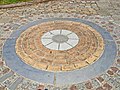 Millennium roundel, Hadleigh - geograph.org.uk - 185895.jpg 640 × 480; 87 KB
-
 Millie Hayes memorial stone.jpg 1 561 × 955; 622 KB
-
 No Horses - geograph.org.uk - 2116573.jpg 1 200 × 1 600; 314 KB


_-_geograph.org.uk_-_6151986.jpg)
_-_geograph.org.uk_-_6151987.jpg)


_-_geograph.org.uk_-_6151980.jpg)


_-_geograph.org.uk_-_3858128.jpg)


_-_geograph.org.uk_-_2941958.jpg)
_-_geograph.org.uk_-_2941975.jpg)


_near_Aldham_-_geograph.org.uk_-_3858201.jpg)


