Category:Halton, Buckinghamshire
Vai alla navigazione
Vai alla ricerca
English: Halton is a small village and is also a civil parish within Aylesbury Valedistrict in Buckinghamshire, England about 2 miles from Wendover and 5 miles from Aylesbury. It features a Royal Air Force (RAF) training station, RAF Halton. The village has a church called St Michael & All Angels.
village and civil parish in Buckinghamshire, United Kingdom  | |||||
| Carica un file multimediale | |||||
| Istanza di | |||||
|---|---|---|---|---|---|
| Luogo | Buckinghamshire, Sud Est dell'Inghilterra, Inghilterra | ||||
 | |||||
Sottocategorie
Questa categoria contiene le 4 sottocategorie indicate di seguito, su un totale di 4.
H
M
R
File nella categoria "Halton, Buckinghamshire"
Questa categoria contiene 195 file, indicati di seguito, su un totale di 195.
-
 "Countryside Award 1970" plaque in Wendover Woods - geograph.org.uk - 5887333.jpg 2 736 × 3 648; 2,78 MB
-

-
 A Farm Shed at Lower Farm, Halton - geograph.org.uk - 1249912.jpg 640 × 480; 247 KB
-
-
 A Junction in the New Road in Wendover Woods - geograph.org.uk - 5770405.jpg 3 648 × 2 432; 2,69 MB
-
-

-
 A Misty view of tall pine trees in Wendover Woods - geograph.org.uk - 5983713.jpg 2 736 × 3 648; 1,77 MB
-
 A Seat on the All Ability Trail through Wendover Woods - geograph.org.uk - 5800572.jpg 1 958 × 2 610; 1,63 MB
-
 A tree in Wendover Woods - geograph.org.uk - 5652336.jpg 640 × 480; 128 KB
-

-
 All we want is a friendly chat - geograph.org.uk - 1290916.jpg 640 × 480; 179 KB
-
 An Abandoned Holloway in Wendover Woods - geograph.org.uk - 5828136.jpg 3 648 × 2 736; 2,92 MB
-

-
 Approach to the Woodland Centre - geograph.org.uk - 5770313.jpg 2 047 × 2 731; 2,04 MB
-
 At work at the new entrance barrier in Wendover Woods - geograph.org.uk - 5770353.jpg 3 648 × 2 736; 2,08 MB
-
 Autumn colours along a forest road through Wendover Woods - geograph.org.uk - 5974322.jpg 2 736 × 3 648; 2,81 MB
-
-
 Autumn leaves on the exit road through Wendover Woods - geograph.org.uk - 5974221.jpg 3 648 × 2 736; 2,12 MB
-
 Avenue of limes, Halton - geograph.org.uk - 165989.jpg 510 × 640; 104 KB
-
 Bluebells and a JCB under the trees in Wendover Woods - geograph.org.uk - 5770463.jpg 3 203 × 2 188; 2,66 MB
-
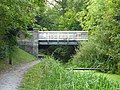 Bridge 10, Wendover Arm - geograph.org.uk - 4175930.jpg 640 × 480; 171 KB
-
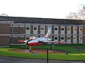
 Buildings at RAF Halton - geograph.org.uk - 4688433.jpg 1 600 × 1 066; 427 KB
-
 Bus Shelter in Halton Village - geograph.org.uk - 1294128.jpg 640 × 480; 136 KB
-
 Cable in the trees - geograph.org.uk - 1884783.jpg 1 500 × 1 000; 451 KB
-
 Cafe in Wendover Woods - geograph.org.uk - 5652344.jpg 640 × 480; 91 KB
-
 Canalside cottage - geograph.org.uk - 3546997.jpg 2 048 × 1 536; 518 KB
-
 Car park in Wendover Woods - geograph.org.uk - 1884779.jpg 1 500 × 1 000; 296 KB
-

-
 Chestnut Avenue at the entrance to RAF Halton - geograph.org.uk - 4483121.jpg 2 560 × 1 920; 2 MB
-
 Chestnut Avenue at the junction of Upper Icknield Way - geograph.org.uk - 4483125.jpg 2 560 × 1 920; 2,18 MB
-

-
 Clayfield Road - geograph.org.uk - 1146612.jpg 640 × 480; 108 KB
-
 Clear ground in Wendover Woods - geograph.org.uk - 1884784.jpg 1 500 × 1 000; 281 KB
-

-
 Constructing the New Car Park in Wendover Woods - geograph.org.uk - 5770326.jpg 2 680 × 1 787; 835 KB
-
 Converted Barn at Lower Farm, Halton - geograph.org.uk - 1336881.jpg 640 × 384; 59 KB
-
 Coot on a nest in the canal at Halton - geograph.org.uk - 1249851.jpg 640 × 480; 259 KB
-
 Danger Deep Bog at Halton - geograph.org.uk - 1259630.jpg 640 × 470; 123 KB
-

-

-
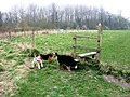 Dogs at a footpath stile in Halton, Buckinghamshire, England.jpg 640 × 480; 83 KB
-
 Emergency access, Halton Airfield - geograph.org.uk - 4299625.jpg 640 × 480; 43 KB
-
 Erecting the boarding round the New Cafe Area - geograph.org.uk - 5800666.jpg 3 648 × 2 736; 1,85 MB
-
 Exercise point in Wendover Woods - geograph.org.uk - 5652320.jpg 640 × 480; 133 KB
-
 Field above Icknield Way - geograph.org.uk - 4176511.jpg 640 × 480; 107 KB
-
 Field entrance, Halton Village - geograph.org.uk - 4483102.jpg 2 560 × 1 920; 1,89 MB
-
 Finishing Off the Frame of the New Cafe in Wendover Woods - geograph.org.uk - 5825811.jpg 3 648 × 2 432; 1,21 MB
-
 Footpath in the woods - geograph.org.uk - 1884786.jpg 1 500 × 982; 458 KB
-
 Footpath in Wendover Woods - geograph.org.uk - 1884776.jpg 1 000 × 1 500; 354 KB
-
 Footpath into the woods, Halton - geograph.org.uk - 170111.jpg 640 × 480; 139 KB
-
 Footpath, Wendover Woods - geograph.org.uk - 2958760.jpg 1 000 × 1 333; 2,5 MB
-
 Framework of the New Cafe in Wendover Woods - Front View - geograph.org.uk - 5828231.jpg 2 221 × 1 665; 832 KB
-
 Further Down the Abandoned Holloway in Wendover Woods - geograph.org.uk - 5828125.jpg 3 648 × 2 736; 2,75 MB
-
 Gate guardian, RAF Halton - geograph.org.uk - 4299592.jpg 4 320 × 3 240; 4,94 MB
-
 Gated trail in Wendover Woods - geograph.org.uk - 1884778.jpg 1 500 × 1 000; 340 KB
-
 Glade in Wendover Woods - geograph.org.uk - 2958770.jpg 1 402 × 1 000; 2,38 MB
-
 Glimpse of Boddington Hill from Haddington Hill - geograph.org.uk - 2974313.jpg 3 968 × 2 976; 2,76 MB
-
 GOC Tring & Wendover Woods 072 Mansion Hill Lodge, Halton (34819372265).jpg 4 608 × 3 456; 5,41 MB
-
 GOC Tring & Wendover Woods 073 Mansion Hill Lodge, Halton (33976178254).jpg 4 608 × 3 456; 5,39 MB
-
 Grand Union Canal (Wendover Arm) - geograph.org.uk - 148361.jpg 640 × 480; 159 KB
-

-

-
 Halton Lane - geograph.org.uk - 165990.jpg 480 × 640; 103 KB
-
 Halton Lane runs over Perch Bridge - geograph.org.uk - 3455601.jpg 1 500 × 991; 284 KB
-
 Halton Village - geograph.org.uk - 4483493.jpg 2 560 × 1 920; 1,99 MB
-
 Hangars at Halton Airfield - geograph.org.uk - 3154194.jpg 1 600 × 1 068; 431 KB
-

-
 House at Perch End, Halton - geograph.org.uk - 1249875.jpg 640 × 480; 188 KB
-
 House by the canal - geograph.org.uk - 4688418.jpg 4 000 × 2 664; 4,29 MB
-
 Houses in Halton Village - geograph.org.uk - 3457624.jpg 1 500 × 1 000; 153 KB
-
 Houses in Halton Village - geograph.org.uk - 4699679.jpg 1 600 × 1 000; 470 KB
-

-

-

-
 Ivy Cottage in Halton - geograph.org.uk - 3457628.jpg 1 500 × 1 000; 269 KB
-
 Jet Provost at RAF Halton Airfield - geograph.org.uk - 4299621.jpg 4 138 × 2 982; 4,07 MB
-
 Just before Sunset in Wendover Woods - geograph.org.uk - 5974207.jpg 3 648 × 2 736; 1,41 MB
-

-

-

-

-

-
 Laying the path to the car park pay stations - geograph.org.uk - 5801010.jpg 3 549 × 2 365; 2,16 MB
-
 Leaving Weston Turville on Weston Road - geograph.org.uk - 4484297.jpg 2 560 × 1 920; 1,57 MB
-
 Looking over Wendover Woods - geograph.org.uk - 1884767.jpg 1 500 × 1 000; 333 KB
-
 Looking towards the site of the New Cafe - geograph.org.uk - 5770314.jpg 3 232 × 2 154; 1,75 MB
-

-

-
 New Children's Play area in Wendover Woods - geograph.org.uk - 5887340.jpg 3 333 × 2 222; 2,2 MB
-
 New Road from Car Park in Wendover Woods - geograph.org.uk - 5770382.jpg 3 648 × 2 736; 2,66 MB
-

-

-
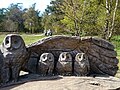 Owl carving - geograph.org.uk - 4955239.jpg 2 877 × 2 160; 3,09 MB
-
 Pasture at Bye Green - geograph.org.uk - 5117608.jpg 3 655 × 2 494; 1,8 MB
-
 Path around Boddington Hillfort ramparts - geograph.org.uk - 5652290.jpg 640 × 480; 133 KB
-
 Path heading into Wendover Woods - geograph.org.uk - 6029083.jpg 640 × 480; 135 KB
-
 Path in Wendover Woods - geograph.org.uk - 5652315.jpg 640 × 480; 126 KB
-
 Path to Beechwood Lane - geograph.org.uk - 6029092.jpg 640 × 480; 131 KB
-
 Path to Weston Turville - geograph.org.uk - 3154192.jpg 1 600 × 1 067; 562 KB
-
 Perch Bridge over the Wendover Arm Canal - geograph.org.uk - 3455603.jpg 1 500 × 1 000; 403 KB
-
 Planned view from the New Cafe in Wendover Woods - geograph.org.uk - 5770320.jpg 3 648 × 2 432; 1,79 MB
-
 Polish war graves in St Michael ^ All Angels churchyard - geograph.org.uk - 3457640.jpg 1 500 × 1 000; 241 KB
-
 Poster showing the 2018 Redevelopment in Wendover Woods - geograph.org.uk - 5800579.jpg 2 695 × 2 736; 1,49 MB
-
 R.A.F. Halton aerodrome, aerial - geograph.org.uk - 3478272.jpg 640 × 427; 81 KB
-

-

-

-
 Ridge walk in Wendover Wood - geograph.org.uk - 5652267.jpg 640 × 480; 83 KB
-
 Rothschild Bridge - geograph.org.uk - 3546957.jpg 2 048 × 1 536; 561 KB
-
 Site of proposed entrance barrier in Wendover Woods - geograph.org.uk - 5770349.jpg 2 052 × 2 736; 1,34 MB
-
 Sports fields, RAF Halton - geograph.org.uk - 4175939.jpg 640 × 480; 80 KB
-
 St Michael ^ All Angels Church in Halton - geograph.org.uk - 3457630.jpg 1 000 × 1 500; 187 KB
-
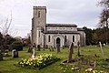 St Michael ^ All Angels Church in Halton - geograph.org.uk - 3457632.jpg 1 500 × 995; 216 KB
-
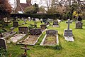 St Michael ^ All Angels churchyard in Halton - geograph.org.uk - 3457634.jpg 1 500 × 1 000; 345 KB
-

-
 Summit end of an Abandoned Holloway in Wendover Woods - geograph.org.uk - 5828119.jpg 2 736 × 3 648; 2,21 MB
-
 Surfacing the new Coach Park in Wendover Woods - geograph.org.uk - 5770431.jpg 3 399 × 2 265; 2,46 MB
-
 Swans on the Wendover Canal - geograph.org.uk - 4688383.jpg 1 024 × 682; 286 KB
-
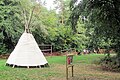 Teepee in the New Play Area in Wendover Woods - geograph.org.uk - 5887362.jpg 3 366 × 2 244; 2,16 MB
-
 The All Ability Trail at Wendover Woods - geograph.org.uk - 5800569.jpg 2 736 × 3 648; 3,03 MB
-
 The Ancient Holloway is cut by a modern woodland road - geograph.org.uk - 5828154.jpg 2 736 × 3 648; 2,87 MB
-
 The Café in the Woods - geograph.org.uk - 4936667.jpg 3 840 × 2 160; 4,71 MB
-
 The Concrete Base of the New Cafe in Wendover Woods - geograph.org.uk - 5825705.jpg 3 638 × 2 150; 1,4 MB
-

-
 The entrance to Go Ape - geograph.org.uk - 1884781.jpg 1 500 × 1 000; 325 KB
-
 The far end of the new stretch of road in Wendover Woods - geograph.org.uk - 5770435.jpg 2 395 × 3 194; 1,9 MB
-
 The final corner on the tarmac road through Wendover Woods - geograph.org.uk - 5974323.jpg 3 648 × 2 736; 2,67 MB
-
-

-
 The Gruffalo - geograph.org.uk - 4936662.jpg 2 878 × 2 160; 3,74 MB
-
 The Gruffalo with the New Cafe Site in the distance - geograph.org.uk - 5770318.jpg 3 648 × 2 736; 1,75 MB
-
 The Holloway from Mansion Hill, in Wendover Woods - geograph.org.uk - 5770512.jpg 3 445 × 2 297; 2,31 MB
-

-
 The main road through Halton Village - geograph.org.uk - 3457622.jpg 1 500 × 1 000; 176 KB
-
 The main road through Halton Village - geograph.org.uk - 3457626.jpg 1 500 × 991; 315 KB
-
 The New Cafe Site - and the Old Cafe - geograph.org.uk - 5770317.jpg 3 646 × 2 431; 2,02 MB
-
 The New Entrance Barrier in Wendover Woods - geograph.org.uk - 5800983.jpg 2 649 × 1 987; 1,4 MB
-
 The New Playground under construction at Wendover Woods - geograph.org.uk - 5887358.jpg 3 648 × 2 432; 2,37 MB
-
 The New Road behind the Visitor Area in Wendover Woods - geograph.org.uk - 5770389.jpg 3 648 × 2 432; 2,5 MB
-

-
 The New Road passes through a picnic area in Wendover Woods - geograph.org.uk - 5770400.jpg 3 648 × 2 736; 3,02 MB
-
-
 The Old Car Park (to become a play area) in Wendover Woods - geograph.org.uk - 5770496.jpg 3 648 × 2 433; 2,31 MB
-

-
 The Path on the Boundary of Hengrove Wood - geograph.org.uk - 5974321.jpg 3 648 × 2 736; 1,96 MB
-
 The Road passing the New Car Park in Wendover Woods - geograph.org.uk - 5770322.jpg 3 648 × 2 736; 2,41 MB
-
 The Road through the Village, Halton - geograph.org.uk - 1294127.jpg 640 × 384; 111 KB
-
 The Site of the New Cafe at Wendover Woods - geograph.org.uk - 5770315.jpg 3 648 × 2 433; 1,56 MB
-
 The Site of the New Cafe at Wendover Woods - geograph.org.uk - 5770316.jpg 2 736 × 3 648; 1,72 MB
-

-
 The South end of the New Car Park in Wendover Woods - geograph.org.uk - 5770338.jpg 3 021 × 2 266; 1,94 MB
-
 The South Exit of the New Car Park in Wendover Woods - geograph.org.uk - 5801033.jpg 3 648 × 2 736; 2,09 MB
-
 The Track to Boddington Bank in November, Wendover Woods - geograph.org.uk - 5983691.jpg 3 000 × 2 250; 2,25 MB
-
 The Twin Exit Barriers at Wendover Woods - geograph.org.uk - 5800998.jpg 3 648 × 2 432; 2,75 MB
-
 The war memorial in St Michael ^ All Angels churchyard - geograph.org.uk - 3457638.jpg 1 000 × 1 500; 139 KB
-
 The Wendover Arm Canal in Halton - geograph.org.uk - 3455604.jpg 1 000 × 1 500; 348 KB
-
 The Wendover Arm Canal in Halton - geograph.org.uk - 3455605.jpg 1 500 × 1 000; 354 KB
-
 The Wendover Arm Canal in Halton - geograph.org.uk - 3455607.jpg 1 793 × 2 700; 614 KB
-
 The Wendover Arm Canal in Halton - geograph.org.uk - 3455610.jpg 1 500 × 1 000; 358 KB
-
 The Wendover Arm Canal in Halton - geograph.org.uk - 3457611.jpg 1 500 × 1 000; 360 KB
-
 The Wendover Arm Canal near Halton - geograph.org.uk - 3455599.jpg 1 500 × 988; 341 KB
-
 The Wendover Arm Canal near Halton - geograph.org.uk - 3455600.jpg 1 500 × 1 000; 400 KB
-
 The Wendover Arm Canal passes cottages in Halton - geograph.org.uk - 3455609.jpg 1 500 × 994; 364 KB
-
 The Wendover Arm Canal towpath in Halton - geograph.org.uk - 3455611.jpg 1 500 × 1 000; 336 KB
-
 The Wides - Wendover Arm - geograph.org.uk - 3546942.jpg 2 048 × 1 536; 571 KB
-

-
 The Wides, Wendover Arm - geograph.org.uk - 5458818.jpg 1 280 × 851; 554 KB
-
 Towpath by the Wendover Arm Canal in Halton - geograph.org.uk - 3457614.jpg 1 500 × 1 000; 394 KB
-
 Towpath by the Wendover Arm Canal in Halton - geograph.org.uk - 3457617.jpg 1 500 × 1 000; 403 KB
-
 Towpath on Wendover canal - geograph.org.uk - 3154184.jpg 1 600 × 1 068; 582 KB
-
 Track through the woods, Halton - geograph.org.uk - 169206.jpg 480 × 640; 131 KB
-
 Trails in Wendover Woods - geograph.org.uk - 1884789.jpg 1 500 × 1 000; 397 KB
-
 Upper Icknield Way, Halton Camp - geograph.org.uk - 4483468.jpg 2 522 × 1 839; 2 MB
-
 View from Halton Village - geograph.org.uk - 4483085.jpg 2 560 × 1 920; 2,06 MB
-
 View from the bridge at Halton - geograph.org.uk - 6008869.jpg 4 608 × 3 456; 4,09 MB
-
 View from woodland towards the new car park - geograph.org.uk - 5770321.jpg 3 648 × 2 736; 2,14 MB
-
 Wendover arm of the Grand Union now disused - geograph.org.uk - 3154188.jpg 1 600 × 1 067; 638 KB
-

-

-

-

-

-

-

-

-
 Wendover view from Haddington Hill - geograph.org.uk - 2974303.jpg 3 968 × 2 976; 2,81 MB
-
 Wendover Woods (Haddington Hill) - geograph.org.uk - 3335955.jpg 2 592 × 1 944; 1,36 MB
-
 Wendover Woods (picnic area) - geograph.org.uk - 1961249.jpg 1 600 × 1 200; 670 KB
-
 Wendover Woods - geograph.org.uk - 1884788.jpg 1 000 × 1 500; 460 KB
-
 Wendover Woods, view south-west - geograph.org.uk - 2974291.jpg 3 968 × 2 976; 2,88 MB
-
 Where have all the people gone^ - geograph.org.uk - 4204056.jpg 3 648 × 2 736; 3,28 MB
-
 Wood Adjacent to Halton Lane - geograph.org.uk - 1379562.jpg 480 × 640; 99 KB
-

-
 Work on the New Information Centre in Wendover Woods - geograph.org.uk - 5770477.jpg 3 648 × 2 432; 2,07 MB


.jpg)
.jpg)
_-_geograph.org.uk_-_148361.jpg)
_in_Halton_-_geograph.org.uk_-_148962.jpg)
_in_Halton_-_geograph.org.uk_-_148965.jpg)


_-_geograph.org.uk_-_5800638.jpg)
_-_geograph.org.uk_-_5800640.jpg)
_-_geograph.org.uk_-_5800647.jpg)
_-_geograph.org.uk_-_5800652.jpg)
_-_geograph.org.uk_-_5800656.jpg)


_in_Wendover_Woods_-_geograph.org.uk_-_5770496.jpg)


_from_the_north_-_geograph.org.uk_-_1265447.jpg)


_-_geograph.org.uk_-_3335955.jpg)
_-_geograph.org.uk_-_1961249.jpg)


