Category:Hamada, Shimane
Zur Navigation springen
Zur Suche springen
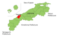
Ort in der Präfektur Shimane, Japan  | |||||
| Medium hochladen | |||||
| Ist ein(e) | |||||
|---|---|---|---|---|---|
| Ort | Präfektur Shimane, Japan | ||||
| Liegt am oder im Gewässer | |||||
| Rechtsform |
| ||||
| Datum der Gründung, Erstellung, Entstehung, Erbauung |
| ||||
| Einwohnerzahl |
| ||||
| Fläche |
| ||||
| Ersetzt |
| ||||
| Verschieden von | |||||
| offizielle Website | |||||
 | |||||
日本語: 島根県浜田市に関するカテゴリ。
Unterkategorien
Es werden 5 von insgesamt 5 Unterkategorien in dieser Kategorie angezeigt:
In Klammern die Anzahl der enthaltenen Kategorien (K), Seiten (S), Dateien (D)
Medien in der Kategorie „Hamada, Shimane“
Folgende 54 Dateien sind in dieser Kategorie, von 54 insgesamt.
-
 Aerial photograph of Geihoku highland Taisa ski resort.jpg 1.500 × 1.000; 1.024 KB
-
 Emblem of Asahi, Shimane (1958–2005).jpg 80 × 80; 4 KB
-
 Emblem of Asahi, Shimane (1958–2005).svg 80 × 80; 2 KB
-
 Emblem of Hamada, Shimane.jpg 103 × 104; 3 KB
-
 Emblem of Hamada, Shimane.svg 383 × 370; 2 KB
-
 Emblem of Misumi, Shimane (1955–2005).jpg 237 × 220; 13 KB
-
 Emblem of Misumi, Shimane (1955–2005).svg 237 × 220; 2 KB
-
 Flag of Hamada, Shimane.png 900 × 600; 24 KB
-
 Flag of Hamada, Shimane.svg 900 × 600; 1 KB
-
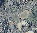
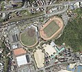 Hamada Athletic Stadium.jpg 1.142 × 1.008; 653 KB
-
 Hamada city center area Aerial photograph.2010.jpg 5.575 × 4.154; 7,45 MB
-
 Hamada city Higashi park.jpg 521 × 467; 246 KB
-
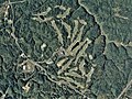 Hamada Golf Links, Hamada Shimane Aerial photograph.2010.jpg 2.062 × 1.546; 1,53 MB
-
 Hamada in Shimane Prefecture Ja.svg 610 × 580; 777 KB
-
 Hamada in Shimane Prefecture.png 1.281 × 801; 35 KB
-
 Hamada Shimane chapter.JPG 383 × 370; 19 KB
-
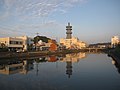
 Hamada station ekimae.JPG 3.072 × 2.304; 3,3 MB
-
 HamadaMapCurrent.png 800 × 500; 75 KB
-
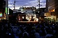
 Iwamikagura-Hounou.jpg 2.100 × 540; 428 KB
-
 Iwamikagura1.jpg 600 × 450; 121 KB
-
 Iwamikagura2.jpg 480 × 320; 66 KB
-
 Iwamikagura3.jpg 460 × 560; 63 KB
-
 Iwamikagura4.jpg 480 × 480; 81 KB
-
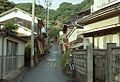
 Kurokawacho, Hamada, Shimane Prefecture 697-0024, Japan - panoramio.jpg 606 × 809; 451 KB
-
 Population distribution of Hamada, Shimane, Japan.svg 512 × 256; 22 KB
-
 Railway signal and wheels in front of Hamada Station.jpg 3.024 × 4.032; 2,74 MB
-
 San'in Main Line Kushiro Station Access road.jpg 3.456 × 2.304; 4,66 MB
-
 Sanin Line (Near Orii) - panoramio.jpg 640 × 480; 52 KB
-
 Shimane Naka-gun Hamada-city.png 260 × 240; 5 KB
-
 Shimane-hamada-city.png 500 × 350; 6 KB
-
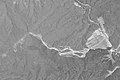
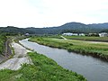 Sufuriver.jpg 4.608 × 3.456; 4,1 MB
-
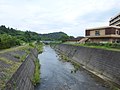 Uyariver.jpg 4.608 × 3.456; 4,3 MB
-
 View in front of Hamada Station at night 2.jpg 3.913 × 2.935; 1,74 MB
-
 View in front of Hamada Station at night.jpg 3.978 × 2.983; 2,8 MB
-
 View near Hamada Station at night 1.jpg 4.032 × 3.024; 2,38 MB
-
 View near Hamada Station at night 2.jpg 4.018 × 3.014; 2,86 MB
-
 View near Hamada Station at night 3.jpg 4.032 × 3.024; 2,8 MB
-
 Yuuhipark Hamada.JPG 3.648 × 2.052; 2,02 MB
-
 Yuuhipark Misumi.JPG 3.648 × 2.052; 2,04 MB
-
 ゆうひパーク - panoramio.jpg 1.600 × 1.200; 457 KB
-
 ゆうひパーク三隅から見る日本海 - panoramio.jpg 4.000 × 3.000; 2,91 MB
-
 イズミ シティパルク浜田 City Parc Hamada - panoramio.jpg 2.816 × 2.112; 2,32 MB
-
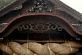
 伊甘神社.jpg 1.358 × 1.030; 517 KB
-
 出雲大社石見分祠 Izumo ground shrine Iwami branch - panoramio.jpg 2.816 × 2.112; 2,68 MB
-
 出雲大社(石見) - panoramio.jpg 1.200 × 813; 185 KB
-
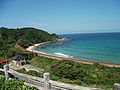
 姉ヶ浜海水浴場 Sep 21, 2009.jpg 800 × 533; 233 KB
-
 島根あさひ社会復帰促進センター.png 1.057 × 713; 944 KB
-
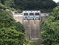 木都賀ダム - panoramio (cropped).jpg 2.997 × 2.289; 2,2 MB
-
 木都賀ダム - panoramio.jpg 3.000 × 4.000; 3,04 MB
-
 浜田川とNTT浜田支店 Hamada Riv. ^ NTT Hamada - panoramio.jpg 2.816 × 2.112; 2,14 MB
-
 浜田市 - panoramio.jpg 1.024 × 702; 211 KB
-
 浜田看板.jpg 1.024 × 768; 237 KB
-
 浜田駅前 - panoramio.jpg 1.024 × 691; 242 KB
-
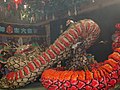
 石見神楽 - panoramio.jpg 1.024 × 669; 163 KB


_-_panoramio.jpg)


.jpg)


.jpg)
.svg)
.jpg)
.svg)