Category:Hambleton, Rutland
Aller à la navigation
Aller à la recherche
village britannique  | |||||
| Téléverser des médias | |||||
| Nature de l’élément | |||||
|---|---|---|---|---|---|
| Lieu | Rutland, Midlands de l'Est, Angleterre | ||||
| Population |
| ||||
| Superficie |
| ||||
 | |||||
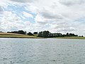
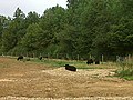
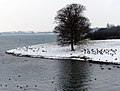
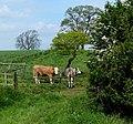
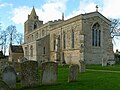
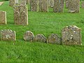
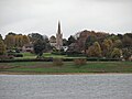
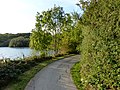
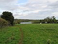
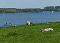
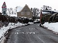
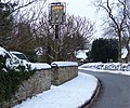
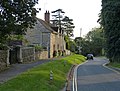
English: Hambleton is a village and civil parish in Rutland, England. It is located about two miles (3 km) east of Oakham. In 2001 it had a population of 140. Since the construction of Rutland Water in the 1970s, the village has been closed off on three sides by water and the area is known as the Hambleton Peninsula.

Sous-catégories
Cette catégorie comprend 3 sous-catégories, dont les 3 ci-dessous.
H
- St Andrew's Church, Hambleton (52 F)
L
Média dans la catégorie « Hambleton, Rutland »
Cette catégorie comprend 568 fichiers, dont les 200 ci-dessous.
(page précédente) (page suivante)-
 'Slipway' to Rutland Water - geograph.org.uk - 3293487.jpg 4 000 × 3 000 ; 4,85 Mio
-
 1 Post Office Cottages, Ketton Road, Upper Hambleton - geograph.org.uk - 5522951.jpg 5 184 × 3 456 ; 4,47 Mio
-
 A cold and icy day at Rutland Water - geograph.org.uk - 3772322.jpg 1 600 × 1 200 ; 590 kio
-
 A glimpse of Normanton Church - geograph.org.uk - 5183369.jpg 1 024 × 768 ; 1,1 Mio
-
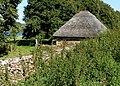 A small thatched stone hut - geograph.org.uk - 3283162.jpg 2 805 × 2 019 ; 2,43 Mio
-
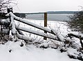
 A snowy day at Rutland Water - geograph.org.uk - 3772211.jpg 1 600 × 1 330 ; 554 kio
-
 A snowy lane through Upper Hambleton - geograph.org.uk - 3768861.jpg 1 600 × 1 310 ; 656 kio
-
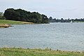
 A view across Rutland Water - geograph.org.uk - 3724606.jpg 1 600 × 957 ; 385 kio
-
 A warm day with a view to Hambleton Old Hall - geograph.org.uk - 6428094.jpg 1 797 × 1 198 ; 601 kio
-
 Across Rutland Water - geograph.org.uk - 5183164.jpg 1 024 × 732 ; 929 kio
-
 Across the bay - geograph.org.uk - 3093838.jpg 3 456 × 2 304 ; 2,45 Mio
-
 Aeration for the nation - geograph.org.uk - 2115936.jpg 2 592 × 1 944 ; 2,05 Mio
-
 Along Rutland Water - geograph.org.uk - 5569554.jpg 1 024 × 768 ; 730 kio
-
 An empty Angler's car park - geograph.org.uk - 1277073.jpg 640 × 480 ; 87 kio
-
 An icy stretch of the Rutland Water Circular Route - geograph.org.uk - 3774804.jpg 1 600 × 1 177 ; 351 kio
-
 Anglers and the draw-off tower in Rutland Water - geograph.org.uk - 3971303.jpg 1 600 × 1 414 ; 588 kio
-
 Anglian Birdwatching Centre - geograph.org.uk - 5527974.jpg 2 000 × 1 333 ; 2,36 Mio
-
 Approaching Hambleton - geograph.org.uk - 5569199.jpg 819 × 1 024 ; 1,11 Mio
-
 Are you wearing your helmet^ - geograph.org.uk - 4812127.jpg 960 × 1 280 ; 395 kio
-
 Armley Lodge - geograph.org.uk - 2357915.jpg 2 592 × 1 944 ; 1,42 Mio
-
 Armley Lodge Farm - geograph.org.uk - 4826394.jpg 1 280 × 843 ; 190 kio
-
 Autumn at Hambleton Wood - geograph.org.uk - 3721979.jpg 1 600 × 1 200 ; 657 kio
-
 Autumn at Rutland Water - geograph.org.uk - 3721917.jpg 1 600 × 1 129 ; 543 kio
-
 Autumn colours at Hambleton Wood - geograph.org.uk - 3724568.jpg 1 600 × 1 182 ; 549 kio
-
 Bales in a field near Upper Hambleton - geograph.org.uk - 3282430.jpg 3 800 × 2 823 ; 3,08 Mio
-
 Barnhill anglers' car park - geograph.org.uk - 4812129.jpg 1 280 × 960 ; 302 kio
-
 Barnhill Creek in the snow - geograph.org.uk - 3773481.jpg 1 600 × 1 080 ; 468 kio
-
 Barnhill Creek on the Hambleton peninsula - geograph.org.uk - 3732109.jpg 1 600 × 1 084 ; 418 kio
-
 Barnhill Creek Rutland Water - geograph.org.uk - 1277084.jpg 640 × 480 ; 66 kio
-
 Barnhill Creek, Rutland Water - geograph.org.uk - 3082463.jpg 1 024 × 768 ; 114 kio
-
 Bench at the end of the Hambleton peninsula - geograph.org.uk - 3281079.jpg 4 000 × 3 000 ; 3,36 Mio
-
 Bench mark, Gateway on Stamford Road - geograph.org.uk - 4826089.jpg 821 × 1 280 ; 397 kio
-
 Bench mark, Hilltop, Hambleton - geograph.org.uk - 4826148.jpg 1 280 × 960 ; 507 kio
-
 Bench mark, St Andrew's Church, Hambleton - geograph.org.uk - 4826111.jpg 960 × 1 280 ; 508 kio
-
 Bench mark, St Andrew's House, Hambleton - geograph.org.uk - 4826168.jpg 1 280 × 960 ; 345 kio
-
 Bench next to the Rutland Water Cycle Route, Hambleton - geograph.org.uk - 5967828.jpg 3 776 × 2 520 ; 4,33 Mio
-
 Black sheep - geograph.org.uk - 2554884.jpg 640 × 479 ; 110 kio
-
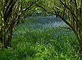
 Bluebell time in Hambleton Wood - geograph.org.uk - 1277093.jpg 640 × 480 ; 137 kio
-
 Bluebell time in Hambleton Wood ^2 - geograph.org.uk - 1277095.jpg 640 × 359 ; 81 kio
-
 Bluebell time in Hambleton Wood ^3 - geograph.org.uk - 1277114.jpg 640 × 406 ; 126 kio
-
 Bluebells in Hambleton Wood - geograph.org.uk - 2357982.jpg 2 592 × 1 944 ; 3,17 Mio
-
 Bluebells in Hambleton Wood - geograph.org.uk - 3971929.jpg 4 000 × 3 000 ; 5,38 Mio
-
 Bluebells in Hambleton Wood - geograph.org.uk - 3971965.jpg 1 600 × 1 160 ; 834 kio
-
 Boat on a cold and snowy Rutland Water - geograph.org.uk - 3772178.jpg 1 600 × 1 198 ; 418 kio
-
 Bridleway near Lyndon - geograph.org.uk - 4849008.jpg 1 280 × 960 ; 401 kio
-
 Bridleway towards Rutland Water - geograph.org.uk - 4007576.jpg 640 × 480 ; 94 kio
-
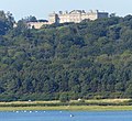 Burley House - geograph.org.uk - 3282590.jpg 2 829 × 2 591 ; 1,55 Mio
-
 Burley on the Hill House from Stamford Road - geograph.org.uk - 4826087.jpg 960 × 1 280 ; 361 kio
-
 Burley on the Hill, aerial 2017 - geograph.org.uk - 5436180.jpg 1 024 × 550 ; 124 kio
-
 Canada Geese at Rutland Water - geograph.org.uk - 3772253.jpg 1 600 × 1 321 ; 751 kio
-
 Canada geese at Rutland Water - geograph.org.uk - 3773499.jpg 1 600 × 1 195 ; 627 kio
-
 Canada geese on Rutland Water - geograph.org.uk - 3281077.jpg 3 367 × 2 662 ; 2,71 Mio
-
 Canada geese on the shore of Rutland Water - geograph.org.uk - 3772263.jpg 1 600 × 1 207 ; 536 kio
-
 Canada geese over Rutland Water - geograph.org.uk - 3294107.jpg 2 442 × 1 791 ; 1,3 Mio
-
 Cattle by Rutland Water - geograph.org.uk - 5183377.jpg 1 024 × 731 ; 761 kio
-
 Cattle grid along the Rutland Water Circular Route - geograph.org.uk - 3773466.jpg 1 600 × 1 175 ; 436 kio
-
 Cattle grid along the Rutland Water Circular Route - geograph.org.uk - 3774800.jpg 1 600 × 1 172 ; 571 kio
-
 Cattle grid along the Rutland Water Circular Route - geograph.org.uk - 3971221.jpg 1 600 × 1 237 ; 492 kio
-
 Cattle grid in Armley Wood - geograph.org.uk - 3773577.jpg 1 600 × 1 318 ; 789 kio
-
 Cattle grid on Rutland Water Circuit - geograph.org.uk - 968683.jpg 640 × 524 ; 136 kio
-
 Cattle grid on the edge of Hambleton Wood - geograph.org.uk - 3771488.jpg 1 600 × 957 ; 359 kio
-
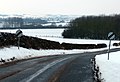
 Cattle grid on the Rutland Water Circular Route - geograph.org.uk - 3721901.jpg 1 600 × 1 035 ; 492 kio
-
 Cattle near Upper Hambleton - geograph.org.uk - 3281083.jpg 3 175 × 2 142 ; 2,15 Mio
-
 Cattle on the Hambleton Peninsula - geograph.org.uk - 3971210.jpg 1 600 × 1 488 ; 925 kio
-
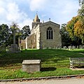
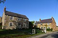
 Church of St Andrew, Hambleton - geograph.org.uk - 4826106.jpg 1 280 × 956 ; 349 kio
-
 Church of St Andrew, Hambleton - geograph.org.uk - 4826113.jpg 1 280 × 960 ; 541 kio
-
 Church of St Andrew, Hambleton - geograph.org.uk - 4826115.jpg 1 280 × 960 ; 699 kio
-
 Church of St Andrew, Hambleton - geograph.org.uk - 4826118.jpg 1 280 × 956 ; 329 kio
-
 Church of St Andrew, Hambleton - geograph.org.uk - 4826120.jpg 960 × 1 280 ; 324 kio
-
 Church of St Andrew, Hambleton - geograph.org.uk - 4826122.jpg 1 280 × 992 ; 274 kio
-
 Church of St Andrew, Hambleton - geograph.org.uk - 4826124.jpg 1 280 × 960 ; 349 kio
-
 Church of St Andrew, Hambleton - geograph.org.uk - 4826126.jpg 960 × 1 280 ; 359 kio
-
 Church of St Andrew, Hambleton - geograph.org.uk - 4826129.jpg 1 280 × 960 ; 379 kio
-
 Church of St Andrew, Hambleton - geograph.org.uk - 4826130.jpg 960 × 1 280 ; 418 kio
-
 Church of St Andrew, Hambleton - geograph.org.uk - 4826133.jpg 506 × 1 280 ; 106 kio
-
 Church of St Andrew, Hambleton - geograph.org.uk - 4826135.jpg 1 280 × 960 ; 299 kio
-
 Church of St Andrew, Hambleton - geograph.org.uk - 4826137.jpg 1 280 × 960 ; 533 kio
-
 Church of St Andrew, Hambleton - geograph.org.uk - 4826139.jpg 1 280 × 936 ; 431 kio
-
 Church of St Andrew, Hambleton - geograph.org.uk - 4826403.jpg 960 × 1 280 ; 259 kio
-
 Church of St Andrew, Hambleton - geograph.org.uk - 4826413.jpg 1 280 × 960 ; 265 kio
-
 Climbing the lane towards Upper Hambleton - geograph.org.uk - 1002393.jpg 640 × 493 ; 105 kio
-
 Clock and sign on the old Post Office - geograph.org.uk - 4826152.jpg 1 280 × 960 ; 385 kio
-
 Cmglee Upper Hambleton high street.jpg 2 048 × 768 ; 384 kio
-
 Coffin lid, St Andrew's church, Hambleton - geograph.org.uk - 5690672.jpg 4 673 × 3 062 ; 5,54 Mio
-
 Construction work on the Hambleton Peninsula - geograph.org.uk - 3456808.jpg 3 005 × 1 921 ; 2,07 Mio
-
 Cormorant nests, Rutland Water - geograph.org.uk - 4826095.jpg 1 280 × 862 ; 433 kio
-
 Cormorants on a platform in Barnhill Creek - geograph.org.uk - 3773486.jpg 1 600 × 1 112 ; 453 kio
-
 Cottages, Upper Hambleton - geograph.org.uk - 3017125.jpg 640 × 480 ; 76 kio
-
 Crossing the road - geograph.org.uk - 1002051.jpg 640 × 501 ; 89 kio
-
 Cycle path alongside a lagoon bund, Rutland Water - geograph.org.uk - 5710669.jpg 3 776 × 2 520 ; 3,48 Mio
-
 Cycle path and Macmillan Way along the south shore of Rutland Water - geograph.org.uk - 5834858.jpg 3 776 × 2 520 ; 2,85 Mio
-
 Cycle path round Rutland Water - geograph.org.uk - 5710652.jpg 3 776 × 2 520 ; 3,55 Mio
-
 Cycle track around Rutland Water - geograph.org.uk - 3017147.jpg 640 × 480 ; 84 kio
-
 Cycleway round Rutland water - geograph.org.uk - 3908328.jpg 480 × 640 ; 236 kio
-
 Cycling around Rutland Water - geograph.org.uk - 3883369.jpg 1 280 × 851 ; 434 kio
-
 Cycling through Hambleton Wood - geograph.org.uk - 1002090.jpg 640 × 480 ; 123 kio
-
 Cycling towards Oakham - geograph.org.uk - 3722115.jpg 1 600 × 1 181 ; 618 kio
-
 Cyclists dismount - geograph.org.uk - 1000862.jpg 640 × 413 ; 79 kio
-
 Cyclists heading towards Upper Hambleton - geograph.org.uk - 3282651.jpg 4 000 × 3 000 ; 4,75 Mio
-
 Descending the lane towards Middle Hambleton - geograph.org.uk - 1002388.jpg 640 × 532 ; 86 kio
-
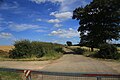
 Descending the road across the Hambleton peninsula - geograph.org.uk - 3282646.jpg 4 000 × 3 000 ; 4,84 Mio
-
 Diverted footpath near Lax Hill - geograph.org.uk - 3956743.jpg 1 024 × 768 ; 193 kio
-
 Draw-off tower in Rutland Water - geograph.org.uk - 3730664.jpg 1 600 × 1 202 ; 438 kio
-
 Eastern part of Rutland Water - geograph.org.uk - 3281075.jpg 3 247 × 2 452 ; 2,49 Mio
-
 Edith Weston from afar - geograph.org.uk - 5183173.jpg 1 024 × 768 ; 985 kio
-

-
 End of the Hambleton Peninsula trail - geograph.org.uk - 4826099.jpg 1 280 × 960 ; 465 kio
-
 Entering Hambleton Wood - geograph.org.uk - 3294065.jpg 4 000 × 3 000 ; 4,91 Mio
-
 Evening sunshine, Rutland Water - geograph.org.uk - 34319.jpg 480 × 640 ; 130 kio
-
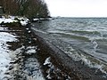
 Exposed beach, Rutland Water - geograph.org.uk - 1981864.jpg 1 280 × 853 ; 454 kio
-
 Exposed shoreline of Rutland Water - geograph.org.uk - 1002072.jpg 640 × 450 ; 92 kio
-
 Farm track, Hambleton Peninsula - geograph.org.uk - 3017136.jpg 640 × 480 ; 105 kio
-
 Farma motyli ( żerowanie na liściach bananowca) - panoramio.jpg 2 288 × 1 712 ; 694 kio
-
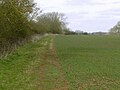
 Farmland near Upper Hambleton - geograph.org.uk - 3017123.jpg 640 × 480 ; 37 kio
-
 Farmland towards Rutland Water - geograph.org.uk - 3017050.jpg 640 × 480 ; 99 kio
-
 Farmland towards Rutland Water - geograph.org.uk - 3017141.jpg 640 × 480 ; 58 kio
-
 Farmland towards Rutland Water - geograph.org.uk - 3017145.jpg 640 × 480 ; 74 kio
-
 Farmland, Hambleton Peninsula - geograph.org.uk - 3017131.jpg 640 × 480 ; 49 kio
-
 Fields leading down to Rutland Water - geograph.org.uk - 2357926.jpg 2 592 × 1 944 ; 1,53 Mio
-
 Finch's Arms - geograph.org.uk - 3093881.jpg 3 456 × 2 304 ; 5,04 Mio
-
 Fireworks at Barnsdale Hotel - geograph.org.uk - 3122600.jpg 3 056 × 2 335 ; 2,73 Mio
-
 Fishermen on Rutland Water - geograph.org.uk - 3293336.jpg 2 585 × 2 206 ; 2,14 Mio
-
 Fishing boat on Rutland Water - geograph.org.uk - 3971800.jpg 1 600 × 1 078 ; 255 kio
-
 Fishing boats near the limnological tower - geograph.org.uk - 3732068.jpg 1 600 × 1 323 ; 299 kio
-
 Fishing in Rutland Water - geograph.org.uk - 1277098.jpg 640 × 570 ; 63 kio
-
 Fishing on Rutland Water - geograph.org.uk - 3293422.jpg 3 209 × 2 140 ; 2,31 Mio
-
 Fishing the shore of Rutland Water - geograph.org.uk - 3721883.jpg 1 600 × 1 200 ; 648 kio
-
 Flock of Canada geese at Rutland Water - geograph.org.uk - 3082444.jpg 1 024 × 768 ; 107 kio
-
 Flotsam caught on the fence - geograph.org.uk - 1067432.jpg 472 × 640 ; 104 kio
-
 Footpath alongside the road to Upper Hambleton - geograph.org.uk - 3293492.jpg 3 125 × 2 586 ; 2,63 Mio
-
 Footpath and cycleway near Lax Hill - geograph.org.uk - 3293257.jpg 4 000 × 3 000 ; 3,48 Mio
-
 Footpath sign and stile, Hambleton Peninsula - geograph.org.uk - 3120423.jpg 800 × 533 ; 324 kio
-
 Footpath through the woods - geograph.org.uk - 1277058.jpg 640 × 453 ; 132 kio
-
 Footpath to Rutland Water - geograph.org.uk - 5569564.jpg 1 024 × 768 ; 922 kio
-
 Footpath to the Rutland Water - geograph.org.uk - 1277059.jpg 640 × 480 ; 108 kio
-
 Gate and cattle grid, Hambleton peninsula - geograph.org.uk - 3119079.jpg 800 × 533 ; 299 kio
-
 Gate and field overlooking Rutland Water - geograph.org.uk - 3724564.jpg 1 600 × 1 136 ; 691 kio
-
 Gate in Hinman's Spinney - geograph.org.uk - 3772298.jpg 1 600 × 1 277 ; 539 kio
-
 Gateway to Burley on the Hill House - geograph.org.uk - 4826091.jpg 960 × 1 280 ; 382 kio
-
 Gateway to Burley on the Hill House and Fishpond Cottage - geograph.org.uk - 4826084.jpg 1 280 × 960 ; 500 kio
-
 Geese on the shore of Rutland Water - geograph.org.uk - 3293557.jpg 3 105 × 2 198 ; 2 Mio
-
 Half Moon Farm near Upper Hambleton - geograph.org.uk - 3281081.jpg 3 390 × 2 529 ; 2,5 Mio
-
 Half Moon Spinney - geograph.org.uk - 2357938.jpg 2 592 × 1 944 ; 2,25 Mio
-
 Half Moon Spinney - geograph.org.uk - 3082452.jpg 1 024 × 768 ; 140 kio
-
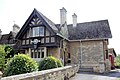
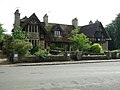
 Hambleton Hall from the lake side - geograph.org.uk - 4826353.jpg 1 280 × 960 ; 591 kio
-
 Hambleton main street - geograph.org.uk - 5568829.jpg 1 024 × 819 ; 1,06 Mio
-
 Hambleton Manor and The Manor Cottage - geograph.org.uk - 4826157.jpg 1 280 × 913 ; 325 kio
-
 Hambleton Old Hall - geograph.org.uk - 4826346.jpg 1 280 × 960 ; 613 kio
-
 Hambleton Old Hall - geograph.org.uk - 4826364.jpg 1 280 × 905 ; 281 kio
-
 Hambleton Old Hall - geograph.org.uk - 5569274.jpg 1 024 × 1 024 ; 1,42 Mio
-
 Hambleton peninsula - end of the road - geograph.org.uk - 5047658.jpg 3 648 × 2 432 ; 3,49 Mio
-
 Hambleton Peninsula - geograph.org.uk - 2399457.jpg 640 × 427 ; 46 kio
-
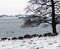
 Hambleton peninsula in the snow - geograph.org.uk - 3773526.jpg 1 600 × 1 184 ; 331 kio
-
 Hambleton Peninsula trail - geograph.org.uk - 4826383.jpg 1 280 × 960 ; 436 kio
-
 Hambleton peninsula, south side - geograph.org.uk - 3082432.jpg 1 024 × 497 ; 71 kio
-
 Hambleton to Burley-on-the-Hill - geograph.org.uk - 5569208.jpg 1 024 × 768 ; 815 kio
-
 Hambleton Village Hall - geograph.org.uk - 4826373.jpg 1 280 × 960 ; 306 kio
-
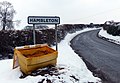 Hambleton village sign - geograph.org.uk - 3774889.jpg 1 600 × 1 101 ; 451 kio
-
 Hambleton Wood - geograph.org.uk - 3293565.jpg 3 157 × 2 418 ; 2,3 Mio
-
 Hambleton Wood at Rutland Water - geograph.org.uk - 3721925.jpg 1 600 × 1 178 ; 939 kio
-
 Hambleton Wood at Rutland Water - geograph.org.uk - 3772204.jpg 1 600 × 1 200 ; 648 kio
-
 Hambleton Wood in the snow - geograph.org.uk - 3772195.jpg 1 600 × 1 121 ; 792 kio
-
 Hambleton, doorway in the former Post Office - geograph.org.uk - 5568852.jpg 683 × 1 024 ; 971 kio
-
 Hambleton, Rutland Water - geograph.org.uk - 34303.jpg 480 × 640 ; 108 kio
-
 Hambleton, war memorial and St Andrew's Church - geograph.org.uk - 5569567.jpg 1 024 × 1 024 ; 1,41 Mio
-
 Harvested field on the Hambleton Peninsula - geograph.org.uk - 2530983.jpg 4 320 × 3 240 ; 5,36 Mio
-
 Heading down the lane towards Oakham - geograph.org.uk - 3774859.jpg 1 600 × 1 095 ; 387 kio
-
 Heavy snow near Upper Hambleton - geograph.org.uk - 3774830.jpg 1 600 × 1 192 ; 508 kio
-
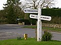 Helpful fingerpost at Hambleton - geograph.org.uk - 4826102.jpg 1 280 × 960 ; 445 kio
-
 High water at Rutland Water - geograph.org.uk - 3281059.jpg 4 000 × 3 000 ; 3,4 Mio
-
 Hill Top Farmhouse - geograph.org.uk - 4826144.jpg 1 280 × 980 ; 351 kio
-
 Hilltop Farmhouse (left) and Hilltop Farm Cottage (right), Hambleton - geograph.org.uk - 5967811.jpg 3 776 × 2 520 ; 3,99 Mio
-
 Hilltop, Oakham Road, Hambleton - geograph.org.uk - 4826146.jpg 1 280 × 960 ; 310 kio
-
 Hinman's spinney - geograph.org.uk - 1277091.jpg 640 × 480 ; 135 kio
-
 Hinman's Spinney and Rutland Water - geograph.org.uk - 3772277.jpg 1 600 × 1 260 ; 478 kio
-
 Hinman's Spinney, Hambleton Peninsula - geograph.org.uk - 3120382.jpg 800 × 533 ; 220 kio
-
 Home Farmhouse, Hambleton - geograph.org.uk - 4826159.jpg 1 280 × 960 ; 328 kio
-
 Houses at Upper Hambleton - geograph.org.uk - 3774801.jpg 1 600 × 1 116 ; 426 kio
-
 In Hambleton churchyard - geograph.org.uk - 5568980.jpg 1 024 × 768 ; 1,06 Mio
-
 In Hambleton Wood - geograph.org.uk - 2357906.jpg 2 592 × 1 944 ; 2,46 Mio
-
 In Hambleton Wood - geograph.org.uk - 5569364.jpg 768 × 1 024 ; 1,33 Mio
-
 Junction near the church, Upper Hambleton - geograph.org.uk - 6291079.jpg 3 631 × 2 758 ; 4,76 Mio
-
 Kerry Cottage and Holly Cottage, Hambleton - geograph.org.uk - 4826163.jpg 1 280 × 960 ; 337 kio
-
 Lagoon 2 from the Redshank Hide, Rutland Water - geograph.org.uk - 5713377.jpg 3 776 × 2 520 ; 2,6 Mio
-
 Lagoon 2, Rutland Water Nature Reserve - geograph.org.uk - 3908332.jpg 640 × 480 ; 110 kio
-
 Lagoon 2, Rutland Water Nature Reserve - geograph.org.uk - 3908333.jpg 640 × 480 ; 122 kio
-
 Lagoon 2, Rutland Water Nature Reserve - geograph.org.uk - 3908337.jpg 640 × 480 ; 125 kio
-
 Lagoon 5 at Egleton - geograph.org.uk - 3880771.jpg 1 280 × 941 ; 294 kio
-
 Lagoon 5, Anglian Water Birdwatching Centre, Rutland Water - geograph.org.uk - 5713374.jpg 3 776 × 2 520 ; 2,72 Mio
-
 Lagoon 6 at Egleton - geograph.org.uk - 3880774.jpg 1 280 × 932 ; 281 kio
-
 Lagoon 7, Rutland Water Nature Reserve - geograph.org.uk - 3908313.jpg 640 × 480 ; 147 kio
-
 Lagoon III, Rutland Water Nature Reserve - geograph.org.uk - 246314.jpg 640 × 427 ; 104 kio
-
 Lakeside path near Hambleton - geograph.org.uk - 4826356.jpg 1 280 × 960 ; 337 kio
-
 Lambs on the Hambleton Peninsula - geograph.org.uk - 3971290.jpg 1 600 × 1 146 ; 460 kio
-
 Lane approaching Upper Hambleton - geograph.org.uk - 3775709.jpg 1 600 × 1 191 ; 484 kio
-
 Lane descending out of Upper Hambleton - geograph.org.uk - 3775714.jpg 1 600 × 1 175 ; 515 kio
-
 Lane heading to the end of the Hambleton peninsula - geograph.org.uk - 3772308.jpg 1 600 × 1 235 ; 351 kio
-
 Lane through Upper Hambleton - geograph.org.uk - 3775727.jpg 1 600 × 1 332 ; 789 kio
-
 Lane to Middle Hambleton - geograph.org.uk - 3293502.jpg 2 579 × 1 961 ; 1,54 Mio
-
 Lane to Middle Hambleton and Rutland Water - geograph.org.uk - 3771316.jpg 1 600 × 1 189 ; 598 kio


_-_panoramio.jpg)


_and_Hilltop_Farm_Cottage_(right),_Hambleton_-_geograph.org.uk_-_5967811.jpg)


