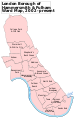
Category:Hammersmith, London
둘러보기로 이동
검색으로 이동

런던의 한 지역이다.  | |||||
| 미디어 올리기 | |||||
| 다음 종류에 속함 | |||||
|---|---|---|---|---|---|
| 위치 | 해머스미스 풀럼구, 그레이터런던, London, 잉글랜드 | ||||
| 다음 유역을 끼고 있음 | |||||
 | |||||
하위 분류
다음은 이 분류에 속하는 하위 분류 34개 가운데 34개입니다.
5
8
- 84 Brook Green (4 F)
C
F
- Figurehead by Rick Kirby (9 F)
G
H
- Hammersmith Bridge Road (4 F)
- Hammersmith bus station (144 F)
- Hammersmith Flyover (24 F)
- Hammersmith Jack in the Green (17 F)
- Hammersmith Library (16 F)
- Hammersmith Police Station (13 F)
K
L
- Livat Hammersmith (16 F)
M
P
Q
R
- Ravenscourt Baptist Church (2 F)
- Riverside Studios (11 F)
S
T
"Hammersmith, London" 분류에 속하는 미디어
다음은 이 분류에 속하는 파일 96개 가운데 96개입니다.
-
 "Alex Chinneck" Art sculpture in West London (40563285451).jpg 4,000 × 2,666; 5.76 MB
-

-

-

-

-

-
 184 Shepherds Bush Road London Portrait (before glass roof addition).jpg 1,000 × 1,494; 1.59 MB
-
 A 220 bus - Shepherd's Bush Road, W6 - geograph.org.uk - 892658.jpg 640 × 480; 89 KB
-
 A road near Hammersmith.JPG 3,264 × 2,176; 1.86 MB
-
 Agate Road - geograph.org.uk - 5129329.jpg 4,000 × 3,000; 3.88 MB
-
 Agate Road, Hammersmith - geograph.org.uk - 3420364.jpg 4,288 × 3,216; 5.52 MB
-
 Amor Road, Hammersmith - geograph.org.uk - 3420399.jpg 4,288 × 3,216; 5.91 MB
-
 An Unnamed Statue In Fulham Reach, Hammersmith - London.jpg 2,999 × 3,999; 3.73 MB
-
 Another 220 - geograph.org.uk - 892664.jpg 640 × 480; 100 KB
-
 Arthur Covey and others at a lawn party. (2999274406).jpg 3,527 × 2,697; 1.55 MB
-
 Auriol Kensington Rowing Club (geograph 2109171).jpg 800 × 747; 108 KB
-
 Barnes and Hammersmith from the air - geograph.org.uk - 2246845.jpg 640 × 353; 144 KB
-
 Beadon Road, Hammersmith - geograph.org.uk - 4081957.jpg 2,304 × 1,728; 830 KB
-
 Benbow Road, W6 - geograph.org.uk - 851347.jpg 640 × 480; 80 KB
-
 Black Lion Lane - geograph.org.uk - 5129344.jpg 3,820 × 2,868; 1.88 MB
-
 Black Lion Lane, Hammersmith - geograph.org.uk - 3610475.jpg 1,000 × 693; 207 KB
-
 Brackenbury Village II, W6 - geograph.org.uk - 892551.jpg 640 × 480; 76 KB
-
 Brackenbury Village, W6 - geograph.org.uk - 892537.jpg 480 × 640; 75 KB
-
 Bulwer Street, Hammersmith - geograph.org.uk - 2214975.jpg 640 × 480; 164 KB
-
 Cambridge Grove - geograph.org.uk - 5129331.jpg 4,000 × 3,000; 3.43 MB
-
 COVID-19 sign - Marks and Spencer - Hammersmith London.jpg 5,472 × 3,080; 10.18 MB
-
 Cromwell Avenue, Ravenscourt Park - geograph.org.uk - 2149752.jpg 1,600 × 1,200; 465 KB
-
 Dalling Road - geograph.org.uk - 4512602.jpg 1,024 × 768; 224 KB
-
-

-
 Flickr - law keven - Just another Tequila Sunset....jpg 3,888 × 2,592; 731 KB
-
 Flickr - law keven - Leaving on a jet plane.....jpg 2,144 × 1,944; 136 KB
-
 Flickr - law keven - Out with a bang.....jpg 3,808 × 2,516; 1.08 MB
-
 Flickr - law keven - The painted sky.....jpg 3,888 × 2,592; 1.07 MB
-
 Fulham Reach W6 - 28882637644.jpg 2,227 × 2,972; 3.24 MB
-
 Fulham Reach W6 - 28882643314.jpg 2,304 × 3,072; 1.36 MB
-
 Fulham Reach W6 - 28885339513.jpg 3,072 × 2,304; 1.31 MB
-
 Fulham Reach W6 - 29218234280.jpg 3,072 × 2,304; 1.42 MB
-
 Fulham Reach W6.jpg 3,072 × 2,304; 1.38 MB
-
 Fulham Reach, Hammersmith (51934494374).jpg 5,184 × 3,888; 5.13 MB
-
 Fulham Reach, Hammersmith (51934494499).jpg 5,184 × 3,888; 5.77 MB
-
 Glenthorne Road, Hammersmith - geograph.org.uk - 1814977.jpg 480 × 640; 68 KB
-
 Great West Road, Hammersmith (1) - geograph.org.uk - 849100.jpg 640 × 480; 69 KB
-
 Great West Road, Hammersmith (2) - geograph.org.uk - 849101.jpg 640 × 480; 75 KB
-
 Hammersmith (51934169116).jpg 5,184 × 3,888; 5.65 MB
-
 Hammersmith - geograph.org.uk - 5723315.jpg 3,720 × 2,480; 7.76 MB
-
 Hammersmith and Fulham from the air - geograph.org.uk - 5074197.jpg 640 × 480; 222 KB
-
 Hammersmith and Fulham from the air - geograph.org.uk - 6087181.jpg 1,024 × 768; 725 KB
-
 Hammersmith and Fulham from the air - geograph.org.uk - 6087182.jpg 1,024 × 768; 796 KB
-
 Hammersmith and Fulham London UK labelled ward map 2002.svg 797 × 1,266; 68 KB
-
 Hammersmith Bridge from the air - geograph.org.uk - 5074223.jpg 640 × 480; 209 KB
-
 Hammersmith from the air - geograph.org.uk - 4418621.jpg 640 × 480; 191 KB
-
 Hammersmith from the air - geograph.org.uk - 5074218.jpg 640 × 480; 214 KB
-
 Hammersmith from the air - geograph.org.uk - 6080418.jpg 1,024 × 768; 792 KB
-
 Hammersmith Hospital - London.jpg 4,000 × 3,000; 2.47 MB
-
 Hammersmith in Spring.jpg 2,349 × 1,566; 3.88 MB
-
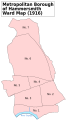 Hammersmith Met. B Ward Map 1916.svg 585 × 1,052; 52 KB
-
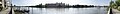 Hammersmith panorama.jpg 3,439 × 408; 1.13 MB
-
 Hammersmith Public Baths.jpg 1,881 × 1,821; 944 KB
-
 Hammersmith Saint Augustine's Priory.JPG 2,176 × 3,264; 1.97 MB
-
 Hammersmith, Beadon Road and Underground station - geograph.org.uk - 3589980.jpg 1,600 × 899; 344 KB
-
 High Rise Under Construction On King Street, Hammersmith - London.jpg 4,000 × 3,000; 3.18 MB
-
 Iffley Road, W6 - geograph.org.uk - 2102429.jpg 480 × 640; 127 KB
-
 Iffley Road, W6 - geograph.org.uk - 965636.jpg 640 × 480; 91 KB
-
 Kings Mall - Lyric Theatre Plaza - panoramio.jpg 500 × 375; 95 KB
-
 Latymer Performing Arts Centre, Hammersmith, London.jpg 3,508 × 2,339; 3.74 MB
-
 Leamore Street, W6 - geograph.org.uk - 2102418.jpg 640 × 434; 133 KB
-
 LFB Hammersmith 2006.jpg 800 × 590; 127 KB
-
 Lillie bridge depot - panoramio.jpg 3,648 × 2,048; 1.97 MB
-
 London , Hammersmith - Colet Gardens - geograph.org.uk - 2408834.jpg 4,152 × 2,626; 3.93 MB
-
 London , Hammersmith - Hammersmith Grove - geograph.org.uk - 2408906.jpg 4,288 × 2,848; 4.78 MB
-
 London , Hammersmith - Shortlands - geograph.org.uk - 2408857.jpg 4,288 × 2,848; 5.66 MB
-
 London United DE120 on Route 33, Hammersmith (16380532164).jpg 3,105 × 2,071; 3.25 MB
-
 Londres - panoramio (8).jpg 3,264 × 2,448; 1.85 MB
-
 Lyric Square by Beadon Road, Hammersmith - geograph.org.uk - 4081956.jpg 2,194 × 1,570; 1.28 MB
-
 Melina Road, Hammersmith - geograph.org.uk - 3420317.jpg 4,288 × 3,216; 6.11 MB
-
 Mrs Henry Foreman - swimming organiser.jpg 565 × 800; 53 KB
-
 One Hammersmith Grove, W6 - geograph.org.uk - 2100904.jpg 640 × 480; 118 KB
-
 Osram Court estate.jpg 3,650 × 2,040; 5.11 MB
-
 Osram Factory 1931.jpg 1,181 × 769; 343 KB
-

-
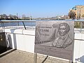
 Sir Alan Herbert Blue Plaque, 12 Hammersmith Terrace - London.jpg 3,801 × 2,852; 1.51 MB
-
 St Peter's Square, Hammersmith.jpg 3,872 × 2,592; 5.11 MB
-
 The Aircraft Factory, Hammersmith - London.jpg 3,877 × 2,907; 2.03 MB
-
 The British Postgraduate Medical School, Hammersmith, London Wellcome V0013426.jpg 2,881 × 2,463; 3.33 MB
-
 The Coach Entrance, Kelmscott House, 26 Upper Mall, Hammersmith - London.jpg 2,824 × 3,825; 2.5 MB
-

-
 The Hands In Pasta Italian Restaurant In Hammersmith - London.jpg 2,819 × 3,000; 1.75 MB
-
 The Leaning Woman by Karel Vogel, Hammersmith.jpg 4,000 × 3,000; 5.8 MB
-

-
 Traffic jam on Glenthorne Road - geograph.org.uk - 2276028.jpg 1,600 × 1,200; 534 KB
-
 Two impures of the ton by DIGHTON, ROBERT - GMII.jpg 435 × 600; 53 KB
-
 The Godolphin schools, Hammersmith, London; perspective view Wellcome V0014791.jpg 3,352 × 2,124; 3.16 MB
-
 Walter Richard Sickert - The River at Hammersmith - 8926.jpg 1,398 × 1,950; 1.65 MB
-
 Watch On The Thames, Upper Mall, Hammersmith - London.jpg 3,000 × 3,779; 1.81 MB
-
 Women at work on the Home Front during the First World War, Hammersmith, London Q31050.jpg 3,841 × 5,367; 9.05 MB
.jpg)
.jpg)
.jpg)
.jpg)
.jpg)
.jpg)
.jpg)


.jpg)
.jpg)


.jpg)
.jpg)

_-_geograph.org.uk_-_849100.jpg)
_-_geograph.org.uk_-_849101.jpg)
.jpg)


.jpg)
.jpg)


_1_Heathrow_Airport_-_Victoria_Station_London00634_(48359647817).jpg)


.jpg)


