Category:London Borough of Hammersmith and Fulham
Jump to navigation
Jump to search
Boroughs of London: City of London · City of Westminster · Barking and Dagenham · Barnet · Bexley · Brent · Bromley · Camden · Croydon · Ealing · Enfield · Greenwich · Hackney · Hammersmith and Fulham · Haringey · Harrow · Havering · Hillingdon · Hounslow · Islington · Kensington and Chelsea · Kingston · Lambeth · Lewisham · Merton · Newham · Redbridge · Richmond · Southwark · Sutton · Tower Hamlets · Waltham Forest · Wandsworth
borough in the London Region in England   | |||||
| Upload media | |||||
| Pronunciation audio | |||||
|---|---|---|---|---|---|
| Instance of | |||||
| Location | Greater London, London, England | ||||
| Legislative body |
| ||||
| Executive body |
| ||||
| Head of government |
| ||||
| Inception |
| ||||
| Population |
| ||||
| Area |
| ||||
| Replaces |
| ||||
| official website | |||||
 | |||||
Subcategories
This category has the following 21 subcategories, out of 21 total.
A
C
E
F
H
M
P
S
Media in category "London Borough of Hammersmith and Fulham"
The following 200 files are in this category, out of 1,920 total.
(previous page) (next page)-
-

-
 "Ghost sign", near Earl's Court - geograph.org.uk - 4753951.jpg 2,346 × 2,148; 1.12 MB
-
 "The Hand ^ Flower", Hammersmith Road - geograph.org.uk - 3238608.jpg 4,171 × 2,503; 2.16 MB
-
 "The Imperial Arms", near Earl's Court - geograph.org.uk - 4744912.jpg 731 × 1,600; 316 KB
-
 "The Ritz", King's Street, Hammersmith - geograph.org.uk - 5935771.jpg 5,028 × 3,575; 3.7 MB
-
 "The Rylston" pub and November morning sky - geograph.org.uk - 3238736.jpg 4,437 × 2,958; 2.95 MB
-

-

-
 "Vineyard", Hurlingham Rd, London - geograph.org.uk - 2057640.jpg 3,296 × 2,472; 1.85 MB
-
 'Ghost sign', Linver Street - geograph.org.uk - 3589942.jpg 774 × 1,200; 808 KB
-
 'Shepherd's East', Richmond Way - geograph.org.uk - 2866530.jpg 1,024 × 683; 140 KB
-
-
 ... and there's a housing shortage^ - geograph.org.uk - 3331431.jpg 2,506 × 1,842; 1.02 MB
-
 1 Down Place, Hammersmith - geograph.org.uk - 3417278.jpg 4,288 × 3,216; 4.47 MB
-
 1-3 Putney Bridge Approach - geograph.org.uk - 3644987.jpg 640 × 382; 129 KB
-
 11 bus on King's Road, Walham Green - geograph.org.uk - 5133988.jpg 2,304 × 1,728; 836 KB
-
 20 St. James Street - geograph.org.uk - 4816355.jpg 3,973 × 2,648; 6.57 MB
-
 2011 census exhibition bus at Westfield - geograph.org.uk - 4994564.jpg 640 × 480; 113 KB
-
 21-56 Batman Close - geograph.org.uk - 4530633.jpg 1,024 × 768; 266 KB
-
 220 bus on Brook Green, Hammersmith - geograph.org.uk - 5115012.jpg 2,304 × 1,728; 784 KB
-
 26-28 Hammersmith Grove - geograph.org.uk - 3420419.jpg 3,216 × 4,288; 5.43 MB
-
 27, Sterne Street - geograph.org.uk - 4425962.jpg 810 × 1,080; 302 KB
-
 3 Wheeler on Boscombe Road - geograph.org.uk - 4365264.jpg 768 × 1,024; 240 KB
-
 49-51 Shepherd's Bush Green, W12 - geograph.org.uk - 2048010.jpg 3,504 × 2,336; 1.98 MB
-
 5-6 Church Gate - geograph.org.uk - 3645008.jpg 512 × 640; 191 KB
-
 52-46 St Dunstan's Road - geograph.org.uk - 4498974.jpg 4,000 × 3,000; 3.51 MB
-
 56 Wood Lane - geograph.org.uk - 4934304.jpg 640 × 435; 178 KB
-
 62-64 Chancellors Road, Hammersmith - geograph.org.uk - 3806337.jpg 640 × 480; 118 KB
-
 85 and 87 Waterford Road - geograph.org.uk - 3806140.jpg 640 × 480; 98 KB
-
 A bad case of Russian Vine - geograph.org.uk - 4122665.jpg 1,024 × 768; 134 KB
-

-

-
 A mock something building from 1906 - geograph.org.uk - 2550131.jpg 3,684 × 2,442; 1.27 MB
-
 A site bought up by Sainsbury's - geograph.org.uk - 2550118.jpg 3,872 × 2,592; 3.73 MB
-
 A site for tyred eyes - geograph.org.uk - 2268176.jpg 640 × 480; 117 KB
-
 A Thames jetty - geograph.org.uk - 2172619.jpg 640 × 480; 72 KB
-
 A Very Corner Shop - geograph.org.uk - 4593874.jpg 3,624 × 2,576; 1.61 MB
-
 A wrecked bike - geograph.org.uk - 4122838.jpg 800 × 600; 139 KB
-
 A40 Savoy Circus, East Acton - geograph.org.uk - 2214585.jpg 4,320 × 3,240; 3.75 MB
-
 A40 Westway junction White City - geograph.org.uk - 2245452.jpg 1,600 × 1,200; 592 KB
-
 A4020 - geograph.org.uk - 4131661.jpg 640 × 430; 97 KB
-
 A4020, Shepherd's Bush - geograph.org.uk - 4143777.jpg 640 × 430; 94 KB
-
 Across the River Thames, Fulham, London - geograph.org.uk - 3173694.jpg 4,500 × 3,000; 6.63 MB
-
 Across the River Thames, Fulham, London - geograph.org.uk - 3173710.jpg 4,800 × 3,200; 5.49 MB
-
 Across the Thames after sunset - geograph.org.uk - 1915689.jpg 640 × 480; 60 KB
-
 Across the Thames to William Hunt Mansions - geograph.org.uk - 3238706.jpg 3,070 × 4,298; 3.09 MB
-
 Acton Bound - geograph.org.uk - 3413718.jpg 1,600 × 985; 1.26 MB
-
 Adam Walk - geograph.org.uk - 3070995.jpg 475 × 640; 79 KB
-
 Addison Gardens contraflow - geograph.org.uk - 4122800.jpg 1,024 × 768; 149 KB
-
 Addison Gardens railway bridge - geograph.org.uk - 2843954.jpg 1,024 × 683; 207 KB
-
 Advertising boards, Shepherds Bush Roundabout - geograph.org.uk - 5080777.jpg 4,000 × 3,000; 2.41 MB
-

-
 Aetherius House, Fulham - geograph.org.uk - 4425423.jpg 4,288 × 2,416; 2.81 MB
-
 Al-Dimshqi, Shepherd's Bush - geograph.org.uk - 4131512.jpg 640 × 430; 72 KB
-
 Aldine Court - geograph.org.uk - 4425975.jpg 1,440 × 1,080; 500 KB
-
 Aldine Court, Caxton Road - geograph.org.uk - 4348172.jpg 1,024 × 768; 174 KB
-

-
 Alleyway in Victoria Junior School, North Hammersmith - geograph.org.uk - 3418720.jpg 4,288 × 3,216; 4.42 MB
-
 Along the Thames Path, Fulham, London - geograph.org.uk - 3171915.jpg 4,140 × 2,760; 7.87 MB
-
 Alterations at 20 St James Street - geograph.org.uk - 3806408.jpg 640 × 480; 114 KB
-
 An unusual landscape feature - geograph.org.uk - 6027983.jpg 4,000 × 3,000; 4.96 MB
-
 Annexe to Kelmscott House, Upper Mall - geograph.org.uk - 2129506.jpg 480 × 640; 117 KB
-
 Apartment block on Fulham Road - geograph.org.uk - 4219977.jpg 640 × 410; 121 KB
-
 Apartment blocks by Parson Green station - geograph.org.uk - 4240600.jpg 1,024 × 431; 105 KB
-
 Apartment blocks near Wandsworth Bridge - geograph.org.uk - 4968174.jpg 1,024 × 682; 112 KB
-
 Apartments by St Mary's Church - geograph.org.uk - 3568363.jpg 1,600 × 1,200; 350 KB
-
 Apartments on North End Road, West Kensington - geograph.org.uk - 3238744.jpg 4,449 × 2,966; 2.96 MB
-
 Apartments on the Thames - geograph.org.uk - 2619213.jpg 1,024 × 680; 186 KB
-
 Apex House - geograph.org.uk - 2861906.jpg 640 × 467; 67 KB
-
 Apex House, Hythe Road Industrial Estate - geograph.org.uk - 5545852.jpg 3,386 × 2,703; 1.37 MB
-
 Apex Industrial Estate, Hythe Road, London NW10 - geograph.org.uk - 3993839.jpg 3,648 × 2,736; 2.11 MB
-

-
-
 Approaching West Kensington - geograph.org.uk - 4820680.jpg 3,973 × 2,648; 7.21 MB
-
 Approaching Willesden Junction from the south - geograph.org.uk - 2830514.jpg 1,024 × 912; 131 KB
-
 Archway on Hofland Road - geograph.org.uk - 4122647.jpg 1,024 × 768; 138 KB
-
 Ariel Way - geograph.org.uk - 4934202.jpg 640 × 428; 110 KB
-
 Ariel Way - geograph.org.uk - 4994473.jpg 640 × 480; 103 KB
-
-
 Arthur Henderson House - geograph.org.uk - 4423035.jpg 1,440 × 1,080; 585 KB
-
 Artillery Lane, W12 - geograph.org.uk - 4995176.jpg 640 × 480; 120 KB
-
 Arts ^ Crafts style building, Hammersmith Road - geograph.org.uk - 4960788.jpg 1,600 × 899; 343 KB
-
 Artwork commemorating the University Boat Race - geograph.org.uk - 3427464.jpg 4,000 × 3,000; 4.31 MB
-
 Artwork, Devonport Road - geograph.org.uk - 4366846.jpg 1,024 × 768; 289 KB
-
 Ashchurch Grove, W12 - geograph.org.uk - 3596163.jpg 1,024 × 769; 224 KB
-
 Ashcroft Square, W6 - geograph.org.uk - 2102460.jpg 2,195 × 1,449; 581 KB
-
 Ashfield House, West Cromwell Road - geograph.org.uk - 4934563.jpg 640 × 426; 132 KB
-
 Aspen Gardens, Hammersmith - geograph.org.uk - 3417275.jpg 4,288 × 3,216; 7.4 MB
-
 Aston Martin Specialist, Goldhawk Road - geograph.org.uk - 4366853.jpg 1,024 × 768; 199 KB
-
 Auriol Road, London W14 - geograph.org.uk - 4960791.jpg 1,600 × 991; 433 KB
-
 Autumn on the Thames Path - geograph.org.uk - 2172613.jpg 640 × 480; 152 KB
-
 Avonmore Primary School - geograph.org.uk - 5999129.jpg 4,000 × 3,000; 5.14 MB
-

-
 Backs to the road - geograph.org.uk - 5353288.jpg 2,592 × 3,722; 2.17 MB
-
 Bagleys Lane - geograph.org.uk - 4365295.jpg 1,024 × 768; 181 KB
-
 Bagleys Lane - geograph.org.uk - 4394963.jpg 1,024 × 768; 166 KB
-
 Bagleys Lane at the junction of Kings Road - geograph.org.uk - 3888988.jpg 2,560 × 1,920; 2 MB
-
 Bagleys Lane depot, Sands End - geograph.org.uk - 3888890.jpg 2,560 × 1,920; 1.97 MB
-
 Bagleys Lane, Sands End - geograph.org.uk - 1985629.jpg 640 × 480; 97 KB
-
 Bank of the Thames at Putney - geograph.org.uk - 2500964.jpg 640 × 480; 71 KB
-
 Barclays and Santander cycles, Fulham High Street - geograph.org.uk - 4423047.jpg 1,080 × 1,080; 530 KB
-
 Barclays bikes, Greyhound Road - geograph.org.uk - 3966517.jpg 427 × 640; 66 KB
-
 Barclays cycle hire at Westfield, SE docking station - geograph.org.uk - 2844513.jpg 3,648 × 2,736; 3.22 MB
-
 Barge on the mud, Riverside, Hammersmith - geograph.org.uk - 2109166.jpg 640 × 430; 127 KB
-
 Barge passes Putney Pier - geograph.org.uk - 2127768.jpg 640 × 480; 58 KB
-
 Barges at The Dove Pier - geograph.org.uk - 2618473.jpg 1,024 × 680; 172 KB
-

-
 Barons Court Road - geograph.org.uk - 4464876.jpg 1,600 × 1,200; 777 KB
-
 Barons Keep, W14 - geograph.org.uk - 868493.jpg 640 × 480; 115 KB
-
 Barrier, Broomhouse Lane - geograph.org.uk - 5276672.jpg 640 × 426; 106 KB
-
 Barton House car park, SW6 - geograph.org.uk - 2065375.jpg 640 × 480; 135 KB
-
 Barton House SW6 - geograph.org.uk - 2654257.jpg 473 × 640; 64 KB
-
 Barton House, SW6 - geograph.org.uk - 3808400.jpg 480 × 640; 95 KB
-
 Basketball Court, Ravenscourt Park - geograph.org.uk - 6150967.jpg 4,836 × 3,496; 2.25 MB
-
 Battersea Reach - geograph.org.uk - 3808198.jpg 640 × 480; 76 KB
-
 Battersea Reach - geograph.org.uk - 4603874.jpg 1,024 × 683; 179 KB
-
 Battersea Reach - geograph.org.uk - 5284419.jpg 640 × 426; 63 KB
-

-
-
 Bayonne Park - geograph.org.uk - 4374489.jpg 5,184 × 3,456; 1.74 MB
-
 BBC White City One building, 2011 - geograph.org.uk - 4994665.jpg 640 × 428; 110 KB
-
 Beach at Putney Bridge - geograph.org.uk - 3602579.jpg 640 × 480; 163 KB
-
 Beadon Road - geograph.org.uk - 6143923.jpg 768 × 1,024; 583 KB
-

-
 Below the railway bridge - geograph.org.uk - 3807344.jpg 640 × 430; 60 KB
-
 Belushis, Shepherds Bush - geograph.org.uk - 4122843.jpg 1,024 × 768; 127 KB
-
 Belvedere, Chelsea Harbour - geograph.org.uk - 2623422.jpg 680 × 1,024; 131 KB
-
 Beneath the A40 flyover - geograph.org.uk - 5526073.jpg 4,000 × 3,000; 2.5 MB
-
-
 Bin store for Hofland House - geograph.org.uk - 4122677.jpg 640 × 480; 99 KB
-
 Bishop's Garden, Fulham - geograph.org.uk - 5735646.jpg 640 × 480; 115 KB
-
 Bishop's Park by Craven Cottage - geograph.org.uk - 5944644.jpg 1,920 × 1,280; 1.56 MB
-
 Bishop's Park, Fulham - geograph.org.uk - 5944786.jpg 1,920 × 1,280; 1.62 MB
-
 Black Lion Stairs - geograph.org.uk - 3807063.jpg 640 × 480; 88 KB
-
 Block H, Fulham Reach - geograph.org.uk - 3381334.jpg 501 × 640; 31 KB
-
 Block H, Fulham Reach - geograph.org.uk - 3381340.jpg 640 × 413; 54 KB
-
 Blocks of flats, Lillie Road, Fulham - geograph.org.uk - 2485883.jpg 640 × 480; 68 KB
-
 Blossom at Novello Street - geograph.org.uk - 4422778.jpg 810 × 1,080; 226 KB
-
 Blossom by Carteret House - geograph.org.uk - 2327448.jpg 640 × 480; 163 KB
-
 Blossom on Sterne Street - geograph.org.uk - 4425964.jpg 3,000 × 1,493; 1.45 MB
-
 Blossom on Sterne Street - geograph.org.uk - 4425969.jpg 1,440 × 1,080; 469 KB
-
 Blythe House, main frontage - geograph.org.uk - 4960717.jpg 899 × 1,600; 321 KB
-
 Blythe House, south-east corner - geograph.org.uk - 4960734.jpg 899 × 1,600; 325 KB
-
 Boat Race Art Work - geograph.org.uk - 5735679.jpg 640 × 480; 90 KB
-
 Boats moored - geograph.org.uk - 5276695.jpg 640 × 426; 89 KB
-
 Boats moored, Battersea Reach - geograph.org.uk - 5284390.jpg 640 × 426; 56 KB
-
-
 Boats off Putney Embankment - geograph.org.uk - 2106030.jpg 640 × 430; 135 KB
-
 Bolingbroke Road - geograph.org.uk - 4122795.jpg 1,024 × 768; 180 KB
-

-
 Bookshop, Ranelagh Gardens SW6 - geograph.org.uk - 3602730.jpg 480 × 640; 191 KB
-
 Bootmaker's Sign - geograph.org.uk - 6145753.jpg 1,024 × 678; 259 KB
-
 Boris bikes at Westfield, NE docking station - geograph.org.uk - 2844529.jpg 3,648 × 2,736; 2.33 MB
-
 Boris bikes at Westfield, SW docking station - geograph.org.uk - 2844539.jpg 3,648 × 2,736; 2.45 MB
-
 Boris hire bikes at Westfield (SE docking point) - geograph.org.uk - 2844510.jpg 3,342 × 2,752; 1.19 MB
-
 Boris' Legacy - geograph.org.uk - 4816634.jpg 4,000 × 2,666; 7.08 MB
-
 Boscombe Road - geograph.org.uk - 4366860.jpg 1,024 × 768; 163 KB
-
 Bottle Kiln at Fulham Pottery, Burlington Road - geograph.org.uk - 4423040.jpg 810 × 1,080; 329 KB
-
 Bowerdean Street - geograph.org.uk - 4513082.jpg 1,024 × 768; 239 KB
-
 Boxing Day games - geograph.org.uk - 6133383.jpg 2,448 × 3,264; 866 KB
-
 Brasserie Blanc, Goldhurst House, Fulham - geograph.org.uk - 5762684.jpg 2,560 × 1,815; 4.51 MB
-
 Bridge over the District Line - geograph.org.uk - 5596849.jpg 4,000 × 3,000; 2.48 MB
-
 Bridge View, Hammersmith - geograph.org.uk - 3417266.jpg 4,288 × 3,216; 5.38 MB
-
 Bridges Wharf in the fog - geograph.org.uk - 2663658.jpg 640 × 480; 15 KB
-
 Brook Green - geograph.org.uk - 3810498.jpg 3,963 × 2,465; 1.83 MB
-
 Brook Green - geograph.org.uk - 4834755.jpg 4,000 × 1,907; 1.82 MB
-
 Brook Hotel - geograph.org.uk - 4070880.jpg 640 × 430; 84 KB
-
 Broomfield Lane - geograph.org.uk - 5276688.jpg 640 × 426; 81 KB
-
 Broomhouse Dock - geograph.org.uk - 1810408.jpg 640 × 424; 68 KB
-
 Broomhouse Dock - geograph.org.uk - 5276693.jpg 640 × 426; 84 KB
-
 Broomhouse Lane - geograph.org.uk - 5276663.jpg 640 × 426; 106 KB
-
 Broughton Road - geograph.org.uk - 4394957.jpg 1,024 × 768; 150 KB
-
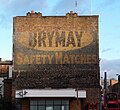
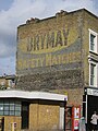 Brymay Safety Matches ghost sign - geograph.org.uk - 5136915.jpg 3,000 × 4,000; 2.93 MB
-
 Builders Merchant by Old Oak Common - geograph.org.uk - 4479142.jpg 3,648 × 2,736; 4.03 MB
-
 Building materials delivery on Rylston Road - geograph.org.uk - 2548628.jpg 3,872 × 2,592; 4.11 MB
-
 Buildings on the corner of Du Cane Road - geograph.org.uk - 4183409.jpg 2,304 × 1,728; 769 KB
-
 Burlington Danes Academy, Scrubs Lane - geograph.org.uk - 4183450.jpg 2,304 × 1,728; 665 KB
-

-
-
-
 Bus stops at Shepherds Bush - geograph.org.uk - 4122841.jpg 1,024 × 768; 89 KB
-
 Buses on Gonville Street - geograph.org.uk - 4423043.jpg 1,440 × 1,080; 437 KB
-
 Bush Hall, Uxbridge Road - geograph.org.uk - 4348176.jpg 1,024 × 768; 157 KB
-
 Cafe in Hythe Road London NW10 - geograph.org.uk - 3994159.jpg 3,648 × 2,736; 2.12 MB
-
 Café Plum, Hammersmith - geograph.org.uk - 4816298.jpg 4,000 × 2,666; 6.69 MB
-
 Canal bridge 7 (Old Oak Lane) - geograph.org.uk - 4849280.jpg 1,600 × 1,200; 359 KB
-
 Canal bridge 7d at Old Oak Common - geograph.org.uk - 4849285.jpg 1,600 × 1,200; 342 KB
-
 Canal bridge maintenance using barge Ruby - geograph.org.uk - 5048859.jpg 3,648 × 2,736; 2.81 MB
-
-
 Car Giant - geograph.org.uk - 3811746.jpg 640 × 430; 48 KB
-
 Car Giant - geograph.org.uk - 5383268.jpg 640 × 426; 65 KB
-
 Car Giant on Hythe Road, College Park - geograph.org.uk - 4393684.jpg 2,304 × 1,728; 855 KB
-

-
 Cargiant , NW10 - geograph.org.uk - 2861869.jpg 480 × 640; 65 KB
-
 Cargiant.co.uk - geograph.org.uk - 4744182.jpg 640 × 480; 93 KB
-
 Carnwath Industrial Estate - geograph.org.uk - 2101492.jpg 640 × 430; 113 KB
-
 Carnwath Rd - geograph.org.uk - 5276717.jpg 640 × 426; 79 KB
-
 Carnwath Rd - geograph.org.uk - 5276724.jpg 640 × 426; 76 KB
-
 Carriages at Willesden Junction - geograph.org.uk - 2870496.jpg 640 × 430; 62 KB


_-_geograph.org.uk_-_2844510.jpg)


_-_geograph.org.uk_-_4849280.jpg)


