Category:Hampstead Norreys
Aller à la navigation
Aller à la recherche
English: Hampstead Norreys (alternatively spelt Hampstead Norris) is a village and civil parish in Berkshire, England.
village britannique  | |||||
| Téléverser des médias | |||||
| Nature de l’élément | |||||
|---|---|---|---|---|---|
| Lieu | West Berkshire, Berkshire, Angleterre du Sud-Est, Angleterre | ||||
| Superficie |
| ||||
 | |||||
Sous-catégories
Cette catégorie comprend 9 sous-catégories, dont les 9 ci-dessous.
B
- Bothampstead (23 F)
C
H
- Hampstead Norreys Motte (3 F)
- Hampstead Norreys Pillboxes (43 F)
P
- Perborough Castle (12 F)
T
- The Living Rainforest (39 F)
Média dans la catégorie « Hampstead Norreys »
Cette catégorie comprend 397 fichiers, dont les 200 ci-dessous.
(page précédente) (page suivante)-
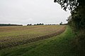
 A clear area - geograph.org.uk - 2848882.jpg 1 024 × 683 ; 215 kio
-
 A shower and a bridge over the M4 - geograph.org.uk - 2904580.jpg 3 443 × 2 305 ; 1,33 Mio
-
 A sign on the bridge - geograph.org.uk - 2733687.jpg 1 024 × 683 ; 219 kio
-
 Air raid shelter in Beech Wood - geograph.org.uk - 1150205.jpg 640 × 426 ; 216 kio
-
 Air raid shelter near the road - geograph.org.uk - 2061826.jpg 1 024 × 683 ; 270 kio
-
 Airstrip towards Beech wood - geograph.org.uk - 2061738.jpg 1 024 × 683 ; 124 kio
-
 All that remains - geograph.org.uk - 2707537.jpg 533 × 800 ; 191 kio
-
 Along Beech wood - geograph.org.uk - 2073891.jpg 533 × 800 ; 117 kio
-
 Along the perimeter road - geograph.org.uk - 2061748.jpg 533 × 800 ; 91 kio
-
 Another base - geograph.org.uk - 2059576.jpg 1 024 × 683 ; 286 kio
-
 Ashridge Wood OBH - geograph.org.uk - 4684858.jpg 3 808 × 2 544 ; 3,4 Mio
-
 Ashridge Wood Pumping Station - geograph.org.uk - 4684862.jpg 4 000 × 2 664 ; 4,24 Mio
-
 B4009 junction with Dog Lane - geograph.org.uk - 2587527.jpg 3 462 × 2 491 ; 1,89 Mio
-
 B4009 junction with lane to Eling - geograph.org.uk - 2904710.jpg 3 363 × 2 284 ; 1,45 Mio
-
 B4009 southeast of Trumplett's Farm - geograph.org.uk - 2904696.jpg 3 197 × 2 659 ; 1,5 Mio
-
 Back through Beech Wood - geograph.org.uk - 2078267.jpg 1 024 × 683 ; 224 kio
-
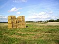 Bales at Haw Farm - geograph.org.uk - 4194446.jpg 1 600 × 1 200 ; 498 kio
-
 Bank in the wood - geograph.org.uk - 2073993.jpg 1 024 × 683 ; 214 kio
-
 Banterwick Farm - geograph.org.uk - 2821893.jpg 2 560 × 1 920 ; 668 kio
-
 Banterwick Farm - geograph.org.uk - 4684688.jpg 4 000 × 2 664 ; 2,92 Mio
-
 Banterwick Farm - geograph.org.uk - 71382.jpg 640 × 480 ; 480 kio
-
 Barn, Hampstead Norreys, Berkshire - geograph.org.uk - 4611682.jpg 4 332 × 3 004 ; 3,17 Mio
-
 Barns at Haw farm - geograph.org.uk - 2079847.jpg 1 024 × 683 ; 120 kio
-
 Base by the path - geograph.org.uk - 2078258.jpg 1 024 × 683 ; 325 kio
-
 Base of a building - geograph.org.uk - 2058899.jpg 1 024 × 683 ; 306 kio
-
 Beacon across the field - geograph.org.uk - 2058530.jpg 1 024 × 683 ; 179 kio
-
 Beacon from the farm - geograph.org.uk - 2061765.jpg 1 024 × 768 ; 139 kio
-
 Beacon near the wood - geograph.org.uk - 2079835.jpg 1 024 × 683 ; 123 kio
-
 Beacon past the pillbox - geograph.org.uk - 2078252.jpg 1 024 × 683 ; 151 kio
-
 Beacon ^ Rubble - geograph.org.uk - 4194744.jpg 1 600 × 1 021 ; 450 kio
-
 Beech Wood House - geograph.org.uk - 1150211.jpg 640 × 426 ; 233 kio
-
 Beech Wood, Hampstead Norreys - geograph.org.uk - 125478.jpg 640 × 480 ; 73 kio
-
 Below Beech Wood - geograph.org.uk - 1148954.jpg 640 × 427 ; 190 kio
-
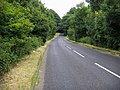
 Bend on the road - geograph.org.uk - 2058534.jpg 1 024 × 683 ; 121 kio
-
 Bend through the woods - geograph.org.uk - 2733680.jpg 1 024 × 683 ; 273 kio
-
 Bendy wire posts - geograph.org.uk - 2070128.jpg 533 × 800 ; 79 kio
-
 Bomb store through the trees - geograph.org.uk - 2075313.jpg 1 024 × 683 ; 283 kio
-
 Bonus point - geograph.org.uk - 2735154.jpg 533 × 800 ; 114 kio
-
 Bottom Barn Pump House - geograph.org.uk - 4803203.jpg 3 597 × 2 505 ; 3,18 Mio
-
 Bottom Barn Pumping Station - geograph.org.uk - 4799114.jpg 4 000 × 3 000 ; 2,41 Mio
-
 Brambles on top - geograph.org.uk - 2056838.jpg 1 024 × 683 ; 226 kio
-
 Brickwork on the arch - geograph.org.uk - 2707466.jpg 1 024 × 683 ; 172 kio
-
 Bridge NDL-16 over the Newbury to Didcot Railway - geograph.org.uk - 2904671.jpg 3 648 × 2 356 ; 3,06 Mio
-
 Bridleway above Banterwick Farm - geograph.org.uk - 2821895.jpg 2 560 × 1 920 ; 687 kio
-
 Bus stop by the road - geograph.org.uk - 2708437.jpg 1 024 × 683 ; 191 kio
-
 Bus stop outside St Mary, Hampstead Norreys - geograph.org.uk - 4796382.jpg 480 × 640 ; 95 kio
-
 Compton DVOR navigation beacon - geograph.org.uk - 125492.jpg 640 × 480 ; 61 kio
-
 Compton that way - geograph.org.uk - 2735152.jpg 1 024 × 683 ; 119 kio
-
 Corner of a field - geograph.org.uk - 986872.jpg 427 × 640 ; 191 kio
-
 Country lane, World's End, Berkshire - geograph.org.uk - 4477011.jpg 945 × 1 024 ; 438 kio
-
 Cow parsley in the wheat - geograph.org.uk - 888934.jpg 640 × 427 ; 120 kio
-
 Crop at Hampstead Norreys - geograph.org.uk - 987028.jpg 640 × 427 ; 158 kio
-
 Crop on Folly Hill - geograph.org.uk - 987030.jpg 640 × 427 ; 155 kio
-
 Crossing of the ways - geograph.org.uk - 861416.jpg 640 × 427 ; 114 kio
-
 Cutmark on Eling rail bridge - geograph.org.uk - 2730632.jpg 480 × 640 ; 121 kio
-
 Cutting at Four Elms - geograph.org.uk - 2840405.jpg 1 024 × 683 ; 354 kio
-
 D-VOR navigational aid, Hampstead Norreys - geograph.org.uk - 876326.jpg 640 × 480 ; 120 kio
-
 Descent to Fiveways - geograph.org.uk - 986959.jpg 640 × 427 ; 180 kio
-
 Down Haw Lane - geograph.org.uk - 2056929.jpg 1 024 × 683 ; 277 kio
-
 Dried up river - geograph.org.uk - 2711073.jpg 533 × 800 ; 199 kio
-
 Dry this side as well - geograph.org.uk - 2710921.jpg 533 × 800 ; 167 kio
-
 Earth on the top - geograph.org.uk - 2070141.jpg 1 024 × 683 ; 174 kio
-
 East of the A34 - geograph.org.uk - 861372.jpg 427 × 640 ; 85 kio
-
 Edge of Beech wood - geograph.org.uk - 2073882.jpg 533 × 800 ; 121 kio
-
 Edge of the field - geograph.org.uk - 2069012.jpg 1 024 × 683 ; 155 kio
-
 Edge of the wood - geograph.org.uk - 2056384.jpg 1 024 × 683 ; 207 kio
-
 Eling Bridge Benchmark - geograph.org.uk - 2733677.jpg 600 × 800 ; 130 kio
-
 Eling Farm - geograph.org.uk - 987072.jpg 640 × 427 ; 198 kio
-
 Eling Farm - geograph.org.uk - 987076.jpg 640 × 427 ; 214 kio
-
 Eling Rail Bridge - geograph.org.uk - 2730633.jpg 1 024 × 683 ; 280 kio
-
 Eling road - geograph.org.uk - 2731988.jpg 1 024 × 683 ; 273 kio
-
 Embankment by the bridge - geograph.org.uk - 2733664.jpg 1 024 × 683 ; 294 kio
-
 Embankment in the trees - geograph.org.uk - 2860085.jpg 1 024 × 683 ; 140 kio
-
 Embankment retaining wall - geograph.org.uk - 2733672.jpg 1 024 × 683 ; 232 kio
-
 Embankment towards Newbury - geograph.org.uk - 2733667.jpg 1 024 × 683 ; 281 kio
-
 End of the parapet - geograph.org.uk - 2841959.jpg 1 024 × 768 ; 354 kio
-
 End of the Station - geograph.org.uk - 2707468.jpg 1 024 × 683 ; 242 kio
-
 Entrance to the bomb dump - geograph.org.uk - 2074019.jpg 1 024 × 683 ; 241 kio
-
 Everington Lane - geograph.org.uk - 879735.jpg 640 × 480 ; 109 kio
-
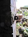 Eye on the wall - geograph.org.uk - 2071997.jpg 600 × 800 ; 100 kio
-
 Farm Buildings at Wyld Court - geograph.org.uk - 4793282.jpg 4 000 × 3 000 ; 3,23 Mio
-
 Farm entrance on Wyld Court Hill - geograph.org.uk - 4608301.jpg 2 304 × 1 728 ; 843 kio
-
 Farm road, Hampstead Norreys - geograph.org.uk - 876282.jpg 640 × 480 ; 91 kio
-
 Farm road, Hampstead Norreys - geograph.org.uk - 876296.jpg 640 × 480 ; 110 kio
-
 Farmland and footpath, Hampstead Norreys - geograph.org.uk - 2320034.jpg 640 × 427 ; 124 kio
-
 Farmland and track, Hampstead Norreys - geograph.org.uk - 4374995.jpg 640 × 480 ; 195 kio
-
 Farmland, Compton - geograph.org.uk - 2320040.jpg 640 × 480 ; 145 kio
-
 Farmland, Hampstead Norreys - geograph.org.uk - 1596830.jpg 640 × 480 ; 155 kio
-
 Farmland, Hampstead Norreys - geograph.org.uk - 2228846.jpg 640 × 480 ; 157 kio
-
 Farmland, Hampstead Norreys - geograph.org.uk - 2228972.jpg 640 × 480 ; 118 kio
-
 Farmland, Hampstead Norreys - geograph.org.uk - 6081527.jpg 1 024 × 768 ; 253 kio
-
 Farmland, Hampstead Norreys - geograph.org.uk - 6081529.jpg 1 024 × 768 ; 291 kio
-
 Farmland, Hampstead Norreys, Berkshire - geograph.org.uk - 4130745.jpg 800 × 542 ; 132 kio
-
 Farmland, Hampstead Norreys, Berkshire - geograph.org.uk - 4599605.jpg 4 340 × 2 794 ; 2,9 Mio
-
 Feature on the loophole - geograph.org.uk - 2056877.jpg 1 024 × 768 ; 232 kio
-
 Fence end in the bank - geograph.org.uk - 2860252.jpg 1 024 × 683 ; 315 kio
-
 Field by Haw Lane - geograph.org.uk - 4609533.jpg 2 304 × 1 728 ; 1,04 Mio
-
 Field by the beacon - geograph.org.uk - 2061725.jpg 1 024 × 683 ; 152 kio
-
 Field by Wyld Court Hill, Hampstead Norreys - geograph.org.uk - 4611018.jpg 2 250 × 1 564 ; 968 kio
-
 Field of rapeseed at World's End, Berkshire - geograph.org.uk - 4476771.jpg 5 680 × 3 087 ; 7,33 Mio
-
 Field towards the beacon - geograph.org.uk - 2061762.jpg 1 024 × 683 ; 146 kio
-

-
 First houses on the road into Hampstead Norreys from the east - geograph.org.uk - 3010855.jpg 2 560 × 1 920 ; 1,01 Mio
-
 Fiveways - geograph.org.uk - 986976.jpg 640 × 427 ; 176 kio
-
 Flood in Hackney Bottom - geograph.org.uk - 3352246.jpg 1 600 × 1 200 ; 486 kio
-
 Flood in Hackney Bottom 2 - geograph.org.uk - 3367082.jpg 1 600 × 1 200 ; 711 kio
-
 Flower of Brassica napus, or oilseed rape - geograph.org.uk - 3924614.jpg 800 × 731 ; 131 kio
-
 Foggy path - geograph.org.uk - 2707364.jpg 533 × 800 ; 181 kio
-
 Footbridge to Hampstead Norreys - geograph.org.uk - 2707360.jpg 1 024 × 683 ; 214 kio
-
 Footpath by the wall - geograph.org.uk - 2708440.jpg 533 × 800 ; 180 kio
-
 Footpath near Haw Farm - geograph.org.uk - 1148982.jpg 640 × 427 ; 203 kio
-
 Footpath over the field - geograph.org.uk - 2073966.jpg 1 024 × 683 ; 113 kio
-
 Footpath to Beech wood - geograph.org.uk - 2058542.jpg 1 024 × 683 ; 142 kio
-
 Footpath to Beech wood - geograph.org.uk - 2060344.jpg 1 024 × 683 ; 124 kio
-
 Footpath to Beech wood - geograph.org.uk - 2068997.jpg 1 024 × 683 ; 170 kio
-
 Footpath to Haw lane - geograph.org.uk - 2060323.jpg 533 × 800 ; 95 kio
-
 Fording the Pang - geograph.org.uk - 987055.jpg 427 × 640 ; 180 kio
-
 Forge Hill - geograph.org.uk - 881883.jpg 640 × 480 ; 78 kio
-
 Forge Hill at the junction of Yattendon Road - geograph.org.uk - 4606306.jpg 2 304 × 1 728 ; 868 kio
-
 Forge Hill, Hampstead Norreys - geograph.org.uk - 8729.jpg 640 × 480 ; 418 kio
-
 Four Elms Benchmark - geograph.org.uk - 2841966.jpg 600 × 800 ; 168 kio
-
 Four Elms Bridge - geograph.org.uk - 2840408.jpg 1 024 × 683 ; 285 kio
-
 Four Elms Railway Bridge - geograph.org.uk - 2729682.jpg 1 024 × 768 ; 273 kio
-
 From the fence to the embankment - geograph.org.uk - 2848885.jpg 1 024 × 683 ; 272 kio
-
 From the lane - geograph.org.uk - 2056934.jpg 1 024 × 683 ; 299 kio
-
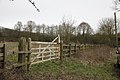 Gate to a field - geograph.org.uk - 2847640.jpg 1 024 × 683 ; 204 kio
-
 Giant Puffballs - geograph.org.uk - 2078237.jpg 1 024 × 683 ; 209 kio
-
 Grain-store, Haw Farm, Hampstead Norreys - geograph.org.uk - 876290.jpg 640 × 480 ; 104 kio
-
 Grain-store, Haw Farm, Hampstead Norreys - geograph.org.uk - 876319.jpg 640 × 480 ; 150 kio
-
 Grassy Bed - geograph.org.uk - 2710918.jpg 533 × 800 ; 178 kio
-
 Graveyard near the church - geograph.org.uk - 2709335.jpg 1 024 × 683 ; 137 kio
-
 Green Fence - geograph.org.uk - 1715991.jpg 1 024 × 768 ; 373 kio
-
 Growing by the wall - geograph.org.uk - 2078198.jpg 1 024 × 683 ; 287 kio
-
 Gulls After the Plough - geograph.org.uk - 4227494.jpg 1 600 × 1 024 ; 382 kio
-
 Gun mount - geograph.org.uk - 2071934.jpg 1 024 × 768 ; 209 kio
-
 Hackney Bottom farm buildings - geograph.org.uk - 2904780.jpg 3 648 × 2 736 ; 2,13 Mio
-
 Hairdresser by the gate - geograph.org.uk - 2710534.jpg 1 024 × 683 ; 171 kio
-
 Hampstead Norreys Recreation Ground - geograph.org.uk - 4778160.jpg 640 × 480 ; 37 kio
-
 Hampstead Norreys Village - geograph.org.uk - 3458003.jpg 4 320 × 3 240 ; 3,39 Mio
-
 Hanging in the Tree - geograph.org.uk - 4784400.jpg 1 024 × 683 ; 211 kio
-
 Haw Farm airstrip - geograph.org.uk - 1150168.jpg 640 × 426 ; 139 kio
-
 Haw Farm airstrip - geograph.org.uk - 1150173.jpg 640 × 426 ; 114 kio
-
 Haw Farm airstrip - geograph.org.uk - 1150179.jpg 640 × 425 ; 159 kio
-
 Haw Farm hangar - geograph.org.uk - 1150175.jpg 640 × 427 ; 176 kio
-
 Haw lane by the wood - geograph.org.uk - 2056382.jpg 1 024 × 683 ; 217 kio
-
 Haw Lane, Ashampstead Green - geograph.org.uk - 4609524.jpg 2 304 × 1 728 ; 801 kio
-

-
 Hedge to Milkhill Farm - geograph.org.uk - 1902593.jpg 2 048 × 1 536 ; 1 001 kio
-
 Hillside, Hampstead Norreys - geograph.org.uk - 3457968.jpg 4 320 × 3 240 ; 3,03 Mio
-
 House at Hampstead Norreys - geograph.org.uk - 987038.jpg 640 × 427 ; 187 kio
-
 House on Wyld Court Hill, Hampstead Norreys - geograph.org.uk - 4609621.jpg 2 304 × 1 728 ; 823 kio
-
 Houses and wheat, Hampstead Norreys - geograph.org.uk - 873088.jpg 640 × 480 ; 192 kio
-
 Houses in Hampstead Norreys - geograph.org.uk - 987019.jpg 640 × 427 ; 193 kio
-
 Houses in the yard - geograph.org.uk - 2707542.jpg 1 024 × 683 ; 234 kio
-
 Houses on the railway line - geograph.org.uk - 987022.jpg 640 × 427 ; 184 kio
-
 Houses on Wyld Court Hill, Hampstead Norreys - geograph.org.uk - 4606321.jpg 2 304 × 1 728 ; 872 kio
-
 Houses on Wyld Court Hill, Hampstead Norreys - geograph.org.uk - 4609453.jpg 2 304 × 1 728 ; 853 kio
-
 Ilsley Down Riding Route - geograph.org.uk - 861398.jpg 427 × 640 ; 83 kio
-
 In Beech Wood - geograph.org.uk - 1150208.jpg 640 × 426 ; 214 kio
-
 In Beech Wood - geograph.org.uk - 2079781.jpg 1 024 × 683 ; 265 kio
-
 In one side out the other - geograph.org.uk - 2075385.jpg 1 024 × 683 ; 270 kio
-
 In the bomb store - geograph.org.uk - 2078209.jpg 1 024 × 683 ; 223 kio
-
 In the pit - geograph.org.uk - 2078248.jpg 1 024 × 683 ; 136 kio
-
 Inside the shelter - geograph.org.uk - 2058881.jpg 600 × 800 ; 118 kio
-
 Ivy buds near Hampstead Norreys, Berkshire - geograph.org.uk - 4130601.jpg 552 × 800 ; 182 kio
-
 Junction, Hampstead Norreys - geograph.org.uk - 3010859.jpg 2 560 × 1 920 ; 981 kio
-
 Just about a footpath - geograph.org.uk - 888930.jpg 427 × 640 ; 120 kio
-
 Lane from Trumpletts Farm - geograph.org.uk - 881664.jpg 640 × 480 ; 74 kio
-
 Lane heading up to Eling - geograph.org.uk - 881676.jpg 640 × 480 ; 92 kio
-
 Lane passing Malthouse - geograph.org.uk - 1271627.jpg 640 × 480 ; 68 kio
-
 Langley Farm - geograph.org.uk - 4227475.jpg 1 600 × 952 ; 442 kio
-
 Last shot of Uplands Bridge - geograph.org.uk - 2860232.jpg 1 024 × 683 ; 266 kio
-
 Laycroft Wood - geograph.org.uk - 1271656.jpg 640 × 480 ; 71 kio
-
 Leading to The Close - geograph.org.uk - 2707365.jpg 1 024 × 683 ; 332 kio
-
 Looking at the school - geograph.org.uk - 2709332.jpg 1 024 × 683 ; 165 kio
-
 Looking back at the bridge - geograph.org.uk - 2840415.jpg 1 024 × 683 ; 336 kio
-
 Looking back to the gate - geograph.org.uk - 2063024.jpg 1 024 × 683 ; 202 kio
-
 Looking through the bridge - geograph.org.uk - 2733682.jpg 1 024 × 683 ; 247 kio
-
 Looking through the station - geograph.org.uk - 2707539.jpg 1 024 × 683 ; 285 kio
-
 Looking through to Compton - geograph.org.uk - 2860074.jpg 1 024 × 683 ; 216 kio
-
 Looking towards Hampstead Norreys - geograph.org.uk - 2731979.jpg 1 024 × 683 ; 205 kio
-
 Looking towards Hampstead Norreys - geograph.org.uk - 2735149.jpg 1 024 × 683 ; 126 kio
-
 Looking towards Haw Farm - geograph.org.uk - 2061792.jpg 1 024 × 683 ; 142 kio
-
 Looking towards the pit - geograph.org.uk - 2079795.jpg 1 024 × 683 ; 117 kio
-
 Looking towards the Water Street junction - geograph.org.uk - 2708442.jpg 533 × 800 ; 78 kio
-
 Looks like a flying saucer - geograph.org.uk - 2058857.jpg 1 024 × 683 ; 122 kio
-
 Low Level Waymarks - geograph.org.uk - 4194715.jpg 1 600 × 1 051 ; 583 kio
-
 M4 bridge over the B4009 - geograph.org.uk - 2847648.jpg 1 024 × 683 ; 223 kio
-
 Machinery park - geograph.org.uk - 1150163.jpg 640 × 427 ; 205 kio
-
 Main entrance - geograph.org.uk - 2074031.jpg 1 024 × 683 ; 291 kio
-
 Mainly farmland near Milkhill Farm - geograph.org.uk - 986947.jpg 640 × 427 ; 179 kio
-
 Maintenance building in the wood - geograph.org.uk - 2058889.jpg 1 024 × 683 ; 150 kio
-
 Mast near the beacon - geograph.org.uk - 2079799.jpg 533 × 800 ; 95 kio
-
 Meeting of the paths - geograph.org.uk - 986861.jpg 427 × 640 ; 194 kio
-
 Milkhill Farm - geograph.org.uk - 986933.jpg 640 × 427 ; 190 kio
-
 Mini roundabout on the junction - geograph.org.uk - 2708445.jpg 1 024 × 683 ; 111 kio
-
 More debris - geograph.org.uk - 2848889.jpg 1 024 × 683 ; 333 kio
-
 More on the top - geograph.org.uk - 2070099.jpg 1 024 × 683 ; 270 kio
-
 Moss on the wall - geograph.org.uk - 2078195.jpg 533 × 800 ; 165 kio
-
 Mushrooms in the stubble - geograph.org.uk - 987085.jpg 640 × 427 ; 204 kio


