Category:Hanmer
Aller à la navigation
Aller à la recherche
village au Royaume-Uni    | |||||
| Téléverser des médias | |||||
| Nature de l’élément | |||||
|---|---|---|---|---|---|
| Lieu | Wrexham, pays de Galles | ||||
| Population |
| ||||
| Superficie |
| ||||
 | |||||
Cymraeg: Pentref bychan ym mwrdeistref sirol Wrecsam yw Hanmer. Gorwedd yn ardal Wrecsam Maelor, tua phum milltir i'r gorllewin o dref Whitchurch, dros y ffin yn Lloegr, a 10 milltir i'r de-ddwyrain o dref Wrecsam. Mae'n enwog am ei eglwys hynafol a gysegrir i Sant Chad.
English: Hanmer is a village in the county borough of Wrexham, Wales. At the 2001 Census the population of the village was recorded at 726.
Sous-catégories
Cette catégorie comprend 5 sous-catégories, dont les 5 ci-dessous.
Média dans la catégorie « Hanmer »
Cette catégorie comprend 103 fichiers, dont les 103 ci-dessous.
-
 "All is safely gathered in" - geograph.org.uk - 533644.jpg 640 × 427 ; 74 kio
-
 "Amaizeing" - geograph.org.uk - 479531.jpg 640 × 427 ; 71 kio
-
 "Wyen Wenn" - geograph.org.uk - 498714.jpg 427 × 640 ; 89 kio
-
 A495 passing The Rookery - geograph.org.uk - 4436999.jpg 640 × 328 ; 63 kio
-
 A525 near Halghton Farm - geograph.org.uk - 6142081.jpg 800 × 600 ; 173 kio
-
 A525 towards Whitchurch - geograph.org.uk - 6142105.jpg 800 × 600 ; 115 kio
-
 A525 towards Whitchurch - geograph.org.uk - 6142119.jpg 800 × 600 ; 109 kio
-
 Ancient and Modern - geograph.org.uk - 479524.jpg 640 × 404 ; 56 kio
-
 Backpacker hostel at hanmer springs .jpg 1 280 × 1 024 ; 193 kio
-
 Bench mark on Hanmer Church - geograph.org.uk - 3455056.jpg 640 × 480 ; 147 kio
-
 Brook Lane, north of Hanmer - geograph.org.uk - 3454541.jpg 640 × 480 ; 107 kio
-
 Church at Little Arowry - geograph.org.uk - 182202.jpg 640 × 480 ; 122 kio
-
 Circuitous Route - geograph.org.uk - 533548.jpg 427 × 640 ; 104 kio
-
 Crossroads on the A525 - geograph.org.uk - 4620037.jpg 4 320 × 3 240 ; 2,75 Mio
-
 Field adjacent to Scrape Wood - geograph.org.uk - 5957908.jpg 5 184 × 3 888 ; 4,67 Mio
-

-
 Gates Galore^ - geograph.org.uk - 533555.jpg 640 × 427 ; 122 kio
-
 Go West - geograph.org.uk - 2528243.jpg 4 000 × 3 000 ; 6 Mio
-
 Golden Crop - geograph.org.uk - 2528247.jpg 4 000 × 3 000 ; 6,06 Mio
-
 Grassland towards woodland - geograph.org.uk - 6142118.jpg 800 × 600 ; 120 kio
-
 Grassy Lane. - geograph.org.uk - 516347.jpg 427 × 640 ; 153 kio
-
 Grazing and hedgerow near Bryn Rossett - geograph.org.uk - 6142114.jpg 800 × 600 ; 153 kio
-
 Grazing near Halghton Farm - geograph.org.uk - 6142077.jpg 800 × 600 ; 123 kio
-
 Grazing near Pandy Farm - geograph.org.uk - 6142084.jpg 800 × 600 ; 146 kio
-
 Gredington Estate - geograph.org.uk - 516343.jpg 427 × 640 ; 113 kio
-
 Halghton Forge.jpg 4 160 × 3 120 ; 3,49 Mio
-
 Halghton Hall Lane - geograph.org.uk - 2528204.jpg 4 000 × 3 000 ; 5,87 Mio
-
 Halghton Hall Lane - geograph.org.uk - 2528209.jpg 4 000 × 3 000 ; 5,9 Mio
-
 Halghton Lane - geograph.org.uk - 6142085.jpg 800 × 600 ; 128 kio
-
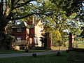
 Hanmer Arms Village Hotel - geograph.org.uk - 223707.jpg 640 × 426 ; 130 kio
-
 Hanmer Hall in Flintshire, the seat of Mrs. Watson.jpeg 900 × 645 ; 701 kio
-
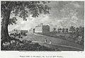 Hanmer Hall, in Flintshire, the seat of Mrs. Watson.jpeg 900 × 614 ; 668 kio
-
 Hanmer Lake, 1951 - geograph.org.uk - 4226962.jpg 2 438 × 1 395 ; 1,59 Mio
-
 Hanmer Scout Hall - geograph.org.uk - 182198.jpg 640 × 480 ; 96 kio
-
 Hanmer sign.jpg 1 600 × 1 200 ; 696 kio
-
 Hanmer springs - 2.jpeg 640 × 512 ; 46 kio
-
 Hanmer springs - 3.jpeg 640 × 512 ; 56 kio
-
 Hanmer springs 2.jpg 1 280 × 1 024 ; 113 kio
-
 Hanmer springs backpacker hostel.jpg 1 280 × 1 024 ; 121 kio
-
 Hanmer springs park.jpg 1 280 × 1 024 ; 136 kio
-
 Hanmer springs spa.jpg 1 280 × 1 024 ; 148 kio
-
 Hanmer springs.jpg 1 280 × 1 024 ; 255 kio
-
 Hanmer Village School - geograph.org.uk - 223720.jpg 640 × 426 ; 99 kio
-
 Junction near Lane Farm - geograph.org.uk - 4438695.jpg 640 × 328 ; 48 kio
-
 Lane Farm by the A495 - geograph.org.uk - 4269180.jpg 1 024 × 769 ; 117 kio
-
 Llyn Bedydd Pool - geograph.org.uk - 225585.jpg 640 × 426 ; 141 kio
-
 Lodge and gateway to Gredington Park - geograph.org.uk - 5957905.jpg 640 × 480 ; 136 kio
-
 Looking Back - geograph.org.uk - 516352.jpg 427 × 640 ; 119 kio
-
 Magpie Cottage - Hanmer - geograph.org.uk - 225402.jpg 640 × 426 ; 150 kio
-
 Manhole Cover On Vyrnwy Aqueduct - geograph.org.uk - 227738 (cropped).jpg 429 × 560 ; 63 kio
-
 Manhole Cover On Vyrnwy Aqueduct - geograph.org.uk - 227738.jpg 480 × 640 ; 93 kio
-
 Milestone at Cumber's Bank, and the A539 - geograph.org.uk - 3455532.jpg 640 × 480 ; 220 kio
-
 Milestone at Cumber's Bank, near Hanmer - geograph.org.uk - 3455507.jpg 640 × 480 ; 201 kio
-
 New Lane junction with A495 - geograph.org.uk - 2899845.jpg 640 × 462 ; 118 kio
-
 Oilseed rape crop, Horseman's Green - geograph.org.uk - 6142103.jpg 800 × 605 ; 175 kio
-
 Old Milestone by the A539, Cumber's Bank, Hanmer - geograph.org.uk - 6098022.jpg 765 × 1 185 ; 300 kio
-
 Ordnance Survey Cut Mark - geograph.org.uk - 5142993.jpg 640 × 633 ; 196 kio
-
 Pandy Bridge - geograph.org.uk - 2528215.jpg 4 000 × 3 000 ; 6 Mio
-
 Pandy Holding.jpg 4 160 × 3 120 ; 3,56 Mio
-
 Redundant churns - geograph.org.uk - 182218.jpg 640 × 480 ; 159 kio
-
 Single Track - geograph.org.uk - 498706.jpg 427 × 640 ; 117 kio
-
 Sir Thomas Hanmer's monument, Hanmer Chapel, 1794.jpg 647 × 1 000 ; 117 kio
-
 St Chad's Church, Hanmer - geograph.org.uk - 5957902.jpg 5 184 × 3 888 ; 4,49 Mio
-
 St Chad's Parish Church, Hanmer - geograph.org.uk - 5924650.jpg 1 080 × 810 ; 169 kio
-
 St, Chad's church, Hanmer - geograph.org.uk - 5244198.jpg 623 × 1 024 ; 132 kio
-
 The A525 at Eglwys Cross - geograph.org.uk - 4479310.jpg 3 000 × 2 250 ; 1,98 Mio
-
 The west face of St Chad's church tower, Hanmer - geograph.org.uk - 3455060.jpg 480 × 640 ; 109 kio
-
 Wales Wrexham Community Hanmer map.svg 512 × 362 ; 495 kio
-
 Western Approach - geograph.org.uk - 2528242.jpg 4 000 × 3 000 ; 5,96 Mio
-
 Artists Sky - geograph.org.uk - 479559.jpg 640 × 427 ; 57 kio
-
 Avenue to Bowen's Hall - geograph.org.uk - 182196.jpg 640 × 480 ; 98 kio
-
 Bank House Farm Boarding Kennels - geograph.org.uk - 182217.jpg 640 × 454 ; 86 kio
-
 Bridge over Emral Brook - geograph.org.uk - 492700.jpg 640 × 427 ; 94 kio
-
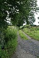
 Bridle path leading to Halghton Lane - geograph.org.uk - 227504.jpg 640 × 480 ; 161 kio
-
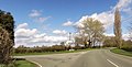
 Country Crossroads - geograph.org.uk - 480249.jpg 640 × 427 ; 102 kio
-
 Country Drive - geograph.org.uk - 479566.jpg 640 × 371 ; 56 kio
-
 Country Lane - geograph.org.uk - 479657.jpg 427 × 640 ; 137 kio
-
 Country Lane - geograph.org.uk - 492743.jpg 427 × 640 ; 98 kio
-
 Croxton Pool Farm - geograph.org.uk - 225621.jpg 640 × 426 ; 168 kio
-
 Farm buildings at Eastwick - geograph.org.uk - 593428.jpg 640 × 480 ; 77 kio
-
 Field and farm - geograph.org.uk - 197056.jpg 640 × 480 ; 142 kio
-
 Halghton Mill Hamlet. - geograph.org.uk - 492702.jpg 640 × 427 ; 64 kio
-
 Hanmer Garage - geograph.org.uk - 225397.jpg 640 × 457 ; 145 kio
-
 Hanmer Garage - geograph.org.uk - 225399.jpg 640 × 426 ; 98 kio
-
 Hanmer Mere - geograph.org.uk - 223695.jpg 640 × 416 ; 115 kio
-
 Hanmer Tennis Club House - geograph.org.uk - 225628.jpg 640 × 426 ; 154 kio
-
 Hanmer Village Stores and Post Office - geograph.org.uk - 225394.jpg 640 × 426 ; 149 kio
-
 Harbingers of Rain - geograph.org.uk - 479544.jpg 640 × 427 ; 78 kio
-
 Hill Farm - geograph.org.uk - 225636.jpg 640 × 426 ; 159 kio
-
 Interlude - geograph.org.uk - 516308.jpg 427 × 640 ; 134 kio
-
 Keeper's Cottage - geograph.org.uk - 516377.jpg 427 × 640 ; 93 kio
-
 Maize stubble at Eastwick - geograph.org.uk - 593572.jpg 640 × 480 ; 131 kio
-
 More Reflections - geograph.org.uk - 516293.jpg 640 × 427 ; 114 kio
-
 Mossfields Farm - geograph.org.uk - 225613.jpg 640 × 426 ; 116 kio
-
 Mount Cop - geograph.org.uk - 182228.jpg 640 × 480 ; 116 kio
-
 Pond - geograph.org.uk - 227524.jpg 640 × 480 ; 168 kio
-
 Rural Reflections - geograph.org.uk - 516284.jpg 640 × 427 ; 146 kio
-
 Shropshire field - geograph.org.uk - 197052.jpg 640 × 480 ; 129 kio
-

-
 The Bank - geograph.org.uk - 479602.jpg 427 × 640 ; 76 kio
-
 The day of the " Treefids" - geograph.org.uk - 516362.jpg 427 × 640 ; 145 kio
-
 Tumulus near Bryn Rossett Farm - geograph.org.uk - 182222.jpg 640 × 480 ; 93 kio
-
 Wood Farm - geograph.org.uk - 225633.jpg 640 × 426 ; 113 kio


.jpg)


