Category:Harbor Island, Seattle, Washington
跳转到导航
跳转到搜索
island in Seattle, Washington, United States of America .jpg)  | |||||
| 上传媒体 | |||||
| 隶属于 | |||||
|---|---|---|---|---|---|
| 位置 | 西雅圖, 金县, 华盛顿州, 太平洋西北地区, 华盛顿州, 美國太平洋沿岸地區 | ||||
| 相異於 | |||||
 | |||||
子分类
本分类有以下11个子分类,共有11个子分类。
D
- Duwamish Railroad Bridge (17 F)
F
H
- Harbor Island Fishing Bridge (5 F)
- Harbor Island Marina (12 F)
J
- Jim Clark Marina (5 F)
S
- Spokane Street Bridge (27 F)
T
- Terminal 18 Park (17 F)
- Tilbury Cement (Seattle) (5 F)
W
分类“Harbor Island, Seattle, Washington”中的媒体文件
以下189个文件属于本分类,共189个文件。
-
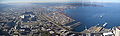
 2005 Seattle harbor container port night.jpg 3,027 × 2,270;2.28 MB
-
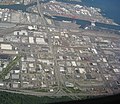
 Aerial of Harbor Island and Downtown Seattle, 1968.jpg 2,973 × 2,358;8.42 MB
-
 Aerial view looking west - West Seattle Bridge and Spokane St Br.jpg 800 × 531;210 KB
-

-
 Aerial view of Elliot Bay, Seattle.jpg 3,264 × 2,448;5.76 MB
-
 Aerial view of Harbor Island in Seattle.jpg 3,264 × 2,448;4.88 MB
-
 Aerial view of Seattle Freeway crossing Harbor Island.jpg 3,264 × 2,448;6.06 MB
-
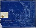
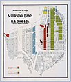 Anderson's Map of Seattle Tide Lands, circa 1907 (MOHAI 13438).jpg 1,035 × 1,200;218 KB
-
 Asahel Curtis panorama of harbor and shipyards, Seattle (1919).jpg 3,544 × 999;395 KB
-
 Ash Grove Cement from West Seattle Bridge 01.jpg 2,592 × 1,944;786 KB
-

-

-
 BNSF car on Harbor Island, Seattle 01.jpg 4,288 × 2,848;3.94 MB
-

-
 Confined space warning 01.jpg 4,288 × 2,848;4.46 MB
-
 Construction Seattle (port town drive) - panoramio.jpg 2,272 × 1,461;1.42 MB
-
 Seattle - Harbor Island - Crowley 04.jpg 4,288 × 2,848;3.82 MB
-
 Distribution - panoramio.jpg 3,264 × 2,448;1.95 MB
-
 Duwamish from West Seattle Bridge 01.jpg 2,592 × 1,944;725 KB
-
 Duwamish from West Seattle Bridge 02.jpg 3,264 × 2,448;2.17 MB
-
 Duwamish Head from the northwest 01.jpg 6,000 × 4,000;9.07 MB
-
 Elliott Bay rainbow 01.jpg 3,264 × 2,448;1.05 MB
-
 Evening in the Seattle Harbor.jpg 1,020 × 765;438 KB
-
 Ferry approaching Seattle 01.jpg 2,592 × 1,944;715 KB
-
 Ferry approaching Seattle 02.jpg 2,592 × 1,944;701 KB
-

-
 FMIB 45073 Plant of J F Duthie & Co, Seattle - cleaned.jpeg 1,253 × 237;92 KB
-
 FMIB 45073 Plant of J F Duthie & Co, Seattle.jpeg 1,253 × 237;147 KB
-

-
 Gear from old Spokane Street Bridge (6111564264).jpg 1,824 × 1,368;416 KB
-
 Gear on display from old Spokane Street Bridge (6111564128).jpg 1,824 × 1,368;632 KB
-
 Harbor Island (3686755972).jpg 3,888 × 2,592;3.15 MB
-
 Harbor Island and Beacon Hill, Seattle, 1917 (MOHAI 13135).jpg 1,000 × 218;29 KB
-
 Harbor Island and Downtown Seattle, 1990 (51190257418).jpg 2,119 × 3,181;3.32 MB
-
 Harbor Island and West Seattle Bridge - Flickr - brewbooks.jpg 1,920 × 1,080;1.44 MB
-
 Harbor Island from downtown Seattle, ca 1913 (MOHAI 6210).jpg 856 × 700;39 KB
-
 Harbor Island from Elliott Bay Water Taxi 01.jpg 2,592 × 1,944;752 KB
-
 Harbor Island from West Seattle (CURTIS 1789).jpeg 768 × 620;56 KB
-
 Harbor Island looking north, 1912 (SEATTLE 1911).jpg 768 × 491;81 KB
-
 Harbor Island, Alki and West Seattle from Columbia Center (3793787493).jpg 3,888 × 2,592;2.55 MB
-
 Highway 99 tunnel south portal by stadiums.jpg 3,024 × 4,032;3.5 MB
-
 Industrial District - Seattle.jpg 2,817 × 2,448;3.21 MB
-
 Industrial South Seattle - Flickr - brewbooks (2).jpg 3,264 × 2,448;3.67 MB
-
 J. F. Duthie & Company, Harbor Island, Seattle, 1919.jpg 1,014 × 319;67 KB
-
 Jack Perry Memorial Shoreline Public Access 01.jpg 2,592 × 1,944;780 KB
-
 Jack Perry Memorial Shoreline Public Access 02.jpg 2,592 × 1,944;735 KB
-
 Jack Perry Memorial Shoreline Public Access 03.jpg 2,592 × 1,944;785 KB
-
 Jack Perry Memorial Shoreline Public Access 04.jpg 2,592 × 1,944;863 KB
-
 Jack Perry Memorial Shoreline Public Access 07.jpg 2,592 × 1,944;770 KB
-
 Jack Perry Memorial Shoreline Public Access 08.jpg 2,592 × 1,944;897 KB
-

-

-
 Looking north from Harbor Island near Fisher Flouring Mill 01.jpg 6,000 × 4,000;9.17 MB
-
 Looking north from Harbor Island near Fisher Flouring Mill 02.jpg 6,000 × 4,000;7.63 MB
-

-
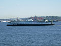 M-V Walla-Walla.jpg 1,909 × 1,440;1.52 MB
-
-
 Map of Seattle Harbor, circa 1971 (52409434495).jpg 1,624 × 3,788;1.16 MB
-
 Myrtle Edwards Park, 2013 (53137228538).jpg 3,375 × 1,420;3.37 MB
-
 Nanuq 01.jpg 4,288 × 2,848;3.59 MB
-
 Nifty Restaurant, 1981 (14650654580).jpg 1,188 × 1,200;356 KB
-
 North from Harbor Island Fishing Bridge 01.jpg 2,592 × 1,944;767 KB
-
 North from Harbor Island Fishing Bridge 02.jpg 2,592 × 1,944;742 KB
-

-

-
 Over the Duwamish River - Flickr - brewbooks.jpg 1,920 × 1,080;1.3 MB
-
-
 Panorama of harbor and shipyards, Seattle (CURTIS 475).jpeg 768 × 602;58 KB
-
 Panorama of harbor and shipyards, Seattle (CURTIS 476).jpeg 768 × 614;44 KB
-
 Panorama of harbor and shipyards, Seattle (CURTIS 477).jpeg 768 × 609;39 KB
-
 Panoramic view from Seattle's Harbor Island Fishing Bridge 01.jpg 5,954 × 2,383;3.63 MB
-

-
 Panoramic view of Harbor Island, between 1912 and 1916.jpg 1,279 × 535;196 KB
-

-
 Port of Seattle, 1990 (32615793528).jpg 794 × 1,200;709 KB
-
 Port-scale-model.jpg 1,271 × 1,109;183 KB
-
 Puget Sound Bridge & Dredging shipyard, circa 1917 (MOHAI 12995).jpg 1,200 × 366;75 KB
-
 Rueda de la fortuna en Seattle Washington 2014-01-04 16-24.jpg 3,264 × 2,448;1.43 MB
-
 Sea-based X-band Radar at Port of Seattle.jpg 4,288 × 2,848;5.31 MB
-
 Seattle - Bridge Gear Park 01.jpg 5,863 × 3,893;14.03 MB
-
 Seattle - containers at south tip of Harbor Island 01.jpg 4,288 × 2,848;4.38 MB
-
 Seattle - East Waterway Terminal, 1915 (22761986476).jpg 3,357 × 2,499;1.74 MB
-
 Seattle - Harbor Island - 13th and Florida pano 01.jpg 20,295 × 2,576;14.94 MB
-
 Seattle - Harbor Island - 13th and Florida pano 02.jpg 19,688 × 1,679;10.29 MB
-
 Seattle - Harbor Island - 16th Ave SW pano 01.jpg 5,211 × 1,771;2.84 MB
-
 Seattle - Harbor Island - Arco 01.jpg 4,288 × 2,848;4.03 MB
-
 Seattle - Harbor Island - Arco 02.jpg 4,288 × 2,848;5.02 MB
-
 Seattle - Harbor Island - BP warning signs.jpg 4,288 × 2,848;4.95 MB
-
 Seattle - Harbor Island - bridges & Mount Rainier 01.jpg 4,288 × 2,848;5.41 MB
-
 Seattle - Harbor Island - bridges & Mount Rainier 02.jpg 4,288 × 2,848;4.52 MB
-
 Seattle - Harbor Island - bridges & Mount Rainier 03.jpg 4,288 × 2,848;5.11 MB
-
 Seattle - Harbor Island - Coast Guard vessel.jpg 4,288 × 2,848;4.07 MB
-
 Seattle - Harbor Island - concertina wire 01.jpg 2,848 × 4,288;4.76 MB
-
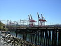
 Seattle - Harbor Island - cranes at east end of SW Florida St 01.jpg 4,288 × 2,848;4.07 MB
-
 Seattle - Harbor Island - cranes near Stacy St.jpg 4,288 × 2,848;4.07 MB
-
 Seattle - Harbor Island - Crowley 01.jpg 4,288 × 2,848;4.46 MB
-
 Seattle - Harbor Island - Crowley 02.jpg 4,288 × 2,848;4.46 MB
-
 Seattle - Harbor Island - Crowley 03.jpg 4,288 × 2,848;4.71 MB
-
 Seattle - Harbor Island - Crowley entrance sign.jpg 4,288 × 2,848;4.46 MB
-
 Seattle - Harbor Island - east end of SW Massachusetts St.jpg 4,288 × 2,848;4.08 MB
-
 Seattle - Harbor Island - foam pipe 02.jpg 2,848 × 4,288;4.33 MB
-
 Seattle - Harbor Island - graffitied rail cars 01.jpg 4,288 × 2,848;3.72 MB
-
 Seattle - Harbor Island - hand-operated rail switch 01.jpg 4,288 × 2,848;6.27 MB
-
 Seattle - Harbor Island - hand-operated rail switch 02.jpg 4,288 × 2,848;6.36 MB
-
 Seattle - Harbor Island - Harley Marine Services.jpg 1,490 × 990;1.07 MB
-
 Seattle - Harbor Island - looking south on 13th Ave SW 01 equalized.jpg 4,288 × 2,848;5.86 MB
-
 Seattle - Harbor Island - looking south on 13th Ave SW 01.jpg 4,288 × 2,848;3.76 MB
-
 Seattle - Harbor Island - Maxum 01.jpg 4,288 × 2,848;3.74 MB
-
 Seattle - Harbor Island - Maxum 02.jpg 4,288 × 2,848;4.11 MB
-
 Seattle - Harbor Island - Maxum 03.jpg 4,288 × 2,848;3.43 MB
-
 Seattle - Harbor Island - Olympic Pipeline Company 01.jpg 4,288 × 2,848;6.15 MB
-
 Seattle - Harbor Island - Olympic Pipeline Company entrance.jpg 4,288 × 2,848;5.41 MB
-
 Seattle - Harbor Island - pedestrian bridge 01.jpg 4,288 × 2,848;3.33 MB
-
 Seattle - Harbor Island - pedestrian bridge closeup.jpg 4,288 × 2,848;4.8 MB
-
 Seattle - Harbor Island - rail signs on SW Massachusetts Ave 01.jpg 4,288 × 2,848;4.1 MB
-
 Seattle - Harbor Island - Rolls Royce building 01.jpg 4,288 × 2,848;3.99 MB
-
 Seattle - Harbor Island - security notice 01.jpg 4,288 × 2,848;4.96 MB
-
 Seattle - Harbor Island - Shell 01.jpg 4,288 × 2,848;6.49 MB
-
 Seattle - Harbor Island - Shell 02.jpg 4,288 × 2,848;5.53 MB
-
 Seattle - Harbor Island - Shell 03.jpg 4,288 × 2,848;5.4 MB
-
 Seattle - Harbor Island - Shell 04.jpg 4,288 × 2,848;3.87 MB
-
 Seattle - Harbor Island - Shell detail 01.jpg 4,288 × 2,848;6.38 MB
-
 Seattle - Harbor Island - Shell detail 02.jpg 4,288 × 2,848;5.46 MB
-
 Seattle - Harbor Island - Shell Operations 01.jpg 4,288 × 2,848;5.1 MB
-
 Seattle - Harbor Island - Shell pano 01.jpg 7,432 × 2,624;7.52 MB
-
 Seattle - Harbor Island - Shell pano 02.jpg 4,983 × 2,029;3.38 MB
-
 Seattle - Harbor Island - SW Florida St 01.jpg 4,288 × 2,848;4.8 MB
-
 Seattle - Harbor Island - SW Florida St 02.jpg 4,288 × 2,848;5.35 MB
-
 Seattle - Harbor Island - tanks contre-jour 01A.jpg 4,288 × 2,848;2.72 MB
-
 Seattle - Harbor Island - Wilhelmsen Maritime Services 01.jpg 4,288 × 2,848;4.81 MB
-
 Seattle - Harbor Island aerial 01.jpg 4,288 × 2,848;4.93 MB
-
 Seattle - Harbor Island aerial 01A.jpg 4,288 × 2,848;6.79 MB
-
 Seattle - Harbor Island aerial 02.jpg 4,288 × 2,848;4.58 MB
-
 Seattle - Harbor Island aerial 02A.jpg 4,288 × 2,848;6.85 MB
-
 Seattle - Harbor Island aerial 03.jpg 4,288 × 2,848;4.36 MB
-
 Seattle - Harbor Island aerial 03A.jpg 4,288 × 2,848;6.96 MB
-
 Seattle - Harbor Island aerial 04.jpg 4,288 × 2,848;4.38 MB
-
 Seattle - Harbor Island aerial 04A.jpg 4,288 × 2,848;7.29 MB
-
 Seattle - Harbor Island aerial 05.jpg 4,288 × 2,848;4.16 MB
-
 Seattle - Harbor Island aerial 05A.jpg 4,288 × 2,848;7.51 MB
-
 Seattle - Harbor Island aerial 06.jpg 4,288 × 2,848;4.05 MB
-
 Seattle - Harbor Island aerial 06A.jpg 4,288 × 2,848;7.41 MB
-
-
 Seattle - Harbor Island and Mount Rainier, featuring Fisher Flour Mill.jpg 4,288 × 2,848;5.24 MB
-
 Seattle - Harbor Island exit - sign.jpg 4,288 × 2,848;4.42 MB
-
 Seattle - Harbor Island foam - pipe 01.jpg 4,288 × 2,848;4.8 MB
-
 Seattle - Harbor Island map.jpg 672 × 1,204;105 KB
-
 Seattle - Jack Block pano.jpg 11,371 × 1,691;2.26 MB
-
 Seattle - Jack Block Park viewing platform and Terminal 5.jpg 6,000 × 4,000;12.55 MB
-
 Seattle - north side of Harbor Island from the ferry (east) (48572312622).jpg 4,928 × 3,264;7.03 MB
-
 Seattle - north side of Harbor Island from the ferry (west) (48572312367).jpg 4,928 × 3,264;7.42 MB
-
 Seattle - oil tanks on Harbor Island 01.jpg 6,000 × 4,000;12.36 MB
-
 Seattle - panoramic view from Water Taxi at Seacrest Park 01.jpg 8,988 × 1,712;4.02 MB
-
 Seattle - Starbucks HQ from Harbor Island 01.jpg 4,288 × 2,848;4.55 MB
-
 Seattle - steam plant and harbor at night 01.jpg 2,592 × 1,944;680 KB
-
 Seattle - steam plant and harbor at night 01A.jpg 2,592 × 1,944;1.05 MB
-
 Seattle - steam plant and harbor at night 01B.jpg 2,502 × 1,756;1.05 MB
-
 Seattle - steam plant and harbor at night 02.jpg 2,592 × 1,944;716 KB
-
 Seattle - steam plant and harbor at night 02A.jpg 2,592 × 1,944;1.01 MB
-
 Seattle - steam plant and harbor at night 02B.jpg 2,575 × 1,767;1,018 KB
-
 Seattle - Terminal 5 from Jack Block Park 01.jpg 6,000 × 4,000;13.34 MB
-
 Seattle Dockyard (5225492154).jpg 3,888 × 2,592;3.56 MB
-
 Seattle Hempfest 2007 - 033.jpg 2,592 × 1,944;739 KB
-
 Seattle Map - Harbor Island.png 394 × 698;13 KB
-
 Seattle megaprojects volume moved.png 2,963 × 1,831;304 KB
-
 Seattle pano from Jack Block Park -June 2010.jpg 9,753 × 3,003;2.57 MB
-
 Seattle port cranes 04.jpg 2,549 × 941;753 KB
-
 Seattle Tide Lands, Volume Two, index, 1894-1896 (MOHAI 13416).jpg 1,200 × 926;201 KB
-
 Seattle's Harbour Island (5719021952).jpg 3,088 × 2,048;4.94 MB
-
 Seattle,Washington,USA. - panoramio (3).jpg 1,649 × 1,043;367 KB
-
 Seattle-Columbia-Center-looking-SSW.jpg 3,658 × 1,089;976 KB
-
 Seattle-Columbia-Center-SSW-2325 (white balanced).jpg 1,600 × 1,200;884 KB
-
 Seattle-Columbia-Center-SSW-2325.jpg 1,600 × 1,200;618 KB
-
 Seattle-Columbia-Center-SSW-2328.jpg 1,600 × 1,200;639 KB
-
 Seattle-Harbor-Island-seen-from-Columbia-Center-2339.jpg 2,560 × 1,920;1.57 MB
-
 SSA Marine on Harbor Island 01.jpg 6,000 × 4,000;13.58 MB
-
 Standard Oil plant, 1916 (MOHAI 5162).jpg 700 × 562;49 KB
-
 Super Heavy.jpg 6,006 × 3,994;8.47 MB
-
 Terminal 105 Park seen across the Duwamish from Harbor Island 01.jpg 6,000 × 4,000;13.22 MB
-
 Seattle - Vigor (Todd) Shipyard from Jack Block Park 01.jpg 6,000 × 4,000;12.87 MB
-
 Seattle - Vigor (Todd) Shipyard from Jack Block Park 02.jpg 6,000 × 4,000;10.91 MB
-
 The Seattle Great Wheel.jpg 4,454 × 2,976;5.21 MB
-
-

-
 USNS General M.C. Meigs (T-AP-116) at Seattle c1951.jpg 1,370 × 732;766 KB
-
 View from West Seattle over Harbor Island, 1955.jpg 1,200 × 830;282 KB
-
 View of Harbor Island, ca 1912 (MOHAI 6276).jpg 700 × 572;51 KB
-
 West Seattle Bridge and Spokane Street Viaduct aerial, 2019.jpg 3,456 × 2,304;3.51 MB
-
 West Seattle Bridge from Elliott Bay 01.jpg 4,288 × 2,848;6.81 MB


.jpg)


.jpg)

.jpg)
.jpg)

.jpg)

_-_panoramio.jpg)


.jpg)
.jpg)
.jpg)
.jpg)

.jpg)

.jpeg)
.jpg)
.jpg)


.jpg)


.jpg)
.jpg)


.jpeg)

.jpg)
.jpg)

.jpg)


.jpeg)
.jpeg)
.jpeg)
.jpeg)
.jpg)

.jpg)
.jpg)


.jpg)


_(48572312622).jpg)
_(48572312367).jpg)


.jpg)


.jpg)
.jpg)
.jpg)
.jpg)


.jpg)


_Shipyard_from_Jack_Block_Park_01.jpg)
_Shipyard_from_Jack_Block_Park_02.jpg)

_and_The_Whidbey_Island-class_amphibious_dock_landing_ship_USS_Germantown_(LSD_42)_lead_the_parade_of_ships.jpg)
_leads_the_parade_of_ships.jpg)
_at_Seattle_c1951.jpg)

.jpg)


.jpg)
.jpg)
.jpg)
.jpg)