Category:Harlton
Vai alla navigazione
Vai alla ricerca
English: Harlton is a village and civil parish in the East of England region and the county Cambridgeshire in the United Kingdom. The area of the village is .
village in Cambridgeshire, England, United Kingdom  | |||||
| Carica un file multimediale | |||||
| Istanza di | |||||
|---|---|---|---|---|---|
| Luogo | South Cambridgeshire, Cambridgeshire, Est dell'Inghilterra, Inghilterra | ||||
| Popolazione |
| ||||
 | |||||
Sottocategorie
Questa categoria contiene le 3 sottocategorie indicate di seguito, su un totale di 3.
H
L
M
File nella categoria "Harlton"
Questa categoria contiene 178 file, indicati di seguito, su un totale di 178.
-
 A bend on Whole Way - geograph.org.uk - 3041883.jpg 1 024 × 768; 906 KB
-
 A field east of Little Eversden - geograph.org.uk - 3271956.jpg 2 592 × 1 944; 2,19 MB
-

-
 A field south of Comberton - geograph.org.uk - 3271952.jpg 2 592 × 1 944; 2,12 MB
-
 A kink in the Roman Road - geograph.org.uk - 3730738.jpg 1 200 × 900; 1,12 MB
-
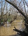 A lot of water in Bourn Brook - geograph.org.uk - 3833015.jpg 807 × 1 024; 1,38 MB
-
 A view from the ridge - geograph.org.uk - 3041666.jpg 1 024 × 768; 918 KB
-
 A View Through the Forest - geograph.org.uk - 2705823.jpg 640 × 480; 113 KB
-
 A wheatfield beside the A603 - geograph.org.uk - 6556300.jpg 1 024 × 683; 606 KB
-
 Along the course of the Varsity Line - geograph.org.uk - 3832407.jpg 796 × 1 024; 1,07 MB
-
 Along the ridge - geograph.org.uk - 3041699.jpg 1 024 × 768; 997 KB
-
 Approaching Harlton - geograph.org.uk - 5603248.jpg 1 024 × 768; 936 KB
-
 Approaching the A603 from Harlton - geograph.org.uk - 3271975.jpg 2 592 × 1 944; 2,31 MB
-
 Arable farming on Chapel Hill - geograph.org.uk - 3045888.jpg 640 × 480; 88 KB
-
 Ascending bridleway - geograph.org.uk - 896288.jpg 640 × 480; 77 KB
-
 Big field and chalk spur - geograph.org.uk - 3041898.jpg 1 024 × 768; 1,28 MB
-
 Big fields and a bend in the road - geograph.org.uk - 2925387.jpg 1 024 × 759; 1,02 MB
-
 Bridge, Washpit Lane, Harlton - geograph.org.uk - 2389436.jpg 800 × 600; 111 KB
-
 Bridle track to Haslingfield - geograph.org.uk - 6419524.jpg 1 024 × 768; 844 KB
-
 Bridleway from Little Eversden - geograph.org.uk - 4562952.jpg 480 × 640; 85 KB
-
 Cambridge Caravans by the A603 - geograph.org.uk - 5365982.jpg 1 600 × 1 188; 211 KB
-
 Cambridge Road at the junction of Eversden Road - geograph.org.uk - 5560990.jpg 2 048 × 1 536; 1,5 MB
-
 Cambridge Road, Harlton - geograph.org.uk - 5568616.jpg 2 048 × 1 536; 949 KB
-
 Cambridge Road, the Washpit Lane turn - geograph.org.uk - 6419554.jpg 1 024 × 683; 839 KB
-
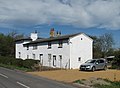
 Cambridgeshire 'White' Bricked Building - geograph.org.uk - 5166992.jpg 4 160 × 2 336; 4,27 MB
-
 Cambridgeshire skyline - geograph.org.uk - 3041871.jpg 1 024 × 768; 836 KB
-
 Cars on the Roman Road - geograph.org.uk - 4296513.jpg 4 320 × 3 240; 4,39 MB
-
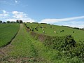
 Cattle grazing - geograph.org.uk - 758935.jpg 640 × 480; 112 KB
-
 Chalk hills between Orwell and the Eversdens - geograph.org.uk - 3875503.jpg 1 200 × 886; 1,1 MB
-
 Closed petrol station forecourt - geograph.org.uk - 896380.jpg 640 × 480; 84 KB
-
 Combe Cottage.jpg 4 032 × 3 024; 3,51 MB
-
 Cottage in Eversden Road - geograph.org.uk - 896280.jpg 640 × 480; 71 KB
-
 Cottage on the corner - geograph.org.uk - 2925394.jpg 1 024 × 767; 1,09 MB
-
 Descending bridleway with view - geograph.org.uk - 896306.jpg 640 × 480; 74 KB
-
 Disappearing bridleway - geograph.org.uk - 896292.jpg 640 × 480; 83 KB
-
 Distant towers - geograph.org.uk - 5602922.jpg 640 × 480; 477 KB
-
 Down Orwell Hill towards Cambridge - geograph.org.uk - 3875487.jpg 1 200 × 857; 1,11 MB
-
 Down the hill to Harlton - geograph.org.uk - 5602961.jpg 1 024 × 768; 778 KB
-
 Elm Cottage.jpg 4 032 × 3 024; 3,54 MB
-

-
 Entering Harlton - geograph.org.uk - 5603247.jpg 1 024 × 768; 989 KB
-
 Eversden Road - geograph.org.uk - 5365985.jpg 1 600 × 1 200; 229 KB
-
 Eversden Road, just west of Harlton village - geograph.org.uk - 3883544.jpg 3 648 × 2 736; 2,93 MB
-
 Field, sky, telescopes - geograph.org.uk - 6419568.jpg 1 024 × 731; 796 KB
-
 Fields south of Little Eversden - geograph.org.uk - 3271989.jpg 2 592 × 1 944; 2,07 MB
-
 Footpath from Harlton - geograph.org.uk - 3045889.jpg 640 × 480; 96 KB
-
 Footpath south of Harlton - geograph.org.uk - 758924.jpg 640 × 480; 101 KB
-
 Footpath to Harlton - geograph.org.uk - 2977439.jpg 640 × 480; 63 KB
-
 Footpath to Little Eversden - geograph.org.uk - 3731501.jpg 1 200 × 881; 1,3 MB
-
 Game cover and footpath - geograph.org.uk - 758931.jpg 640 × 444; 90 KB
-
 Glimpsed through the hedge - geograph.org.uk - 3875511.jpg 847 × 1 024; 1,36 MB
-
 Harlton - Best Kept Village - geograph.org.uk - 839106.jpg 640 × 480; 117 KB
-
 Harlton church on a midsummer morning - geograph.org.uk - 6515948.jpg 1 024 × 683; 889 KB
-
 Harlton churchyard and The Old Rectory - geograph.org.uk - 6298388.jpg 1 024 × 683; 832 KB
-
 Harlton Clunch Pit - geograph.org.uk - 4675567.jpg 640 × 480; 108 KB
-
 Harlton Clunch Pit - geograph.org.uk - 4675568.jpg 640 × 480; 128 KB
-
 Harlton Clunch Pit - geograph.org.uk - 4675570.jpg 480 × 640; 116 KB
-
 Harlton footpath view - geograph.org.uk - 4675558.jpg 480 × 640; 85 KB
-
 Harlton footpath view - geograph.org.uk - 4675559.jpg 480 × 640; 64 KB
-
 Harlton footpath view - geograph.org.uk - 4675560.jpg 480 × 640; 52 KB
-
 Harlton footpath view - geograph.org.uk - 4675562.jpg 640 × 480; 57 KB
-
 Harlton footpath view - geograph.org.uk - 4675564.jpg 480 × 640; 126 KB
-
 Harlton footpath view - geograph.org.uk - 4675571.jpg 480 × 640; 88 KB
-
 Harlton footpath view - geograph.org.uk - 4675572.jpg 480 × 640; 149 KB
-
 Harlton footpath view - geograph.org.uk - 4675573.jpg 480 × 640; 105 KB
-
 Harlton footpath view - geograph.org.uk - 4675578.jpg 480 × 640; 63 KB
-
 Harlton footpath view - geograph.org.uk - 4675581.jpg 480 × 640; 59 KB
-
 Harlton footpath view - geograph.org.uk - 4675583.jpg 640 × 480; 73 KB
-
 Harlton footpath view - geograph.org.uk - 4675585.jpg 640 × 480; 121 KB
-
 Harlton from the Barrington Ridge - geograph.org.uk - 3520626.jpg 1 600 × 861; 2,03 MB
-
 Harlton High Street, postbox and pub - geograph.org.uk - 2925745.jpg 1 024 × 768; 1 019 KB
-
 Harlton in April - geograph.org.uk - 2925739.jpg 1 024 × 734; 1,08 MB
-
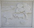 Harlton Millennium Sign - agriculture - geograph.org.uk - 896261.jpg 640 × 534; 66 KB
-
 Harlton Millennium Sign - geograph.org.uk - 896250.jpg 640 × 480; 102 KB
-
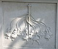 Harlton Millennium Sign - maypole - geograph.org.uk - 896273.jpg 640 × 540; 73 KB
-

-
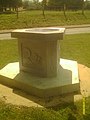 HARLTON Monument - panoramio.jpg 1 536 × 2 048; 978 KB
-
 Harlton Phone Box - ex - geograph.org.uk - 4675576.jpg 480 × 640; 95 KB
-
 Harlton pond - geograph.org.uk - 6515932.jpg 1 024 × 683; 898 KB
-
 Harlton pond in January - geograph.org.uk - 6026488.jpg 1 024 × 1 024; 1,63 MB
-
 Harlton to Haslingfield - geograph.org.uk - 3727638.jpg 1 024 × 820; 440 KB
-
 Harlton Village Hall - geograph.org.uk - 4675557.jpg 480 × 640; 69 KB
-
 Harlton Village Hall - geograph.org.uk - 839111.jpg 640 × 480; 97 KB
-
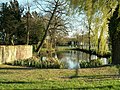
 Harlton village pond - geograph.org.uk - 3271966.jpg 2 592 × 1 944; 2,03 MB
-
 Harlton weathercock - geograph.org.uk - 6298372.jpg 819 × 1 024; 644 KB
-
 Harlton, a Dutch barn - geograph.org.uk - 6298500.jpg 800 × 800; 743 KB
-
 Harlton, a military family - geograph.org.uk - 5603060.jpg 748 × 1 024; 801 KB
-
 Harlton, a sloping field - geograph.org.uk - 5602978.jpg 1 024 × 768; 891 KB
-
 Harlton, abandoned farm buildings by Snakes Lane - geograph.org.uk - 6298505.jpg 1 024 × 1 024; 1,19 MB
-
 Harlton, barns and bare branches - geograph.org.uk - 5603076.jpg 1 024 × 1 024; 1,6 MB
-
 Harlton, Clunch House - geograph.org.uk - 2925431.jpg 1 024 × 747; 885 KB
-

-

-
 Harlton, hillside field - geograph.org.uk - 5602969.jpg 1 024 × 768; 1 017 KB
-
 Harlton, hillside herd - geograph.org.uk - 2925756.jpg 1 024 × 768; 1,09 MB
-
 Harlton, Manor Barn - geograph.org.uk - 6515926.jpg 1 024 × 683; 754 KB
-
 Harlton, Manor Farm - geograph.org.uk - 6599119.jpg 1 024 × 1 024; 1,16 MB
-
 Harlton, Manor Farm Barn - geograph.org.uk - 2434409.jpg 640 × 480; 57 KB
-
 Harlton, nave, aisles and chancel - geograph.org.uk - 6298394.jpg 768 × 1 024; 805 KB
-
 Harlton, nearing the centre of the village - geograph.org.uk - 6026514.jpg 1 024 × 768; 947 KB
-
 Harlton, on Washpit Lane - geograph.org.uk - 6515826.jpg 1 024 × 1 024; 1,49 MB
-
 Harlton, Organ Cottage and the parish church - geograph.org.uk - 2925695.jpg 1 024 × 768; 991 KB
-

-
 Harlton, post van in Eversden Road - geograph.org.uk - 2925446.jpg 1 024 × 783; 944 KB
-
 Harlton, remembered on the churchyard wall - geograph.org.uk - 6298365.jpg 819 × 1 024; 1,1 MB
-
 Harlton, reworking farm buildings - geograph.org.uk - 6515961.jpg 1 024 × 682; 882 KB
-
 Harlton, Snakes Lane and The Dove House - geograph.org.uk - 2925460.jpg 1 024 × 752; 1,01 MB
-
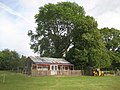 Harlton, The cricket pavilion - geograph.org.uk - 2434383.jpg 640 × 480; 92 KB
-
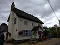
 Harlton, The Hare and Hounds - geograph.org.uk - 2433693.jpg 640 × 480; 55 KB
-
 Harlton, The Millennium Sign - geograph.org.uk - 2434364.jpg 640 × 480; 92 KB
-
 Harlton, The village pond - geograph.org.uk - 2434350.jpg 640 × 480; 127 KB
-
 Harlton, Washpit Lane - geograph.org.uk - 2925636.jpg 1 024 × 772; 1,02 MB
-
 Harlton, Washpit Lane, Snakes Lane and the pond - geograph.org.uk - 6298507.jpg 819 × 1 024; 1,09 MB
-
 Harlton, winter sunlight - geograph.org.uk - 6026487.jpg 1 024 × 732; 1 MB
-
 Harlton1.jpg 2 000 × 2 229; 567 KB
-
 Hillside, Wimpole - geograph.org.uk - 5567014.jpg 2 048 × 1 536; 878 KB
-
 Hillside, Wimpole - geograph.org.uk - 5567019.jpg 2 020 × 1 500; 916 KB
-
 In Harlton churchyard - geograph.org.uk - 5603047.jpg 1 024 × 768; 969 KB
-
 La pergola Restaurant by A603 - geograph.org.uk - 5365993.jpg 1 600 × 1 237; 206 KB
-
 Last of the summer rape - geograph.org.uk - 839460.jpg 640 × 480; 56 KB
-
 Leaving Harlton on the Harlton Road - geograph.org.uk - 5550556.jpg 480 × 640; 92 KB
-
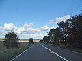
 Looking east from Comberton Road - geograph.org.uk - 4739077.jpg 640 × 480; 84 KB
-
 Lord's Bridge, flooded bridleway - geograph.org.uk - 3832423.jpg 804 × 1 024; 1,13 MB
-

-
 Lyn Cottage.jpg 4 032 × 3 024; 3,16 MB
-
 Manor Farm pond - geograph.org.uk - 4675591.jpg 480 × 640; 112 KB
-
 Manor Farm, Harlton - geograph.org.uk - 2389449.jpg 800 × 600; 128 KB
-
 Manor Farm, Harlton - geograph.org.uk - 4675586.jpg 640 × 480; 68 KB
-
 Manor Farm, Harlton - geograph.org.uk - 4675587.jpg 640 × 480; 67 KB
-
 Manor Farm, Harlton - geograph.org.uk - 4675589.jpg 480 × 640; 89 KB
-
 Mullard Radio Astronomy Observatory - geograph.org.uk - 4991327.jpg 1 600 × 1 128; 452 KB
-
 Oilseed rape and a triangular wood - geograph.org.uk - 3041864.jpg 1 024 × 768; 1,02 MB
-
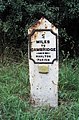
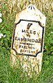
 Old Milepost - geograph.org.uk - 1715706.jpg 1 200 × 1 600; 668 KB
-
 Old Milepost - geograph.org.uk - 1715710.jpg 1 600 × 1 200; 760 KB
-
 Old Milepost - geograph.org.uk - 3610626.jpg 1 024 × 768; 247 KB
-
 Old Milepost - geograph.org.uk - 3610633.jpg 768 × 1 024; 363 KB
-
 Old Milepost by the A603, Cambridge Road (geograph 5622596).jpg 295 × 448; 144 KB
-
 Old Milepost by the A603, north east of May Pole Farm (geograph 5622598).jpg 1 331 × 2 067; 339 KB
-
 On the hill above Harlton - geograph.org.uk - 5602954.jpg 1 024 × 768; 865 KB
-
 On Whole Way - geograph.org.uk - 3041714.jpg 1 024 × 768; 1,27 MB
-
 Once the Varsity Line - geograph.org.uk - 6419610.jpg 1 024 × 819; 788 KB
-
 Over the hedge towards Harlton - geograph.org.uk - 6026519.jpg 1 024 × 768; 1,3 MB
-
 Over the hill to Barrington - geograph.org.uk - 3041909.jpg 1 024 × 768; 1,02 MB
-
 Passing place on Washpit Lane - geograph.org.uk - 3042182.jpg 1 024 × 735; 929 KB
-

-
 Radio telescope reflected - geograph.org.uk - 3875520.jpg 1 200 × 900; 1,41 MB
-
 Red Lion House, Harlton - geograph.org.uk - 838382.jpg 640 × 480; 84 KB
-
 Road junction and grass triangle - geograph.org.uk - 5458144.jpg 3 648 × 2 736; 2,55 MB
-
 Storm clouds over harvested fields - geograph.org.uk - 5987172.jpg 3 024 × 4 032; 1,96 MB
-
 Sunnyside (1).jpg 4 032 × 3 024; 3,47 MB
-
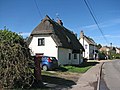
 Thatched cottage, High Street - geograph.org.uk - 839093.jpg 640 × 480; 72 KB
-
 The Hare And Hound Public House.jpg 4 032 × 3 024; 3,01 MB
-
 The Hare and Hounds, Harlton - geograph.org.uk - 839436.jpg 640 × 480; 82 KB
-
 The start of Whole Way - geograph.org.uk - 2925412.jpg 1 024 × 768; 947 KB
-
 The village pond at Harlton - geograph.org.uk - 1244978.jpg 640 × 480; 137 KB
-
 The village pond at Harlton - geograph.org.uk - 3883543.jpg 3 648 × 2 736; 3,21 MB
-
 The Wheatsheaf - geograph.org.uk - 4296508.jpg 4 320 × 3 240; 3,72 MB
-
 The Wheatsheaf, Harlton - geograph.org.uk - 896386.jpg 640 × 480; 60 KB
-
 The White House (1).jpg 4 032 × 3 024; 4,54 MB
-
 The Woods - panoramio.jpg 3 968 × 2 976; 2,9 MB
-
 Towards Orwell Hill - geograph.org.uk - 3041921.jpg 1 024 × 768; 917 KB
-
 Towards the observatory - geograph.org.uk - 3733633.jpg 600 × 800; 567 KB
-
 Up Orwell Hill - geograph.org.uk - 3875505.jpg 1 200 × 900; 1,27 MB
-
 Up Orwell Hill - geograph.org.uk - 6556290.jpg 1 024 × 732; 714 KB
-
 Verdant field boundary - geograph.org.uk - 3045892.jpg 640 × 480; 74 KB
-
 View from Harlton churchyard - geograph.org.uk - 2925687.jpg 1 024 × 711; 892 KB
-
 View from HARLTON forest - panoramio.jpg 2 048 × 1 536; 668 KB
-
 Village cricket pitch - geograph.org.uk - 758939.jpg 640 × 494; 81 KB
-
 Westwards on the former Varsity Line - geograph.org.uk - 2842674.jpg 1 024 × 768; 1,13 MB
-
 Wheat ^ I want some sunshine - geograph.org.uk - 3045886.jpg 640 × 480; 72 KB
-
 Where the footpath goes - geograph.org.uk - 3045884.jpg 640 × 480; 121 KB
-
 Whole Way - geograph.org.uk - 4745993.jpg 480 × 640; 63 KB
-
 Whole Way - geograph.org.uk - 4745995.jpg 480 × 640; 78 KB
-
 Whole Way, a few poppies near the top of the hill - geograph.org.uk - 3041708.jpg 1 024 × 768; 1,16 MB
-
 Wholeway Cottage, Eversden Road - geograph.org.uk - 896285.jpg 640 × 480; 88 KB
-
 Wholeway Cottage, front - geograph.org.uk - 896325.jpg 640 × 480; 88 KB
-
 Young tree plantation - geograph.org.uk - 896297.jpg 640 × 480; 68 KB
-
 Fields and hillside view over Harlton - geograph.org.uk - 275508.jpg 640 × 439; 124 KB


.jpg)
.jpg)


.jpg)


.jpg)


