Category:Harrietsham
Aller à la navigation
Aller à la recherche
English: Harrietsham is a village and civil parish in the Maidstone District of Kent, England. According to the United Kingdom Census 2001, it has a population of around 1,504. The parish is located on the slope of the North Downs, east of Maidstone. Within its boundaries are settlements at Marley, Pollhill and Fairbourne.
localité britannique du comté anglais du Kent  | |||||
| Téléverser des médias | |||||
| Nature de l’élément | |||||
|---|---|---|---|---|---|
| Lieu | Maidstone, Kent, Angleterre du Sud-Est, Angleterre | ||||
| Réputé identique à | Harrietsham (page en doublon, paroisse civile) | ||||
 | |||||
Sous-catégories
Cette catégorie comprend 6 sous-catégories, dont les 6 ci-dessous.
B
- Bell Farm House, Harrietsham (1 F)
G
- Greenway Forstal Farm (2 F)
O
P
- Pollhill (8 F)
R
- Harrietsham railway station (17 F)
Média dans la catégorie « Harrietsham »
Cette catégorie comprend 325 fichiers, dont les 200 ci-dessous.
(page précédente) (page suivante)-
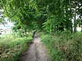
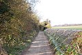
 A claggy bit of the Pilgrim's Way - geograph.org.uk - 137030.jpg 640 × 480 ; 155 kio
-
 A coombe in the North Downs - geograph.org.uk - 2264503.jpg 640 × 430 ; 117 kio
-
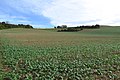
 A field of oilseed rape - geograph.org.uk - 4484906.jpg 4 000 × 3 000 ; 4,09 Mio
-
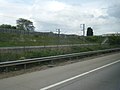
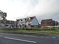
 A20 (Ashford Road), Harrietsham - geograph.org.uk - 3721449.jpg 640 × 480 ; 260 kio
-
 A20, Ashford Road - geograph.org.uk - 3721451.jpg 640 × 480 ; 342 kio
-
 Access to The Hollies from the A20 - geograph.org.uk - 3468468.jpg 881 × 660 ; 145 kio
-
 Access Track leading onto Fairbourne Lane - geograph.org.uk - 5078274.jpg 1 600 × 1 067 ; 785 kio
-
 Alexander Road access to The Hollies - geograph.org.uk - 3624450.jpg 1 077 × 807 ; 216 kio
-
 Alexander Road entrance to The Hollies - geograph.org.uk - 3468450.jpg 946 × 709 ; 163 kio
-
 Alms houses, East Street, Harrietsham - geograph.org.uk - 64933.jpg 640 × 480 ; 106 kio
-
 Almshouses at East Street, Harrietsham - geograph.org.uk - 3911836.jpg 4 000 × 3 000 ; 4,24 Mio
-
 Almshouses at East Street, Harrietsham - geograph.org.uk - 3914511.jpg 4 000 × 3 000 ; 4,28 Mio
-
 Almshouses at East Street, Harrietsham - geograph.org.uk - 3914521.jpg 4 000 × 3 000 ; 4,41 Mio
-
 Alongside the Pilgrim's Way and North Downs Way near Harrietsham - geograph.org.uk - 4484914.jpg 4 000 × 3 000 ; 3,98 Mio
-
 Ashford Road approaching Harrietsham - geograph.org.uk - 4996071.jpg 2 048 × 1 536 ; 945 kio
-
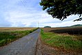
 Ashford Road east of Harrietsham - geograph.org.uk - 4996105.jpg 2 048 × 1 536 ; 1,53 Mio
-
 Ashford Road, Harrietsham - geograph.org.uk - 4995318.jpg 2 026 × 1 508 ; 805 kio
-
 Ashford Road, Harrietsham - geograph.org.uk - 4996098.jpg 2 048 × 1 536 ; 1,4 Mio
-
 Ashford Road, near Harrietsham - geograph.org.uk - 4751577.jpg 2 272 × 1 704 ; 873 kio
-
 At the top of the scarp slope above Harrietsham - geograph.org.uk - 4484137.jpg 4 000 × 3 000 ; 4,1 Mio
-
 Birds Nest by the Maidstone East line - geograph.org.uk - 2260115.jpg 640 × 430 ; 106 kio
-
 Br Percival - geograph.org.uk - 5472396.jpg 2 268 × 4 032 ; 5,22 Mio
-
 Bridleway junction in King's Wood - geograph.org.uk - 1189258.jpg 640 × 481 ; 136 kio
-
-

-

-

-
 Burchells Wood Road - geograph.org.uk - 4692080.jpg 640 × 480 ; 161 kio
-
 Burchells Wood Road, Harrietsham - geograph.org.uk - 5017162.jpg 3 264 × 2 448 ; 1,93 Mio
-
 Burchells Wood Road, Harrietsham - geograph.org.uk - 5111896.jpg 3 264 × 2 448 ; 1,65 Mio
-
 Burchells Wood Road, near Harrietsham - geograph.org.uk - 5111898.jpg 3 264 × 2 448 ; 2,49 Mio
-
 Byway through No Man's Acre - geograph.org.uk - 1195941.jpg 640 × 481 ; 137 kio
-
 Carpark off Harrison Drive - geograph.org.uk - 4746079.jpg 3 264 × 2 448 ; 2,35 Mio
-
 Catholic Church of the Good Shepherd - geograph.org.uk - 1189188.jpg 640 × 481 ; 86 kio
-
 Champion Hill from the footpath N - geograph.org.uk - 4209156.jpg 1 024 × 682 ; 357 kio
-
 Champion Hill Shaw - geograph.org.uk - 2263196.jpg 640 × 430 ; 111 kio
-
 Channel Tunnel Rail Link bridge 822 - geograph.org.uk - 66985.jpg 640 × 480 ; 89 kio
-
 Channel Tunnel Rail Link tunnel-bridge - geograph.org.uk - 2577383.jpg 3 640 × 2 494 ; 1,04 Mio
-
-
 Chegworth Lane, Chegworth - geograph.org.uk - 5032806.jpg 3 264 × 2 448 ; 2,46 Mio
-
 Chegworth Lane, Chegworth - geograph.org.uk - 5032839.jpg 3 264 × 2 448 ; 2,22 Mio
-
 Chegworth Lane, Chegworth - geograph.org.uk - 5032872.jpg 3 264 × 2 448 ; 2,33 Mio
-
 Church Crescent, Harrietsham - geograph.org.uk - 4751738.jpg 2 272 × 1 704 ; 728 kio
-
 Church Lane, Harrietsham - geograph.org.uk - 4751586.jpg 2 272 × 1 704 ; 740 kio
-
 Church Lane, Harrietsham - geograph.org.uk - 4751744.jpg 2 272 × 1 704 ; 761 kio
-
 Church on Church Lane, Lenham - geograph.org.uk - 1189180.jpg 640 × 481 ; 93 kio
-
 Church Road, Harrietsham - geograph.org.uk - 4751732.jpg 2 272 × 1 704 ; 926 kio
-
 Colesdane and Colesdane Wood - geograph.org.uk - 3492908.jpg 4 608 × 3 456 ; 3,93 Mio
-
 Cottages at East Street, Harrietsham - geograph.org.uk - 3914614.jpg 4 000 × 3 000 ; 4,25 Mio
-
 Countryside by Poplar Farm - geograph.org.uk - 5078281.jpg 1 600 × 1 067 ; 605 kio
-
 Countryside near Greenway Court - geograph.org.uk - 2260054.jpg 640 × 430 ; 111 kio
-
 Court Lodge Cottages - geograph.org.uk - 2263151.jpg 640 × 430 ; 152 kio
-
 Court Lodge Farm - geograph.org.uk - 141607.jpg 640 × 480 ; 114 kio
-
 Court Lodge Farm - geograph.org.uk - 2263171.jpg 640 × 430 ; 135 kio
-
 Court Lodge Farm - geograph.org.uk - 2263177.jpg 640 × 430 ; 126 kio
-
 Court Lodge farm from the Pilgrims Way - geograph.org.uk - 4209151.jpg 1 024 × 683 ; 370 kio
-
 Court Lodge Road, Harrietsham - geograph.org.uk - 4751735.jpg 2 272 × 1 704 ; 841 kio
-
 Court Lodge Road, Harrietsham - geograph.org.uk - 5024561.jpg 3 264 × 2 448 ; 1,3 Mio
-
 Court Lodge Road, Harrietsham - geograph.org.uk - 5024571.jpg 3 264 × 2 448 ; 1,98 Mio
-
 Court Lodge Road, Harrietsham - geograph.org.uk - 5025387.jpg 3 264 × 2 448 ; 2,1 Mio
-
 Court Lodge Road, Harrietsham - geograph.org.uk - 5025392.jpg 3 264 × 2 448 ; 2,35 Mio
-
 Cowl of Oast House - geograph.org.uk - 6248899.jpg 3 456 × 3 456 ; 381 kio
-
 Daffodils at East Street, Harrietsham - geograph.org.uk - 3914609.jpg 4 000 × 3 000 ; 4,07 Mio
-
 Dead mouse on the Pilgrim's Way - geograph.org.uk - 141421.jpg 640 × 481 ; 124 kio
-
 Deans Hill, Harrietsham - geograph.org.uk - 5017131.jpg 3 264 × 2 448 ; 1,93 Mio
-
 Descending the North Downs scarp through a sea of oilseed rape - geograph.org.uk - 4484142.jpg 4 000 × 3 000 ; 4,1 Mio
-
 Downlands at the junction of Ashford Road - geograph.org.uk - 4997642.jpg 2 048 × 1 536 ; 959 kio
-
 Downlands, Harrietsham - geograph.org.uk - 4751584.jpg 2 272 × 1 704 ; 861 kio
-
 Dutch House - geograph.org.uk - 2263153.jpg 640 × 430 ; 179 kio
-
 East Street, Harrietsham - geograph.org.uk - 3914620.jpg 4 000 × 3 000 ; 4,44 Mio
-
 East Street, Harrietsham - geograph.org.uk - 5025430.jpg 3 264 × 2 448 ; 1,8 Mio
-
 East Street, Harrietsham - geograph.org.uk - 5025439.jpg 3 264 × 2 448 ; 1,97 Mio
-
 Entrance to Summoner's Farm, Pilgrims' Way - geograph.org.uk - 2263017.jpg 640 × 430 ; 193 kio
-
 Extension of 14 Quested Way - geograph.org.uk - 3620652.jpg 848 × 636 ; 134 kio
-
 Fairbourn Mill - geograph.org.uk - 4990510.jpg 640 × 480 ; 105 kio
-
 Fairbourne Court, Fairbourne Lane, Harrietsham - geograph.org.uk - 1227732.jpg 640 × 427 ; 138 kio
-
 Fairbourne Lane Bridge, M20 - geograph.org.uk - 4572783.jpg 640 × 430 ; 34 kio
-
 Fairbourne Lane crosses over M20 Motorway - geograph.org.uk - 1189211.jpg 640 × 481 ; 66 kio
-
 Fairbourne Lane goes over the M20 - geograph.org.uk - 4065634.jpg 1 600 × 1 200 ; 1,03 Mio
-
 Fairbourne Lane, near Harrietsham - geograph.org.uk - 2077522.jpg 2 711 × 1 999 ; 1,25 Mio
-
 Fairbourne Mill Barn - geograph.org.uk - 1189225.jpg 640 × 481 ; 90 kio
-
 Fallen Tree in King's Wood - geograph.org.uk - 1189252.jpg 640 × 481 ; 127 kio
-
 Farmland by Pilgrims' Way - geograph.org.uk - 2263188.jpg 640 × 430 ; 120 kio
-
 Farmland near Goddington Wood - geograph.org.uk - 2260061.jpg 640 × 430 ; 104 kio
-
 Field by Pilgrims' Way near Stede Wood - geograph.org.uk - 2263019.jpg 640 × 430 ; 163 kio
-
 Field edge near Hogbarn - geograph.org.uk - 4483266.jpg 4 000 × 3 000 ; 4,24 Mio
-
 Field edge near Stedehill Wood - geograph.org.uk - 4483228.jpg 4 000 × 3 000 ; 4,12 Mio
-
 Field edge near Stedehill Wood - geograph.org.uk - 4483235.jpg 4 000 × 3 000 ; 4,31 Mio
-
 Field north of Burchells Wood Road - geograph.org.uk - 4692093.jpg 640 × 480 ; 92 kio
-
 Flooded Road Junction - geograph.org.uk - 1730921.jpg 640 × 480 ; 65 kio
-
 Footpath across a field - geograph.org.uk - 2263161.jpg 640 × 430 ; 113 kio
-
 Footpath across a field - geograph.org.uk - 4483225.jpg 4 000 × 3 000 ; 4,21 Mio
-
 Footpath by the Pilgrims Way looking S - geograph.org.uk - 4209153.jpg 1 024 × 683 ; 432 kio
-
 Footpath N off the Pilgrims Way - geograph.org.uk - 4209155.jpg 673 × 1 024 ; 395 kio
-
 Footpath near Marley Court - geograph.org.uk - 4483210.jpg 4 000 × 3 000 ; 4,08 Mio
-
 Footpath through oilseed rape - geograph.org.uk - 4484900.jpg 4 000 × 3 000 ; 4,24 Mio
-
 Footpath to Harrietsham - geograph.org.uk - 4483204.jpg 4 000 × 3 000 ; 4,15 Mio
-
 Footpath to Lower Deans Farm - geograph.org.uk - 140905.jpg 640 × 480 ; 118 kio
-
 Footpath to the crest of the North Downs - geograph.org.uk - 4483691.jpg 4 000 × 3 000 ; 4 Mio
-
 Footpath to the North Downs - geograph.org.uk - 4483212.jpg 4 000 × 3 000 ; 4,33 Mio
-
 Forge Meadow, Harrietsham - geograph.org.uk - 4751748.jpg 2 272 × 1 704 ; 851 kio
-
 Forge Meadow, Harrietsham - geograph.org.uk - 5033278.jpg 3 264 × 2 448 ; 1,57 Mio
-
 Former Harrietsham Primary School - geograph.org.uk - 4751604.jpg 2 272 × 1 704 ; 883 kio
-
 Frosty Farmland by the Maidstone East Line - geograph.org.uk - 2261282.jpg 640 × 363 ; 70 kio
-
 Gate and pre-fab hut, Pilgrims' Way - geograph.org.uk - 2261869.jpg 640 × 430 ; 158 kio
-
 Glebe Croft - geograph.org.uk - 2263010.jpg 640 × 430 ; 121 kio
-
 Goddington Lane - geograph.org.uk - 4691830.jpg 640 × 480 ; 193 kio
-
 Goddington Lane, Harrietsham - geograph.org.uk - 5033250.jpg 3 264 × 2 448 ; 2,77 Mio
-
 Goddington Lane, Harrietsham - geograph.org.uk - 5033254.jpg 3 264 × 2 448 ; 2,19 Mio
-
 Goddington Lane, Harrietsham - geograph.org.uk - 5033255.jpg 3 264 × 2 448 ; 2,56 Mio
-
 Goddington Lane, Harrietsham - geograph.org.uk - 5033257.jpg 3 264 × 2 448 ; 2,65 Mio
-
 Goddington Lane, Harrietsham - geograph.org.uk - 5033265.jpg 3 264 × 2 448 ; 2,26 Mio
-
 Goddington Wood - geograph.org.uk - 2260063.jpg 640 × 430 ; 100 kio
-
 Greenway Forstal Lane, near Harrietsham - geograph.org.uk - 5033246.jpg 3 264 × 2 448 ; 1,66 Mio
-
 Greenway Forstal Lane, near Harrietsham - geograph.org.uk - 5033247.jpg 3 264 × 2 448 ; 1,49 Mio
-
 Greenway Lane - geograph.org.uk - 1730953.jpg 640 × 427 ; 80 kio
-
 Greenway Lane, Harrietsham, Kent - geograph.org.uk - 62682.jpg 600 × 450 ; 217 kio
-
 Harrietsham church - geograph.org.uk - 4691970.jpg 640 × 480 ; 104 kio
-
 Harrietsham church - geograph.org.uk - 4691973.jpg 640 × 480 ; 114 kio
-
 Harrietsham Manor - geograph.org.uk - 163753.jpg 640 × 480 ; 121 kio
-
 Harrietsham Rail Bridge over Ashford Road - geograph.org.uk - 3721444.jpg 640 × 480 ; 306 kio
-
 Harrietsham station - geograph.org.uk - 4691966.jpg 640 × 480 ; 135 kio
-
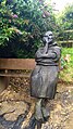
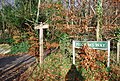
 Harrietsham Village Sign - geograph.org.uk - 1190663.jpg 481 × 640 ; 47 kio
-
 Harrietsham Village Sign - geograph.org.uk - 1504846.jpg 480 × 640 ; 75 kio
-
 Harrietsham, Ashford Road - geograph.org.uk - 3721447.jpg 640 × 480 ; 276 kio
-
 Hedgeline at the foot of the North Downs - geograph.org.uk - 4483218.jpg 4 000 × 3 000 ; 3,95 Mio
-
 Hoarding, 10, West Street - geograph.org.uk - 5098732.jpg 3 264 × 2 448 ; 1,69 Mio
-
 Hogbarn Caravan Park - geograph.org.uk - 4209256.jpg 1 024 × 683 ; 324 kio
-
 Hogbarn Lane - geograph.org.uk - 1730966.jpg 640 × 480 ; 100 kio
-
 Hogbarn Lane, Harrietsham - geograph.org.uk - 5017158.jpg 3 264 × 2 448 ; 2,12 Mio
-
 Hogbarn Lane, Harrietsham - geograph.org.uk - 5111888.jpg 3 264 × 2 448 ; 2,11 Mio
-
 Holm Mill Lane - geograph.org.uk - 3744485.jpg 4 000 × 3 000 ; 4,49 Mio
-
 Holm Mill Lane - geograph.org.uk - 4691855.jpg 640 × 480 ; 175 kio
-
 Holm Mill Lane, Harrietsham - geograph.org.uk - 5033249.jpg 3 264 × 2 448 ; 1,92 Mio
-
 Hook Lane, Harrietsham - geograph.org.uk - 5033272.jpg 3 264 × 2 448 ; 1,94 Mio
-
 Hook Lane, Harrietsham - geograph.org.uk - 5033274.jpg 2 567 × 2 003 ; 1,07 Mio
-
 Horses by Pilgrims' Way - geograph.org.uk - 2263016.jpg 640 × 430 ; 177 kio
-
 Horses, Summoner's farm - geograph.org.uk - 2263014.jpg 640 × 430 ; 145 kio
-
 Houses by Ashford Road, Harrietsham - geograph.org.uk - 4995320.jpg 2 048 × 1 536 ; 940 kio
-

-
 Ink Cap Mushroom - geograph.org.uk - 63842.jpg 433 × 640 ; 165 kio
-
 Inscription on the almshouses at East Street, Harrietsham - geograph.org.uk - 3911842.jpg 4 000 × 3 000 ; 4,06 Mio
-
 Keep Out^ - geograph.org.uk - 66088.jpg 640 × 480 ; 141 kio
-
 Lakelands, Harrietsham - geograph.org.uk - 4751733.jpg 2 272 × 1 704 ; 704 kio
-
 Lane near Stedehill Wood - geograph.org.uk - 4483243.jpg 4 000 × 3 000 ; 4,3 Mio
-
 Lenham Sports Cars Ltd, Harrietsham - geograph.org.uk - 2077508.jpg 3 488 × 2 616 ; 2,32 Mio
-
 Looking east along Horwood Way, The Hollies - geograph.org.uk - 4169472.jpg 1 175 × 881 ; 200 kio
-
 Looking east-northeast along Horwood Way - geograph.org.uk - 4634787.jpg 3 264 × 2 448 ; 2,48 Mio
-
 Looking east-northeast along Horwood Way, The Hollies - geograph.org.uk - 4169492.jpg 1 142 × 772 ; 193 kio
-
 Looking north along Alexander Road, The Hollies - geograph.org.uk - 4169524.jpg 1 096 × 809 ; 193 kio
-
 Looking up the North Downs scarp slope - geograph.org.uk - 2263183.jpg 640 × 430 ; 112 kio
-
 Lower Deans Farm - geograph.org.uk - 4483689.jpg 4 000 × 3 000 ; 4,39 Mio
-
 M20 bridge carries minor road south of Harrietsham - geograph.org.uk - 2577455.jpg 3 648 × 2 736 ; 1,2 Mio
-

-
 M20, coastbound - geograph.org.uk - 4572779.jpg 640 × 519 ; 46 kio
-
 M20, coastbound - geograph.org.uk - 4572780.jpg 640 × 514 ; 44 kio
-
 M20, coastbound - geograph.org.uk - 4572786.jpg 640 × 465 ; 33 kio
-
 Mallard duck and large Goose - geograph.org.uk - 63921.jpg 471 × 640 ; 125 kio
-
 Malthouse, East Street - geograph.org.uk - 4418575.jpg 2 000 × 1 333 ; 869 kio
-
 Manhamead, Pilgrims' Way - geograph.org.uk - 2261866.jpg 640 × 430 ; 134 kio
-
 Manor Barn - geograph.org.uk - 1189240.jpg 640 × 481 ; 85 kio
-
 Marley Rd - geograph.org.uk - 2261872.jpg 640 × 430 ; 147 kio
-
 Marley Road - geograph.org.uk - 4692069.jpg 640 × 480 ; 146 kio
-
 Marley Works - new buildings (1) - geograph.org.uk - 778399.jpg 640 × 481 ; 63 kio
-
 Marley Works - new buildings (2) - geograph.org.uk - 778403.jpg 640 × 480 ; 39 kio
-
 Mass bank of Crocuses - geograph.org.uk - 1181201.jpg 640 × 481 ; 155 kio
-
 Merlewood Farm House - geograph.org.uk - 1169182.jpg 640 × 481 ; 99 kio
-
 Mile Hill - geograph.org.uk - 1169171.jpg 640 × 481 ; 76 kio
-
 Mile Hill - geograph.org.uk - 4990612.jpg 640 × 480 ; 95 kio
-
 Mobile Phone Mast in Lower Deans Farm - geograph.org.uk - 1169178.jpg 640 × 481 ; 68 kio
-
 Narrow Lane outside Poplar Farm - geograph.org.uk - 5078286.jpg 1 600 × 1 067 ; 858 kio
-
 New barn, Court Lodge Farm - geograph.org.uk - 2263175.jpg 640 × 430 ; 117 kio
-
 New houses on Ashford Road, Harrietsham - geograph.org.uk - 4995327.jpg 2 048 × 1 536 ; 945 kio
-
 Newly erected houses - geograph.org.uk - 4634824.jpg 3 183 × 2 448 ; 2,38 Mio
-
 NNE towards Coles Deane - geograph.org.uk - 4209144.jpg 683 × 1 024 ; 579 kio
-
 North Downs Way - geograph.org.uk - 2263150.jpg 640 × 430 ; 184 kio
-
 North Downs Way - geograph.org.uk - 2263157.jpg 640 × 430 ; 181 kio
-
 North Downs Way - geograph.org.uk - 2263167.jpg 640 × 430 ; 195 kio
-
 North Downs Way - geograph.org.uk - 2263186.jpg 640 × 430 ; 155 kio
-
 North Downs Way - geograph.org.uk - 2263194.jpg 640 × 430 ; 161 kio
-
 North Downs Way sign, Pilgrims' Way - geograph.org.uk - 2263050.jpg 640 × 430 ; 217 kio
-
 NW Near the Pilgrims Way - geograph.org.uk - 4209148.jpg 1 024 × 683 ; 374 kio
-
 NW Near the Pilgrims Way - geograph.org.uk - 4209150.jpg 683 × 1 024 ; 463 kio
-
 NW on the Pilgrims Way - geograph.org.uk - 4209152.jpg 1 024 × 683 ; 435 kio
-
 NW towards Court Lodge Farm - geograph.org.uk - 4209143.jpg 1 024 × 683 ; 326 kio
-
 NW towards Court Lodge Farm from foot path - geograph.org.uk - 4209134.jpg 1 024 × 683 ; 295 kio
-
 Oast House - geograph.org.uk - 6248896.jpg 5 184 × 3 456 ; 1,13 Mio
-
 Oasts at Fairbourne Mill - geograph.org.uk - 5078266.jpg 1 600 × 1 067 ; 783 kio
-
 Ockley Mead - geograph.org.uk - 3313898.jpg 640 × 426 ; 58 kio
-
 Old petrol pumps, Harrietsham - geograph.org.uk - 1946317.jpg 3 072 × 2 304 ; 2,76 Mio
-

-
 Ordnance Survey Flush Bracket 2907 - geograph.org.uk - 4934979.jpg 4 000 × 3 000 ; 2,9 Mio
-
 Overgrown banks of a drainage ditch - geograph.org.uk - 4634802.jpg 3 264 × 2 448 ; 3,95 Mio
-
 Paddock North of Chegworth - geograph.org.uk - 5078886.jpg 1 600 × 1 067 ; 616 kio
-
 Parkwood Close - geograph.org.uk - 4634779.jpg 3 120 × 2 448 ; 2,52 Mio
-
 Path across a field - geograph.org.uk - 4480286.jpg 4 000 × 3 000 ; 3,93 Mio
-
 Path near Dean's Hill - geograph.org.uk - 4480856.jpg 4 000 × 3 000 ; 4,28 Mio
-
 Path through a sea of oilseed rape - geograph.org.uk - 4480284.jpg 4 000 × 3 000 ; 4,03 Mio
-
 Path through oilseed rape - geograph.org.uk - 4484894.jpg 4 000 × 3 000 ; 4,03 Mio
-
 Path to Harrietsham Church - geograph.org.uk - 4209260.jpg 1 024 × 683 ; 394 kio


,_Harrietsham_-_geograph.org.uk_-_3721449.jpg)


_-_geograph.org.uk_-_778399.jpg)
_-_geograph.org.uk_-_778403.jpg)


