Category:Hartland, Devon
Vai alla navigazione
Vai alla ricerca
Cymraeg: Mae Hartland yn dref fach sy'n denu ymwelwyr. Roedd hi'n borthladd pwysig hyd nes yr 16eg ganrif. Mae wedi'i lleoli ger penrhyn o'r enw Hartland Point lle ceir goleudy ac eglwys: Sant Nectan.
Deutsch: Das in angelsächsischer Zeit gegründete Hartland nahe dem Bristol Channel ist die nordwestlichste Stadt in der südwestenglischen Grafschaft Devon. Zur Gemeinde gehören das Dörfchen Stoke im Westen und die Ortschaft Meddon im Süden.
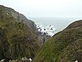
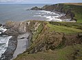
English: The town of Hartland, which incorporates the hamlet of Stoke to the west and the village of Meddon in the south, is the most north-westerly settlement in the county of Devon, England.
Français : La ville de Hartland, qui comprend le hameau de Stoke à l'ouest et le village de Meddon au sud, est la région la plus au nord-ouest du comté du Devon en Angleterre.
Nederlands: Hartland is een dorp in het bestuurlijke gebied Torridge, in het Engelse graafschap Devon.
Svenska: Hartland är namnet på flera orter:
Volapük: Dabinons:
town and civil parish in Devon, England  | |||||
| Carica un file multimediale | |||||
| Istanza di | |||||
|---|---|---|---|---|---|
| Luogo | Torridge, Devon, Sud Ovest dell'Inghilterra, Inghilterra | ||||
 | |||||
Sottocategorie
Questa categoria contiene le 14 sottocategorie indicate di seguito, su un totale di 14.
B
C
H
- Hart Inn, Hartland, Devon (2 F)
J
- St John's Chapel, Hartland (2 F)
M
- Meddon (6 F)
N
S
- St Catherine's Tor (13 F)
- Stoke, Torridge (10 F)
T
- Tosberry (2 F)
W
File nella categoria "Hartland, Devon"
Questa categoria contiene 200 file, indicati di seguito, su un totale di 1 584.
(pagina precedente) (pagina successiva)-
 A bench above Shipload Bay - geograph.org.uk - 5146920.jpg 1 024 × 768; 228 KB
-
 A frustrating notice - geograph.org.uk - 4102626.jpg 4 912 × 3 264; 7,06 MB
-
 A junction on a quiet lane - geograph.org.uk - 2382730.jpg 640 × 480; 83 KB
-

-
-
 A touch of Ireland in West Devon - geograph.org.uk - 4728949.jpg 800 × 449; 185 KB
-
 A track between Clifford Mill and Trew Farm - geograph.org.uk - 3981608.jpg 6 000 × 4 000; 5,37 MB
-
 A track between Clifford Mill and Trew Farm - geograph.org.uk - 3981619.jpg 5 934 × 3 956; 5,22 MB
-
 A track between Trew Farm and Clifford Mill - geograph.org.uk - 3981612.jpg 6 000 × 4 000; 4,89 MB
-
 A track between Trew Farm and Clifford Mill - geograph.org.uk - 3981617.jpg 6 000 × 4 000; 5,46 MB
-
 A track which runs between Clifford Mill and Burford - geograph.org.uk - 3981599.jpg 6 000 × 4 000; 4,94 MB
-

-
 A39 at Deptford - geograph.org.uk - 698372.jpg 640 × 480; 108 KB
-
 A39 at Welsford Moor - geograph.org.uk - 5477483.jpg 2 088 × 1 440; 1,53 MB
-
 A39 Bend near Lower Deptford - geograph.org.uk - 5477502.jpg 1 600 × 1 078; 374 KB
-
 A39 from Summerville Cross - geograph.org.uk - 3640212.jpg 1 024 × 586; 82 KB
-
 A39 near Meddon, Devon - geograph.org.uk - 4929596.jpg 960 × 1 280; 1,09 MB
-
 A39 near Meddon, Devon - geograph.org.uk - 4929618.jpg 1 280 × 960; 1,04 MB
-
 A39 near Meddon, Devon - geograph.org.uk - 4929627.jpg 1 024 × 718; 491 KB
-
 A39 near Meddon, Devon - geograph.org.uk - 4929665.jpg 1 280 × 800; 978 KB
-
 A39 passing a windblown tree - geograph.org.uk - 5477480.jpg 1 967 × 1 360; 1,51 MB
-
 A39 passing Greenfields B^B - geograph.org.uk - 3640243.jpg 1 024 × 586; 99 KB
-
 A39 passing The West Country Inn - geograph.org.uk - 5477496.jpg 2 256 × 1 496; 1,38 MB
-
 Abbey River - geograph.org.uk - 505922.jpg 480 × 640; 121 KB
-
 Abbey River - Hartland Abbey - geograph.org.uk - 5392371.jpg 640 × 480; 122 KB
-
 Abbey River - Hartland Abbey - geograph.org.uk - 5392375.jpg 640 × 483; 112 KB
-
 Abbey River at Hartland Abbey - geograph.org.uk - 3640602.jpg 768 × 1 024; 231 KB
-
 Abbey River beneath narrow bridge - geograph.org.uk - 2382733.jpg 640 × 480; 144 KB
-
 Abbey River emerging on to Blegberry beach - August 2011 - panoramio.jpg 2 288 × 1 712; 854 KB
-
 Abbey River meets the sea at Blegberry Beach - Aug 2011 - panoramio.jpg 1 712 × 2 288; 1 000 KB
-
 Above Gawlish Cliff - geograph.org.uk - 1521909.jpg 640 × 480; 84 KB
-
 Above Gawlish Cliff - geograph.org.uk - 5146914.jpg 800 × 600; 141 KB
-
 Access road to Hartland Quay - geograph.org.uk - 4361319.jpg 1 600 × 1 063; 458 KB
-
 Access to East Titchberry Farm - geograph.org.uk - 4356708.jpg 1 024 × 689; 271 KB
-
 Across Blagdon Coombe - geograph.org.uk - 1929676.jpg 1 024 × 682; 225 KB
-
 Across the pasture to Hartland in Devon - geograph.org.uk - 4810608.jpg 1 280 × 561; 884 KB
-
 Alien beacon - Warren Beach - geograph.org.uk - 4361314.jpg 1 600 × 1 051; 660 KB
-
 All about the area - geograph.org.uk - 4356935.jpg 1 600 × 1 063; 373 KB
-
 Almost accurate - geograph.org.uk - 4356889.jpg 1 129 × 1 600; 652 KB
-
 An access road to Westhay Farm,Trew Farm and other premises - geograph.org.uk - 3981594.jpg 5 966 × 3 977; 5,15 MB
-
 An access road which leads to Trew View and Trew Farm - geograph.org.uk - 3981595.jpg 6 000 × 4 000; 5,22 MB
-
 An adder below Knap Head - geograph.org.uk - 1521939.jpg 640 × 548; 175 KB
-
 Ancient field boundary - Gawlish Cliff - geograph.org.uk - 4356871.jpg 1 600 × 1 056; 551 KB
-
 Ancient field boundary - Gawlish Cliff - geograph.org.uk - 4356925.jpg 1 600 × 1 046; 548 KB
-
 Ancient field boundary - Gawlish Cliff - geograph.org.uk - 4356927.jpg 1 600 × 1 063; 547 KB
-
 Anticline at Welcome Mouth - geograph.org.uk - 1910317.jpg 1 024 × 682; 224 KB
-

-

-
 B3248 at Rosedown - geograph.org.uk - 979889.jpg 640 × 480; 90 KB
-
 Bank between track and stream - geograph.org.uk - 6108129.jpg 1 200 × 1 600; 1,11 MB
-
 Barley Bay - geograph.org.uk - 1378440.jpg 640 × 359; 118 KB
-
 Barley Bay - geograph.org.uk - 5074473.jpg 1 024 × 768; 128 KB
-
 Barley Bay east of Hartland Point, Devon - geograph.org.uk - 4555750.jpg 1 280 × 960; 890 KB
-
 Barley Bay east of Hartland Point, Devon - geograph.org.uk - 4555793.jpg 1 280 × 1 028; 981 KB
-
 Barley Bay east of Hartland Point, Devon - geograph.org.uk - 4555803.jpg 768 × 1 024; 564 KB
-
 Barley Bay Radar Tower - geograph.org.uk - 1917997.jpg 640 × 480; 81 KB
-
 Barns and footpath near Titchberry in Devon - geograph.org.uk - 4816232.jpg 1 280 × 837; 762 KB
-
 Barns at Titchberry in Devon - geograph.org.uk - 4816100.jpg 1 280 × 795; 596 KB
-
 Base of the cliff - Welcombe Mouth - geograph.org.uk - 4723224.jpg 1 600 × 1 062; 660 KB
-
 Base of the cliff - Welcombe Mouth - geograph.org.uk - 4723228.jpg 1 600 × 1 062; 577 KB
-
 Baxworthy Cross - geograph.org.uk - 3640253.jpg 1 024 × 616; 108 KB
-
 Baxworthy Cross - geograph.org.uk - 697873.jpg 640 × 480; 88 KB
-
 Beach access at Speke's Mill Mouth - geograph.org.uk - 506871.jpg 640 × 480; 157 KB
-
 Beach and Cliff at Blackpool Mill - geograph.org.uk - 2968452.jpg 640 × 480; 84 KB
-
 Beach and cliff at Welcombe Mouth, Devon - geograph.org.uk - 4935019.jpg 1 280 × 960; 981 KB
-
 Beach and cliffs at Blackpool Mill - geograph.org.uk - 3640597.jpg 1 024 × 768; 211 KB
-
 Beach and coastline rocks by Hartland Quay, Devon - geograph.org.uk - 4586748.jpg 1 280 × 960; 1,03 MB
-
 Beach cave north of Hartland Quay, Devon - geograph.org.uk - 4689584.jpg 1 280 × 842; 1 017 KB
-
 Bear Rock - geograph.org.uk - 3108020.jpg 427 × 640; 173 KB
-
 Beech trees across footpath - geograph.org.uk - 505909.jpg 640 × 480; 147 KB
-
 Bench on Knap Head - geograph.org.uk - 1555085.jpg 640 × 480; 122 KB
-
 Bench with a view - geograph.org.uk - 4361307.jpg 1 600 × 1 003; 720 KB
-
 Benches above Hartland Bay - geograph.org.uk - 2823481.jpg 1 024 × 680; 231 KB
-
 Benchmark, East Titchbury Farm - geograph.org.uk - 5522882.jpg 640 × 427; 115 KB
-
 Berry Farm - geograph.org.uk - 103637.jpg 640 × 480; 72 KB
-
 Black and white at Hartland Point in Devon ... - geograph.org.uk - 4557106.jpg 1 024 × 768; 379 KB
-
 Black and white near Hartland Point, Devon - geograph.org.uk - 4557124.jpg 1 024 × 768; 630 KB
-

-
 Blackpool and the mill - geograph.org.uk - 2381384.jpg 640 × 469; 79 KB
-
 Blagden cliff. - geograph.org.uk - 2998912.jpg 640 × 480; 73 KB
-
 Blagdon Cliffside - geograph.org.uk - 1929640.jpg 1 024 × 682; 176 KB
-
 Blagdon Combe - geograph.org.uk - 1520399.jpg 640 × 480; 135 KB
-
 Blagdon Combe - geograph.org.uk - 78605.jpg 640 × 480; 19 KB
-
 Blagdon Farm - geograph.org.uk - 1929662.jpg 1 024 × 682; 227 KB
-
 Blagdon Farm - geograph.org.uk - 3981641.jpg 6 000 × 4 000; 4,57 MB
-
 Blegberry Cliff - geograph.org.uk - 4309155.jpg 1 600 × 904; 434 KB
-
 Blegberry Cliffs - August 2011 - panoramio.jpg 2 288 × 1 712; 796 KB
-
 Bluebells south of Elmscott in Devon - geograph.org.uk - 5204220.jpg 768 × 1 024; 566 KB
-
 Bridge above the waterfall at Speke's Mill Mouth - geograph.org.uk - 6108751.jpg 1 600 × 1 200; 1,02 MB
-
 Bridge near Brimford Bridge - geograph.org.uk - 3624880.jpg 1 024 × 768; 223 KB
-
 Bridge over Abbey River at Hartland Abbey - geograph.org.uk - 3640600.jpg 1 024 × 768; 223 KB
-

-
 Bridleway bridge over Titchberry Water - geograph.org.uk - 3112114.jpg 800 × 533; 414 KB
-

-

-
 Bringing in the straw bales, 1 - geograph.org.uk - 4658490.jpg 800 × 451; 150 KB
-
 Bringing in the straw bales, 2 - geograph.org.uk - 4658497.jpg 800 × 451; 179 KB
-
 Bringing in the straw bales, 3 - geograph.org.uk - 4658500.jpg 800 × 451; 235 KB
-
 Broad Beach - geograph.org.uk - 4309141.jpg 4 320 × 2 432; 2,19 MB
-
 Broad Beach - geograph.org.uk - 4567356.jpg 1 024 × 680; 228 KB
-
 Brook at Watergap Cross, Devon - geograph.org.uk - 4568766.jpg 768 × 1 024; 671 KB
-
 Brook at Watergap Cross, Devon - geograph.org.uk - 4568769.jpg 1 024 × 768; 643 KB
-
 Building, East Titchbury Farm - geograph.org.uk - 5522876.jpg 640 × 427; 83 KB
-
 Bungalow and lane south of Elmscott, Devon - geograph.org.uk - 5202384.jpg 1 024 × 646; 523 KB
-
 Bursdon (geograph 3402131).jpg 640 × 480; 113 KB
-
 Bursdon Moor - geograph.org.uk - 1455710.jpg 640 × 427; 71 KB
-
 Bursdon Moor - geograph.org.uk - 1455714.jpg 640 × 427; 69 KB
-
 Bursdon Moor - geograph.org.uk - 1455729.jpg 640 × 427; 79 KB
-
 Bursdon Moor - geograph.org.uk - 4142878.jpg 2 560 × 1 920; 2,49 MB
-
 Bursdon Moor - geograph.org.uk - 504388.jpg 640 × 480; 125 KB
-
 Bursdon Moor - geograph.org.uk - 687793.jpg 640 × 480; 69 KB
-
 Bursdon Moor - geograph.org.uk - 698380.jpg 640 × 480; 103 KB
-
 Bursdon Moor at Summerville Cross - geograph.org.uk - 687855.jpg 640 × 480; 84 KB
-
 Bursdon Moor south-east of Hartland, Devon - geograph.org.uk - 4928490.jpg 1 280 × 778; 630 KB
-
 Bursdon Moor south-east of Hartland, Devon - geograph.org.uk - 4928524.jpg 1 280 × 886; 749 KB
-
 Bursdon Moor south-east of Hartland, Devon - geograph.org.uk - 4928554.jpg 1 280 × 836; 889 KB
-
 Bursdon Moor south-east of Hartland, Devon - geograph.org.uk - 4928822.jpg 1 280 × 960; 1 015 KB
-
 Bursdon Moor.jpg 2 592 × 3 888; 8,16 MB
-
 Buttercup Meadow - geograph.org.uk - 1910402.jpg 1 024 × 682; 286 KB
-
 Byway and farmland near Lutsford, Devon - geograph.org.uk - 4927659.jpg 1 280 × 891; 768 KB
-
 Byway north of Lutsford, Devon - geograph.org.uk - 4927662.jpg 960 × 1 280; 822 KB
-
 Byway to Lutsford Cross, Devon - geograph.org.uk - 4564399.jpg 768 × 1 024; 687 KB
-
 Byway to Stoke, Devon - geograph.org.uk - 4582765.jpg 1 024 × 685; 546 KB
-
 Byway towards Welcombe, Devon - geograph.org.uk - 4575248.jpg 1 024 × 768; 623 KB
-
 Byway towards Welcombe, Devon - geograph.org.uk - 4575257.jpg 1 023 × 767; 589 KB
-
 Car Park at Hartland Abbey - geograph.org.uk - 5420490.jpg 640 × 427; 67 KB
-
 Car park for Shipload Bay - geograph.org.uk - 4356714.jpg 640 × 424; 83 KB
-
 Car Park near Hartland Quay, Devon - geograph.org.uk - 4803319.jpg 1 280 × 793; 664 KB
-
 Car park, Summerwell Moor Plantation - geograph.org.uk - 689019.jpg 640 × 480; 206 KB
-
 Cattle at Edistone, Devon - geograph.org.uk - 4564483.jpg 1 280 × 853; 837 KB
-
 Cattle at Edistone, Devon - geograph.org.uk - 4564491.jpg 1 024 × 768; 538 KB
-
 Cattle grazing near Elmscott, Devon - geograph.org.uk - 4970916.jpg 1 280 × 960; 729 KB
-
 Cattle grid at Tosberry Moor - geograph.org.uk - 2382769.jpg 640 × 480; 77 KB
-
 Cave at Welcombe Mouth - geograph.org.uk - 4723235.jpg 1 462 × 1 600; 663 KB
-
 Cave at Welcombe Mouth - geograph.org.uk - 4723236.jpg 1 600 × 1 062; 514 KB
-
 Celandines south of Elmscott in Devon - geograph.org.uk - 5204223.jpg 1 024 × 1 024; 679 KB
-
 Centre of Hartland - geograph.org.uk - 5074397.jpg 1 024 × 840; 134 KB
-
 Childspit Beach - geograph.org.uk - 3108267.jpg 533 × 800; 329 KB
-
 CholwillArms.png 812 × 933; 61 KB
-
 Church House, Stoke, Hartland (geograph 5743972).jpg 1 024 × 702; 131 KB
-
 Cliff above Brownspear Point - geograph.org.uk - 6108746.jpg 1 200 × 1 600; 1,07 MB
-
 Cliff and rocky beach at Welcombe Mouth, Devon - geograph.org.uk - 4935184.jpg 1 280 × 960; 1,06 MB
-
 Cliff and rocky shore at Welcombe Mouth, Devon - geograph.org.uk - 4935161.jpg 1 280 × 960; 1,17 MB
-

-

-
 Cliff at St Catherine's Tor in Devon - geograph.org.uk - 4808271.jpg 960 × 1 280; 964 KB
-
 Cliff at Welcombe Mouth - geograph.org.uk - 4722100.jpg 1 600 × 1 062; 456 KB
-
 Cliff by Hartland Point in Devon - geograph.org.uk - 4820715.jpg 768 × 1 024; 667 KB
-
 Cliff coastline near Elmscott, Devon - geograph.org.uk - 4578818.jpg 1 280 × 844; 604 KB
-
 Cliff flowers at Hartland Quay, Devon - geograph.org.uk - 4803241.jpg 1 280 × 960; 1 002 KB
-
 Cliff slump above Titchberry Water - geograph.org.uk - 3112203.jpg 800 × 533; 411 KB
-
 Cliff slump above Titchberry Water - geograph.org.uk - 3112284.jpg 800 × 559; 360 KB
-
 Cliff south of Screda Cove - geograph.org.uk - 2966986.jpg 640 × 480; 81 KB
-
 Cliff top at Speke's Mill Mouth in Devon - geograph.org.uk - 4804498.jpg 1 280 × 960; 849 KB
-
 Cliff top at Speke's Mill Mouth in Devon - geograph.org.uk - 4804517.jpg 960 × 1 280; 859 KB
-
 Cliff top near Elmscott, Devon - geograph.org.uk - 4561412.jpg 1 280 × 891; 655 KB
-
 Cliff top path - geograph.org.uk - 4356852.jpg 1 600 × 1 056; 664 KB
-
 Cliff-top potato field near Elmscott, Devon - geograph.org.uk - 4554352.jpg 1 024 × 749; 462 KB
-
 Cliff-top potato field near Elmscott, Devon - geograph.org.uk - 4554360.jpg 1 280 × 960; 1 000 KB
-
 Clifford Farm Cottages - geograph.org.uk - 3981630.jpg 5 089 × 3 816; 5,21 MB
-
 Clifford Mill - geograph.org.uk - 3981603.jpg 6 000 × 4 000; 4,49 MB
-
 Clifford Water by Clifford Mill - geograph.org.uk - 689085.jpg 640 × 480; 263 KB
-
 Cliffs above Barley Bay in Devon - geograph.org.uk - 4818383.jpg 1 280 × 852; 819 KB
-
 Cliffs above Broad Beach - geograph.org.uk - 2823437.jpg 1 024 × 680; 189 KB
-
 Cliffs above Speke's Mill Beach - geograph.org.uk - 506856.jpg 640 × 478; 109 KB
-
 Cliffs above Speke's Mill Mouth - geograph.org.uk - 1524934.jpg 640 × 480; 100 KB
-
 Cliffs and fields near Hartland Point in Devon - geograph.org.uk - 4824997.jpg 1 280 × 853; 972 KB
-

-
 Cliffs at Brownspear Point - geograph.org.uk - 6108752.jpg 1 600 × 1 200; 1,03 MB
-
 Cliffs at Embury Beacon - geograph-1910334.jpg 1 024 × 682; 195 KB
-
 Cliffs at Hartland Quay - geograph.org.uk - 5420483.jpg 640 × 427; 110 KB
-
 Cliffs at Speke's Mill Mouth, Devon - geograph.org.uk - 4804482.jpg 1 024 × 720; 682 KB
-
 Cliffs at Warren Beach - geograph.org.uk - 4361284.jpg 1 600 × 1 063; 578 KB
-
 Cliffs at Welcombe Mouth - geograph.org.uk - 4723239.jpg 1 600 × 1 062; 667 KB
-
 Cliffs at Welcombe Mouth - geograph.org.uk - 4723241.jpg 1 600 × 1 062; 638 KB
-
 Cliffs near Elmscott, Devon - geograph.org.uk - 4553095.jpg 768 × 1 024; 483 KB
-
 Cliffs north of South Hole, Devon - geograph.org.uk - 4553088.jpg 1 280 × 960; 871 KB
-

-
 Cliffs to the South of Hartland Quay - geograph.org.uk - 1926443.jpg 1 024 × 682; 270 KB
-
 Clifftop farmland near Stoke, Devon. - geograph.org.uk - 4557463.jpg 1 280 × 753; 539 KB
-
 Clifftop north of South Hole, Devon - geograph.org.uk - 4578752.jpg 1 280 × 875; 977 KB
-
 Coast at Blackpool Mill - geograph.org.uk - 2968446.jpg 640 × 461; 59 KB
-
 Coast north of the Warren - geograph.org.uk - 506251.jpg 640 × 473; 112 KB
-
 Coast path above Brownsham Cliff - geograph.org.uk - 1520090.jpg 640 × 480; 113 KB
-
 Coast path above Exmansworthy Cliff - geograph.org.uk - 507041.jpg 640 × 430; 118 KB
-
 Coast path at Embury Beacon - geograph.org.uk - 1555072.jpg 640 × 480; 103 KB
-
 Coastal path above Shipload Bay in Devon - geograph.org.uk - 4816129.jpg 1 280 × 960; 788 KB
-

-

-

-
 Coastal Path and St Catherine's Tor, Devon - geograph.org.uk - 4803450.jpg 1 280 × 855; 821 KB
-
 Coastal path approaching Hartland Quay, Devon - geograph.org.uk - 4559381.jpg 1 024 × 1 024; 525 KB
-
 Coastal path approaching Hartland Quay, Devon - geograph.org.uk - 4559427.jpg 768 × 1 024; 689 KB
-
 Coastal path approaching Hartland Quay, Devon - geograph.org.uk - 4559441.jpg 768 × 1 024; 450 KB
-
 Coastal path at Hartland Quay, Devon - geograph.org.uk - 4803259.jpg 1 024 × 712; 731 KB
-
 Coastal path at Hartland Quay, Devon - geograph.org.uk - 4803266.jpg 1 024 × 768; 795 KB
-
 Coastal path at Hartland Quay, Devon - geograph.org.uk - 4803289.jpg 768 × 1 024; 674 KB
-
 Coastal path at Hartland Quay, Devon - geograph.org.uk - 4803313.jpg 1 280 × 871; 815 KB
-
 Coastal path near Hartland Point in Devon - geograph.org.uk - 4819832.jpg 1 280 × 946; 940 KB
-
 Coastal path near Hartland Quay, Devon - geograph.org.uk - 4803305.jpg 768 × 1 024; 700 KB


s_Jefferys,_Geographer_to_his_Majesty_;_To_John_Baring_of..._-_btv1b53056953n_(01_of_12).jpg)


.jpg)


.jpg)


