Category:Hartmanice (České Budějovice District)
Aller à la navigation
Aller à la recherche
commune tchèque (České Budějovice) ,_kostel_II.jpg)    | |||||
| Téléverser des médias | |||||
| Nature de l’élément | |||||
|---|---|---|---|---|---|
| Lieu |
| ||||
| Population |
| ||||
| Superficie |
| ||||
| Altitude |
| ||||
| site officiel | |||||
 | |||||
Sous-catégories
Cette catégorie comprend seulement la sous-catégorie ci-dessous.
Média dans la catégorie « Hartmanice (České Budějovice District) »
Cette catégorie comprend 25 fichiers, dont les 25 ci-dessous.
-
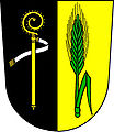 Hartmanice CB CZ CoA.jpg 1 424 × 1 640 ; 341 kio
-
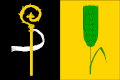 Hartmanice cb prapor.gif 600 × 400 ; 9 kio
-
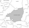
 Hartmanice CB CZ.png 1 091 × 1 442 ; 95 kio
-
 CB Hartmanice.png 588 × 572 ; 19 kio
-
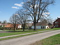
 Hartmanice (okres České Budějovice) (001).jpg 5 184 × 3 456 ; 5,29 Mio
-
 Hartmanice (okres České Budějovice) (002).jpg 5 184 × 3 456 ; 5,6 Mio
-
 Hartmanice (okres České Budějovice) (008).jpg 5 184 × 3 456 ; 5,97 Mio
-
 Hartmanice (okres České Budějovice), bytovka.jpg 4 416 × 3 312 ; 6,41 Mio
-
 Hartmanice (okres České Budějovice), cesta.jpg 4 416 × 3 312 ; 7,66 Mio
-
 Hartmanice (okres České Budějovice), chalupa.jpg 4 416 × 3 312 ; 6,1 Mio
-
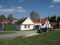
 Hartmanice (okres České Budějovice), hospoda.jpg 4 416 × 3 312 ; 7,87 Mio
-
 Hartmanice (okres České Budějovice), hřiště.jpg 4 416 × 3 312 ; 8,99 Mio
-
 Hartmanice (okres České Budějovice), kostel II.jpg 3 312 × 4 416 ; 7,03 Mio
-
 Hartmanice (okres České Budějovice), kostel.jpg 4 416 × 3 312 ; 5,93 Mio
-
 Hartmanice (okres České Budějovice), náves.jpg 4 416 × 3 312 ; 9,33 Mio
-
 Hartmanice (okres České Budějovice), pole.jpg 4 416 × 3 312 ; 6,87 Mio
-
 Hartmanice (okres České Budějovice), rybník.jpg 4 416 × 3 312 ; 6,96 Mio
-
 Hartmanice (okres České Budějovice), silnice.jpg 4 416 × 3 312 ; 6,53 Mio
-
 Hartmanice (okres České Budějovice), ulice.jpg 4 416 × 3 312 ; 6,36 Mio
-
 Hartmanice (okres České Budějovice), zastavení.jpg 3 312 × 4 416 ; 7,24 Mio
-
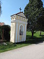
 Kaple v Hartmanicích (Q80460593).jpg 1 200 × 900 ; 165 kio
-
 Kaplička u Hartmanic (Q80462319).jpg 1 200 × 895 ; 117 kio
-
 Kaplička v Hartmanicích na návsi (Q80460588).jpg 1 200 × 895 ; 135 kio
-
 Kaplička v Hartmanicích u křižovatky (Q80460600).jpg 1 200 × 675 ; 120 kio
-
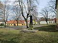 Pomník padlým v Hartmanicích (Q80460597).jpg 1 200 × 900 ; 236 kio

_(001).jpg)
_(002).jpg)
_(008).jpg)
,_bytovka.jpg)
,_cesta.jpg)
,_chalupa.jpg)
,_hospoda.jpg)
,_h%C5%99i%C5%A1t%C4%9B.jpg)
,_kostel.jpg)
,_n%C3%A1ves.jpg)
,_pole.jpg)
,_rybn%C3%ADk.jpg)
,_silnice.jpg)
,_ulice.jpg)
,_zastaven%C3%AD.jpg)
.jpg)
.jpg)
.jpg)
.jpg)
.jpg)