Category:Hassocks
ナビゲーションに移動
検索に移動
イングランドの村 _1.jpg) | |||||
| メディアをアップロード | |||||
| 分類 | |||||
|---|---|---|---|---|---|
| 場所 | ミッド・サセックス, ウェスト・サセックス, 南東イングランド, イングランド | ||||
| 面積 |
| ||||
| 同一とされる事物 | Hassocks (ウィキメディアの重複ページ, シヴィル・パリッシュ) | ||||
| 公式ウェブサイト | |||||
 | |||||
下位カテゴリ
このカテゴリに属する 10 個のサブカテゴリのうち、 10 個を表示しています。
A
C
- Clayton Wood Natural Burial Ground (3ファイル)
F
- Friars Oak pub, Hassocks (5ファイル)
H
- Hassocks Infants School (6ファイル)
- Hassocks United Reformed Church (6ファイル)
K
R
S
T
- The Hassocks pub, Hassocks (6ファイル)
カテゴリ「Hassocks」にあるメディア
このカテゴリに属する 391 個のファイルのうち、 200 個を表示しています。
(前のページ) (次のページ)-
 A Bridle Path - geograph.org.uk - 5233666.jpg 5,050 × 3,367;4.52メガバイト
-
 A273 Brighton Road near Hassocks - geograph.org.uk - 6124650.jpg 1,024 × 768;200キロバイト
-
 A273 Brighton Road, Hassocks - geograph.org.uk - 6229362.jpg 1,024 × 768;407キロバイト
-
 Abandoned Peugeot near path to Highfields Farm - geograph.org.uk - 2391331.jpg 4,000 × 3,000;3.52メガバイト
-
 Access road under railway - geograph.org.uk - 5007362.jpg 800 × 600;212キロバイト
-
 Across the valley to Jack and Jill - geograph.org.uk - 2433593.jpg 800 × 600;92キロバイト
-
 Adastra Avenue - geograph.org.uk - 2158646.jpg 1,600 × 1,200;576キロバイト
-
 Alan's Fish Bar, Keymer Road - geograph.org.uk - 1804453.jpg 640 × 479;92キロバイト
-
 Along the Path - geograph.org.uk - 6253597.jpg 3,498 × 2,333;7.7メガバイト
-
 Approaching Broadhill Farm - geograph.org.uk - 6169621.jpg 1,600 × 1,049;761キロバイト
-
 Artwork on The Green Circle - geograph.org.uk - 5551819.jpg 1,024 × 621;246キロバイト
-
 Bee-Mason, A Life in Pictures - geograph.org.uk - 5854897.jpg 5,472 × 3,648;4.26メガバイト
-
 Belmont Lane - geograph.org.uk - 5808938.jpg 1,024 × 768;437キロバイト
-
 Bend in Ockley Lane - geograph.org.uk - 2523023.jpg 4,000 × 3,000;3.45メガバイト
-
 Boundary sign for West Sussex - geograph.org.uk - 2521779.jpg 4,000 × 3,000;3.44メガバイト
-
 Bridge at the end of Woodsland Road - geograph.org.uk - 2196767.jpg 640 × 480;180キロバイト
-
 Bridge carrying the A273 over Herrings Stream - geograph.org.uk - 2523447.jpg 4,000 × 3,000;3.48メガバイト
-
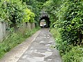
 Bridge under railway line at Hassocks - geograph.org.uk - 2158682.jpg 4,000 × 3,000;2.73メガバイト
-
 Bridleway 4-2C to Hurstpierpoint College - geograph.org.uk - 2523428.jpg 4,000 × 3,000;3.79メガバイト
-
 Bridleway and footpath junction by Hassocks Golf club - geograph.org.uk - 2523408.jpg 4,000 × 3,000;3.44メガバイト
-
 Bridleway approaching Hammond Mill Cottages - geograph.org.uk - 2523419.jpg 4,000 × 3,000;3.44メガバイト
-
 Bridleway goes east from Hillview - geograph.org.uk - 5007405.jpg 800 × 600;131キロバイト
-

-

-
 Bridleway north of Clayton windmills - geograph.org.uk - 6334087.jpg 1,024 × 768;271キロバイト
-
 Bridleway reaches Ockley Lane - geograph.org.uk - 5007402.jpg 800 × 600;132キロバイト
-
 Bridleway to Oldland Mill - geograph.org.uk - 2015018.jpg 2,048 × 1,536;689キロバイト
-
 Brighton Line - geograph.org.uk - 6253088.jpg 3,180 × 2,121;7.68メガバイト
-
 Brighton Line - geograph.org.uk - 6253091.jpg 3,101 × 2,068;7.47メガバイト
-
 Brighton Main Line near Hassocks - geograph.org.uk - 6124659.jpg 1,024 × 768;200キロバイト
-
 Brompton bike hire dock at Hassocks Station - geograph.org.uk - 5436105.jpg 1,280 × 960;490キロバイト
-
 Buildings at Coldharbour Farm - geograph.org.uk - 5281889.jpg 800 × 517;181キロバイト
-
 Bullsmead Shaw - geograph.org.uk - 4026114.jpg 640 × 480;86キロバイト
-
 Bungalow on Ockley Road, Keymer - geograph.org.uk - 5873195.jpg 1,998 × 1,470;1.13メガバイト
-
 Bus stops on Hurst Road - geograph.org.uk - 5281590.jpg 800 × 600;141キロバイト
-
 Butchers Wood, Hassocks.JPG 1,632 × 1,224;712キロバイト
-
 Camping and caravan site at the Lodge Farm - geograph.org.uk - 2521920.jpg 4,000 × 3,000;3.45メガバイト
-
 Carol's Café, Station Approach - geograph.org.uk - 1304374.jpg 640 × 480;61キロバイト
-
 Cattle near Clayton - geograph.org.uk - 5708610.jpg 1,600 × 937;263キロバイト
-
 Cattle on the Path - geograph.org.uk - 6250933.jpg 3,477 × 2,317;7.73メガバイト
-
 Centenary Oak, Adastra Recreation Ground - geograph.org.uk - 2049081.jpg 640 × 480;69キロバイト
-
 Clay Courts. The Weald Tennis Club - geograph.org.uk - 5126244.jpg 1,600 × 1,200;223キロバイト
-
 Claydon Windmill 'Jill' - geograph.org.uk - 5479072.jpg 4,896 × 3,672;6.5メガバイト
-
 Clayton Avenue, Hassocks - geograph.org.uk - 1095663.jpg 640 × 427;78キロバイト
-
 Clayton Avenue, Hassocks snowscene - geograph.org.uk - 1149742.jpg 640 × 427;50キロバイト
-
 Clayton Castle - geograph.org.uk - 3788889.jpg 2,048 × 3,072;906キロバイト
-
 Clayton from the Clayton Windmills car park - geograph.org.uk - 4802223.jpg 3,874 × 2,591;5.32メガバイト
-
 Clayton from the Jack and Jill Windmills - geograph.org.uk - 3437324.jpg 4,000 × 3,000;3.89メガバイト
-
 Clayton Holt - geograph.org.uk - 5709666.jpg 1,024 × 647;85キロバイト
-
 Clayton Recreation Ground - geograph.org.uk - 3168274.jpg 1,600 × 1,201;491キロバイト
-
 Clayton Wickham Farm - geograph.org.uk - 6253335.jpg 3,578 × 2,386;7.77メガバイト
-
 Climbing the hill to Jill - geograph.org.uk - 2606610.jpg 640 × 427;65キロバイト
-
 Clubhouse, The Weald Tennis club - geograph.org.uk - 5126230.jpg 1,024 × 768;166キロバイト
-
 Coldharbour Farm - geograph.org.uk - 2242775.jpg 640 × 428;74キロバイト
-
 Coldharbour Farm - geograph.org.uk - 3788883.jpg 3,072 × 2,048;963キロバイト
-
 Coppicing in Butchers Wood - geograph.org.uk - 1131911.jpg 640 × 427;126キロバイト
-
 Cottages West of Hassocks station - geograph.org.uk - 1977892.jpg 1,600 × 1,200;463キロバイト
-
 Cows cross Lodge Lane, Keymer - geograph.org.uk - 3168252.jpg 1,600 × 1,002;278キロバイト
-
 Dale Avenue, Hassocks - geograph.org.uk - 3124713.jpg 1,600 × 1,193;373キロバイト
-
 Dipping Platform - geograph.org.uk - 5349029.jpg 1,024 × 648;248キロバイト
-
 Disguised communication mast north of Hassocks - geograph.org.uk - 2523252.jpg 4,000 × 3,000;3.09メガバイト
-
 Disused bostal, South Downs - geograph.org.uk - 6334513.jpg 1,024 × 768;327キロバイト
-
 Ditchling Shaw Field - geograph.org.uk - 6461634.jpg 640 × 480;57キロバイト
-
 Downlands School.jpeg 2,448 × 1,836;849キロバイト
-
 Dry pond by reservoir - geograph.org.uk - 2521836.jpg 4,000 × 3,000;3.53メガバイト
-
 East along the B2116 Hurst Road entering Hassocks - geograph.org.uk - 2390145.jpg 4,000 × 3,000;3.44メガバイト
-
 Electricity sub station - geograph.org.uk - 1097634.jpg 640 × 427;62キロバイト
-
 Embankment steps to the London to Brighton main line - geograph.org.uk - 2523154.jpg 4,000 × 3,000;3.49メガバイト
-
 Entrance to Hammond's Mill Farm - geograph.org.uk - 2523457.jpg 4,000 × 3,000;3.51メガバイト
-
 Entrance to Hassocks Golf Club - geograph.org.uk - 2523273.jpg 4,000 × 3,000;3.16メガバイト
-
 Entrance to South Downs Nursery, Hassocks - geograph.org.uk - 2820340.jpg 1,600 × 1,007;239キロバイト
-
 Entrance to South East Water's plant on Underhill Lane - geograph.org.uk - 2521810.jpg 4,000 × 3,000;3.5メガバイト
-
 Fancy gates, drive to Belmont - geograph.org.uk - 5808936.jpg 1,024 × 768;403キロバイト
-
 Farm access road near Clayton - geograph.org.uk - 6124646.jpg 1,024 × 768;207キロバイト
-
 Farmland by Jill windmill - geograph.org.uk - 2606581.jpg 640 × 480;126キロバイト
-
 Farms south of Oldland Windmills - geograph.org.uk - 5905867.jpg 1,600 × 1,200;434キロバイト
-
 Field by Jill windmill - geograph.org.uk - 2606631.jpg 640 × 480;134キロバイト
-
 Field east of Belmont Lane - geograph.org.uk - 5808855.jpg 1,024 × 768;403キロバイト
-
 Field path leads to stile on boundary - geograph.org.uk - 5007438.jpg 800 × 600;207キロバイト
-
 Field south of Keymer - geograph.org.uk - 5905958.jpg 1,600 × 1,200;478キロバイト
-
 Field south of Keymer - geograph.org.uk - 5905966.jpg 1,600 × 1,200;421キロバイト
-
 Field view to Bullsmead Shaw - geograph.org.uk - 2390062.jpg 4,000 × 3,000;2.91メガバイト
-
 Fields off Ockley Lane - geograph.org.uk - 2158619.jpg 1,600 × 1,200;337キロバイト
-
 Fields south of Oldland Mill - geograph.org.uk - 6169928.jpg 4,032 × 2,714;5.28メガバイト
-
 Footbridge and path junction - geograph.org.uk - 5007358.jpg 800 × 600;202キロバイト
-
 Footpath 12K halfway to Halfway - geograph.org.uk - 2522892.jpg 4,000 × 3,000;3.42メガバイト
-
 Footpath 5K west to Woodside Grange and kennels - geograph.org.uk - 2523035.jpg 4,000 × 3,000;3.08メガバイト
-
 Footpath and bridleway junction near Belmont - geograph.org.uk - 2391313.jpg 4,000 × 3,000;3.55メガバイト
-
 Footpath and county boundary, near Keymer - geograph.org.uk - 6119868.jpg 1,024 × 768;310キロバイト
-
 Footpath and driveway to Weald House - geograph.org.uk - 2524580.jpg 4,000 × 3,000;3.62メガバイト
-
 Footpath at Clayton Wood Natural Burial Ground - geograph.org.uk - 4724517.jpg 4,608 × 3,456;5.68メガバイト
-
 Footpath at northern end of Woodsland Road - geograph.org.uk - 5007361.jpg 800 × 600;211キロバイト
-
 Footpath by the brook - geograph.org.uk - 2196995.jpg 640 × 480;177キロバイト
-
 Footpath crosses over the B2116 - geograph.org.uk - 2390135.jpg 4,000 × 3,000;3.62メガバイト
-

-
 Footpath goes east towards Ockley Lane - geograph.org.uk - 5007398.jpg 800 × 600;145キロバイト
-

-
 Footpath going west from Lodge Lane - geograph.org.uk - 5007448.jpg 800 × 600;155キロバイト
-
 Footpath Junction - geograph.org.uk - 6253610.jpg 2,942 × 1,962;7.61メガバイト
-

-
 Footpath near Keymer - geograph.org.uk - 6119864.jpg 1,024 × 768;300キロバイト
-

-
 Footpath sign at field corner - geograph.org.uk - 5007129.jpg 800 × 600;151キロバイト
-

-
 Footpath to Hurstpierpoint College - geograph.org.uk - 6253605.jpg 3,180 × 2,121;7.66メガバイト
-
 Footpath to Oldland Mill - geograph.org.uk - 2015000.jpg 2,048 × 1,536;707キロバイト
-
 Footpath to Patson's Copse - geograph.org.uk - 4724540.jpg 4,608 × 3,456;4.66メガバイト
-
 Footpaths near Hassocks - geograph.org.uk - 6124664.jpg 1,024 × 768;294キロバイト
-
 Fourteen Acres - geograph.org.uk - 6461628.jpg 640 × 433;54キロバイト
-
 Foxhole Cottages - geograph.org.uk - 38010.jpg 640 × 388;86キロバイト
-
 Friars Oak House by bridleway 4-2C - geograph.org.uk - 2523285.jpg 4,000 × 3,000;3.58メガバイト
-
 Friars Oak Road - geograph.org.uk - 1632298.jpg 640 × 480;124キロバイト
-
-
 Gates - geograph.org.uk - 2111168.jpg 640 × 425;81キロバイト
-
 Gateway, drive to Belmont - geograph.org.uk - 5808929.jpg 1,024 × 768;410キロバイト
-
 Goal^ Clayton Recreation Ground, West Sussex - geograph.org.uk - 3168272.jpg 1,600 × 1,185;462キロバイト
-
 Grand Avenue, Hassocks - geograph.org.uk - 1139903.jpg 640 × 427;73キロバイト
-
 Grand Avenue, Keymer - geograph.org.uk - 6119847.jpg 1,024 × 768;196キロバイト
-

-
 Grassy footpath going east behind housing - geograph.org.uk - 5007376.jpg 800 × 600;141キロバイト
-
 Grave of Sir Norman Hartnell - geograph.org.uk - 2002115.jpg 640 × 426;195キロバイト
-
 Hammonds Ridge Meadows - geograph.org.uk - 5349426.jpg 1,024 × 660;148キロバイト
-
 Hammonds Ridge Meadows - geograph.org.uk - 5865186.jpg 1,024 × 768;249キロバイト
-
 Hammonds Ridge Meadows Pond - geograph.org.uk - 5349006.jpg 833 × 1,024;256キロバイト
-
 Hard Court at the Weald Tennis Club - geograph.org.uk - 5126192.jpg 1,600 × 1,200;474キロバイト
-
 Bushy Field - geograph.org.uk - 1632118.jpg 640 × 480;63キロバイト
-
 Hassocks - geograph.org.uk - 6253153.jpg 3,339 × 2,227;7.54メガバイト
-
 Hassocks Brook.jpg 1,200 × 1,600;281キロバイト
-
 Hassocks Burial Ground.JPG 2,816 × 1,880;1.12メガバイト
-
 Hassocks Skatepark - geograph.org.uk - 1094293.jpg 640 × 427;83キロバイト
-
 Hassocks Station - geograph.org.uk - 6253095.jpg 3,657 × 2,439;7.54メガバイト
-
 Hassocks Station - geograph.org.uk - 6253102.jpg 4,135 × 2,758;7.6メガバイト
-
 Hassocks viewed from the S Downs 1108.jpg 2,592 × 1,944;701キロバイト
-
 Herrings Stream (2) - geograph.org.uk - 1096637.jpg 480 × 640;154キロバイト
-
 Herrings Stream - geograph.org.uk - 4109953.jpg 480 × 640;135キロバイト
-
 Herrings Stream by the A273 at Hassocks - geograph.org.uk - 2523269.jpg 4,000 × 3,000;3.31メガバイト
-
 Hot Air Balloon over the South Downs - geograph.org.uk - 3280338.jpg 2,288 × 1,520;896キロバイト
-
 House Near Hassocks - geograph.org.uk - 6253157.jpg 3,339 × 2,227;7.66メガバイト
-
 House near Stonepound Crossroads - geograph.org.uk - 2158382.jpg 4,000 × 3,000;1.6メガバイト
-

-
 I hope he's comfortable^ - geograph.org.uk - 4232162.jpg 640 × 480;33キロバイト
-
 Information Plaque - geograph.org.uk - 5854901.jpg 4,522 × 3,016;1.89メガバイト
-
 Jack and Jill - geograph.org.uk - 6250904.jpg 3,657 × 2,439;7.79メガバイト
-
 Jack and Jill the Clayton Windmills - geograph.org.uk - 5708599.jpg 1,024 × 637;85キロバイト
-
 Jack and Jill Windmills (Clayton Windmills) - geograph.org.uk - 6217343.jpg 1,024 × 768;139キロバイト
-
 Jack and Jill Windmills - geograph.org.uk - 6250482.jpg 4,373 × 2,917;7.81メガバイト
-
 Jack and Jill Windmills - geograph.org.uk - 6250486.jpg 3,737 × 2,492;7.63メガバイト
-
 Jack and Jill Windmills - geograph.org.uk - 6250487.jpg 4,249 × 2,832;7.79メガバイト
-
 Jack and Jill windmills, Clayton - geograph.org.uk - 6162932.jpg 1,024 × 768;289キロバイト
-
 Jack Tower Mill - geograph.org.uk - 6052534.jpg 3,648 × 5,472;3.16メガバイト
-
 Jack Windmill - geograph.org.uk - 6052538.jpg 5,472 × 3,648;2.26メガバイト
-
 Jack windmill, Clayton - geograph.org.uk - 6334105.jpg 1,024 × 768;401キロバイト
-
 Jack ^ Jill Inn, Clayton - geograph.org.uk - 5906004.jpg 1,600 × 1,200;558キロバイト
-
 Jane Murray Way, Burgess Hill - geograph.org.uk - 5869467.jpg 1,972 × 1,430;1.24メガバイト
-
 Jill of the Clayton Windmills - geograph.org.uk - 5709672.jpg 1,024 × 668;156キロバイト
-
 Jill Windmill - geograph.org.uk - 6250490.jpg 4,612 × 3,076;7.72メガバイト
-
 Jill Windmill - geograph.org.uk - 6250495.jpg 2,917 × 3,645;7.57メガバイト
-
 Jill Windmill - geograph.org.uk - 6250497.jpg 3,959 × 2,970;7.75メガバイト
-
 Jill Windmill, Clayton - geograph.org.uk - 6217336.jpg 1,024 × 768;193キロバイト
-
 Jill windmill, Clayton - geograph.org.uk - 6334557.jpg 1,024 × 768;299キロバイト
-
 Jill windmill, Clayton - geograph.org.uk - 6334565.jpg 1,024 × 1,024;267キロバイト
-
 Josh Green Hassocks.jpg 1,057 × 595;570キロバイト
-
 Junction between B2116 and A273 at Hassocks - geograph.org.uk - 2243396.jpg 1,600 × 1,101;420キロバイト
-
 Junction of Adastra and Grand Avenues - geograph.org.uk - 5007351.jpg 800 × 600;89キロバイト
-

-
 Junction of New Way Lane and the A273 north to Hassocks - geograph.org.uk - 2262218.jpg 4,000 × 3,000;2.14メガバイト
-
 Keymer 18 Public Footpath - geograph.org.uk - 6461640.jpg 480 × 640;71キロバイト
-
 Keymer 25 Public Bridleway - geograph.org.uk - 6461648.jpg 640 × 480;59キロバイト
-
 Keymer and Hassocks Men's Club - geograph.org.uk - 1109012.jpg 640 × 427;95キロバイト
-
 Keymer Road (E from Bridge).jpg 1,600 × 1,200;671キロバイト
-
 Keymer Road (E) 1.jpg 1,600 × 1,200;664キロバイト
-
 Keymer Road (W).jpg 1,600 × 1,200;673キロバイト
-
 Keymer Road - geograph.org.uk - 684404.jpg 640 × 479;104キロバイト
-
 Keymer Road at the junction of Lodge Lane - geograph.org.uk - 5868654.jpg 2,048 × 1,536;1.49メガバイト
-
 Keymer Road, Hassocks - geograph.org.uk - 1977912.jpg 1,600 × 1,200;362キロバイト
-
 Keymer Road, Hassocks - geograph.org.uk - 6119786.jpg 1,024 × 768;192キロバイト
-
 Keymer Road, Hassocks - geograph.org.uk - 6124667.jpg 1,024 × 768;221キロバイト
-
 Keymer, St Cosmas ^ St Damian - geograph.org.uk - 6369420.jpg 4,000 × 3,000;4.89メガバイト
-
 KV03 ZFJ (Route 33) at Stonepound Crossroads, Hassocks (16916197079).jpg 2,592 × 1,944;1.1メガバイト
-
 KX54 NKE (Route 33) at Keymer Road, Hassocks (17076507276).jpg 1,944 × 2,592;1.1メガバイト
-
 KX54 NKE (Route EB1) at Stonepound Crossroads, Hassocks (3) (17138695115).jpg 2,592 × 1,944;1メガバイト
-
 Lambrettas at Jack and Jill - geograph.org.uk - 6250913.jpg 3,498 × 2,333;7.55メガバイト
-
 Lambrettas Leaving Jack and Jill - geograph.org.uk - 6250918.jpg 3,657 × 2,439;7.62メガバイト
-
 Land for new housing estate - geograph.org.uk - 2523142.jpg 4,000 × 3,000;3.23メガバイト
-
 Leader of the pack - geograph.org.uk - 2278759.jpg 4,000 × 3,000;3.42メガバイト
-
 Little Ridge - geograph.org.uk - 4026121.jpg 640 × 480;67キロバイト
-
 Llama guarding sheep. - geograph.org.uk - 1099416.jpg 640 × 427;74キロバイト
-
 Lodge Cottage - geograph.org.uk - 2199337.jpg 640 × 480;79キロバイト
-
 London bound - geograph.org.uk - 2523237.jpg 4,000 × 3,000;3.49メガバイト
-
 London Road, Hassocks - geograph.org.uk - 3001065.jpg 4,320 × 3,240;4.6メガバイト
-
 London to Brighton - geograph.org.uk - 5595872.jpg 1,024 × 733;221キロバイト
-
 London to Brighton line - geograph.org.uk - 5905988.jpg 1,600 × 1,096;505キロバイト
-
 London to Brighton Veteran Car Run - geograph.org.uk - 5595867.jpg 1,024 × 631;242キロバイト
-
 Looking across field from footpath stile - geograph.org.uk - 5007437.jpg 800 × 600;143キロバイト
-

-
 Looking east along the B2112 - geograph.org.uk - 5018515.jpg 800 × 600;102キロバイト
-
 Looking into Oldlands Avenue - geograph.org.uk - 5007345.jpg 800 × 600;123キロバイト
-
 Looking into Park Avenue - geograph.org.uk - 5007444.jpg 800 × 600;119キロバイト
-
 Looking into Priory Road - geograph.org.uk - 5007371.jpg 800 × 600;119キロバイト
-
 Looking north on Ockley Lane - geograph.org.uk - 5007400.jpg 800 × 600;141キロバイト


_-_geograph.org.uk_-_1096637.jpg)


_-_geograph.org.uk_-_6217343.jpg)


.jpg)
.jpg)


_at_Stonepound_Crossroads,_Hassocks_(16916197079).jpg)
_at_Keymer_Road,_Hassocks_(17076507276).jpg)
_at_Stonepound_Crossroads,_Hassocks_(3)_(17138695115).jpg)


