Category:Hatcliffe
Aller à la navigation
Aller à la recherche
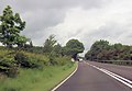
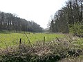
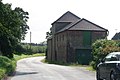
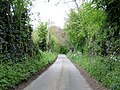
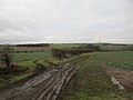
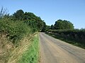
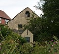
English: Hatcliffe is a small picturesque village in rural North East Lincolnshire, England. The village sits in a designated Area of Outstanding Natural Beauty. Its population at the 2001 census was 115. It lies 12 km (7½ miles) south-west of Grimsby and 3 km (2 miles) west of the A18 road. It neighbours the small village of Beelsby. The parish church 'St Mary's' is 13th century and contains memorial stones dedicated to the Hatcliffe family (it is probable that the Hatcliffe family takes its name from the name of the village) dating back to 1525. The former post office (now converted to a house) in the centre of the village stands by an attractive small stream with stone access bridges crossing it at regular intervals.
localité britannique du comté anglais de Lincolnshire  | |||||
| Téléverser des médias | |||||
| Nature de l’élément | |||||
|---|---|---|---|---|---|
| Lieu | North East Lincolnshire, Lincolnshire, Yorkshire-et-Humber, Angleterre | ||||
| Réputé identique à | Hatcliffe (page en doublon, paroisse civile) | ||||
 | |||||
Sous-catégories
Cette catégorie comprend seulement la sous-catégorie ci-dessous.
M
- St Mary's church, Hatcliffe (8 F)
Média dans la catégorie « Hatcliffe »
Cette catégorie comprend 130 fichiers, dont les 130 ci-dessous.
-
 A minor road to the A18 - geograph.org.uk - 2081107.jpg 800 × 600 ; 208 kio
-
 A18 approaching Hatcliffe turning sign - geograph.org.uk - 3008950.jpg 640 × 442 ; 58 kio
-
 A18 north of Park House - geograph.org.uk - 3520742.jpg 640 × 349 ; 65 kio
-

-
 All decked out like a Christmas tree - geograph.org.uk - 3790574.jpg 427 × 640 ; 101 kio
-
 Almost there - geograph.org.uk - 390113.jpg 640 × 480 ; 89 kio
-
 An opening - geograph.org.uk - 390074.jpg 640 × 480 ; 118 kio
-
 Approaching Hatcliffe from the south - geograph.org.uk - 2456769.jpg 640 × 480 ; 77 kio
-
 Arable land and woods - geograph.org.uk - 390092.jpg 640 × 480 ; 106 kio
-
 Barton Street (A18) - geograph.org.uk - 3929778.jpg 640 × 480 ; 52 kio
-
 Beck, bridge and trees - geograph.org.uk - 386793.jpg 640 × 480 ; 136 kio
-
 Bridleway and willows alongside Waithe Beck - geograph.org.uk - 4145160.jpg 640 × 427 ; 87 kio
-
 Buildings at Gunnerby Farm - geograph.org.uk - 4144779.jpg 640 × 427 ; 68 kio
-
 Cattle grid and new gate - geograph.org.uk - 4085492.jpg 1 024 × 768 ; 247 kio
-
 Cattle Grid on Hatcliffe Road - geograph.org.uk - 3007580.jpg 640 × 409 ; 84 kio
-
 Cottages, Gunnerby Farm - geograph.org.uk - 4635510.jpg 640 × 480 ; 71 kio
-
 Country lane down toward The Spinneys - geograph.org.uk - 5379546.jpg 1 532 × 1 145 ; 956 kio
-

-
 Derelict buildings near Old Farm - geograph.org.uk - 3383739.jpg 1 024 × 768 ; 194 kio
-
 Derelict farm buildings near Old Farm - geograph.org.uk - 5659443.jpg 1 024 × 768 ; 254 kio
-
 Electric sub station near Gunnerby - geograph.org.uk - 2458614.jpg 640 × 480 ; 77 kio
-
 Electricity transmission lines near Wold Newton Substation - geograph.org.uk - 4314002.jpg 4 272 × 2 848 ; 3,44 Mio
-
 End of valley - geograph.org.uk - 390079.jpg 640 × 480 ; 115 kio
-
 Entering Hatcliffe, Lincolnshire - geograph.org.uk - 2745218.jpg 800 × 600 ; 253 kio
-
 Entrance to Gunnerby House - geograph.org.uk - 2456753.jpg 640 × 480 ; 110 kio
-
 Excuse me. Can I have a word ^ - geograph.org.uk - 2547133.jpg 1 024 × 768 ; 218 kio
-
 Far from home - geograph.org.uk - 2547080.jpg 1 024 × 768 ; 213 kio
-
 Farm buildings near Old Farm - geograph.org.uk - 2081113.jpg 800 × 600 ; 301 kio
-
 Farm buildings, Gunnerby Farm - geograph.org.uk - 4635508.jpg 640 × 480 ; 53 kio
-
 Farm track near Hatcliffe Top - geograph.org.uk - 5659448.jpg 1 024 × 768 ; 138 kio
-
 Fence line near Gunnerby House - geograph.org.uk - 4635503.jpg 640 × 480 ; 89 kio
-
 Field above Waithe Beck - geograph.org.uk - 5659456.jpg 1 024 × 768 ; 143 kio
-

-
 Field near Gunnerby House - geograph.org.uk - 4635505.jpg 640 × 480 ; 73 kio
-
 Grazing towards Fairfield Plantation - geograph.org.uk - 3929737.jpg 640 × 480 ; 123 kio
-
 Gunnerby House - geograph.org.uk - 1518878.jpg 640 × 274 ; 50 kio
-
 Gunnerby sub-station - geograph.org.uk - 450827.jpg 640 × 427 ; 63 kio
-

-

-
 Hatcliffe farmland and power lines - geograph.org.uk - 4723143.jpg 1 024 × 768 ; 202 kio
-
 Hatcliffe signpost - geograph.org.uk - 4723147.jpg 1 024 × 768 ; 355 kio
-

-
 Heading towards the plantation - geograph.org.uk - 2366308.jpg 1 024 × 768 ; 179 kio
-
 Horse riding down from Gunnerby - geograph.org.uk - 2458612.jpg 640 × 480 ; 71 kio
-
 Lane toward Hatcliffe - geograph.org.uk - 5379551.jpg 1 474 × 1 061 ; 907 kio
-
 Lane towards East Ravendale - geograph.org.uk - 3929738.jpg 640 × 480 ; 97 kio
-
 Lane towards Hatcliffe - geograph.org.uk - 3929779.jpg 640 × 480 ; 51 kio
-
 Leaving Hatcliffe - geograph.org.uk - 3929736.jpg 640 × 480 ; 83 kio
-
 Leaving the A18 on the Hatcliffe road - geograph.org.uk - 2456861.jpg 640 × 480 ; 76 kio
-
 Lincolnshire Wolds near Hatcliffe - geograph.org.uk - 4723145.jpg 1 024 × 768 ; 191 kio
-
 Low Road - geograph.org.uk - 3754833.jpg 800 × 533 ; 148 kio
-
 Manor Farm Cottage, Hatcliffe - geograph.org.uk - 2745213.jpg 800 × 600 ; 308 kio
-
 Minor road heading north, Gunnerby - geograph.org.uk - 4635511.jpg 640 × 480 ; 96 kio
-
 Minor road near Gunnerby House - geograph.org.uk - 4635507.jpg 640 × 480 ; 84 kio
-
 Minor road near Old Farm - geograph.org.uk - 2081139.jpg 800 × 600 ; 172 kio
-
 Minor road to the A18 - geograph.org.uk - 2081133.jpg 800 × 600 ; 157 kio
-
 Minor road toward Hatcliffe - geograph.org.uk - 5379517.jpg 1 535 × 1 152 ; 876 kio
-
 Minor road towards Gunnerby Farm - geograph.org.uk - 3383738.jpg 1 024 × 768 ; 105 kio
-
 Minor track near Park House - geograph.org.uk - 5667891.jpg 1 024 × 768 ; 286 kio
-
 Oilseed rape crop west of the A18 - geograph.org.uk - 3929774.jpg 640 × 480 ; 60 kio
-
 Old building at Hatcliffe Mill - geograph.org.uk - 4122052.jpg 1 024 × 941 ; 286 kio
-
 Phone Box Letter Box and village street Hatcliffe - geograph.org.uk - 5379565.jpg 1 507 × 1 115 ; 766 kio
-
 Power lines near Hatcliffe - geograph.org.uk - 4723142.jpg 1 024 × 768 ; 144 kio
-
 Powerlines across the road to East Ravendale - geograph.org.uk - 3790630.jpg 640 × 427 ; 38 kio
-
 Pylon and darkening sky - geograph.org.uk - 2547118.jpg 1 024 × 768 ; 139 kio
-
 Pylon in a stubble field - geograph.org.uk - 4144762.jpg 640 × 427 ; 60 kio
-

-
 Pylons by the road to Gunnerby - geograph.org.uk - 3623664.jpg 640 × 427 ; 75 kio
-
 Ragwort infested field - geograph.org.uk - 2547098.jpg 1 024 × 768 ; 193 kio
-
 Road along Homewalk Plantation - geograph.org.uk - 4313652.jpg 4 272 × 2 848 ; 5,91 Mio
-
 Road from Hatcliffe near the Old Farm - geograph.org.uk - 2456882.jpg 640 × 480 ; 87 kio
-
 Road heading south through Hatcliffe - geograph.org.uk - 3929636.jpg 640 × 480 ; 88 kio
-
 Road past Gunnerby House - geograph.org.uk - 2456754.jpg 640 × 480 ; 68 kio
-
 Road south from Gunnerby House - geograph.org.uk - 2456766.jpg 480 × 640 ; 86 kio
-
 Road south through the village of Hatcliffe - geograph.org.uk - 2456784.jpg 640 × 480 ; 108 kio
-
 Road through Hatcliffe village - geograph.org.uk - 3010115.jpg 640 × 489 ; 71 kio
-
 Road to Hatcliffe - geograph.org.uk - 2458609.jpg 640 × 475 ; 56 kio
-
 Road to Hatcliffe approaching The Old Farm - geograph.org.uk - 2456883.jpg 640 × 460 ; 76 kio
-
 Shall I open the gate or just cycle around^ - geograph.org.uk - 4723153.jpg 1 024 × 768 ; 252 kio
-
 St Mary's Church, Hatcliffe - geograph.org.uk - 6265237.jpg 1 024 × 768 ; 292 kio
-
 St Mary's Parish Church Hatcliffe - geograph.org.uk - 5379575.jpg 2 304 × 1 728 ; 1,6 Mio
-
 The A18 Brigg to Boston road - geograph.org.uk - 2081125.jpg 800 × 600 ; 187 kio
-
 The A18 to Boston - geograph.org.uk - 2081144.jpg 800 × 600 ; 232 kio
-
 The bridleway to Hatcliffe - geograph.org.uk - 2547088.jpg 1 024 × 768 ; 199 kio
-
 The electric sub station at Gunnerby - geograph.org.uk - 2745209.jpg 800 × 600 ; 248 kio
-
 The garden wall of Hatcliffe Manor - geograph.org.uk - 2547143.jpg 1 024 × 768 ; 192 kio
-
 The Road From Hatcliffe - geograph.org.uk - 307287.jpg 640 × 480 ; 88 kio
-
 The Road To Hatcliffe - geograph.org.uk - 304675.jpg 640 × 480 ; 100 kio
-
 The road to Swinhope - geograph.org.uk - 2081092.jpg 800 × 600 ; 229 kio
-

-
 Think Bike sign - geograph.org.uk - 3383740.jpg 1 024 × 768 ; 123 kio
-
 Thorganby fields - geograph.org.uk - 1519483.jpg 640 × 348 ; 74 kio
-
 Thorganby, aerial 2017 - geograph.org.uk - 5246599.jpg 640 × 427 ; 33 kio
-
 Through the hedge - geograph.org.uk - 2366294.jpg 1 024 × 768 ; 220 kio
-
 Track to Hatcliffe Top - geograph.org.uk - 5659459.jpg 1 024 × 768 ; 150 kio
-
-
 Tree belt on the bridleway to the Ravendales - geograph.org.uk - 3790590.jpg 427 × 640 ; 113 kio
-
 Two bridges, two gates - geograph.org.uk - 2547109.jpg 1 024 × 768 ; 260 kio
-
 Unnamed lane towards Gunnerby - geograph.org.uk - 4314005.jpg 4 272 × 2 848 ; 5,59 Mio
-
 View into Deepdale - geograph.org.uk - 2547072.jpg 1 024 × 768 ; 206 kio
-
 View towards Gunnerby - geograph.org.uk - 4085481.jpg 1 024 × 768 ; 146 kio
-
 View towards the Hatcliffe to Binbrook road - geograph.org.uk - 2547137.jpg 1 024 × 768 ; 151 kio
-
 Wanderlust Way - geograph.org.uk - 6265243.jpg 1 024 × 768 ; 208 kio
-
 Wanderlust Way approaching Hatcliffe - geograph.org.uk - 3007586.jpg 640 × 414 ; 68 kio
-
 Wanderlust Way towards Barnoldby le Beck - geograph.org.uk - 6137037.jpg 1 600 × 1 065 ; 1 004 kio
-

-
 Wold scenery - geograph.org.uk - 4085497.jpg 1 024 × 768 ; 167 kio
-
 Wolds valley at Gunnerby, aerial 2017 - geograph.org.uk - 5246528.jpg 427 × 640 ; 54 kio
-
 Bridleway to Hatcliffe - geograph.org.uk - 451224.jpg 640 × 427 ; 96 kio
-
 Conifer Street - geograph.org.uk - 386803.jpg 640 × 480 ; 156 kio
-
 Farm Track West Of Hatcliffe - geograph.org.uk - 554890.jpg 640 × 480 ; 93 kio
-
 Farmland Close To Beelsby - geograph.org.uk - 307276.jpg 640 × 480 ; 95 kio
-
 Footpath to Beelsby - geograph.org.uk - 171529.jpg 640 × 427 ; 138 kio
-
 Hatcliffe Bridleway - geograph.org.uk - 451227.jpg 640 × 427 ; 74 kio
-
 Hatcliffe views (1) - geograph.org.uk - 390143.jpg 640 × 480 ; 122 kio
-
 Hatcliffe views - geograph.org.uk - 390140.jpg 640 × 480 ; 122 kio
-
 Hatcliffe village - geograph.org.uk - 390126.jpg 640 × 409 ; 93 kio
-
 Looking Towards Hatcliffe Top - geograph.org.uk - 307286.jpg 640 × 480 ; 106 kio
-
 Old Mill - geograph.org.uk - 386560.jpg 640 × 480 ; 152 kio
-
 Pylons to Hatcliffe - geograph.org.uk - 390097.jpg 640 × 480 ; 83 kio
-
 Ravendale - geograph.org.uk - 171348.jpg 640 × 427 ; 125 kio
-
 Ravendale - geograph.org.uk - 171516.jpg 640 × 427 ; 98 kio
-
 Ravendale Valley - geograph.org.uk - 372051.jpg 640 × 426 ; 308 kio
-
 Ravendale valley west - geograph.org.uk - 390149.jpg 640 × 480 ; 91 kio
-
 Signs a-plenty - geograph.org.uk - 390118.jpg 640 × 480 ; 112 kio
-
 Tasty green grass - geograph.org.uk - 386544.jpg 640 × 480 ; 106 kio
-
 The Road To Beelsby - geograph.org.uk - 304663.jpg 640 × 480 ; 85 kio
-
 The Road To The A18 - geograph.org.uk - 307274.jpg 640 × 480 ; 95 kio
-
 There's an Old Mill by the stream...... - geograph.org.uk - 386566.jpg 640 × 480 ; 97 kio
-
 Within the Valley - geograph.org.uk - 390156.jpg 640 × 480 ; 147 kio


_-_geograph.org.uk_-_3929778.jpg)


_-_geograph.org.uk_-_390143.jpg)


