Category:Hatfield Peverel
Vai alla navigazione
Vai alla ricerca
English: Hatfield Peverel is a large urban village and civil parish in the centre of Essex, England. Its population, including the hamlet of Nounsley, is approximately 5,500 (in 2004). Hatfield means a 'heathery space in the forest'; Peverel refers to William Peverel, the Norman knight granted lands in the area by William the Conqueror after the Norman invasion of 1066. Sited on high ground east of the River Ter, between Boreham and Witham on the A12, it is situated in the southern extremity of the Braintree District Council area (to which it elects two members). However, it is only 6 miles (10 km) northeast of Chelmsford, the nearest large town, to which it is more directly connected by road and rail. Hatfield Peverel Station is seen quite extensively in the 1976 film 'EXPOSÉ' starring Linda Hayden and Fiona Richmond. The surrounding countryside is also seen.
Nederlands: Hatfield Peverel is een plaats in het bestuurlijke gebied Braintree, in het Engelse graafschap Essex. De plaats telt 5.500 inwoners.
village and civil parish in Essex, England, UK  | |||||
| Carica un file multimediale | |||||
| Istanza di | |||||
|---|---|---|---|---|---|
| Luogo | Braintree, Essex, Est dell'Inghilterra, Inghilterra | ||||
| Considerato essere uguale a | Hatfield Peverel (pagina Wikimedia duplicata, parrocchia civile dell'Inghilterra) | ||||
 | |||||
Sottocategorie
Questa categoria contiene le 9 sottocategorie indicate di seguito, su un totale di 9.
File nella categoria "Hatfield Peverel"
Questa categoria contiene 146 file, indicati di seguito, su un totale di 146.
-
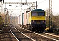
 66 593 Hatfield Peveral close up whilst working Bristol-Felixstowe intermodal.jpg 4 106 × 2 521; 1,49 MB
-
 66 593 nears Hatfield Peveral whilst working Bristol-Felixstowe intermodal.jpg 4 754 × 2 143; 1,98 MB
-
 90 049 approaches Hatfield Peveral with 4L41 Crewe-Felixstowe.jpg 2 767 × 1 930; 4,61 MB
-
 16-00 from Liverpool Street - geograph.org.uk - 405733.jpg 640 × 428; 335 KB
-

-
-
 A12 - B1389 junction - geograph.org.uk - 3256876.jpg 640 × 430; 50 KB
-
 A12 - geograph.org.uk - 3880894.jpg 640 × 430; 41 KB
-
 A12 - Station Road Bridge - geograph.org.uk - 3256870.jpg 640 × 430; 60 KB
-
 A12 approaching Junction 20a - geograph.org.uk - 3254438.jpg 640 × 430; 50 KB
-
 A12 Hatfield Peverel Bypass - geograph.org.uk - 3930570.jpg 1 974 × 1 649; 339 KB
-
 A12 London Road, Crix - geograph.org.uk - 5872411.jpg 4 608 × 3 456; 3,72 MB
-
 A12 London Road, Crix - geograph.org.uk - 5872415.jpg 4 608 × 3 456; 3,94 MB
-
 A12 Main Road, Crix - geograph.org.uk - 3644414.jpg 3 072 × 2 304; 1,28 MB
-
 A12 Main Road, Crix - geograph.org.uk - 3644426.jpg 1 697 × 2 305; 474 KB
-
 A12 westbound - geograph.org.uk - 4224883.jpg 640 × 494; 47 KB
-
 A12 westbound - geograph.org.uk - 4224895.jpg 640 × 465; 32 KB
-
 A12 westbound - geograph.org.uk - 4224898.jpg 640 × 480; 43 KB
-
 A12 westbound - geograph.org.uk - 4224899.jpg 640 × 440; 47 KB
-
 A12 westbound - geograph.org.uk - 4224901.jpg 640 × 467; 53 KB
-
 A12 westbound - geograph.org.uk - 4224904.jpg 640 × 448; 34 KB
-
 A12, Hatfield Peverel - geograph.org.uk - 2677802.jpg 640 × 430; 44 KB
-
 A12, Witham bypass - geograph.org.uk - 3256880.jpg 640 × 430; 57 KB
-
 Abeilio Class 90010 passes Hatfield Peverall with a Norwich-Liverpool St service.jpg 3 217 × 2 053; 842 KB
-
 Agricultural equipment, Ulting - geograph.org.uk - 4349335.jpg 640 × 428; 82 KB
-
 Allotments near public footpath, Hatfield Peverel - geograph.org.uk - 4175943.jpg 3 648 × 2 736; 2,95 MB
-
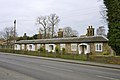
 Almshouses, Hatfield Peverel - geograph.org.uk - 3421821.jpg 640 × 480; 53 KB
-
 Annerlee Cottage on the B1019 - geograph.org.uk - 153852.jpg 640 × 426; 79 KB
-
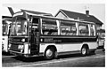
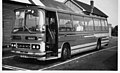
 ANO395L, Golden Boy Coaches Bedford VAL70 Miss Catherine.jpg 1 596 × 1 032; 123 KB
-
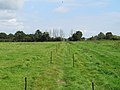
 Arable field boundary, Mowden - geograph.org.uk - 4347904.jpg 3 648 × 2 432; 2,76 MB
-
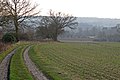
 Arable land near Crix Farm, Hatfield Peverel - geograph.org.uk - 4347899.jpg 3 626 × 2 417; 2,79 MB
-
 Arable land, Nounsley - geograph.org.uk - 4175962.jpg 3 648 × 2 736; 2,7 MB
-
 B1019, Maldon Road - geograph.org.uk - 4349273.jpg 640 × 480; 101 KB
-
 B1137 Bridge, A12 - geograph.org.uk - 2677793.jpg 640 × 430; 64 KB
-
 B1389 Bridge, A12 - geograph.org.uk - 2677805.jpg 640 × 390; 47 KB
-
 Big puddle on Bumfords Lane - geograph.org.uk - 3252988.jpg 640 × 480; 119 KB
-
 Bridge over A12 for restricted access junction - geograph.org.uk - 4084012.jpg 1 600 × 1 600; 1,32 MB
-
 Bridge over the A12 - geograph.org.uk - 3256875.jpg 640 × 430; 55 KB
-

-
 Broad verge on Spring Lane - geograph.org.uk - 4349297.jpg 640 × 428; 91 KB
-
 Bumfords Bridge - geograph.org.uk - 2882241.jpg 640 × 427; 110 KB
-
 Bumfords Lane - geograph.org.uk - 2882254.jpg 640 × 427; 45 KB
-
 By Mowden Hall Lane - geograph.org.uk - 3312899.jpg 640 × 480; 154 KB
-
 Chalet bungalow on Bury Lane, Hatfield Peverel - geograph.org.uk - 5339812.jpg 2 304 × 1 728; 823 KB
-
 Chase Cottages - geograph.org.uk - 3312903.jpg 640 × 480; 94 KB
-
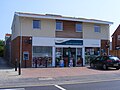
 Co-op (33935122426).jpg 2 304 × 1 728; 905 KB
-
 Crabb's Bridge - geograph.org.uk - 3294446.jpg 640 × 480; 171 KB
-

-
 East of England Co-operative, Hatfield Peverel.jpg 3 264 × 2 448; 1,41 MB
-
 Electric fence along public footpath, Nounsley - geograph.org.uk - 4175968.jpg 3 607 × 2 705; 2,62 MB
-
 Field near Berwick Farm - geograph.org.uk - 6483568.jpg 1 600 × 1 067; 412 KB
-
 Fields near River Ter - geograph.org.uk - 4953291.jpg 800 × 461; 54 KB
-
 Flood - road closed - geograph.org.uk - 3252846.jpg 640 × 480; 105 KB
-
-
 Footpath to Boreham - geograph.org.uk - 5898823.jpg 3 888 × 2 592; 1,95 MB
-
 Frank Harris first Volvo - Duple Dominant YVW 583L.jpg 1 620 × 1 032; 93 KB
-
 Frank Harris of Grays Bristol LHS coach NEV106P in Essex 1976 (1).jpg 1 590 × 1 032; 132 KB
-

-
 George Ward of Epping , Volvo B58- Duple, STW407M.jpg 1 590 × 966; 142 KB
-
 Great Eastern main line - geograph.org.uk - 6308951.jpg 1 024 × 685; 278 KB
-
 Hatfield Peverel Methodist Church - geograph.org.uk - 3312675.jpg 640 × 428; 98 KB
-
 Hatfield Peverel old fire station - geograph.org.uk - 1910226.jpg 640 × 427; 233 KB
-
 Hatfield Peverel post office - geograph.org.uk - 3294980.jpg 640 × 480; 118 KB
-
 Hatfield Peverel, A12 - geograph.org.uk - 1862920.jpg 1 024 × 768; 157 KB
-
 Hatfield Peverel, milepost - geograph.org.uk - 1862898.jpg 800 × 600; 169 KB
-
 Hedgerow beside Bumfords Lane - geograph.org.uk - 2882280.jpg 640 × 427; 60 KB
-
 Hidden Bridge - geograph.org.uk - 3913356.jpg 1 500 × 2 000; 3,28 MB
-
 House by the Canal - geograph.org.uk - 1979767.jpg 3 008 × 2 000; 1,61 MB
-
 House on The Street, Hatfield Peverel - geograph.org.uk - 5339811.jpg 2 216 × 1 606; 988 KB
-
 Litter Bin ^ Roadsign - geograph.org.uk - 5872419.jpg 2 958 × 3 944; 5,14 MB
-
 Local shops, Hatfield Peverel - geograph.org.uk - 3421827.jpg 640 × 480; 57 KB
-

-
 Lovibond Cottages, Hatfield Peverel - geograph.org.uk - 3294511.jpg 640 × 428; 112 KB
-
 Metal Milepost - geograph.org.uk - 3264422.jpg 1 600 × 1 200; 775 KB
-
 Mowden Hall Lane, Hatfield Peverel.jpg 4 000 × 3 000; 2,89 MB
-
 Mowdena Cottages - geograph.org.uk - 3294416.jpg 640 × 480; 130 KB
-
 Nounsley Ford - geograph.org.uk - 2909892.jpg 3 048 × 1 715; 2,64 MB
-
 Nounsley Ford - geograph.org.uk - 3294472.jpg 640 × 480; 162 KB
-
 Nounsley Ford - geograph.org.uk - 3312664.jpg 640 × 480; 177 KB
-
 Nounsley Ford - geograph.org.uk - 3414454.jpg 3 872 × 2 592; 2,37 MB
-
 On Wickham Bishop Road - geograph.org.uk - 6193289.jpg 1 067 × 1 600; 400 KB
-
 Paper Mill Lock - geograph.org.uk - 1387680.jpg 640 × 480; 126 KB
-
 Parish Pump - geograph.org.uk - 154075.jpg 426 × 640; 100 KB
-
 Part of Hatfield Peverel Dairy - geograph.org.uk - 3312687.jpg 640 × 428; 73 KB
-
 Part of Lane's Farm - geograph.org.uk - 803389.jpg 640 × 480; 102 KB
-
 Part of Wickham Bishops Road - geograph.org.uk - 803391.jpg 640 × 461; 89 KB
-
 Ploughed field - geograph.org.uk - 3294927.jpg 640 × 480; 123 KB
-

-
 Public footpath near Hatfield Place, Hatfield Peverel - geograph.org.uk - 4349059.jpg 3 648 × 2 736; 5,07 MB
-
 Railway bridge over Terling Hall Road - geograph.org.uk - 3294943.jpg 640 × 480; 188 KB
-
 River Chelmer - geograph.org.uk - 2802883.jpg 640 × 480; 118 KB
-
 River cruise - geograph.org.uk - 4004398.jpg 3 000 × 1 995; 1,72 MB
-
 River Ter at Crabbs Hill - geograph.org.uk - 2121356.jpg 1 024 × 768; 383 KB
-
 River Ter Viaduct - geograph.org.uk - 3911327.jpg 1 500 × 2 000; 3,65 MB
-
 Road junction with grass triangle - geograph.org.uk - 5276725.jpg 3 648 × 2 736; 2,79 MB
-
 Road junction with grass triangle - geograph.org.uk - 5276735.jpg 3 648 × 2 736; 2,76 MB
-
 Rushey Lock - geograph.org.uk - 215395.jpg 640 × 426; 141 KB
-
 SAN913L R.DREWERY Red Car Coach Hire, Woodford Green. BEDFORD VAL70.jpg 1 590 × 1 026; 84 KB
-
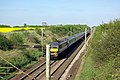
 Siemens Desiro 360 115 passes Hatfield Peveril with an Ipswich semi-fast service.jpg 3 841 × 2 221; 1,1 MB
-
 SOS Emergency Telephone - geograph.org.uk - 5872425.jpg 2 958 × 3 944; 5,06 MB
-
 Sunset over Boreham, Essex - geograph.org.uk - 420387.jpg 640 × 480; 82 KB
-
 Swallow of Hornchurchs Leyland Leopard Plaxton OHV 494K c 1975.jpg 1 583 × 1 025; 125 KB
-
 Terling Hall Road Bridge, A12 - geograph.org.uk - 2677789.jpg 640 × 430; 53 KB
-
 Terling Hall Road Bridge, Crix - geograph.org.uk - 5872352.jpg 3 937 × 2 979; 4,25 MB
-
 Terling Road Bridge, A12 - geograph.org.uk - 3880895.jpg 640 × 434; 45 KB
-
 The A12 - geograph.org.uk - 3880897.jpg 640 × 346; 29 KB
-
 The A12 - geograph.org.uk - 3880898.jpg 640 × 393; 33 KB
-

-

-
 The Ford at Nounsley - geograph.org.uk - 2121354.jpg 1 024 × 740; 354 KB
-
 The River Ter - geograph.org.uk - 2882228.jpg 424 × 640; 111 KB
-
 The River Ter and Viaduct - geograph.org.uk - 3911342.jpg 2 000 × 1 500; 3,37 MB
-
 The Wick - geograph.org.uk - 6478842.jpg 1 600 × 1 067; 572 KB
-
 The William B - geograph.org.uk - 6483535.jpg 1 600 × 1 067; 356 KB
-

-
 Track on arable field near Latney's, Hatfield Peverel - geograph.org.uk - 4367354.jpg 2 334 × 1 556; 1,16 MB
-
 Track to Maddox Hall - geograph.org.uk - 3294912.jpg 640 × 480; 152 KB
-

-

-
 Trees shielding arable land from the A12, Hatfield Peverel - geograph.org.uk - 4367362.jpg 3 648 × 2 736; 4,25 MB
-
 View across the fields from the Chelmer navigation ^2 - geograph.org.uk - 3555258.jpg 3 456 × 2 592; 2,97 MB
-
 View across the fields from the North Hill road bridge ^2 - geograph.org.uk - 3555183.jpg 3 456 × 2 592; 3,09 MB
-

-

-
 View towards Hatfield Peverel Station - geograph.org.uk - 6479047.jpg 1 600 × 1 067; 467 KB
-
 View Towards Little Baddow.jpg 4 000 × 3 000; 2,91 MB
-
 View towards Wickham Bishops - geograph.org.uk - 3969298.jpg 1 600 × 1 064; 516 KB
-
 Weir, Paper Mill Lock - geograph.org.uk - 2216627.jpg 640 × 480; 108 KB
-
 Whitelands Business Centre - geograph.org.uk - 2825708.jpg 3 588 × 2 524; 3,12 MB
-
 Wickham Bishops Road - geograph.org.uk - 2820390.jpg 3 648 × 2 736; 4,03 MB
-
 Wickham Bishops Road near Lane's Farm - geograph.org.uk - 1889162.jpg 2 816 × 2 112; 1,48 MB
-
 Wickham Bishops, fingerpost - geograph.org.uk - 1863170.jpg 480 × 640; 56 KB
-
 William B. pub.JPG 4 000 × 2 664; 938 KB
-
 Willows and water - geograph.org.uk - 4397780.jpg 3 974 × 2 964; 6,29 MB
-

-
 Barn conversion at Ulting Grove - geograph.org.uk - 262567.jpg 640 × 480; 73 KB
-

-
-
 Farm Shop, Witham, Essex - geograph.org.uk - 208249.jpg 640 × 480; 74 KB
-
 Footbridge on the Chelmer - geograph.org.uk - 215386.jpg 640 × 426; 119 KB
-
 Zoom in on Paper Mill Lock from the North Hill road bridge - geograph.org.uk - 3555201.jpg 3 456 × 2 592; 2,94 MB
-
 Railway bridge at Hatfield Peverel, Essex - geograph.org.uk - 233216.jpg 640 × 480; 107 KB
-

-

-
 The Wick, near Hatfield Peverel, Essex - geograph.org.uk - 233220.jpg 640 × 480; 111 KB
-
 Towards Termitts Farm - geograph.org.uk - 405405.jpg 640 × 428; 340 KB


.jpg)


.jpg)


