Category:Hauxton
Aller à la navigation
Aller à la recherche
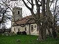
English: Hauxton is a small village in Cambridgeshire, England to the south of Cambridge. In 1316 it was noted as Haukestone.
localité britannique du comté anglais de Cambridgeshire  | |||||
| Téléverser des médias | |||||
| Nature de l’élément | |||||
|---|---|---|---|---|---|
| Lieu | South Cambridgeshire, Cambridgeshire, Angleterre de l'Est, Angleterre | ||||
 | |||||
Sous-catégories
Cette catégorie comprend 5 sous-catégories, dont les 5 ci-dessous.
Média dans la catégorie « Hauxton »
Cette catégorie comprend 318 fichiers, dont les 200 ci-dessous.
(page précédente) (page suivante)-
 66702 Hauxton LC.jpg 4 950 × 1 870 ; 1,58 Mio
-
 A bench by the river - geograph.org.uk - 4416140.jpg 819 × 1 024 ; 1,28 Mio
-
 A bend in the Cam - geograph.org.uk - 4416042.jpg 819 × 1 024 ; 1,43 Mio
-
 A bend in the Cam - geograph.org.uk - 768477.jpg 640 × 476 ; 140 kio
-
 A broad track turns north at a thicket - geograph.org.uk - 744433.jpg 640 × 426 ; 203 kio
-
 A changed view from the path to Hauxton Mill - geograph.org.uk - 6324384.jpg 1 024 × 732 ; 1,25 Mio
-
 A fine house - surprisingly unoccupied - geograph.org.uk - 768525.jpg 480 × 640 ; 89 kio
-
 A house in the country - geograph.org.uk - 768556.jpg 640 × 475 ; 133 kio
-
 A new path to the Cam - geograph.org.uk - 4416161.jpg 1 024 × 731 ; 964 kio
-
 A10 approaching the M11 and Cambridge - geograph.org.uk - 768552.jpg 640 × 477 ; 94 kio
-
 A10 arriving at Cambridge - geograph.org.uk - 5722871.jpg 640 × 458 ; 66 kio
-
 A10 between Trumpington and Harston - geograph.org.uk - 768049.jpg 640 × 473 ; 80 kio
-
 A10 crossing The Granta - geograph.org.uk - 4981158.jpg 640 × 441 ; 52 kio
-
 A10 on west of Hauxton - geograph.org.uk - 5966003.jpg 1 600 × 1 203 ; 891 kio
-
 Access bridge, M11 - geograph.org.uk - 4841265.jpg 640 × 426 ; 33 kio
-
 Access gate for Hauxton Mill - geograph.org.uk - 768057.jpg 640 × 475 ; 96 kio
-
 Across the Cam near Hauxton Mill - geograph.org.uk - 6324391.jpg 1 024 × 1 024 ; 1,32 Mio
-
 Across the M11 - geograph.org.uk - 5494553.jpg 1 024 × 768 ; 886 kio
-
 All change at Hauxton - geograph.org.uk - 4981159.jpg 640 × 426 ; 43 kio
-
 Allotments at Hauxton - geograph.org.uk - 6431192.jpg 1 024 × 768 ; 944 kio
-
 Allotments in Hauxton - geograph.org.uk - 74799.jpg 640 × 480 ; 102 kio
-
 Approaching J11, M11 - geograph.org.uk - 4840985.jpg 640 × 426 ; 39 kio
-
 Arable land on Rectory Farm - geograph.org.uk - 74712.jpg 640 × 480 ; 61 kio
-
 Barley by the Motorway - geograph.org.uk - 5029718.jpg 1 600 × 1 200 ; 834 kio
-

-
 Beware cyclists - geograph.org.uk - 1141118.jpg 640 × 468 ; 35 kio
-
 Boundary wall of the industrial site - geograph.org.uk - 768493.jpg 640 × 480 ; 145 kio
-
 Bridge over M11 - geograph.org.uk - 2640996.jpg 640 × 428 ; 88 kio
-
 Bridge over River - geograph.org.uk - 4559465.jpg 480 × 640 ; 133 kio
-
 Bridge over the M11 - geograph.org.uk - 4444481.jpg 1 600 × 1 200 ; 482 kio
-
 Bridge over the M11 near Junction 11 - geograph.org.uk - 6220447.jpg 800 × 533 ; 532 kio
-
 Bridleway close to Rectory Farm - geograph.org.uk - 4559208.jpg 480 × 640 ; 89 kio
-
 Bridleway to Hauxton - geograph.org.uk - 1978263.jpg 1 600 × 1 239 ; 757 kio
-
 Bridleway to Rectory Farm - geograph.org.uk - 4559206.jpg 480 × 640 ; 65 kio
-
 Bridleway towards Haslingfield - geograph.org.uk - 4559236.jpg 480 × 640 ; 55 kio
-
 Bridleway towards Haslingfield - geograph.org.uk - 4559239.jpg 640 × 480 ; 58 kio
-
 Cam meadows in February - geograph.org.uk - 4833183.jpg 1 024 × 732 ; 999 kio
-
 Cambridge bound train - geograph.org.uk - 1978278.jpg 1 600 × 1 200 ; 728 kio
-
 Cambridge Road before Hauxton - geograph.org.uk - 5580585.jpg 2 014 × 1 490 ; 815 kio
-
 Cambridgeshire farmland scenery - geograph.org.uk - 5224050.jpg 640 × 426 ; 31 kio
-
 Cambridgeshire scenery - geograph.org.uk - 5198312.jpg 640 × 426 ; 42 kio
-
 Canoeing on the Cam - geograph.org.uk - 4416011.jpg 1 024 × 731 ; 1,37 Mio
-
 Church Road - Hauxton - geograph.org.uk - 2670415.jpg 640 × 417 ; 62 kio
-
 Church Road, Hauxton - geograph.org.uk - 5394347.jpg 2 304 × 1 728 ; 862 kio
-
 Cleared and cleaned former chemical site - geograph.org.uk - 4062597.jpg 1 600 × 1 200 ; 485 kio
-

-
 Cottages on Hauxton High Street - geograph.org.uk - 2349308.jpg 800 × 594 ; 451 kio
-
 Cranes at Hauxton Meadows - geograph.org.uk - 5479371.jpg 1 024 × 683 ; 771 kio
-
 Crossing the M11 (by junction 11) - geograph.org.uk - 5390229.jpg 640 × 480 ; 113 kio
-
 Crossing the M11 (by junction 11) - geograph.org.uk - 5390233.jpg 640 × 480 ; 119 kio
-
 Crossing the M11 - geograph.org.uk - 767753.jpg 640 × 461 ; 66 kio
-
 Cycle track to Hauxton Mill - geograph.org.uk - 6316281.jpg 1 024 × 768 ; 1,18 Mio
-
 Cycling to Hauxton in late July - geograph.org.uk - 5479375.jpg 1 024 × 768 ; 1 014 kio
-
 Cycling to Hauxton on a frosty morning - geograph.org.uk - 5262332.jpg 1 024 × 768 ; 970 kio
-
 Danger, deep water - geograph.org.uk - 4676449.jpg 819 × 1 024 ; 1,66 Mio
-
 Farm cottages near Hauxton Mill - geograph.org.uk - 4193152.jpg 1 024 × 1 024 ; 1,33 Mio
-
 Farmland - geograph.org.uk - 3443372.jpg 1 600 × 1 000 ; 749 kio
-
 Farmland by the M11 - geograph.org.uk - 5401098.jpg 640 × 480 ; 136 kio
-
 Farmland near Hauxton - geograph.org.uk - 5086916.jpg 640 × 426 ; 39 kio
-
 Farmland near Hauxton - geograph.org.uk - 5198228.jpg 640 × 426 ; 51 kio
-
 Farmland off A10 - geograph.org.uk - 4062625.jpg 1 600 × 1 200 ; 672 kio
-
 Field near Harston - geograph.org.uk - 6017324.jpg 1 024 × 681 ; 130 kio
-
 Field near Hauxton - geograph.org.uk - 5086913.jpg 640 × 426 ; 41 kio
-
 Field near Hauxton - geograph.org.uk - 6017327.jpg 1 024 × 681 ; 100 kio
-
 Flat farmland - geograph.org.uk - 4193523.jpg 640 × 430 ; 38 kio
-
 Flat farmland - geograph.org.uk - 5086945.jpg 640 × 426 ; 48 kio
-
 Flat farmland - geograph.org.uk - 5198310.jpg 640 × 426 ; 41 kio
-
 Flat farmland by the M11 - geograph.org.uk - 3782795.jpg 640 × 430 ; 47 kio
-
 Flood gauge on the Cam at Hauxton - geograph.org.uk - 677361.jpg 480 × 640 ; 149 kio
-
 Footbridge over a stream running off the Cam - geograph.org.uk - 768423.jpg 640 × 477 ; 127 kio
-
 Footpath to Hauxton Mill - geograph.org.uk - 4559455.jpg 640 × 480 ; 62 kio
-
 Footpath to Hauxton Mill - geograph.org.uk - 4559457.jpg 480 × 640 ; 73 kio
-
 Former coprolite pit, Trumpington Meadows - geograph.org.uk - 4830896.jpg 1 216 × 912 ; 230 kio
-
 Former farm track - geograph.org.uk - 5390232.jpg 640 × 480 ; 118 kio
-
 Former sports field - geograph.org.uk - 768590.jpg 640 × 466 ; 71 kio
-
 Formerly Fisons - geograph.org.uk - 3377575.jpg 1 200 × 900 ; 1,32 Mio
-
 Frozen coprolite pits - geograph.org.uk - 5697671.jpg 1 024 × 768 ; 1,14 Mio
-
 Grassland near Hauxton - geograph.org.uk - 5335637.jpg 640 × 426 ; 52 kio
-
 Grassland, Hauxton - geograph.org.uk - 3782790.jpg 640 × 430 ; 43 kio
-
 Green bin day on London Road - geograph.org.uk - 837724.jpg 640 × 480 ; 64 kio
-
 Grey skies over Cambridge - geograph.org.uk - 2101992.jpg 800 × 497 ; 60 kio
-
 Hauxton allotments - geograph.org.uk - 4252026.jpg 1 024 × 732 ; 1 Mio
-
 Hauxton church - geograph.org.uk - 5470259.jpg 480 × 640 ; 73 kio
-
 Hauxton churchyard in December - geograph.org.uk - 5617514.jpg 1 024 × 1 024 ; 1,4 Mio
-
 Hauxton green - geograph.org.uk - 5479344.jpg 1 024 × 731 ; 988 kio
-
 Hauxton Green - geograph.org.uk - 6324662.jpg 1 024 × 768 ; 1,3 Mio
-
 Hauxton High Street in early spring - geograph.org.uk - 4862832.jpg 1 024 × 683 ; 896 kio
-
 Hauxton Junction - geograph.org.uk - 4416005.jpg 1 024 × 768 ; 1,33 Mio
-
 Hauxton Meadows - geograph.org.uk - 5029668.jpg 1 600 × 1 200 ; 855 kio
-
 Hauxton Meadows - geograph.org.uk - 5029673.jpg 1 600 × 1 205 ; 485 kio
-
 Hauxton Meadows - geograph.org.uk - 5314227.jpg 4 000 × 3 000 ; 687 kio
-
 Hauxton Meadows development starting - geograph.org.uk - 4444351.jpg 1 600 × 1 200 ; 527 kio
-
 Hauxton Meadows in January - geograph.org.uk - 4796641.jpg 1 024 × 732 ; 940 kio
-
 Hauxton Meadows sales centre - geograph.org.uk - 5479352.jpg 1 024 × 1 024 ; 1,13 Mio
-
 Hauxton Meadows, Mill Lane - geograph.org.uk - 6378740.jpg 1 024 × 1 024 ; 1,04 Mio
-
 Hauxton Meadows, Turner Crescent - geograph.org.uk - 6378562.jpg 1 024 × 732 ; 812 kio
-
 Hauxton Milestone - geograph.org.uk - 4559198.jpg 523 × 640 ; 105 kio
-
 Hauxton Mill - geograph.org.uk - 4559474.jpg 480 × 640 ; 86 kio
-
 Hauxton Mill - geograph.org.uk - 4559477.jpg 640 × 480 ; 116 kio
-
 Hauxton Mill buildings - geograph.org.uk - 4559475.jpg 640 × 480 ; 76 kio
-
 Hauxton Mill from the north east - geograph.org.uk - 6324277.jpg 1 024 × 768 ; 987 kio
-
 Hauxton Mill from the south east - geograph.org.uk - 6324281.jpg 1 024 × 768 ; 1,09 Mio
-
 Hauxton Mill in March - geograph.org.uk - 5697663.jpg 819 × 1 024 ; 1,25 Mio
-
 Hauxton Parish Church - geograph.org.uk - 4559451.jpg 640 × 480 ; 69 kio
-
 Hauxton Parish Church - geograph.org.uk - 4559452.jpg 480 × 640 ; 76 kio
-
 Hauxton Recreation Ground in February - geograph.org.uk - 4334448.jpg 1 024 × 731 ; 1 016 kio
-
 Hauxton Sports Ground, new pavilion under way - geograph.org.uk - 6378748.jpg 1 024 × 731 ; 700 kio
-
 Hauxton to Trumpington - geograph.org.uk - 4416936.jpg 1 024 × 731 ; 1,06 Mio
-
 Hauxton village green - geograph.org.uk - 4252021.jpg 1 024 × 732 ; 1,27 Mio
-
 Hauxton Village Green - geograph.org.uk - 728381.jpg 640 × 480 ; 116 kio
-
 Hauxton Village Sign - geograph.org.uk - 2666732.jpg 4 000 × 3 000 ; 3,28 Mio
-
 Hauxton village sign - geograph.org.uk - 4559448.jpg 480 × 640 ; 113 kio
-
 Hauxton, a bench on The Green - geograph.org.uk - 5974741.jpg 1 024 × 768 ; 996 kio
-
 Hauxton, a lot of orange on an autumn morning - geograph.org.uk - 6324407.jpg 1 024 × 682 ; 1 Mio
-
 Hauxton, a new cycle route - geograph.org.uk - 4417299.jpg 1 024 × 732 ; 1,01 Mio
-
 Hauxton, a new estate on the Fisons site - geograph.org.uk - 4750301.jpg 1 024 × 625 ; 756 kio
-
 Hauxton, bare branches and St Edmund's Church - geograph.org.uk - 5617536.jpg 819 × 1 024 ; 1,33 Mio
-
 Hauxton, building houses - geograph.org.uk - 5974747.jpg 1 024 × 683 ; 622 kio
-
 Hauxton, Church Road - geograph.org.uk - 4252018.jpg 1 024 × 683 ; 838 kio
-
 Hauxton, Church Road in early spring - geograph.org.uk - 3867504.jpg 1 024 × 1 024 ; 1,48 Mio
-
 Hauxton, Church Road in winter - geograph.org.uk - 4796651.jpg 1 024 × 731 ; 924 kio
-
 Hauxton, churchyard wall repairs - geograph.org.uk - 3377580.jpg 1 200 × 1 200 ; 1,58 Mio
-
 Hauxton, deep furrows - geograph.org.uk - 2345463.jpg 800 × 600 ; 623 kio
-
 Hauxton, Desmond's Close - geograph.org.uk - 6324667.jpg 1 024 × 732 ; 870 kio
-
 Hauxton, Desmond's Close and University Barns - geograph.org.uk - 6378561.jpg 800 × 571 ; 417 kio
-
 Hauxton, Farm Cottage and Desmond's Close - geograph.org.uk - 6324666.jpg 1 024 × 768 ; 977 kio
-
 Hauxton, former village shop - geograph.org.uk - 2349325.jpg 1 024 × 738 ; 213 kio
-
 Hauxton, houses in Church Road - geograph.org.uk - 4334455.jpg 1 024 × 732 ; 1,01 Mio
-
 Hauxton, housing on the Fisons site - geograph.org.uk - 5830813.jpg 1 024 × 683 ; 710 kio
-
 Hauxton, library, pump and village hall - geograph.org.uk - 6430934.jpg 819 × 1 024 ; 1,22 Mio
-
 Hauxton, Mill View on the Fisons site - geograph.org.uk - 5602622.jpg 1 024 × 1 024 ; 1,09 Mio
-
 Hauxton, new building on the Fisons site - geograph.org.uk - 6019919.jpg 1 024 × 682 ; 652 kio
-
 Hauxton, oilseed rape near Rectory Farm - geograph.org.uk - 6430906.jpg 1 024 × 768 ; 950 kio
-
 Hauxton, on Church Road in November - geograph.org.uk - 6324458.jpg 1 024 × 682 ; 920 kio
-
 Hauxton, on The Lane in a dry summer - geograph.org.uk - 5830819.jpg 1 024 × 731 ; 1,05 Mio
-
 Hauxton, on the path to Hauxton Mill in November - geograph.org.uk - 6324401.jpg 1 024 × 683 ; 1,15 Mio
-
 Hauxton, redevelopment of the Fisons site - geograph.org.uk - 4647844.jpg 1 024 × 683 ; 757 kio
-
 Hauxton, redevelopment of the Fisons site - geograph.org.uk - 5602625.jpg 1 024 × 819 ; 1,05 Mio
-
 Hauxton, reduce your speed - geograph.org.uk - 4252032.jpg 1 024 × 732 ; 982 kio
-
 Hauxton, St Edmund - chancel windows - geograph.org.uk - 2345654.jpg 1 024 × 768 ; 591 kio
-
 Hauxton, St Edmund - from the north-east - geograph.org.uk - 4251997.jpg 1 024 × 1 024 ; 1,23 Mio
-
 Hauxton, St Edmund - from the north-west - geograph.org.uk - 5617516.jpg 819 × 1 024 ; 1,04 Mio
-
 Hauxton, St Edmund - from the south-east - geograph.org.uk - 2346300.jpg 800 × 597 ; 680 kio
-
 Hauxton, St Edmund - from the south-east - geograph.org.uk - 5617524.jpg 819 × 1 024 ; 1,5 Mio
-
 Hauxton, St Edmund - geograph.org.uk - 2345477.jpg 800 × 600 ; 519 kio
-
 Hauxton, St Edmund - geograph.org.uk - 5974728.jpg 819 × 1 024 ; 1,18 Mio
-
 Hauxton, St Edmund - geograph.org.uk - 6358009.jpg 3 000 × 4 000 ; 4,05 Mio
-
 Hauxton, St Edmund - Norman south door and window - geograph.org.uk - 2346288.jpg 1 024 × 768 ; 1,03 Mio
-
 Hauxton, St Edmund - November sunlight - geograph.org.uk - 4750339.jpg 1 024 × 1 024 ; 1,37 Mio
-

-
 Hauxton, St Edmund - the chancel - geograph.org.uk - 2346281.jpg 800 × 600 ; 534 kio
-
 Hauxton, St Edmund - the chancel arch - geograph.org.uk - 2345640.jpg 600 × 800 ; 523 kio
-
 Hauxton, St Edmund's Church in February - geograph.org.uk - 4334462.jpg 1 024 × 1 024 ; 1,45 Mio
-
 Hauxton, St Edmund's from the west - geograph.org.uk - 4750309.jpg 819 × 1 024 ; 1,17 Mio
-
 Hauxton, St Edmund's through churchyard trees - geograph.org.uk - 6329128.jpg 1 024 × 1 024 ; 1,79 Mio
-
 Hauxton, Sunday football - geograph.org.uk - 5949830.jpg 1 024 × 768 ; 953 kio
-
 Hauxton, the former Fisons Sports Ground - geograph.org.uk - 2345456.jpg 800 × 600 ; 571 kio
-
 Hauxton, The Lane - geograph.org.uk - 2349300.jpg 800 × 576 ; 431 kio
-
 Hauxton, The Lane - geograph.org.uk - 5479347.jpg 1 024 × 732 ; 804 kio
-
 Hauxton, the start of a new cycle route - geograph.org.uk - 4417307.jpg 1 024 × 732 ; 1,06 Mio
-
 Hedge - Church Road, hauxton - geograph.org.uk - 768532.jpg 640 × 459 ; 59 kio
-
 High fence by the A10 - geograph.org.uk - 768594.jpg 640 × 467 ; 73 kio
-
 Highway Boundary Marker - geograph.org.uk - 4559459.jpg 480 × 640 ; 127 kio
-
 Houses on Hauxton High Street - geograph.org.uk - 3377655.jpg 1 200 × 815 ; 1 002 kio
-
 Huge garages - Church Road - geograph.org.uk - 768519.jpg 640 × 467 ; 55 kio
-
 In Hauxton churchyard on a frosty morning - geograph.org.uk - 6324411.jpg 1 024 × 1 024 ; 1,43 Mio
-
 In Trumpington Meadows Country Park - geograph.org.uk - 5697902.jpg 1 024 × 768 ; 970 kio
-
 In Trumpington Meadows Country Park - geograph.org.uk - 6324226.jpg 1 024 × 683 ; 927 kio
-
 In Trumpington Meadows Country Park in autumn - geograph.org.uk - 6324231.jpg 1 024 × 682 ; 848 kio
-
 Jogging to Hauxton - geograph.org.uk - 2345366.jpg 800 × 600 ; 497 kio
-
 Jopling Way, Hauxton - geograph.org.uk - 5029684.jpg 1 600 × 1 256 ; 607 kio
-
 Junction 11, little traffic on the M11 - geograph.org.uk - 6430900.jpg 1 024 × 768 ; 715 kio
-
 Junction with The Lane, Hauxton - geograph.org.uk - 5470262.jpg 640 × 480 ; 66 kio
-
 Layby post box - geograph.org.uk - 5470256.jpg 480 × 640 ; 100 kio
-
 Looking down the A10 - geograph.org.uk - 768603.jpg 640 × 464 ; 66 kio
-
 M11 - 1-2 mile sign, junction 11 - geograph.org.uk - 2640972.jpg 640 × 428 ; 103 kio
-
 M11 - beware of side winds - geograph.org.uk - 2641015.jpg 640 × 428 ; 89 kio
-
 M11 at High Street, Hauxton - geograph.org.uk - 2640954.jpg 640 × 428 ; 90 kio
-
 M11 half mile to Junction 11 - geograph.org.uk - 3456953.jpg 1 617 × 955 ; 670 kio
-
 M11 heading towards junction 12 - geograph.org.uk - 5390231.jpg 640 × 480 ; 93 kio
-
 M11 looking north - geograph.org.uk - 5314234.jpg 3 373 × 2 526 ; 322 kio
-
 M11 near Trumpington - geograph.org.uk - 3458776.jpg 1 554 × 904 ; 733 kio
-
 M11 northbound after junction 11 - geograph.org.uk - 3548627.jpg 2 014 × 1 210 ; 1,1 Mio
-
 M11 northbound crosses the railway - geograph.org.uk - 3548613.jpg 2 328 × 1 425 ; 1,43 Mio
-
 M11 Southbound Exit at Junction 11 - geograph.org.uk - 6220449.jpg 800 × 533 ; 532 kio
-
 M11, approaching J11 - geograph.org.uk - 4841260.jpg 640 × 426 ; 42 kio
-
 M11, J11 - geograph.org.uk - 4811622.jpg 640 × 383 ; 30 kio
-
 M11, junction 11 - geograph.org.uk - 4444477.jpg 1 600 × 1 200 ; 437 kio
-
 M11, northbound - geograph.org.uk - 4841257.jpg 640 × 426 ; 41 kio
-
 M11, northbound - geograph.org.uk - 4841266.jpg 640 × 426 ; 37 kio
-
 M11, southbound - geograph.org.uk - 4811620.jpg 640 × 426 ; 42 kio
-
 Motorway bridge over Hauxton Road - geograph.org.uk - 728365.jpg 640 × 480 ; 75 kio
-
 Motorway bridge over Newton Road - geograph.org.uk - 728358.jpg 640 × 480 ; 81 kio
-
 Near Rectory Farm - geograph.org.uk - 5262121.jpg 819 × 1 024 ; 1,21 Mio
-
 Near Rectory Farm in early September - geograph.org.uk - 4155243.jpg 1 024 × 1 024 ; 1,2 Mio
-
 Nearing Hauxton Mill - geograph.org.uk - 2783062.jpg 1 024 × 772 ; 1,54 Mio
-
 Nearing the A10 on a frosty morning - geograph.org.uk - 5262323.jpg 1 024 × 732 ; 1 014 kio
-
 New building near Hauxton - geograph.org.uk - 4559461.jpg 640 × 480 ; 89 kio
-
 New cycle lane by Church Road - geograph.org.uk - 5029658.jpg 1 600 × 1 200 ; 460 kio
-
 New footpath off the A10 - geograph.org.uk - 4062605.jpg 1 600 × 1 200 ; 615 kio


_-_geograph.org.uk_-_5390229.jpg)
_-_geograph.org.uk_-_5390233.jpg)


