Category:Haworth
Zur Navigation springen
Zur Suche springen
Ortschaft in England, UK  Main Street s obchody a podniky v roce 2005 | |||||
| Medium hochladen | |||||
| Ist ein(e) | |||||
|---|---|---|---|---|---|
| Ort | Haworth, Cross Roads and Stanbury, City of Bradford, West Yorkshire, Yorkshire and the Humber, England | ||||
| Einwohnerzahl |
| ||||
| offizielle Website | |||||
 | |||||
English: Haworth is a village and tourist attraction in the English ceremonial county of West Yorkshire best known for its association with the Brontë sisters.
Español: Haworth es un pueblo situado en el condado inglés de West Yorkshire. Tradicionalmente asociado con las hermanas Brontë (Emily,Charlotte y Anne) Haworth es también un centro turístico.
Suomi: Haworth on kylä ja turistikohde, joka sijaitsee Englannin West Yorkshiressa. Kylä tunnetaan parhaiten 1800-luvulla eläneiden, kuuluisien Brontën kirjailijasisarten Charlotte, Emily ja Anne Brontën sekä heidän perheensä kotipaikkana. Brontë-yhteyksiensä takia kylä on suosittu turistikohde. Sen muihin nähtävyyksiin kuuluu esimerkiksi Haworthin rautatieasema, joka on osa Keighley and Worth Valley Railway -rautatietä. Rautatie on turistikohde höyryjuniensa takia.
Français : Haworth est un village du West Yorkshire, dont il constitue une des attractions touristiques, du fait de sa connection étroite avec l'histoire des sœurs Brontë
Frysk: Haworth is in doarp yn it Ingelske greefskip (county) West Yorkshire. Haworth leit yn de high Pennine moors.
Nederlands: Haworth is een dorp en toeristische trekpleister in het Engelse graafschap (county) West Yorkshire.
Русский: Хауорт — деревня в Англии, Западный Йоркшир, известная, в первую очередь, как родина английских писательниц XIX века — сестер Бронте (Шарлотты, Эмили и Анны). Деревня является популярным туристическим местом среди поклонников творчества сестёр.
Unterkategorien
Es werden 11 von insgesamt 11 Unterkategorien in dieser Kategorie angezeigt:
In Klammern die Anzahl der enthaltenen Kategorien (K), Seiten (S), Dateien (D)
Medien in der Kategorie „Haworth“
Folgende 140 Dateien sind in dieser Kategorie, von 140 insgesamt.
-
 2005 windowbox England 2276534150.jpg 1.200 × 1.600; 1,03 MB
-
 A quiet corner of Haworth - geograph.org.uk - 5246646.jpg 3.888 × 5.184; 3,69 MB
-
 A View towards Haworth - geograph.org.uk - 6136294.jpg 5.184 × 3.456; 5,45 MB
-
 Bamford's Improved Oil Cake Breaker.jpg 2.662 × 2.662; 7,07 MB
-
 Bars of soap Pcs34560 IMG1666.jpg 5.472 × 3.648; 6,3 MB
-
 Bath, Parson's Field, Haworth - geograph.org.uk - 849497.jpg 640 × 479; 145 KB
-
 BDUK WYorks Haworth3 (15457694508).jpg 6.048 × 4.032; 8,47 MB
-
 Benchmark on North Street building - geograph.org.uk - 5620471.jpg 684 × 1.024; 239 KB
-
 Benchmark on ^21 Victoria Avenue - geograph.org.uk - 5621516.jpg 1.024 × 684; 217 KB
-
 Bird houses - panoramio.jpg 4.288 × 3.216; 6,17 MB
-
 Blue gears (2590206855).jpg 1.890 × 1.557; 2,33 MB
-
 Bridgehouse Beck - geograph.org.uk - 5781046.jpg 1.024 × 768; 221 KB
-
 Bronte Bridge (26898662073).jpg 1.802 × 1.802; 3,57 MB
-
 Bronte Foods factory ruins - geograph.org.uk - 962652.jpg 640 × 485; 289 KB
-
 Bronte Way approaching Sowdens Farm - geograph.org.uk - 6136280.jpg 5.184 × 3.456; 6,25 MB
-
 Chapel and Graveyard (2585552212).jpg 2.560 × 1.920; 3,05 MB
-
 Chimneys at Mytholmes (8693066665).jpg 3.754 × 2.503; 9,41 MB
-
 Derelict buildings (27508969485).jpg 4.000 × 2.857; 9,69 MB
-
 Derelict farm and guardlamb (27434441551).jpg 2.301 × 2.876; 5,84 MB
-
 Derelict farm near Haworth (26919193534).jpg 4.000 × 2.079; 7,85 MB
-
 Don't forget to write (2597765679).jpg 1.599 × 1.552; 1,82 MB
-
 Dry stone dykes - geograph.org.uk - 929742.jpg 640 × 480; 58 KB
-
 Dry Stone Dykes - geograph.org.uk - 929745.jpg 640 × 480; 64 KB
-
 Enfield Side Road, Haworth (27476931271).jpg 4.000 × 3.000; 10,85 MB
-
 Flowers at Haworth (9361788944).jpg 1.840 × 2.768; 3,46 MB
-
 Flowers by Haworth Parish Church (5912719953).jpg 2.784 × 4.176; 10,42 MB
-
 Footpath and Milestone (9208337855).jpg 2.590 × 3.238; 8,71 MB
-

-
 Footpath from Haworth - geograph.org.uk - 1375705.jpg 640 × 480; 166 KB
-
-

-

-
 Former Springhead Mills - geograph.org.uk - 6158984.jpg 1.024 × 768; 175 KB
-
 Foul (15789125715).jpg 3.622 × 2.587; 6,72 MB
-
 Graggy's Pantry - geograph.org.uk - 5336425.jpg 1.024 × 768; 335 KB
-
 Grease holes - geograph.org.uk - 1252840.jpg 428 × 640; 98 KB
-
 Haworth (25334132732).jpg 3.942 × 2.365; 7,1 MB
-
 Haworth (506345) (39304628504).jpg 3.924 × 2.616; 4,99 MB
-
 Haworth (506346) (28235237619).jpg 3.985 × 2.659; 3,68 MB
-
 Haworth (506347) (39304634864).jpg 4.585 × 2.579; 3,28 MB
-
 Haworth (506348) (39325061874).jpg 5.028 × 2.828; 4,09 MB
-
 Haworth (506349) (40002795692).jpg 5.121 × 2.880; 3,8 MB
-
 Haworth (5551382516).jpg 2.432 × 3.857; 6,54 MB
-
 Haworth (9184530189).jpg 2.917 × 3.683; 8,22 MB
-
 Haworth (9184541801).jpg 2.691 × 3.767; 9,68 MB
-
 Haworth fire station - geograph.org.uk - 188148.jpg 640 × 427; 212 KB
-
 Haworth Flowers (9365464581).jpg 2.145 × 2.145; 3,59 MB
-
 Haworth Flowers (9368252386).jpg 2.300 × 2.300; 3,8 MB
-
 Haworth from Height Lane, Oxenhope (14877414136).jpg 4.524 × 3.076; 11,24 MB
-
 Haworth graveyard (5561734175).jpg 3.979 × 2.971; 5,39 MB
-
 Haworth houses.JPG 2.592 × 1.944; 2,17 MB
-
 Haworth Medical Centre - Rawdon Road - geograph.org.uk - 1278463.jpg 640 × 482; 203 KB
-
 Haworth Moor (24648621914).jpg 4.000 × 2.857; 9,74 MB
-
 Haworth Moor (24852877494).jpg 4.000 × 3.000; 10,25 MB
-
 Haworth Moor (24963665624).jpg 4.000 × 2.857; 9,22 MB
-
 Haworth Primary School - geograph.org.uk - 76790.jpg 367 × 550; 57 KB
-
 Haworth School Board - geograph.org.uk - 1043462.jpg 640 × 480; 78 KB
-
 Haworth Social Centre - geograph.org.uk - 1043466.jpg 640 × 480; 103 KB
-
 Haworth Tennis Club - Rawdon Road - geograph.org.uk - 1278461.jpg 640 × 490; 223 KB
-
 Haworth Tree (9365483907).jpg 3.000 × 4.000; 4,33 MB
-
 Haworth View - geograph.org.uk - 5964325.jpg 800 × 520; 156 KB
-
 Haworth Village.JPG 2.592 × 1.944; 2,19 MB
-
 Haworth vintage car.JPG 2.592 × 1.944; 2,23 MB
-
 Heathcliff, Haworth - geograph.org.uk - 853468.jpg 640 × 480; 169 KB
-
 Houses at Haworth - geograph.org.uk - 1043458.jpg 640 × 480; 100 KB
-
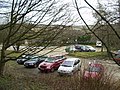 Jaggers Quarry Car Park, Haworth - geograph.org.uk - 128218.jpg 640 × 480; 123 KB
-
 Knock Knock^ - panoramio.jpg 3.216 × 3.934; 3,05 MB
-
 Lees Primary School - Haworth Road - geograph.org.uk - 600212.jpg 640 × 417; 26 KB
-
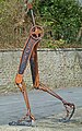 Legs (8700376146).jpg 2.440 × 3.889; 10,29 MB
-
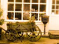 Little cart - panoramio.jpg 4.288 × 3.216; 2,94 MB
-
 Living Artwork - panoramio.jpg 4.275 × 2.799; 5,67 MB
-
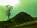
 Lonely Tree - panoramio (2).jpg 4.288 × 3.216; 1,52 MB
-
 Long Bridge - geograph.org.uk - 1410520.jpg 640 × 480; 163 KB
-
 Long Bridge, Nr Haworth - geograph.org.uk - 33523.jpg 640 × 480; 148 KB
-
 Low Eye View - panoramio.jpg 3.216 × 4.288; 5,37 MB
-

-
 Milepost, Bocking.jpg 683 × 1.024; 171 KB
-
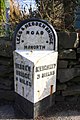
 Milestone - Hebden Road (geograph 4610618).jpg 480 × 640; 106 KB
-
 Milestone beside A6033 opposite Dean Street, Haworth Brow (geograph 6566671).jpg 683 × 1.024; 204 KB
-
 Modern housing at Haworth - geograph.org.uk - 916567.jpg 640 × 480; 88 KB
-
 Naylor Hill Quarry Wind Turbine - geograph.org.uk - 572214.jpg 640 × 480; 72 KB
-

-
 Oh La La La - panoramio.jpg 3.216 × 4.288; 2,81 MB
-
 Old Milestone, A6033, Hebden Road, 'top' road (geograph 6746099).jpg 493 × 693; 73 KB
-
 Old Quarry near Haworth - panoramio.jpg 4.288 × 3.216; 3,62 MB
-
 One man went to mow (27548563876).jpg 2.474 × 1.828; 4,48 MB
-
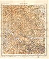 Ordnance Survey One-Inch Tourist Map of Ilkley District, Published 1935.jpg 13.058 × 15.538; 24,8 MB
-
 Overgrown path to Field Head Farm - geograph.org.uk - 5817860.jpg 640 × 480; 87 KB
-

-
 Parson's Field, Haworth - geograph.org.uk - 849491.jpg 640 × 480; 179 KB
-
 Parson's Field, Haworth - geograph.org.uk - 853471.jpg 640 × 480; 200 KB
-

-
-
 Pcs34560 IMG1583.JPG 3.648 × 5.472; 8,09 MB
-
 Pcs34560 IMG1598.JPG 5.472 × 3.648; 6,41 MB
-
 Private Road - geograph.org.uk - 847775.jpg 640 × 480; 72 KB
-
 Quarry waste, Haworth - geograph.org.uk - 849837.jpg 640 × 480; 175 KB
-
 Reading the hobbit (3415104377).jpg 2.048 × 1.371; 835 KB
-
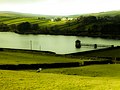 Reservoir Near Haworth - panoramio.jpg 4.288 × 3.216; 3,44 MB
-
 Ruined Mill, Haworth (9219464492).jpg 3.897 × 2.598; 9,49 MB
-
 Shop Window, Haworth (9361472318).jpg 2.672 × 2.541; 4,83 MB
-
 Sign, Brow Moor, Haworth (4964480543).jpg 1.664 × 2.496; 3,53 MB
-
 Stanbury Barn.JPG 1.944 × 2.592; 1,85 MB
-
 Telephone Box - panoramio.jpg 3.216 × 4.288; 7,15 MB
-
 That is Haworth.jpg 1.920 × 2.560; 2,34 MB
-
 THE BRONTE BUS - HOWARTH (27509559074).jpg 2.848 × 2.134; 1,34 MB
-
 The footpath to Sowdens - geograph.org.uk - 4781019.jpg 1.024 × 768; 178 KB
-
 The old stocks, Haworth, Yorkshire.jpg 4.178 × 2.355; 2,36 MB
-
 The paved path to Balcony and Penistone Hill - geograph.org.uk - 4781016.jpg 768 × 1.024; 621 KB
-
 Traditional Sweetshop, Haworth - geograph.org.uk - 143534.jpg 640 × 480; 128 KB
-
 Upper Heights (25416016065).jpg 3.830 × 2.525; 7,37 MB
-
 Vapour trails in the sky - geograph.org.uk - 5338117.jpg 768 × 1.024; 83 KB
-
 View from the Bronte Way towards Haworth (3647430981).jpg 2.497 × 1.664; 2,77 MB
-
 View over Dimples Lane wall towards Haworth - geograph.org.uk - 5631859.jpg 1.024 × 684; 173 KB
-
 View over Worth Valley - geograph.org.uk - 5039983.jpg 1.600 × 1.200; 587 KB
-
 View to Pickles Hill from Cemetery Road, Haworth - geograph.org.uk - 5215555.jpg 1.024 × 768; 257 KB
-
 View towards Haworth (3660551272).jpg 2.560 × 1.384; 2,44 MB
-
 View towards Lower Laithe Reservoir (9361755010).jpg 4.000 × 2.248; 5,63 MB
-
 View towards Lumb Foot from Cemetery Road - geograph.org.uk - 5215100.jpg 1.024 × 768; 220 KB
-
 Walled path (2591051512).jpg 2.560 × 1.920; 5,52 MB
-
 Weavers Hill - Sun Street - geograph.org.uk - 1266097.jpg 640 × 480; 248 KB
-
 White Boar - panoramio.jpg 3.216 × 4.288; 4,81 MB
-
 White house (5916808986).jpg 2.641 × 4.079; 9,56 MB
-

-
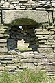 Withens window (5936433961).jpg 2.667 × 4.000; 10,83 MB
-
 Worth Valley (9359004511).jpg 4.000 × 3.000; 7,87 MB
-
 Bell Isle - Bridgehouse Lane - geograph.org.uk - 419409.jpg 640 × 601; 135 KB
-
 Cross Roads Park Crown Bowling Green - geograph.org.uk - 600216.jpg 640 × 387; 19 KB
-
 Cross Roads Park Playground - geograph.org.uk - 600219.jpg 640 × 480; 55 KB
-
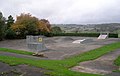 Cross Roads Park Skateboarding Area - geograph.org.uk - 600217.jpg 640 × 404; 23 KB
-
 Crossroads with Lees - geograph.org.uk - 59442.jpg 480 × 640; 88 KB
-
 Cullingworth Moor - geograph.org.uk - 59440.jpg 640 × 480; 102 KB
-
 Footpath above Haworth - geograph.org.uk - 364370.jpg 640 × 426; 186 KB
-
 Haworth Park - geograph.org.uk - 419398.jpg 640 × 361; 79 KB
-
 Haworth Park - geograph.org.uk - 419401.jpg 640 × 351; 65 KB
-
 Laveroc Hall Farm - geograph.org.uk - 539781.jpg 640 × 480; 113 KB
-
 Quarry on Brow Moor Edge. - geograph.org.uk - 397172.jpg 640 × 480; 91 KB
-
 Rough Nook - West Lane - geograph.org.uk - 419358.jpg 640 × 454; 94 KB
-
 The Flappit, Flappit Spring - geograph.org.uk - 635726.jpg 640 × 480; 63 KB
-
 Wind Turbine on Brow Moor near Quarry - geograph.org.uk - 419413.jpg 476 × 640; 53 KB


.jpg)


.jpg)

.jpg)


.jpg)
.jpg)
.jpg)
.jpg)
.jpg)
.jpg)


.jpg)
.jpg)
.jpg)
.jpg)


.jpg)


.jpg)
_(39304628504).jpg)
_(28235237619).jpg)
_(39304634864).jpg)
_(39325061874).jpg)
_(40002795692).jpg)
.jpg)
.jpg)
.jpg)

.jpg)
.jpg)
.jpg)
.jpg)


.jpg)
.jpg)
.jpg)


.jpg)


.jpg)


.jpg)


.jpg)
.jpg)


.jpg)

.jpg)


.jpg)

.jpg)
.jpg)
.jpg)


.jpg)


.jpg)

.jpg)


.jpg)
.jpg)

.jpg)


.jpg)

.jpg)
.jpg)


