Category:Heath and Holmewood
Aller à la navigation
Aller à la recherche
English: Heath and Holmewood is a civil parish forming part of the district of North East Derbyshire in England.
localité britannique du comté anglais de Derbyshire | |||||
| Téléverser des médias | |||||
| Nature de l’élément | |||||
|---|---|---|---|---|---|
| Lieu | North East Derbyshire, Derbyshire, Midlands de l'Est, Angleterre | ||||
| Population |
| ||||
 | |||||
Sous-catégories
Cette catégorie comprend 2 sous-catégories, dont les 2 ci-dessous.
H
Média dans la catégorie « Heath and Holmewood »
Cette catégorie comprend 199 fichiers, dont les 199 ci-dessous.
-
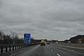
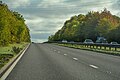
 2-3 mile to junction 29 - geograph.org.uk - 4567406.jpg 640 × 316 ; 45 kio
-
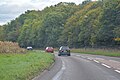
 A617 coming up to M1 junction 29 - geograph.org.uk - 1968498.jpg 640 × 480 ; 47 kio
-
 A617 towards Chesterfield - geograph.org.uk - 2415147.jpg 950 × 770 ; 374 kio
-
 A6175 towards Holmewood - geograph.org.uk - 2335553.jpg 1 600 × 1 200 ; 476 kio
-
 Access road to the A6175 - geograph.org.uk - 2335551.jpg 1 600 × 1 200 ; 197 kio
-
 All Saints church in Heath. - geograph.org.uk - 4045098.jpg 640 × 480 ; 110 kio
-
 All Saints Church, Heath - geograph.org.uk - 5149152.jpg 1 600 × 1 065 ; 861 kio
-
 All Saints Parish Church - Heath - geograph.org.uk - 3870838.jpg 5 014 × 3 761 ; 5,05 Mio
-
 Approaching a turnoff on the M1 - geograph.org.uk - 5801174.jpg 2 000 × 1 333 ; 1,73 Mio
-
 Approaching junction 29 - geograph.org.uk - 2045518.jpg 640 × 480 ; 43 kio
-
 At Williamthorpe Nature Reserve - geograph.org.uk - 3870933.jpg 4 858 × 3 886 ; 5,85 Mio
-
 Big lorry on roundabout - geograph.org.uk - 2283298.jpg 3 648 × 2 736 ; 4,79 Mio
-
 Bridge over the A617 - geograph.org.uk - 2415140.jpg 950 × 658 ; 324 kio
-
 Chapel Hill near Heath - geograph.org.uk - 2690599.jpg 3 296 × 2 472 ; 963 kio
-
 Church Lane - geograph.org.uk - 1925218.jpg 640 × 426 ; 151 kio
-
 Crossing Muster Brook - geograph.org.uk - 5679723.jpg 5 343 × 3 005 ; 3,21 Mio
-
 Crossing the River Doe Lea - geograph.org.uk - 2317748.jpg 3 648 × 2 736 ; 6,29 Mio
-
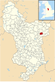 Derbyshire UK parish map highlighting Heath and Holmewood.svg 888 × 1 308 ; 2,35 Mio
-
 Dual carriageway near junction 29 of the M1. - geograph.org.uk - 2045528.jpg 640 × 480 ; 45 kio
-
 Eastbound A617 - geograph.org.uk - 4206587.jpg 640 × 480 ; 271 kio
-
 Eastbound A617 Approaching M1 - geograph.org.uk - 4205324.jpg 640 × 480 ; 283 kio
-
 Eastbound A617 at Junction with M1 - geograph.org.uk - 4205330.jpg 640 × 427 ; 253 kio
-

-
 Eastbound A617, Shire Lane bridge - geograph.org.uk - 4205313.jpg 640 × 480 ; 256 kio
-
 Elm Tree, Heath - geograph.org.uk - 5149162.jpg 1 600 × 1 065 ; 750 kio
-
 Elm Tree, Heath - geograph.org.uk - 5149165.jpg 1 600 × 1 065 ; 513 kio
-
 Entering Heath from the west - geograph.org.uk - 2446901.jpg 950 × 601 ; 269 kio
-
 Entering the Williamthorpe Nature Reserve - geograph.org.uk - 5679719.jpg 5 204 × 2 927 ; 5,43 Mio
-
 Farm Bridge over the A617 at Heath - geograph.org.uk - 5149141.jpg 1 600 × 1 065 ; 582 kio
-
 Farm building near Heath - geograph.org.uk - 2335538.jpg 1 600 × 1 200 ; 592 kio
-
 Farm track and footpath under the motorway - geograph.org.uk - 2415089.jpg 950 × 713 ; 325 kio
-
 Farm track at Gildage Farm - geograph.org.uk - 5149227.jpg 1 600 × 1 065 ; 796 kio
-
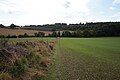
 Farmland south of Heath - geograph.org.uk - 3092056.jpg 1 024 × 768 ; 217 kio
-
 Fern Cottage, Heath - geograph.org.uk - 5149156.jpg 1 600 × 1 063 ; 520 kio
-
 Field by the motorway - geograph.org.uk - 2446857.jpg 950 × 528 ; 206 kio
-
 Field of Potatoes near Doe Lea - geograph.org.uk - 4123241.jpg 640 × 480 ; 91 kio
-
 Field rising to Heath village - geograph.org.uk - 2418837.jpg 950 × 592 ; 254 kio
-
 Field rising to High House Farm - geograph.org.uk - 2446911.jpg 950 × 713 ; 299 kio
-
 Fields near the M1 motorway - geograph.org.uk - 2415131.jpg 950 × 603 ; 253 kio
-
 Fishing in the top pond - Williamthorpe Nature Reserve - geograph.org.uk - 3870844.jpg 4 928 × 3 520 ; 5,34 Mio
-
 Fishing pond beside Mansfield Road - geograph.org.uk - 5416848.jpg 800 × 533 ; 139 kio
-
 Fishing pond in Grassmoor Country Park - geograph.org.uk - 4461399.jpg 1 280 × 953 ; 1,09 Mio
-
 Five Pits Trail - geograph.org.uk - 2843276.jpg 4 000 × 3 000 ; 2,49 Mio
-
 Five Pits Trail north of Holmewood - geograph.org.uk - 3870841.jpg 5 184 × 3 888 ; 6,08 Mio
-
 Footbridge over a dike near Stainsby - geograph.org.uk - 5149237.jpg 1 600 × 1 065 ; 977 kio
-
 Footbridge over a dike near Stainsby - geograph.org.uk - 5149240.jpg 1 600 × 1 065 ; 883 kio
-
 Footbridge over the A617 near Heath - geograph.org.uk - 4205322.jpg 640 × 480 ; 284 kio
-
 Footbridge under major roundabout - geograph.org.uk - 2415176.jpg 950 × 713 ; 367 kio
-
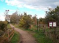
 Footpath by industrial estate - geograph.org.uk - 2418762.jpg 950 × 713 ; 314 kio
-
 Footpath by the old school house in Heath - geograph.org.uk - 1968527.jpg 640 × 480 ; 68 kio
-

-
 Footpath junction - geograph.org.uk - 2418768.jpg 950 × 713 ; 296 kio
-
 Footpath rising towards Heath - geograph.org.uk - 2415123.jpg 823 × 950 ; 392 kio
-
 Footpath sign and church in Heath - geograph.org.uk - 1968511.jpg 640 × 480 ; 100 kio
-
 Footpath to Doe Lea by the A617 - geograph.org.uk - 2415200.jpg 950 × 713 ; 370 kio
-
 Footpath to Heath - geograph.org.uk - 2418826.jpg 950 × 713 ; 327 kio
-
 Footpath towards Heath - geograph.org.uk - 2446845.jpg 713 × 950 ; 301 kio
-
 Ford at Stainsby Hagg Farm - geograph.org.uk - 4446370.jpg 3 872 × 2 592 ; 5,05 Mio
-
 Former Heath Village School 1687 - 1963 - geograph.org.uk - 5149183.jpg 1 600 × 1 065 ; 390 kio
-
 Former Post Office on Main Road, Heath - geograph.org.uk - 5149204.jpg 1 600 × 1 065 ; 572 kio
-
 Former Post Office on Mansfield Road, Heath - geograph.org.uk - 5149174.jpg 1 600 × 1 065 ; 737 kio
-
 Gated field entrance - geograph.org.uk - 2335528.jpg 1 600 × 1 200 ; 919 kio
-
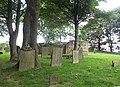
 Graveyard at All Saints Church, Heath - geograph.org.uk - 5149147.jpg 1 600 × 1 065 ; 710 kio
-
 Graveyard at All Saints Church, Heath - geograph.org.uk - 5149150.jpg 1 600 × 1 065 ; 933 kio
-
 Heath - All Saints Church - from SE - geograph.org.uk - 4868213.jpg 1 600 × 1 219 ; 716 kio
-
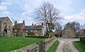
 Heath - farmyard at Ivy Farm - geograph.org.uk - 4864076.jpg 1 600 × 1 200 ; 500 kio
-
 Heath - Fern Cottage - geograph.org.uk - 4868202.jpg 1 600 × 1 225 ; 577 kio
-
 Heath - Mansfield Road alongside Heath Common - geograph.org.uk - 4864072.jpg 1 600 × 1 180 ; 752 kio
-
 Heath - The Elm Tree - geograph.org.uk - 4864068.jpg 1 600 × 1 141 ; 567 kio
-
 Heath and Holmewood , M1 Motorway - geograph.org.uk - 6627193.jpg 6 000 × 4 000 ; 6,97 Mio
-
 Heath and Holmewood , M1 Motorway - geograph.org.uk - 6627194.jpg 6 000 × 4 000 ; 6,77 Mio
-
 Heath Farm - geograph.org.uk - 1253969.jpg 640 × 480 ; 111 kio
-
 Holmewood - charity shop on Heath Road - geograph.org.uk - 4802907.jpg 1 600 × 1 171 ; 506 kio
-
 Holmewood - Economy Fabrics on Heath Road - geograph.org.uk - 4802913.jpg 1 600 × 1 200 ; 468 kio
-
 Holmewood - Henstocks Bakers Shop - geograph.org.uk - 4796216.jpg 1 600 × 1 200 ; 580 kio
-
 Holmewood - Library on Heath Road - geograph.org.uk - 4802909.jpg 1 600 × 1 289 ; 485 kio
-
 Holmewood - Post Office - geograph.org.uk - 4802916.jpg 1 600 × 1 200 ; 517 kio
-
 Holmewood - St Albans Centre - geograph.org.uk - 4802923.jpg 1 600 × 1 321 ; 531 kio
-
 Houses by Chesterfield road - geograph.org.uk - 2418788.jpg 950 × 668 ; 259 kio
-
 Houses on Chesterfield Road, Williamthorpe - geograph.org.uk - 5156325.jpg 1 600 × 1 065 ; 572 kio
-
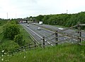
 J29 overbridges, M1 - geograph.org.uk - 4667506.jpg 640 × 372 ; 36 kio
-
 Jasmine House, Main Road, Heath - geograph.org.uk - 5149188.jpg 1 600 × 1 065 ; 517 kio
-
 Joining the A617 - geograph.org.uk - 5802083.jpg 2 000 × 1 333 ; 2,14 Mio
-
 Junction 29 Road Bridge over M1 - geograph.org.uk - 5894606.jpg 1 024 × 594 ; 104 kio
-
 Junction 29 Road Bridge over M1 - geograph.org.uk - 5894608.jpg 1 024 × 615 ; 101 kio
-
 Junction of paths near Holmewood Industrial Estate - geograph.org.uk - 4592394.jpg 3 663 × 5 010 ; 5,27 Mio
-
 Just above Junction 29 on the M1 - geograph.org.uk - 2842923.jpg 640 × 480 ; 50 kio
-
 Lake, Williamthorpe Ponds Nature Reserve - geograph.org.uk - 2304865.jpg 950 × 685 ; 341 kio
-
 Lake, Williamthorpe Ponds Nature Reserve - geograph.org.uk - 2304889.jpg 950 × 681 ; 371 kio
-
 Lakes at Williamthorpe Ponds reserve - geograph.org.uk - 2304872.jpg 950 × 668 ; 282 kio
-
 Laurel Cottage, Main Road, Heath - geograph.org.uk - 5149197.jpg 1 600 × 1 065 ; 513 kio
-
 Layby on A617 - geograph.org.uk - 4206586.jpg 640 × 427 ; 267 kio
-
 Layby View - geograph.org.uk - 3885476.jpg 800 × 600 ; 84 kio
-
 Looking across Williamthorpe Ponds - geograph.org.uk - 5679727.jpg 5 018 × 2 823 ; 2,3 Mio
-
 Looking along Chesterfield Road - geograph.org.uk - 2418798.jpg 950 × 619 ; 258 kio
-
 M1 approaching J29 - geograph.org.uk - 4667502.jpg 640 × 426 ; 27 kio
-
 M1 just south of junction 29 - geograph.org.uk - 4567538.jpg 640 × 290 ; 88 kio
-
 M1 motorway at junction 29, looking north - geograph.org.uk - 2418850.jpg 950 × 713 ; 308 kio
-
 M1 north of junction 29 - geograph.org.uk - 4324315.jpg 640 × 331 ; 37 kio
-
 M1 northbound at junction 29 - geograph.org.uk - 4355262.jpg 1 600 × 1 062 ; 756 kio
-
 M1 northbound towards junction 29a - geograph.org.uk - 4355255.jpg 1 600 × 1 062 ; 371 kio
-
 M1, junction 29, looking south - geograph.org.uk - 2415195.jpg 950 × 699 ; 357 kio
-
 Main Road, Heath - geograph.org.uk - 5149208.jpg 1 600 × 1 065 ; 471 kio
-
 Main Road, Heath - geograph.org.uk - 5149212.jpg 1 600 × 1 065 ; 569 kio
-
 Making a new path in Grassmoor Country Park - geograph.org.uk - 4461408.jpg 1 280 × 953 ; 1,26 Mio
-
 Mansfield Road, from Slack Lane - geograph.org.uk - 2283311.jpg 3 648 × 2 736 ; 5,67 Mio
-
 Mansfield Road, Heath - geograph.org.uk - 2446884.jpg 950 × 713 ; 306 kio
-
 Minor road towards Heath - geograph.org.uk - 2335533.jpg 1 600 × 1 200 ; 730 kio
-
 Near Junction 29 on the M1 - geograph.org.uk - 2842932.jpg 640 × 480 ; 58 kio
-
 New housing development, Doe Lea - geograph.org.uk - 2374485.jpg 909 × 481 ; 288 kio
-
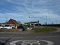
 North East Derbyshire , Esso Petrol Station - geograph.org.uk - 5952815.jpg 6 000 × 4 000 ; 7,31 Mio
-
 North East Derbyshire , Esso Petrol Station - geograph.org.uk - 5976249.jpg 6 000 × 4 000 ; 5,33 Mio
-
 North East Derbyshire , Heath Interchange - geograph.org.uk - 5955271.jpg 6 000 × 4 000 ; 5,71 Mio
-
 North East Derbyshire , M1 Motorway - geograph.org.uk - 5951696.jpg 6 000 × 4 000 ; 7,46 Mio
-
 North East Derbyshire , M1 Motorway - geograph.org.uk - 5952820.jpg 6 000 × 4 000 ; 6,66 Mio
-
 North East Derbyshire , M1 Motorway - geograph.org.uk - 5952823.jpg 6 000 × 4 000 ; 6,88 Mio
-
 North East Derbyshire , Mill Lane - geograph.org.uk - 5955265.jpg 6 000 × 4 000 ; 6,6 Mio
-
 North East Derbyshire , The A617 - geograph.org.uk - 5951697.jpg 6 000 × 4 000 ; 5,9 Mio
-
 North East Derbyshire , The A617 - geograph.org.uk - 5951698.jpg 6 000 × 4 000 ; 7,44 Mio
-
 North East Derbyshire , The A617 - geograph.org.uk - 5951699.jpg 6 000 × 4 000 ; 7,22 Mio
-
 North East Derbyshire , The A617 - geograph.org.uk - 5952812.jpg 6 000 × 4 000 ; 7,86 Mio
-
 North East Derbyshire , The A617 - geograph.org.uk - 5952816.jpg 5 332 × 3 555 ; 6,04 Mio
-
 North East Derbyshire , The A617 - geograph.org.uk - 5952817.jpg 6 000 × 4 000 ; 7,28 Mio
-
 North East Derbyshire , The A6175 - geograph.org.uk - 5955268.jpg 6 000 × 4 000 ; 7,05 Mio
-
 North East Derbyshire , The A6175 - geograph.org.uk - 5955269.jpg 6 000 × 4 000 ; 7,85 Mio
-
 On the Five Pits Trail - geograph.org.uk - 5416841.jpg 800 × 533 ; 152 kio
-
 Palterton, hotel - geograph.org.uk - 2240379.jpg 1 024 × 745 ; 162 kio
-
 Palterton, motorway - geograph.org.uk - 2240366.jpg 1 024 × 768 ; 120 kio
-
 Park Farm, Sutton Scarsdale - geograph.org.uk - 5149124.jpg 1 600 × 1 065 ; 571 kio
-
 Park Road - geograph.org.uk - 5679705.jpg 5 343 × 3 005 ; 4,91 Mio
-
 Path between the Williamthorpe Ponds - geograph.org.uk - 5416846.jpg 800 × 533 ; 193 kio
-
 Path leading to Heath - geograph.org.uk - 5149121.jpg 1 600 × 1 065 ; 901 kio
-
 Path leading to Heath - geograph.org.uk - 5149122.jpg 1 600 × 1 065 ; 776 kio
-
 Path leading to Heath - geograph.org.uk - 5149126.jpg 1 600 × 1 065 ; 720 kio
-
 Path leading to Heath - geograph.org.uk - 5149128.jpg 1 600 × 1 065 ; 907 kio
-
 Path leading to Heath - geograph.org.uk - 5149133.jpg 1 600 × 1 065 ; 507 kio
-
 Path leading to Heath - geograph.org.uk - 5149136.jpg 1 600 × 1 065 ; 985 kio
-
 Path leading to Heath - geograph.org.uk - 5149138.jpg 1 600 × 1 065 ; 546 kio
-
 Path leading to Stainsby - geograph.org.uk - 5149230.jpg 1 600 × 1 065 ; 479 kio
-
 Path leading to the A6175 - geograph.org.uk - 5149215.jpg 1 600 × 1 065 ; 847 kio
-
 Path leading to the A6175 - geograph.org.uk - 5149217.jpg 1 600 × 1 065 ; 588 kio
-
 Path under repair - geograph.org.uk - 2283201.jpg 3 648 × 2 736 ; 6,21 Mio
-
 Pedestrian route over the M1 - geograph.org.uk - 2415184.jpg 950 × 697 ; 354 kio
-
 Petrol station, Slack Lane - geograph.org.uk - 2283303.jpg 3 648 × 2 736 ; 4,85 Mio
-
 Potato field and northward view - geograph.org.uk - 2418820.jpg 950 × 713 ; 283 kio
-
 Pylons and field - geograph.org.uk - 2317755.jpg 3 648 × 2 736 ; 5,36 Mio
-
 Remains of Heath Old Church - geograph.org.uk - 4123182.jpg 3 861 × 2 802 ; 2,24 Mio
-
 Rich farmland by the M1 north of Heath - geograph.org.uk - 3870836.jpg 5 184 × 3 888 ; 6,27 Mio
-
 River Doe Lea tunnel under the A617 embankment - geograph.org.uk - 2418866.jpg 950 × 713 ; 317 kio
-
 Roundabout on the A6175 - geograph.org.uk - 2335556.jpg 1 600 × 1 200 ; 426 kio
-
 Signs and flag by Chesterfield Road - geograph.org.uk - 2418790.jpg 673 × 950 ; 325 kio
-
 Slack Lane, Holmewood - geograph.org.uk - 5156307.jpg 1 600 × 1 065 ; 376 kio
-
 Sports training ground - geograph.org.uk - 2283292.jpg 3 648 × 2 736 ; 5,85 Mio
-
 Start of footpath to Doe Lea from Mill Lane - geograph.org.uk - 2374483.jpg 789 × 950 ; 455 kio
-
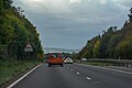
 Still lots of spray on the A617 - geograph.org.uk - 6173959.jpg 2 000 × 1 294 ; 1,42 Mio
-
 Sutton Cum Duckmanton , M1 Motorway - geograph.org.uk - 6627195.jpg 6 000 × 4 000 ; 7,07 Mio
-
 Temporary crash barrier at Junction 29 of M1 southbound - geograph.org.uk - 4618315.jpg 1 600 × 1 067 ; 1 010 kio
-
 The Elm Tree Public House in Heath - geograph.org.uk - 2690616.jpg 3 296 × 2 472 ; 930 kio
-
 The Five Pits Trail - geograph.org.uk - 4461584.jpg 1 280 × 960 ; 1,29 Mio
-
 The Five Pits Trail near Holmewood - geograph.org.uk - 3180329.jpg 4 000 × 3 000 ; 2,66 Mio
-
 The Five Pits Trail near Holmewood - geograph.org.uk - 3180330.jpg 3 846 × 2 784 ; 2,29 Mio
-
 The Five Pits Trail near Williamthorpe Ponds - geograph.org.uk - 3180331.jpg 4 000 × 3 000 ; 2,12 Mio
-
 The Five Pits Trail near Williamthorpe Ponds - geograph.org.uk - 3180332.jpg 4 000 × 3 000 ; 2,37 Mio
-
 The Five Pits Trail Williamthorpe loop - geograph.org.uk - 5679688.jpg 5 272 × 2 965 ; 4,12 Mio
-
 The Five Pits Trail Williamthorpe loop - geograph.org.uk - 5679690.jpg 5 343 × 3 005 ; 4,44 Mio
-
 The Five Pits Trail Williamthorpe loop - geograph.org.uk - 5679692.jpg 5 214 × 2 932 ; 3,6 Mio
-
 The Five Pits Trail Williamthorpe loop - geograph.org.uk - 5679698.jpg 5 343 × 3 005 ; 5,02 Mio
-
 The Five Pits Trail Williamthorpe loop - geograph.org.uk - 5679713.jpg 5 103 × 2 870 ; 4,71 Mio
-
 The Five Pits Trail Williamthorpe loop - geograph.org.uk - 5679731.jpg 5 343 × 3 005 ; 3,96 Mio
-
 The Five Pits Trail Williamthorpe loop - geograph.org.uk - 5679755.jpg 5 100 × 2 868 ; 5,12 Mio
-
 The Five Pits Trail Williamthorpe loop - geograph.org.uk - 5679762.jpg 5 160 × 2 902 ; 3,66 Mio
-
 The most beautiful garden in Heath - geograph.org.uk - 1968553.jpg 640 × 480 ; 125 kio
-
 The old Mansfield Road away from Heath - geograph.org.uk - 2415158.jpg 640 × 458 ; 83 kio
-
 The Old Post Office - geograph.org.uk - 1260239.jpg 640 × 390 ; 58 kio
-
 The Old Reading Room - geograph.org.uk - 1255500.jpg 640 × 390 ; 74 kio
-
 The Old School House - geograph.org.uk - 1255499.jpg 640 × 430 ; 67 kio
-
 The Old School House - Heath - geograph.org.uk - 3870840.jpg 640 × 512 ; 70 kio
-
 The Old School House on Main Road, Heath - geograph.org.uk - 5149186.jpg 1 600 × 1 065 ; 553 kio
-
 The southern lake at Williamthorpe Ponds reserve - geograph.org.uk - 2418809.jpg 950 × 713 ; 290 kio
-
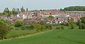
 The village of Heath. - geograph.org.uk - 4045103.jpg 640 × 393 ; 68 kio
-
 The Williamthorpe Nature Reserve - geograph.org.uk - 5679721.jpg 4 992 × 2 808 ; 3,72 Mio
-
 Track approaching Heath village - geograph.org.uk - 2446872.jpg 950 × 713 ; 310 kio
-
 Track north of Williamthorpe Ponds - geograph.org.uk - 3870843.jpg 3 888 × 5 184 ; 6,06 Mio
-
 Tracks in the Williamthorpe Ponds nature reserve - geograph.org.uk - 2418805.jpg 950 × 713 ; 290 kio
-
 Traffic on a busy roundabout - geograph.org.uk - 2418844.jpg 950 × 602 ; 288 kio
-
 Vicarage Close off Main Road, Heath - geograph.org.uk - 5149177.jpg 1 600 × 1 065 ; 561 kio
-
 View across fields - geograph.org.uk - 2415114.jpg 950 × 525 ; 198 kio
-
 Warehouse by a nature reserve - geograph.org.uk - 2304882.jpg 950 × 713 ; 459 kio
-
 Well insulated - geograph.org.uk - 2282403.jpg 3 648 × 2 736 ; 5,74 Mio
-
 Wheat fields and telegraph poles - geograph.org.uk - 3092073.jpg 1 024 × 768 ; 190 kio
-
 Williamthorpe Ponds (middle pond) - geograph.org.uk - 2031697.jpg 800 × 600 ; 152 kio
-
 Williamthorpe Ponds - geograph.org.uk - 2843295.jpg 4 000 × 3 000 ; 2,51 Mio
-
 Williamthorpe Ponds - geograph.org.uk - 5416843.jpg 800 × 533 ; 83 kio
-
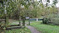
 Williamthorpe Ponds Footbridge - geograph.org.uk - 646874.jpg 640 × 480 ; 100 kio
-
 Williamthorpe Ponds in Grassmoor Country Park - geograph.org.uk - 4461452.jpg 1 280 × 960 ; 1,2 Mio
-
 Williamthorpe Ponds Nature Reserve - geograph.org.uk - 646864.jpg 640 × 480 ; 87 kio
-
 Williamthorpe Ponds Nature Reserve - geograph.org.uk - 646989.jpg 640 × 480 ; 103 kio
-

-
 Yet more spray on the A617 - geograph.org.uk - 6173953.jpg 2 000 × 1 493 ; 1,6 Mio


_-_geograph.org.uk_-_2031697.jpg)


