Category:Helland
Aller à la navigation
Aller à la recherche
village britannique  | |||||
| Téléverser des médias | |||||
| Nature de l’élément | |||||
|---|---|---|---|---|---|
| Lieu | Cornouailles, Angleterre du Sud-Ouest, Angleterre | ||||
| Baigné par | |||||
 | |||||
Sous-catégories
Cette catégorie comprend 5 sous-catégories, dont les 5 ci-dessous.
B
C
- Clerkenwater (1 F)
H
- St Helena's church, Helland (6 F)
- Helland Bridge (8 F)
- Helland War Memorial (1 F)
Média dans la catégorie « Helland »
Cette catégorie comprend 129 fichiers, dont les 129 ci-dessous.
-

-
 Approaching shower over Helland Wood, Holton near Bodmin - geograph.org.uk - 4285030.jpg 1 024 × 768 ; 121 kio
-
 Barns near Calleynough - geograph.org.uk - 5492521.jpg 640 × 480 ; 66 kio
-

-
 Bend in the road on the way to Lecudden - geograph.org.uk - 5492727.jpg 640 × 480 ; 150 kio
-
 Bodmin and the Gilbert memorial - geograph.org.uk - 2099832.jpg 640 × 473 ; 88 kio
-
 Bodwen Farm - geograph.org.uk - 5676388.jpg 4 288 × 2 484 ; 1,28 Mio
-
 Bridge over the Camel Trail - geograph.org.uk - 2097903.jpg 640 × 480 ; 126 kio
-
 Camel Trail - geograph.org.uk - 5203733.jpg 1 600 × 1 067 ; 961 kio
-
 Camel Trail - geograph.org.uk - 5203755.jpg 1 600 × 1 067 ; 738 kio
-
 Camel Trail - geograph.org.uk - 5203762.jpg 1 600 × 1 067 ; 876 kio
-
 Camel Trail - geograph.org.uk - 5203776.jpg 1 600 × 1 067 ; 745 kio
-
 Camel Trail - geograph.org.uk - 5203809.jpg 1 600 × 1 067 ; 803 kio
-
 Camel Trail - geograph.org.uk - 5203812.jpg 1 600 × 1 067 ; 632 kio
-
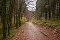
 Camel Trail and forest track in East Wood - geograph.org.uk - 2848032.jpg 800 × 600 ; 485 kio
-
 Camel Trail and River Camel in Outlands Wood - geograph.org.uk - 2847906.jpg 800 × 600 ; 510 kio
-
 Camel Trail at Waterland - geograph.org.uk - 2847846.jpg 800 × 600 ; 398 kio
-
 Camel Trail east of Hellandbridge - geograph.org.uk - 2847850.jpg 600 × 800 ; 462 kio
-
 Camel Trail east of Hellandbridge - geograph.org.uk - 2847852.jpg 800 × 600 ; 484 kio
-
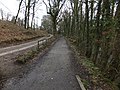
 Camel Trail in Lower Helland Wood - geograph.org.uk - 2847890.jpg 800 × 600 ; 506 kio
-
 Camel Trail in Shell Woods - geograph.org.uk - 2847813.jpg 600 × 800 ; 516 kio
-
 Camel Trail in Shell Woods - geograph.org.uk - 2847822.jpg 600 × 800 ; 509 kio
-
 Camel Trail NCN 3 - geograph.org.uk - 5203696.jpg 1 600 × 1 067 ; 980 kio
-
 Camel Trail north of Outlands Wood - geograph.org.uk - 2847893.jpg 640 × 480 ; 115 kio
-
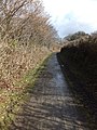
 Camel Trail west of Hellandbridge - geograph.org.uk - 2847879.jpg 600 × 800 ; 506 kio
-
 Camel Trail, Outlands Wood, NW of Bodmin - geograph.org.uk - 4285047.jpg 1 024 × 768 ; 325 kio
-
 Camel valley - geograph.org.uk - 5676312.jpg 4 238 × 2 154 ; 1,5 Mio
-
 Cattle grid, Racecourse Downs - geograph.org.uk - 5676737.jpg 4 288 × 2 848 ; 2,52 Mio
-
 Clerkenwater bridge - geograph.org.uk - 5492737.jpg 640 × 480 ; 120 kio
-
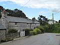 Cottages in Helland - geograph.org.uk - 5491301.jpg 640 × 480 ; 69 kio
-
 Crossroads approaching Racecourse Downs - geograph.org.uk - 5676653.jpg 4 288 × 2 680 ; 2,61 Mio
-
 Crossroads below Racecourse Downs - geograph.org.uk - 5676666.jpg 3 951 × 2 355 ; 828 kio
-
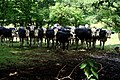 Curious Cattle - geograph.org.uk - 1977973.jpg 1 024 × 682 ; 283 kio
-

-
 Entrance and drive to Trewardale - geograph.org.uk - 748819.jpg 640 × 480 ; 126 kio
-
 Farmland on the Valley Side - geograph.org.uk - 1978005.jpg 1 024 × 682 ; 206 kio
-
 Field between Camel Trail and River Camel - geograph.org.uk - 2847840.jpg 800 × 600 ; 532 kio
-
 Field by Little Shell Wood - geograph.org.uk - 1978023.jpg 1 024 × 682 ; 240 kio
-
 Field near Helland - geograph.org.uk - 5676482.jpg 3 908 × 2 003 ; 931 kio
-
 Field near Helland - geograph.org.uk - 5676494.jpg 4 288 × 2 848 ; 2,33 Mio
-
 Field of barley near Helland - geograph.org.uk - 5491310.jpg 480 × 640 ; 79 kio
-

-
 Field, Helland - geograph.org.uk - 5676491.jpg 4 288 × 2 848 ; 2,85 Mio
-
 Ford at Clerkenwater - geograph.org.uk - 5139509.jpg 6 000 × 4 000 ; 6,88 Mio
-
 Forest track, East Wood, NW of Bodmin - geograph.org.uk - 4285043.jpg 768 × 1 024 ; 271 kio
-
 Former Helland Wesleyan Methodist Church - geograph.org.uk - 5676349.jpg 3 876 × 2 528 ; 1,03 Mio
-

-
 Helland Bridge - geograph.org.uk - 5676260.jpg 4 302 × 2 869 ; 1,97 Mio
-
 Helland Methodist Church - geograph.org.uk - 1631380.jpg 640 × 480 ; 86 kio
-
 Helland Village Hall - geograph.org.uk - 5676489.jpg 4 288 × 2 848 ; 2,11 Mio
-
 Helland Village Hall - geograph.org.uk - 756293.jpg 640 × 427 ; 117 kio
-
 Helland War Memorial - geograph.org.uk - 5492720.jpg 640 × 480 ; 95 kio
-
 Helland-church and war memorial - geograph.org.uk - 5676487.jpg 3 919 × 2 389 ; 1,71 Mio
-
 Higher Coldrennick Farm - geograph.org.uk - 793272.jpg 640 × 423 ; 67 kio
-
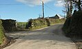
 Holton Lane - geograph.org.uk - 849519.jpg 640 × 391 ; 88 kio
-

-
 Information display at Shell Woods - geograph.org.uk - 2847674.jpg 800 × 600 ; 520 kio
-
 Junction east of Helland - geograph.org.uk - 5676575.jpg 4 236 × 2 004 ; 875 kio
-
 Junction with the A30 - geograph.org.uk - 757133.jpg 640 × 427 ; 89 kio
-
 Lane and track, Racecourse Downs - geograph.org.uk - 5676749.jpg 4 280 × 2 607 ; 1,75 Mio
-
 Lane approaching Helland - geograph.org.uk - 5676346.jpg 4 263 × 2 534 ; 1,43 Mio
-
 Lane at Broad's Cottages - geograph.org.uk - 5676629.jpg 4 104 × 2 848 ; 1,67 Mio
-
 Lane from Helland - geograph.org.uk - 5676582.jpg 3 506 × 1 763 ; 885 kio
-
 Lane near Broad's Farm - geograph.org.uk - 5676624.jpg 4 131 × 2 120 ; 1,16 Mio
-
 Lane near Helland - geograph.org.uk - 5676501.jpg 4 277 × 2 367 ; 1,34 Mio
-
 Lane to Council Barrow - geograph.org.uk - 5676727.jpg 4 288 × 2 848 ; 2,63 Mio
-
 Lane to Lower Kernick - geograph.org.uk - 5676537.jpg 4 288 × 2 848 ; 1,3 Mio
-
 Memorial beside the Camel Trail - geograph.org.uk - 2845508.jpg 600 × 800 ; 467 kio
-
 Milestone near Lower Kernick - geograph.org.uk - 5492608.jpg 640 × 480 ; 96 kio
-
 Minor lane leading down to Holton, Bodmin - geograph.org.uk - 4285028.jpg 1 024 × 768 ; 168 kio
-
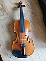 Olaf G.Helland violin.jpg 3 072 × 4 096 ; 2,81 Mio
-
 Old barn at Helland Barton - geograph.org.uk - 5491304.jpg 640 × 480 ; 73 kio
-
 Old Guide Stone near Broads Cottages, Helland (geograph 6045762).jpg 524 × 714 ; 231 kio
-
 Old Guide Stone near Broads Cottages, Helland (geograph 6392691).jpg 3 456 × 4 608 ; 5,16 Mio
-
 Old Milestone by Whitley Wood, Clerkenwater - geograph.org.uk - 5623166.jpg 600 × 800 ; 225 kio
-
 Old Milestone east of Helland and Lower Kernick - geograph.org.uk - 5623151.jpg 600 × 800 ; 274 kio
-
 Old Milestone on Racecourse Downs - geograph.org.uk - 5623150.jpg 600 × 800 ; 227 kio
-
 Old quarry face by the roadside near Lecudden - geograph.org.uk - 5492726.jpg 640 × 480 ; 148 kio
-
 Old wheel at Ruined Mill, Helland-Clerkenwater - geograph.org.uk - 5094689.jpg 1 600 × 900 ; 255 kio
-
 On the Camel Trail near Dunmere - geograph.org.uk - 2848056.jpg 800 × 600 ; 426 kio
-
 Open shed at Waterland by Camel Trail - geograph.org.uk - 2847843.jpg 800 × 600 ; 433 kio
-
 Postbox by Clerkenwater bridge - geograph.org.uk - 5492734.jpg 640 × 480 ; 137 kio
-
 Primitive milestone on Racecourse Downs - geograph.org.uk - 5490654.jpg 480 × 640 ; 84 kio
-
 River Camel - geograph.org.uk - 5203723.jpg 1 600 × 1 067 ; 1 017 kio
-
 River Camel from the Camel Trail - geograph.org.uk - 2097852.jpg 480 × 640 ; 142 kio
-
 River Camel in Outlands Wood - geograph.org.uk - 2847908.jpg 600 × 800 ; 489 kio
-
 Road across Bodmin Moor at Racecourse Downs - geograph.org.uk - 5490660.jpg 640 × 480 ; 70 kio
-
 Road junction near Broad's Cottages - geograph.org.uk - 5492602.jpg 640 × 480 ; 55 kio
-
 Sheep grazing near Smith's Tenement - geograph.org.uk - 5492789.jpg 640 × 480 ; 70 kio
-
 Shell Woods, leisure and forestry - geograph.org.uk - 2847677.jpg 600 × 800 ; 496 kio
-
 Smith's Tenement - geograph.org.uk - 793285.jpg 640 × 510 ; 87 kio
-
 Sunset and pylons - geograph.org.uk - 2099461.jpg 640 × 343 ; 32 kio
-
 The Camel Trail - geograph.org.uk - 1977897.jpg 682 × 1 024 ; 298 kio
-
 The Camel Trail - geograph.org.uk - 2792272.jpg 800 × 600 ; 138 kio
-
 The Camel Trail Through Lower Helland Wood - geograph.org.uk - 1977923.jpg 1 024 × 682 ; 335 kio
-
 The Camel Trail Through Lower Helland Wood - geograph.org.uk - 1977933.jpg 1 024 × 682 ; 324 kio
-
 The Church of St Helena at Helland - geograph.org.uk - 5490727.jpg 640 × 480 ; 99 kio
-
 The High Road - geograph.org.uk - 751510.jpg 640 × 427 ; 79 kio
-
 The River Camel - geograph.org.uk - 1977882.jpg 1 024 × 682 ; 329 kio
-
 The River Camel at Dunmere - geograph.org.uk - 1841979.jpg 640 × 480 ; 137 kio
-

-
 Towards Lower Kernick - geograph.org.uk - 5676557.jpg 3 181 × 1 518 ; 706 kio
-
 Towards the Camel valley - geograph.org.uk - 5676356.jpg 4 266 × 2 328 ; 1,11 Mio
-
 Track leading from Camel Trail at Outlands - geograph.org.uk - 2848026.jpg 600 × 800 ; 508 kio
-
 Track leading to Penhargard - geograph.org.uk - 5492731.jpg 640 × 480 ; 88 kio
-
 Track running W from Holton, near Bodmin - geograph.org.uk - 4285036.jpg 1 024 × 768 ; 261 kio
-
 Victorian postbox, Helland - geograph.org.uk - 5676360.jpg 4 288 × 2 848 ; 2,13 Mio
-
 Victorian postbox, Helland - geograph.org.uk - 5676362.jpg 2 690 × 3 918 ; 1,55 Mio
-
 View across Bodmin Town from Copshorn Road - geograph.org.uk - 2099536.jpg 640 × 480 ; 100 kio
-
 View N to Copshorn , N of Bodmin - geograph.org.uk - 4285039.jpg 1 024 × 768 ; 195 kio
-
 Walkway between the Car Park and the Camel Trail - geograph.org.uk - 1978041.jpg 1 024 × 682 ; 314 kio
-
 Wall of Old Mill, Helland - geograph.org.uk - 5094686.jpg 1 600 × 900 ; 159 kio
-
 Weir on River Camel - geograph.org.uk - 2848028.jpg 600 × 800 ; 532 kio
-

-
 A road off the A30 - geograph.org.uk - 169879.jpg 640 × 426 ; 61 kio
-
 Approaching Helland - geograph.org.uk - 756229.jpg 640 × 427 ; 111 kio
-
 Cardinham Downs - geograph.org.uk - 560206.jpg 640 × 480 ; 60 kio
-
 Cardinham Downs lane - geograph.org.uk - 560209.jpg 640 × 480 ; 146 kio
-
 Cardinham Woods - geograph.org.uk - 560223.jpg 480 × 640 ; 79 kio
-
 Cattle Grid on a Minor Road - geograph.org.uk - 757125.jpg 640 × 427 ; 95 kio
-
 Farmland and Powerlines - geograph.org.uk - 756208.jpg 640 × 427 ; 71 kio
-
 Farmland and Woodland - geograph.org.uk - 751420.jpg 640 × 427 ; 113 kio
-
 Field and Hedge Bank - geograph.org.uk - 751485.jpg 640 × 427 ; 124 kio
-
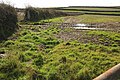
 Fields below Helland Bridge - geograph.org.uk - 51079.jpg 640 × 480 ; 114 kio
-
 Fields of Grass - geograph.org.uk - 756320.jpg 640 × 427 ; 129 kio
-
 Path in Cardinham Woods - geograph.org.uk - 560216.jpg 640 × 480 ; 120 kio
-
 Picnic table in Cardinham Woods - geograph.org.uk - 560218.jpg 540 × 640 ; 153 kio
-
 Road to Helligan Barton - geograph.org.uk - 519002.jpg 640 × 480 ; 154 kio
-
 The Old Mill Herbary - geograph.org.uk - 31191.jpg 640 × 416 ; 70 kio


.jpg)
.jpg)


