Category:Helpston
Vai alla navigazione
Vai alla ricerca
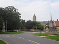
English: Helpston (also, formerly, "Helpstone") is an English village formerly in the Soke of Peterborough, geographically in Northamptonshire — subsequently (1965–1974) in Huntingdon and Peterborough, then in Cambridgeshire — and administered by the City of Peterborough unitary authority.
village in the City of Peterborough, England  | |||||
| Carica un file multimediale | |||||
| Istanza di | |||||
|---|---|---|---|---|---|
| Luogo | City of Peterborough, Cambridgeshire, Est dell'Inghilterra, Inghilterra | ||||
| Considerato essere uguale a | Helpston (pagina Wikimedia duplicata, parrocchia civile dell'Inghilterra) | ||||
 | |||||
Sottocategorie
Questa categoria contiene le 7 sottocategorie indicate di seguito, su un totale di 7.
B
- The Bluebell, Helpston (6 F)
- St Botolph Church, Helpston (17 F)
E
- Exeter Arms, Helpston (6 F)
H
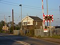
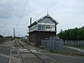
- Helpston railway station (3 F)
J
- John Clare Cottage (4 F)
M
- Market Cross, Helpston (6 F)
- Monument to John Clare (14 F)
File nella categoria "Helpston"
Questa categoria contiene 200 file, indicati di seguito, su un totale di 282.
(pagina precedente) (pagina successiva)-
 20 Maxey Road, Helpston (geograph 6896365).jpg 1 024 × 768; 155 KB
-
 2016, a year on Geograph (Day 176) - geograph.org.uk - 5012183.jpg 640 × 480; 60 KB
-

-
 A mown field - geograph.org.uk - 4208333.jpg 640 × 430; 55 KB
-
 Aerial View of Helpston - geograph.org.uk - 647187.jpg 640 × 421; 82 KB
-
 Along Maxey Cut - geograph.org.uk - 5023158.jpg 640 × 480; 49 KB
-

-
 Arborfield Close, Helpston - geograph.org.uk - 3945510.jpg 4 000 × 3 000; 2,6 MB
-
 Barriers at Helpston Crossing - geograph.org.uk - 4144242.jpg 3 123 × 2 379; 1,12 MB
-
 Bend in Heath Road - geograph.org.uk - 967668.jpg 640 × 480; 50 KB
-
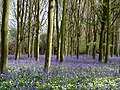 Bluebells at Helpston Heath - geograph.org.uk - 641739.jpg 640 × 480; 152 KB
-
 Bridge on Maxey Road - geograph.org.uk - 3349821.jpg 640 × 464; 43 KB
-
 Bridge over drainage channel, Maxey Road - geograph.org.uk - 2442837.jpg 4 000 × 3 000; 4,33 MB
-
 Broad Wheel Road - geograph.org.uk - 5367130.jpg 640 × 471; 56 KB
-
 Broad Wheel Road, Helpston - geograph.org.uk - 4144127.jpg 4 000 × 3 000; 2,65 MB
-
 Christ in Majesty - geograph.org.uk - 6295349.jpg 1 067 × 1 600; 682 KB
-
 Church Lane, Helpston - geograph.org.uk - 3951435.jpg 4 000 × 3 000; 2,63 MB
-

-
 Copse of trees in wheat - geograph.org.uk - 4208326.jpg 640 × 312; 39 KB
-
 Cottage and garden, Helpston - geograph.org.uk - 5968930.jpg 1 024 × 768; 220 KB
-
 Cottage on Church Lane, Helpston - geograph.org.uk - 4069985.jpg 4 000 × 3 000; 2,61 MB
-
 Cottage on West Street, Helpston - geograph.org.uk - 4144660.jpg 4 000 × 3 000; 2,61 MB
-
 Cottage on West Street, Helpston - geograph.org.uk - 4144690.jpg 3 000 × 4 000; 2,64 MB
-
 Cottage on West Street, Helpston - geograph.org.uk - 6134575.jpg 1 892 × 1 238; 1,58 MB
-
 Cottages on Broad Wheel Road, Helpston - geograph.org.uk - 4144167.jpg 4 000 × 3 000; 2,66 MB
-
 Cottages on West Street, Helpston - geograph.org.uk - 4144642.jpg 4 000 × 3 000; 2,68 MB
-
 Cottages on Woodgate, Helpston - geograph.org.uk - 3945400.jpg 4 000 × 3 000; 2,65 MB
-
 Country scene on the outskirts of Helpston - geograph.org.uk - 2445701.jpg 4 000 × 3 000; 3,95 MB
-
 Countryside scene on Helpston Road - geograph.org.uk - 2307280.jpg 1 280 × 960; 637 KB
-
 Cromwell Mews, Helpston - geograph.org.uk - 4144705.jpg 3 515 × 2 835; 2,05 MB
-

-
 CrossCountry train at Helpston Crossing - geograph.org.uk - 4144088.jpg 3 679 × 2 835; 1,5 MB
-
 Demolished wall on Woodgate, Helpston - geograph.org.uk - 6134455.jpg 1 920 × 1 280; 1,12 MB
-
 Derelict barn near Helpston - geograph.org.uk - 2455128.jpg 4 000 × 3 000; 3,98 MB
-
 Derelict barn near Helpston - geograph.org.uk - 2455131.jpg 4 000 × 3 000; 4,3 MB
-
 Disused garage and petrol filling station, Helpston - geograph.org.uk - 4144265.jpg 4 000 × 3 000; 2,93 MB
-
 Disused garage and petrol filling station, Helpston - geograph.org.uk - 4144279.jpg 4 000 × 3 000; 2,94 MB
-
 Double bend in Heath Road near Helpston - geograph.org.uk - 3875653.jpg 4 320 × 3 240; 5,63 MB
-
 Dovecote and garden at Clare Cottage - geograph.org.uk - 6295673.jpg 1 600 × 1 067; 933 KB
-
 East Coast 225 approaches King Street Level Crossing - geograph.org.uk - 2446977.jpg 4 000 × 3 000; 4,25 MB
-

-
 East Coast Mainline - geograph.org.uk - 5023140.jpg 640 × 480; 59 KB
-
 East Midlands train at Helpston Crossing - geograph.org.uk - 4144079.jpg 3 525 × 2 585; 1,39 MB
-
 Eastwards from the bridge - geograph.org.uk - 3349822.jpg 640 × 465; 33 KB
-
 Edge of Rice Wood - geograph.org.uk - 967674.jpg 640 × 480; 75 KB
-
 Electricity pylon near Helpston - geograph.org.uk - 3971136.jpg 4 000 × 3 000; 2,84 MB
-
 Entering Helpston - geograph.org.uk - 4008807.jpg 640 × 480; 56 KB
-
 Entering Helpston - geograph.org.uk - 4008816.jpg 640 × 480; 62 KB
-
 Farm buildings south of Rice Wood - geograph.org.uk - 3252272.jpg 2 193 × 1 645; 1 009 KB
-
 Farming landscape, Helpston - geograph.org.uk - 4208325.jpg 640 × 329; 38 KB
-

-
 Farmland and pylon, Ailsworth Heath - geograph.org.uk - 3019691.jpg 640 × 480; 50 KB
-
 Farmland by Maxey Rd - geograph.org.uk - 4336265.jpg 640 × 430; 28 KB
-
 Farmland near Helpston - geograph.org.uk - 3020376.jpg 640 × 452; 40 KB
-
 Farmland near Helpston - geograph.org.uk - 4336270.jpg 640 × 430; 30 KB
-
 Farmland near Helpston Crossing - geograph.org.uk - 4336274.jpg 640 × 430; 31 KB
-
 Farmland near Maxey Crossing - geograph.org.uk - 4399021.jpg 640 × 426; 37 KB
-

-
 Farmland west of Marholm - geograph.org.uk - 3020512.jpg 640 × 480; 99 KB
-
 Farmland, Helpston - geograph.org.uk - 3020382.jpg 640 × 431; 40 KB
-
 Farmland, Helpston - geograph.org.uk - 4208330.jpg 640 × 315; 31 KB
-
 Field by Helpston Road - geograph.org.uk - 6140339.jpg 1 920 × 1 280; 2,05 MB
-
 Field by Oxey Wood - geograph.org.uk - 6141610.jpg 1 920 × 1 280; 1,63 MB
-
 Field on the edge of Helpston - geograph.org.uk - 5968898.jpg 1 024 × 768; 155 KB
-
 Flat farmland - geograph.org.uk - 4399020.jpg 640 × 426; 42 KB
-
 Flooded path in Swaddywell Pit Nature Reserve - geograph.org.uk - 3880147.jpg 4 000 × 3 000; 4,21 MB
-
 Flowering bush by Heath Road, Helpston - geograph.org.uk - 6159012.jpg 1 920 × 1 280; 2,49 MB
-
 Footbridge near Helpston - geograph.org.uk - 2304367.jpg 1 280 × 960; 640 KB
-
 Footpath next to Scotts Cottage - geograph.org.uk - 3880542.jpg 4 000 × 3 000; 4,17 MB
-
 Footpath to Heath Road - geograph.org.uk - 2306558.jpg 1 280 × 960; 624 KB
-
 Former footpath level crossing near Lolham Bridges - geograph.org.uk - 4500087.jpg 4 000 × 3 000; 2,65 MB
-
 Garden on the corner of West Street, Helpston - geograph.org.uk - 6134696.jpg 1 920 × 1 280; 1,37 MB
-
 Gateway to St. Botolph's Church, Helpston - geograph.org.uk - 3945636.jpg 3 000 × 4 000; 2,92 MB
-
 Gateway to the churchyard, Helpston (geograph 6896353).jpg 768 × 1 024; 239 KB
-
 Glinton Road (B1443), Helpston - geograph.org.uk - 4008834.jpg 640 × 480; 49 KB
-
 Glinton Road (B1443), Helpston - geograph.org.uk - 967662.jpg 640 × 480; 64 KB
-
 Golden Drop - geograph.org.uk - 5966611.jpg 640 × 480; 64 KB
-
 Golden Drop, Helpston - geograph.org.uk - 4144694.jpg 3 000 × 4 000; 2,62 MB
-
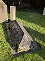 Grave John Clare.jpg 3 024 × 4 032; 6,67 MB
-
 Grazing - geograph.org.uk - 4378248.jpg 4 896 × 3 672; 5,68 MB
-
 Grazing, Helpston - geograph.org.uk - 4008818.jpg 640 × 480; 73 KB
-
 Hairdressing salon on West Street, Helpston - geograph.org.uk - 4144725.jpg 4 000 × 3 000; 2,93 MB
-
 Heath Road at Oxey Wood - geograph.org.uk - 967678.jpg 640 × 480; 122 KB
-

-
 Heath Road south of Helpston - geograph.org.uk - 6141609.jpg 1 920 × 1 280; 1,35 MB
-
 Heath Road, Helpston - geograph.org.uk - 4008821.jpg 640 × 480; 71 KB
-
 Heath Road, Helpston - geograph.org.uk - 4144149.jpg 4 000 × 3 000; 2,64 MB
-
 Heath Road, Helpston - geograph.org.uk - 6141617.jpg 1 906 × 1 260; 1,2 MB
-
 Hedge and farmland - geograph.org.uk - 4399025.jpg 640 × 426; 49 KB
-
 Helpston - geograph.org.uk - 3075800.jpg 4 320 × 3 240; 6,67 MB
-
 Helpston - James Bradford Almshouses - geograph.org.uk - 2332441.jpg 1 600 × 1 176; 531 KB
-
 Helpston - The Feathers - geograph.org.uk - 2336633.jpg 1 600 × 1 155; 427 KB
-
 Helpston - United Methodist Free Church - geograph.org.uk - 2332459.jpg 1 600 × 1 219; 394 KB
-
 Helpston Crossing - geograph.org.uk - 6269349.jpg 1 024 × 512; 188 KB
-
 Helpston Crossing - geograph.org.uk - 959293.jpg 640 × 480; 80 KB
-
 Helpston House, Helpston - geograph.org.uk - 4144653.jpg 4 000 × 3 000; 2,64 MB
-
 Helpston Level Crossing - geograph.org.uk - 2442906.jpg 4 000 × 3 000; 4,03 MB
-
 Helpston Level Crossing - geograph.org.uk - 4008838.jpg 640 × 480; 47 KB
-
 Helpston Level Crossing - geograph.org.uk - 4008848.jpg 640 × 480; 49 KB
-
 Helpston Post Office - geograph.org.uk - 3945492.jpg 4 000 × 3 000; 2,63 MB
-
 Helpston Post Office - geograph.org.uk - 4144669.jpg 4 000 × 3 000; 2,64 MB
-
 Helpston Post Office - geograph.org.uk - 4144774.jpg 4 000 × 3 000; 2,66 MB
-
 Helpston Post Office - geograph.org.uk - 4158698.jpg 2 553 × 3 668; 1,75 MB
-
 Helpston Quarry - geograph.org.uk - 3875305.jpg 4 320 × 3 240; 5,81 MB
-
 Helpston Road north of Ailsworth - geograph.org.uk - 6140338.jpg 1 920 × 1 280; 1,19 MB
-
 Helpston Shop, late June 2016 - geograph.org.uk - 5021603.jpg 640 × 360; 63 KB
-
 Helpston signal box - geograph.org.uk - 3951460.jpg 4 000 × 3 000; 3,03 MB
-
 Helpston Signal Box - geograph.org.uk - 4008843.jpg 640 × 480; 52 KB
-
 Helpston village cross.jpg 3 024 × 4 032; 6,44 MB
-
 Helpston Village Hall - geograph.org.uk - 4144220.jpg 4 000 × 3 000; 2,64 MB
-
 Hi speed Massey Ferguson - geograph.org.uk - 3252254.jpg 2 229 × 1 672; 1,04 MB
-
 House near Helpston Crossing - geograph.org.uk - 4208298.jpg 640 × 367; 41 KB
-
 House on Glinton Rd - geograph.org.uk - 4336275.jpg 640 × 430; 32 KB
-
 House on Heath Road, Helpston - geograph.org.uk - 6159013.jpg 1 920 × 1 280; 1,21 MB
-

-
 Houses between Glinton, Helpston and Etton - geograph.org.uk - 4715261.jpg 1 600 × 643; 113 KB
-

-
 Houses on West Street, Helpston - geograph.org.uk - 3873497.jpg 4 320 × 3 240; 5,69 MB
-
 James Bradford Almshouses, Helpston - geograph.org.uk - 4144193.jpg 4 000 × 3 000; 2,64 MB
-
 James Bradford Almshouses, Helpston - geograph.org.uk - 4144210.jpg 4 000 × 3 000; 2,61 MB
-
 John Clare Cottage gardens.jpg 4 032 × 3 024; 5,79 MB
-
 John Clare statue - rear view - geograph.org.uk - 5098271.jpg 2 304 × 3 456; 5,54 MB
-
 John Clare statue in the grounds of his birthplace - geograph.org.uk - 5098264.jpg 2 304 × 3 456; 4,98 MB
-
 John Clare's cottage, Helpston - geograph.org.uk - 5098257.jpg 3 456 × 2 304; 3,6 MB
-
 John Clare's grave - geograph.org.uk - 6295390.jpg 3 872 × 2 592; 3,84 MB
-
 John Clare's study - geograph.org.uk - 6296254.jpg 1 600 × 1 071; 907 KB
-
 Junction near Woodcroft Castle - geograph.org.uk - 162373.jpg 640 × 480; 82 KB
-
 Junction of Heath Road and Broad Wheel Road, Helpston - geograph.org.uk - 4144121.jpg 4 000 × 3 000; 2,74 MB
-
 Junction of Track to Woodcroft Lodge - geograph.org.uk - 162367.jpg 640 × 480; 78 KB
-

-
 King Street level crossing - geograph.org.uk - 2445692.jpg 4 000 × 3 000; 3,94 MB
-
 King Street level crossing - geograph.org.uk - 2445694.jpg 4 000 × 3 000; 4,28 MB
-
 King Street Roman Road (B1443) - geograph.org.uk - 4008801.jpg 640 × 480; 47 KB
-
 King Street Roman Road - geograph.org.uk - 4008812.jpg 640 × 480; 44 KB
-
 Kitchen at Clare Cottage - geograph.org.uk - 6296240.jpg 1 600 × 1 066; 862 KB
-
 Kneelers in St Botolph's Church - geograph.org.uk - 2261187.jpg 3 264 × 2 448; 4,43 MB
-
 Lake near Lolham Bridges - geograph.org.uk - 4494349.jpg 4 000 × 3 000; 2,61 MB
-
 Lake near Lolham Bridges - geograph.org.uk - 4494351.jpg 3 000 × 4 000; 2,62 MB
-
 Lake near Lolham Bridges - geograph.org.uk - 4494353.jpg 4 000 × 3 000; 2,63 MB
-
 Lake near Lolham Bridges - geograph.org.uk - 4494356.jpg 4 000 × 3 000; 2,66 MB
-
 Lake near Lolham Bridges - geograph.org.uk - 4494359.jpg 4 000 × 3 000; 2,77 MB
-
 Lake near Lolham Bridges - geograph.org.uk - 4494360.jpg 3 000 × 4 000; 2,63 MB
-
 Lake near Lolham Bridges - geograph.org.uk - 4494361.jpg 4 000 × 3 000; 2,66 MB
-
 Lane near Helpston - geograph.org.uk - 2306556.jpg 1 280 × 960; 643 KB
-

-
 Living room in Clare Cottage - geograph.org.uk - 6296234.jpg 1 600 × 1 067; 916 KB
-
 Log piles in Oxey Wood - geograph.org.uk - 5012875.jpg 640 × 480; 93 KB
-
 Lolham Bridges - geograph.org.uk - 2446919.jpg 4 000 × 3 000; 4,28 MB
-
 Lolham Bridges - geograph.org.uk - 2446924.jpg 4 000 × 3 000; 4,06 MB
-
 Lolham Bridges-geograph.org.uk-3969111.jpg 4 320 × 3 240; 5,85 MB
-
 Lolham Fisheries - geograph.org.uk - 2367629.jpg 640 × 368; 70 KB
-
 Lolham level crossing - geograph.org.uk - 3757256.jpg 1 024 × 849; 139 KB
-
 Looking across Helpston Level Crossing - geograph.org.uk - 2442911.jpg 4 000 × 3 000; 4,01 MB
-
 Looking across Maxey Road Level Crossing, Helpston - geograph.org.uk - 2442749.jpg 4 000 × 3 000; 3,95 MB
-
 Looking down the line from King Street Level Crossing - geograph.org.uk - 2446956.jpg 4 000 × 3 000; 4,11 MB
-

-
 Looking west in St Botolph's Church - geograph.org.uk - 6295305.jpg 1 071 × 1 600; 940 KB
-
 Maxey Crossing - geograph.org.uk - 5966663.jpg 640 × 480; 72 KB
-
 Maxey Cut - geograph.org.uk - 1514793.jpg 426 × 640; 86 KB
-
 Maxey Cut - geograph.org.uk - 1514799.jpg 640 × 426; 75 KB
-
 Maxey Cut - geograph.org.uk - 1514804.jpg 640 × 426; 85 KB
-
 Maxey Cut - geograph.org.uk - 3349823.jpg 640 × 476; 43 KB
-
 Maxey Cut - geograph.org.uk - 959250.jpg 640 × 480; 65 KB
-
 Maxey Cut at Lolham Bridges - geograph.org.uk - 2446937.jpg 4 000 × 3 000; 4,29 MB
-
 Maxey Cut beneath Maxey Road - geograph.org.uk - 3349824.jpg 640 × 475; 51 KB
-
 Maxey Cut westwards - geograph.org.uk - 3349825.jpg 640 × 490; 48 KB
-
 Maxey Road - geograph.org.uk - 1514811.jpg 640 × 426; 68 KB
-
 Maxey Road into Helpston - geograph.org.uk - 3349819.jpg 640 × 490; 50 KB
-
 Maxey Road Level Crossing - geograph.org.uk - 2442734.jpg 4 000 × 3 000; 4,08 MB
-
 Maxey Road level crossing - geograph.org.uk - 3349820.jpg 640 × 496; 42 KB
-
 Maxey Road Level Crossing looking towards Peterborough - geograph.org.uk - 2442762.jpg 4 000 × 3 000; 4,04 MB
-
 Maxey Road near Helpston - geograph.org.uk - 5968911.jpg 1 024 × 768; 152 KB
-
 Maxey Road towards Helpston - geograph.org.uk - 3349826.jpg 640 × 479; 38 KB
-
 Maxey Road towards Maxey - geograph.org.uk - 3349827.jpg 640 × 470; 37 KB
-

-

-
 Near Helpston Crossing - geograph.org.uk - 4399030.jpg 640 × 467; 49 KB
-
 New house on West Street, Helpston - geograph.org.uk - 6134695.jpg 1 920 × 1 280; 897 KB
-
 Old stone barn south of Helpston - geograph.org.uk - 3875651.jpg 4 170 × 3 032; 5,04 MB
-
 Path through Rice Wood, Helpston - geograph.org.uk - 6159011.jpg 1 872 × 1 204; 2,02 MB
-
 Pipe and bridge over Maxey Cut - geograph.org.uk - 3349828.jpg 640 × 441; 42 KB
-
 Plaque on the John Clare Cottage, Helpston - geograph.org.uk - 3945603.jpg 2 666 × 2 000; 1 006 KB
-
-

-
 Pond by Footpath - geograph.org.uk - 967677.jpg 640 × 480; 74 KB
-
 Prairie like landscape - geograph.org.uk - 4208332.jpg 640 × 357; 38 KB
-
 Prairies near Helpston - geograph.org.uk - 4336269.jpg 640 × 430; 36 KB
-
 Private road near Helpston - geograph.org.uk - 5968905.jpg 1 024 × 768; 109 KB
-

-
 Pylons seen from Heath Road, near Helpston - geograph.org.uk - 2307288.jpg 1 280 × 960; 638 KB
-
 Railway at Bainton Green level crossing - geograph.org.uk - 3874155.jpg 4 320 × 3 240; 5,97 MB
-
 Railway bridge at Bainton Green level crossing - geograph.org.uk - 3874162.jpg 4 320 × 3 240; 6,06 MB
-

-
 Railway heading east - geograph.org.uk - 4008799.jpg 640 × 480; 90 KB
-
 Railway towards Peterborough - geograph.org.uk - 4008840.jpg 640 × 480; 57 KB
-
 Rape field by Heath Road, Helpston - geograph.org.uk - 6141614.jpg 1 920 × 1 280; 1,43 MB
-
 Restricted junction - geograph.org.uk - 5966587.jpg 640 × 419; 45 KB
-

-
 Road junction - geograph.org.uk - 5367206.jpg 640 × 480; 82 KB
-
 Road junction - geograph.org.uk - 5367214.jpg 640 × 480; 41 KB
.jpg)
_-_geograph.org.uk_-_5012183.jpg)


.jpg)
,_Helpston_-_geograph.org.uk_-_4008834.jpg)
,_Helpston_-_geograph.org.uk_-_967662.jpg)


_-_geograph.org.uk_-_4008801.jpg)


