Category:Hertford
Zur Navigation springen
Zur Suche springen
English: Media about Hertford.
Français : Média sur Hertford.
Stadt in der Grafschaft Hertfordshire in England    | |||||
| Medium hochladen | |||||
| Ist ein(e) |
| ||||
|---|---|---|---|---|---|
| Name in Muttersprache |
| ||||
| Benannt nach |
| ||||
| Ort |
| ||||
| Liegt am oder im Gewässer | |||||
| Physisch verbunden mit | |||||
| Amtssprache | |||||
| Sammlung |
| ||||
| Datum der Gründung, Erstellung, Entstehung, Erbauung |
| ||||
| Einwohnerzahl |
| ||||
| Fläche |
| ||||
| Höhe über dem Meeresspiegel |
| ||||
| Verschieden von | |||||
| Eventuell gleichwertig | Hertford (Wikimedia-Dublette, Civil Parish in England) | ||||
| offizielle Website | |||||
 | |||||
Unterkategorien
Es werden 18 von insgesamt 18 Unterkategorien in dieser Kategorie angezeigt:
In Klammern die Anzahl der enthaltenen Kategorien (K), Seiten (S), Dateien (D)
2
B
- Balls Park (1 D)
C
F
H
- Hertford Basin (1 D)
- Hertford Cemetery (66 D)
- Hertford East railway station (48 D)
- Hertford Lock (6 D)
- Hertford North railway station (53 D)
- Hertford Viaduct (4 D)
- Hornsmill Viaduct (4 D)
K
- King's Meads (22 D)
M
- Maps of Hertford, England (3 D)
P
R
W
- Hertford War Memorial (15 D)
Medien in der Kategorie „Hertford“
Folgende 200 Dateien sind in dieser Kategorie, von 684 insgesamt.
(vorherige Seite) (nächste Seite)-
 A marvellous display of roses on Mill Bridge ^2 - geograph.org.uk - 4458861.jpg 3.872 × 2.592; 3,74 MB
-

-
-

-
 A marvellous display of tulips and primulas on Mill Bridge - geograph.org.uk - 4458859.jpg 3.872 × 2.592; 2,77 MB
-
-
 A spelling mistake - geograph.org.uk - 1981533.jpg 1.280 × 960; 465 KB
-
 A10 bridge over the Lea near Ware - geograph.org.uk - 3583289.jpg 640 × 360; 80 KB
-
 A10, Lea Valley Viaduct - geograph.org.uk - 4793423.jpg 640 × 426; 30 KB
-
 A10, Lea Valley Viaduct - geograph.org.uk - 4793424.jpg 640 × 426; 33 KB
-
 A119 Ware Road, Hertford - geograph.org.uk - 6063160.jpg 1.024 × 684; 272 KB
-
 A414 eastbound - geograph.org.uk - 6063145.jpg 1.024 × 684; 251 KB
-
 A414 Hertingfordbury Road, eastbound - geograph.org.uk - 6063152.jpg 1.024 × 684; 266 KB
-
 Access road off Gascoyne Way - geograph.org.uk - 2323307.jpg 1.600 × 1.200; 623 KB
-
 Allotments, Hertford - geograph.org.uk - 4632257.jpg 640 × 480; 174 KB
-
 Apartment Block near River Lea, Hertford, Hertfordshire - geograph.org.uk - 5094626.jpg 1.400 × 1.050; 1,39 MB
-
 Apartment Block near River Lea, Hertford, Hertfordshire - geograph.org.uk - 5094627.jpg 1.400 × 1.012; 1,73 MB
-
 Baker Street Hertford - geograph.org.uk - 2323299.jpg 1.600 × 1.200; 573 KB
-
 Balls Park - north lodge - geograph.org.uk - 2446748.jpg 1.024 × 768; 213 KB
-
 Balls Park developers sign - geograph.org.uk - 1977230.jpg 1.536 × 2.048; 675 KB
-
 Barclays Bank, Hertford - geograph.org.uk - 4201348.jpg 1.238 × 929; 1,04 MB
-
 Barge on the River Lee Navigation, Hertford - geograph.org.uk - 6372997.jpg 2.000 × 1.500; 824 KB
-
 Basin, Lee Navigation, Hertford - geograph.org.uk - 4627740.jpg 640 × 480; 126 KB
-
 Bayford, Hertford SG13, UK - panoramio.jpg 3.456 × 2.304; 2,81 MB
-
 Beane Road at the junction of Port Vale - geograph.org.uk - 4830937.jpg 2.254 × 1.660; 1,15 MB
-
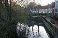
 Bend in the River Lea, near Hertford - geograph.org.uk - 3583246.jpg 640 × 360; 61 KB
-
 Bengeo Water Tower, Hertford (51136474069).jpg 4.608 × 3.456; 6,24 MB
-
 Bentley Road at the junction of Panshanger Road - geograph.org.uk - 6198554.jpg 1.920 × 1.280; 1,74 MB
-
 Bentley Road, Hertford - geograph.org.uk - 6198553.jpg 1.890 × 1.232; 1,33 MB
-
 Beside the River Lea, Hertford - geograph.org.uk - 5979700.jpg 1.600 × 902; 553 KB
-
 Bikes and Circus on Hartham Common - geograph.org.uk - 2075290.jpg 3.476 × 2.484; 2,18 MB
-
 Bircherley Street, Hertford - geograph.org.uk - 1978628.jpg 1.280 × 960; 479 KB
-
 Bircherley Street, Hertford - geograph.org.uk - 1981523.jpg 1.280 × 960; 481 KB
-
 Black Ditch (2) - geograph.org.uk - 4527790.jpg 640 × 480; 109 KB
-
 Black Ditch - geograph.org.uk - 4527788.jpg 640 × 480; 101 KB
-
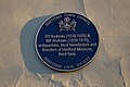
 Blue plaque, Parliament Square, Hertford - geograph.org.uk - 6318553.jpg 1.600 × 1.064; 271 KB
-
 Bluecoats Roundabout, Hertford - geograph.org.uk - 2003608.jpg 1.280 × 960; 479 KB
-
 Bramfield Road - geograph.org.uk - 4930877.jpg 640 × 480; 131 KB
-
 Brewery Dray - geograph.org.uk - 3919898.jpg 800 × 600; 152 KB
-
 Brickendon Brook in Hertford (1) - geograph.org.uk - 723857.jpg 640 × 480; 120 KB
-
 Brickendon Brook in Hertford (2) - geograph.org.uk - 723868.jpg 640 × 480; 110 KB
-
 Brickendon Lane becomes suburban - geograph.org.uk - 4965848.jpg 640 × 480; 194 KB
-
 Brickendon Lane, Facing South - geograph.org.uk - 2969438.jpg 2.560 × 1.920; 1,1 MB
-

-
 Bridge House, Hertford North - geograph.org.uk - 5161895.jpg 4.415 × 2.996; 4,2 MB
-
 Bridge in Port Hill, SG14 - geograph.org.uk - 4532627.jpg 640 × 480; 73 KB
-
-

-
 Bridge over New River - geograph.org.uk - 4627457.jpg 640 × 480; 148 KB
-
 Bridge over the lane to Hertingfordbury - geograph.org.uk - 3448955.jpg 4.320 × 3.240; 6,28 MB
-

-

-

-

-
 Bullsmill Lane at the junction of a farm track - geograph.org.uk - 3209631.jpg 2.048 × 1.536; 1,49 MB
-
 Bullsmill Lane at the junction of Sacombe Road - geograph.org.uk - 4664944.jpg 2.560 × 1.920; 1,9 MB
-

-
 Canada geese, River Lea - geograph.org.uk - 5124209.jpg 4.608 × 3.456; 5,16 MB
-
 Car park, Hartham Leisure Centre - geograph.org.uk - 2501589.jpg 588 × 640; 91 KB
-
 Car parking under the Ware Viaduct on Hertford Road - geograph.org.uk - 6283288.jpg 1.920 × 1.280; 1,53 MB
-
 Castle Gatehouse and lodge. Castle Street, Hertford - geograph.org.uk - 6372509.jpg 2.000 × 1.417; 893 KB
-
 Castle House, Hertford - geograph.org.uk - 6224874.jpg 800 × 600; 92 KB
-
 Castle Moat House, Hertford.jpg 4.608 × 3.456; 3,53 MB
-
 Chadwell Spring, between Hertford and Ware, Hertfordshire. - geograph.org.uk - 1747067.jpg 3.008 × 2.000; 3,63 MB
-
 Church Road - Elton Road, SG14 (2) - geograph.org.uk - 4532618.jpg 640 × 480; 116 KB
-
 Church Road - Elton Road, SG14 (3) - geograph.org.uk - 4532620.jpg 640 × 480; 114 KB
-
 Church Road - Elton Road, SG14 - geograph.org.uk - 4532617.jpg 640 × 480; 102 KB
-
 Church Road, SG14 - geograph.org.uk - 4532622.jpg 640 × 480; 126 KB
-
 Churchfields at the junction of London Road - geograph.org.uk - 5616297.jpg 1.960 × 1.410; 792 KB
-

-
-
-

-
 Corn mill, Hertingfordbury - geograph.org.uk - 4929843.jpg 640 × 480; 68 KB
-
 Corner of Fore Street, Hertford - geograph.org.uk - 4201347.jpg 1.238 × 929; 861 KB
-
 County Hall, Hertford - geograph.org.uk - 4350088.jpg 4.158 × 3.012; 3,09 MB
-
 County Hall, Hertford.jpg 3.785 × 2.839; 2,07 MB
-
 Cowbridge, Hertford - geograph.org.uk - 2029232.jpg 1.280 × 960; 474 KB
-
 Cowbridge, Hertford - geograph.org.uk - 2208825.jpg 1.600 × 1.200; 573 KB
-
 Cows near Hartham Common - geograph.org.uk - 6150577.jpg 1.600 × 900; 558 KB
-
 Crop field towards Blakemore Wood - geograph.org.uk - 4929851.jpg 640 × 480; 59 KB
-
 Crop field west of St Mary's Lane - geograph.org.uk - 4929829.jpg 640 × 480; 59 KB
-
-
 Double aperture Elizabeth II postbox, Old Cross Hertford - geograph.org.uk - 6225131.jpg 2.136 × 2.848; 1,3 MB
-

-
 Duncombe Close, Bengeo - geograph.org.uk - 4830939.jpg 2.188 × 1.562; 1,02 MB
-
 Duncombe Road, Bengeo - geograph.org.uk - 4830945.jpg 2.258 × 1.666; 910 KB
-

-

-
-

-
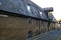
 Ekins ^ Co. Ltd. Building Contractors, Hartham Lane - geograph.org.uk - 4458784.jpg 3.872 × 2.592; 2,1 MB
-
 Elle's Kitchen, Hertford - geograph.org.uk - 6224872.jpg 600 × 800; 87 KB
-

-
 Entrance to Holly Dell, Hertford - geograph.org.uk - 6276513.jpg 1.600 × 1.064; 498 KB
-
 Farmers Market Hertford.jpg 1.280 × 848; 423 KB
-
 First General Synod of the English Church - geograph.org.uk - 6438116.jpg 934 × 1.086; 546 KB
-
 Footbridge over the Cole Green Way - geograph.org.uk - 6301226.jpg 1.600 × 900; 767 KB
-
 Footbridge, A10 - geograph.org.uk - 4793421.jpg 640 × 426; 47 KB
-
 Footpath loop between the River Beane and the River Lea - geograph.org.uk - 6150570.jpg 1.600 × 1.200; 765 KB
-
 Fore Street, Hertford - geograph.org.uk - 1547248.jpg 640 × 480; 102 KB
-
 Fore Street, Hertford - geograph.org.uk - 1978626.jpg 1.280 × 960; 472 KB
-
 Fore Street, Hertford - geograph.org.uk - 2342663.jpg 1.280 × 856; 175 KB
-
 Former entrance to Balls Park - geograph.org.uk - 2003615.jpg 1.280 × 960; 499 KB
-
 Former Green Dragon Hotel, The Wash, Hertford - geograph.org.uk - 6319413.jpg 1.064 × 1.600; 357 KB
-
 Former police station, Castle Street, Hertford - geograph.org.uk - 6316838.jpg 1.600 × 1.064; 368 KB
-
 Foxholes Avenue, Hertford - geograph.org.uk - 6119958.jpg 1.920 × 1.280; 1,65 MB
-
 Foxholes roundabout on the A414, Hertford - geograph.org.uk - 2992975.jpg 1.600 × 1.200; 500 KB
-
 Garage on Ware Road, Hertford - geograph.org.uk - 2323294.jpg 1.600 × 1.200; 654 KB
-
 Garth House, Hertingfordbury - geograph.org.uk - 4287388.jpg 4.320 × 3.240; 3,76 MB
-
 George V postbox on Bengeo Street, Bengeo, Hertford - geograph.org.uk - 6225132.jpg 1.663 × 2.823; 935 KB
-
 George VI postbox on Horns Mill Road, Hertford - geograph.org.uk - 6225128.jpg 1.511 × 2.808; 793 KB
-
 Ginger bar and restaurant - geograph.org.uk - 5537666.jpg 5.202 × 3.465; 3,85 MB
-
 GOC Bayford–Hertford 020 House in Hertford (26316697656).jpg 3.778 × 2.837; 2,88 MB
-
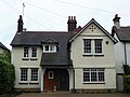 GOC Bayford–Hertford 021 House in Hertford (25739896623).jpg 3.495 × 2.623; 2,49 MB
-

-
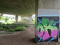 Graffiti and horses under the flyover - geograph.org.uk - 5124217.jpg 4.608 × 3.456; 4,3 MB
-
 Great Molewood at the junction of North Road - geograph.org.uk - 4540642.jpg 2.560 × 1.920; 1,89 MB
-
 GSS Group, Ware - geograph.org.uk - 6272906.jpg 1.866 × 1.194; 1,44 MB
-
 Hagsdell Road from the junction of Queens Road - geograph.org.uk - 3206138.jpg 2.048 × 1.536; 2,13 MB
-
 Hagsdell Road in the snow - geograph.org.uk - 3296882.jpg 640 × 480; 112 KB
-
 Hale Road Hertford - geograph.org.uk - 2323306.jpg 1.491 × 1.152; 464 KB
-
 Hartham Grazing Meadow (2) - geograph.org.uk - 4531688.jpg 640 × 480; 104 KB
-
 Hartham Grazing Meadow - geograph.org.uk - 4531683.jpg 640 × 480; 79 KB
-
 HarthamLTAClub.jpg 2.048 × 654; 319 KB
-
 HarthamPlaygroundSnow.jpg 2.048 × 1.536; 790 KB
-
 HarthamPoolGym.jpg 2.048 × 820; 341 KB
-
 HarthamSummer08.jpg 3.071 × 1.311; 616 KB
-
 Hertford - Hertfordshire red dot.png 1.802 × 2.589; 187 KB
-
 Hertford at War Display, Hertford Museum - geograph.org.uk - 3874539.jpg 3.586 × 2.295; 909 KB
-
 Hertford Baptist Church - geograph.org.uk - 5070337.jpg 1.600 × 1.523; 448 KB
-
 Hertford Baptist Church - geograph.org.uk - 6224914.jpg 800 × 600; 90 KB
-
 Hertford Bus Station.jpg 3.130 × 2.236; 1,59 MB
-
 Hertford Castle, from Castle Street - geograph.org.uk - 6316153.jpg 1.600 × 1.064; 463 KB
-
 Hertford Cemetery on Bramfield Road - geograph.org.uk - 4541185.jpg 2.560 × 1.920; 2,04 MB
-
 Hertford County Hall - geograph.org.uk - 6224862.jpg 800 × 600; 113 KB
-
 Hertford County Hall - geograph.org.uk - 6313758.jpg 1.600 × 1.064; 364 KB
-
 Hertford East Class 720s.jpg 4.032 × 3.024; 2,76 MB
-
 Hertford East Platform 2 Class 720s.jpg 4.032 × 3.024; 2,73 MB
-
 Hertford East station - geograph.org.uk - 5161925.jpg 1.515 × 1.191; 896 KB
-
 Hertford East station buildings (2) - geograph.org.uk - 4532667.jpg 640 × 480; 79 KB
-
 Hertford East station buildings - geograph.org.uk - 4532665.jpg 640 × 480; 67 KB
-
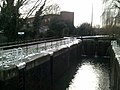 Hertford Lock - geograph.org.uk - 3339562.jpg 2.048 × 1.536; 607 KB
-
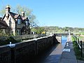 Hertford Lock - geograph.org.uk - 4531643.jpg 640 × 480; 78 KB
-
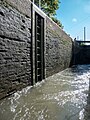 Hertford Lock, River Lea, Hertford, Hertfordshire - geograph.org.uk - 5094619.jpg 788 × 1.050; 1,01 MB
-
 Hertford Lock, River Lea, Hertford, Hertfordshire - geograph.org.uk - 5094621.jpg 1.400 × 1.022; 1,02 MB
-

-
 Hertford Millennium Sculpture, Hertford - geograph.org.uk - 4200933.jpg 768 × 1.024; 1,19 MB
-
 Hertford Millennium Statue - geograph.org.uk - 6224898.jpg 600 × 800; 166 KB
-
 Hertford Police Station - geograph.org.uk - 6224868.jpg 800 × 600; 107 KB
-
 Hertford Town - geograph.org.uk - 1764042.jpg 640 × 475; 68 KB
-
 Hertford Town Bull Plain - geograph.org.uk - 1764050.jpg 640 × 476; 80 KB
-
 Hertford Town Church, Hartham Lane - geograph.org.uk - 6322335.jpg 1.600 × 1.064; 239 KB
-
 Hertford town coat of arms standard.webp 1.034 × 1.101; 138 KB
-
 Hertford Town Council logo.webp 400 × 333; 22 KB
-
 Hertford War Memorial - geograph.org.uk - 5161901.jpg 1.210 × 1.263; 494 KB
-
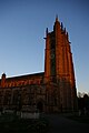 Hertford, All Saints Church - geograph.org.uk - 6322813.jpg 1.064 × 1.600; 182 KB
-
 Hertford, All Saints Church - geograph.org.uk - 6322817.jpg 1.600 × 1.064; 469 KB
-
 Hertford, All Saints Church from Church Street - geograph.org.uk - 6322805.jpg 1.600 × 1.064; 331 KB
-
 Hertford, B158 Lower Hatfield Road - geograph.org.uk - 723906.jpg 640 × 480; 96 KB
-
 Hertford, blue plaque on Castle Street - geograph.org.uk - 6316157.jpg 1.600 × 1.064; 493 KB
-
 Hertford, Boer War memorial plaque on old Library - geograph.org.uk - 6322321.jpg 1.064 × 1.600; 252 KB
-
-
 Hertford, cottages at south end of Parliament Square - geograph.org.uk - 6316840.jpg 1.600 × 1.064; 214 KB
-
 Hertford, cottages on Castle Street - geograph.org.uk - 6316155.jpg 1.600 × 1.064; 321 KB
-
 Hertford, cottages on Old Wash - geograph.org.uk - 6322196.jpg 1.600 × 1.064; 246 KB
-
 Hertford, drinking fountain in front of old Library - geograph.org.uk - 6322325.jpg 1.064 × 1.600; 350 KB
-
 Hertford, Edmunds Corner, off Old Cross - geograph.org.uk - 6322281.jpg 1.064 × 1.600; 343 KB
-
 Hertford, Ekins ^ Co. building contractors - geograph.org.uk - 6322395.jpg 1.600 × 1.064; 266 KB
-

-
 Hertford, Fore Street - geograph.org.uk - 5161907.jpg 1.226 × 1.536; 794 KB
-
 Hertford, Fore Street - geograph.org.uk - 6322782.jpg 1.600 × 1.064; 287 KB
-
 Hertford, former McMullen's brewery, Hartham Lane - geograph.org.uk - 6322330.jpg 1.600 × 1.064; 226 KB
-

-
 Hertford, former warehouse on Nicholas Lane - geograph.org.uk - 6322197.jpg 1.600 × 1.064; 440 KB
-

-

-
 Hertford, looking north up Cowbridge - geograph.org.uk - 6322333.jpg 1.600 × 1.064; 317 KB
-
 Hertford, looking south along Market Place - geograph.org.uk - 6322432.jpg 1.600 × 1.064; 386 KB
-
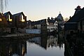
 Hertford, looking upstream at Mill Bridge - geograph.org.uk - 6321502.jpg 1.600 × 1.064; 538 KB
-
 Hertford, McMullen's Brewery, Old Cross - geograph.org.uk - 6322282.jpg 1.600 × 1.064; 257 KB
-
 Hertford, Mead Lane - geograph.org.uk - 1552165.jpg 640 × 480; 81 KB
-
 Hertford, Morgan's Road at Holly Dell - geograph.org.uk - 6313743.jpg 1.600 × 1.064; 397 KB
-
 Hertford, new development along the River Lea - geograph.org.uk - 6322400.jpg 1.600 × 1.064; 261 KB
-
 Hertford, old library - geograph.org.uk - 6322195.jpg 1.064 × 1.600; 249 KB
-
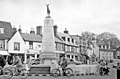 Hertford, Parliament Square 1956 - geograph.org.uk - 4592771.jpg 2.260 × 1.487; 1,47 MB
-
 Hertford, redevelopment along the River Lea - geograph.org.uk - 6322405.jpg 1.600 × 1.064; 277 KB
-
 Hertford, Rowleys Road Drain - geograph.org.uk - 2157460.jpg 640 × 480; 119 KB
-
 Hertford, Salisbury Arms - geograph.org.uk - 5161910.jpg 1.536 × 1.536; 1,01 MB
-

-
 Hertford, statue of Rev. Samuel Stone - geograph.org.uk - 6320842.jpg 1.064 × 1.600; 400 KB
-
 Hertford, subway under Gascoyne Way - geograph.org.uk - 6316139.jpg 1.600 × 1.064; 296 KB
-
 Hertford, The Gulphs - geograph.org.uk - 2167683.jpg 640 × 473; 96 KB
-
 Hertford, the Mill Bridge Rooms, from The Wash - geograph.org.uk - 6320144.jpg 1.064 × 1.600; 258 KB
-
 Hertford, the Old Barge pub next to the River Lea - geograph.org.uk - 6322406.jpg 1.600 × 1.064; 400 KB
-
 Hertford, the Salisbury Arms, Fore Street - geograph.org.uk - 6322796.jpg 1.600 × 1.064; 283 KB
-
 Hertford, the White Hart, Market Place - geograph.org.uk - 6322434.jpg 1.600 × 1.064; 447 KB
-

-
 Hertford, traffic on the approach to Mill Bridge - geograph.org.uk - 6320146.jpg 1.600 × 1.064; 268 KB
-
 Hertford, Villiers Street - geograph.org.uk - 208157.jpg 640 × 480; 80 KB


.jpg)


_-_geograph.org.uk_-_4527790.jpg)


_-_geograph.org.uk_-_723857.jpg)
_-_geograph.org.uk_-_723868.jpg)


_-_geograph.org.uk_-_4527702.jpg)


_-_geograph.org.uk_-_4525657.jpg)

_-_geograph.org.uk_-_4527769.jpg)


_-_geograph.org.uk_-_4930807.jpg)


_-_geograph.org.uk_-_4532618.jpg)
_-_geograph.org.uk_-_4532620.jpg)


.jpg)
.jpg)
,_Hertford_(26130245830).jpg)


_-_geograph.org.uk_-_4531688.jpg)


_-_geograph.org.uk_-_4532667.jpg)


