Category:Hethe
Aller à la navigation
Aller à la recherche
ville du Royaume-Uni  | |||||
| Téléverser des médias | |||||
| Nature de l’élément | |||||
|---|---|---|---|---|---|
| Lieu | Cherwell, Oxfordshire, Angleterre du Sud-Est, Angleterre | ||||
| Population |
| ||||
| Superficie |
| ||||
| Réputé identique à | Hethe (page en doublon, paroisse civile) | ||||
 | |||||
Sous-catégories
Cette catégorie comprend 4 sous-catégories, dont les 4 ci-dessous.
Média dans la catégorie « Hethe »
Cette catégorie comprend 78 fichiers, dont les 78 ci-dessous.
-
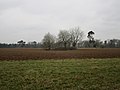
 A field with sheep in it - geograph.org.uk - 4682836.jpg 1 600 × 1 066 ; 384 kio
-
 Allotments near Hethe - geograph.org.uk - 2736743.jpg 640 × 480 ; 77 kio
-
 Allotments, Hethe - geograph.org.uk - 5178495.jpg 1 024 × 768 ; 232 kio
-
 Autumn colour in Willaston Park - geograph.org.uk - 5178510.jpg 1 024 × 768 ; 167 kio
-
 Autumn, Willaston Park - geograph.org.uk - 5178519.jpg 1 024 × 768 ; 298 kio
-
 Bainton Road from Hethe - geograph.org.uk - 6165326.jpg 2 700 × 2 025 ; 279 kio
-
 Barley and bridleway to Stoke Lyne - geograph.org.uk - 5811371.jpg 1 600 × 1 066 ; 533 kio
-
 Behind Holy Trinity Church - geograph.org.uk - 4682847.jpg 1 600 × 1 045 ; 484 kio
-
 Bridleway crosses Featherbed Lane - geograph.org.uk - 5131408.jpg 1 600 × 1 066 ; 444 kio
-
 Bridleway to Cottisford - geograph.org.uk - 4384475.jpg 1 024 × 768 ; 216 kio
-
 Bridleway to Newton Purcell - geograph.org.uk - 2416471.jpg 640 × 475 ; 148 kio
-
 Bridleway to Newton Purcell - geograph.org.uk - 4387354.jpg 1 024 × 768 ; 180 kio
-
 Bridleway to Newton Purcell - geograph.org.uk - 5131403.jpg 1 600 × 1 066 ; 498 kio
-
 Bridleway to The Belt - geograph.org.uk - 5131405.jpg 1 600 × 1 066 ; 665 kio
-
 Bridleway towards Shelswell Plantation - geograph.org.uk - 5131396.jpg 1 600 × 1 066 ; 618 kio
-
 Byway through the park at Willaston - geograph.org.uk - 5178507.jpg 1 024 × 768 ; 227 kio
-
 Byway to Newton Morrell - geograph.org.uk - 5175633.jpg 1 024 × 768 ; 244 kio
-
 Byway to the left footpath straight ahead - geograph.org.uk - 2736709.jpg 640 × 480 ; 74 kio
-

-

-

-
 Cherwell Churches Christmas chug through (78) - geograph.org.uk - 6355392.jpg 640 × 480 ; 108 kio
-

-

-

-

-

-

-

-

-
 Direction Sign – Signpost - geograph.org.uk - 6565196.jpg 640 × 960 ; 148 kio
-
 Entrance to Willaston Farm - geograph.org.uk - 4699703.jpg 1 600 × 1 066 ; 598 kio
-
 Footpath to Cottisford - geograph.org.uk - 5811259.jpg 1 600 × 1 066 ; 430 kio
-
 Footpath to Wilaston Farm - geograph.org.uk - 5131390.jpg 1 600 × 1 066 ; 478 kio
-
 Footpath to Willaston and Willaston Spinney - geograph.org.uk - 6274729.jpg 1 600 × 1 066 ; 392 kio
-
 Hethe Allotments - geograph.org.uk - 5811333.jpg 1 600 × 1 066 ; 456 kio
-
 Hethe Road, Cottisford - geograph.org.uk - 6652016.jpg 1 787 × 1 173 ; 1,67 Mio
-
 Isolated clump of trees - geograph.org.uk - 4387348.jpg 1 024 × 768 ; 126 kio
-
 Ivy covered cottage, Hethe - geograph.org.uk - 1416399.jpg 640 × 480 ; 106 kio
-
 Main Street Hethe - geograph.org.uk - 2736737.jpg 640 × 480 ; 93 kio
-
 Main Street in Hethe - geograph.org.uk - 6165322.jpg 2 700 × 2 025 ; 526 kio
-
 Main Street in Hethe - geograph.org.uk - 6165324.jpg 2 700 × 2 025 ; 369 kio
-
 Orchard in Shelswell Park - geograph.org.uk - 5131389.jpg 1 600 × 1 066 ; 424 kio
-
 Oven at the Pub - geograph.org.uk - 4694662.jpg 4 000 × 2 664 ; 3,63 Mio
-
 Pine trees near Hethe - geograph.org.uk - 5178500.jpg 1 024 × 768 ; 221 kio
-
 Poppies by the bridleway into Hethe - geograph.org.uk - 5811342.jpg 1 600 × 1 066 ; 561 kio
-
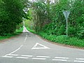
 Road from Fringford towards Cottisford and beyond - geograph.org.uk - 6579279.jpg 1 024 × 684 ; 345 kio
-
 Road from Fringford towards Cottisford and beyond - geograph.org.uk - 6579295.jpg 1 024 × 684 ; 506 kio
-
 Road uphill from Fringford Bridge - geograph.org.uk - 6579269.jpg 1 024 × 684 ; 353 kio
-
 Silver Birches at Willaston - geograph.org.uk - 4683829.jpg 4 000 × 2 664 ; 2,23 Mio
-
 Tangley Farm - geograph.org.uk - 5811346.jpg 1 600 × 1 066 ; 294 kio
-
 The drive to Willaston Farm House - geograph.org.uk - 5175636.jpg 1 024 × 768 ; 250 kio
-
 The Entrance to Featherbed Lane - geograph.org.uk - 2416442.jpg 640 × 480 ; 112 kio
-
 The entrance to Willaston Farm, Hethe - geograph.org.uk - 6636524.jpg 1 920 × 1 280 ; 1,13 Mio
-
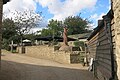
 The Muddy Duck, Hethe - geograph.org.uk - 4683871.jpg 3 738 × 2 084 ; 1,48 Mio
-
 Town Well, Hethe - geograph.org.uk - 4683840.jpg 4 000 × 2 664 ; 2,58 Mio
-
 Trees ^ Sky - geograph.org.uk - 2713464.jpg 4 272 × 2 848 ; 5,14 Mio
-
 Warins Barn - geograph.org.uk - 2736693.jpg 640 × 480 ; 127 kio
-
 Willaston Farm - geograph.org.uk - 2736716.jpg 640 × 480 ; 77 kio
-
 Willaston Farm - geograph.org.uk - 5178504.jpg 1 024 × 768 ; 129 kio
-
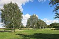
 Willaston Park in the autumn - geograph.org.uk - 5178514.jpg 1 024 × 768 ; 259 kio
-
 Willows by the stream - geograph.org.uk - 5811264.jpg 1 600 × 1 066 ; 482 kio
-
 Woolly hedge by the footpath into Hethe - geograph.org.uk - 5811250.jpg 1 600 × 1 066 ; 456 kio
-
 Yew berries - geograph.org.uk - 5178491.jpg 1 024 × 768 ; 190 kio
-
 Footpath to Cottisford - geograph.org.uk - 559670.jpg 640 × 480 ; 125 kio
-
 Hardwick - geograph.org.uk - 344222.jpg 640 × 480 ; 70 kio
-
 Hardwick Church sign - geograph.org.uk - 344215.jpg 640 × 480 ; 115 kio
-
 Hethe - geograph.org.uk - 344226.jpg 640 × 480 ; 82 kio
-
 Hethe Lodge - geograph.org.uk - 344211.jpg 640 × 480 ; 115 kio
-
 North lodge, Shelswell Park - geograph.org.uk - 559662.jpg 640 × 480 ; 137 kio
-
 Outbuilding of Home Farm - geograph.org.uk - 464844.jpg 640 × 425 ; 74 kio
-
 River at Hethe Brede - geograph.org.uk - 398489.jpg 640 × 480 ; 120 kio
-
 Road near Cottisford - geograph.org.uk - 393605.jpg 640 × 427 ; 145 kio
-
 Road the Hethe - geograph.org.uk - 344229.jpg 480 × 640 ; 72 kio
-
 Shelswell Park - geograph.org.uk - 398475.jpg 640 × 480 ; 69 kio
-
 Signs on the road near Cottisford - geograph.org.uk - 393586.jpg 640 × 443 ; 117 kio
-
 Willaston Farm Outbuildings - geograph.org.uk - 99613.jpg 480 × 640 ; 116 kio
-
 Woodland stream near Cottisford - geograph.org.uk - 393597.jpg 640 × 427 ; 167 kio


_-_geograph.org.uk_-_6355386.jpg)
_-_geograph.org.uk_-_6355387.jpg)
_-_geograph.org.uk_-_6355389.jpg)
_-_geograph.org.uk_-_6355392.jpg)
_-_geograph.org.uk_-_6355396.jpg)
_-_geograph.org.uk_-_6355397.jpg)
_-_geograph.org.uk_-_6355400.jpg)
_-_geograph.org.uk_-_6355404.jpg)
_-_geograph.org.uk_-_6355406.jpg)
_-_geograph.org.uk_-_6355408.jpg)
_-_geograph.org.uk_-_6355410.jpg)
_-_geograph.org.uk_-_6355412.jpg)


