Category:High Hoyland
Aller à la navigation
Aller à la recherche
English: High Hoyland is a village and civil parish in the Metropolitan Borough of Barnsley in South Yorkshire, England, on the border with West Yorkshire. It lies to the west of Kexbrough, and is located at approximately , at an elevation of around 200 metres above sea level. At the 2001 census it had a population of 142.
Nederlands: High Hoyland is een dorp (village) en civil parish in het bestuurlijke gebied Barnsley, in het Engelse graafschap South Yorkshire. De civil parish telt
village britannique  | |||||
| Téléverser des médias | |||||
| Nature de l’élément | |||||
|---|---|---|---|---|---|
| Lieu | district métropolitain de Barnsley, Yorkshire du Sud, Yorkshire-et-Humber, Angleterre | ||||
| Population |
| ||||
 | |||||
Sous-catégories
Cette catégorie comprend 4 sous-catégories, dont les 4 ci-dessous.
Média dans la catégorie « High Hoyland »
Cette catégorie comprend 198 fichiers, dont les 198 ci-dessous.
-
 "Red Slate Line" by Richard Long - geograph.org.uk - 4441590.jpg 533 × 800 ; 179 kio
-
 "Red Slate Line" by Richard Long - geograph.org.uk - 4441599.jpg 552 × 800 ; 238 kio
-
 "Wave" at The Yorkshire Sculpture Park - geograph.org.uk - 4708361.jpg 5 015 × 3 788 ; 5,03 Mio
-
 'Eddy' - geograph.org.uk - 6278493.jpg 640 × 480 ; 143 kio
-
 'Wilsis' by Jaume Plensa - geograph.org.uk - 6642153.jpg 480 × 640 ; 101 kio
-
 A dew pond on Hoyland Hill - geograph.org.uk - 758694.jpg 640 × 480 ; 67 kio
-
 A Happy Family At Dean Hill Farm - geograph.org.uk - 1181078.jpg 640 × 447 ; 66 kio
-
 A leaf litter, litter picker - geograph.org.uk - 783577.jpg 640 × 480 ; 59 kio
-
 A pair of winter trees near Jebb Lane - geograph.org.uk - 3264104.jpg 1 024 × 727 ; 170 kio
-
 A sculpted tree stump - geograph.org.uk - 284804.jpg 480 × 640 ; 170 kio
-
 Across the lake - geograph.org.uk - 4660182.jpg 640 × 427 ; 90 kio
-
 Across the Lower Lake - geograph.org.uk - 4660190.jpg 640 × 427 ; 86 kio
-
 An ex-exhibit of YSP - geograph.org.uk - 5277635.jpg 658 × 1 024 ; 243 kio
-
 Bank End Lane High Hoyland - geograph.org.uk - 4691221.jpg 1 024 × 768 ; 266 kio
-
 Barbed wire fence - geograph.org.uk - 1046011.jpg 640 × 402 ; 77 kio
-
 Barnsley Boundary Walk below Litherop Road - geograph.org.uk - 859867.jpg 640 × 480 ; 87 kio
-
 Barnsley Boundary Walk towards West Bretton - geograph.org.uk - 2791081.jpg 640 × 426 ; 74 kio
-
 Benchmark on gate post High Hoyland - geograph.org.uk - 2837879.jpg 1 600 × 1 342 ; 781 kio
-
 Bluebells in Bath Wood - geograph.org.uk - 5391799.jpg 800 × 600 ; 239 kio
-
 Bluebells in Bath Wood - geograph.org.uk - 5391801.jpg 600 × 800 ; 219 kio
-
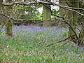 Bluebells in Round Wood - geograph.org.uk - 1579583.jpg 640 × 480 ; 116 kio
-
 Bretton Country Park seen from Jebb Lane - geograph.org.uk - 5263956.jpg 4 544 × 3 357 ; 3,6 Mio
-
 Bretton country park. - geograph.org.uk - 2802814.jpg 640 × 326 ; 31 kio
-
 Bretton Hall - geograph.org.uk - 4750479.jpg 1 024 × 528 ; 151 kio
-
 Bridge from the stepping stones - geograph.org.uk - 4660179.jpg 640 × 427 ; 144 kio
-
 Bridleway to Bretton Hall - geograph.org.uk - 4691217.jpg 1 024 × 768 ; 157 kio
-
 Bridleway, High Hoyland - geograph.org.uk - 730209.jpg 640 × 480 ; 153 kio
-
 Buddha, Yorkshire Sculpture Park - geograph.org.uk - 5826299.jpg 1 067 × 1 600 ; 807 kio
-
 Canada Geese at Bretton Country Park - geograph.org.uk - 5520026.jpg 429 × 640 ; 85 kio
-
 Cascade Bridge - geograph.org.uk - 5830457.jpg 1 024 × 683 ; 639 kio
-
 Cascade Bridge and weir, Bretton Country Park - geograph.org.uk - 5835127.jpg 1 067 × 1 600 ; 751 kio
-
 Cascading poppies and the Lower Lake - geograph.org.uk - 4660175.jpg 640 × 427 ; 93 kio
-
 Cawthorne Park and Upper Field Lane - geograph.org.uk - 180462.jpg 640 × 480 ; 156 kio
-
 Church Lane High Hoyland - geograph.org.uk - 546063.jpg 640 × 480 ; 90 kio
-
 Church of All Hallows, High Hoyland - geograph.org.uk - 6337515.jpg 600 × 800 ; 155 kio
-
 Cows near Long Side - geograph.org.uk - 4604315.jpg 3 794 × 4 946 ; 4,98 Mio
-
 Dam Head Bridge - geograph.org.uk - 4660191.jpg 640 × 427 ; 82 kio
-
 Dead tree on Upper Field Lane - geograph.org.uk - 1046019.jpg 413 × 640 ; 80 kio
-
 Edge of Rushworth Plantation - geograph.org.uk - 4604305.jpg 5 184 × 3 888 ; 6,4 Mio
-
 Elizabeth II postbox on High Hoyland Lane, High Hoyland - geograph.org.uk - 6340212.jpg 2 864 × 4 423 ; 4,22 Mio
-
 Enclosing Outclosure - geograph.org.uk - 3936408.jpg 800 × 533 ; 103 kio
-
 Entering High Hoyland from Church Lane - geograph.org.uk - 782533.jpg 640 × 480 ; 123 kio
-
 Entrance to woodland off Upper Field Lane - geograph.org.uk - 3677873.jpg 1 600 × 1 200 ; 966 kio
-
 Farm Track From Litherop Road - geograph.org.uk - 574841.jpg 640 × 480 ; 99 kio
-
 Farmland and woodland near High Hoyland - geograph.org.uk - 6337497.jpg 800 × 600 ; 146 kio
-
 Farmland near High hoyland. - geograph.org.uk - 2802819.jpg 640 × 368 ; 31 kio
-

-
 Field gate on Upper Field Lane - geograph.org.uk - 2621825.jpg 1 024 × 768 ; 221 kio
-
 Field off Jebb Lane - geograph.org.uk - 6337516.jpg 800 × 600 ; 120 kio
-
 Footpath to Dean Hill - geograph.org.uk - 6337489.jpg 800 × 600 ; 103 kio
-
 Former pond south of Bretton Hall lakes - geograph.org.uk - 4604320.jpg 5 184 × 3 888 ; 6,61 Mio
-
 Former Primitive Methodist Chapel, High Hoyland - geograph.org.uk - 6337494.jpg 800 × 600 ; 170 kio
-
 Former Primitive Methodist Chapel, High Hoyland - geograph.org.uk - 6337495.jpg 800 × 569 ; 151 kio
-
 From Longside, across the valley - geograph.org.uk - 1549248.jpg 640 × 480 ; 59 kio
-
 Gateway, Bretton Park - geograph.org.uk - 6011132.jpg 1 280 × 960 ; 370 kio
-
 Grass field north of Upper Field Lane - geograph.org.uk - 2621830.jpg 1 024 × 768 ; 168 kio
-
 Grazing near High Hoyland - geograph.org.uk - 5260942.jpg 4 540 × 3 293 ; 3,32 Mio
-
 Grazing near Kexbrough - geograph.org.uk - 5260947.jpg 4 608 × 3 456 ; 4 Mio
-
 Grazing off Upper Field Lane - geograph.org.uk - 6337507.jpg 800 × 600 ; 93 kio
-
 Grazing towards woodland - geograph.org.uk - 6337486.jpg 800 × 600 ; 130 kio
-
 Green Acre Pond - geograph.org.uk - 2741331.jpg 640 × 426 ; 95 kio
-
 Green Acre Pond by Jebb Lane - geograph.org.uk - 5263960.jpg 4 608 × 3 456 ; 4,1 Mio
-
 Harvest time at High Hoyland - geograph.org.uk - 4604443.jpg 4 928 × 3 759 ; 4,64 Mio
-
 Hedge-side field path near High Hoyland - geograph.org.uk - 5717289.jpg 4 000 × 3 000 ; 4,64 Mio
-
 High Hoyland - geograph.org.uk - 1012589.jpg 640 × 469 ; 52 kio
-
 High Hoyland - geograph.org.uk - 758648.jpg 640 × 480 ; 83 kio
-
 High Hoyland from Hoyland Bank Bridleway - geograph.org.uk - 859849.jpg 640 × 480 ; 95 kio
-
 High Hoyland Lane - geograph.org.uk - 6337487.jpg 800 × 600 ; 112 kio
-
 High Hoyland Lane, High Hoyland - geograph.org.uk - 6337506.jpg 800 × 600 ; 93 kio
-
 High Hoyland Lane, High Hoyland - geograph.org.uk - 6340213.jpg 5 184 × 3 888 ; 5,11 Mio
-
 High Hoyland Lane, High Hoyland - geograph.org.uk - 6489663.jpg 2 000 × 1 380 ; 1,33 Mio
-
 High Hoyland looking towards the pennines - geograph.org.uk - 1210306.jpg 640 × 439 ; 72 kio
-
 High Hoyland Village - geograph.org.uk - 546053.jpg 640 × 480 ; 68 kio
-
 High Hoyland Village.jpg 2 032 × 1 524 ; 578 kio
-
 House on High Hoyland Lane - geograph.org.uk - 6337493.jpg 800 × 600 ; 159 kio
-
 Houses on High Hoyland Lane, High Hoyland - geograph.org.uk - 6337505.jpg 800 × 600 ; 151 kio
-
 Houses, High Hoyland - geograph.org.uk - 6337491.jpg 800 × 558 ; 143 kio
-
 Hoyland Bank and High Hoyland Church - geograph.org.uk - 4709416.jpg 3 888 × 5 184 ; 5,28 Mio
-
 Hoyland Bank bridleway - geograph.org.uk - 782559.jpg 640 × 480 ; 165 kio
-
 Hoyland Hall, High Hoyland - geograph.org.uk - 4604303.jpg 4 992 × 3 744 ; 5,02 Mio
-
 Hyacinthoides in Hoyland Bank Wood - geograph.org.uk - 782547.jpg 640 × 480 ; 147 kio
-
 Jebb Lane - Longside Gallery - geograph.org.uk - 1152681.jpg 480 × 640 ; 108 kio
-

-
 Jebb Lane, Long Side - geograph.org.uk - 6337517.jpg 800 × 600 ; 149 kio
-
 Jubb Lane, High Hoyland - geograph.org.uk - 726113.jpg 640 × 452 ; 68 kio
-
 Junction of Litherop Lane and Jebb Lane - geograph.org.uk - 3677867.jpg 1 600 × 1 200 ; 695 kio
-
 Lady Eglinton's Well - geograph.org.uk - 6263409.jpg 1 024 × 683 ; 294 kio
-
 Lady Eglinton's Well, Bretton Country Park - geograph.org.uk - 5520046.jpg 480 × 640 ; 131 kio
-
 Lady Eglintown's Well - geograph.org.uk - 6011244.jpg 960 × 1 280 ; 519 kio
-
 Litherop Lane bridge - geograph.org.uk - 2250087.jpg 1 024 × 768 ; 194 kio
-
 Litherop Lane, metropolitan county boundary - geograph.org.uk - 2250102.jpg 1 024 × 768 ; 175 kio
-
 Lodge by Litherop Road, Bretton Country Park - geograph.org.uk - 3472701.jpg 640 × 480 ; 407 kio
-
 Lodge, Litherop Lane,High Hoyland - geograph.org.uk - 726098.jpg 640 × 422 ; 57 kio
-
 Long shadows cast by Round Wood - geograph.org.uk - 5138987.jpg 1 024 × 768 ; 112 kio
-
 Long Side Gallery - geograph.org.uk - 1152974.jpg 640 × 480 ; 78 kio
-
 Long Side, Bretton Country Park - geograph.org.uk - 3092669.jpg 640 × 427 ; 323 kio
-
 Longside Gallery - geograph.org.uk - 1261308.jpg 640 × 480 ; 101 kio
-
 Longside Gallery - geograph.org.uk - 3677871.jpg 1 600 × 1 200 ; 377 kio
-
 Looking north from Jebb Lane - geograph.org.uk - 4604308.jpg 5 033 × 3 583 ; 4,82 Mio
-
 Low water in YSP's Lower Lake - geograph.org.uk - 4875043.jpg 1 024 × 768 ; 531 kio
-
 Lower Lake - geograph.org.uk - 4660167.jpg 640 × 427 ; 89 kio
-
 Lower Lake - geograph.org.uk - 4660185.jpg 640 × 427 ; 97 kio
-
 Lower Lake at Bretton Country Park - geograph.org.uk - 4197626.jpg 1 024 × 713 ; 777 kio
-
 Lower Lake, Bretton Country Park - geograph.org.uk - 5830392.jpg 1 000 × 750 ; 701 kio
-
 Molehills in farmland north of Jebb Lane - geograph.org.uk - 3264091.jpg 1 024 × 768 ; 128 kio
-
 Network - geograph.org.uk - 6263556.jpg 683 × 1 024 ; 377 kio
-
 New Road at Hoyland Hill entering High Hoyland - geograph.org.uk - 5717282.jpg 4 000 × 3 000 ; 3,24 Mio
-
 Ordnance Survey Cut Mark - geograph.org.uk - 5717375.jpg 4 000 × 3 000 ; 2,66 Mio
-
 Outclosure - geograph.org.uk - 3936403.jpg 800 × 533 ; 187 kio
-
 Path in Yorkshire Sculpture Park - geograph.org.uk - 4943153.jpg 640 × 480 ; 78 kio
-
 Path south of Menagerie Wood - geograph.org.uk - 4604336.jpg 5 184 × 3 888 ; 6,69 Mio
-
 Path through the trees - geograph.org.uk - 3936418.jpg 533 × 800 ; 209 kio
-
 Path to Long Side - geograph.org.uk - 5926079.jpg 640 × 360 ; 86 kio
-
 Plantation on a bank below Litherop Road - geograph.org.uk - 3472693.jpg 640 × 480 ; 454 kio
-
 Pony and trap, High Hoyland - geograph.org.uk - 236397.jpg 640 × 437 ; 41 kio
-
 Poppies - geograph.org.uk - 3574067.jpg 1 024 × 683 ; 125 kio
-
 Poppies in a sugar beet field - geograph.org.uk - 4604329.jpg 3 694 × 4 712 ; 5,07 Mio
-
 Poppies on the bridleway over Cascade Bridge - geograph.org.uk - 4691205.jpg 1 024 × 768 ; 277 kio
-
 Poppies-Wave glimpsed through the trees - geograph.org.uk - 4656441.jpg 800 × 533 ; 211 kio
-
 Poppy by the way-side - geograph.org.uk - 3574066.jpg 1 024 × 683 ; 180 kio
-
 Road junction and footpath sign near High Hoyland - geograph.org.uk - 4267425.jpg 768 × 1 024 ; 144 kio
-
 Round Wood viewed from Jebb Lane - geograph.org.uk - 5263963.jpg 4 608 × 3 456 ; 3,97 Mio
-
 Seventy-One Steps - geograph.org.uk - 3936421.jpg 533 × 800 ; 180 kio
-
 Shaded field, north of Round Wood - geograph.org.uk - 5138990.jpg 1 024 × 768 ; 203 kio
-
 Sheep grazing ,Bretton Park. - geograph.org.uk - 1153085.jpg 640 × 480 ; 95 kio
-
 Sheep in October sunshine - geograph.org.uk - 4709401.jpg 3 888 × 5 184 ; 6,01 Mio
-
 Sign for the Cherry Tree, High Hoyland - geograph.org.uk - 6337504.jpg 455 × 800 ; 85 kio
-
 Speed Breakers - geograph.org.uk - 5924876.jpg 640 × 427 ; 163 kio
-
 Spring lambs on Hoyland Hill - geograph.org.uk - 2846140.jpg 1 024 × 768 ; 216 kio
-
 Stepping Stones and Lower Lake, Bretton Country Park - geograph.org.uk - 6571768.jpg 1 024 × 683 ; 338 kio
-
 Stream next to High Hoyland Lane, High Hoyland - geograph.org.uk - 6489705.jpg 2 000 × 1 500 ; 1,98 Mio
-
 The Cherry Tree Inn High Hoyland - geograph.org.uk - 4691219.jpg 1 024 × 768 ; 117 kio
-
 The Cherry Tree Public House in High Hoyland - geograph.org.uk - 5260938.jpg 4 608 × 3 456 ; 3,74 Mio
-
 The Cherry Tree, High Hoyland - geograph.org.uk - 3677857.jpg 1 600 × 1 200 ; 371 kio
-
 The Cherry Tree, High Hoyland - geograph.org.uk - 6337503.jpg 800 × 559 ; 78 kio
-
 The edge of Oxley Bank Wood - geograph.org.uk - 6011237.jpg 1 280 × 960 ; 449 kio
-
 The Hall - geograph.org.uk - 681544.jpg 640 × 477 ; 86 kio
-
 The Hall at High Hoyland - geograph.org.uk - 2438553.jpg 1 299 × 1 009 ; 427 kio
-
 The Hall at High Hoyland - geograph.org.uk - 2846127.jpg 768 × 1 024 ; 285 kio
-
 The Hall, High Hoyland - geograph.org.uk - 6337514.jpg 800 × 522 ; 158 kio
-
 The Hall, High Hoyland, near Barnsley, South Yorkshire - geograph.org.uk - 2845590.jpg 4 000 × 2 248 ; 2,16 Mio
-
 The Lower Lake at Yorkshire Sculpture Park - geograph.org.uk - 3936427.jpg 800 × 541 ; 50 kio
-
 The Old School House, High Hoyland - geograph.org.uk - 6546672.jpg 1 984 × 1 488 ; 691 kio
-
 The Upper Lake at Yorkshire Sculpture Park - geograph.org.uk - 6280478.jpg 640 × 480 ; 114 kio
-
 The wave of Poppies over Cascade Bridge - geograph.org.uk - 4691215.jpg 768 × 1 024 ; 351 kio
-
 Through a folly to Cannon Hall Country Park - geograph.org.uk - 284915.jpg 480 × 640 ; 84 kio
-
 Towards Red Slate Line - geograph.org.uk - 5830449.jpg 1 024 × 683 ; 770 kio
-
 Track beside woodland - geograph.org.uk - 6337551.jpg 600 × 800 ; 236 kio
-
 Track into Cawthorne Park - geograph.org.uk - 1046014.jpg 640 × 487 ; 135 kio
-

-
 Track through Cawthorne Park Wood - geograph.org.uk - 2621821.jpg 1 024 × 768 ; 224 kio
-
 Tree in a field - geograph.org.uk - 5926074.jpg 640 × 360 ; 87 kio
-
 Triple strength field boundary, off Upper Field Lane - geograph.org.uk - 2621834.jpg 1 024 × 768 ; 153 kio
-
 Upper Field Lane - geograph.org.uk - 2621811.jpg 1 024 × 768 ; 247 kio
-
 Upper Field Lane - geograph.org.uk - 6337508.jpg 800 × 600 ; 187 kio
-

-
 Upper Field Lane, High Hoyland - geograph.org.uk - 787030.jpg 640 × 480 ; 75 kio
-
 Upper Lake through the trees - geograph.org.uk - 5830421.jpg 1 024 × 683 ; 725 kio
-
 View from High Hoyland - geograph.org.uk - 1012581.jpg 640 × 480 ; 57 kio
-
 View from High Hoyland over to Barnsley - geograph.org.uk - 1210345.jpg 640 × 480 ; 63 kio
-
 View from High Hoyland over to Grenoside - geograph.org.uk - 1210347.jpg 640 × 480 ; 55 kio
-
 View from High Hoyland over to Pennines - geograph.org.uk - 1210349.jpg 640 × 477 ; 55 kio
-
 View from Oxley Bank - geograph.org.uk - 6011203.jpg 1 280 × 960 ; 237 kio
-
 View From The Hall in High Hoyland - geograph.org.uk - 5260930.jpg 4 608 × 3 456 ; 3,71 Mio
-
 View from the Longside Gallery - geograph.org.uk - 6011133.jpg 1 280 × 960 ; 382 kio
-
 View over the Lower Lake in Bretton Country Park - geograph.org.uk - 6642154.jpg 640 × 480 ; 141 kio
-
 Waiting for a boat^ - geograph.org.uk - 6011122.jpg 1 280 × 866 ; 386 kio
-
 Weir, Lower Lake, Bretton Country Park - geograph.org.uk - 5830460.jpg 1 000 × 750 ; 1 006 kio
-
 Winter Hill Farm - geograph.org.uk - 3677862.jpg 1 600 × 1 200 ; 576 kio
-
 Winter Hill Farm, High Hoyland - geograph.org.uk - 40773.jpg 640 × 480 ; 100 kio
-
 Winter trees on Jebb Lane - geograph.org.uk - 3264086.jpg 1 024 × 768 ; 156 kio
-
 Winter trees on the south side of the Dearne valley - geograph.org.uk - 3264096.jpg 1 024 × 768 ; 135 kio
-
 Winter Wonderland - geograph.org.uk - 1165817.jpg 640 × 480 ; 67 kio
-
 Wooded footpath heading towards Winter Hill - geograph.org.uk - 5717296.jpg 4 000 × 3 000 ; 5,33 Mio
-
 Woodland on Oxley Bank. - geograph.org.uk - 6315020.jpg 1 024 × 768 ; 323 kio
-
 Woodland, Litherop Lane, High Hoyland - geograph.org.uk - 726107.jpg 640 × 480 ; 143 kio
-
 Yorkshire Sculpture Park - geograph.org.uk - 6553784.jpg 1 024 × 852 ; 214 kio
-
 Yorkshire Sculpture Park - Inside to Outside - geograph.org.uk - 6011136.jpg 1 500 × 683 ; 212 kio
-
 Yorkshire Sculpture Park - Outside to Inside^ - geograph.org.uk - 6011137.jpg 1 500 × 933 ; 397 kio
-
 Yorkshire Sculpture Park, 'Outclosure' - geograph.org.uk - 6011141.jpg 1 280 × 960 ; 662 kio
-
 Yorkshire Sculpture Park, 'Seventy-one Steps' - geograph.org.uk - 6011223.jpg 939 × 1 280 ; 485 kio
-
 Yorkshire Sculpture Park, 'Speed breakers' - geograph.org.uk - 6011217.jpg 960 × 1 280 ; 612 kio
-
 Yorkshire Sculpture Park, Upper Lake - geograph.org.uk - 5837831.jpg 1 280 × 960 ; 657 kio
-
 Yorkshire Sculpture Park, Upper Lake - geograph.org.uk - 5837864.jpg 1 280 × 960 ; 435 kio
-
 Cannon Hall - geograph.org.uk - 95721.jpg 640 × 480 ; 87 kio
-
 Cannon Hall Country Park - geograph.org.uk - 95725.jpg 640 × 480 ; 93 kio
-
 Fields and building site - geograph.org.uk - 371789.jpg 640 × 480 ; 87 kio
-
 Footpath to High Hoyland - geograph.org.uk - 86952.jpg 640 × 480 ; 144 kio
-
 Footpath up to Toppit Farm - geograph.org.uk - 95980.jpg 640 × 480 ; 101 kio
-
 High Hoyland House - geograph.org.uk - 40781.jpg 640 × 480 ; 114 kio
-
 Houses in Bilham Lane, Clayton West - geograph.org.uk - 39001.jpg 640 × 480 ; 93 kio
-
 Jebb Lane - geograph.org.uk - 86946.jpg 640 × 480 ; 130 kio
-
 Looking down Jebb Lane - geograph.org.uk - 86948.jpg 640 × 480 ; 139 kio
-
 Path to Deffer Wood - geograph.org.uk - 95967.jpg 640 × 480 ; 124 kio
-
 The Cherry Tree - geograph.org.uk - 371541.jpg 640 × 480 ; 56 kio
-
 Tower Cott, near Cannon Hall - geograph.org.uk - 284789.jpg 640 × 480 ; 129 kio
-
 Tower Cottage - geograph.org.uk - 371571.jpg 640 × 480 ; 110 kio
-
 Upper Field Lane - geograph.org.uk - 371538.jpg 640 × 480 ; 71 kio


