Category:Hiking in Australia
Zur Navigation springen
Zur Suche springen
Staaten in Ozeanien: Australien · Neuseeland · Papua-Neuguinea
Weitere Gebiete: Hawaii · Neukaledonien – Partly: Indonesien
Weitere Gebiete: Hawaii · Neukaledonien – Partly: Indonesien
Wikimedia-Kategorie | |||||
| Medium hochladen | |||||
| Ist ein(e) | |||||
|---|---|---|---|---|---|
| Kategorie kombiniert die Themen | |||||
 | |||||
Unterkategorien
Es werden 8 von insgesamt 8 Unterkategorien in dieser Kategorie angezeigt:
In Klammern die Anzahl der enthaltenen Kategorien (K), Seiten (S), Dateien (D)
Medien in der Kategorie „Hiking in Australia“
Folgende 71 Dateien sind in dieser Kategorie, von 71 insgesamt.
-
 .0 2144 Purnululu National Park - Hiking trails.jpg 1.867 × 2.800; 6,13 MB
-
 096 Waterloo Bay, Wilson's Prom., Jan 1979 (52096951975).jpg 2.560 × 1.920; 1,47 MB
-
 135 Mt Feathertop, Jan 79 (52116725964).jpg 1.920 × 2.560; 1,98 MB
-
 136 Mt Feathertop, Jan 79 (52117244918).jpg 2.560 × 1.920; 1,53 MB
-
 138 Mt Feathertop, Jan 79 (52116180182).jpg 2.560 × 1.920; 1,97 MB
-
 264 Victoria Falls Track, Oct 79 (52154486862).jpg 2.560 × 1.920; 1,3 MB
-
 269 National Pass, Wentworth Falls, Oct 79 (52157112721).jpg 1.920 × 2.272; 1,74 MB
-
 301 Newnes, Dec 79 (52166984551).jpg 1.920 × 2.560; 1,65 MB
-
 68-12 Tasmania trip 10 Cradle Mtn track, 1968 (51229866224).jpg 1.761 × 1.251; 465 KB
-
 68-12 Tasmania trip 6 Cradle Mtn track, 1968 (51230169210).jpg 2.235 × 1.713; 626 KB
-
 AAWT map Stevage.png 2.000 × 2.247; 2,22 MB
-
 Alligator Gorge, Mount Remarkable National Park. (The Narrows) 01.jpg 1.836 × 3.264; 1,47 MB
-
 Alligator Gorge, Mount Remarkable National Park. (The Narrows) 02.jpg 1.836 × 3.264; 999 KB
-
 Alligator Gorge, Mount Remarkable National Park. (The Narrows) 03.jpg 1.836 × 3.264; 1,18 MB
-
 AlligatorGorge1.JPG 2.292 × 3.056; 1,27 MB
-
 Another Bush Track c. 1860 (9836996343).jpg 4.762 × 6.094; 3,07 MB
-
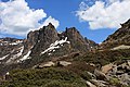
 Ascending Mt Feathertop Stevage.jpg 2.136 × 2.848; 1,44 MB
-
 Australian outback Rémi Camus 01.jpg 5.151 × 3.863; 1,95 MB
-
 Australian outback Rémi Camus top of Petermann Range.jpg 5.036 × 3.777; 1,35 MB
-
 Australian outback Rémi Camus under the car.jpg 5.184 × 2.916; 1,48 MB
-
 Bluff knoll-42.jpg 5.102 × 3.401; 3,02 MB
-
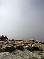
 Bushwalking in Kosciuszko National Park.jpg 1.024 × 768; 403 KB
-
 Bushwalking in the rain at Kosciuszko National Park.jpg 1.024 × 768; 523 KB
-

-
 Cape Byron walking trail.jpg 4.032 × 3.024; 2,89 MB
-
 Flat Rock Middle Harbour (11923540164).jpg 1.842 × 1.653; 263 KB
-
 Gap to gap4 - Christopher Watson.jpg 1.200 × 1.600; 530 KB
-
 Gap to gap5 - Christopher Watson.jpg 1.600 × 1.200; 471 KB
-
 Glenrock bush trail.JPG 1.280 × 960; 1,39 MB
-
 GlenrockCoalCuttingOnYuelarbahTrack.JPG 2.592 × 1.944; 2,24 MB
-
 GlenrockCoalLineOnYuelarbahTrack.JPG 2.592 × 1.944; 2,19 MB
-
 GlenrockLagoonFromLeichhardtLookout.JPG 2.592 × 1.944; 1,39 MB
-
 Grampians National Park hiking.jpg 5.472 × 3.648; 18,41 MB
-
 Grampians National Park Scenary.jpg 5.170 × 3.447; 15,04 MB
-
 Heysen Trail near Waitpinga.jpg 2.592 × 1.944; 2,45 MB
-
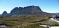
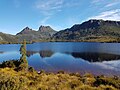 Hiking at Cradle Mountain, Lake St Clair National Park.jpg 4.032 × 3.024; 5,6 MB
-
 Hiking in Aus banner 1.jpg 2.135 × 305; 139 KB
-
 Hiking in Aus banner 2.jpg 1.024 × 146; 101 KB
-
 Hiking in Aus banner 3.jpg 2.592 × 370; 416 KB
-
 Hiking in the Stirling Ranges.jpg 750 × 562; 291 KB
-
 Hiking towards Cradle Mountain.jpg 4.048 × 1.935; 2,22 MB
-
 Mount Kosciuszko View.jpg 3.024 × 4.032; 2,17 MB
-
 Mount Kosciuszko Walk.jpg 4.496 × 3.000; 6,36 MB
-
 Mount Misery rainforest walking track.JPG 1.280 × 960; 993 KB
-
 Mount Ossa Tasmania 2.jpg 3.888 × 2.592; 4,8 MB
-
 Mount Shank Conservation Trail Mount Gambier South Australia.jpg 1.227 × 1.220; 834 KB
-
 Munster WA 6166, Australia - panoramio.jpg 3.072 × 2.304; 1,23 MB
-
 OBA2.jpg 2.048 × 1.536; 1,04 MB
-
 Ochre trail, Dryandra Woodland, November 2020.jpg 4.608 × 3.456; 6,13 MB
-
 Off For A Walk (137820113).jpeg 2.048 × 1.366; 1,63 MB
-
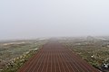
 Rain Forest Boardwalk (29679077283).jpg 5.760 × 3.840; 19,81 MB
-
 Rainforest walk (334979530).jpg 600 × 800; 175 KB
-
 River Crossing, Dwellingup, Western Australia.jpg 640 × 480; 150 KB
-
 River, Bibbulmun Track, Western Australia 08 (10).jpg 750 × 562; 261 KB
-
 Rob and the Typhoon - beaten forest.jpg 1.600 × 1.204; 592 KB
-

-
 StateLibQld 2 394129 Waterfall, Bunya Mountains, 1913.jpg 729 × 1.000; 174 KB
-
 StateLibQld 2 394141 Tree Fern Gully, Bunya Mountains, ca. 1920.jpg 622 × 1.000; 165 KB
-
 Stirling Ranges - Camp.jpg 750 × 1.000; 451 KB
-
 Tall Grass Tree, Bibbulmun Track, Western Australia 08 (20).jpg 750 × 1.000; 901 KB
-
 The track up - panoramio.jpg 800 × 1.200; 1,05 MB
-
 Toolbrunupnoodles.jpg 6.896 × 2.992; 7,05 MB
-
 Trail Blaze Australia.jpg 1.704 × 2.272; 970 KB
-
 Victorian Alps Mount Speculation 2.jpg 8.000 × 2.496; 11,64 MB
-
 Victorian Alps Mount Speculation 3.jpg 10.326 × 3.320; 18,09 MB
-
 Victorian Alps Mount Speculation 4.jpg 5.759 × 3.159; 7,88 MB
-
 Victorian Alps Mount Speculation 5.jpg 2.500 × 801; 924 KB
-
 Victorian Alps Mount Speculation 6.jpg 2.500 × 819; 895 KB
-
 View of Broker's Nose from old Balgownie mine.jpg 639 × 426; 36 KB
-
 Walk in the black bulga range.jpg 2.121 × 1.333; 1,94 MB
-
 Xanthorrhoea glauca.jpg 1.029 × 688; 371 KB

.jpg)
.jpg)
.jpg)
.jpg)
.jpg)
.jpg)
.jpg)
.jpg)
.jpg)

_01.jpg)
_02.jpg)
_03.jpg)

.jpg)


_(7701486584).jpg)

.jpg)


.jpeg)
.jpg)
.jpg)

.jpg)


.jpg)


