Category:Hindon, Wiltshire
Aller à la navigation
Aller à la recherche
village britannique  | |||||
| Téléverser des médias | |||||
| Nature de l’élément | |||||
|---|---|---|---|---|---|
| Lieu | Wiltshire, Angleterre du Sud-Ouest, Angleterre | ||||
 | |||||
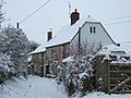
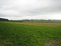
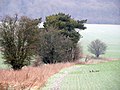
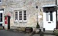
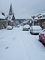
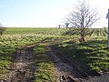
English: Hindon is a medium-sized village in Wiltshire, England, west of Salisbury and 9.6 miles (15.4 kms) south of Warminster. It lies within the Cranborne Chase and West Wiltshire Downs Area of Outstanding Natural Beauty (AONB). Formerly a thriving small town with its own market, Hindon is now a quiet country village, favoured by commuters, retirees and weekenders. Its current population is around 500 people.
Suomi: Hindon keskikokoinen kylä Englannin Wiltshiressa 26 km Salisburysta länteen ja 11 km Warminsterista etelään. Se on alueella, joka on määritelty erityisen luonnonkauniiksi (AONB) Se oli aiemmin menestyvä pikku kaupunki, jossa oli oma tori, mutta nyt se on hiljainen maalaiskylä, jossa asuu muualla työssäkäyviä, eläkeläisiä ja lomanviettäjiä. Sen väkiluku on 500.
Sous-catégories
Cette catégorie comprend 3 sous-catégories, dont les 3 ci-dessous.
H
- Hindon War Memorial (2 F)
L
Média dans la catégorie « Hindon, Wiltshire »
Cette catégorie comprend 98 fichiers, dont les 98 ci-dessous.
-
 14 Says Cottages, Hindon - geograph.org.uk - 1704847.jpg 640 × 480 ; 122 kio
-
 17 and 19 Says Cottages, Hindon - geograph.org.uk - 1704860.jpg 640 × 480 ; 85 kio
-
 Allotments, Hindon - geograph.org.uk - 1704764.jpg 640 × 480 ; 84 kio
-
 Arable field, Hawking Down - geograph.org.uk - 2256549.jpg 640 × 480 ; 72 kio
-
 Baker's Arch, High Street, Hindon - geograph.org.uk - 1704689.jpg 480 × 640 ; 106 kio
-

-
 Byway in the allotments, Hindon - geograph.org.uk - 1704773.jpg 640 × 480 ; 87 kio
-
 Church of St John the Baptist, Hindon - geograph.org.uk - 6404621.jpg 3 776 × 2 520 ; 4,08 Mio
-
 Cock pheasant near Beacon Hill - geograph.org.uk - 359379.jpg 640 × 480 ; 163 kio
-
 Cottages in Hindon High Street - geograph.org.uk - 2676050.jpg 640 × 480 ; 98 kio
-
 Denland House, High Street, Hindon - geograph.org.uk - 1704697.jpg 640 × 480 ; 84 kio
-
 Dusk on the road south from Hindon - geograph.org.uk - 6404445.jpg 3 776 × 2 520 ; 3,3 Mio
-
 Entrance to muddy lane north of Hindon - geograph.org.uk - 6404631.jpg 3 401 × 2 291 ; 2,49 Mio
-
 Farmland and woods near Hindon - geograph.org.uk - 495981.jpg 640 × 480 ; 107 kio
-
 Farmland near Down Dairy - geograph.org.uk - 914318.jpg 640 × 480 ; 91 kio
-
 Farmland near Down Dairy 2 - geograph.org.uk - 914322.jpg 640 × 480 ; 67 kio
-
 Field and woods near Hindon - geograph.org.uk - 496006.jpg 640 × 480 ; 109 kio
-
 Field edge, Chicklade - geograph.org.uk - 2265955.jpg 640 × 482 ; 97 kio
-
 Footpath near Newtown - geograph.org.uk - 359352.jpg 640 × 480 ; 168 kio
-
 George VI postbox, Hindon - geograph.org.uk - 890921.jpg 480 × 640 ; 92 kio
-
 High Steps, High Street, Hindon - geograph.org.uk - 1704824.jpg 480 × 640 ; 99 kio
-
 High Street, Hindon - geograph.org.uk - 2012473.jpg 640 × 462 ; 261 kio
-
 High Street, Hindon - geograph.org.uk - 6404613.jpg 3 776 × 2 520 ; 4,18 Mio
-
 Baker's Arch, High Street, Hindon - geograph.org.uk - 1704837.jpg 640 × 480 ; 95 kio
-

-
 Hindon High Street - geograph.org.uk - 2676535.jpg 640 × 480 ; 79 kio
-
 Hindon playgound and High Street - geograph.org.uk - 1704749.jpg 640 × 480 ; 76 kio
-
 Hindon playground - geograph.org.uk - 1704742.jpg 640 × 480 ; 70 kio
-
 Hindon Post Office - geograph.org.uk - 299559.jpg 640 × 480 ; 125 kio
-
 Hindon village centre - geograph.org.uk - 2676844.jpg 640 × 480 ; 63 kio
-
 Hindon Village Hall - geograph.org.uk - 299484.jpg 480 × 640 ; 105 kio
-
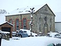 Old Methodist Chapel, Hindon - geograph.org.uk - 1704833.jpg 640 × 480 ; 70 kio
-
 Hindon, The Lamb Inn - geograph.org.uk - 2668832.jpg 1 200 × 795 ; 927 kio
-

-

-
 Lane from Newtown heading towards Hindon - geograph.org.uk - 6395801.jpg 5 184 × 3 456 ; 6,45 Mio
-
 Looking along the B3089 towards Hindon - geograph.org.uk - 2908793.jpg 1 024 × 768 ; 182 kio
-
 Looking down Hindon High Street - geograph.org.uk - 1704793.jpg 640 × 480 ; 65 kio
-

-
 Looking up School Lane from The Dene, Hindon - geograph.org.uk - 1704758.jpg 640 × 480 ; 67 kio
-
 Milestone with bench mark, Hindon - geograph.org.uk - 2309060.jpg 480 × 640 ; 101 kio
-
 Monarch's Way joins road east of Hindon - geograph.org.uk - 2908790.jpg 1 024 × 768 ; 186 kio
-
 Muck and Manure beside the Wessex Ridgeway - geograph.org.uk - 6396651.jpg 5 184 × 3 456 ; 5,47 Mio
-

-

-
 On the West Wiltshire Downs - geograph.org.uk - 6404639.jpg 3 776 × 2 520 ; 3,13 Mio
-
 Ox Drove - geograph.org.uk - 6396679.jpg 5 184 × 3 456 ; 4,22 Mio
-
 Passion Flower at Hindon - geograph.org.uk - 890935.jpg 640 × 480 ; 84 kio
-
 Playground - geograph.org.uk - 299474.jpg 640 × 480 ; 157 kio
-
 Road near Terrace Farm - geograph.org.uk - 914351.jpg 640 × 480 ; 139 kio
-
 Road near Terrace Farm 2 - geograph.org.uk - 914379.jpg 640 × 480 ; 126 kio
-
 Says Cottages, Hindon - geograph.org.uk - 1704842.jpg 480 × 640 ; 66 kio
-

-
 Shop on High Street, Hindon - geograph.org.uk - 5705143.jpg 2 048 × 1 536 ; 1,7 Mio
-
 Sign at the "Lamb Inn" at Hindon - geograph.org.uk - 3153716.jpg 600 × 800 ; 85 kio
-
 Sign for the Beckford Arms - geograph.org.uk - 689587.jpg 640 × 633 ; 115 kio
-
 Snowy garden gates, Hindon - geograph.org.uk - 1704879.jpg 640 × 480 ; 115 kio
-
 Squat Tower at Pinchers Hill, Hindon - geograph.org.uk - 299695.jpg 640 × 410 ; 156 kio
-
 The Angel Inn - geograph.org.uk - 299561.jpg 640 × 480 ; 81 kio
-

-
 The Lamb Inn sign at Hindon - geograph.org.uk - 2676615.jpg 480 × 640 ; 70 kio
-
 The Lamb, Hindon - geograph.org.uk - 5338981.jpg 640 × 428 ; 106 kio
-
 The north edge of Terrace Wood - geograph.org.uk - 6404437.jpg 3 776 × 2 520 ; 3,2 Mio
-
 The Old PO, Hindon, Wiltshire ... (4399455908).jpg 3 039 × 1 912 ; 4,02 Mio
-
 The Orange Way in Wiltshire (61) - geograph.org.uk - 3164720.jpg 800 × 600 ; 154 kio
-
 The Orange Way in Wiltshire (62) - geograph.org.uk - 3164725.jpg 800 × 600 ; 169 kio
-
 The Orange Way in Wiltshire (63) - geograph.org.uk - 3164762.jpg 800 × 600 ; 154 kio
-
 The Orange Way in Wiltshire (64) - geograph.org.uk - 3164787.jpg 800 × 703 ; 155 kio
-
 The Orange Way in Wiltshire (65) - geograph.org.uk - 3164821.jpg 800 × 600 ; 132 kio
-
 The Post Office at Hindon in Wiltshire ... (4399452570).jpg 3 072 × 2 304 ; 3,12 Mio
-
 The Wessex Ridgeway path leaving Hindon - geograph.org.uk - 6404624.jpg 3 776 × 2 520 ; 3,07 Mio
-
 Torrens - geograph.org.uk - 299647.jpg 640 × 480 ; 132 kio
-
 Twilight over Hindon - geograph.org.uk - 6395803.jpg 5 184 × 3 456 ; 6,01 Mio
-
 View down the High Street, Hindon - geograph.org.uk - 1704811.jpg 640 × 480 ; 75 kio
-
 View down the High Street, Hindon - geograph.org.uk - 1704872.jpg 480 × 640 ; 51 kio
-
 Wessex Ridgeway Crossing Cold Berwick Hill - geograph.org.uk - 6396649.jpg 5 184 × 3 456 ; 5,54 Mio
-
 Wessex Ridgeway descending to Chicklade Bottom - geograph.org.uk - 6396667.jpg 5 184 × 3 456 ; 5,42 Mio
-
 Wessex Ridgeway heading North East from Hindon - geograph.org.uk - 6396640.jpg 5 184 × 3 456 ; 6,6 Mio
-
 Wessex Ridgeway on High Street, Hindon - geograph.org.uk - 6396635.jpg 5 184 × 3 456 ; 6,81 Mio
-
 Approaching Hindon - geograph.org.uk - 458197.jpg 640 × 385 ; 38 kio
-
 Bends - geograph.org.uk - 299652.jpg 640 × 480 ; 96 kio
-
 Bridleway to Hindon - geograph.org.uk - 360237.jpg 640 × 480 ; 86 kio
-
 Byway to Hindon - geograph.org.uk - 360250.jpg 640 × 480 ; 125 kio
-
 Coach Cottage - geograph.org.uk - 299648.jpg 640 × 480 ; 145 kio
-
 Coaching Inn - geograph.org.uk - 299637.jpg 640 × 480 ; 98 kio
-
 Cottage in White Mead Wood, Newtown - geograph.org.uk - 359370.jpg 640 × 480 ; 176 kio
-
 Everything You Need^ - geograph.org.uk - 299642.jpg 640 × 480 ; 125 kio
-
 Farmland near Hindon - geograph.org.uk - 458189.jpg 640 × 480 ; 55 kio
-
 Fields of wheat - geograph.org.uk - 458196.jpg 640 × 480 ; 68 kio
-
 Grosvernors Arms - geograph.org.uk - 299636.jpg 640 × 480 ; 123 kio
-
 House near Fonthill Gifford - geograph.org.uk - 482382.jpg 481 × 640 ; 98 kio
-
 Knobbly Tree at Fonthill Lake - geograph.org.uk - 320628.jpg 480 × 640 ; 195 kio
-
 Lakeside Footpath at Fonthill - geograph.org.uk - 320625.jpg 640 × 480 ; 197 kio
-
 Old Boathouse beside Fonthill Lake - geograph.org.uk - 320620.jpg 640 × 480 ; 186 kio
-
 Ruddlemoor Farm - geograph.org.uk - 495143.jpg 640 × 480 ; 109 kio
-
 Scrapyard near Hindon - geograph.org.uk - 360347.jpg 640 × 480 ; 125 kio
-
 South Wiltshire Downs - geograph.org.uk - 458191.jpg 640 × 480 ; 68 kio
-
 Wessex Ridgeway - geograph.org.uk - 458186.jpg 640 × 480 ; 66 kio


.jpg)
_-_geograph.org.uk_-_3164720.jpg)
_-_geograph.org.uk_-_3164725.jpg)
_-_geograph.org.uk_-_3164762.jpg)
_-_geograph.org.uk_-_3164787.jpg)
_-_geograph.org.uk_-_3164821.jpg)
.jpg)


