Category:Hindringham
Aller à la navigation
Aller à la recherche
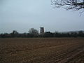
English: Hindringham is a village and a civil parish in the English county of Norfolk.. The village is 8.5 miles north east of the town of Fakenham, 16.4 miles west of Cromer and 122 miles north of London. The nearest railway station is at Sheringham for the Bittern Line which runs between Sheringham, Cromer and Norwich. The nearest airport is Norwich International Airport.
localité britannique du comté anglais de Norfolk | |||||
| Téléverser des médias | |||||
| Nature de l’élément | |||||
|---|---|---|---|---|---|
| Lieu | North Norfolk, Norfolk, Angleterre de l'Est, Angleterre | ||||
| Superficie |
| ||||
| Réputé identique à | Hindringham (page en doublon, paroisse civile) | ||||
 | |||||
Sous-catégories
Cette catégorie comprend 5 sous-catégories, dont les 5 ci-dessous.
C
- Church Farm, Hindringham (2 F)
H
- Hindringham Hall (3 F)
- Hindringham Meadows (7 F)
- Hindringham War Memorial (3 F)
Média dans la catégorie « Hindringham »
Cette catégorie comprend 109 fichiers, dont les 109 ci-dessous.
-
 A farm cart on display at Hindringham - geograph.org.uk - 4581323.jpg 640 × 480 ; 181 kio
-
 Access road to Upper Hall - geograph.org.uk - 3947009.jpg 640 × 384 ; 105 kio
-
 Blakeney Road towards Abbot Farm - geograph.org.uk - 3852694.jpg 2 912 × 1 937 ; 4,29 Mio
-

-
 Bullocks in pasture - geograph.org.uk - 3946990.jpg 640 × 446 ; 105 kio
-
 Bullocks in pasture by Hindringham - geograph.org.uk - 3946987.jpg 640 × 480 ; 260 kio
-
 Cattle pasture by Hindringham - geograph.org.uk - 3946985.jpg 640 × 386 ; 143 kio
-
 Cottage on Moorgate Road - geograph.org.uk - 3849519.jpg 3 000 × 2 000 ; 5,68 Mio
-
 Cottages near Hall Farm, Hindringham - geograph.org.uk - 2240650.jpg 640 × 480 ; 222 kio
-
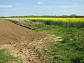
 Cultivated fields by Hindringham - geograph.org.uk - 3947016.jpg 640 × 480 ; 198 kio
-
 Cultivated fields by Hindringham - geograph.org.uk - 3947021.jpg 640 × 480 ; 188 kio
-
 Detail of Hindringham village sign - geograph.org.uk - 2031423.jpg 640 × 480 ; 102 kio
-
 Driveway to Birds Farm and Camping Site - geograph.org.uk - 571288.jpg 640 × 480 ; 117 kio
-
 Entrance to Foxburrow Farm - geograph.org.uk - 3852700.jpg 3 088 × 2 056 ; 3,28 Mio
-
 Farm track heading north - geograph.org.uk - 3851237.jpg 3 088 × 2 056 ; 3,65 Mio
-
 Fieldhouse farm - geograph.org.uk - 6419730.jpg 800 × 533 ; 139 kio
-
 Fields by Godfrey's Hall - geograph.org.uk - 3947024.jpg 640 × 443 ; 205 kio
-
 Fields by Hindringham - geograph.org.uk - 3947023.jpg 640 × 480 ; 186 kio
-
 Fields by Hindringham Hall - geograph.org.uk - 3947013.jpg 640 × 480 ; 121 kio
-
 Flint-faced farmhouse - geograph.org.uk - 511036.jpg 640 × 480 ; 115 kio
-
 Godfey's Hall - geograph.org.uk - 5119719.jpg 4 175 × 3 131 ; 4,23 Mio
-
 Grange Farm, Hindringham, Norfolk - geograph.org.uk - 2240681.jpg 640 × 480 ; 197 kio
-
 Hall Farm, Hindringham, Norfolk - geograph.org.uk - 2240647.jpg 640 × 480 ; 201 kio
-
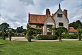
 Hindringham Hall - geograph.org.uk - 6244031.jpg 6 849 × 4 565 ; 7,17 Mio
-
 Hindringham Hall - geograph.org.uk - 6244138.jpg 6 855 × 4 570 ; 5,96 Mio
-
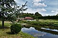
 Hindringham Hall from the Bog Area - geograph.org.uk - 6244149.jpg 6 008 × 4 005 ; 5,94 Mio
-
 Hindringham Hall from the Bog Area - geograph.org.uk - 6244155.jpg 6 243 × 4 163 ; 7,49 Mio
-
 Hindringham Hall from the entry to the Formal Garden - geograph.org.uk - 6244057.jpg 7 176 × 4 784 ; 6,44 Mio
-
 Hindringham Hall from the Stiffkey Stream Garden - geograph.org.uk - 6244148.jpg 6 545 × 4 363 ; 7,72 Mio
-
 Hindringham Hall from the Stiffkey Stream Garden - geograph.org.uk - 6244157.jpg 6 993 × 4 662 ; 6,5 Mio
-
 Hindringham Hall, Building used as a holiday let - geograph.org.uk - 6244043.jpg 6 894 × 4 596 ; 6,33 Mio
-
 Hindringham Hall, Circular tree seat - geograph.org.uk - 6244080.jpg 4 269 × 6 403 ; 6,79 Mio
-
 Hindringham Hall, Clematis 1 - geograph.org.uk - 6244045.jpg 6 714 × 4 476 ; 5,79 Mio
-
 Hindringham Hall, Clematis 2 - geograph.org.uk - 6244077.jpg 5 902 × 3 934 ; 4,37 Mio
-
 Hindringham Hall, eastern aspect - geograph.org.uk - 6244068.jpg 6 940 × 4 626 ; 7,39 Mio
-
 Hindringham Hall, eastern aspect - geograph.org.uk - 6244069.jpg 7 631 × 5 086 ; 7,69 Mio
-
 Hindringham Hall, eastern aspect - geograph.org.uk - 6244071.jpg 6 429 × 4 286 ; 6,03 Mio
-
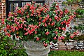
 Hindringham Hall, Fuchsia - geograph.org.uk - 6244049.jpg 4 428 × 6 643 ; 7,47 Mio
-
 Hindringham Hall, Fuchsia - geograph.org.uk - 6244052.jpg 6 109 × 4 072 ; 5,7 Mio
-
 Hindringham Hall, Kale growing in the Herb Garden - geograph.org.uk - 6244036.jpg 6 157 × 4 105 ; 7,26 Mio
-
 Hindringham Hall, north western aspect - geograph.org.uk - 6244143.jpg 6 988 × 4 658 ; 7,43 Mio
-
 Hindringham Hall, northern aspect - geograph.org.uk - 6244039.jpg 7 455 × 4 969 ; 7,58 Mio
-
 Hindringham Hall, Outdoor seating for the tea room - geograph.org.uk - 6244024.jpg 6 661 × 4 440 ; 6,07 Mio
-
 Hindringham Hall, South facing windows - geograph.org.uk - 6244066.jpg 5 571 × 3 714 ; 7,1 Mio
-
 Hindringham Hall, southern aspect - geograph.org.uk - 6244060.jpg 6 397 × 4 265 ; 7,61 Mio
-
 Hindringham Hall, southern aspect - geograph.org.uk - 6244063.jpg 6 520 × 4 346 ; 7,59 Mio
-
 Hindringham Hall, southern aspect - geograph.org.uk - 6244161.jpg 7 061 × 4 707 ; 6,47 Mio
-
 Hindringham Hall, Tea room - geograph.org.uk - 6244027.jpg 6 668 × 4 446 ; 4,81 Mio
-
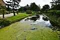
 Hindringham Hall, The moat - geograph.org.uk - 6244041.jpg 6 311 × 4 208 ; 5,15 Mio
-
 Hindringham Hall, The moat - geograph.org.uk - 6244073.jpg 7 185 × 4 790 ; 7,6 Mio
-
 Hindringham Hall, The moat - geograph.org.uk - 6244163.jpg 6 677 × 4 452 ; 7,64 Mio
-
 Hindringham Hall, Vegetables growing in the Herb Garden - geograph.org.uk - 6244033.jpg 6 047 × 4 030 ; 7,15 Mio
-
 Hindringham Hall, Victorian Nut Walk - geograph.org.uk - 6244054.jpg 4 422 × 6 634 ; 6,66 Mio
-
 Hindringham Hall, western aspect - geograph.org.uk - 6244144.jpg 6 437 × 4 291 ; 6,51 Mio
-
 Hindringham Lower Green Windmill.jpg 640 × 480 ; 67 kio
-
 Hindringham Meadows nature reserve - geograph.org.uk - 3946983.jpg 640 × 480 ; 251 kio
-
 Hindringham tower mill (geograph 2031088).jpg 457 × 640 ; 156 kio
-
 Hindringham War Memorial - geograph.org.uk - 4583534.jpg 3 456 × 2 592 ; 3,88 Mio
-
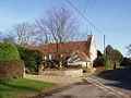
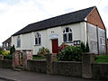
 Hindringham, the Village Hall, in Arts and Crafts style - geograph.org.uk - 1959565.jpg 2 560 × 1 920 ; 1,33 Mio
-
 Home Farm - the farmhouse - geograph.org.uk - 3946951.jpg 640 × 480 ; 204 kio
-
 Home Guard shelter by Grove Farm - geograph.org.uk - 3946950.jpg 640 × 480 ; 172 kio
-
 House in Wells Road, Hindringham - geograph.org.uk - 3946964.jpg 640 × 480 ; 177 kio
-
 Michaelmas Daisies (Aster novi-belgii) - geograph.org.uk - 571233.jpg 480 × 640 ; 54 kio
-
 Minor road - geograph.org.uk - 5119721.jpg 4 259 × 3 193 ; 3,87 Mio
-
 Monkey Puzzle Tree on Wells Road - geograph.org.uk - 3854766.jpg 2 056 × 3 088 ; 2,89 Mio
-
 Playing Field at Hindringham - geograph.org.uk - 4180577.jpg 640 × 480 ; 90 kio
-
 Ploughing at Hindringham - geograph.org.uk - 2031117.jpg 640 × 473 ; 80 kio
-
 Ploughman's Lane (track) - geograph.org.uk - 3851247.jpg 3 088 × 2 056 ; 3,87 Mio
-
 Primitive Methodist Chapel - geograph.org.uk - 570127.jpg 640 × 480 ; 58 kio
-
 Pumphouse by Hall Farm - geograph.org.uk - 3947020.jpg 640 × 480 ; 219 kio
-
 Road Junction - geograph.org.uk - 6420010.jpg 800 × 533 ; 166 kio
-
 Rosehips in a hedgerow - geograph.org.uk - 570188.jpg 640 × 480 ; 74 kio
-
 Sad, dishevelled Robin^ - geograph.org.uk - 2031433.jpg 640 × 480 ; 91 kio
-
 Telephone Box - geograph.org.uk - 313196.jpg 640 × 480 ; 176 kio
-
 The Elms, Hindringham - geograph.org.uk - 3946963.jpg 640 × 437 ; 156 kio
-
 The graveyard to the north of Hindringham church - geograph.org.uk - 5616244.jpg 3 456 × 2 592 ; 3,94 Mio
-
 The old windmill at Hindringham - geograph.org.uk - 4180586.jpg 640 × 480 ; 109 kio
-
 The Street, Hindringham - geograph.org.uk - 3946946.jpg 640 × 480 ; 206 kio
-
 Tree line - geograph.org.uk - 6420022.jpg 800 × 533 ; 120 kio
-
 Upper Hall, Hindringham - geograph.org.uk - 3947007.jpg 640 × 355 ; 99 kio
-
 Upper Mill, Hindringham - geograph.org.uk - 3946956.jpg 640 × 480 ; 206 kio
-
 View across the playing field, Hindringham - geograph.org.uk - 3946960.jpg 640 × 462 ; 184 kio
-
 View east across ploughed field - geograph.org.uk - 570243.jpg 640 × 480 ; 90 kio
-
 View north across farmland - geograph.org.uk - 570184.jpg 640 × 480 ; 203 kio
-
 View NW across farmland - geograph.org.uk - 570239.jpg 640 × 480 ; 81 kio
-
 View NW from Ploughman's Lane - geograph.org.uk - 570117.jpg 640 × 480 ; 64 kio
-
 View towards Upper Hall - geograph.org.uk - 3947002.jpg 640 × 495 ; 166 kio
-
 Village homes - geograph.org.uk - 246388.jpg 640 × 480 ; 139 kio
-
 Village Sign, Hindringham, Norfolk - geograph.org.uk - 1780523.jpg 640 × 481 ; 154 kio
-
 Wells Road, Hindringham - geograph.org.uk - 3946966.jpg 640 × 424 ; 139 kio
-
 Wheat crop by Hindringham Hall - geograph.org.uk - 3947010.jpg 640 × 480 ; 203 kio
-

-
 Cottage on Lower Green - geograph.org.uk - 570169.jpg 640 × 480 ; 64 kio
-
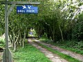
 County Farm - geograph.org.uk - 571284.jpg 640 × 480 ; 75 kio
-
 Driveway to Snoring Barn - geograph.org.uk - 571223.jpg 640 × 480 ; 70 kio
-
 Entrance to the cemetery - geograph.org.uk - 550555.jpg 640 × 480 ; 71 kio
-

-
 Farm road to Coldmoor Plantation - geograph.org.uk - 571291.jpg 640 × 480 ; 73 kio
-
 Heading east on Hindringham Road - geograph.org.uk - 570230.jpg 640 × 480 ; 81 kio
-
 Heading west on Hindringham Road - geograph.org.uk - 570248.jpg 480 × 640 ; 111 kio
-

-
 Large agricultural shed - geograph.org.uk - 570259.jpg 640 × 480 ; 54 kio
-
 Orchard House - geograph.org.uk - 550563.jpg 640 × 480 ; 90 kio
-
 Road junction near Thursford Common - geograph.org.uk - 571228.jpg 640 × 480 ; 68 kio
-
 Road to Hindringham - geograph.org.uk - 335041.jpg 640 × 480 ; 97 kio
-
 Snoring Barn - geograph.org.uk - 571225.jpg 640 × 480 ; 36 kio
-
 Track past a horse pasture - geograph.org.uk - 570176.jpg 640 × 480 ; 68 kio
-
 Track to Folly Farm - geograph.org.uk - 570179.jpg 480 × 640 ; 88 kio
-
 Winter solitude - geograph.org.uk - 313210.jpg 640 × 480 ; 102 kio


.jpg)


_-_geograph.org.uk_-_571233.jpg)


_-_geograph.org.uk_-_3851247.jpg)


