Category:Hinton Waldrist
Aller à la navigation
Aller à la recherche
localité britannique du comté anglais d'Oxfordshire  | |||||
| Téléverser des médias | |||||
| Nature de l’élément | |||||
|---|---|---|---|---|---|
| Lieu | Vale of White Horse, Oxfordshire, Angleterre du Sud-Est, Angleterre | ||||
| site officiel | |||||
 | |||||
English: Hinton Waldrist is a village and civil parish in Oxfordshire, England. It was in Berkshire until 1974. It is between Oxford and Faringdon, about 9 miles southwest of Oxford. The parish includes the hamlet of Duxford.
Sous-catégories
Cette catégorie comprend 2 sous-catégories, dont les 2 ci-dessous.
D
Média dans la catégorie « Hinton Waldrist »
Cette catégorie comprend 87 fichiers, dont les 87 ci-dessous.
-
 A Nice Road to Nowhere Much - geograph.org.uk - 4440583.jpg 4 000 × 3 000 ; 2,78 Mio
-
 A thatched barn on Church Road - geograph.org.uk - 3715785.jpg 1 500 × 986 ; 180 kio
-
 Across the allotment - geograph.org.uk - 1470865.jpg 640 × 427 ; 74 kio
-
 Aerial view of Cherbury Camp - geograph.org.uk - 3417762.jpg 1 253 × 709 ; 285 kio
-
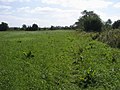
 Allotment gardens in Hinton Waldrist - geograph.org.uk - 3715801.jpg 1 500 × 999 ; 254 kio
-
 Approaching Hinton Waldrist from Longworth - geograph.org.uk - 1005206.jpg 640 × 427 ; 58 kio
-
 Approaching Shifford Lock - geograph.org.uk - 5073806.jpg 2 592 × 1 944 ; 1,69 Mio
-
 Approaching the A420 - geograph.org.uk - 309765.jpg 640 × 480 ; 77 kio
-
 Arable field near Hinton Waldrist - geograph.org.uk - 3888577.jpg 1 500 × 999 ; 198 kio
-
 Avenue of Bales - geograph.org.uk - 4179920.jpg 4 000 × 3 000 ; 2,53 Mio
-
 Backwater of the River Thames - geograph.org.uk - 3904501.jpg 1 500 × 999 ; 256 kio
-
 Barn, Near Duxford - geograph.org.uk - 459004.jpg 640 × 427 ; 53 kio
-
 Bridleway by Ford Cottage - geograph.org.uk - 3904479.jpg 1 500 × 999 ; 314 kio
-
 Bridleway to Glebe Farm - geograph.org.uk - 3269954.jpg 1 024 × 768 ; 292 kio
-
 Bridleway to the A420 - geograph.org.uk - 3269965.jpg 1 024 × 768 ; 232 kio
-
 Church Road by the allotments - geograph.org.uk - 3715805.jpg 1 500 × 999 ; 181 kio
-
 Dairy farm in Duxford - geograph.org.uk - 3888619.jpg 1 500 × 999 ; 167 kio
-
 Tree lined lane at Duxford - geograph.org.uk - 1004855.jpg 427 × 640 ; 128 kio
-
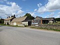
 Duxford Farm - geograph.org.uk - 91575.jpg 640 × 481 ; 68 kio
-
 Falling Down in the Farmyard - geograph.org.uk - 4179922.jpg 4 000 × 3 000 ; 2,97 Mio
-
 Faringdon from the air - geograph.org.uk - 5612642.jpg 3 264 × 2 448 ; 4,64 Mio
-
 Farmland between Hinton Waldrist and Longworth - geograph.org.uk - 4816192.jpg 1 024 × 683 ; 304 kio
-
 Farmland near Duxford - geograph.org.uk - 5073812.jpg 2 592 × 1 944 ; 1,41 Mio
-
 Farmland near Shifford - geograph.org.uk - 4493683.jpg 3 856 × 2 796 ; 2,79 Mio
-
 Farmland near the Warren, Hinton Waldrist - geograph.org.uk - 6239173.jpg 4 000 × 3 000 ; 4,61 Mio
-
 Farmland, Hinton Waldrist - geograph.org.uk - 2816337.jpg 640 × 480 ; 125 kio
-
 Farmland, Hinton Waldrist - geograph.org.uk - 2816367.jpg 640 × 480 ; 200 kio
-
 Farmland, Hinton Waldrist - geograph.org.uk - 6185700.jpg 1 024 × 683 ; 192 kio
-
 Food on the path - geograph.org.uk - 1462463.jpg 426 × 640 ; 137 kio
-
 Footpath to the Thames Path - geograph.org.uk - 3904495.jpg 1 500 × 999 ; 279 kio
-
 Green by the Church - geograph.org.uk - 1470832.jpg 640 × 427 ; 93 kio
-
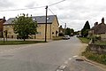
 High Street Hinton Waldrist - geograph.org.uk - 3269958.jpg 1 024 × 768 ; 185 kio
-
 High Street in Hinton Waldrist - geograph.org.uk - 3715817.jpg 1 500 × 999 ; 154 kio
-
 Old school by the road - geograph.org.uk - 1470867.jpg 640 × 427 ; 117 kio
-
 HintonWaldrist FormerSchool.jpg 1 280 × 853 ; 744 kio
-
 Kissing gate on the footpath - geograph.org.uk - 3452883.jpg 1 500 × 1 000 ; 387 kio
-
 Laggott's Farm, High Street - geograph.org.uk - 6239163.jpg 4 000 × 3 000 ; 4,6 Mio
-
 Look like teasels - geograph.org.uk - 1462469.jpg 426 × 640 ; 96 kio
-
 Lovell's Court Farm drive - geograph.org.uk - 6237862.jpg 3 808 × 2 808 ; 5,94 Mio
-
 Nearing the B4508 junction on the A420 - geograph.org.uk - 1878144.jpg 640 × 480 ; 36 kio
-
 Old Toll House, Farlington Road, Southmoor (geograph 6115037).jpg 280 × 371 ; 35 kio
-
 Old toll-house by the former A420 west of Southmoor - geograph.org.uk - 6206136.jpg 1 024 × 769 ; 179 kio
-
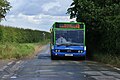
 Optare Solo YJ10 MFE HintonWaldrist PriorsLane.jpg 1 280 × 720 ; 572 kio
-
 Optare Solo YJ10 MFE HintonWaldrist.jpg 1 280 × 852 ; 593 kio
-
 Path heading to Duxford - geograph.org.uk - 3269893.jpg 1 024 × 768 ; 257 kio
-
 Piles of Stuff Again - geograph.org.uk - 4179930.jpg 3 904 × 2 832 ; 2,14 Mio
-
 Piles of Stuff, Hinton Waldrist - geograph.org.uk - 4179928.jpg 1 600 × 1 178 ; 405 kio
-
 Pillbox by Duxford Ford - geograph.org.uk - 3904506.jpg 1 500 × 970 ; 311 kio
-
 Public footpath beside the Thames - geograph.org.uk - 6239186.jpg 4 000 × 3 000 ; 4,63 Mio
-
 Red and green - geograph.org.uk - 1470855.jpg 640 × 427 ; 100 kio
-
 Remains of a Road - geograph.org.uk - 4440120.jpg 3 824 × 2 700 ; 2,72 Mio
-
 Restored barn, Duxford Farm - geograph.org.uk - 6196895.jpg 4 000 × 3 000 ; 4,71 Mio
-
 River Thames at Shifford - geograph.org.uk - 4494214.jpg 4 000 × 3 000 ; 2,68 Mio
-
 River Thames near Shifford Lock - geograph.org.uk - 2429107.jpg 1 024 × 680 ; 297 kio
-
 Road from A420 to Hinton Waldrist - geograph.org.uk - 5527572.jpg 1 600 × 1 200 ; 578 kio
-
 Road to Hinton Waldrist - geograph.org.uk - 3888587.jpg 1 500 × 999 ; 135 kio
-
 Road to the Church - geograph.org.uk - 1470848.jpg 640 × 427 ; 86 kio
-
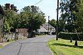
 Road to the manor - geograph.org.uk - 1470791.jpg 640 × 427 ; 65 kio
-
 Rural road in Duxford - geograph.org.uk - 3888602.jpg 1 500 × 999 ; 178 kio
-
 Rural road in Duxford - geograph.org.uk - 3888611.jpg 1 500 × 999 ; 188 kio
-
 Rural road to Duxford Farm - geograph.org.uk - 3888597.jpg 1 500 × 990 ; 234 kio
-
 Sign on A420 for staggered crossroads near Longworth - geograph.org.uk - 5527579.jpg 1 600 × 1 200 ; 797 kio
-
 Sun on a plantation - geograph.org.uk - 4180147.jpg 683 × 1 024 ; 398 kio
-
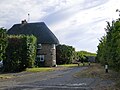
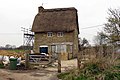
 Thatched Barn, Hinton Waldrist - geograph.org.uk - 4180137.jpg 4 000 × 3 000 ; 2,24 Mio
-
 Thatched cottage by the bridleway - geograph.org.uk - 3904475.jpg 1 500 × 999 ; 233 kio
-
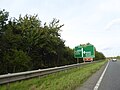
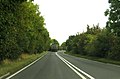
 The A420 near Hinton Waldrist - geograph.org.uk - 6236480.jpg 1 920 × 1 280 ; 1,15 Mio
-
 The A420 to Oxford - geograph.org.uk - 4199295.jpg 1 500 × 985 ; 144 kio
-
 The A420 to Oxford - geograph.org.uk - 4199298.jpg 1 500 × 999 ; 145 kio
-
 The ford across the River Thames at Duxford - geograph.org.uk - 6239179.jpg 4 000 × 3 000 ; 4,76 Mio
-
 The old A420 west of Southmoor - geograph.org.uk - 6206181.jpg 1 024 × 757 ; 135 kio
-
 The Old School on Church Road - geograph.org.uk - 3715798.jpg 1 500 × 999 ; 223 kio
-
 The road to Hinton Waldrist at the A420 - geograph.org.uk - 6236482.jpg 1 920 × 1 280 ; 1,19 Mio
-
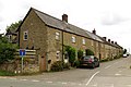 The Row in Hinton Waldrist - geograph.org.uk - 3715819.jpg 1 500 × 999 ; 177 kio
-
 Towards the school - geograph.org.uk - 1470802.jpg 640 × 427 ; 98 kio
-
 Track and farmland, Hinton Waldrist - geograph.org.uk - 2816340.jpg 640 × 480 ; 185 kio
-
 Track and farmland, Hinton Waldrist - geograph.org.uk - 2816359.jpg 640 × 480 ; 133 kio
-
 Track and farmland, Hinton Waldrist - geograph.org.uk - 2816360.jpg 640 × 480 ; 154 kio
-
 Track and Tree - geograph.org.uk - 4440135.jpg 4 000 × 3 000 ; 3,07 Mio
-
 Tree in the Thames - geograph.org.uk - 4493665.jpg 4 000 × 3 000 ; 3,94 Mio
-
 Under the root - geograph.org.uk - 1462483.jpg 640 × 480 ; 95 kio
-
 Upriver from the root - geograph.org.uk - 1462504.jpg 426 × 640 ; 63 kio
-
 View south along Church Road, Hinton Waldrist - geograph.org.uk - 6097376.jpg 1 024 × 768 ; 389 kio
-
-
 View towards the Thames Path - geograph.org.uk - 2233379.jpg 1 024 × 683 ; 129 kio
-
 Wall around Hinton Manor garden - geograph.org.uk - 6196900.jpg 4 000 × 3 000 ; 4,69 Mio
-
 Fine row of poplars - geograph.org.uk - 309309.jpg 640 × 480 ; 105 kio
-
 Welmore Farm - geograph.org.uk - 309318.jpg 640 × 480 ; 100 kio


.jpg)


