Category:History of Honduras
Salti al navigilo
Salti al serĉilo
aspect of history | |||||
| Alŝuti plurmedion | |||||
| Estas | |||||
|---|---|---|---|---|---|
| Rilatas al | |||||
| Loko |
| ||||
| Havas parton |
| ||||
| |||||
Subkategorioj
Ĉi tiu kategorio havas la 23 jenajn subkategoriojn, el 23 entute.
*
A
B
C
D
F
- Family trees of Honduras (1 D)
H
- Honduras in World War I (2 D)
L
- History of La Ceiba (4 D)
M
S
- Spanish conquest of Honduras (5 D)
T
U
Dosieroj en kategorio “History of Honduras”
La jenaj 50 dosieroj estas en ĉi tiu kategorio, el 50 entute.
-
 1 Guerra civil 1919 (Leonardo Urquía), 2014).jpg 640 × 480; 204 KB
-
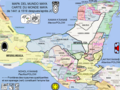
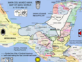
 Mesoamérica y Centroamerica prehispanica siglo XVI.svg 4 592 × 3 101; 2,02 MB
-
 2 Guerra civil 1924 (Leonardo Urquía, 2014).jpg 640 × 480; 208 KB
-
 557px-CentralAmerica1860Map a.jpg 351 × 337; 45 KB
-
 612 Air Base Squadron.jpg 431 × 492; 113 KB
-
 A gully at Chigareni Bay, Fonseca, Central America, Honduras.jpg 437 × 612; 85 KB
-
 A New Survey of the West Indies or The English American his Travel by Sea and Land.djvu 3 062 × 4 930, 518 paĝoj; 69,03 MB
-
 A New Survey of the West Indies or The English American his Travel by Sea and Land.pdf 706 × 1 137, 518 paĝoj; 88,22 MB
-

-
 Apuntes para la historia de Honduras (IA apuntesparalahis00vera).pdf 818 × 1 254, 338 paĝoj; 17,46 MB
-
 Batalla de La Trinidad (1827).png 1 170 × 850; 1,41 MB
-
 Batalla La Trinidad (Leonardo Urquía, 2014).jpg 640 × 480; 206 KB
-
 Caribbean and Eastern Pacific maritime security- regional cooperation in bridge and insular states (IA caribbeanndeaste1094558287).pdf 1 275 × 1 650, 160 paĝoj; 1,83 MB
-
 Carte Cités Maya MAJ BIS.tif 960 × 720; 940 KB
-
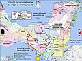
 Carte des cités Mayas Haute Définition Maj.jpg 3 072 × 2 287; 1 018 KB
-
 Carte Empire Itza 1519 FR.tif 960 × 720; 945 KB
-
 Carte Empire Itza 1519.tif 960 × 720; 943 KB
-
 Carte monde Maya +1221+1441 HD.jpg 3 072 × 2 287; 917 KB
-
 Carte monde Maya +1441+1519 HD Maj.jpg 3 072 × 2 287; 985 KB
-
 Carte monde Maya +535 HD.jpg 3 072 × 2 287; 888 KB
-
 Carte monde Maya 1519 MAJ BIS.tif 960 × 720; 1,1 MB
-
 Carte monde Maya 378.jpg 3 072 × 2 287; 850 KB
-
 Carte Mundo Maya 1519 Bis.tif 960 × 720; 896 KB
-
 Cartes ciudades maya.tif 960 × 720; 845 KB
-
 Casain2.jpg 1 208 × 906; 309 KB
-
 Central America; Describing Each of the States of Guatemala, Honduras, Salvador, Nicaragua, and Costa Rica WDL7306.pdf 675 × 995, 198 paĝoj; 60,59 MB
-
 CENTRAL AMERICAN FOSSIL REPORTED BY GREGORY MASON IN 1933.jpg 627 × 720; 38 KB
-
 Century Mag Hieroglyphic stairway.png 1 060 × 1 620; 1,92 MB
-
 Comayagua Colonial 01.JPG 554 × 558; 77 KB
-
 Commercial directory of Honduras, 1911 (IA commercialdirect00fletrich).pdf 814 × 1 297, 44 paĝoj; 1,85 MB
-
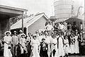
 Conferencia de Paz 1907.jpg 1 260 × 705; 115 KB
-
 Conflicto de 1907 (Leonardo Urquía, 2014).jpg 640 × 480; 217 KB
-
 Criminal violence and state responses in the Northern Triangle (IA criminalviolence1094551660).pdf 1 275 × 1 650, 96 paĝoj; 753 KB
-
 Crisis in Honduras- the search for answers to the removal of president Manuel Zelaya (IA crisisinhonduras1094537679).pdf 1 275 × 1 650, 112 paĝoj; 517 KB
-
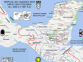
 ESQUEMA DE LA BATALLA DE NAMASIGÜE (13-27 de marzo de 1907).jpg 3 264 × 2 448; 2,12 MB
-
 Ferdinand VI of Bourbon coat of arms.jpg 1 163 × 1 440; 987 KB
-
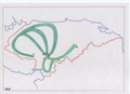
 Guerra 1907.png 1 170 × 850; 1,45 MB
-
 Guerra 1919.png 1 170 × 850; 1,39 MB
-
 Guerra 1924.png 1 170 × 850; 1,4 MB
-

-
 Honduras quake 28 May 2009.jpg 410 × 470; 65 KB
-
 Iglesia de Trujillo antigua.jpg 1 200 × 829; 188 KB
-
 La ceiba.jpg 4 692 × 3 168; 3,95 MB
-
 MEDEL.jpg 1 154 × 1 129; 437 KB
-
 Mesoamérica y Centroamerica prehispanica siglo XVI.jpg 20 001 × 13 538; 21,4 MB
-
 R. Camilo Diaz, Charge d'Affairs, Honduras, Pan Amer. Union LCCN2016823216.jpg 5 949 × 4 328; 2,82 MB
-
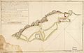 Roatan1782.jpg 5 882 × 3 725; 4,54 MB
-
 Siguatepeque10.JPG 2 592 × 3 872; 3,77 MB
-
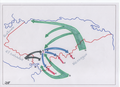
 Timeline of the 1923 Central American Treaty of Peace and Amity.png 2 000 × 1 000; 139 KB
-
Wanaragua, Gusuna..webm 14 min 49 s, 1 280 × 720; 412,26 MB
,_2014).jpg)

.jpg)


.jpg)
.png)
.jpg)


.jpg)
.jpg)


