Category:History of Kumamoto prefecture
Zur Navigation springen
Zur Suche springen

English: History of Kumamoto prefecture
日本語: 熊本県の歴史
Wikimedia-Geschichts-Artikel | |||||
| Medium hochladen | |||||
| Ist ein(e) |
| ||||
|---|---|---|---|---|---|
| Unterklasse von | |||||
| Aspekt von | |||||
| Ort | Präfektur Kumamoto, Japan | ||||
| |||||
Unterkategorien
Es werden 30 von insgesamt 30 Unterkategorien in dieser Kategorie angezeigt:
In Klammern die Anzahl der enthaltenen Kategorien (K), Seiten (S), Dateien (D)
A
B
C
D
E
F
H
I
J
- Janes' Mansion (Kumamoto) (3 D)
K
- Kaito Sonshi (7 D)
M
N
P
S
- Shinpūren Rebellion (9 D)
Medien in der Kategorie „History of Kumamoto prefecture“
Folgende 23 Dateien sind in dieser Kategorie, von 23 insgesamt.
-
 Colonists for Kutami.JPG 1.250 × 970; 294 KB
-
 Colonists from Kutami.JPG 1.475 × 972; 255 KB
-
 Commanders of the Kumamoto garrison.jpg 2.806 × 1.638; 2,33 MB
-
 Erupting Asosan, April 1953.JPG 2.048 × 2.816; 1.008 KB
-
 Flag of Kumamoto Prefecture (1960).svg 1.028 × 691; 3 KB
-
 Headquarters at Sentoguchi, Kumamoto LACMA M.84.31.319a-c.jpg 2.100 × 1.077; 807 KB
-
 Jomon Kaimen.png 650 × 834; 666 KB
-
 Kawasaki Ki-61 at Kengun airfield 1945.jpeg 1.878 × 1.341; 1,22 MB
-
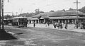 Kumamoto City Tram in 1924.JPG 502 × 270; 34 KB
-
 Kumamoto Light Railway.JPG 549 × 490; 73 KB
-
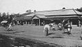
 Kumamoto Station in Meiji era.JPG 508 × 296; 29 KB
-
 Kumamoto Station in Taisho era.JPG 510 × 293; 33 KB
-
 Matsumae Shigeyoshi at Kumamoto Technical High School.jpg 1.242 × 844; 138 KB
-
 Miike map circa 1930.PNG 1.768 × 1.237; 1,51 MB
-
 Minamata Station in Taisho and Pre-war Showa eras.JPG 551 × 316; 49 KB
-
 Mount Hanaoka-yama stupa 3.jpg 800 × 600; 308 KB
-
 National Sports Festival of Japan 1960-1.jpg 2.046 × 2.598; 1,47 MB
-
 National Sports Festival of Japan 1960-2.jpg 2.912 × 2.204; 1,47 MB
-
 Radio Kumamoto 1953.jpg 2.282 × 1.888; 1,02 MB
-
 Taiyo Department Store aerial photograph.jpg 300 × 300; 36 KB
-
 Toshima kakure-nenbutsu.jpg 640 × 472; 301 KB
-
 熊本市二本木1961年~1969年に撮影された空中写真 国土地理院.png 363 × 644; 375 KB
-
 熊本市二本木1961年~1969年に撮影された空中写真 地理院地図.png 1.467 × 785; 836 KB


.svg)


