Category:Hita, Oita
Vai alla navigazione
Vai alla ricerca


|
العربية: هيتا، أويتا · English: Hita-shi, is a city in Ōita Pref., Japan. · فارسی: هیتا، اوئیتا · 한국어: 히타 시 · 日本語: 日田市(ひたし) · Русский: Хита · Українська: Хіта · |
città nella prefettura di Ōita, Giappone   | |||||
| Carica un file multimediale | |||||
| Istanza di | |||||
|---|---|---|---|---|---|
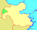
| Luogo | prefettura di Ōita, Giappone | ||||
| Forma giuridica |
| ||||
| Data di fondazione o creazione |
| ||||
| Popolazione |
| ||||
| Superficie |
| ||||
| Ha sostituito |
| ||||
| Distinto da | |||||
| sito web ufficiale | |||||
 | |||||
Sottocategorie
Questa categoria contiene le 9 sottocategorie indicate di seguito, su un totale di 9.
2
A
B
G
H
- Hita Gion Festival (19 F)
O
- Onta Pottery Village (7 F)
S
- Shimouke Dam (4 F)
T
Y
- Yoake Dam (6 F)
File nella categoria "Hita, Oita"
Questa categoria contiene 181 file, indicati di seguito, su un totale di 181.
-
 Hita in Oita Prefecture Ja.svg 560 × 622; 10 KB
-
 Hita in Oita Prefecture.png 1 181 × 901; 36 KB
-
 Map Hita en.png 1 181 × 901; 35 KB
-
 Emblem of Hita, Oita.svg 250 × 250; 3 KB
-
 Flag of Hita, Oita.svg 900 × 600; 896 byte
-
 - panoramio - denki-kurage (4).jpg 1 920 × 1 080; 901 KB
-
 - panoramio - denki-kurage (5).jpg 1 920 × 1 080; 890 KB
-
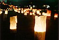 1000nen-akari.jpg 3 541 × 2 377; 5,14 MB
-
 107 PANA-P1070533 P1070533.JPG 960 × 1 280; 515 KB
-
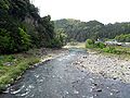
 Chikugo-river Ukiha-Hita.jpg 640 × 460; 81 KB
-
 Chikugogawa River from train for Teruoka Station.jpg 3 903 × 2 927; 3,24 MB
-
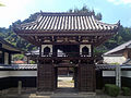 Chohzenji Shohroumon gate Hita Oita 1.jpg 3 264 × 2 448; 2,03 MB
-
 Chohzenji Shohroumon gate Hita Oita 2.jpg 2 364 × 2 107; 1,26 MB
-
 Clock tower in front of Hita Station.jpg 4 032 × 3 024; 2,44 MB
-
 Emblem of Hita, Oita.jpg 96 × 96; 3 KB
-
 Flag of Amagase, Ōita (1967–2005).svg 324 × 216; 8 KB
-
 Flag of Amase Oita.png 199 × 113; 907 byte
-
 Former Hita Yoake Elementary School 2.JPG 2 560 × 1 389; 596 KB
-
 Fukami Liquor Store near Mamedamachi Area.jpg 4 032 × 3 024; 2,24 MB
-
 Fukiage Kannon and Fukiage Jinja.jpg 3 264 × 2 448; 2,95 MB
-
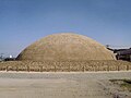 Garandoya Kofun.jpg 1 200 × 899; 192 KB
-
 Gate of Kangi Elementary School in Hita, Oita.jpg 4 032 × 3 024; 2,4 MB
-
 Gate of Myoeiji Temple in Hita, Oita.jpg 3 990 × 2 993; 3,46 MB
-
 Gyotoku Family House 01.jpg 3 264 × 2 448; 1,08 MB
-
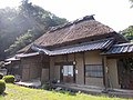 Gyotoku Family House 02.jpg 3 264 × 2 448; 987 KB
-
 Hinamatsuri in Hirose museum, Hita.jpg 2 560 × 1 600; 1,45 MB
-
 Hita 20210320100626 (51336570956).jpg 4 032 × 3 024; 3,76 MB
-
 Hita 20210320102225 (51336568606).jpg 4 032 × 3 024; 5,77 MB
-
 Hita 20210320102813 (51336567946).jpg 4 032 × 3 024; 4,24 MB
-
 Hita 20210320103844 (51337300429).jpg 4 032 × 3 024; 3,1 MB
-
 Hita 20210320105054 (51337300219).jpg 4 032 × 3 024; 3,26 MB
-
 Hita 20210320105132 (51337299959).jpg 4 032 × 3 024; 3,12 MB
-
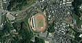 Hita Athletic Stadium.jpg 1 878 × 1 008; 836 KB
-
 Hita Basin Relief Map, SRTM-1.jpg 1 000 × 750; 651 KB
-
 Hita Branch of Fukuoka Bank 20161231.jpg 4 032 × 3 024; 2,28 MB
-
 Hita city center area Aerial photograph.2018.jpg 9 046 × 8 262; 28,25 MB
-
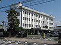
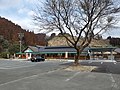
 Hita city office.jpg 600 × 450; 113 KB
-
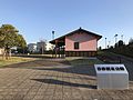
 Hita City Tourist Information Center 20161231.jpg 4 006 × 3 005; 3 MB
-
 Hita Gekijo early Showa era.jpg 1 395 × 925; 249 KB
-
 Hita jinnya.png 1 006 × 746; 555 KB
-
 Hita police-stn.jpg 1 555 × 1 166; 289 KB
-
 Hita Post office.JPG 1 296 × 972; 275 KB
-
 Hita Reimei kan.jpg 3 264 × 2 448; 829 KB
-
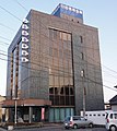 Hita shinkin.JPG 2 736 × 3 069; 1,31 MB
-
 Hita Station North Park 20161231.jpg 4 032 × 3 024; 3,14 MB
-
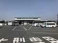
 Hita station square left.jpg 1 000 × 562; 362 KB
-
 Hita station square right.jpg 1 000 × 588; 167 KB
-
 Hita Tenryosui factory01.jpg 800 × 450; 76 KB
-
 Hita vista panoramica do Fukiage Kannon.JPG 3 264 × 2 448; 2,62 MB
-
 Hita Yakisoba.JPG 640 × 480; 244 KB
-
 Hita Yosoyama.png 922 × 538; 700 KB
-
 Hita Youiku kan 1.jpg 2 448 × 3 264; 1,49 MB
-
 Hita Youiku kan 2.jpg 2 843 × 2 116; 971 KB
-
 Hita-bussenter.jpg 1 024 × 683; 368 KB
-
 Hitageta Hita Oita.JPG 1 024 × 768; 234 KB
-
 Hitahashiri1.jpg 448 × 336; 35 KB
-
 Hitahikosan Line BRT Hita station.jpg 1 920 × 1 280; 989 KB
-
 Hitahikosan Line BRT Iwaibaru station for Soeda.jpg 1 920 × 1 280; 1,16 MB
-
 Hitahikosan Line BRT Kamimura station.jpg 1 920 × 1 280; 1,05 MB
-
 Hitahikosan Line BRT Kugiwara station for Hita.jpg 1 920 × 1 280; 1,13 MB
-
 Hitahikosan Line BRT Teruoka station.jpg 1 920 × 1 280; 1,02 MB
-
 HitaShiKennai1956.png 240 × 200; 3 KB
-
 Hitasishou.png 558 × 372; 16 KB
-
 Hosikuma park Distant view.jpg 1 536 × 1 152; 563 KB
-
 Japan National Route 212 and Motomachi Crossroads.jpg 4 032 × 3 024; 2,26 MB
-
 Japan National Route 212 on east side of Motomachi Crossroads.jpg 4 032 × 3 024; 2,4 MB
-
 Japan National Route 386 in front of Yoake Station.jpg 4 032 × 3 024; 1,86 MB
-
 Japan oita hita river opening festival.jpg 1 536 × 2 048; 826 KB
-
 JNR SL D51176.jpg 960 × 1 280; 253 KB
-
 Kamitsue Village Bus busstop.jpg 1 344 × 3 976; 719 KB
-
 Kangi Community Center 20161231.jpg 4 032 × 3 024; 1,99 MB
-
 Kangi Elementary School in Hita, Oita 20161231.jpg 3 983 × 2 988; 2,71 MB
-
 Kianhi monument in Tukikuma park.jpg 2 304 × 3 072; 3,35 MB
-
 Kiha47-4509 2.jpg 1 500 × 1 000; 891 KB
-
 Kuroshio hita 1.jpg 1 536 × 1 152; 801 KB
-
 Kusugawa River and Ichinomurahashi Bridge from train of Kyudai Main Line.jpg 3 782 × 2 837; 4,47 MB
-
 Kusugawa River and Ikenoharubashi Bridge from train of Kyudai Main Line.jpg 3 634 × 2 979; 3,45 MB
-
 Kusugawa River and Sakaibashi Bridge from train of Kyudai Main Line.jpg 3 800 × 2 850; 3,9 MB
-
 Kusugawa River from train of Kyudai Main Line 2.jpg 3 823 × 2 868; 3,38 MB
-
 Kusugawa River from train of Kyudai Main Line.jpg 3 893 × 2 920; 4,73 MB
-
 Kusugawa River near Amagase Station from train of Kyudai Main Line.jpg 3 970 × 2 978; 4,45 MB
-
 Kusugawa River near Yunotsuru Hot Spring from train of Kyudai Main Line.jpg 3 954 × 2 965; 4,83 MB
-
 Kusugawa river.JPG 3 072 × 2 304; 1,2 MB
-
 Kyudai main line 20220910130257 (52650740648).jpg 4 032 × 3 024; 4,37 MB
-
 Kyudai main line 20220910143735 (52650699645).jpg 4 032 × 3 024; 4,32 MB
-
 Kyudai main line 20220910145802 (52650699155).jpg 4 032 × 3 024; 6,21 MB
-
 Main factory of Hita Bus Company.jpg 3 999 × 3 000; 2,42 MB
-
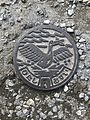 Manhole cover of Hita, Oita 2.jpg 3 024 × 4 032; 7,69 MB
-
 Manhole cover of Hita, Oita 3.jpg 3 877 × 2 908; 4,8 MB
-
 Manhole cover of Hita, Oita 4.jpg 2 944 × 3 925; 6,14 MB
-
 Manhole cover of Hita, Oita.jpg 3 450 × 2 830; 4,67 MB
-
 Matsubara-2798-r1.JPG 3 072 × 2 304; 1,04 MB
-
 Michinoeki Kamitsue 2022.jpg 4 032 × 3 024; 9,94 MB
-
 Mikuma-Ohashi Bridge from south side.jpg 4 032 × 3 024; 3,19 MB
-
 Motomachi-bus-stop.jpg 131 × 448; 26 KB
-
 Myooji Temple in Hita, Oita.jpg 4 032 × 3 024; 2,26 MB
-
 Nakajo Otabisho Shrine and Warehouse of Dashi in Nakajomachi, Hita, Oita.jpg 3 935 × 2 951; 3,21 MB
-
 Nakajogawa River in Hita, Oita.jpg 3 956 × 2 967; 2,65 MB
-
 Nakajomachi Yakushido Hall in Hita, Oita.jpg 3 983 × 2 987; 3 MB
-
 Nakanogawa River from Yanagibashi Bridge (east).jpg 4 032 × 3 024; 4,78 MB
-
 Nakanogawa River from Yanagibashi Bridge (west).jpg 3 912 × 2 934; 5,8 MB
-
 Nakatsue Village Bus busstop.jpg 1 912 × 4 065; 1,03 MB
-
 NDL-DC 2540870 33-Utagawa Hiroshige II-諸国六十八景 豊後-文久2-crd1.jpg 3 092 × 4 155; 2,01 MB
-
 Nikushi, Hita, Oita Prefecture 877-0000, Japan - panoramio.jpg 2 592 × 1 936; 1,37 MB
-
 Nishitetsu bus at Maetsue Hita Oita.JPG 1 600 × 1 200; 908 KB
-
 Oita amagasetakatsuka interchange.jpg 1 024 × 768; 406 KB
-
 Oita Expressway in Yoake, Hita, Oita.jpg 4 032 × 3 024; 1,95 MB
-
 Oita hita interchange.jpg 1 024 × 768; 403 KB
-
 Oita kumamoto r12 amagaseaso.jpg 1 024 × 768; 495 KB
-
 Oita matsubara dam.jpg 1 024 × 768; 594 KB
-
 Oita Prefectural Road No.48 and Kyudai Main Line on west side of Hita Station.jpg 4 032 × 3 024; 2,41 MB
-
 Oita Prefectural Road No.48 near Hita Station 2.jpg 4 032 × 3 024; 3,35 MB
-
 Oita Prefectural Road No.48 near Hita Station.jpg 4 032 × 3 024; 4,02 MB
-
 Oita Prefectural Road No.9 near Mikuma-Ohashi Bridge 2.jpg 3 967 × 2 975; 2,9 MB
-
 Oita Prefectural Road No.9 near Mikuma-Ohashi Bridge.jpg 3 873 × 2 905; 2,87 MB
-
 Oita Prefectural Road No.9 near Motomachi Crossroads.jpg 4 032 × 3 024; 3,37 MB
-
 Oita-expwy-hita-interchange.jpg 2 048 × 1 152; 1,78 MB
-
 Oita-expwy-hitacity.jpg 2 048 × 1 159; 1,66 MB
-
 Oita-hagio-parking.jpg 1 280 × 960; 871 KB
-
 Old street of Kuma uo street Hita oita japan.jpg 1 944 × 2 592; 2,24 MB
-
 Onagohata power station reservoir 1976.jpg 956 × 717; 173 KB
-
 Onagohata power station.JPG 3 072 × 2 304; 1,16 MB
-
 Oyama Dam.jpg 5 184 × 3 456; 14,11 MB
-
 Park on north side of Hita Station.jpg 3 971 × 2 978; 5,01 MB
-
 Perf-oita hita-city kamitsue-town.jpg 2 048 × 1 159; 1,54 MB
-
 Population distribution of Hita, Oita, Japan.svg 512 × 256; 22 KB
-
 Route442 nakatsue.jpg 1 024 × 768; 708 KB
-
 Rs-oita-kamitsue.jpg 1 600 × 1 200; 1,24 MB
-
 Rs-oita-oyama.jpg 1 280 × 960; 882 KB
-
 Saiseikai Hita Hospital.jpg 4 283 × 1 042; 1,62 MB
-
 Sky Building on north side of Hita Station.jpg 4 032 × 3 024; 3,25 MB
-
 Stele of Ohara Hachiman Shrine near Tanso 1-Chome Crossroads.jpg 4 032 × 3 024; 2,64 MB
-
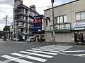
 Street view in front of Hita Station 2.jpg 3 948 × 2 961; 3,01 MB
-
 Street view in front of Hita Station.jpg 4 032 × 3 024; 2,7 MB
-
 Street view near Hita Station.jpg 3 960 × 2 970; 3,28 MB
-
 Street view near Mikuma-Ohashi Bridge.jpg 3 912 × 2 934; 3,06 MB
-
 Street view near site of Kangien School.jpg 4 032 × 3 024; 2,28 MB
-
 Symbol of Amagase Oita.gif 82 × 75; 2 KB
-
 Takai mountain.jpg 1 634 × 1 224; 499 KB
-
 Takatsuka Jizou Goshinboku.jpg 2 112 × 2 816; 1,7 MB
-
 Takatuka Atago Zizou son of Amagase Hita Oita Japan.JPG 3 264 × 2 448; 2,81 MB
-
 Tsuetate onsen Hizenya.JPG 2 560 × 1 262; 554 KB
-
 Tukikuma park Distant view 2.jpg 1 129 × 806; 360 KB
-
 Tukikuma park Distant view 3.jpg 3 264 × 2 448; 2,85 MB
-
 Tukikuma park Distant view.jpg 1 536 × 1 152; 367 KB
-
 View from platform of Yoake Station.jpg 3 969 × 2 977; 3,4 MB
-
 View in front of Hita Station.jpg 3 979 × 2 984; 2,71 MB
-
 View in front of Teruoka Station.jpg 4 032 × 3 024; 3,53 MB
-
 View in front of Yoake Station.jpg 3 958 × 2 968; 2,81 MB
-
 View of Hondo of Myoeiji Temple in Hita, Oita.jpg 4 032 × 3 024; 3,22 MB
-
 View of Kangi Elementary School in Hita, Oita.jpg 4 032 × 3 024; 2,15 MB
-
 View of Oyama in Hita city(3318756986).jpg 5 616 × 3 744; 7,02 MB
-
 Yoake Post Office 20161231.jpg 3 993 × 2 995; 2,9 MB
-
 Yuyama Power Station.jpg 2 180 × 1 108; 525 KB
-
 Yショップ 日田隈店 2017 (35750933563).jpg 3 024 × 4 032; 3,7 MB
-
 おとしよりが出ます - panoramio.jpg 2 816 × 2 112; 2,62 MB
-
 お米 すいか (35725281634).jpg 3 800 × 2 850; 7,22 MB
-
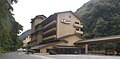
 かんぽの宿日田 - panoramio.jpg 1 600 × 902; 232 KB
-
 亀山亭ホテルの外観.jpg 5 184 × 3 456; 7,62 MB
-
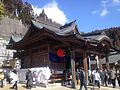
 亀山公園稲荷神社 - panoramio.jpg 2 048 × 1 536; 1,49 MB
-
 大原のしだれ桜(夜間).jpg 2 048 × 1 536; 849 KB
-
 大原のしだれ桜(昼間).jpg 2 592 × 1 936; 2,88 MB
-
 天瀬観音の滝 - panoramio.jpg 1 920 × 2 560; 1,46 MB
-
 新池の山橋から見る津江川 - panoramio.jpg 2 816 × 2 112; 991 KB
-
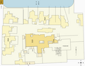
 日田城跡(現慈眼山公園).png 736 × 520; 645 KB
-
 日田市「日ノ隈山亀山公園」 - panoramio.jpg 2 048 × 1 536; 1,26 MB
-
 日田市花月 - panoramio.jpg 1 600 × 902; 246 KB
-
 日田祇園山鉾川原町山鉾.jpg 480 × 640; 128 KB
-
 日田街道 - panoramio - Yobito KAYANUMA (1).jpg 1 600 × 902; 151 KB
-
 日田街道 - panoramio - Yobito KAYANUMA.jpg 1 600 × 902; 197 KB
-
 日田街道 - panoramio.jpg 1 600 × 902; 254 KB
-
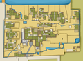
 日田陣屋平面略図.png 1 200 × 931; 79 KB
-
 沈み橋 - panoramio.jpg 2 816 × 2 112; 1,15 MB
-
 県道720号線 - panoramio - Yobito KAYANUMA.jpg 1 600 × 902; 153 KB
-
 県道720号線 - panoramio.jpg 1 600 × 902; 390 KB
-
 筏場眼鏡橋 - panoramio.jpg 4 896 × 3 264; 6,4 MB
-
 終了 みくま飯店 (42226049822).jpg 3 840 × 2 160; 4,28 MB
-
 緑橋 - panoramio (1).jpg 2 816 × 2 112; 2,85 MB
-
 花月橋 - panoramio.jpg 1 600 × 902; 377 KB
-
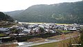
 隈・日田温泉街.png 514 × 732; 504 KB
-
 隈町三隈川沿岸より望む亀山公園.png 732 × 521; 589 KB


.jpg)
.jpg)


.svg)


.jpg)
.jpg)
.jpg)
.jpg)
.jpg)
.jpg)


.jpg)
.jpg)
.jpg)


.jpg)
.jpg)


.jpg)


.jpg)

.jpg)


.jpg)


.jpg)
.jpg)


