Category:Hoby with Rotherby
Aller à la navigation
Aller à la recherche
localité britannique du comté anglais de Leicestershire | |||||
| Téléverser des médias | |||||
| Nature de l’élément | |||||
|---|---|---|---|---|---|
| Lieu | Melton, Leicestershire, Midlands de l'Est, Angleterre | ||||
 | |||||
Cebuano: Hoby with Rotherby maoy parokya sa Hiniusang Gingharian. Ang Hoby with Rotherby nahimutang sa kondado sa Leicestershire ug apil sa nasod sa Inglatera, sa habagatang bahin sa nasod, km sa amihanan sa ulohang dakbayan London. (→Hoby with Rotherby)
English: Hoby with Rotherby is a civil parish in Leicestershire, England. In the 2001 census it had a population of 594, reducing to 556 at the time of the 2011 census. It includes the villages of Hoby, Rotherby, Ragdale and Brooksby. The parish is part of Melton local government district, and within the Rutland and Melton constituency. (→Hoby with Rotherby)
Svenska: Hoby with Rotherby är en parish i Storbritannien. Den ligger i grevskapet Leicestershire och riksdelen England, i den södra delen av landet, km norr om huvudstaden London. (→Hoby with Rotherby)

Sous-catégories
Cette catégorie comprend 5 sous-catégories, dont les 5 ci-dessous.
Média dans la catégorie « Hoby with Rotherby »
Cette catégorie comprend 197 fichiers, dont les 197 ci-dessous.
-
 A607 towards Melton Mowbray - geograph.org.uk - 3041842.jpg 640 × 480 ; 65 kio
-
 A607 towards Melton Mowbray - geograph.org.uk - 3041852.jpg 640 × 480 ; 58 kio
-
 All that's yellow isn't rape - geograph.org.uk - 5782838.jpg 1 280 × 854 ; 395 kio
-
 Allotments by the road from Hoby to Brooksby - geograph.org.uk - 4390120.jpg 640 × 427 ; 67 kio
-
 Asfordby Road eastwards - geograph.org.uk - 1300990.jpg 640 × 480 ; 145 kio
-
 Asfordby Road towards Hoby - geograph.org.uk - 1300992.jpg 640 × 479 ; 129 kio
-
 Asfordby Road towards Hoby - geograph.org.uk - 3078748.jpg 640 × 480 ; 126 kio
-
 Austen Dyke - geograph.org.uk - 1242317.jpg 640 × 480 ; 114 kio
-
 Barn at Rotherby Lodge - geograph.org.uk - 3068492.jpg 1 576 × 1 171 ; 805 kio
-
 Between Rotherby and Brooksby - geograph.org.uk - 3591128.jpg 1 024 × 512 ; 54 kio
-
 Between the railway and River Wreake - geograph.org.uk - 3591150.jpg 769 × 1 024 ; 167 kio
-
 Boundary between two fields - geograph.org.uk - 5015735.jpg 640 × 405 ; 60 kio
-
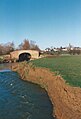
 Bridge over the River Wreake - geograph.org.uk - 4431786.jpg 640 × 426 ; 53 kio
-
 Bridge over the River Wreake - geograph.org.uk - 4448669.jpg 1 170 × 1 723 ; 185 kio
-
 Bridge over the Wreake - geograph.org.uk - 523820.jpg 640 × 480 ; 67 kio
-

-
 Bridges over the River Wreake - geograph.org.uk - 3591153.jpg 1 024 × 487 ; 80 kio
-
 Bridle Path Only - geograph.org.uk - 2351140.jpg 640 × 456 ; 87 kio
-
-
 Bridleway near Brooksby Grange Farm - geograph.org.uk - 5782929.jpg 1 280 × 960 ; 502 kio
-
 Bridleway near Brooksby Grange Farm - geograph.org.uk - 5782934.jpg 1 280 × 875 ; 359 kio
-
 Brilliant blue by the wayside - geograph.org.uk - 5782942.jpg 1 280 × 833 ; 561 kio
-
 Brooksbty Melton College - geograph.org.uk - 3591129.jpg 1 024 × 768 ; 255 kio
-
 Brooksby Bridge over the River Wreake (detail) - geograph.org.uk - 5782833.jpg 1 280 × 960 ; 662 kio
-
 Brooksby Bridge over the River Wreake - geograph.org.uk - 5782832.jpg 1 280 × 908 ; 334 kio
-
 Brooksby College - geograph.org.uk - 4446937.jpg 1 761 × 1 188 ; 250 kio
-
 Brooksby Hall - geograph.org.uk - 4462730.jpg 1 280 × 908 ; 251 kio
-
 Brooksby Road towards Hoby - geograph.org.uk - 2000439.jpg 640 × 510 ; 101 kio
-
 Brooksby Station building - geograph.org.uk - 5782908.jpg 1 280 × 961 ; 370 kio
-
 Bumpy fields near to Rotherby - geograph.org.uk - 2000454.jpg 640 × 480 ; 75 kio
-
 Bus stop shelter on the A607 - geograph.org.uk - 6372237.jpg 3 776 × 2 520 ; 1,47 Mio
-
 Crop field east of Rotherby - geograph.org.uk - 3041866.jpg 640 × 480 ; 100 kio
-
 Crop field near Rotherby - geograph.org.uk - 3041851.jpg 640 × 427 ; 73 kio
-
 Disused lock on River Wreake - geograph.org.uk - 4390123.jpg 640 × 427 ; 94 kio
-
 Downstream from Washstones Bridge - geograph.org.uk - 3349580.jpg 640 × 487 ; 95 kio
-

-
 Entrance to Barn Farm and Villiers Farm - geograph.org.uk - 6372345.jpg 3 776 × 2 520 ; 3,96 Mio
-
 Entrance to Hives Farm - geograph.org.uk - 1999506.jpg 640 × 480 ; 74 kio
-
 Entrance to Rotherby Lodge - geograph.org.uk - 6372250.jpg 3 701 × 2 469 ; 1,29 Mio
-
 Farm buildings by the road into Ragdale - geograph.org.uk - 4390062.jpg 640 × 427 ; 58 kio
-
 Farm buildings next to Ragdale Road - geograph.org.uk - 5015736.jpg 640 × 469 ; 95 kio
-
 Farm in a valley at Ragdale - geograph.org.uk - 4390030.jpg 640 × 427 ; 36 kio
-
 Farmland and tree near Brooksby - geograph.org.uk - 3041840.jpg 480 × 640 ; 64 kio
-
 Farmland in the Wreake Valley - geograph.org.uk - 4431801.jpg 640 × 426 ; 60 kio
-
 Farmland in the Wreake Valley - geograph.org.uk - 4431802.jpg 640 × 426 ; 66 kio
-
 Farmland in the Wreake Valley - geograph.org.uk - 4431862.jpg 640 × 426 ; 40 kio
-
 Farmland near Brooksby - geograph.org.uk - 3038583.jpg 640 × 502 ; 31 kio
-
 Farmland near Hoby - geograph.org.uk - 3038581.jpg 640 × 483 ; 46 kio
-
 Farmland next to Gaddesby Lane - geograph.org.uk - 3068495.jpg 3 264 × 2 448 ; 2,99 Mio
-
 Farmland off Ragdale Road - geograph.org.uk - 3078764.jpg 640 × 480 ; 108 kio
-
 Farmland, Ragdale - geograph.org.uk - 3078788.jpg 640 × 480 ; 84 kio
-
 Farmland, Rotherby - geograph.org.uk - 4431815.jpg 640 × 426 ; 69 kio
-
 Farmland, Six Hills - geograph.org.uk - 3038657.jpg 640 × 510 ; 55 kio
-
 Farmland, Six Hills - geograph.org.uk - 3038664.jpg 640 × 480 ; 62 kio
-
 Farmland, Spingfield Farm - geograph.org.uk - 3078771.jpg 640 × 480 ; 115 kio
-
 Farmland, Warren Farm - geograph.org.uk - 3078754.jpg 640 × 480 ; 97 kio
-
 Farmland, Washstones Bridge - geograph.org.uk - 3078723.jpg 640 × 480 ; 90 kio
-
 Farmyard at Brooksby - geograph.org.uk - 5782904.jpg 1 280 × 960 ; 515 kio
-
 Field entrance off Asfordby Road - geograph.org.uk - 3078743.jpg 640 × 480 ; 102 kio
-
 Field of rape east of Hoby Road - geograph.org.uk - 5015739.jpg 640 × 463 ; 110 kio
-
 Fields by A607 Melton Road near Rotherby - geograph.org.uk - 2000449.jpg 640 × 357 ; 60 kio
-
 Footpath to River Wreake, Hoby - geograph.org.uk - 4390117.jpg 640 × 427 ; 43 kio
-
 Footpath to Rotherby - geograph.org.uk - 3591144.jpg 1 024 × 768 ; 214 kio
-
 Former lock on the River Wreake navigation - geograph.org.uk - 3349553.jpg 640 × 480 ; 79 kio
-
 Former station buildings at Brooksby - geograph.org.uk - 4448667.jpg 1 761 × 1 183 ; 147 kio
-
 Gaddesby Lane crosses a stream - geograph.org.uk - 2806062.jpg 640 × 480 ; 104 kio
-
 Gaddesby Lane crosses A607 - geograph.org.uk - 2000452.jpg 640 × 383 ; 71 kio
-
 Gaddesby Lane from near to A607 junction - geograph.org.uk - 2806058.jpg 640 × 474 ; 115 kio
-
 Gaddesby Lane heading towards Rotherby - geograph.org.uk - 6372258.jpg 3 776 × 2 520 ; 4,17 Mio
-
 Gaddesby Lane meets Melton Road - geograph.org.uk - 2806059.jpg 640 × 472 ; 81 kio
-
 Gaddesby Lane near Rotherby Lodge entrance - geograph.org.uk - 2806063.jpg 640 × 480 ; 95 kio
-
 Gaddesby Lane off the A607 - geograph.org.uk - 3041857.jpg 640 × 480 ; 98 kio
-
 Gaddesby Lane towards Gaddesby - geograph.org.uk - 2786394.jpg 640 × 498 ; 105 kio
-
 Gaddesby Lane towards Gaddesby - geograph.org.uk - 2806064.jpg 640 × 480 ; 81 kio
-
 Gaddesby Lane towards Gaddesby - geograph.org.uk - 3068483.jpg 2 448 × 3 264 ; 3,68 Mio
-
 Gaddesby Lane towards Gaddesby - geograph.org.uk - 5925097.jpg 640 × 473 ; 61 kio
-
 Gaddesby Lane towards Rotherby - geograph.org.uk - 2786396.jpg 640 × 539 ; 130 kio
-
 Gaddesby Lane towards Rotherby - geograph.org.uk - 2806060.jpg 640 × 480 ; 95 kio
-
 Gaddesby Lane towards Rotherby - geograph.org.uk - 3068500.jpg 3 264 × 2 448 ; 3,77 Mio
-
 Gaddesby Lane towards Rotherby - geograph.org.uk - 5925098.jpg 640 × 462 ; 80 kio
-
 Garden Centre, Brooksby Road, south of Hoby - geograph.org.uk - 4390119.jpg 640 × 427 ; 69 kio
-
 Gates on Gaddesby Lane 001 - geograph.org.uk - 5925094.jpg 640 × 504 ; 120 kio
-
 Gates on Gaddesby Lane 002 - geograph.org.uk - 5925095.jpg 640 × 476 ; 55 kio
-
 Gates on Gaddesby Lane 003 - geograph.org.uk - 5925096.jpg 640 × 423 ; 112 kio
-
 Grass in the Wreake Valley - geograph.org.uk - 4431808.jpg 640 × 426 ; 60 kio
-
 Hall Farm - geograph.org.uk - 4431847.jpg 640 × 426 ; 49 kio
-
 Hoby Road towards Hoby - geograph.org.uk - 5015740.jpg 640 × 463 ; 59 kio
-
 Hoby Road towards Ragdale - geograph.org.uk - 5015741.jpg 640 × 488 ; 104 kio
-
 Houses on Melton Road (A607) - geograph.org.uk - 3041846.jpg 1 024 × 544 ; 138 kio
-

-

-
 Lane between Asfordby Road and Rotherby Lane - geograph.org.uk - 6372432.jpg 3 776 × 2 520 ; 3,15 Mio
-
 Lane past Brooksby College entrance - geograph.org.uk - 2000442.jpg 640 × 486 ; 104 kio
-
 Lane to Brooksby - geograph.org.uk - 4431831.jpg 640 × 478 ; 67 kio
-
 Lane to Brooksby leading off Thrussington Road - geograph.org.uk - 6372325.jpg 3 776 × 2 520 ; 3,93 Mio
-
 Leicester Road (A607) towards Melton Mowbray - geograph.org.uk - 3041868.jpg 640 × 480 ; 59 kio
-
 Leicestershire landscape near Ragdale - geograph.org.uk - 4455847.jpg 1 280 × 960 ; 444 kio
-
 Letter box number LE14 81 - geograph.org.uk - 2000446.jpg 315 × 640 ; 81 kio
-
 Limited bridleway southwards from Six Hills - geograph.org.uk - 4389989.jpg 640 × 427 ; 70 kio
-
 Looking down Main Street, Ragdale - geograph.org.uk - 4390069.jpg 640 × 427 ; 56 kio
-
 Looking towards the River Wreake from Brooksby - geograph.org.uk - 3591136.jpg 1 024 × 768 ; 171 kio
-
 Main Street, Hoby - geograph.org.uk - 3830091.jpg 1 280 × 960 ; 232 kio
-
 Melton Road (A607) - geograph.org.uk - 3041319.jpg 640 × 480 ; 71 kio
-
 Melton Road passes Brooksby College - geograph.org.uk - 2000443.jpg 640 × 504 ; 81 kio
-
 Mill Lane - geograph.org.uk - 2000440.jpg 640 × 509 ; 89 kio
-
 Minor road towards Ragdale - geograph.org.uk - 3038663.jpg 640 × 480 ; 56 kio
-
 New gap in hedge - geograph.org.uk - 5925099.jpg 640 × 445 ; 110 kio
-

-

-
 Oilseed rape crop near Six Hills - geograph.org.uk - 3038662.jpg 640 × 480 ; 73 kio
-

-

-
-
 Over the road - geograph.org.uk - 2000429.jpg 640 × 558 ; 114 kio
-
 Path from Ragdale (Main Street) to Six Hills - geograph.org.uk - 4390074.jpg 427 × 640 ; 54 kio
-
 Ploughed field near Thrussington and Hoby - geograph.org.uk - 238700.jpg 640 × 427 ; 74 kio
-
 Pylon by the railway - geograph.org.uk - 4431850.jpg 640 × 426 ; 42 kio
-
 Ragdale Road heading north - geograph.org.uk - 3078761.jpg 640 × 480 ; 101 kio
-
 Ragdale Road heading north - geograph.org.uk - 3078768.jpg 640 × 480 ; 79 kio
-
 Ragdale Road north from Hoby - geograph.org.uk - 6372336.jpg 3 776 × 2 520 ; 3,09 Mio
-
 Ragdale Road towards Hoby - geograph.org.uk - 1242253.jpg 640 × 373 ; 76 kio
-
 Ragdale Road towards Hoby - geograph.org.uk - 5015737.jpg 640 × 451 ; 63 kio
-
 Ragdale Road towards Ragdale - geograph.org.uk - 5015738.jpg 640 × 455 ; 74 kio
-

-
 Rainbow - geograph.org.uk - 2785199.jpg 640 × 386 ; 39 kio
-
 Ready for harvest - geograph.org.uk - 2000457.jpg 640 × 480 ; 100 kio
-
 Remains of Brooksby Station - geograph.org.uk - 5782909.jpg 1 280 × 960 ; 453 kio
-

-

-
 Ridge and furrow, Midshires Way, Hoby - geograph.org.uk - 4390090.jpg 640 × 427 ; 72 kio
-
 River Wreake - geograph.org.uk - 3303831.jpg 607 × 439 ; 46 kio
-
 River Wreake - geograph.org.uk - 4431781.jpg 640 × 426 ; 79 kio
-
 River Wreake - geograph.org.uk - 4431795.jpg 640 × 426 ; 79 kio
-
 River Wreake towards Syston - geograph.org.uk - 3349554.jpg 640 × 481 ; 59 kio
-
 River Wreake towards Syston - geograph.org.uk - 3349555.jpg 640 × 470 ; 92 kio
-
 Road towards Hoby - geograph.org.uk - 3078727.jpg 640 × 480 ; 69 kio
-
 Road towards Ragdale - geograph.org.uk - 3078779.jpg 640 × 480 ; 76 kio
-

-
 Rolling landscape north of Ragdale - geograph.org.uk - 4390034.jpg 640 × 427 ; 39 kio
-
 Rotherby and Hoby - geograph.org.uk - 2000456.jpg 640 × 503 ; 109 kio
-
 Rotherby Lane north of the A607 - geograph.org.uk - 6372436.jpg 3 776 × 2 520 ; 3,19 Mio
-
 Rotherby Lane towards Frisby - geograph.org.uk - 1300993.jpg 640 × 571 ; 153 kio
-

-
 Sheep by the River Wreake - geograph.org.uk - 4431821.jpg 640 × 426 ; 85 kio
-
 Shoby Scholes, aerial 2018 - geograph.org.uk - 5846107.jpg 533 × 800 ; 102 kio
-
 Shoby, aerial 2018 - geograph.org.uk - 5846109.jpg 533 × 800 ; 115 kio
-
 Site of Brooksby medieval village - geograph.org.uk - 4462732.jpg 1 280 × 960 ; 322 kio
-
 Six Hills Road into Ragdale - geograph.org.uk - 5453245.jpg 640 × 474 ; 108 kio
-
 Six Hills Road leaving Ragdale - geograph.org.uk - 3078796.jpg 640 × 480 ; 93 kio
-
 Six Hills Road-Six Hills Lane junction - geograph.org.uk - 1300977.jpg 640 × 520 ; 112 kio
-
 Small spinney and crops - geograph.org.uk - 3068488.jpg 2 681 × 1 794 ; 1,91 Mio
-
 Snowfall in May - geograph.org.uk - 5782902.jpg 947 × 1 280 ; 547 kio
-
 Snowfall in May – detail - geograph.org.uk - 5782903.jpg 1 280 × 1 280 ; 380 kio
-
 Spinney Campus, Brooksby Melton College - geograph.org.uk - 5782912.jpg 1 280 × 960 ; 327 kio
-
 Spinney Campus, Brooksby Melton College - geograph.org.uk - 5782913.jpg 1 280 × 960 ; 404 kio
-
 Spinney Campus, Brooksby Melton College - geograph.org.uk - 5782916.jpg 1 280 × 960 ; 529 kio
-
 Spinney Campus, Brooksby Melton College - geograph.org.uk - 5782921.jpg 1 280 × 866 ; 318 kio
-
 Spring turn out - geograph.org.uk - 5347503.jpg 3 648 × 2 736 ; 2,65 Mio
-
 Stone and brick walls, Ragdale - geograph.org.uk - 4390055.jpg 640 × 427 ; 77 kio
-
 Syston and Peterborough Railway - geograph.org.uk - 3303833.jpg 549 × 452 ; 27 kio
-
 Tell me the time - geograph.org.uk - 5782938.jpg 1 280 × 788 ; 424 kio
-
 The drive to Hive's Farm - geograph.org.uk - 5782932.jpg 1 280 × 960 ; 711 kio
-
 The lane to Spinney Farm - geograph.org.uk - 5782918.jpg 1 280 × 960 ; 480 kio
-
 The Lodge Farm - geograph.org.uk - 2610127.jpg 640 × 480 ; 71 kio
-
 The Midshires Way past Spinney Farm - geograph.org.uk - 6372221.jpg 3 776 × 2 520 ; 4 Mio
-
 The Midshires Way starting a descent to the Wreake Valley - geograph.org.uk - 6372228.jpg 3 776 × 2 520 ; 3,9 Mio
-
 The Old Post Office and former smithy - geograph.org.uk - 3830086.jpg 1 280 × 960 ; 310 kio
-
-

-

-
 The road past Brooksby Hall - geograph.org.uk - 5782911.jpg 1 280 × 960 ; 362 kio
-
 The road to Rotherby - geograph.org.uk - 4462735.jpg 1 280 × 875 ; 276 kio
-
-
 The Wreake Valley - geograph.org.uk - 4431844.jpg 640 × 426 ; 39 kio
-
 Thrussington Road entering Hoby - geograph.org.uk - 6372334.jpg 3 776 × 2 520 ; 3,1 Mio
-
 To Thrussington - geograph.org.uk - 2000434.jpg 640 × 393 ; 81 kio
-
 Towards Brooksby - geograph.org.uk - 3349556.jpg 640 × 465 ; 66 kio
-
 Towards Brooksby Quarry - geograph.org.uk - 5437080.jpg 640 × 406 ; 64 kio
-
 Towards Gaddesby - geograph.org.uk - 5437081.jpg 640 × 476 ; 86 kio
-
 Towards Six Hills - geograph.org.uk - 1300978.jpg 640 × 480 ; 69 kio
-
 Track to Barn Farm - geograph.org.uk - 3078737.jpg 640 × 480 ; 59 kio
-
 Track to Brooksby - geograph.org.uk - 5437082.jpg 640 × 458 ; 102 kio
-
 Track to Hall Farm - geograph.org.uk - 1999505.jpg 640 × 443 ; 81 kio
-
 Track to Hall Farm - geograph.org.uk - 3041313.jpg 640 × 480 ; 79 kio
-

-
 Turning to Brooksby - geograph.org.uk - 4458955.jpg 1 280 × 950 ; 285 kio
-
 View over a rape field to Frisby on the Wreake - geograph.org.uk - 3931823.jpg 1 876 × 2 501 ; 1,61 Mio
-
 View to Hoby from Rotherby Lane - geograph.org.uk - 3931829.jpg 2 464 × 1 760 ; 1,09 Mio
-
 View towards Brooksby - geograph.org.uk - 4458954.jpg 1 280 × 847 ; 200 kio
-
-

-
 Welcome to Spinney Campus - geograph.org.uk - 5782924.jpg 1 280 × 1 280 ; 757 kio
-
 Wonky telegraph pole near Brooksby - geograph.org.uk - 5782840.jpg 960 × 1 280 ; 325 kio
-
 Wreake Centre - geograph.org.uk - 2000432.jpg 640 × 422 ; 57 kio
-
 Wreake Valley towards Melton - geograph.org.uk - 3349558.jpg 640 × 470 ; 44 kio
-
 Wreake Valley towards Syston - geograph.org.uk - 3349559.jpg 640 × 464 ; 40 kio
-


_-_geograph.org.uk_-_5782833.jpg)


_-_geograph.org.uk_-_3041846.jpg)

_and_the_road_to_Hoby_-_geograph.org.uk_-_4390015.jpg)


_towards_Melton_Mowbray_-_geograph.org.uk_-_3041868.jpg)


_-_geograph.org.uk_-_3041319.jpg)


_to_Six_Hills_-_geograph.org.uk_-_4390074.jpg)


_of_%22Willows%22_-_geograph.org.uk_-_1550433.jpg)


,_Melton_Mowbray_Navigation_-_geograph.org.uk_-_5782835.jpg)
,_Melton_Mowbray_Navigation_-_geograph.org.uk_-_5782836.jpg)


