Category:Hockerton
Aller à la navigation
Aller à la recherche
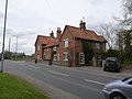
English: Hockerton is a village in Nottinghamshire. It is 2 miles from the town of Southwell on the A617 between Newark and Mansfield. Fewer than 60 houses are situated around the church, the Spread Eagle pub and village hall. The local properties range from the carbon neutral housing of the Hockerton Housing Project to converted barns, 1960s and 70s housing together with much older houses and an 18th century grade II listed vicarage. The parish church of St Nicholas is Norman with an aisleless nave and a 14th century chancel .
village britannique  | |||||
| Téléverser des médias | |||||
| Nature de l’élément | |||||
|---|---|---|---|---|---|
| Lieu | Newark and Sherwood, Nottinghamshire, Midlands de l'Est, Angleterre | ||||
| Population |
| ||||
 | |||||
Sous-catégories
Cette catégorie comprend seulement la sous-catégorie ci-dessous.
N
Média dans la catégorie « Hockerton »
Cette catégorie comprend 125 fichiers, dont les 125 ci-dessous.
-
 A617 Approaching Hockerton - geograph.org.uk - 4207727.jpg 640 × 480 ; 334 kio
-
 A617 at Hockerton village boundary - geograph.org.uk - 5134018.jpg 640 × 480 ; 42 kio
-
 A617 at Winkburn Lane - geograph.org.uk - 5134020.jpg 640 × 481 ; 41 kio
-
 A617 heading east - geograph.org.uk - 3642180.jpg 640 × 480 ; 104 kio
-
 A617 heading west - geograph.org.uk - 3642045.jpg 640 × 480 ; 60 kio
-
 A617 heading west - geograph.org.uk - 3642189.jpg 640 × 480 ; 47 kio
-
 A617 near Hockerton - geograph.org.uk - 6604896.jpg 1 280 × 960 ; 481 kio
-
 A617 near Wyton Lodge Farm - geograph.org.uk - 2632339.jpg 1 280 × 960 ; 448 kio
-
 A617 under the power lines east of Hockerton - geograph.org.uk - 3519453.jpg 640 × 386 ; 54 kio
-
 Arable land near Broadclose Wood - 1 - geograph.org.uk - 2155196.jpg 1 024 × 768 ; 395 kio
-
 Arable land near Broadclose Wood - 2 - geograph.org.uk - 2155213.jpg 1 024 × 768 ; 395 kio
-
 Arable land west of Nut Wood - geograph.org.uk - 2155246.jpg 1 024 × 768 ; 356 kio
-
 Bank Cottage and neighbour - geograph.org.uk - 3429772.jpg 1 280 × 960 ; 247 kio
-
 Barn beside Broadclose Wood - geograph.org.uk - 4870464.jpg 3 072 × 1 728 ; 2,17 Mio
-
 Barn on Galley Hill Road - geograph.org.uk - 838627.jpg 640 × 426 ; 83 kio
-
 Bench mark, Hockerton Church - geograph.org.uk - 3429760.jpg 1 280 × 960 ; 451 kio
-
 Bench mark, Hockerton Road bridge - geograph.org.uk - 3429140.jpg 1 280 × 960 ; 362 kio
-
 Bird Feeder and Triangulation Pillar deep in Dukes Wood - geograph.org.uk - 3891331.jpg 4 000 × 3 000 ; 3,46 Mio
-
 Bronze statue of The Oil Patch Warrior - geograph.org.uk - 4863713.jpg 1 728 × 3 072 ; 1,82 Mio
-
 Caunton Road - geograph.org.uk - 3642056.jpg 640 × 480 ; 75 kio
-
 Cheveral Wood - geograph.org.uk - 305774.jpg 640 × 480 ; 148 kio
-
 Cottage in Hockerton - geograph.org.uk - 3642054.jpg 640 × 480 ; 75 kio
-
 Crop field north off the A617 - geograph.org.uk - 3642047.jpg 640 × 480 ; 102 kio
-
 Datestone on Bank Cottage - geograph.org.uk - 3429775.jpg 1 280 × 960 ; 313 kio
-
 Datestone on Hockerton school - geograph.org.uk - 3427048.jpg 1 280 × 960 ; 380 kio
-
 Dead straight - geograph.org.uk - 3432213.jpg 1 280 × 960 ; 361 kio
-
 Entering Hockerton from the west - geograph.org.uk - 3519441.jpg 640 × 397 ; 80 kio
-
 Entrance to Wyton Lodge Farm - geograph.org.uk - 6263816.jpg 1 024 × 768 ; 363 kio
-
 Estate cottages, Hockerton - geograph.org.uk - 3432178.jpg 1 280 × 960 ; 182 kio
-
 Farm buildings and Broadclose Wood - geograph.org.uk - 6263773.jpg 1 024 × 768 ; 195 kio
-
 Farm shop - geograph.org.uk - 3642184.jpg 640 × 480 ; 77 kio
-
 Farm track off the A617 - geograph.org.uk - 3642042.jpg 640 × 480 ; 93 kio
-
 Farm track to Hockerton Moor Farm - geograph.org.uk - 1537406.jpg 640 × 480 ; 65 kio
-
 Farmland south of the A617 - geograph.org.uk - 3642179.jpg 640 × 480 ; 101 kio
-
 Farmland, Brickfield Farm - geograph.org.uk - 3642188.jpg 640 × 480 ; 73 kio
-
 Farmland, Lodge Farm - geograph.org.uk - 3642043.jpg 640 × 480 ; 64 kio
-
 Field and plantation near Hockerton - geograph.org.uk - 3429750.jpg 1 280 × 960 ; 248 kio
-
 Field boundary near Broadclose Wood - geograph.org.uk - 6263777.jpg 1 024 × 768 ; 269 kio
-
 Field edge - geograph.org.uk - 6263805.jpg 1 024 × 768 ; 374 kio
-
 Field near Hockerton - geograph.org.uk - 6604892.jpg 1 280 × 960 ; 525 kio
-
 Field to Winkburn - geograph.org.uk - 134961.jpg 640 × 480 ; 75 kio
-
 Fields off Hockerton Lane - geograph.org.uk - 5401444.jpg 1 024 × 768 ; 138 kio
-
 Footbridge across Hockerton Dumble - geograph.org.uk - 6604890.jpg 1 280 × 960 ; 619 kio
-
 Footpath at the A617 - geograph.org.uk - 6604895.jpg 1 280 × 960 ; 484 kio
-
 Footpath to Maythorne - geograph.org.uk - 175179.jpg 640 × 480 ; 139 kio
-
 Footpath to Winkburn - geograph.org.uk - 3432196.jpg 1 280 × 960 ; 327 kio
-
 Former Methodist Schoolroom - geograph.org.uk - 3427043.jpg 1 280 × 960 ; 438 kio
-
 Hay filled barn on the Robin Hood Way - geograph.org.uk - 4863763.jpg 800 × 600 ; 120 kio
-
 Hockerton farmland - geograph.org.uk - 3057243.jpg 640 × 427 ; 107 kio
-
 Hockerton Housing Project - geograph.org.uk - 3230831.jpg 640 × 427 ; 119 kio
-
 Hockerton Housing Project - geograph.org.uk - 3230839.jpg 640 × 427 ; 103 kio
-
 Hockerton main street - geograph.org.uk - 3432166.jpg 1 280 × 960 ; 273 kio
-
 Hockerton Road bridge - geograph.org.uk - 3429139.jpg 1 280 × 960 ; 356 kio
-
 Hockerton Sunset - geograph.org.uk - 3230822.jpg 640 × 427 ; 149 kio
-
 Hockerton telephone kiosk - geograph.org.uk - 3432181.jpg 1 280 × 960 ; 380 kio
-
 Hockerton village - geograph.org.uk - 3432219.jpg 1 280 × 960 ; 157 kio
-
 Hockerton village - geograph.org.uk - 4139604.jpg 1 024 × 725 ; 108 kio
-
 Hockerton, A617 - geograph.org.uk - 4207731.jpg 640 × 480 ; 324 kio
-
 Hockerton-Southwell postbox NG25 96 - geograph.org.uk - 3429767.jpg 960 × 1 280 ; 336 kio
-
 Hockerwood hedgeline - geograph.org.uk - 3057430.jpg 640 × 427 ; 125 kio
-
 In Nut Wood - geograph.org.uk - 4864280.jpg 800 × 600 ; 203 kio
-
 Manor Farm, Hockerton - geograph.org.uk - 3429763.jpg 1 280 × 1 041 ; 314 kio
-
 Maxey's Farm Shop - geograph.org.uk - 5465009.jpg 1 024 × 768 ; 143 kio
-
 Methodist schoolroom - geograph.org.uk - 3057395.jpg 640 × 427 ; 138 kio
-
 Minor road near Hockerton - geograph.org.uk - 4139601.jpg 1 024 × 768 ; 140 kio
-
 Mystery Hill - geograph.org.uk - 3230740.jpg 640 × 427 ; 85 kio
-
 Mystery Hill - geograph.org.uk - 3230755.jpg 640 × 427 ; 93 kio
-
 Mystery Hill Lake - geograph.org.uk - 3230778.jpg 640 × 427 ; 65 kio
-
 Mystery Hill Lake - geograph.org.uk - 3230817.jpg 640 × 427 ; 109 kio
-
 New housing at Hockerton - geograph.org.uk - 5293721.jpg 1 024 × 768 ; 158 kio
-
 Newfield Farm - geograph.org.uk - 450235.jpg 640 × 480 ; 100 kio
-
 Organic vegetable garden - geograph.org.uk - 3229361.jpg 640 × 427 ; 103 kio
-
 Organic vegetable garden - geograph.org.uk - 3229374.jpg 640 × 427 ; 158 kio
-
 Plank bridge on Robin Hood's Way - geograph.org.uk - 2933721.jpg 1 024 × 768 ; 216 kio
-
 Prepared field near Broadclose Wood - geograph.org.uk - 6263784.jpg 1 024 × 768 ; 245 kio
-
 Prepared field near Wyton Lodge Farm - geograph.org.uk - 6263812.jpg 1 024 × 768 ; 313 kio
-
 Reed bed - geograph.org.uk - 3230797.jpg 640 × 427 ; 101 kio
-
 Road junction on Hockerton Moor - geograph.org.uk - 3519427.jpg 640 × 388 ; 110 kio
-
 Road to Hockerton Moor Farm - geograph.org.uk - 3330579.jpg 2 256 × 1 504 ; 856 kio
-
 Robin Hood Way - geograph.org.uk - 2933730.jpg 1 024 × 768 ; 151 kio
-
 Robin Hood Way - geograph.org.uk - 6263780.jpg 1 024 × 768 ; 211 kio
-
 Robin Hood Way - geograph.org.uk - 6263787.jpg 1 024 × 768 ; 410 kio
-
 Robin Hood Way - geograph.org.uk - 6263794.jpg 1 024 × 768 ; 421 kio
-
 Robin Hood Way - geograph.org.uk - 6263799.jpg 768 × 1 024 ; 395 kio
-
 Robin Hood Way north of Kirklington - geograph.org.uk - 6263765.jpg 1 024 × 768 ; 233 kio
-
 Robin Hood Way through Nut Wood - geograph.org.uk - 4870470.jpg 2 479 × 1 728 ; 1,58 Mio
-
 Seven standing stones - geograph.org.uk - 3230730.jpg 640 × 427 ; 126 kio
-
 Sunday outing - geograph.org.uk - 3429752.jpg 1 280 × 960 ; 282 kio
-
 Sunnybank Farm, Hockerton - geograph.org.uk - 3432186.jpg 1 280 × 960 ; 174 kio
-
 The Old Rectory, Hockerton - geograph.org.uk - 3429770.jpg 1 280 × 960 ; 179 kio
-
 The Reservoir - geograph.org.uk - 3230720.jpg 640 × 427 ; 121 kio
-
 The Spread Eagle - geograph.org.uk - 3057260.jpg 640 × 427 ; 84 kio
-
 The Spread Eagle Hockerton - geograph.org.uk - 3519443.jpg 640 × 352 ; 64 kio
-
 The Spread Eagle Pub, Hockerton - geograph.org.uk - 3330576.jpg 1 989 × 1 344 ; 1,56 Mio
-
 The Spread Eagle pub, Hockerton - geograph.org.uk - 3642051.jpg 640 × 480 ; 40 kio
-
 Track in the trees - geograph.org.uk - 4870466.jpg 3 072 × 1 728 ; 3,34 Mio
-
 Track off Wheatgrass Hill (A617) - geograph.org.uk - 2634064.jpg 1 280 × 960 ; 319 kio
-
 Track through Nut Wood - geograph.org.uk - 2155260.jpg 1 024 × 768 ; 419 kio
-
 Track through Redgate Wood - geograph.org.uk - 2155268.jpg 1 600 × 1 200 ; 1 020 kio
-
 Trees beside the Robin Hood Way - geograph.org.uk - 4863762.jpg 800 × 600 ; 212 kio
-
 View towards Newfields Farm - geograph.org.uk - 5293734.jpg 1 024 × 768 ; 142 kio
-
 View towards The Wink - geograph.org.uk - 3432205.jpg 1 280 × 960 ; 204 kio
-
 Waymark and wind turbine - geograph.org.uk - 3432192.jpg 1 280 × 960 ; 282 kio
-
 Wheatfield and distant poplars - geograph.org.uk - 5465013.jpg 1 024 × 768 ; 143 kio
-
 Wheatfield and plantation off Hockerton Road - geograph.org.uk - 5401437.jpg 1 024 × 768 ; 221 kio
-
 Wheatfield and wind turbine near Hockerton - geograph.org.uk - 5466328.jpg 1 024 × 768 ; 135 kio
-
 Wheatgrass Hill (A617) - geograph.org.uk - 2634134.jpg 1 280 × 960 ; 374 kio
-
 Wheatgrass Hill (A617) - geograph.org.uk - 3642049.jpg 640 × 480 ; 71 kio
-
 Wind Turbine with Triangulation Pillar at Winkburn Park - geograph.org.uk - 3891293.jpg 4 000 × 3 000 ; 2,73 Mio
-
 Wyton Lodge Farm entrance from A617 - geograph.org.uk - 3519437.jpg 640 × 497 ; 105 kio
-
 Barn and Cars - geograph.org.uk - 140438.jpg 640 × 480 ; 84 kio
-
 Bridge Over the Wink - geograph.org.uk - 134964.jpg 480 × 640 ; 106 kio
-
 Farm Entrance - geograph.org.uk - 134969.jpg 640 × 480 ; 94 kio
-
 Farmland over Hockerton Moor - geograph.org.uk - 61823.jpg 640 × 480 ; 93 kio
-
 From Gorsey Hill towards Cheveral Wood - geograph.org.uk - 302782.jpg 640 × 427 ; 103 kio
-
 Hockerton Road Meets A617 - geograph.org.uk - 134895.jpg 640 × 480 ; 68 kio
-
 Hockerwood Farm - geograph.org.uk - 305785.jpg 640 × 480 ; 86 kio
-
 Looking west to Southwell from Upton - geograph.org.uk - 306799.jpg 640 × 427 ; 35 kio
-
 North Lodge and Entrance Winkburn Hall - geograph.org.uk - 61779.jpg 640 × 480 ; 114 kio
-
 Park Spring Wood - geograph.org.uk - 302036.jpg 640 × 427 ; 45 kio
-
 Park Spring Wood - geograph.org.uk - 450261.jpg 640 × 480 ; 72 kio
-
 Polythene Scarecrows - geograph.org.uk - 134899.jpg 640 × 480 ; 87 kio
-
 Track to the Woods - geograph.org.uk - 134956.jpg 640 × 480 ; 87 kio
-
 View towards Hockerton Dumble - geograph.org.uk - 302023.jpg 640 × 427 ; 53 kio
-
 Woodchip factory - geograph.org.uk - 450248.jpg 640 × 480 ; 63 kio


_-_geograph.org.uk_-_2634064.jpg)


_-_geograph.org.uk_-_2634134.jpg)
_-_geograph.org.uk_-_3642049.jpg)


