Category:Hockliffe
Vai alla navigazione
Vai alla ricerca
village and civil parish in Bedfordshire, UK  | |||||
| Carica un file multimediale | |||||
| Istanza di | |||||
|---|---|---|---|---|---|
| Luogo | Central Bedfordshire, Bedfordshire, Est dell'Inghilterra, Inghilterra | ||||
 | |||||
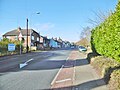
English: Hockliffe is a village in Bedfordshire on the crossroads of the A5 road which lies upon the course of the roman road known as Watling Street and the A4012 road.
Nederlands: Hockliffe is een dorp in het Engelse graafschap Bedfordshire. Het dorp ligt in het district South Bedfordshire en telt ca. 730 inwoners.
Sottocategorie
Questa categoria contiene un'unica sottocategoria, indicata di seguito.
H
File nella categoria "Hockliffe"
Questa categoria contiene 80 file, indicati di seguito, su un totale di 80.
-
 A5 heading towards Milton Keynes - geograph.org.uk - 5646755.jpg 640 × 428; 128 KB
-
 A5 Hockliffe - geograph.org.uk - 2304120.jpg 2 272 × 1 704; 696 KB
-
 A5 road at Hockliffe - geograph.org.uk - 1989770.jpg 640 × 480; 136 KB
-
 A5 road, Hockliffe - geograph.org.uk - 1989788.jpg 640 × 480; 143 KB
-
 A5 through Hockliffe - geograph.org.uk - 5646741.jpg 640 × 428; 88 KB
-

-
 Arable land behind McDonald's - geograph.org.uk - 5818073.jpg 1 280 × 960; 315 KB
-
 Bridleway to Tilsworth - geograph.org.uk - 3411404.jpg 1 600 × 1 068; 794 KB
-
 Bridleway to Tilsworth - geograph.org.uk - 3411422.jpg 1 600 × 1 068; 758 KB
-
 Bull farm on the A5, Hockliffe - geograph.org.uk - 2882732.jpg 1 600 × 1 200; 573 KB
-
 Central Bedfordshire , Layby - geograph.org.uk - 5733066.jpg 6 000 × 4 000; 7,72 MB
-
 Central Bedfordshire , Redwings Lodge - geograph.org.uk - 5733071.jpg 6 000 × 4 000; 5,55 MB
-
 Central Bedfordshire , The A5 - geograph.org.uk - 5733056.jpg 6 000 × 4 000; 7,16 MB
-
 Central Bedfordshire , The A5 - geograph.org.uk - 5733057.jpg 6 000 × 4 000; 6,82 MB
-
 Central Bedfordshire - The Hall (geograph 5733068).jpg 5 175 × 3 450; 6 MB
-
 Clifford Close at the junction of Watling Street - geograph.org.uk - 6196605.jpg 1 906 × 1 260; 1,53 MB
-
 Drainage ditch - geograph.org.uk - 5818081.jpg 1 280 × 960; 450 KB
-
 Entrance to Hockliffe Grange - geograph.org.uk - 3182393.jpg 1 600 × 1 067; 732 KB
-
 Farm Entrance - Grange Farm - geograph.org.uk - 2623101.jpg 4 000 × 3 000; 5,13 MB
-
 Former Telephone Repeater Station, Hockliffe (1) - geograph.org.uk - 2856399.jpg 3 072 × 2 304; 1,8 MB
-
 Former Telephone Repeater Station, Hockliffe (2) - geograph.org.uk - 2856410.jpg 3 072 × 2 304; 1,78 MB
-

-

-
 Hedgerow by Little Lane - geograph.org.uk - 3182381.jpg 1 600 × 1 069; 573 KB
-
 Hill Farm, Hockliffe - geograph.org.uk - 2623117.jpg 4 000 × 3 000; 4,73 MB
-
 Hockliffe , Birch's Close - geograph.org.uk - 5733064.jpg 5 793 × 3 861; 7,37 MB
-
 Hockliffe , Harvester - geograph.org.uk - 5733063.jpg 6 000 × 4 000; 7,89 MB
-
 Hockliffe , Houses - geograph.org.uk - 5733061.jpg 6 000 × 4 000; 6,83 MB
-
 Hockliffe , McDonald's - geograph.org.uk - 5733065.jpg 5 647 × 3 764; 6,18 MB
-
 Hockliffe , The A5 - geograph.org.uk - 5733058.jpg 6 000 × 4 000; 6,39 MB
-
 Hockliffe , The A5 - geograph.org.uk - 5733059.jpg 6 000 × 4 000; 6,62 MB
-
 Hockliffe , Woburn Road B5704 - geograph.org.uk - 5733062.jpg 6 000 × 4 000; 5,8 MB
-
 Hockliffe Grounds Lane - geograph.org.uk - 2623095.jpg 4 000 × 3 000; 4,62 MB
-
 Hockliffe Grounds Lane - geograph.org.uk - 3182392.jpg 1 600 × 1 067; 574 KB
-
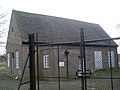
 Hockliffe Telephone Exchange, Beds - geograph.org.uk - 2856386.jpg 3 072 × 2 304; 1,78 MB
-
 Hockliffe, St Nicholas - geograph.org.uk - 5439440.jpg 4 608 × 3 456; 5,44 MB
-
 Hockliffe, Watling Street - geograph.org.uk - 5615320.jpg 1 024 × 768; 170 KB
-
 Houses on Hockliffe Road - geograph.org.uk - 5570249.jpg 2 048 × 1 536; 1,43 MB
-
 Junction of A5 and A4012 at Hockliffe - geograph.org.uk - 1989797.jpg 640 × 480; 133 KB
-
 Layby on the A5 approaching Hockliffe - geograph.org.uk - 2882602.jpg 1 600 × 1 200; 598 KB
-
 Leighton Road, Hockliffe - geograph.org.uk - 5279822.jpg 2 304 × 1 728; 1,23 MB
-
 Little Chef ^ Travelodge - geograph.org.uk - 2633304.jpg 4 000 × 3 000; 4,9 MB
-

-
 McDonald's on Watling Street, Hockliffe - geograph.org.uk - 6196609.jpg 1 886 × 1 228; 1,38 MB
-
 New houses on Watling Street, Hockliffe - geograph.org.uk - 6146717.jpg 1 920 × 1 280; 1,55 MB
-
 Path down to the A5 - geograph.org.uk - 3182369.jpg 1 600 × 1 069; 744 KB
-
 Path to Church End from the A5 - geograph.org.uk - 3182366.jpg 1 600 × 1 068; 819 KB
-
 Path to Hill Farm - geograph.org.uk - 3411425.jpg 1 600 × 1 068; 523 KB
-
 Path to Old Stock Farm - geograph.org.uk - 3182397.jpg 1 200 × 1 600; 841 KB
-
 Ploughed field near Hockliffe - geograph.org.uk - 3182385.jpg 1 200 × 1 600; 582 KB
-
 Public Footpath - geograph.org.uk - 2631440.jpg 4 000 × 3 000; 4,71 MB
-

-
 Roman ring inscribed DEO TOTA.jpg 1 398 × 1 662; 293 KB
-
-
 St. Nicholas Church, Hockliffe Church End - geograph.org.uk - 2623076.jpg 4 000 × 3 000; 5,17 MB
-

-
-

-
 Stanbridgeford and Stanbridge - geograph.org.uk - 5463169.jpg 3 264 × 2 448; 3,42 MB
-
 Stream and Travelodge - geograph.org.uk - 3411408.jpg 1 600 × 1 068; 565 KB
-
 The A5 approaching Hockliffe - geograph.org.uk - 2882600.jpg 1 600 × 1 200; 600 KB
-
 The A5 north of Hockliffe - geograph.org.uk - 2882604.jpg 1 600 × 1 200; 548 KB
-
 The Harvester on Watling Street, Hockliffe - geograph.org.uk - 2882734.jpg 1 600 × 1 200; 595 KB
-
 The Harvester on Watling Street, Hockliffe - geograph.org.uk - 5279821.jpg 2 304 × 1 728; 866 KB
-
 The view eastwards along Church Lane - geograph.org.uk - 2594080.jpg 640 × 480; 80 KB
-
 The view westwards along Church Lane - geograph.org.uk - 2594082.jpg 640 × 480; 83 KB
-
 Tree on Watling Street, Hockliffe - geograph.org.uk - 6146718.jpg 1 872 × 1 204; 2,08 MB
-
 Trees hiding the A5 - geograph.org.uk - 3182373.jpg 1 600 × 1 065; 567 KB
-
 View NNW up the A4012 - geograph.org.uk - 1989806.jpg 640 × 480; 155 KB
-
 Watling Street, Hockliffe - geograph.org.uk - 2882733.jpg 1 600 × 1 200; 579 KB
-
 Animal Farm - geograph.org.uk - 182728.jpg 480 × 640; 93 KB
-
 Chalgrave Parish Sign - geograph.org.uk - 326088.jpg 640 × 480; 144 KB
-
 Footpath through fields near the A5 - geograph.org.uk - 325780.jpg 640 × 480; 107 KB
-
 Hedgerow beside footpath - geograph.org.uk - 326842.jpg 640 × 480; 99 KB
-
 Hill Farm, Hockliffe - geograph.org.uk - 183141.jpg 640 × 267; 51 KB
-
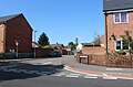
 Manor Avenue, Hockliffe - geograph.org.uk - 171949.jpg 640 × 480; 118 KB
-
 Tilsworth Golf Centre , The Clubhouse - geograph.org.uk - 193765.jpg 640 × 374; 65 KB
-
 Tilsworth Golf Course - geograph.org.uk - 193411.jpg 640 × 480; 60 KB
-
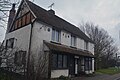
 Trinity Hall Farmhouse - geograph.org.uk - 204364.jpg 640 × 473; 121 KB
-
 Woodcock Lane, Hockliffe - geograph.org.uk - 183438.jpg 640 × 480; 81 KB


.jpg)


_-_geograph.org.uk_-_2856399.jpg)
_-_geograph.org.uk_-_2856410.jpg)


_-_geograph.org.uk_-_2600679.jpg)
_-_geograph.org.uk_-_2600685.jpg)
_-_geograph.org.uk_-_2600691.jpg)


