Category:Holcot
Aller à la navigation
Aller à la recherche
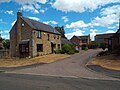
English: Holcot is a village in the West Northamptonshire district of the county of Northamptonshire in England.
village britannique  | |||||
| Téléverser des médias | |||||
| Nature de l’élément | |||||
|---|---|---|---|---|---|
| Lieu | West Northamptonshire, Northamptonshire, Midlands de l'Est, Angleterre | ||||
| Population |
| ||||
| Superficie |
| ||||
 | |||||
Sous-catégories
Cette catégorie comprend 2 sous-catégories, dont les 2 ci-dessous.
H
- Holcot War Memorial (5 F)
Média dans la catégorie « Holcot »
Cette catégorie comprend 91 fichiers, dont les 91 ci-dessous.
-
 Balloons over Pitsford Reservoir - geograph.org.uk - 138165.jpg 640 × 480 ; 123 kio
-
 Brixworth Road - geograph.org.uk - 1809050.jpg 640 × 426 ; 75 kio
-
 Brixworth road - geograph.org.uk - 4042652.jpg 2 048 × 1 536 ; 1,53 Mio
-
 Brixworth Road at Pitsford Water, Northamptonshire - geograph.org.uk - 5859517.jpg 1 024 × 768 ; 217 kio
-
 Brixworth Road causeway - geograph.org.uk - 2492196.jpg 640 × 480 ; 95 kio
-
 Brixworth Road towards Pitsford Water - geograph.org.uk - 5319745.jpg 800 × 626 ; 195 kio
-
 Canada Goose - geograph.org.uk - 1809043.jpg 640 × 426 ; 174 kio
-
 Cars crossing Pitsford Reservoir on the Causeway - geograph.org.uk - 4064074.jpg 1 024 × 683 ; 126 kio
-
 Causeway across Pitsford Water, Northamptonshire - geograph.org.uk - 5859520.jpg 1 024 × 768 ; 223 kio
-
 Causeway over Pitsford Reservoir - geograph.org.uk - 1833277.jpg 4 288 × 2 848 ; 6,22 Mio
-
 Cricket Ground with Gazebo. - geograph.org.uk - 61050.jpg 640 × 480 ; 132 kio
-
 Farm Close, Holcot, Northamptonshire - geograph.org.uk - 5859523.jpg 1 024 × 768 ; 207 kio
-
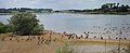
 Geese at Pitsford Reservoir - geograph.org.uk - 2488568.jpg 640 × 480 ; 90 kio
-
 Geese at Pitsford Reservoir - geograph.org.uk - 2492254.jpg 640 × 480 ; 99 kio
-
 Geese at Pitsford Reservoir - geograph.org.uk - 2494097.jpg 640 × 264 ; 48 kio
-
 Heading north along Walgrave Road - geograph.org.uk - 5319778.jpg 800 × 600 ; 114 kio
-
 Holcot - Brixworth Road about 1960 - geograph.org.uk - 3453964.jpg 3 762 × 2 499 ; 1,39 Mio
-
 Holcot Church - geograph.org.uk - 5439074.jpg 480 × 640 ; 79 kio
-
 Holcot entrance sign - geograph.org.uk - 2369285.jpg 640 × 480 ; 60 kio
-
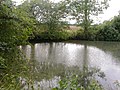
 Holcot pond - geograph.org.uk - 1831817.jpg 640 × 426 ; 106 kio
-
 Holcot Rectory and Parish Church - geograph.org.uk - 3267359.jpg 3 900 × 2 600 ; 1,65 Mio
-
 Holcot village across Pitsford reservoir causeway - geograph.org.uk - 3454021.jpg 3 824 × 2 558 ; 1,54 Mio
-
 Holcot, aerial 2015 - geograph.org.uk - 4500633.jpg 640 × 427 ; 68 kio
-
 Holcot, UK - panoramio (1).jpg 1 097 × 1 097 ; 568 kio
-
 Holcot, UK - panoramio (2).jpg 1 440 × 1 440 ; 640 kio
-
 Holcot, UK - panoramio (3).jpg 1 440 × 1 440 ; 544 kio
-
 Holcot, UK - panoramio (4).jpg 1 440 × 1 440 ; 502 kio
-
 Holcot, UK - panoramio.jpg 1 045 × 1 045 ; 300 kio
-
 Holcot-aerial 2015 - geograph.org.uk - 4500630.jpg 640 × 427 ; 75 kio
-
 Holcot-Walgrave Road - geograph.org.uk - 5377749.jpg 1 600 × 1 200 ; 649 kio
-
 Main Street, Holcot - geograph.org.uk - 5859525.jpg 1 024 × 768 ; 218 kio
-
 Main Street, near Holcot - geograph.org.uk - 5859532.jpg 1 024 × 768 ; 263 kio
-
 Marshall threshing machine at Holcot 08.JPG 3 088 × 2 056 ; 2,73 Mio
-
 Moulton Grange - geograph.org.uk - 61042.jpg 640 × 480 ; 147 kio
-
 Moulton Lodge Farm - geograph.org.uk - 5382202.jpg 1 600 × 1 200 ; 435 kio
-
 Munching Horse - geograph.org.uk - 147725.jpg 640 × 480 ; 125 kio
-
 Old phone box used as a book exchange - geograph.org.uk - 3537509.jpg 4 320 × 3 240 ; 5,95 Mio
-
 Old road - geograph.org.uk - 1880567.jpg 480 × 640 ; 60 kio
-
 Path alongside Pitsford Water, Northamptonshire - geograph.org.uk - 5859510.jpg 1 024 × 768 ; 265 kio
-
 Path near Pitsford Water, Northamptonshire - geograph.org.uk - 5859516.jpg 768 × 1 024 ; 273 kio
-
 Pitsford Causeway - geograph.org.uk - 3356903.jpg 800 × 601 ; 91 kio
-
 Pitsford Causeway, entrance sign - geograph.org.uk - 2369289.jpg 640 × 480 ; 49 kio
-
 Pitsford Reservoir - geograph.org.uk - 2492191.jpg 640 × 480 ; 77 kio
-
 Pitsford reservoir and causeway, aerial 2014 - geograph.org.uk - 4054834.jpg 640 × 388 ; 49 kio
-
 Pitsford reservoir causeway - geograph.org.uk - 4042647.jpg 2 048 × 1 536 ; 609 kio
-
 Pitsford Reservoir from Holcot tower - geograph.org.uk - 3267345.jpg 3 900 × 2 600 ; 1,63 Mio
-
 Pitsford Reservoir wall - geograph.org.uk - 2488570.jpg 640 × 480 ; 83 kio
-
-
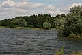
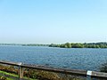
 Pitsford Water - geograph.org.uk - 1809041.jpg 640 × 426 ; 86 kio
-
 Pitsford Water - geograph.org.uk - 1809047.jpg 640 × 426 ; 76 kio
-
 Pitsford Water - geograph.org.uk - 1809052.jpg 640 × 426 ; 73 kio
-
 Pitsford Water - geograph.org.uk - 2369292.jpg 640 × 480 ; 51 kio
-
 Pitsford Water causeway - geograph.org.uk - 1809049.jpg 640 × 426 ; 84 kio
-
 Pitsford Water causeway - geograph.org.uk - 2369293.jpg 640 × 480 ; 45 kio
-
 Road junction in Holcot, Northamptonshire - geograph.org.uk - 5859521.jpg 1 024 × 768 ; 202 kio
-
 Road junction near Holcot, Northamptonshire - geograph.org.uk - 5859528.jpg 1 024 × 768 ; 258 kio
-
 St Mary and All Saints' church in Holcot - geograph.org.uk - 5319759.jpg 800 × 525 ; 115 kio
-
 St Mary and All Saints' church in Holcot - geograph.org.uk - 5319770.jpg 800 × 788 ; 160 kio
-
 Stile on Footpath - geograph.org.uk - 147714.jpg 640 × 480 ; 97 kio
-
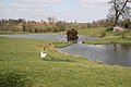
 Swan on its nest - geograph.org.uk - 1833321.jpg 2 863 × 1 900 ; 1,19 Mio
-
 The causeway at Pitsford Water - geograph.org.uk - 5319739.jpg 800 × 600 ; 123 kio
-
 The Manor House at Holcot - geograph.org.uk - 5319766.jpg 800 × 497 ; 132 kio
-
 The Northamptonshire Round - geograph.org.uk - 5439075.jpg 640 × 480 ; 58 kio
-
 The White Swan, Holcot - geograph.org.uk - 3540436.jpg 4 320 × 3 240 ; 4,12 Mio
-
 A Bad Sign on the A43 - geograph.org.uk - 143993.jpg 640 × 480 ; 106 kio
-
 Back Lane, Holcot - geograph.org.uk - 147075.jpg 640 × 480 ; 82 kio
-
 Bridge over Brook - geograph.org.uk - 61045.jpg 640 × 480 ; 166 kio
-
 Brixworth Country Park - geograph.org.uk - 61023.jpg 640 × 480 ; 139 kio
-
 Brixworth Road - geograph.org.uk - 61081.jpg 640 × 480 ; 130 kio
-
 Chartered Accountants Offices - geograph.org.uk - 143997.jpg 640 × 467 ; 64 kio
-
 Common Mallow (Malva Sylvestris) - geograph.org.uk - 460717.jpg 480 × 640 ; 153 kio
-
 Distant Farm - geograph.org.uk - 147738.jpg 640 × 480 ; 78 kio
-
 Farm Pond - geograph.org.uk - 236654.jpg 640 × 480 ; 117 kio
-
 Farm Track. - geograph.org.uk - 460658.jpg 640 × 480 ; 119 kio
-
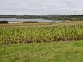 Farmland South of Pitsford Water - geograph.org.uk - 61054.jpg 640 × 480 ; 137 kio
-
 Footbridge - geograph.org.uk - 147720.jpg 480 × 640 ; 104 kio
-
 Footpath through Maize - geograph.org.uk - 236645.jpg 640 × 480 ; 125 kio
-
 Footpath through Ploughed Field - geograph.org.uk - 236650.jpg 640 × 480 ; 126 kio
-
 Grange Cottages - geograph.org.uk - 234991.jpg 640 × 480 ; 94 kio
-
 Headland Footpath through a Ploughed Field - geograph.org.uk - 236653.jpg 640 × 480 ; 115 kio
-
 Holcot Road - geograph.org.uk - 236751.jpg 640 × 480 ; 98 kio
-
 Main Street, Holcot - geograph.org.uk - 147074.jpg 640 × 480 ; 75 kio
-
 Moulton Lodge Farm - geograph.org.uk - 236749.jpg 640 × 480 ; 91 kio
-
 Moulton Road - geograph.org.uk - 236742.jpg 640 × 480 ; 105 kio
-
 Overgrown Ditch. - geograph.org.uk - 460652.jpg 640 × 480 ; 110 kio
-
 Rectory Farm - geograph.org.uk - 143994.jpg 640 × 480 ; 73 kio
-
 Rectory Farm - geograph.org.uk - 236642.jpg 640 × 480 ; 78 kio
-
 Road Works on the A43 - geograph.org.uk - 143951.jpg 640 × 480 ; 93 kio
-
 Stone Bridge over a Brook - geograph.org.uk - 235002.jpg 640 × 480 ; 82 kio
-
 Sywell Lodge Farm - geograph.org.uk - 143995.jpg 640 × 466 ; 80 kio
-
 Vintage Tractor Ploughing Contest. - geograph.org.uk - 61083.jpg 640 × 480 ; 156 kio


.jpg)
.jpg)
.jpg)
.jpg)


_-_geograph.org.uk_-_460717.jpg)


