Category:Holywell, Flintshire
Zur Navigation springen
Zur Suche springen
Kleinstadt im Vereinigten Königreich   | |||||
| Medium hochladen | |||||
| Ist ein(e) | |||||
|---|---|---|---|---|---|
| Ort | Flintshire, Wales | ||||
| Einwohnerzahl |
| ||||
| offizielle Website | |||||
 | |||||
Brezhoneg: Treffynnon (a zo Holywell e saozneg) zo ur gêr e Sir y Fflint, e biz Kembre, er c'hornôg da aber ar stêr Dyfrdwy. Pempvet kêr vrasañ kontelezh Y Fflint eo-hi.
Cymraeg: Mae Treffynnon ( Saesneg: Holywell) yn dref yn Sir y Fflint. Saif yn agos i lan orllewinol Glannau Dyfrdwy ar yr A5026, tua hanner ffordd rhwng Prestatyn i'r gogledd a'r Wyddgrug i'r de, tua 5 milltir o dref Y Fflint. Mae'r hen dref yn gorwedd ar un o lethrau is Mynydd Helygain. Mae'r dref yn enwog fel lleoliad Ffynnon Gwenffrewi a'i chapel, sy'n ganolfan pererindod i Gatholigion ac eraill ers canrifoedd lawer.
English: Holywell is the fifth largest town in Flintshire, North Wales, lying to the west of the estuary of the River Dee.
- NOTE: Holywell may refer to many other places
Français : Holywell (galois : Treffynnon) est le cinquième plus grand village du Flintshire, au nord du Pays de Galles. Il est situé à l'ouest de l'estuaire du fleuve Dee.
Nederlands: Holywell is een plaats in Wales, in het bestuurlijke graafschap Flintshire en in het ceremoniële behouden graafschap Clwyd. De plaats telt 2300 inwoners.
Unterkategorien
Es werden 9 von insgesamt 9 Unterkategorien in dieser Kategorie angezeigt:
In Klammern die Anzahl der enthaltenen Kategorien (K), Seiten (S), Dateien (D)
Medien in der Kategorie „Holywell, Flintshire“
Folgende 200 Dateien sind in dieser Kategorie, von 379 insgesamt.
(vorherige Seite) (nächste Seite)-
 'The Lookout' and the Duke of Lancaster - geograph.org.uk - 3257552.jpg 640 × 480; 101 KB
-
 'The Lookout' at Greenfield Dock - geograph.org.uk - 3257360.jpg 480 × 640; 61 KB
-
 2010 Wales Flintshire Community Holywell map.svg 512 × 568; 494 KB
-
 2024 Wales Flintshire Community Holywell map.svg 512 × 568; 394 KB
-
 A boundary sign on the Greenfield Valley Heritage Trail - geograph.org.uk - 2558858.jpg 3.296 × 2.472; 2,05 MB
-
 A mess of boats at Greenfield Dock - geograph.org.uk - 2483235.jpg 4.000 × 3.000; 4,12 MB
-

-

-
 A red telephone kiosk, Holywell - geograph.org.uk - 6293055.jpg 1.536 × 2.048; 521 KB
-
 A type C EIIR double pillar box, Holywell - geograph.org.uk - 6293094.jpg 3.120 × 4.160; 3,89 MB
-

-
 A548 Bagillt Road - geograph.org.uk - 3392875.jpg 640 × 480; 61 KB
-
 A548 Bagillt Road and a bench mark - geograph.org.uk - 2267460.jpg 640 × 480; 145 KB
-

-
 A548 Mostyn Road at Greenfield-Maes-Glas - geograph.org.uk - 6194674.jpg 800 × 600; 183 KB
-
 A55 near Pantasaph - geograph.org.uk - 33782.jpg 512 × 384; 31 KB
-
 Abandoned coastal track - geograph.org.uk - 2986698.jpg 1.600 × 1.200; 399 KB
-
 Abandoned farm above Stokyn Hall - geograph.org.uk - 1925238.jpg 640 × 480; 102 KB
-
 Abbey Barn (1) - geograph.org.uk - 2558754.jpg 3.296 × 2.472; 2,01 MB
-
 Abbey Barn (2) - geograph.org.uk - 2558759.jpg 3.296 × 2.472; 1,94 MB
-
 Ancient hay rake - geograph.org.uk - 2558830.jpg 3.296 × 2.472; 2,02 MB
-
 Autumn Lake (enhanced).jpg 2.000 × 1.500; 3,54 MB
-

-

-

-
 Bandstand Greenfield Valley Heritage trail - geograph.org.uk - 2558787.jpg 3.296 × 2.472; 2,01 MB
-

-

-
 Bank of the River Dee estuary - geograph.org.uk - 3258596.jpg 640 × 480; 121 KB
-
 Bank side smelting works, near Greenfield.jpeg 603 × 466; 97 KB
-
 Basingwerk Abbey - geograph.org.uk - 6256600.jpg 5.184 × 3.888; 5,3 MB
-
 Bay Parking - geograph.org.uk - 2274846.jpg 4.000 × 3.000; 5,67 MB
-

-

-

-
 Bench mark and bolt on St James' church - geograph.org.uk - 2262979.jpg 480 × 640; 143 KB
-

-
 Bench mark on the former British School - geograph.org.uk - 2265026.jpg 480 × 640; 171 KB
-

-
 Bench mark on the former railway bridge - geograph.org.uk - 2264375.jpg 480 × 640; 195 KB
-
 Bench mark on the NatWest Bank, Holywell - geograph.org.uk - 2263053.jpg 480 × 640; 149 KB
-

-

-
 Benchmark on courthouse, Holywell - geograph.org.uk - 6286712.jpg 1.200 × 1.600; 488 KB
-
 Benchmark on old railway bridge, Holywell - geograph.org.uk - 6291599.jpg 1.536 × 2.048; 816 KB
-
 Benchmark on town hall, Holywell - geograph.org.uk - 6288632.jpg 1.200 × 1.600; 582 KB
-
 Bethel Baptist Chapel, Holywell (24701476069).jpg 1.671 × 1.347; 517 KB
-
 Birds on the wire - geograph.org.uk - 3258588.jpg 640 × 480; 87 KB
-
 Boat Train.jpg 5.309 × 2.071; 6,99 MB
-
 Boats at Greenfield Dock - geograph.org.uk - 6126681.jpg 800 × 546; 142 KB
-
 Boats in Greenfield Dock - geograph.org.uk - 2805555.jpg 480 × 640; 50 KB
-

-

-
 Bryn Celyn pond - geograph.org.uk - 104456.jpg 640 × 480; 94 KB
-
 Brynford Hall Farm - geograph.org.uk - 1142377.jpg 640 × 498; 105 KB
-
 Brynford Pets' Cemetery - geograph.org.uk - 6147871.jpg 4.000 × 3.000; 2,91 MB
-
 Brynford Road, Holywell - geograph.org.uk - 6147864.jpg 3.970 × 2.682; 1,68 MB
-
 Brynford Street 1 - geograph.org.uk - 5867301.jpg 640 × 480; 65 KB
-
 Brynford Street 2 - geograph.org.uk - 5867302.jpg 640 × 480; 70 KB
-
 Buoy at Greenfield Dock - geograph.org.uk - 2805551.jpg 640 × 480; 43 KB
-
 Business Park - geograph.org.uk - 4498337.jpg 640 × 281; 27 KB
-

-

-
 Carved entrance to Greenfield Heritage Park - geograph.org.uk - 2558010.jpg 3.296 × 2.472; 2,01 MB
-
 Chimney and landing stage at Battery Pool - geograph.org.uk - 2769504.jpg 3.296 × 2.472; 2 MB
-
 Chimney below Battery Pool - geograph.org.uk - 2769461.jpg 2.472 × 3.296; 1,98 MB
-

-
 Coastal defences - geograph.org.uk - 2986557.jpg 1.600 × 1.200; 414 KB
-
 Coastal defences along the Dee Estuary - geograph.org.uk - 6196395.jpg 800 × 600; 149 KB
-
 Coastal walk on a windy day - geograph.org.uk - 3184062.jpg 1.600 × 1.200; 351 KB
-
 Coed Mawr Farm - geograph.org.uk - 6053841.jpg 640 × 480; 106 KB
-

-
 Copper & brass works.jpeg 800 × 625; 141 KB
-
 Cottages in Greenfield Valley Museum - geograph.org.uk - 2280488.jpg 640 × 480; 153 KB
-
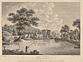 Cotton Works near Holywell, Flintshire.jpeg 523 × 388; 75 KB
-

-
 Courthouse on Halkyn Street, Holywell - geograph.org.uk - 6283744.jpg 2.048 × 1.536; 381 KB
-
 Cwm Llydan Farmhouse - geograph.org.uk - 2558840.jpg 3.296 × 2.472; 1,96 MB
-
 DD marks in pavement, Holywell - geograph.org.uk - 6292035.jpg 4.160 × 3.120; 5,21 MB
-
 Derelict landscape - geograph.org.uk - 4498377.jpg 640 × 426; 52 KB
-
 Derelict warehouse - geograph.org.uk - 4498335.jpg 640 × 426; 48 KB
-
-

-
 Doc Maes Glas - geograph.org.uk - 2986601.jpg 1.600 × 1.200; 306 KB
-
 Doc Maesglas - Greenfield Dock - geograph.org.uk - 2805515.jpg 480 × 640; 81 KB
-
 Doc y Maes Glas - Greenfield Dock - geograph.org.uk - 6053216.jpg 640 × 480; 81 KB
-
 Doreen O'Shea, posing for Turners at Holywell, July 1957.jpg 710 × 907; 199 KB
-

-
 Drainage well from Battery Pool - geograph.org.uk - 2769477.jpg 3.296 × 2.472; 2,04 MB
-
 Electricity sub-station at Greenfield Dock, Flintshire - geograph.org.uk - 4747128.jpg 3.700 × 2.467; 1,18 MB
-
 Elizabeth II pillar box, Holywell - geograph.org.uk - 6293082.jpg 1.536 × 2.048; 401 KB
-
 Entrance to Greenfield Dock Parking Area - geograph.org.uk - 4747113.jpg 3.184 × 2.123; 2,41 MB
-
 Fan vaulting at St Winefride's Well - geograph.org.uk - 6348042.jpg 5.184 × 3.888; 4,44 MB
-
 Farmland - geograph.org.uk - 4498345.jpg 640 × 426; 49 KB
-
 Finished product ready for dispatch - geograph.org.uk - 2986791.jpg 1.600 × 1.200; 346 KB
-

-

-

-
 Footpaths in Greenfield Valley - geograph.org.uk - 2268858.jpg 640 × 480; 207 KB
-
 Former County Police station on Halkyn Street, Holywell - geograph.org.uk - 6285542.jpg 2.048 × 1.536; 394 KB
-
 Former Holywell Town station site in 2020..jpg 2.048 × 1.536; 407 KB
-

-
 Former Road Bridge, Holywell - geograph.org.uk - 5884517.jpg 1.600 × 1.200; 599 KB
-
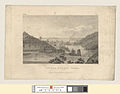
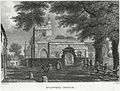
 Four views in Flintshire, a View near Holywell.jpeg 800 × 677; 239 KB
-
 Gate along the Wales Coast Path - geograph.org.uk - 6196298.jpg 800 × 530; 106 KB
-

-

-
 Gate stile on the River Dee bank - geograph.org.uk - 3258632.jpg 640 × 480; 83 KB
-

-

-
 GPO Cross Connection Cabinet, Holywell - geograph.org.uk - 6294998.jpg 4.160 × 3.120; 4,79 MB
-
 Graffiti at St.Winefrides Well - geograph.org.uk - 4126767.jpg 1.024 × 683; 407 KB
-
 Grassland between the sea wall and the inner bank - geograph.org.uk - 3186398.jpg 1.600 × 1.200; 364 KB
-
 Greenfield Business Park - geograph.org.uk - 2805498.jpg 640 × 480; 56 KB
-
 Greenfield Business Park - geograph.org.uk - 2805507.jpg 640 × 480; 51 KB
-
 Greenfield Business Park - geograph.org.uk - 5319810.jpg 640 × 478; 41 KB
-
 Greenfield Dock - geograph.org.uk - 1925305.jpg 640 × 480; 96 KB
-
 Greenfield Dock - geograph.org.uk - 3257532.jpg 640 × 480; 99 KB
-
 Greenfield Dock - geograph.org.uk - 4433871.jpg 2.288 × 1.712; 802 KB
-
 Greenfield Dock - May 2017 (1) - geograph.org.uk - 5380073.jpg 1.088 × 1.250; 1,65 MB
-
 Greenfield Dock - May 2017 (2) - geograph.org.uk - 5380076.jpg 1.250 × 829; 1,22 MB
-
 Greenfield Dock, Flintshire - geograph.org.uk - 4746837.jpg 3.184 × 2.123; 2,01 MB
-
 Greenfield Dock, Flintshire - geograph.org.uk - 4746853.jpg 3.184 × 2.123; 1,89 MB
-
 Greenfield Heritage Park - geograph.org.uk - 97417.jpg 640 × 480; 164 KB
-

-

-

-

-

-

-
-

-

-

-

-

-

-

-

-

-
 Greenfield waste water treatment works - geograph.org.uk - 2986532.jpg 1.600 × 1.200; 342 KB
-
 Greenfield waste water treatment works - geograph.org.uk - 2986637.jpg 1.600 × 1.200; 412 KB
-

-

-
 Halkyn Road, home of Holywell Town.jpg 3.648 × 2.736; 3,12 MB
-
 Handicap chase (13178652353).jpg 2.745 × 1.768; 1,41 MB
-
 Hanes Methodistiaeth yn Nosbarth Trefffynon 1750-1910.djvu 1.783 × 2.605, 333 Seiten; 23,19 MB
-
 High Street, Holywell - geograph.org.uk - 5817390.jpg 2.961 × 2.221; 1.022 KB
-

-

-
 History of Holywell Parish, River bank smelting works.jpeg 900 × 788; 903 KB
-
 Holway Convenience Store, Holway - geograph.org.uk - 6224838.jpg 1.600 × 1.068; 540 KB
-
 Holway Level entrance (1).jpg 4.624 × 3.468; 7,51 MB
-
 Holway Level entrance (2).jpg 3.468 × 4.624; 3,75 MB
-
 Holywell (24609526685).jpg 4.000 × 3.000; 3,38 MB
-
 Holywell - Arcadians 1927-1928.jpg 3.600 × 2.353; 4,53 MB
-
 Holywell beats Ma Filleule (13180072874).jpg 2.807 × 2.213; 1,27 MB
-
 Holywell Chapel.jpg 640 × 480; 100 KB
-
 Holywell Chapela.jpg 442 × 476; 295 KB
-
 Holywell Church.jpeg 900 × 680; 787 KB
-
 Holywell Flintshire welcome sign (angled).jpg 4.624 × 3.468; 5,68 MB
-
 Holywell Flintshire welcome sign.jpg 4.624 × 3.468; 4,92 MB
-
 Holywell High Street.jpg 640 × 458; 113 KB
-
 Holywell IMG 5322 - panoramio.jpg 1.600 × 979; 564 KB
-
 Holywell Wales banner.jpg 4.128 × 590; 1,59 MB
-
 Holywell, UK - panoramio - IIya Kuzhekin (1).jpg 3.909 × 2.931; 2,54 MB
-
 Holywell, UK - panoramio - IIya Kuzhekin (2).jpg 4.000 × 3.000; 4,6 MB
-
 Holywell, UK - panoramio - IIya Kuzhekin.jpg 4.000 × 2.250; 1,9 MB
-
 Holywell, UK - panoramio.jpg 4.000 × 3.000; 4,14 MB
-
 Hotel Victoria, Holywell - geograph.org.uk - 2264742.jpg 640 × 480; 127 KB
-
 Hotel Victoria, Holywell - geograph.org.uk - 6283425.jpg 660 × 495; 73 KB
-

-

-
 Inscribed stone (2) in wall on Halkyn Street, Holywell - geograph.org.uk - 6296737.jpg 4.160 × 3.120; 6,1 MB
-
 Inscribed stone in wall on Halkyn Street, Holywell - geograph.org.uk - 6295555.jpg 4.160 × 3.120; 5,99 MB
-
-

-
 Jetty and the New Quay reservoir - geograph.org.uk - 2276071.jpg 640 × 480; 151 KB
-
 Landing stage Battery Pool - geograph.org.uk - 2769495.jpg 3.296 × 2.472; 2,07 MB
-
 Llwybr Arfordir Cymru - geograph.org.uk - 2986680.jpg 1.600 × 1.200; 457 KB
-
 Llwybr Arfordir Cymru - geograph.org.uk - 2986708.jpg 1.600 × 1.200; 437 KB
-
 Llwybr Arfordir Cymru - geograph.org.uk - 3183982.jpg 1.600 × 1.200; 312 KB
-
 Llwybr Arfordir Cymru - geograph.org.uk - 3184099.jpg 1.600 × 1.200; 386 KB
-
 Looking east across the Dee estuary - geograph.org.uk - 2810577.jpg 640 × 480; 75 KB
-
 Lower Cotton Mill - geograph.org.uk - 2558813.jpg 3.296 × 2.472; 2,01 MB
-
 Lower Cotton Mill, Greenfield Valley - geograph.org.uk - 2271747.jpg 640 × 480; 198 KB
-

-
 Lumps and bumps at Basingwerk Abbey - geograph.org.uk - 2281965.jpg 640 × 480; 123 KB
-
 Main Stand at Halkyn Road.jpg 3.648 × 2.736; 2,84 MB
-
 Marshy land at Greenfield Dock - geograph.org.uk - 2810568.jpg 640 × 480; 86 KB
-
 Meadow Mill on the Greenfield Heritage trail (1) - geograph.org.uk - 2558848.jpg 3.296 × 2.472; 2,01 MB
-
 Meadow Mill on the Greenfield Heritage trail (2) - geograph.org.uk - 2558854.jpg 3.296 × 2.472; 2,1 MB
-
 Melin Trefynnon, Holywell.jpg 640 × 480; 65 KB
-
 Mill pond at Bryn Celyn - geograph.org.uk - 2558863.jpg 3.296 × 2.472; 2,07 MB
-
 Miss Hughes, Holywell NLW3364429.jpg 344 × 553; 34 KB
-
 Muddy landscape - geograph.org.uk - 4498382.jpg 640 × 338; 37 KB
-
 New Road, Holywell - geograph.org.uk - 6431574.jpg 1.280 × 876; 430 KB
-

-

-


_-_geograph.org.uk_-_2558754.jpg)
_-_geograph.org.uk_-_2558759.jpg)

.jpg)


.jpg)


.jpg)


_-_geograph.org.uk_-_5380073.jpg)
_-_geograph.org.uk_-_5380076.jpg)


.jpg)


.jpg)
.jpg)
.jpg)

.jpg)


.jpg)


.jpg)
.jpg)


_in_wall_on_Halkyn_Street,_Holywell_-_geograph.org.uk_-_6296737.jpg)


_-_geograph.org.uk_-_2558848.jpg)
_-_geograph.org.uk_-_2558854.jpg)


