Category:Homersfield
Aller à la navigation
Aller à la recherche
English: South Elmham St. Mary, known as Homersfield, is a small village located on the banks of the River Waveney in Suffolk, UK, on the border with Norfolk. It is one of The Saints. It is the home of the oldest surviving concrete bridge in Britain, a 50-foot span built in 1870 by the Adair estate. It was restored during the 1990s by a partnership between the parish council and various local authorities and heritage bodies.
localité britannique du comté anglais de Suffolk  | |||||
| Téléverser des médias | |||||
| Nature de l’élément | |||||
|---|---|---|---|---|---|
| Lieu | St. Mary, South Elmham otherwise Homersfield, East Suffolk, Suffolk, Angleterre de l'Est, Angleterre | ||||
 | |||||
Sous-catégories
Cette catégorie comprend 3 sous-catégories, dont les 3 ci-dessous.
B
- The Black Swan, Homersfield (4 F)
H
- Homersfield Bridge (9 F)
M
- St Mary's Church, Homersfield (23 F)
Média dans la catégorie « Homersfield »
Cette catégorie comprend 23 fichiers, dont les 23 ci-dessous.
-
 Church Lane, Homersfield - geograph.org.uk - 3409972.jpg 640 × 480 ; 81 kio
-
 Cottages by the village green, Homersfield - geograph.org.uk - 3409982.jpg 640 × 480 ; 117 kio
-
 Cottages by the village green, Homersfield - geograph.org.uk - 3409984.jpg 640 × 462 ; 90 kio
-
 Footpath to St Mary's church, Homersfield - geograph.org.uk - 3409970.jpg 640 × 480 ; 175 kio
-
 Homersfield - village sign - geograph.org.uk - 2309231.jpg 1 074 × 1 280 ; 654 kio
-
 Homersfield - village sign - geograph.org.uk - 2309250.jpg 890 × 1 280 ; 488 kio
-
 Homersfield Village Sign - geograph.org.uk - 1136742.jpg 3 072 × 2 304 ; 1,44 Mio
-
 Homersfield Village Sign - geograph.org.uk - 1136812.jpg 3 072 × 2 304 ; 1,38 Mio
-
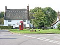
 K6 telephone box on Homersfield village green - geograph.org.uk - 3409983.jpg 640 × 480 ; 127 kio
-
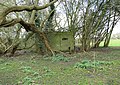 Pillbox by the River Waveney, Homersfield - geograph.org.uk - 3409986.jpg 640 × 454 ; 179 kio
-
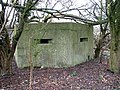
 Pillbox by the River Waveney, Homersfield - geograph.org.uk - 3409988.jpg 640 × 480 ; 190 kio
-
 Pillbox by the River Waveney, Homersfield - geograph.org.uk - 3409989.jpg 640 × 480 ; 173 kio
-
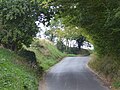 St Cross Road - geograph.org.uk - 5518384.jpg 4 000 × 3 000 ; 4,51 Mio
-
 St Cross Road - geograph.org.uk - 5518388.jpg 4 000 × 3 000 ; 4,61 Mio
-
 Thatched cottage in Church Lane, Homersfield - geograph.org.uk - 3409975.jpg 640 × 480 ; 90 kio
-
 Thatched house in Homersfield - geograph.org.uk - 3409977.jpg 640 × 480 ; 84 kio
-
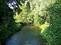
 The River Waveney near Homersfield - geograph.org.uk - 2309196.jpg 1 280 × 736 ; 311 kio
-
 The River Waveney, Homersfield - geograph.org.uk - 912241.jpg 640 × 480 ; 128 kio
-
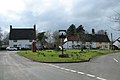 The village green in Homersfield - geograph.org.uk - 3409979.jpg 640 × 426 ; 71 kio
-
 View from Britain's oldest Concrete bridge - geograph.org.uk - 1431149.jpg 640 × 480 ; 151 kio
-
 Village Sign for Homersfield - geograph.org.uk - 1922099.jpg 480 × 640 ; 47 kio
-
 Church Lane, Homersfield - geograph.org.uk - 287127.jpg 640 × 480 ; 153 kio
-
 Homersfield village green - geograph.org.uk - 287130.jpg 640 × 480 ; 175 kio


