Category:Hook Norton
Vai alla navigazione
Vai alla ricerca
village and civil parish in Cherwell district, Oxfordshire, England  | |||||
| Carica un file multimediale | |||||
| Istanza di | |||||
|---|---|---|---|---|---|
| Luogo | Cherwell, Oxfordshire, Sud Est dell'Inghilterra, Inghilterra | ||||
| Popolazione |
| ||||
| Superficie |
| ||||
| Considerato essere uguale a | Hook Norton (pagina Wikimedia duplicata, parrocchia civile dell'Inghilterra) | ||||
| sito web ufficiale | |||||
 | |||||
Sottocategorie
Questa categoria contiene le 3 sottocategorie indicate di seguito, su un totale di 3.
File nella categoria "Hook Norton"
Questa categoria contiene 200 file, indicati di seguito, su un totale di 476.
(pagina precedente) (pagina successiva)-
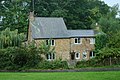
 A part of High Street in Hook Norton - geograph.org.uk - 5596620.jpg 4 000 × 3 000; 3,5 MB
-
 A spring at the foot of Council Hill - geograph.org.uk - 2966262.jpg 1 600 × 1 200; 799 KB
-
-
 A view down the valley - geograph.org.uk - 1732286.jpg 4 000 × 3 000; 1,95 MB
-
 A view over oilseed rape, south of Sibford Ferris - geograph.org.uk - 2947526.jpg 1 600 × 1 200; 638 KB
-
 Across the drive - geograph.org.uk - 1975389.jpg 4 000 × 3 000; 4,61 MB
-
 Across the field - geograph.org.uk - 2433443.jpg 4 288 × 3 216; 2,52 MB
-
 Across the field - geograph.org.uk - 2780407.jpg 4 320 × 3 240; 4,83 MB
-
 Across the Hook Norton Brook valley (geograph 7414814).jpg 4 187 × 2 518; 1,28 MB
-
 Across the road - geograph.org.uk - 2779259.jpg 4 320 × 3 240; 4,93 MB
-
 Allotments and Church - geograph.org.uk - 2433002.jpg 4 288 × 3 216; 3,9 MB
-
 Approaching Hook Norton - geograph.org.uk - 1735229.jpg 4 000 × 3 000; 2,54 MB
-
 Arable fields north of South Hill Farm - geograph.org.uk - 3993307.jpg 3 648 × 2 736; 2,51 MB
-
 Away from the lake - geograph.org.uk - 2780438.jpg 4 320 × 3 240; 4,82 MB
-
 Baptist Church Hall - geograph.org.uk - 1733412.jpg 1 280 × 959; 390 KB
-
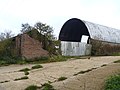
 Barn at Cowpastures Farm - geograph.org.uk - 1973823.jpg 4 000 × 3 000; 2 MB
-
 Bell Hill - geograph.org.uk - 1733427.jpg 1 280 × 959; 262 KB
-
 Bell Hill meets the High Street - geograph.org.uk - 3994812.jpg 3 482 × 2 630; 1,18 MB
-
 Belle Isle Farm - geograph.org.uk - 2779233.jpg 4 320 × 3 240; 4,88 MB
-
 Benacre Cottage being re-thatched (geograph 6618641).jpg 1 024 × 768; 163 KB
-
 Berryfield Farm - geograph.org.uk - 408420.jpg 640 × 480; 152 KB
-
 Between the houses - geograph.org.uk - 2780479.jpg 4 320 × 3 240; 4,95 MB
-
 Beware of badgers - geograph.org.uk - 1732262.jpg 4 000 × 3 000; 3,48 MB
-
 Bird shelter - geograph.org.uk - 2778293.jpg 4 320 × 3 240; 4,85 MB
-

-
 Bourne Lane - geograph.org.uk - 2693361.jpg 640 × 480; 90 KB
-
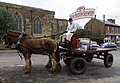
 Brewery dray at the Pear Tree Inn - geograph.org.uk - 2441324.jpg 640 × 480; 104 KB
-
 Brewery Dray, Hook Horton - geograph.org.uk - 4766868.jpg 1 500 × 1 701; 1,18 MB
-
 Brewery Lane - geograph.org.uk - 1733399.jpg 1 280 × 959; 351 KB
-
 Bridge abutment - geograph.org.uk - 5431441.jpg 1 024 × 768; 281 KB
-
 Bridleway across the road - geograph.org.uk - 1735185.jpg 4 000 × 3 000; 4,73 MB
-
 Bridleway and cottage - geograph.org.uk - 2779256.jpg 4 320 × 3 240; 4,93 MB
-

-
 Bridleway junction (1) - geograph.org.uk - 2779504.jpg 4 320 × 3 240; 4,85 MB
-
 Bridleway junction (2) - geograph.org.uk - 2779514.jpg 4 320 × 3 240; 4,87 MB
-
 Bridleway junction (3) - geograph.org.uk - 2779529.jpg 4 320 × 3 240; 4,61 MB
-
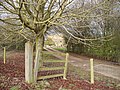
 Bridleway leaves road - geograph.org.uk - 2412875.jpg 4 288 × 3 216; 2,15 MB
-
 Bridleway sign - geograph.org.uk - 389160.jpg 640 × 481; 108 KB
-
 Bridleway to Swalcliffe Grange - geograph.org.uk - 6343291.jpg 1 024 × 768; 202 KB
-
 Bridleway to Wychford Hill - geograph.org.uk - 2433458.jpg 4 288 × 3 216; 1,1 MB
-
 Brockford Farm - geograph.org.uk - 1975399.jpg 4 000 × 3 000; 2,83 MB
-
 Brymbo Cottages - geograph.org.uk - 2266292.jpg 896 × 600; 123 KB
-
 Bus shelter, High Street - geograph.org.uk - 1733423.jpg 1 280 × 959; 243 KB
-
 Butter Hill under snow - geograph.org.uk - 2608872.jpg 2 592 × 1 944; 798 KB
-
 Buxton and Tornley - geograph.org.uk - 5107741.jpg 1 024 × 768; 287 KB
-
 By a spring on the path to Council Hill - geograph.org.uk - 2966999.jpg 1 200 × 1 600; 852 KB
-
 Camouflaged stile - geograph.org.uk - 1975385.jpg 4 000 × 3 000; 3,21 MB
-
 Cattle grid and drive - geograph.org.uk - 5429164.jpg 1 024 × 768; 254 KB
-
 Chalet style - geograph.org.uk - 2779552.jpg 4 320 × 3 240; 4,66 MB
-
 Church bus stop, Hook Norton - geograph.org.uk - 1733419.jpg 959 × 1 280; 273 KB
-
 Hook Norton Baptist Church - geograph.org.uk - 1733440.jpg 1 251 × 934; 599 KB
-
 Clay Bank - geograph.org.uk - 1733400.jpg 1 280 × 959; 289 KB
-
 Climb the hill - geograph.org.uk - 2432971.jpg 4 288 × 3 216; 2,5 MB
-
 Closeup of spring on the path to Council Hill - geograph.org.uk - 2967005.jpg 1 600 × 1 200; 685 KB
-
 Colman's Elm Barn - geograph.org.uk - 2777974.jpg 4 320 × 3 240; 4,85 MB
-
 Corner Cottage - geograph.org.uk - 1733432.jpg 1 280 × 959; 244 KB
-
 Corner Cottage - geograph.org.uk - 3994835.jpg 3 262 × 2 595; 1,26 MB
-
 Cornisa Cottage - geograph.org.uk - 2779239.jpg 4 320 × 3 240; 4,77 MB
-
 Cottage near The Pear Tree pub - geograph.org.uk - 765393.jpg 640 × 426; 109 KB
-
 Cottage on the green - geograph.org.uk - 2432851.jpg 4 288 × 3 216; 4,65 MB
-
 Cottages on Bell Hill - geograph.org.uk - 1733426.jpg 1 280 × 959; 362 KB
-
 Cottages on Netting Street - geograph.org.uk - 2721205.jpg 1 024 × 769; 623 KB
-
 Cottages on Netting Street, Hook Norton (geograph 7091640).jpg 3 406 × 2 591; 1,13 MB
-
 Country crossroads - geograph.org.uk - 2777990.jpg 4 320 × 3 240; 5,35 MB
-
 Country junction - geograph.org.uk - 2415687.jpg 4 288 × 3 216; 2,78 MB
-
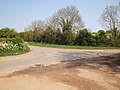 Country junction - geograph.org.uk - 2415701.jpg 4 288 × 3 216; 3,28 MB
-
 Country junction - geograph.org.uk - 2432150.jpg 4 288 × 3 216; 5,16 MB
-
 Country junction - geograph.org.uk - 2729536.jpg 4 320 × 3 240; 4,96 MB
-
 Country junction - geograph.org.uk - 2729822.jpg 4 320 × 3 240; 5 MB
-
 Country junction - geograph.org.uk - 2779207.jpg 4 320 × 3 240; 4,77 MB
-
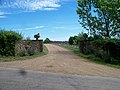
 Country road, north of Hook Norton - geograph.org.uk - 5429203.jpg 1 024 × 768; 240 KB
-
 Court Farm - geograph.org.uk - 1732275.jpg 4 000 × 3 000; 2,9 MB
-
 Court Farm - geograph.org.uk - 1733460.jpg 4 000 × 3 000; 1,47 MB
-
 Cowpasture Farm (1) - geograph.org.uk - 1973785.jpg 4 000 × 3 000; 3,52 MB
-
 Cowpasture Farm (2) - geograph.org.uk - 1973788.jpg 4 000 × 3 000; 2,8 MB
-
 Cowpasture Farm (3) - geograph.org.uk - 1973793.jpg 4 000 × 3 000; 3,16 MB
-
 Cowpasture Farm (4) - geograph.org.uk - 1973802.jpg 4 000 × 3 000; 3,04 MB
-
 Cowpastures Farmhouse - geograph.org.uk - 1735195.jpg 4 000 × 3 000; 5,48 MB
-
 Croft's Lane - geograph.org.uk - 5429868.jpg 1 024 × 768; 263 KB
-
 D'Arcy Dalton Way (1) - geograph.org.uk - 2780376.jpg 4 320 × 3 240; 4,81 MB
-
 D'Arcy Dalton Way (2) - geograph.org.uk - 2780381.jpg 4 320 × 3 240; 4,72 MB
-
 D'Arcy Dalton Way (3) - geograph.org.uk - 2780477.jpg 4 320 × 3 240; 4,96 MB
-
 D'Arcy Dalton Way (4) - geograph.org.uk - 2780481.jpg 4 320 × 3 240; 4,9 MB
-
 D'Arcy Dalton Way (5) - geograph.org.uk - 2780482.jpg 4 320 × 3 240; 4,99 MB
-
 D'Arcy Dalton Way (6) - geograph.org.uk - 2780483.jpg 4 320 × 3 240; 4,69 MB
-
 D'Arcy Dalton Way - geograph.org.uk - 4754178.jpg 640 × 480; 78 KB
-
 D'Arcy Dalton Way - geograph.org.uk - 4754183.jpg 640 × 480; 95 KB
-
 D'Arcy Dalton Way - geograph.org.uk - 4754190.jpg 640 × 480; 96 KB
-

-
 Digging out the mash tun at Hook Norton - geograph.org.uk - 1862760.jpg 640 × 480; 221 KB
-
 Double gates - geograph.org.uk - 5429906.jpg 1 024 × 768; 365 KB
-
 Double stile - geograph.org.uk - 2777953.jpg 4 320 × 3 240; 5,02 MB
-
 Down End - geograph.org.uk - 1733433.jpg 1 280 × 959; 308 KB
-
 Down End, Hook Norton (geograph 7434816).jpg 4 210 × 2 227; 1,74 MB
-
 Drive Cogs, Hook Norton Brewery - geograph.org.uk - 6343126.jpg 1 024 × 768; 131 KB
-
 Drive mechanism at Hook Norton Brewery - geograph.org.uk - 6343125.jpg 1 024 × 768; 164 KB
-
 Driveway and bridleway - geograph.org.uk - 2779579.jpg 4 320 × 3 240; 4,54 MB
-
 Driveway and footpath - geograph.org.uk - 1735210.jpg 4 000 × 3 000; 2,32 MB
-
 Driveway to Hafotty - geograph.org.uk - 1735218.jpg 4 000 × 3 000; 3,47 MB
-
 Driveway to Swerford Park Farm - geograph.org.uk - 215452.jpg 640 × 480; 85 KB
-
 Driveway to the manor. - geograph.org.uk - 1975391.jpg 4 000 × 3 000; 3,15 MB
-
 East End Railway - geograph.org.uk - 202184.jpg 640 × 480; 136 KB
-
 East window, Hook Norton church - geograph.org.uk - 5430312.jpg 768 × 1 024; 282 KB
-
 Eating is more important - geograph.org.uk - 2777968.jpg 4 320 × 3 240; 4,75 MB
-
 Enclosed footpath - geograph.org.uk - 1973797.jpg 4 000 × 3 000; 3,96 MB
-
 End of bridleway - geograph.org.uk - 1735203.jpg 4 000 × 3 000; 4,9 MB
-
 End of the bridleway - geograph.org.uk - 2780366.jpg 4 320 × 3 240; 4,65 MB
-
 Entering Hook Norton - geograph.org.uk - 407990.jpg 640 × 480; 134 KB
-
 Explosives store - geograph.org.uk - 2780415.jpg 4 320 × 3 240; 4,48 MB
-
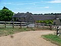
 Farm buildings (1) - geograph.org.uk - 2779479.jpg 4 320 × 3 240; 4,79 MB
-
 Farm buildings (2) - geograph.org.uk - 2779493.jpg 4 320 × 3 240; 5,08 MB
-
 Farm buildings - geograph.org.uk - 389208.jpg 640 × 481; 73 KB
-
 Farm directions - geograph.org.uk - 2779609.jpg 4 320 × 3 240; 4,92 MB
-
 Farm Drive - geograph.org.uk - 1973782.jpg 4 000 × 3 000; 3,3 MB
-
 Farmland - geograph.org.uk - 389171.jpg 640 × 481; 76 KB
-
 Farmland - geograph.org.uk - 389175.jpg 640 × 481; 71 KB
-
 Farmland - geograph.org.uk - 389199.jpg 640 × 481; 59 KB
-
 Farmland at Hook Norton - geograph.org.uk - 5429863.jpg 1 024 × 768; 361 KB
-
 Farmland beside Chipping Norton Road - geograph.org.uk - 5429862.jpg 1 024 × 768; 345 KB
-
 Farmland near Fodge Farm - geograph.org.uk - 5429199.jpg 1 024 × 768; 342 KB
-
 Farmland near Rollright Heath Farm - geograph.org.uk - 5429861.jpg 1 024 × 768; 296 KB
-
 Field below Fanville Farm - geograph.org.uk - 2693383.jpg 640 × 480; 104 KB
-
 Field beside Croft's Lane - geograph.org.uk - 5429869.jpg 1 024 × 768; 262 KB
-
 Field edge path - geograph.org.uk - 1973817.jpg 4 000 × 3 000; 3,8 MB
-
 Field edge path - geograph.org.uk - 2433438.jpg 4 288 × 3 216; 1,63 MB
-
 Fields of poppies (1) - geograph.org.uk - 3053417.jpg 4 320 × 3 240; 4,44 MB
-
 Fields of poppies (2) - geograph.org.uk - 3053432.jpg 4 320 × 3 240; 5,3 MB
-
 Find the bridge - geograph.org.uk - 2778060.jpg 4 320 × 3 240; 4,87 MB
-
 Find the path - geograph.org.uk - 2778057.jpg 4 320 × 3 240; 4,49 MB
-
 Find the path - geograph.org.uk - 2778235.jpg 4 320 × 3 240; 4,76 MB
-
 Fine tree - geograph.org.uk - 2780478.jpg 4 320 × 3 240; 5,2 MB
-
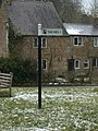 Fingerpost at Scotland End - geograph.org.uk - 1733393.jpg 959 × 1 280; 376 KB
-
 Firs garage crossroads - geograph.org.uk - 2969610.jpg 1 200 × 1 600; 586 KB
-
 Fodge Farm (1) - geograph.org.uk - 2778069.jpg 4 320 × 3 240; 4,84 MB
-
 Fodge Farm (2) - geograph.org.uk - 2778074.jpg 4 320 × 3 240; 4,68 MB
-
 Fodge Farm (3) - geograph.org.uk - 2778080.jpg 4 320 × 3 240; 4,58 MB
-
 Fodge Farm (4) - geograph.org.uk - 2778099.jpg 4 320 × 3 240; 4,77 MB
-
 Fodge Farm (5) - geograph.org.uk - 2778343.jpg 4 320 × 3 240; 5,14 MB
-
 Follow the field edge - geograph.org.uk - 2777950.jpg 4 320 × 3 240; 5,18 MB
-
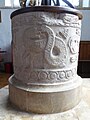
 Font detail, Hook Norton church ^1 - geograph.org.uk - 5430330.jpg 768 × 1 024; 200 KB
-
 Font detail, Hook Norton church ^2 - geograph.org.uk - 5430334.jpg 768 × 1 024; 201 KB
-
 Font detail, Hook Norton church ^3 - geograph.org.uk - 5430341.jpg 768 × 1 024; 182 KB
-
 Footpath from South Hill - geograph.org.uk - 2693371.jpg 640 × 480; 74 KB
-
 Footpath leaves road - geograph.org.uk - 2432904.jpg 4 288 × 3 216; 1,76 MB
-
 Footpath leaves road - geograph.org.uk - 2780371.jpg 4 320 × 3 240; 5,63 MB
-
 Footpath meets road - geograph.org.uk - 2433435.jpg 4 288 × 3 216; 5,28 MB
-
 Footpath meets road - geograph.org.uk - 2729817.jpg 4 320 × 3 240; 5,06 MB
-
 Footpath meets the road - geograph.org.uk - 2778310.jpg 4 320 × 3 240; 4,57 MB
-
 Footpath to Swalcliffe - geograph.org.uk - 2780471.jpg 4 320 × 3 240; 5,35 MB
-
 Footpath to Temple Mills - geograph.org.uk - 2729691.jpg 4 320 × 3 240; 4,75 MB
-
 Former wort cooler - geograph.org.uk - 5107702.jpg 1 024 × 768; 199 KB
-
 Four ways to go (2) - geograph.org.uk - 2433497.jpg 4 288 × 3 216; 5,85 MB
-
 Four ways to go (3) - geograph.org.uk - 2433512.jpg 4 067 × 2 873; 4,1 MB
-
 Gates at Swerford - geograph.org.uk - 2450583.jpg 640 × 480; 118 KB
-
 Grass Mowing - geograph.org.uk - 5027567.jpg 1 600 × 900; 586 KB
-
 Grist Mill, Hook Norton Brewery - geograph.org.uk - 5107718.jpg 1 024 × 768; 197 KB
-
 Growing well - geograph.org.uk - 2432954.jpg 4 288 × 3 216; 3,31 MB
-
 Heading towards Wychford Lodge Farm - geograph.org.uk - 2693400.jpg 640 × 480; 93 KB
-
 High Street with village store - geograph.org.uk - 1733430.jpg 1 280 × 959; 273 KB
-
 High Street, Hook Norton - geograph.org.uk - 5429898.jpg 1 024 × 768; 292 KB
-
 Highwall Spinney from near Fodge Farm - geograph.org.uk - 2778261.jpg 4 320 × 3 240; 4,77 MB
-
 D'Arcy Dalton Way - geograph.org.uk - 389167.jpg 640 × 481; 69 KB
-

-

-
 Hook Norton - geograph.org.uk - 2432812.jpg 4 288 × 3 216; 3,97 MB
-
 Hook Norton - The Pear Tree P.H. - geograph.org.uk - 4712300.jpg 1 337 × 1 000; 934 KB
-
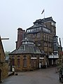
 Hook Norton - The Tower Brewery - geograph.org.uk - 4712316.jpg 1 000 × 1 319; 1,07 MB
-
 Hook Norton Brewery (geograph 7416532).jpg 4 268 × 2 465; 835 KB
-
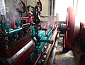 Hook Norton Brewery - Buxton ^ Thornley Steam Engine - geograph.org.uk - 5404377.jpg 1 301 × 1 000; 902 KB
-
 Hook Norton Brewery - geograph.org.uk - 3201007.jpg 3 240 × 4 320; 4,9 MB
-
 Hook Norton Brewery - geograph.org.uk - 3894656.jpg 1 024 × 683; 220 KB
-
 Hook Norton Brewery - geograph.org.uk - 4282381.jpg 2 000 × 1 314; 916 KB
-
 Hook Norton Brewery - geograph.org.uk - 4599746.jpg 480 × 640; 60 KB
-
 Hook Norton Brewery - geograph.org.uk - 4599751.jpg 480 × 640; 55 KB
-
 Hook Norton Brewery - geograph.org.uk - 4766900.jpg 2 000 × 2 082; 1,28 MB
-
 Hook Norton Brewery - geograph.org.uk - 5048827.jpg 1 125 × 1 500; 181 KB
-
 Hook Norton Brewery - geograph.org.uk - 5048830.jpg 1 119 × 1 500; 221 KB
-
 Hook Norton Brewery - geograph.org.uk - 5106128.jpg 768 × 1 024; 231 KB
-
 Hook Norton Brewery - geograph.org.uk - 5107689.jpg 1 024 × 768; 200 KB
-
 Hook Norton Brewery - geograph.org.uk - 5429502.jpg 768 × 1 024; 205 KB
-
 Hook Norton Brewery - geograph.org.uk - 5861318.jpg 851 × 1 024; 204 KB
-
 Hook Norton Brewery - geograph.org.uk - 5881820.jpg 1 600 × 1 200; 477 KB
-
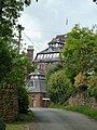
 Hook Norton Brewery - Old Brewery and tower - geograph.org.uk - 5404355.jpg 1 000 × 1 391; 942 KB
-
 Hook Norton Brewery - steam engine - geograph.org.uk - 5655775.jpg 640 × 443; 74 KB
-
 Hook Norton Brewery - Steam Engine in action - geograph.org.uk - 5404369.jpg 1 362 × 1 000; 645 KB
-
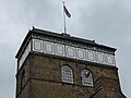 Hook Norton Brewery - Top of the tower - geograph.org.uk - 5404358.jpg 1 333 × 1 000; 721 KB
-
 Hook Norton Brewery appears on Brewery Lane - geograph.org.uk - 4712306.jpg 1 000 × 1 333; 1,2 MB
-
 Hook Norton Brewery dray outside the Sun Inn - geograph.org.uk - 4282393.jpg 2 000 × 1 380; 877 KB
-
 Hook Norton church - geograph.org.uk - 5429487.jpg 768 × 1 024; 220 KB
-
 Hook Norton cottages 1 - geograph.org.uk - 2721213.jpg 1 024 × 768; 682 KB
-
 Hook Norton cottages 2 - geograph.org.uk - 2721215.jpg 1 024 × 768; 640 KB
-
 Hook Norton High Street - geograph.org.uk - 5429903.jpg 1 024 × 768; 287 KB
-
 Hook Norton Library - geograph.org.uk - 1733414.jpg 1 280 × 959; 374 KB
-
 Hook Norton Manor - geograph.org.uk - 1733442.jpg 959 × 1 280; 418 KB
-
 Hook Norton Memorial Hall on Chapel Street - geograph.org.uk - 4974035.jpg 1 600 × 1 086; 653 KB
-
 Hook Norton Road junction east of Rollright Heath Farm - geograph.org.uk - 3993140.jpg 3 648 × 2 736; 1,46 MB
-
 Hook Norton Viaduct - geograph.org.uk - 224672.jpg 639 × 430; 44 KB
-
 Hook norton viaduct 1.jpg 1 024 × 581; 594 KB
-
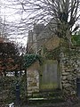
 Hook Norton, St. Peter's Church - geograph.org.uk - 5434747.jpg 3 680 × 3 778; 5,5 MB
-
 Hook Norton, St. Peter's Church, c15th roof corbel 1 - geograph.org.uk - 5434895.jpg 3 678 × 2 456; 3,4 MB


.jpg)


.jpg)


_-_geograph.org.uk_-_2779504.jpg)
_-_geograph.org.uk_-_2779514.jpg)
_-_geograph.org.uk_-_2779529.jpg)


.jpg)


_-_geograph.org.uk_-_1973785.jpg)
_-_geograph.org.uk_-_1973788.jpg)
_-_geograph.org.uk_-_1973793.jpg)
_-_geograph.org.uk_-_1973802.jpg)


_-_geograph.org.uk_-_2780376.jpg)
_-_geograph.org.uk_-_2780381.jpg)
_-_geograph.org.uk_-_2780477.jpg)
_-_geograph.org.uk_-_2780481.jpg)
_-_geograph.org.uk_-_2780482.jpg)
_-_geograph.org.uk_-_2780483.jpg)


.jpg)


_-_geograph.org.uk_-_2779479.jpg)
_-_geograph.org.uk_-_2779493.jpg)


_-_geograph.org.uk_-_3053417.jpg)
_-_geograph.org.uk_-_3053432.jpg)


_-_geograph.org.uk_-_2778069.jpg)
_-_geograph.org.uk_-_2778074.jpg)
_-_geograph.org.uk_-_2778080.jpg)
_-_geograph.org.uk_-_2778099.jpg)
_-_geograph.org.uk_-_2778343.jpg)


_-_geograph.org.uk_-_2433497.jpg)
_-_geograph.org.uk_-_2433512.jpg)


.jpg)


