Category:Hooton Roberts
Aller à la navigation
Aller à la recherche
English: Hooton Roberts is a village and civil parish in the Metropolitan Borough of Rotherham in South Yorkshire, England. It has a population of 181.
Nederlands: Hooton Roberts is een dorp (village) en civil parish in het bestuurlijke gebied Rotherham, in het Engelse graafschap South Yorkshire. De civil parish telt
village and civil parish in South Yorkshire, England  | |||||
| Téléverser des médias | |||||
| Nature de l’élément | |||||
|---|---|---|---|---|---|
| Lieu | district métropolitain de Rotherham, Yorkshire du Sud, Yorkshire-et-Humber, Angleterre | ||||
 | |||||
Sous-catégories
Cette catégorie comprend 2 sous-catégories, dont les 2 ci-dessous.
Média dans la catégorie « Hooton Roberts »
Cette catégorie comprend 131 fichiers, dont les 131 ci-dessous.
-
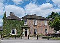 "The Earl of Strafford" public house in Hooton Roberts - geograph.org.uk - 3527296.jpg 3 501 × 2 501 ; 1,65 Mio
-
 A630 Doncaster Road heading east - geograph.org.uk - 6124820.jpg 1 024 × 770 ; 108 kio
-
 A630, Hooton Roberts - geograph.org.uk - 1420596.jpg 640 × 480 ; 44 kio
-
 Almost out of the woods - geograph.org.uk - 6485879.jpg 2 736 × 3 648 ; 5,43 Mio
-
 Arbour Lane at Firsby Hall Farm - geograph.org.uk - 5912433.jpg 1 600 × 1 064 ; 758 kio
-
 Arbour Lane towards Garden Lane - geograph.org.uk - 5912455.jpg 1 600 × 1 064 ; 1 003 kio
-
 Autumn landscape - geograph.org.uk - 2193790.jpg 3 264 × 2 448 ; 661 kio
-
 Avenue to Denaby Lane - geograph.org.uk - 6046669.jpg 1 024 × 768 ; 275 kio
-
 B6090 Kilnhurst Road nearing Doncaster Road - geograph.org.uk - 6124817.jpg 1 024 × 768 ; 171 kio
-
 Back Lane near Hooton Roberts - geograph.org.uk - 3588684.jpg 3 892 × 2 850 ; 1,71 Mio
-
 Back Lane, Hooton Roberts - geograph.org.uk - 3527247.jpg 2 736 × 3 648 ; 2,15 Mio
-
 Back Lane, Hooton Roberts - geograph.org.uk - 3732771.jpg 1 600 × 1 200 ; 669 kio
-
 Back Lane, Hooton Roberts - geograph.org.uk - 5912402.jpg 1 600 × 1 064 ; 565 kio
-
 Back Lane, Hooton Roberts - geograph.org.uk - 5912415.jpg 1 600 × 1 064 ; 576 kio
-
 Back Lane, Hooton Roberts - geograph.org.uk - 6485874.jpg 2 736 × 3 648 ; 5,88 Mio
-
 Back Lane, Hooton Roberts - geograph.org.uk - 6485883.jpg 3 648 × 2 736 ; 6,3 Mio
-
 Bales in a field - geograph.org.uk - 4849873.jpg 1 024 × 768 ; 242 kio
-
 Barn at Hooton Roberts - geograph.org.uk - 3667630.jpg 2 848 × 2 144 ; 1,51 Mio
-
 Barn off Back Lane, Hooton Roberts - geograph.org.uk - 5912417.jpg 1 600 × 1 064 ; 573 kio
-
 Barn, Firsby Hall Farm.jpg 3 648 × 2 736 ; 3,8 Mio
-
 Behind the hedge near Hooton Common Farm - geograph.org.uk - 4842809.jpg 1 024 × 768 ; 181 kio
-
 Beware of Pedestrians - geograph.org.uk - 1854888.jpg 800 × 600 ; 148 kio
-
 Bridleway at Firsby Hall Farm - geograph.org.uk - 4867586.jpg 1 024 × 768 ; 102 kio
-
 Bridleway northwest of Firsby Hall Farm - geograph.org.uk - 3732811.jpg 1 600 × 1 200 ; 626 kio
-
 Bridleway to Hooton Roberts - geograph.org.uk - 6042742.jpg 1 024 × 768 ; 235 kio
-
 Bridleway to Ravenfield - geograph.org.uk - 4867769.jpg 1 024 × 768 ; 228 kio
-
 Bridleway towards Firsby Hall Farm - geograph.org.uk - 5912419.jpg 1 600 × 1 064 ; 664 kio
-
 Bridleway towards Firsby Hall Farm - geograph.org.uk - 5912420.jpg 1 600 × 1 064 ; 1 019 kio
-
 Bridleway towards Firsby Hall Farm - geograph.org.uk - 5912421.jpg 1 600 × 1 064 ; 916 kio
-
 Bridleway towards Firsby Hall Farm - geograph.org.uk - 5912422.jpg 1 600 × 1 064 ; 1,09 Mio
-
 Bridleway towards Firsby Hall Farm - geograph.org.uk - 5912424.jpg 1 600 × 1 064 ; 1,21 Mio
-
 Bridleway towards Firsby Hall Farm - geograph.org.uk - 5912426.jpg 1 600 × 1 064 ; 1,16 Mio
-
 Bridleway towards Howdike Lane - geograph.org.uk - 5912226.jpg 1 600 × 1 060 ; 959 kio
-
 Bridleway towards Howdike Lane - geograph.org.uk - 5912230.jpg 1 600 × 1 064 ; 871 kio
-
 Bridleway towards Howdike Lane - geograph.org.uk - 5912231.jpg 1 600 × 1 064 ; 956 kio
-
 Bridleway towards Howdike Lane - geograph.org.uk - 5912233.jpg 1 600 × 1 064 ; 616 kio
-
 Bridleway towards Howdike Lane - geograph.org.uk - 5912238.jpg 1 600 × 1 064 ; 605 kio
-
 Bridleway towards Howdike Lane - geograph.org.uk - 5912241.jpg 1 600 × 1 064 ; 655 kio
-
 Bridleway towards Howdike Lane - geograph.org.uk - 5912244.jpg 1 600 × 1 064 ; 745 kio
-
 Broken wall and solitary tree - geograph.org.uk - 6484159.jpg 640 × 480 ; 95 kio
-
 Buildings on Doncaster Road, Hooton Roberts - geograph.org.uk - 5912369.jpg 1 600 × 1 086 ; 688 kio
-
 Church of St John the Baptist - geograph.org.uk - 6484165.jpg 640 × 504 ; 92 kio
-
 Common Plantation near Hooton Roberts - geograph.org.uk - 4837452.jpg 640 × 480 ; 179 kio
-
 Converted barn, Hooton Roberts.jpg 1 200 × 799 ; 308 kio
-
 Cottage in Hooton Roberts - geograph.org.uk - 4849870.jpg 1 024 × 768 ; 158 kio
-
 Cottages in Hooton Roberts - geograph.org.uk - 4849868.jpg 1 024 × 768 ; 131 kio
-
 Cottages on The Wapping - geograph.org.uk - 6484171.jpg 640 × 480 ; 81 kio
-
 Crop Field viewed from Holmes Lane - geograph.org.uk - 2467716.jpg 2 981 × 2 079 ; 1 013 kio
-
 Cruel - geograph.org.uk - 6468532.jpg 768 × 1 024 ; 181 kio
-
 Doncaster Road A630 at Hotton Roberts - geograph.org.uk - 4891462.jpg 1 200 × 799 ; 310 kio
-
 Earl of Stafford, Hotton Roberts - geograph.org.uk - 4891451.jpg 1 200 × 799 ; 366 kio
-
 Earl of Strafford, Hotton Roberts - geograph.org.uk - 4891454.jpg 799 × 1 200 ; 223 kio
-
 Early morning near Hooton Roberts - geograph.org.uk - 785733.jpg 640 × 450 ; 51 kio
-
 Entrance to Thrybergh Country Park - geograph.org.uk - 1420594.jpg 640 × 480 ; 114 kio
-
 Farm buildings at Hotton Roberts - geograph.org.uk - 4891478.jpg 1 200 × 799 ; 309 kio
-
 Farm Road towards Denaby Lane - geograph.org.uk - 5912216.jpg 1 600 × 1 064 ; 1 011 kio
-
 Farmer John's Road Sign - geograph.org.uk - 521291.jpg 640 × 480 ; 80 kio
-
 Farmyard off The Wapping, Hooton Roberts - geograph.org.uk - 5912381.jpg 1 600 × 1 064 ; 484 kio
-
 Field edge near Firsby Hall Farm - geograph.org.uk - 4867592.jpg 1 024 × 768 ; 203 kio
-
 Firsby Hall Farm - geograph.org.uk - 4867590.jpg 1 024 × 768 ; 129 kio
-
 Firsby Hall Farm - geograph.org.uk - 5912429.jpg 1 600 × 1 064 ; 663 kio
-
 Firsby Lane - geograph.org.uk - 4867596.jpg 1 024 × 768 ; 180 kio
-
 Firsby Lane - geograph.org.uk - 4867645.jpg 1 024 × 768 ; 200 kio
-
 Firsby Lane - geograph.org.uk - 4867650.jpg 1 024 × 768 ; 328 kio
-
 Firsby Lane heading south - geograph.org.uk - 2583223.jpg 1 600 × 1 200 ; 403 kio
-

-
 Firsby Reservoir - geograph.org.uk - 4842750.jpg 1 024 × 768 ; 174 kio
-
 Footpath from Arbour Lane to Park Lane - geograph.org.uk - 3220567.jpg 640 × 480 ; 115 kio
-
 Footpath from Back Lane to Doncaster Road (A630) - geograph.org.uk - 3221926.jpg 640 × 480 ; 165 kio
-
 Footpath from Doncaster Road A630 to Firsby Lane - geograph.org.uk - 3223963.jpg 640 × 480 ; 154 kio
-
 Footpath from Firsby Lane to Hooton Roberts - geograph.org.uk - 3221904.jpg 640 × 480 ; 86 kio
-
 Footpath from Firsby Lane to Park Lane - geograph.org.uk - 3220616.jpg 640 × 480 ; 82 kio
-
 Hill Top Road - geograph.org.uk - 2583230.jpg 1 600 × 1 200 ; 448 kio
-
 Hilltop Hotel - geograph.org.uk - 816571.jpg 590 × 442 ; 68 kio
-
 Holmes Lane - geograph.org.uk - 4849874.jpg 1 024 × 768 ; 116 kio
-
 Holmes Lane and St Johns Church, Hooton Roberts - geograph.org.uk - 6124818.jpg 1 024 × 768 ; 188 kio
-
 Holmes Lane towards Howdike Lane - geograph.org.uk - 5912282.jpg 1 600 × 1 064 ; 765 kio
-
 Holmes Lane towards Howdike Lane - geograph.org.uk - 5912289.jpg 1 600 × 1 064 ; 702 kio
-
 Holmes Lane, Howdike Lane - geograph.org.uk - 5912304.jpg 1 600 × 1 064 ; 729 kio
-
 Holmes Lanes towards Hooton Roberts - geograph.org.uk - 5912291.jpg 1 600 × 1 064 ; 642 kio
-
 Holmes Lanes, Hooton Roberts - geograph.org.uk - 5912301.jpg 1 600 × 1 064 ; 704 kio
-
 Hooton Common Farmhouse.jpg 1 024 × 768 ; 146 kio
-
 Hooton Roberts - geograph.org.uk - 3588691.jpg 3 926 × 2 900 ; 1,41 Mio
-
 Hooton Roberts - geograph.org.uk - 4849871.jpg 1 024 × 768 ; 128 kio
-
 Hooton Roberts - The Wapping.jpg 640 × 480 ; 101 kio
-
 Houses on the A630, Hooton Roberts - geograph.org.uk - 521268.jpg 640 × 386 ; 82 kio
-
 Kilnhurst Road - geograph.org.uk - 6485801.jpg 3 648 × 2 736 ; 5 Mio
-
 Kilnhurst Road at Denaby Lane junction - geograph.org.uk - 6124813.jpg 1 024 × 767 ; 154 kio
-
 Milepost, Hooton Roberts.jpg 1 200 × 1 600 ; 361 kio
-
 No tipping on Howdike Lane - geograph.org.uk - 6485813.jpg 3 648 × 2 736 ; 4,12 Mio
-
 On Firsby lane. - geograph.org.uk - 1658281.jpg 640 × 480 ; 33 kio
-
 Outbuilding at Firsby Hall Farm - geograph.org.uk - 3588674.jpg 4 000 × 3 000 ; 1,83 Mio
-
 Overflow from Firsby Reservoir - geograph.org.uk - 4849753.jpg 1 024 × 768 ; 310 kio
-
 Path through a field of wheat - geograph.org.uk - 6484175.jpg 640 × 480 ; 76 kio
-
 Path through a field of wheat - geograph.org.uk - 6484177.jpg 480 × 640 ; 73 kio
-
 Poppies near Denaby Lane - geograph.org.uk - 2467724.jpg 3 296 × 2 472 ; 1,01 Mio
-
 Poppies near Grange Farm - geograph.org.uk - 2467738.jpg 3 296 × 2 472 ; 1 007 kio
-
 Private access to Grange Farm - geograph.org.uk - 6046671.jpg 1 024 × 768 ; 192 kio
-
 Road works on Carr Lane - geograph.org.uk - 6485796.jpg 3 648 × 2 736 ; 2,15 Mio
-
 School on Hill Top Road, Conisbrough - geograph.org.uk - 2583228.jpg 1 600 × 1 200 ; 392 kio
-
 St John the Baptist, former parish church, Hooton Roberts - geograph.org.uk - 6485833.jpg 3 198 × 2 276 ; 1,95 Mio
-
 St John's Church, Hooton Roberts - geograph.org.uk - 5912308.jpg 1 600 × 1 064 ; 604 kio
-
 St John's Church, Hooton Roberts - geograph.org.uk - 5912310.jpg 1 600 × 1 064 ; 759 kio
-
 St John's Church, Hooton Roberts - geograph.org.uk - 5912372.jpg 1 600 × 1 064 ; 685 kio
-
 St Johns Church, Hotton Roberts - geograph.org.uk - 4891455.jpg 1 200 × 799 ; 401 kio
-
 Start of the unmetalled section of Howdike Lane - geograph.org.uk - 3731484.jpg 1 600 × 1 200 ; 524 kio
-
 The dam, Firsby Reservoir - geograph.org.uk - 4849740.jpg 1 024 × 768 ; 260 kio
-
 The Earl of Strafford - geograph.org.uk - 6484163.jpg 640 × 480 ; 113 kio
-
 The Earl of Strafford and St John the Baptist church, Hooton Roberts - geograph.org.uk - 6485828.jpg 4 883 × 2 703 ; 2,46 Mio
-
 The edge of Common Plantation, Hooton Roberts - geograph.org.uk - 3527306.jpg 3 648 × 2 736 ; 2,4 Mio
-
 The Wapping, Hooton Roberts - geograph.org.uk - 5912376.jpg 1 600 × 1 042 ; 534 kio
-
 The Wapping, Hooton Roberts - geograph.org.uk - 5912383.jpg 1 600 × 1 064 ; 459 kio
-
 Track to Old Denaby - geograph.org.uk - 4849876.jpg 1 024 × 768 ; 137 kio
-
 View from the churchyard, Hooton Roberts - geograph.org.uk - 4842801.jpg 1 024 × 768 ; 190 kio
-
 View from the end of Ravenfield park. - geograph.org.uk - 1658274.jpg 640 × 480 ; 79 kio
-
 View towards Grange Farm - geograph.org.uk - 6046675.jpg 1 024 × 768 ; 204 kio
-
 View towards Kilnhurst Road - geograph.org.uk - 4849823.jpg 1 024 × 740 ; 148 kio
-
 Wheat field by Firsby Hall Farm - geograph.org.uk - 6485892.jpg 3 648 × 2 736 ; 3,58 Mio
-
 Where Arbour Lane and Firsby Lane meet - geograph.org.uk - 3220592.jpg 640 × 480 ; 58 kio
-
 Boundary Bridleway - geograph.org.uk - 254526.jpg 640 × 480 ; 87 kio
-
 Bridleway - geograph.org.uk - 448036.jpg 640 × 480 ; 99 kio
-
 Farmer John's Farmyard - geograph.org.uk - 521278.jpg 640 × 480 ; 98 kio
-
 Fields towards Old Denaby - geograph.org.uk - 1420603.jpg 640 × 480 ; 43 kio
-
 Firsby reservoir - geograph.org.uk - 447964.jpg 640 × 472 ; 77 kio
-
 House at Hooton Roberts - geograph.org.uk - 521298.jpg 640 × 480 ; 104 kio
-
 Lakeside Cafe - geograph.org.uk - 254520.jpg 640 × 480 ; 89 kio
-
 Moorside Farm - geograph.org.uk - 210258.jpg 640 × 427 ; 65 kio
-
 Park Lane - geograph.org.uk - 447879.jpg 480 × 640 ; 113 kio
-
 Reservoir at Firsby - geograph.org.uk - 447945.jpg 640 × 462 ; 81 kio
-
 Short Path - geograph.org.uk - 254522.jpg 640 × 480 ; 114 kio
-
 The Old Road at Hill Top - geograph.org.uk - 567140.jpg 640 × 500 ; 98 kio


_-_geograph.org.uk_-_3221926.jpg)


