Category:Hope, Derbyshire
Vai alla navigazione
Vai alla ricerca
località britannica del Derbyshire  | |||||
| Carica un file multimediale | |||||
| Istanza di | |||||
|---|---|---|---|---|---|
| Luogo | High Peak, Derbyshire, Midlands Orientali, Inghilterra | ||||
| Considerato essere uguale a | Hope (pagina Wikimedia duplicata, parrocchia civile dell'Inghilterra) | ||||
 | |||||
Sottocategorie
Questa categoria contiene le 11 sottocategorie indicate di seguito, su un totale di 11.
E
- Earles Sidings, Hope (11 F)
H
- Hope Cross (21 F)
- Hope Pinfold (3 F)
- Hope Valley, Derbyshire (14 F)
- Hope War Memorial (2 F)
J
L
- Lose Hill (85 F)
M
- Madwoman's Stones (4 F)
P
File nella categoria "Hope, Derbyshire"
Questa categoria contiene 200 file, indicati di seguito, su un totale di 592.
(pagina precedente) (pagina successiva)-
 "Bleak House", Hope - geograph.org.uk - 3198038.jpg 4 407 × 2 938; 3,3 MB
-
 "No Parking" sign by Edge Farm, Aston - geograph.org.uk - 4867794.jpg 4 942 × 3 758; 5,55 MB
-
 "Spring House Farm" south of Lose Hill - geograph.org.uk - 3198040.jpg 4 345 × 2 897; 2,54 MB
-
 "The Cheshire Cheese" public house, Hope - geograph.org.uk - 3813916.jpg 5 182 × 3 702; 4,98 MB
-
 'Tin Town' Hairdresser - geograph.org.uk - 61198.jpg 640 × 488; 51 KB
-
 A bit of sunlight on Hope Chimney - geograph.org.uk - 3853561.jpg 4 912 × 3 264; 3,81 MB
-
 A Boundary Wall alongside Woodland Valley - geograph.org.uk - 473325.jpg 640 × 459; 100 KB
-
 A cottage in Hope - geograph.org.uk - 6071932.jpg 3 888 × 5 184; 6,08 MB
-
 A glimpse of Upper Fulwood Farm - geograph.org.uk - 1972865.jpg 640 × 480; 80 KB
-
 A lot of Hope - geograph.org.uk - 1485262.jpg 640 × 479; 114 KB
-
 A pair of lonely trees on Crookstone Hill - geograph.org.uk - 4545881.jpg 6 000 × 4 000; 3,84 MB
-
 A railway bridge on Castleton Road, Hope - geograph.org.uk - 2434406.jpg 800 × 600; 292 KB
-
 A second class footpath sign - geograph.org.uk - 4689177.jpg 4 606 × 3 454; 5,47 MB
-
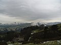
 A view from Bradwell Edge - geograph.org.uk - 3445095.jpg 600 × 800; 110 KB
-
 A6187 Castleton Road near Hope - geograph.org.uk - 2697355.jpg 3 209 × 2 326; 940 KB
-
 Abandoned building Edale Road - geograph.org.uk - 857867.jpg 640 × 480; 137 KB
-
 Above Brough - geograph.org.uk - 177365.jpg 640 × 480; 116 KB
-

-
 Above Twitchell farm. - geograph.org.uk - 2794700.jpg 640 × 480; 36 KB
-
 Along the ridge top toward Win Hill - geograph.org.uk - 4689153.jpg 4 602 × 3 448; 5,53 MB
-
 Along the top towards Win Hill - geograph.org.uk - 4689125.jpg 4 608 × 3 456; 5,4 MB
-

-
 Approaching Hope Cross - geograph.org.uk - 5962964.jpg 3 763 × 5 017; 5,11 MB
-

-
 Ashton's Engine House - geograph.org.uk - 2368711.jpg 800 × 531; 176 KB
-
 Ashton's Mine - geograph.org.uk - 2368707.jpg 800 × 531; 185 KB
-
 Aston Lane - geograph.org.uk - 3345548.jpg 640 × 480; 99 KB
-
 Aston Lane towards Aston - geograph.org.uk - 6109564.jpg 1 600 × 1 065; 758 KB
-
 At Hope Cross - geograph.org.uk - 5962989.jpg 4 811 × 3 579; 3,67 MB
-
 At Losehill End - geograph.org.uk - 6071877.jpg 3 888 × 5 184; 5,22 MB
-
 Atmospheric trees - geograph.org.uk - 5648847.jpg 640 × 411; 131 KB
-
 Autumn sunlight on Backside Wood - geograph.org.uk - 5963792.jpg 4 887 × 3 887; 4,7 MB
-

-
 Backside Wood - geograph.org.uk - 3028453.jpg 640 × 480; 82 KB
-
 Backside Wood under a shower cloud - geograph.org.uk - 3028474.jpg 640 × 480; 59 KB
-
 Barn and Sheep Pasture - geograph.org.uk - 4248762.jpg 480 × 640; 63 KB
-
 Barn below Losehill Farm - geograph.org.uk - 3880646.jpg 4 015 × 2 507; 3,99 MB
-
 Barn on south side of Townhead Bridge - geograph.org.uk - 2313076.jpg 1 500 × 997; 1,31 MB
-
 Barns above Hope Station - geograph.org.uk - 1485392.jpg 640 × 479; 107 KB
-
 Barns near Hope railway station - geograph.org.uk - 3115265.jpg 1 500 × 951; 1,36 MB
-
 Bend in the Road in Hope - geograph.org.uk - 2496223.jpg 640 × 480; 61 KB
-
 Black sheep near Crookstone Barn - geograph.org.uk - 3213172.jpg 3 946 × 2 631; 2,63 MB
-
 Bowden Lane - geograph.org.uk - 3029991.jpg 640 × 427; 299 KB
-
 BR Bridge Castleton Rd Hope - geograph.org.uk - 4533584.jpg 640 × 480; 97 KB
-
 Bridge with village names - geograph.org.uk - 1973523.jpg 640 × 480; 107 KB
-
 Bridleway Below Top Plantation - geograph.org.uk - 1293527.jpg 640 × 426; 124 KB
-
 Bridleway crossroads - geograph.org.uk - 4711844.jpg 1 024 × 768; 231 KB
-
 Bridleway crossroads and a cattle meeting place - geograph.org.uk - 4689012.jpg 3 046 × 2 273; 2,59 MB
-
 Bridleway down to Hope - geograph.org.uk - 4711866.jpg 1 024 × 768; 221 KB
-
 Bridleway down to Hope Cross - geograph.org.uk - 4689000.jpg 4 608 × 3 454; 5,64 MB
-
 Broken wall below Wooler Knoll - geograph.org.uk - 5933188.jpg 640 × 480; 123 KB
-
 Broken wall on Crookstone Out Moor - geograph.org.uk - 5815210.jpg 800 × 600; 117 KB
-
 Brough Lane - geograph.org.uk - 177309.jpg 640 × 480; 147 KB
-
 By the main road through Hope - geograph.org.uk - 2873321.jpg 1 024 × 720; 237 KB
-
 Cafe Adventure - geograph.org.uk - 5103015.jpg 640 × 427; 80 KB
-
 Cafe Adventure in Hope - geograph.org.uk - 5670683.jpg 1 024 × 708; 175 KB
-
 Cairn by a path junction on Lose Hill - geograph.org.uk - 2828083.jpg 1 024 × 712; 158 KB
-
 Cast iron footpath sign (1909) at Brough - geograph.org.uk - 3095450.jpg 4 608 × 3 072; 3,16 MB
-
 Castleton Road Hope - geograph.org.uk - 4074784.jpg 1 024 × 768; 137 KB
-
 Castleton Road near Marsh Farm - geograph.org.uk - 2110676.jpg 2 048 × 1 536; 1,22 MB
-
 Castleton Road, Hope - geograph.org.uk - 2908972.jpg 3 912 × 2 078; 1,66 MB
-
 Cement Works Railway - geograph.org.uk - 5730180.jpg 1 600 × 1 200; 852 KB
-
 Cheshire Cheese Inn, Hope - geograph.org.uk - 6108877.jpg 1 600 × 1 065; 658 KB
-
 Cheshire Cheese Inn, Hope - geograph.org.uk - 6108883.jpg 1 268 × 1 600; 726 KB
-

-
 Cottage by Edale Road - geograph.org.uk - 2873332.jpg 1 024 × 768; 232 KB
-
 Cottages beside the Edale Road - geograph.org.uk - 5730448.jpg 1 600 × 1 200; 511 KB
-
 Course of Old Roman Road - geograph.org.uk - 1945781.jpg 3 296 × 2 472; 1,13 MB
-
 Cows grazing south of Hope - geograph.org.uk - 3095468.jpg 4 330 × 2 887; 2,89 MB
-
 Crimea Farm - geograph.org.uk - 1815854.jpg 427 × 640; 298 KB
-
 Crimea Farm on the slopes of Lose Hill - geograph.org.uk - 6071898.jpg 5 184 × 3 888; 5,84 MB
-
 Crookstone Barn - geograph.org.uk - 1047821.jpg 640 × 480; 124 KB
-
 Crookstone Barn - geograph.org.uk - 3213147.jpg 4 189 × 2 710; 2,37 MB
-
 Crookstone Barn - geograph.org.uk - 4492461.jpg 4 842 × 3 259; 1,6 MB
-
 Crookstone Barn - geograph.org.uk - 5814878.jpg 800 × 600; 101 KB
-
 Crookstone Barn - geograph.org.uk - 5817266.jpg 800 × 600; 187 KB
-
 Crookstone Barn from the path near Hope Cross - geograph.org.uk - 4799207.jpg 1 200 × 900; 523 KB
-
 Crookstone Hill - geograph.org.uk - 3028525.jpg 640 × 480; 54 KB
-
 Crookstone Hill - geograph.org.uk - 4109598.jpg 3 648 × 2 736; 5,05 MB
-
 Crookstone Hill - geograph.org.uk - 5546015.jpg 3 648 × 2 736; 6,39 MB
-
 Crookstone Hill and Jaggers Clough - geograph.org.uk - 5989133.jpg 1 024 × 665; 224 KB
-
 Crookstone Knoll - geograph.org.uk - 1047800.jpg 640 × 480; 159 KB
-
 Crookstone Knoll and Blackley Hay slopes below - geograph.org.uk - 2941619.jpg 1 024 × 742; 231 KB
-
 Crookstone Out Moor - geograph.org.uk - 3028563.jpg 640 × 480; 69 KB
-
 Culvert under Railway and Sink - geograph.org.uk - 3029995.jpg 427 × 640; 288 KB
-
 Cut Mark 48 Castleton Rd Hope - geograph.org.uk - 4533589.jpg 640 × 480; 97 KB
-
 Cut Mark BR Bridge Castleton Rd Hope - geograph.org.uk - 4533583.jpg 640 × 480; 76 KB
-
 Cut Mark Killhill Farm Hope - geograph.org.uk - 4533595.jpg 640 × 480; 127 KB
-
 Cut Mark Netherhall Bridge Hope - geograph.org.uk - 4533628.jpg 640 × 480; 81 KB
-
 Cyclists on bridleway by Top Plantation - geograph.org.uk - 3746618.jpg 4 912 × 3 264; 6,72 MB
-
 D of E group on Crookstone Hill - geograph.org.uk - 4545911.jpg 6 000 × 4 000; 3,89 MB
-
 Derbyshire UK parish map highlighting Hope.svg 888 × 1 308; 2,34 MB
-
 Derelict barn north west of Aston - geograph.org.uk - 4867789.jpg 4 995 × 3 673; 4,87 MB
-

-
 Descending Crookstone Hill - geograph.org.uk - 3213162.jpg 3 070 × 4 298; 3,03 MB
-
 Descending Lose Hill - geograph.org.uk - 5670477.jpg 1 600 × 966; 315 KB
-
 Descending the hill towards Hope - geograph.org.uk - 6129640.jpg 1 024 × 576; 230 KB
-
 Descent of Lose Hill - geograph.org.uk - 4544206.jpg 6 000 × 4 000; 7,28 MB
-
 Dilapidated barn doors near Townhead Bridge - geograph.org.uk - 5962710.jpg 4 976 × 3 771; 3,83 MB
-
 Ditch and Field Boundaries - geograph.org.uk - 4248766.jpg 480 × 640; 124 KB
-
 Downhill view, lower slopes of Win Hill - geograph.org.uk - 2873355.jpg 1 024 × 768; 228 KB
-
 Drystone Wall (26721799888).png 2 024 × 3 035; 11,85 MB
-
 Drystone wall climbing to Hope Brink - geograph.org.uk - 6027893.jpg 640 × 479; 134 KB
-
 Duke of Edinburgh award candidates - geograph.org.uk - 473653.jpg 640 × 480; 57 KB
-
 Ear -ringed sheep - geograph.org.uk - 2515599.jpg 3 648 × 2 736; 5,72 MB
-
 Edale End - geograph.org.uk - 2827642.jpg 768 × 1 024; 280 KB
-
 Edale Road towards Hope - geograph.org.uk - 6108860.jpg 1 600 × 1 065; 875 KB
-
 Edale Road towards Hope - geograph.org.uk - 6108863.jpg 1 600 × 1 065; 615 KB
-
 Edale Road, Hope - geograph.org.uk - 1485388.jpg 640 × 479; 118 KB
-
 Edale Road, Hope - geograph.org.uk - 6108870.jpg 1 600 × 1 065; 624 KB
-
 Edge Barn, the Ruin - geograph.org.uk - 1293548.jpg 640 × 426; 129 KB
-
 Entering Backside Wood - geograph.org.uk - 4892735.jpg 1 728 × 3 072; 4,54 MB
-
 Entrance to Dimings - geograph.org.uk - 1215226.jpg 597 × 400; 103 KB
-
 Etched Stone near Hope Quarry - geograph.org.uk - 2697348.jpg 3 296 × 2 472; 1 013 KB
-
 Fairfield Farm - geograph.org.uk - 4248750.jpg 640 × 480; 74 KB
-
 Farm buildings, Normans Farm - geograph.org.uk - 3345553.jpg 800 × 587; 106 KB
-
 Farm ruin at Losehill End - geograph.org.uk - 6071886.jpg 5 184 × 3 888; 6,38 MB
-
 Farm track climbing towards Twitchill Farm - geograph.org.uk - 2873344.jpg 1 024 × 768; 241 KB
-
 Farmland and woodland, Harrop Farm - geograph.org.uk - 3345552.jpg 800 × 515; 120 KB
-
 Farmland near Hope - geograph.org.uk - 4269170.jpg 640 × 430; 49 KB
-
 Farmland north of Pindale Farm, Hope Valley - geograph.org.uk - 3095489.jpg 3 033 × 4 246; 2,86 MB
-
 Farmland, Fullwood Stile - geograph.org.uk - 3345551.jpg 640 × 480; 61 KB
-
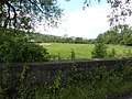
 Farmland, Hope Valley - geograph.org.uk - 3345546.jpg 640 × 480; 52 KB
-
 Feeding time on Wooler Knoll - geograph.org.uk - 6030439.jpg 640 × 480; 94 KB
-
 Fence, Ladybrook Pasture - geograph.org.uk - 1815842.jpg 427 × 640; 302 KB
-
 Field Boundary - geograph.org.uk - 3537000.jpg 640 × 480; 61 KB
-
 Field of Buttercups - geograph.org.uk - 3536998.jpg 640 × 480; 70 KB
-
 Fields above Normans Farm - geograph.org.uk - 4544360.jpg 6 000 × 4 000; 4,03 MB
-
 Fields by Peakshole Water - geograph.org.uk - 3157272.jpg 1 024 × 768; 417 KB
-
 Finger of Fun on Hope Brink - geograph.org.uk - 1293517.jpg 640 × 426; 140 KB
-
 Fishing lake in a former quarrying area - geograph.org.uk - 2873300.jpg 1 024 × 768; 289 KB
-
 Footbridge near Hallum Barn - geograph.org.uk - 6109579.jpg 1 600 × 1 065; 663 KB
-
 Footpath above Twitchill Farm - geograph.org.uk - 2873348.jpg 1 024 × 732; 215 KB
-
 Footpath across railway - geograph.org.uk - 3157249.jpg 1 024 × 768; 494 KB
-
 Footpath between Hope station and the main road - geograph.org.uk - 2873463.jpg 776 × 1 024; 311 KB
-
 Footpath from Hope to Castleton - geograph.org.uk - 5730160.jpg 1 600 × 1 200; 556 KB
-
 Footpath near Spring House Farm - geograph.org.uk - 2056984.jpg 2 048 × 1 536; 1,17 MB
-
 Footpath off Aston Lane - geograph.org.uk - 6109569.jpg 1 600 × 1 065; 853 KB
-
 Footpath on Hope Brink - geograph.org.uk - 2241614.jpg 768 × 1 024; 287 KB
-
 Footpath Overlooking Twitchill Farm - geograph.org.uk - 2496210.jpg 3 296 × 2 472; 1,18 MB
-
 Footpath through railway arch near Hope - geograph.org.uk - 5103021.jpg 640 × 427; 131 KB
-
 Footpath to Ladybower Reservoir enters forestry - geograph.org.uk - 4689160.jpg 4 608 × 3 456; 5,57 MB
-
 Footpath to Lose Hill - geograph.org.uk - 5670648.jpg 1 024 × 602; 250 KB
-
 Footpath, Crookstone Out Moor - geograph.org.uk - 2941595.jpg 1 024 × 709; 220 KB
-
-
 Forest edge near Wooler Knoll - geograph.org.uk - 1048139.jpg 640 × 480; 141 KB
-
 Freight trains, Earle's Sidings - geograph.org.uk - 4269164.jpg 640 × 355; 67 KB
-
 From the Roman Road to the Vale of Edale - geograph.org.uk - 4689141.jpg 4 608 × 3 456; 4,88 MB
-
 Fulwood Stile Farm - geograph.org.uk - 4711868.jpg 1 024 × 768; 225 KB
-
 Gate and stile - geograph.org.uk - 6132918.jpg 1 024 × 683; 242 KB
-
 Gated track on Thornhill Brink - geograph.org.uk - 4689228.jpg 4 608 × 3 456; 4,99 MB
-
 Gatepost near Wooler Knott - geograph.org.uk - 2686356.jpg 640 × 427; 238 KB
-
 Gateposts on Hope Brink - geograph.org.uk - 2241543.jpg 1 024 × 768; 310 KB
-
 Gateposts, Hope Brink - geograph.org.uk - 2686339.jpg 640 × 427; 234 KB
-
 Geodesic Dome Greenhouse in a Derbyshire Garden - geograph.org.uk - 4798336.jpg 2 218 × 1 469; 2,19 MB
-
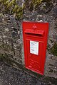 Georgian postbox on Edale Road, Hope - geograph.org.uk - 6108866.jpg 1 065 × 1 600; 684 KB
-
 Gift shop in Hope - geograph.org.uk - 5933221.jpg 640 × 481; 72 KB
-

-
 Grazing sheep with views to Mam Tor - geograph.org.uk - 3856131.jpg 3 078 × 2 308; 2,41 MB
-
 Guardian of The Valley - geograph.org.uk - 5962960.jpg 5 057 × 3 601; 3,95 MB
-
 Guest House - geograph.org.uk - 1815414.jpg 427 × 640; 277 KB
-
 Guinea fowl near Fulwood Stile Farm - geograph.org.uk - 3054727.jpg 4 221 × 2 814; 2,84 MB
-
 Hair by Strands - geograph.org.uk - 941352.jpg 640 × 480; 54 KB
-

-
 Heather clad moorland to Ladybower Reservoir - geograph.org.uk - 4689209.jpg 4 532 × 3 352; 6,11 MB
-

-
 Heather on Hope Brink - geograph.org.uk - 3110346.jpg 640 × 480; 86 KB
-
 High Peak , Castleton Road A6187 - geograph.org.uk - 5952008.jpg 6 000 × 4 000; 6,55 MB
-
 High Peak , Hope Road A6187 - geograph.org.uk - 5952004.jpg 6 000 × 4 000; 7,65 MB
-
 High Peak , Hope Road A6187 - geograph.org.uk - 5952065.jpg 6 000 × 4 000; 5,41 MB
-
 Historic beauty salon in Hope - geograph.org.uk - 4465880.jpg 5 002 × 3 509; 3,83 MB
-
 Holiday cottage at Mead Farm, Hope - geograph.org.uk - 3198037.jpg 4 298 × 3 070; 3,08 MB
-
 Hope , Castleton Road A6187 - geograph.org.uk - 5952007.jpg 6 000 × 4 000; 5,6 MB
-
 Hope , Castleton Road A6187 - geograph.org.uk - 5952060.jpg 6 000 × 4 000; 7,59 MB
-
 Hope , Station Road A6187 - geograph.org.uk - 5952005.jpg 6 000 × 4 000; 6,79 MB
-
 Hope , Station Road A6187 - geograph.org.uk - 5952006.jpg 6 000 × 4 000; 5,63 MB
-
 Hope , The Crescent - geograph.org.uk - 5952062.jpg 6 000 × 4 000; 6,85 MB
-
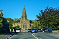
 Hope - Chapel - 1.jpg 3 000 × 2 250; 2,43 MB
-
 Hope - footpath to Ryecroft - geograph.org.uk - 3647759.jpg 1 200 × 1 600; 922 KB
-
 Hope - Garage on Castleton Road - geograph.org.uk - 3647851.jpg 1 600 × 1 169; 533 KB
-
 Hope - geograph.org.uk - 4854163.jpg 3 919 × 1 758; 1,78 MB
-
 Hope - Kilnhill Bridge - geograph.org.uk - 3647777.jpg 1 200 × 1 600; 588 KB
-
 Hope - Methodist Church - geograph.org.uk - 3647839.jpg 1 600 × 1 195; 662 KB
-
 Hope - Mill Cottage - geograph.org.uk - 3647782.jpg 1 600 × 1 195; 814 KB
-
 Hope - The Old Hall Hotel - geograph.org.uk - 3647872.jpg 1 600 × 1 200; 689 KB
-
 Hope - view to Bradwell Edge - geograph.org.uk - 3647767.jpg 1 600 × 1 200; 582 KB
-
 Hope - view to Win Hill - geograph.org.uk - 3647752.jpg 1 600 × 1 200; 703 KB
-
 Hope - Woodbine Cafe - geograph.org.uk - 3647845.jpg 1 600 × 1 184; 689 KB
-
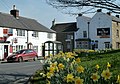
 Hope - Woodroffe Arms - geograph.org.uk - 3647877.jpg 1 600 × 1 187; 632 KB
-
 Hope Brink - geograph.org.uk - 769059.jpg 640 × 480; 61 KB
-
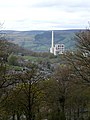
 Hope Cement Works - geograph.org.uk - 3494820.jpg 3 399 × 3 399; 1,98 MB
-
 Hope Cement Works - geograph.org.uk - 3962172.jpg 3 742 × 2 348; 1,15 MB
-
 Hope Cement Works - geograph.org.uk - 4854162.jpg 3 197 × 1 285; 1,88 MB
-
 Hope Cement Works - geograph.org.uk - 5933172.jpg 640 × 480; 73 KB
-
 Hope cement works and Mam Tor - geograph.org.uk - 6031266.jpg 640 × 480; 72 KB
-
 Hope Cement Works from Stanage - geograph.org.uk - 3819754.jpg 3 551 × 4 734; 3,2 MB
-
 Hope Cement Works seen from Stanage - geograph.org.uk - 5198438.jpg 4 983 × 3 745; 4,52 MB
-
 Hope cement works, seen from footpath - geograph.org.uk - 6133009.jpg 1 024 × 683; 180 KB
-
 Hope Cemetery - geograph.org.uk - 3054730.jpg 4 608 × 3 072; 3,52 MB
-
 Hope Chimney - geograph.org.uk - 1972804.jpg 640 × 480; 58 KB


_at_Brough_-_geograph.org.uk_-_3095450.jpg)


.png)


