Category:Hopwell
Aller à la navigation
Aller à la recherche
civil parish in Erewash, Derbyshire, England | |||||
| Téléverser des médias | |||||
| Nature de l’élément | |||||
|---|---|---|---|---|---|
| Lieu | Erewash, Derbyshire, Midlands de l'Est, Angleterre | ||||
 | |||||
Sous-catégories
Cette catégorie comprend seulement la sous-catégorie ci-dessous.
H
- Hopwell Hall (1 F)
Média dans la catégorie « Hopwell »
Cette catégorie comprend 31 fichiers, dont les 31 ci-dessous.
-
 A52, Parking in a quarter of a mile - geograph.org.uk - 3884580.jpg 3 088 × 2 056 ; 2,2 Mio
-
 Barley Field - geograph.org.uk - 855382.jpg 476 × 640 ; 363 kio
-
 Barley Field Shaded by Trees - geograph.org.uk - 860305.jpg 640 × 427 ; 241 kio
-
 Constitution Hill - geograph.org.uk - 116905.jpg 640 × 480 ; 102 kio
-
 Constitution Hill - geograph.org.uk - 917924.jpg 640 × 427 ; 201 kio
-
 Crop field off Nottingham Road - geograph.org.uk - 6196795.jpg 800 × 600 ; 141 kio
-
 Drive to Manor Farm, Draycott - geograph.org.uk - 3979239.jpg 1 280 × 960 ; 308 kio
-
 Footpath at Hopwell Nook - geograph.org.uk - 3603214.jpg 4 000 × 3 000 ; 2,51 Mio
-
 Footpath near Hopwell Hall - geograph.org.uk - 3603167.jpg 4 000 × 3 000 ; 3,23 Mio
-
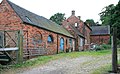
 Front of Old House at Hopwell Hall Farm - geograph.org.uk - 862642.jpg 640 × 377 ; 276 kio
-
 Grassland near Hopwell Hall Farm - geograph.org.uk - 3603129.jpg 4 000 × 3 000 ; 1,76 Mio
-
 Hopwell Hall - geograph.org.uk - 116911.jpg 640 × 480 ; 95 kio
-
 Hopwell Hall Farm - geograph.org.uk - 862647.jpg 640 × 399 ; 198 kio
-
 Hopwell Hall, Derbyshire - geograph.org.uk - 855336.jpg 640 × 425 ; 218 kio
-
 Hopwell Lodge - geograph.org.uk - 3948015.jpg 1 280 × 945 ; 234 kio
-
 Manor Farm and Howell House from Hopwellnook - geograph.org.uk - 116920.jpg 640 × 480 ; 96 kio
-
 Newly worked fields - geograph.org.uk - 6056813.jpg 2 000 × 1 333 ; 2,3 Mio
-
 Outbuildings at Manor Farm, Draycott - geograph.org.uk - 3979252.jpg 1 280 × 960 ; 232 kio
-
 Path Through a Field of Barley - geograph.org.uk - 855369.jpg 640 × 427 ; 242 kio
-
 Private entrance to Manor Farm - geograph.org.uk - 3979243.jpg 1 280 × 960 ; 353 kio
-
 Rear of Old House at Hopwell Hall Farm - geograph.org.uk - 862637.jpg 640 × 397 ; 262 kio
-
 Ripening Barley with Oak and Poplars - geograph.org.uk - 886009.jpg 640 × 427 ; 218 kio
-
 Ripening crop off Nottingham Road - geograph.org.uk - 6196786.jpg 800 × 600 ; 125 kio
-
 Sowing seed - geograph.org.uk - 5571794.jpg 1 280 × 960 ; 614 kio
-
 The drive to Hopwell Hall - geograph.org.uk - 3948013.jpg 1 280 × 960 ; 278 kio
-
 The track to Hopwell Hall Farm - geograph.org.uk - 6368109.jpg 3 008 × 2 000 ; 1,16 Mio
-
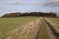
 Track (footpath) to Hopwell Hall - geograph.org.uk - 6196790.jpg 800 × 600 ; 142 kio
-
 Track to a Farm - geograph.org.uk - 1066334.jpg 640 × 457 ; 118 kio
-
 Track to Hopwell Hall Farm - geograph.org.uk - 1361942.jpg 640 × 427 ; 123 kio
-
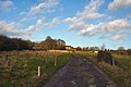
 Track towards Hopwell Hall - geograph.org.uk - 670506.jpg 640 × 429 ; 66 kio
-
 Underpass, Manor Farm driveway - geograph.org.uk - 3979246.jpg 949 × 1 280 ; 224 kio


_to_Hopwell_Hall_-_geograph.org.uk_-_6196790.jpg)


