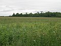
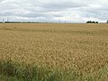
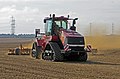
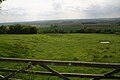
Category:Horkstow
Aller à la navigation
Aller à la recherche
Horkstow is a village and civil parish in North Lincolnshire, England.

localité britannique du comté anglais de Lincolnshire  | |||||
| Téléverser des médias | |||||
| Nature de l’élément | |||||
|---|---|---|---|---|---|
| Lieu | North Lincolnshire, Lincolnshire, Yorkshire-et-Humber, Angleterre | ||||
 | |||||
Sous-catégories
Cette catégorie comprend 11 sous-catégories, dont les 11 ci-dessous.
A
E
- Electricity pylons in Horkstow (24 F)
F
- Fog in Horkstow (7 F)
G
- Gates in Horkstow (17 F)
H
- Hedges in Horkstow (53 F)
T
- Trees in Horkstow (33 F)
- Turton's Covert (31 F)
W
- Watercourses in Horkstow (21 F)
Média dans la catégorie « Horkstow »
Cette catégorie comprend 390 fichiers, dont les 200 ci-dessous.
(page précédente) (page suivante)-
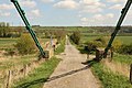
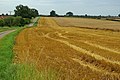
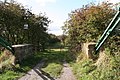 A bridge too far - geograph.org.uk - 3154511.jpg 640 × 427 ; 123 kio
-
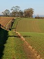
 A footpath along the Ancholme - geograph.org.uk - 2167984.jpg 800 × 600 ; 333 kio
-
 A Gap in the Hedge - geograph.org.uk - 2188507.jpg 960 × 1 280 ; 876 kio
-
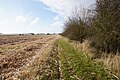
 A Lincolnshire Wolds' Bridleway - geograph.org.uk - 2163132.jpg 2 736 × 3 648 ; 2,23 Mio
-
 A Lincolnshire Wolds' Footpath - geograph.org.uk - 2163122.jpg 2 736 × 3 648 ; 3,71 Mio
-
 A Minor Lincolnshire Wolds' Road - geograph.org.uk - 2163154.jpg 2 641 × 3 522 ; 2,68 Mio
-
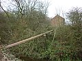 A pipeline over Weir Dyke - geograph.org.uk - 2168001.jpg 800 × 600 ; 335 kio
-
 A public footpath towards Turton's Covert - geograph.org.uk - 2048371.jpg 800 × 600 ; 220 kio
-
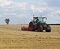 After the Harvest on Saxby Wolds - geograph.org.uk - 3601473.jpg 1 500 × 1 216 ; 1,45 Mio
-
 After the Pea Harvest - geograph.org.uk - 3584996.jpg 1 500 × 1 500 ; 1,05 Mio
-
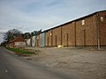
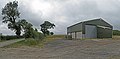 Agricultural Storage Building near Saxby All Saints - geograph.org.uk - 4065832.jpg 1 600 × 787 ; 959 kio
-
 Ancholme Flooding - geograph.org.uk - 3771911.jpg 1 600 × 1 040 ; 496 kio
-
 Another Landmark Tree Lost - geograph.org.uk - 2227510.jpg 1 280 × 960 ; 864 kio
-
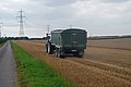 Another Load to the Grain Store - geograph.org.uk - 2580696.jpg 640 × 429 ; 62 kio
-
 Autumn Ploughing near North Wold Farm - geograph.org.uk - 3663732.jpg 1 600 × 1 157 ; 2,03 Mio
-
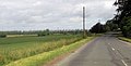
 B1204 entering Horkstow - geograph.org.uk - 3011062.jpg 640 × 445 ; 124 kio
-
 B1204 just south of Horkstow - geograph.org.uk - 3011061.jpg 640 × 327 ; 51 kio
-
 B1204 near Horkstow Grange - geograph.org.uk - 5113311.jpg 1 600 × 1 064 ; 428 kio
-
 Bale Storage - geograph.org.uk - 3109427.jpg 1 500 × 1 125 ; 1,08 Mio
-
 Barns at North Wold Farm - geograph.org.uk - 4304133.jpg 1 600 × 871 ; 1,09 Mio
-
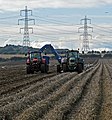
 Beet Handling Machine near North Wold Farm - geograph.org.uk - 4676179.jpg 1 600 × 1 051 ; 1,38 Mio
-
 Beet Harvesting near North Wold Farm - geograph.org.uk - 3691988.jpg 1 600 × 1 267 ; 1,97 Mio
-
 Beet Harvesting near North Wold Farm - geograph.org.uk - 3700046.jpg 1 600 × 1 035 ; 2,07 Mio
-
 Between Horkstow and Saxby All Saints - geograph.org.uk - 2075250.jpg 1 000 × 763 ; 862 kio
-
 Between the lines - geograph.org.uk - 6291575.jpg 3 507 × 1 677 ; 911 kio
-
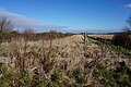
 Bird Friendly Field Corner near Manor Wold Farm - geograph.org.uk - 2045124.jpg 1 000 × 750 ; 246 kio
-
 Bodged signpost on Middlegate Lane, Horkstow - geograph.org.uk - 4975333.jpg 640 × 427 ; 69 kio
-
 Bridge Headroom Gauge - geograph.org.uk - 4867525.jpg 1 600 × 1 065 ; 456 kio
-
 Bridge Lane - geograph.org.uk - 4296747.jpg 1 024 × 683 ; 264 kio
-
 Bridge Lane in January - geograph.org.uk - 2752439.jpg 1 280 × 927 ; 1,51 Mio
-
 Bridge Lane towards Horkstow Bridge - geograph.org.uk - 5668097.jpg 1 600 × 1 064 ; 648 kio
-
 Bridge Lane, Horkstow - geograph.org.uk - 1913157.jpg 1 280 × 854 ; 434 kio
-
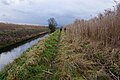
 Bridleway by the New River Ancholme - geograph.org.uk - 5168744.jpg 1 024 × 768 ; 270 kio
-
-
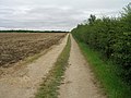
 Bridleway leading to Horkstow Road - geograph.org.uk - 1973243.jpg 1 024 × 768 ; 219 kio
-
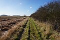
 Bridleway on the Lincolnshire Wolds - geograph.org.uk - 5064757.jpg 1 024 × 768 ; 200 kio
-
 Bridleway running parallel to the River Ancholme - geograph.org.uk - 4875721.jpg 1 024 × 768 ; 178 kio
-
 Bridleway to Turton's Covert - geograph.org.uk - 4044506.jpg 1 600 × 1 064 ; 730 kio
-
 Bridleway towards Horkstow Road - geograph.org.uk - 2527629.jpg 1 600 × 1 200 ; 530 kio
-
 Bridleway towards Horkstow Road - geograph.org.uk - 2527634.jpg 1 600 × 1 200 ; 424 kio
-
 Bridleway towards Horkstow Road - geograph.org.uk - 6021126.jpg 1 600 × 1 064 ; 645 kio
-
 Bridleway towards Horkstow Road - geograph.org.uk - 6021127.jpg 1 600 × 1 064 ; 571 kio
-
 Bridleway towards Turton's Covert - geograph.org.uk - 6021122.jpg 1 600 × 1 064 ; 559 kio
-
 Broad Acres - geograph.org.uk - 4128861.jpg 1 600 × 1 200 ; 648 kio
-
 By the Horkstow Road near North Wold Farm - geograph.org.uk - 1928131.jpg 1 000 × 640 ; 814 kio
-
 Cemented in the Middle - geograph.org.uk - 2163088.jpg 3 394 × 2 549 ; 1,94 Mio
-
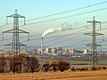
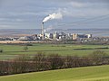 Cemex Cement Works - South Ferriby - geograph.org.uk - 2736636.jpg 1 280 × 960 ; 737 kio
-
 Chapel Lane, Horkstow - geograph.org.uk - 2069021.jpg 1 000 × 686 ; 617 kio
-
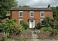 Church House, Main Street, Horkstow - geograph.org.uk - 2017014.jpg 1 000 × 711 ; 928 kio
-
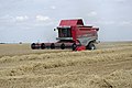
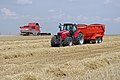
 Combining near North Wold Farm - geograph.org.uk - 2580673.jpg 1 280 × 857 ; 824 kio
-
 Combining near North Wold Farm - geograph.org.uk - 4112332.jpg 1 600 × 1 200 ; 826 kio
-
 Combining on Saxby Wolds - geograph.org.uk - 3590281.jpg 1 500 × 996 ; 546 kio
-
 Copse near Horkstow - geograph.org.uk - 1856033.jpg 1 024 × 876 ; 318 kio
-
 Crates, Horkstow Wolds - geograph.org.uk - 1973237.jpg 1 024 × 768 ; 125 kio
-
 Crop field off Horkstow Road - geograph.org.uk - 2527644.jpg 1 600 × 1 200 ; 326 kio
-
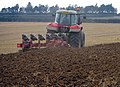
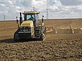 Cultivating near North Wold Farm - geograph.org.uk - 3397200.jpg 1 500 × 1 125 ; 698 kio
-
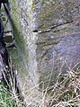 Cut Mark, Horkstow Bridge - geograph.org.uk - 3545360.jpg 478 × 640 ; 132 kio
-
 Dark Clouds over the Wolds - geograph.org.uk - 3026056.jpg 1 500 × 1 365 ; 2,03 Mio
-
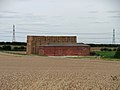
 Derelict farm building - geograph.org.uk - 5099587.jpg 800 × 607 ; 111 kio
-
 Downhill to Horkstow - geograph.org.uk - 2212665.jpg 1 280 × 878 ; 984 kio
-
 Drilling near Manor Wold Farm - geograph.org.uk - 2615659.jpg 1 280 × 802 ; 932 kio
-
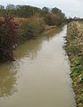
 Duckweed on the New River Ancholme - geograph.org.uk - 2078146.jpg 1 000 × 1 032 ; 932 kio
-
 Dutch Barns at North Wold Farm - geograph.org.uk - 1870136.jpg 1 000 × 750 ; 752 kio
-
 East Drain at Horkstow Bridge - geograph.org.uk - 3240358.jpg 1 164 × 1 500 ; 1,45 Mio
-
 East Drain near Horkstow - geograph.org.uk - 5667857.jpg 1 600 × 1 064 ; 882 kio
-
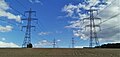
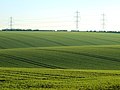
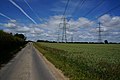
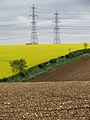 Electricity Pylons - geograph.org.uk - 3470722.jpg 1 125 × 1 500 ; 658 kio
-
 Emerging Beet Crop near Hall Top - geograph.org.uk - 4510565.jpg 1 600 × 1 200 ; 1,91 Mio
-
 Emerging crop, Middlegate Road, Horkstow - geograph.org.uk - 4975354.jpg 640 × 427 ; 61 kio
-
 Emerging Potato Crop near North Wold Farm - geograph.org.uk - 3001681.jpg 1 500 × 1 500 ; 2,16 Mio
-
 Entry to Farm Track - geograph.org.uk - 3240372.jpg 1 500 × 958 ; 912 kio
-
 Ewe and Lambs near Horkstow - geograph.org.uk - 3407489.jpg 1 500 × 989 ; 388 kio
-
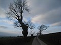
 Fallen Tree near Manor Wold Farm - geograph.org.uk - 2099691.jpg 1 280 × 774 ; 1,26 Mio
-
 Farm building, Horkstow Grange - geograph.org.uk - 2527740.jpg 1 600 × 1 200 ; 391 kio
-
 Farm buildings at Horkstow Grange - geograph.org.uk - 2342666.jpg 800 × 600 ; 247 kio
-
 Farm buildings next to Horkstow Road - geograph.org.uk - 5102145.jpg 800 × 445 ; 77 kio
-
 Farm buildings on Horkstow Road - geograph.org.uk - 2527641.jpg 1 600 × 1 200 ; 335 kio
-
 Farm buildings on Horkstow Road - geograph.org.uk - 4044594.jpg 1 600 × 1 064 ; 574 kio
-
 Farm buildings on Horkstow Road - geograph.org.uk - 4044598.jpg 1 600 × 1 064 ; 532 kio
-
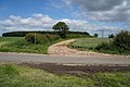
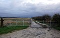
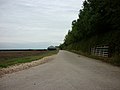
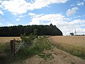
 Farm track (bridleway) near White Hart Farm - geograph.org.uk - 2527614.jpg 1 600 × 1 200 ; 468 kio
-
 Farm track off Bridge Lane - geograph.org.uk - 2527711.jpg 1 600 × 1 200 ; 530 kio
-
 Farm track to Manor Wold Farm, Horkstow Road - geograph.org.uk - 2032064.jpg 800 × 600 ; 215 kio
-
 Farm Track to the Old Quarry - geograph.org.uk - 3233992.jpg 1 500 × 1 125 ; 1,61 Mio
-
 Farmland alongside East Drain - geograph.org.uk - 5667848.jpg 1 600 × 1 064 ; 577 kio
-
 Farmland alongside East Drain - geograph.org.uk - 5668092.jpg 1 600 × 1 064 ; 796 kio
-
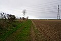
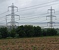
 Farmland and pylons near White Hart Farm - geograph.org.uk - 2527625.jpg 1 600 × 1 200 ; 385 kio
-
 Farmland near Horkstow Grange - geograph.org.uk - 2527745.jpg 1 600 × 1 200 ; 454 kio
-
 Farmland near North Wold Farm - geograph.org.uk - 2527635.jpg 1 600 × 1 200 ; 369 kio
-
 Farmland near White Hart Farm - geograph.org.uk - 2527609.jpg 1 600 × 1 200 ; 368 kio
-
 Farmland off Bridge Lane - geograph.org.uk - 2527714.jpg 1 600 × 1 200 ; 483 kio
-
 Farmland on the Horkstow Wolds - geograph.org.uk - 5102148.jpg 800 × 514 ; 81 kio
-
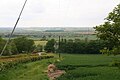
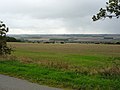
 Farmland towards the Humber - geograph.org.uk - 2527704.jpg 1 600 × 1 200 ; 397 kio
-
 Farmland, Horkstow Wolds - geograph.org.uk - 2527873.jpg 1 600 × 1 200 ; 537 kio
-
 February Ploughing on Horkstow Wolds - geograph.org.uk - 4364227.jpg 1 600 × 1 244 ; 1,78 Mio
-
 Field by Middlegate Lane, near Horkstow - geograph.org.uk - 3202297.jpg 640 × 635 ; 187 kio
-
 Field Entrance - geograph.org.uk - 3333848.jpg 1 285 × 1 500 ; 1,69 Mio
-

-
 Field Entry off Horkstow Road - geograph.org.uk - 1997262.jpg 1 000 × 750 ; 848 kio
-
 Field Gate near Horkstow - geograph.org.uk - 2736627.jpg 1 280 × 960 ; 1,1 Mio
-
 Field Gate near Horkstow - geograph.org.uk - 3273386.jpg 1 500 × 1 125 ; 1,34 Mio
-
 Field Preparation near North Wold Farm - geograph.org.uk - 3678360.jpg 1 600 × 1 047 ; 1,2 Mio
-
-
 Field with Poppies near Hall Top - geograph.org.uk - 4544084.jpg 1 600 × 1 200 ; 2,16 Mio
-
 Fields near Turton's Covert - geograph.org.uk - 2112890.jpg 1 280 × 851 ; 855 kio
-
 Fishing pitch on the River Ancholme - geograph.org.uk - 4875720.jpg 1 024 × 768 ; 194 kio
-
 Flooding at Ferriby Sluice - geograph.org.uk - 3771916.jpg 1 600 × 1 200 ; 664 kio
-
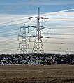
 Fluctuating under Power - geograph.org.uk - 2163111.jpg 3 648 × 2 736 ; 2,65 Mio
-
 Following the Plough - geograph.org.uk - 3303649.jpg 1 323 × 1 500 ; 1,41 Mio
-
 Footbridge over Weir Dike - geograph.org.uk - 5668375.jpg 1 600 × 1 064 ; 850 kio
-
 Footbridge over Weir Dike - geograph.org.uk - 5668377.jpg 1 600 × 1 064 ; 776 kio
-
 Footpath alongside the River Ancholme - geograph.org.uk - 4867397.jpg 1 600 × 1 065 ; 724 kio
-
 Footpath alongside the River Ancholme - geograph.org.uk - 4867400.jpg 1 600 × 1 065 ; 694 kio
-
 Footpath alongside the River Ancholme - geograph.org.uk - 4867558.jpg 1 600 × 1 065 ; 683 kio
-
 Footpath alongside the River Ancholme - geograph.org.uk - 4867566.jpg 1 600 × 1 065 ; 860 kio
-
 Footpath alongside the River Ancholme - geograph.org.uk - 4867570.jpg 1 600 × 1 065 ; 950 kio
-
 Footpath alongside the River Ancholme - geograph.org.uk - 4868664.jpg 1 600 × 1 065 ; 851 kio
-
 Footpath alongside the River Ancholme - geograph.org.uk - 4868672.jpg 1 600 × 1 065 ; 750 kio
-
 Footpath by the River Ancholme - geograph.org.uk - 1936325.jpg 800 × 600 ; 160 kio
-
 Footpath towards South Ferriby - geograph.org.uk - 2527703.jpg 1 600 × 1 200 ; 444 kio
-
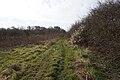
 Footpath towards Turton's Covert - geograph.org.uk - 1915638.jpg 1 000 × 977 ; 760 kio
-
-
 Georgian Cartshed at Horkstow Grange - geograph.org.uk - 4362975.jpg 1 600 × 1 200 ; 1,54 Mio
-
 Georgian Symmetry - geograph.org.uk - 2934581.jpg 1 371 × 1 934 ; 1,76 Mio
-
 Grain store on Saxby Wold - geograph.org.uk - 2294673.jpg 1 024 × 768 ; 118 kio
-
 Green Leaves of Spring near North Wold Farm - geograph.org.uk - 1835255.jpg 640 × 520 ; 346 kio
-
 Harvest Commenced - geograph.org.uk - 3092531.jpg 1 500 × 997 ; 1,61 Mio
-
 Harvest on Saxby Wolds - geograph.org.uk - 3590271.jpg 1 500 × 996 ; 631 kio
-
 Harvesting near Horkstow - geograph.org.uk - 4636375.jpg 1 600 × 1 172 ; 1,52 Mio
-
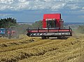
 Harvesting near North Wold Farm - geograph.org.uk - 2580681.jpg 1 280 × 857 ; 858 kio
-
 Harvesting near North Wold Farm - geograph.org.uk - 4154129.jpg 1 600 × 1 200 ; 1,47 Mio
-
 Harvesting Potatoes near North Wold Farm - geograph.org.uk - 3172966.jpg 1 500 × 1 125 ; 1,45 Mio
-
 Harvesting Potatoes near North Wold Farm - geograph.org.uk - 3179980.jpg 1 396 × 1 500 ; 1,74 Mio
-
 Haulm Destruction near North Wold Farm - geograph.org.uk - 3163489.jpg 1 500 × 1 125 ; 1,85 Mio
-
 Hawthorn and Miscanthus by the New River Ancholme - geograph.org.uk - 5168769.jpg 1 024 × 768 ; 207 kio
-
 Heading west along Horkstow Road - geograph.org.uk - 4044577.jpg 1 600 × 1 064 ; 483 kio
-
 Heading west along Horkstow Road - geograph.org.uk - 4044581.jpg 1 600 × 1 064 ; 500 kio
-
 Heading west along Horkstow Road - geograph.org.uk - 4044585.jpg 1 600 × 1 064 ; 587 kio
-
 Heading west along Horkstow Road - geograph.org.uk - 4044590.jpg 1 600 × 1 064 ; 579 kio
-
 Heavy Going - geograph.org.uk - 3191792.jpg 1 500 × 965 ; 1,51 Mio
-
 Hedge on Horkstow Wolds - geograph.org.uk - 1826487.jpg 750 × 1 000 ; 867 kio
-
 Hedgerow and Hose Reel - geograph.org.uk - 4061283.jpg 1 600 × 1 200 ; 1,82 Mio
-
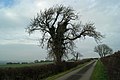
 Hedgerow Trees near Horkstow - geograph.org.uk - 4309328.jpg 1 600 × 1 200 ; 1,44 Mio
-
 Holloway near Horkstow - geograph.org.uk - 2294668.jpg 1 024 × 768 ; 317 kio
-
 Horkston Bridge - geograph.org.uk - 2167964.jpg 800 × 600 ; 232 kio
-
 Horkston Bridge over the River Ancholme - geograph.org.uk - 4867529.jpg 1 600 × 1 065 ; 484 kio
-
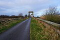
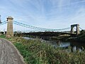 Horkstow Bridge - geograph.org.uk - 6267748.jpg 1 024 × 768 ; 197 kio
-
 Horkstow Bridge across New River Ancholme - geograph.org.uk - 6291596.jpg 2 821 × 1 675 ; 1,19 Mio
-
 Horkstow Bridge across New River Ancholme - geograph.org.uk - 6291597.jpg 3 197 × 1 628 ; 1,36 Mio
-
 Horkstow Bridge over the River Ancholme - geograph.org.uk - 5668102.jpg 1 600 × 1 082 ; 635 kio
-
 Horkstow Carrs - geograph.org.uk - 1970385.jpg 1 000 × 750 ; 764 kio
-
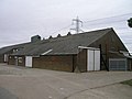
 Horkstow Grange farm buildings - geograph.org.uk - 4929508.jpg 1 024 × 768 ; 138 kio
-
 Horkstow Grange from B1204 - geograph.org.uk - 3011060.jpg 640 × 461 ; 66 kio
-
 Horkstow Hall seen from Middlegate - geograph.org.uk - 1818951.jpg 1 000 × 688 ; 660 kio
-
 Horkstow Postbox - geograph.org.uk - 260059.jpg 448 × 640 ; 166 kio
-
 Horkstow Road - geograph.org.uk - 1970346.jpg 1 000 × 702 ; 461 kio
-
 Horkstow Road - geograph.org.uk - 2002570.jpg 990 × 1 239 ; 950 kio
-
 Horkstow Road - geograph.org.uk - 2336330.jpg 640 × 427 ; 43 kio
-
 Horkstow Road - geograph.org.uk - 2336343.jpg 640 × 427 ; 48 kio
-
 Horkstow Road - geograph.org.uk - 5013887.jpg 640 × 480 ; 424 kio
-
 Horkstow Road - geograph.org.uk - 5064776.jpg 1 024 × 653 ; 110 kio
-
 Horkstow Road descending to the Ancholme Valley - geograph.org.uk - 5099609.jpg 800 × 611 ; 121 kio
-
 Horkstow road goes up the hill - geograph.org.uk - 4929539.jpg 1 024 × 768 ; 142 kio
-
 Horkstow sheep - geograph.org.uk - 3198631.jpg 640 × 458 ; 212 kio
-
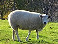 Horkstow Sheep - geograph.org.uk - 3750177.jpg 1 600 × 1 220 ; 914 kio
-
 Horkstow tulips - geograph.org.uk - 4296286.jpg 1 024 × 683 ; 381 kio
-
 Horkstow Wold towards North Wold Farm - geograph.org.uk - 5057175.jpg 640 × 427 ; 44 kio
-
 Horkstow Wolds - geograph.org.uk - 1826470.jpg 1 000 × 750 ; 647 kio
-
 Horkstow Wolds in December - geograph.org.uk - 2212682.jpg 1 280 × 533 ; 561 kio
-
 Horkstow, White's Directory of Lincolnshire 1872.jpg 1 250 × 731 ; 573 kio
-
 Hose Reel on Bridge Lane - geograph.org.uk - 3109410.jpg 1 500 × 1 208 ; 1,34 Mio
-
 How the mighty, and powerful, have fallen - geograph.org.uk - 6291584.jpg 3 462 × 1 655 ; 1,27 Mio
-
 Humber View near Horkstow - geograph.org.uk - 2434643.jpg 1 280 × 1 074 ; 1,04 Mio
-
 Irrigating potatoes - geograph.org.uk - 1973314.jpg 1 024 × 768 ; 139 kio
-
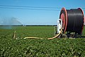
 Irrigation Hose Drum near North Wold Farm - geograph.org.uk - 1948538.jpg 1 000 × 750 ; 655 kio
-
 Irrigation Hose Reel - geograph.org.uk - 3084826.jpg 1 600 × 1 200 ; 1,57 Mio
-
 Irrigation on Horkstow Wolds - geograph.org.uk - 1919162.jpg 1 000 × 673 ; 667 kio
-
 Jacobean manor house, Main Street, Horkstow - geograph.org.uk - 4816075.jpg 5 184 × 3 456 ; 3,16 Mio
-
 Land Drain off Weir Dike - geograph.org.uk - 4868622.jpg 1 600 × 1 065 ; 698 kio
-
 Last of the Blasted Oak - geograph.org.uk - 2227465.jpg 1 280 × 960 ; 1,13 Mio
-
 Loading a Seed Drill near Horkstow - geograph.org.uk - 3922613.jpg 1 600 × 967 ; 1,27 Mio
-
 Loading Bales near North Wold Farm - geograph.org.uk - 3635074.jpg 1 600 × 1 181 ; 1,7 Mio
-
 Lone tree at Hall Top - geograph.org.uk - 4837045.jpg 3 888 × 4 798 ; 5,21 Mio
-
-
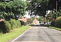
 Looking down Horkstow Road - geograph.org.uk - 2046635.jpg 800 × 600 ; 204 kio
-
 Looking towards Ferriby Sluice - geograph.org.uk - 1970371.jpg 1 000 × 641 ; 507 kio
-
 Looking towards Field House Farm - geograph.org.uk - 2294686.jpg 1 024 × 768 ; 151 kio
-
 Looking towards Scunthorpe - geograph.org.uk - 2075273.jpg 1 000 × 750 ; 710 kio
-
 Looking towards Scunthorpe - geograph.org.uk - 3084839.jpg 1 600 × 1 200 ; 1,84 Mio
-
 Looking towards South Ferriby - geograph.org.uk - 2736651.jpg 1 280 × 960 ; 892 kio
-
 Looking towards Turton's Covert - geograph.org.uk - 1973288.jpg 1 024 × 768 ; 152 kio
-
 Looking towards Turton's Covert - geograph.org.uk - 3109416.jpg 998 × 1 500 ; 1,68 Mio
-
 Looking west along the pylons - geograph.org.uk - 6407004.jpg 1 024 × 768 ; 168 kio
-
 Low cloud over Roxby Carrs - geograph.org.uk - 2046645.jpg 800 × 600 ; 178 kio
-
 Main Street Horkstow - geograph.org.uk - 5113297.jpg 4 624 × 3 064 ; 5,81 Mio
-
 Main Street, Horkstow - geograph.org.uk - 3199523.jpg 640 × 455 ; 213 kio
-
 Main Street, Horkstow - geograph.org.uk - 5113303.jpg 4 385 × 3 050 ; 5,46 Mio
-
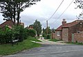
 Middlegate - geograph.org.uk - 2311870.jpg 640 × 427 ; 66 kio
-
 Middlegate above Horkstow Grange - geograph.org.uk - 2294680.jpg 1 024 × 768 ; 134 kio
-
 Middlegate in Late May - geograph.org.uk - 2428708.jpg 1 280 × 960 ; 1,33 Mio
-
 Middlegate in Late November - geograph.org.uk - 2171138.jpg 1 280 × 852 ; 982 kio
-
 Middlegate in November - geograph.org.uk - 3239523.jpg 1 500 × 1 125 ; 2,1 Mio


_near_White_Hart_Farm_-_geograph.org.uk_-_2527614.jpg)


