Category:Horní Heřmanice (Třebíč District)
Aller à la navigation
Aller à la recherche
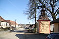
municipalité tchèque  Centrum obce s kaplí Panny Marie   | |||||
| Téléverser des médias | |||||
| Nature de l’élément | |||||
|---|---|---|---|---|---|
| Lieu |
| ||||
| Population |
| ||||
| Superficie |
| ||||
| Altitude |
| ||||
| site officiel | |||||
 | |||||
Sous-catégories
Cette catégorie comprend 7 sous-catégories, dont les 7 ci-dessous.
B
D
S
Média dans la catégorie « Horní Heřmanice (Třebíč District) »
Cette catégorie comprend 2 fichiers, dont les 2 ci-dessous.
-
 Center of Horní Heřmanice in 2015, Třebíč District.JPG 3 888 × 2 592 ; 4,74 Mio
-
 Center with chapel of Saint Mary in Horní Heřmanice, Třebíč District.JPG 4 320 × 3 240 ; 3,89 Mio
