Category:Hornton
Aller à la navigation
Aller à la recherche
localité britannique du comté anglais d'Oxfordshire  | |||||
| Téléverser des médias | |||||
| Nature de l’élément | |||||
|---|---|---|---|---|---|
| Lieu | Cherwell, Oxfordshire, Angleterre du Sud-Est, Angleterre | ||||
| Population |
| ||||
| Superficie |
| ||||
| site officiel | |||||
 | |||||
Sous-catégories
Cette catégorie comprend seulement la sous-catégorie ci-dessous.
H
Média dans la catégorie « Hornton »
Cette catégorie comprend 171 fichiers, dont les 171 ci-dessous.
-
 A snowy field at Hornton Grounds Farm - geograph.org.uk - 5625732.jpg 640 × 480 ; 231 kio
-
 Aglais io - geograph.org.uk - 192669.jpg 480 × 640 ; 118 kio
-
 All mod cons... - geograph.org.uk - 6258653.jpg 480 × 640 ; 312 kio
-
 All mod cons... - geograph.org.uk - 6258655.jpg 480 × 640 ; 299 kio
-
 Animal feeder on Bush Hill - geograph.org.uk - 3489782.jpg 2 000 × 1 500 ; 519 kio
-
 Bell Street, Hornton - geograph.org.uk - 5193413.jpg 640 × 480 ; 197 kio
-
 Borage and beehives, Hornton Grounds Farm - geograph.org.uk - 4054262.jpg 640 × 480 ; 582 kio
-
 Cattle at Hornton Grounds Farm - geograph.org.uk - 3184067.jpg 640 × 480 ; 87 kio
-
 Church Lane, Hornton - geograph.org.uk - 1568041.jpg 501 × 640 ; 76 kio
-
 Church Lane, Hornton - geograph.org.uk - 5852440.jpg 640 × 480 ; 287 kio
-
 Cleared driveway to Hornton Grounds Farm - geograph.org.uk - 5625455.jpg 640 × 480 ; 326 kio
-
 Cottage on the Green at Hornton - geograph.org.uk - 5804871.jpg 640 × 480 ; 235 kio
-
 D'Arcy Dalton Way - geograph.org.uk - 1568212.jpg 640 × 333 ; 54 kio
-
 D'Arcy Dalton Way - geograph.org.uk - 1568336.jpg 640 × 480 ; 87 kio
-
 D'Arcy Dalton Way - geograph.org.uk - 3489546.jpg 2 000 × 1 500 ; 568 kio
-
 D'Arcy Dalton Way - geograph.org.uk - 3489555.jpg 2 000 × 1 500 ; 502 kio
-
 D'Arcy Dalton Way - geograph.org.uk - 3489690.jpg 2 000 × 1 500 ; 583 kio
-
 D'Arcy Dalton Way - geograph.org.uk - 3489704.jpg 2 000 × 1 500 ; 622 kio
-
 D'Arcy Dalton Way - geograph.org.uk - 3489718.jpg 2 000 × 1 500 ; 544 kio
-
 D'Arcy Dalton Way - geograph.org.uk - 3489761.jpg 2 000 × 1 500 ; 507 kio
-
 D'Arcy Dalton Way - geograph.org.uk - 4754101.jpg 640 × 480 ; 116 kio
-
 D'Arcy Dalton Way - geograph.org.uk - 4754103.jpg 640 × 480 ; 95 kio
-
 D'Arcy Dalton Way crosses Quarry Road - geograph.org.uk - 3487778.jpg 2 000 × 1 500 ; 495 kio
-
 Deer sculpture - geograph.org.uk - 6258665.jpg 640 × 480 ; 442 kio
-
 Driveway at Hornton Grounds Farm - geograph.org.uk - 5625194.jpg 640 × 480 ; 387 kio
-
 Driveway at Hornton Grounds Farm - geograph.org.uk - 5625234.jpg 480 × 640 ; 401 kio
-
 Driveway at Hornton Grounds Farm - geograph.org.uk - 5625240.jpg 480 × 640 ; 369 kio
-
 Duck sculptures - geograph.org.uk - 6258671.jpg 640 × 480 ; 402 kio
-
 Eastgate, Hornton - geograph.org.uk - 5804901.jpg 480 × 640 ; 307 kio
-
 Farm road at Hornton Grounds Farm - geograph.org.uk - 5625705.jpg 640 × 480 ; 317 kio
-
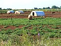
 Farmland, Horley - geograph.org.uk - 2676732.jpg 640 × 480 ; 126 kio
-
 Field near Poplar's farm - geograph.org.uk - 1865818.jpg 640 × 480 ; 60 kio
-
 Field of barley at Hornton Grounds Farm - geograph.org.uk - 5804854.jpg 640 × 480 ; 258 kio
-
 Field of Barley, Hornton Grounds Farm - geograph.org.uk - 4054260.jpg 640 × 480 ; 453 kio
-
 Field of borage, Hornton Grounds Farm - geograph.org.uk - 4054261.jpg 640 × 480 ; 576 kio
-
 Field of bullocks at Hornton Grounds Farm - geograph.org.uk - 4995616.jpg 640 × 480 ; 251 kio
-
 Field of wheat, Hornton Grounds Farm - geograph.org.uk - 4054263.jpg 640 × 480 ; 509 kio
-
 Field of wheat, Hornton Grounds Farm - geograph.org.uk - 4054264.jpg 640 × 480 ; 446 kio
-
 Field of wheat, Hornton Grounds Farm - geograph.org.uk - 4054265.jpg 640 × 480 ; 472 kio
-
 Fields south of Quarry Road - geograph.org.uk - 3487769.jpg 2 000 × 1 500 ; 597 kio
-

-
 Font in St John the Baptist Church, Hornton - geograph.org.uk - 5852437.jpg 480 × 640 ; 254 kio
-
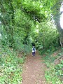
 Footpath and farmland, Hornton - geograph.org.uk - 2676716.jpg 640 × 480 ; 157 kio
-
 Footpath descends Bush Hill - geograph.org.uk - 3489809.jpg 1 500 × 2 000 ; 559 kio
-
 Footpath off Hornton Holloway - geograph.org.uk - 5804867.jpg 480 × 640 ; 345 kio
-
 Ford at Sor Brook - geograph.org.uk - 3223657.jpg 4 000 × 3 000 ; 2,57 Mio
-
 Fungi near Starveall Barn - geograph.org.uk - 1566848.jpg 511 × 640 ; 129 kio
-
 Hay meadow by the footpath - geograph.org.uk - 3489874.jpg 2 000 × 1 500 ; 508 kio
-
 Hornton - geograph.org.uk - 192655.jpg 640 × 480 ; 63 kio
-
 Hornton - geograph.org.uk - 196934.jpg 640 × 480 ; 81 kio
-
 Hornton Grounds - geograph.org.uk - 1568262.jpg 640 × 346 ; 52 kio
-
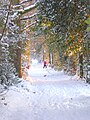
 Hornton Grounds Farm in snow - geograph.org.uk - 5625457.jpg 480 × 640 ; 353 kio
-
 Hornton Primary School - geograph.org.uk - 192658.jpg 640 × 480 ; 71 kio
-
 Hornton village - geograph.org.uk - 4054266.jpg 640 × 480 ; 605 kio
-
 Hornton village - geograph.org.uk - 4054268.jpg 640 × 480 ; 592 kio
-
 Hornton village green - geograph.org.uk - 5804881.jpg 480 × 640 ; 304 kio
-
 Hornton Village School - geograph.org.uk - 5733395.jpg 640 × 419 ; 194 kio
-
 Hornton West End - geograph.org.uk - 1567983.jpg 640 × 475 ; 87 kio
-
 Hornton, St John the Baptist - geograph.org.uk - 4400805.jpg 4 320 × 3 240 ; 5,42 Mio
-
 Hornton-Cottage By the Green - geograph.org.uk - 4966011.jpg 1 600 × 1 200 ; 499 kio
-
 Hornton-Millers Lane - geograph.org.uk - 4966003.jpg 1 600 × 1 134 ; 443 kio
-
 Horton - geograph.org.uk - 196932.jpg 640 × 480 ; 85 kio
-
 Houses in Hornton - geograph.org.uk - 5734688.jpg 640 × 421 ; 190 kio
-
 Inside La Retraite - geograph.org.uk - 6258642.jpg 640 × 480 ; 254 kio
-
 Inside La Retraite - geograph.org.uk - 6258647.jpg 640 × 480 ; 249 kio
-
 Inside St John the Baptist, Hornton (a) - geograph.org.uk - 5608020.jpg 640 × 480 ; 77 kio
-
 Inside St John the Baptist, Hornton (b) - geograph.org.uk - 5608021.jpg 640 × 480 ; 44 kio
-
 Inside St John the Baptist, Hornton (c) - geograph.org.uk - 5608023.jpg 480 × 640 ; 67 kio
-
 Inside St John the Baptist, Hornton (d) - geograph.org.uk - 5608025.jpg 480 × 640 ; 76 kio
-
 Inside St John the Baptist, Hornton (e) - geograph.org.uk - 5608026.jpg 640 × 480 ; 42 kio
-
 La Retraite - geograph.org.uk - 6258633.jpg 640 × 480 ; 345 kio
-
 La Retraite - geograph.org.uk - 6258638.jpg 640 × 480 ; 349 kio
-
 Little valley, west of Hornton - geograph.org.uk - 3223682.jpg 4 000 × 3 000 ; 2,47 Mio
-
 Manor House, The Green - geograph.org.uk - 3223680.jpg 4 000 × 3 000 ; 2,52 Mio
-
 Many, many hay bales - geograph.org.uk - 5804848.jpg 640 × 480 ; 241 kio
-
 Mechanical hay rake at Hornton Grounds Farm - geograph.org.uk - 5801355.jpg 640 × 480 ; 209 kio
-
 Mechanical hay rake at Hornton Grounds Farm - geograph.org.uk - 5801359.jpg 640 × 480 ; 301 kio
-
 Mechanical hay rake at Hornton Grounds Farm - geograph.org.uk - 5801362.jpg 640 × 480 ; 219 kio
-
 Methodist chapel, Hornton - geograph.org.uk - 1568025.jpg 640 × 429 ; 71 kio
-

-
 Millers Lane, Hornton - geograph.org.uk - 5606237.jpg 640 × 480 ; 80 kio
-
 Millers Lane, Hornton, is closed - geograph.org.uk - 5193433.jpg 640 × 480 ; 204 kio
-
 Muddy farm tracks and field of maize - geograph.org.uk - 3223663.jpg 4 000 × 3 000 ; 2,38 Mio
-
 No picnic today^ - geograph.org.uk - 5625737.jpg 640 × 480 ; 253 kio
-
-
 Path at Hornton Grounds Farm - geograph.org.uk - 5625720.jpg 480 × 640 ; 262 kio
-
 Path to Hornton Grounds Farm - geograph.org.uk - 5625725.jpg 640 × 480 ; 246 kio
-
 Pheasant feeders - geograph.org.uk - 5625714.jpg 480 × 640 ; 355 kio
-
 Plinth, Honton - geograph.org.uk - 5607988.jpg 640 × 480 ; 95 kio
-
 Poplars Farm - geograph.org.uk - 3223664.jpg 4 000 × 3 000 ; 2,46 Mio
-
 Proffitts House Hornton Geograph-3223668-by-Peter-Barr.jpg 4 000 × 3 000 ; 2,53 Mio
-
 Property for sale - geograph.org.uk - 3222776.jpg 4 000 × 3 000 ; 2,48 Mio
-
 Quarry Nurseries - geograph.org.uk - 442243.jpg 640 × 397 ; 83 kio
-
 Quarry Road near Hornton Hall - geograph.org.uk - 3489530.jpg 2 000 × 1 500 ; 605 kio
-
 Road junction north of Hornton - geograph.org.uk - 1865813.jpg 640 × 480 ; 66 kio
-
 Rural road near Hornton - geograph.org.uk - 4534484.jpg 1 500 × 999 ; 201 kio
-
 Sandstone quarry near Upton House - geograph.org.uk - 3222374.jpg 4 000 × 3 000 ; 2,29 Mio
-
 Seen on the driveway to Hornton Grounds Farm - geograph.org.uk - 5625452.jpg 640 × 480 ; 217 kio
-
 Seven Shires Way - geograph.org.uk - 2695050.jpg 640 × 480 ; 132 kio
-
 Seven Shires Way - geograph.org.uk - 2695055.jpg 640 × 480 ; 94 kio
-
 Sheep and Hornton - geograph.org.uk - 1568147.jpg 640 × 494 ; 76 kio
-
 Snowman with attitude - geograph.org.uk - 5625717.jpg 480 × 640 ; 205 kio
-
 Snowy cockerel and duck - geograph.org.uk - 5625710.jpg 640 × 480 ; 249 kio
-
 Snowy cow - geograph.org.uk - 5625254.jpg 480 × 640 ; 225 kio
-
 Snowy deer - geograph.org.uk - 5625712.jpg 480 × 640 ; 302 kio
-
 Sor Valley - geograph.org.uk - 3223659.jpg 4 000 × 3 000 ; 2,55 Mio
-
 St John the Baptist Church, Hornton - geograph.org.uk - 4054270.jpg 640 × 480 ; 637 kio
-
 St John the Baptist Church, Hornton - geograph.org.uk - 5852442.jpg 640 × 480 ; 339 kio
-
 St John the Baptist, Hornton - geograph.org.uk - 6294600.jpg 1 024 × 768 ; 230 kio
-
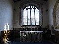
 St John the Baptist, Hornton, altar (a) - geograph.org.uk - 5608013.jpg 640 × 480 ; 69 kio
-
 St John the Baptist, Hornton, altar (b) - geograph.org.uk - 5608015.jpg 640 × 480 ; 75 kio
-
 St John the Baptist, Hornton, altar (c) - geograph.org.uk - 5608018.jpg 640 × 480 ; 59 kio
-
 St John the Baptist, Hornton, churchyard (a) - geograph.org.uk - 5608008.jpg 640 × 480 ; 88 kio
-
 St John the Baptist, Hornton, churchyard (b) - geograph.org.uk - 5608009.jpg 640 × 480 ; 75 kio
-
 St John the Baptist, Hornton, churchyard (c) - geograph.org.uk - 5608011.jpg 640 × 480 ; 93 kio
-
 St John the Baptist, Hornton, font - geograph.org.uk - 5608006.jpg 480 × 640 ; 56 kio
-
-
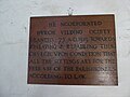
 St John the Baptist, Hornton, memorial (1) - geograph.org.uk - 5607993.jpg 640 × 480 ; 77 kio
-
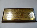
 St John the Baptist, Hornton, memorial (2) - geograph.org.uk - 5607995.jpg 480 × 640 ; 74 kio
-
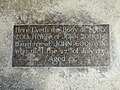
 St John the Baptist, Hornton, memorial (3) - geograph.org.uk - 5607997.jpg 640 × 480 ; 58 kio
-
 St John the Baptist, Hornton, memorial (4) - geograph.org.uk - 5607999.jpg 640 × 480 ; 91 kio
-
 St John the Baptist, Hornton, memorial (5) - geograph.org.uk - 5608000.jpg 640 × 480 ; 90 kio
-
 St John the Baptist, Hornton, memorial (6) - geograph.org.uk - 5608002.jpg 640 × 480 ; 57 kio
-
 St John the Baptist, Hornton, memorial (7) - geograph.org.uk - 5608004.jpg 640 × 480 ; 89 kio
-
 St John the Baptist, Hornton, mid November 2017 - geograph.org.uk - 5606212.jpg 640 × 480 ; 100 kio
-
 St John the Baptist, Hornton, porch - geograph.org.uk - 5608012.jpg 640 × 480 ; 123 kio
-
 St John the Baptist, Hornton, pulpit - geograph.org.uk - 5608016.jpg 480 × 640 ; 52 kio
-
 Strip of maize - geograph.org.uk - 5625461.jpg 640 × 480 ; 264 kio
-
 Substation near The Bungalow - geograph.org.uk - 198013.jpg 640 × 480 ; 53 kio
-
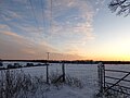
 Sunset at Hornton Grounds Farm - geograph.org.uk - 5625246.jpg 640 × 480 ; 325 kio
-
 Sunset at Hornton Grounds Farm - geograph.org.uk - 5625464.jpg 640 × 480 ; 208 kio
-
 Tamworth Red piglets at Hornton Grounds Farm - geograph.org.uk - 5625699.jpg 640 × 481 ; 243 kio
-
 Tennis cancelled - geograph.org.uk - 5625436.jpg 640 × 480 ; 357 kio
-
 Tennis court and hay bales - geograph.org.uk - 5804844.jpg 640 × 480 ; 268 kio
-
 The "Doom", St John the Baptist Church, Hornton - geograph.org.uk - 5852434.jpg 640 × 480 ; 274 kio
-
 The avenue at Hornton Grounds Farm - geograph.org.uk - 5625256.jpg 480 × 640 ; 344 kio
-
 The bicycle as planter - geograph.org.uk - 5804876.jpg 640 × 480 ; 345 kio
-
 The Dun Cow public House, Horton, Oxfordshire.jpg 640 × 480 ; 79 kio
-
 The Dun Cow, Hornton, mid November 2017 - geograph.org.uk - 5606232.jpg 640 × 480 ; 78 kio
-
 The edge of the village, Hornton - geograph.org.uk - 3223674.jpg 4 000 × 3 000 ; 2,55 Mio
-
 The Green, mid November 2017 - geograph.org.uk - 5606228.jpg 480 × 640 ; 73 kio
-
 The Holloway at Hornton - geograph.org.uk - 5804861.jpg 480 × 640 ; 409 kio
-
 The piggery at Hornton Grounds Farm - geograph.org.uk - 4054258.jpg 640 × 480 ; 554 kio
-
 The road to Horley - geograph.org.uk - 4534487.jpg 1 500 × 999 ; 243 kio
-
 The upper pond at Hornton Grounds Farm - geograph.org.uk - 5625729.jpg 640 × 480 ; 317 kio
-
 Three snowy ducks - geograph.org.uk - 5625431.jpg 480 × 640 ; 159 kio
-
 Track near Hornton Grounds - geograph.org.uk - 1568255.jpg 640 × 443 ; 71 kio
-
 Track to Horley Fields Farm - geograph.org.uk - 3174855.jpg 640 × 480 ; 78 kio
-
 Track to Hornton Hill Farm - geograph.org.uk - 3174816.jpg 640 × 480 ; 100 kio
-
 Track to Hornton Hill Farm - geograph.org.uk - 5193668.jpg 640 × 480 ; 207 kio
-
 Track to Starveall Barn - geograph.org.uk - 1865816.jpg 640 × 480 ; 45 kio
-
 Traffic jam in Hornton - geograph.org.uk - 5606233.jpg 640 × 480 ; 64 kio
-
 Trees above the Sor Valley - geograph.org.uk - 3223661.jpg 4 000 × 3 000 ; 2,49 Mio
-
 Two pot pigs at Hornton Grounds Farm - geograph.org.uk - 4054257.jpg 640 × 480 ; 606 kio
-
 Valley near Hornton - geograph.org.uk - 1567957.jpg 487 × 640 ; 111 kio
-
 Valley west of Hornton - geograph.org.uk - 1567970.jpg 640 × 480 ; 86 kio
-
 View north from Bush Hill - geograph.org.uk - 3486790.jpg 2 000 × 1 500 ; 590 kio
-

-
 Woodpile at Hornton Grounds Farm - geograph.org.uk - 5625445.jpg 640 × 480 ; 344 kio
-
 Yard and silo at Hornton Grounds Farm - geograph.org.uk - 3184065.jpg 640 × 480 ; 60 kio
-

-
 Dyke Lane Bridge - geograph.org.uk - 199177.jpg 640 × 480 ; 46 kio
-
 Heath Farm - geograph.org.uk - 197423.jpg 640 × 480 ; 62 kio
-
 Inquisitive cow - geograph.org.uk - 196941.jpg 640 × 480 ; 97 kio
-
 Marigolds at Quarry Nurseries - geograph.org.uk - 442244.jpg 640 × 474 ; 186 kio
-
 Ragnell Farm - geograph.org.uk - 197991.jpg 640 × 480 ; 53 kio
-
 Site of Langley Ironstone Quarry - geograph.org.uk - 199174.jpg 640 × 480 ; 55 kio
-
-
 The Bungalow - geograph.org.uk - 197421.jpg 640 × 480 ; 44 kio
-
 The New Inn, Wroxton Heath - geograph.org.uk - 197422.jpg 640 × 478 ; 44 kio
-
 View towards the Dairy - geograph.org.uk - 198015.jpg 640 × 480 ; 50 kio


_-_geograph.org.uk_-_5608020.jpg)
_-_geograph.org.uk_-_5608021.jpg)
_-_geograph.org.uk_-_5608023.jpg)
_-_geograph.org.uk_-_5608025.jpg)
_-_geograph.org.uk_-_5608026.jpg)


_-_geograph.org.uk_-_5608013.jpg)
_-_geograph.org.uk_-_5608015.jpg)
_-_geograph.org.uk_-_5608018.jpg)
_-_geograph.org.uk_-_5608008.jpg)
_-_geograph.org.uk_-_5608009.jpg)
_-_geograph.org.uk_-_5608011.jpg)


_-_geograph.org.uk_-_5607993.jpg)
_-_geograph.org.uk_-_5607995.jpg)
_-_geograph.org.uk_-_5607997.jpg)
_-_geograph.org.uk_-_5607999.jpg)
_-_geograph.org.uk_-_5608000.jpg)
_-_geograph.org.uk_-_5608002.jpg)
_-_geograph.org.uk_-_5608004.jpg)


