Category:Hoveton
Aller à la navigation
Aller à la recherche
English: Hoveton (pronounced /ˈhɒftən/) is a village and civil parish in the English county of Norfolk. It is located within the Norfolk Broads, and immediately across the River Bure from the town of Wroxham. Whilst Hoveton is north of the river, Wroxham is south; but many people refer to the whole settlement as "Wroxham".
localité britannique du comté anglais de Norfolk  | |||||
| Téléverser des médias | |||||
| Nature de l’élément | |||||
|---|---|---|---|---|---|
| Partie de |
| ||||
| Lieu | North Norfolk, Norfolk, Angleterre de l'Est, Angleterre | ||||
| Superficie |
| ||||
 | |||||
Sous-catégories
Cette catégorie comprend 11 sous-catégories, dont les 11 ci-dessous.
B
C
- Cafés in Hoveton (2 F)
H
J
P
R
- Restaurants in Hoveton (3 F)
S
V
W
- Wroxham railway station (BVR) (83 F)
Média dans la catégorie « Hoveton »
Cette catégorie comprend 456 fichiers, dont les 200 ci-dessous.
(page précédente) (page suivante)-
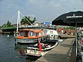
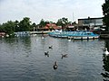
 'Hustler', Cabin Yacht, River Bure - geograph.org.uk - 4535841.jpg 2 048 × 1 536 ; 2,16 Mio
-
 11, Stalham Road, Hoveton - geograph.org.uk - 5662422.jpg 3 456 × 2 592 ; 3,77 Mio
-
 A private broad by Salhouse - geograph.org.uk - 2256718.jpg 1 500 × 984 ; 241 kio
-
 A view at Hoveton Hall Gardens.JPG 2 304 × 1 728 ; 1,79 Mio
-
 A view of Hoveton Hall Gardens 1.JPG 2 304 × 1 728 ; 1,69 Mio
-
 Access road to Leys Farm - geograph.org.uk - 4171208.jpg 640 × 480 ; 166 kio
-
 Access road to The Grange - geograph.org.uk - 4171146.jpg 640 × 480 ; 213 kio
-
 Across the Field - geograph.org.uk - 4174628.jpg 4 240 × 2 832 ; 5,6 Mio
-
 Angling Direct - geograph.org.uk - 5379673.jpg 640 × 480 ; 58 kio
-
 Approach to Hoveton on the A1062 (Horning Road) - geograph.org.uk - 903612.jpg 480 × 640 ; 149 kio
-
 Approaching Bure Valley Railway - geograph.org.uk - 5016918.jpg 4 608 × 3 456 ; 6 Mio
-
 Approaching Hoveton - geograph.org.uk - 5014938.jpg 4 512 × 3 324 ; 6,55 Mio
-
-

-

-

-
 Approaching the subway at Wroxham and Hoveton Station - geograph.org.uk - 2421082.jpg 3 888 × 2 592 ; 3,58 Mio
-
 Arid flower bed next to Sentiments - geograph.org.uk - 5379659.jpg 640 × 480 ; 79 kio
-
 B1354 leaving Hoveton - geograph.org.uk - 2463937.jpg 2 592 × 3 888 ; 4,48 Mio
-
 B1354 towards Coltishall - geograph.org.uk - 2421828.jpg 2 592 × 3 888 ; 5,04 Mio
-
 Battle of the Gauges (15113644788).jpg 4 000 × 2 671 ; 2,47 Mio
-
 Battle of the Gauges - geograph.org.uk - 4174769.jpg 4 000 × 2 671 ; 7,48 Mio
-
 Beauty Clinic and Hair Studio. Church Road - geograph.org.uk - 5378979.jpg 640 × 480 ; 70 kio
-
 Belaugh Lane Railway Crossing - geograph.org.uk - 6264156.jpg 4 608 × 3 456 ; 7,66 Mio
-
 Beneath Wroxham Railway Bridge - geograph.org.uk - 2469004.jpg 3 888 × 2 592 ; 3,43 Mio
-
 Bird café - geograph.org.uk - 4760208.jpg 640 × 441 ; 347 kio
-
 Bittern Line Train - geograph.org.uk - 2424289.jpg 3 888 × 2 592 ; 3,88 Mio
-

-
 Boarded-up house in Station Road - geograph.org.uk - 939825.jpg 640 × 480 ; 135 kio
-
 Boardwalk from Hoveton village - geograph.org.uk - 2468517.jpg 2 592 × 3 888 ; 5,5 Mio
-
 Boardwalk to Hoveton village - geograph.org.uk - 2468507.jpg 2 592 × 3 888 ; 5,5 Mio
-
 Boats on River Bure - geograph.org.uk - 5541528.jpg 4 000 × 3 000 ; 4,4 Mio
-
 Boats on River Bure - geograph.org.uk - 5541530.jpg 4 000 × 3 000 ; 3,78 Mio
-
 Boats on Wroxham Broad - geograph.org.uk - 3133982.jpg 640 × 480 ; 85 kio
-
 Boatyard at Wroxham - geograph.org.uk - 4732594.jpg 640 × 480 ; 457 kio
-
 Boatyard on the River Bure - geograph.org.uk - 2472155.jpg 3 888 × 2 592 ; 3,19 Mio
-
 Bridges over the B1354 - geograph.org.uk - 2463936.jpg 3 888 × 2 592 ; 6,87 Mio
-
 Bridleway through Palmer's Plantation - geograph.org.uk - 4171194.jpg 640 × 480 ; 273 kio
-
 Broads Hotel Cottage - geograph.org.uk - 939836.jpg 640 × 480 ; 151 kio
-
 Building Society in Station Road - geograph.org.uk - 5379664.jpg 640 × 480 ; 78 kio
-
 Bungalow in Long Lane - geograph.org.uk - 4171178.jpg 640 × 480 ; 184 kio
-
 Bure Valley Path - geograph.org.uk - 2423962.jpg 3 888 × 2 592 ; 5,45 Mio
-
 Bure Valley Path - geograph.org.uk - 2423971.jpg 3 888 × 2 592 ; 4,85 Mio
-
 Bure Valley Path - geograph.org.uk - 2423983.jpg 3 888 × 2 592 ; 4,42 Mio
-
 Bure Valley Path - geograph.org.uk - 2424272.jpg 3 888 × 2 592 ; 4,73 Mio
-
 Bure Valley Path and Railway - geograph.org.uk - 2424251.jpg 3 888 × 2 592 ; 4,65 Mio
-
 Bure Valley Railway and the Bittern Line - geograph.org.uk - 2424233.jpg 3 888 × 2 592 ; 7,68 Mio
-
 Bure Valley Railway and the Bittern Line - geograph.org.uk - 2453602.jpg 3 888 × 2 592 ; 4,8 Mio
-
 Bure Valley Railway and the Bittern Line - geograph.org.uk - 2463934.jpg 2 592 × 3 888 ; 3,87 Mio
-
 Bure Valley Railway approaching Wroxham - geograph.org.uk - 2453071.jpg 3 888 × 2 592 ; 3,81 Mio
-
 Busy junction in Wroxham - geograph.org.uk - 3133947.jpg 640 × 480 ; 70 kio
-
 Butchers in Station Road - geograph.org.uk - 5379670.jpg 640 × 480 ; 72 kio
-
 By the footpath along the River Bure - geograph.org.uk - 939858.jpg 480 × 640 ; 157 kio
-
 Calling the signal box - geograph.org.uk - 2453208.jpg 3 888 × 2 592 ; 2,94 Mio
-
 Cammi and Harriet (information board) - geograph.org.uk - 4760238.jpg 416 × 640 ; 324 kio
-
 Cammi and Harriet - geograph.org.uk - 4760237.jpg 640 × 360 ; 323 kio
-
 Cammi and Harriet at Wroxham Barns - geograph.org.uk - 4760235.jpg 640 × 518 ; 427 kio
-
 Camouflagephant - geograph.org.uk - 1059143.jpg 640 × 470 ; 133 kio
-
 Canton Orient Chinese Restaurant - geograph.org.uk - 2463943.jpg 3 888 × 2 592 ; 3,06 Mio
-
 Canton Orient Chinest Restaurant - geograph.org.uk - 2463940.jpg 3 888 × 2 592 ; 2,96 Mio
-
 Car Park at Wroxham Bure Valley Railway Station - geograph.org.uk - 2422711.jpg 3 888 × 2 592 ; 4,94 Mio
-
 Cars in Horning Road West - geograph.org.uk - 5378703.jpg 640 × 480 ; 66 kio
-
 Catering for the tourists - geograph.org.uk - 939804.jpg 640 × 480 ; 130 kio
-
 Channel off the River Bure - geograph.org.uk - 2256740.jpg 1 500 × 1 000 ; 184 kio
-
 Channel off the River Bure to houses - geograph.org.uk - 2256738.jpg 1 500 × 1 000 ; 204 kio
-
 Christmas tree at Wroxham Barns - geograph.org.uk - 4760211.jpg 640 × 360 ; 345 kio
-
 Christmas tree at Wroxham Barns - geograph.org.uk - 4760213.jpg 456 × 640 ; 448 kio
-
 Coloured Launches at Wroxham - geograph.org.uk - 2893398.jpg 1 024 × 708 ; 828 kio
-
 Common holly (Ilex aquifolium) with berries - geograph.org.uk - 4171184.jpg 640 × 589 ; 329 kio
-

-
 Cormorant (Phalacrocorax carbo) - geograph.org.uk - 5674443.jpg 1 000 × 662 ; 171 kio
-
 Cottage - geograph.org.uk - 2380442.jpg 1 600 × 1 200 ; 395 kio
-
 Courtyard Confectionery - geograph.org.uk - 4760223.jpg 640 × 520 ; 412 kio
-
 Crop field by Leys Farm - geograph.org.uk - 4171190.jpg 640 × 480 ; 145 kio
-
 Crop field near Belaugh Green - geograph.org.uk - 4962518.jpg 640 × 443 ; 43 kio
-
 Crop fields by The Grange - geograph.org.uk - 4171147.jpg 640 × 480 ; 188 kio
-
 Crop fields south of Long Lane - geograph.org.uk - 4171159.jpg 640 × 480 ; 208 kio
-
 Damaged fence - geograph.org.uk - 691743.jpg 480 × 640 ; 196 kio
-
 Didler's Mill, Hoveton Marshes - geograph.org.uk - 4734860.jpg 640 × 480 ; 581 kio
-
 Disused buffer stop beside the Bittern Line - geograph.org.uk - 2424018.jpg 3 888 × 2 592 ; 6,05 Mio
-
 Dydall's Drainage Mill on the River Bure - geograph.org.uk - 5458338.jpg 1 024 × 616 ; 245 kio
-
 Dydall's or Didler's Drainage Mill near Hoveton Marshes in Norfolk - geograph.org.uk - 5811458.jpg 3 728 × 2 795 ; 3,09 Mio
-
 Dydler's Mill - geograph.org.uk - 2380457.jpg 1 600 × 1 200 ; 382 kio
-
 Electricity sub-station near Hoveton and Wroxham Station - geograph.org.uk - 2421757.jpg 3 888 × 2 592 ; 4,02 Mio
-
 Entrance to Bridge Broad - geograph.org.uk - 2468461.jpg 3 888 × 2 592 ; 5,55 Mio
-
 Entrance to coach and car park - geograph.org.uk - 5016928.jpg 4 608 × 3 456 ; 6,17 Mio
-
 Entrance to Hoveton Great Broad - geograph.org.uk - 4732763.jpg 640 × 480 ; 649 kio
-
 Entrance to Hoveton Great Broad, Norfolk - geograph.org.uk - 5811450.jpg 4 032 × 3 024 ; 3,6 Mio
-
 Entrance to Hoveton Little Broad - geograph.org.uk - 870918.jpg 640 × 415 ; 132 kio
-
 Entrance to Junior Farm - geograph.org.uk - 4760216.jpg 640 × 452 ; 380 kio
-

-
 Entrance to Wroxham Barns - geograph.org.uk - 4760201.jpg 640 × 360 ; 270 kio
-
 Exit from Roys of Wroxham overflow car park - geograph.org.uk - 2421038.jpg 3 888 × 2 592 ; 5,25 Mio
-
 Fence on the edge of Long Covert - geograph.org.uk - 4171223.jpg 640 × 480 ; 303 kio
-
 Field beside the Bure Valley Path - geograph.org.uk - 2424217.jpg 3 888 × 2 592 ; 4,78 Mio
-
 Field south of Long Lane - geograph.org.uk - 4171153.jpg 640 × 480 ; 247 kio
-
 Flower bed in Horning Road West - geograph.org.uk - 5378707.jpg 640 × 480 ; 90 kio
-
 Footbridge over the B1354 - geograph.org.uk - 2421785.jpg 3 888 × 2 592 ; 5,99 Mio
-
 Footbridge over the B1354 - geograph.org.uk - 2421814.jpg 2 592 × 3 888 ; 4,66 Mio
-
 Footpath off Long Lane - geograph.org.uk - 4171186.jpg 630 × 640 ; 127 kio
-
 Footpath running parallel with Long Lane - geograph.org.uk - 4171210.jpg 640 × 480 ; 222 kio
-
 Former railway good building at Wroxham - geograph.org.uk - 2453581.jpg 3 888 × 2 592 ; 3,18 Mio
-
 Fred Roy.JPG 1 728 × 2 304 ; 1,57 Mio
-
 Free Moorings on Wroxham Broad Island - geograph.org.uk - 4736574.jpg 480 × 640 ; 522 kio
-
 Garage in Station Road - geograph.org.uk - 5379672.jpg 640 × 480 ; 45 kio
-
 Gated entrance by Long Covert - geograph.org.uk - 4171219.jpg 640 × 480 ; 265 kio
-
 Good Friday in Wroxham - geograph.org.uk - 5378996.jpg 640 × 480 ; 78 kio
-
 Good Friday in Wroxham - geograph.org.uk - 5379660.jpg 640 × 480 ; 56 kio
-
 Herbaceous Border Hoveton Hall Gardens.JPG 2 304 × 1 728 ; 1,71 Mio
-
 Hire boats lined up on Wroxham Broad - geograph.org.uk - 3133963.jpg 640 × 480 ; 76 kio
-
 Hire boats on the River Bure - geograph.org.uk - 3721807.jpg 640 × 480 ; 76 kio
-
 Holiday homes near Wroxham Bridge - geograph.org.uk - 2551850.jpg 3 888 × 2 592 ; 3,24 Mio
-
 Horning Road West (B1254) through Hoveton - geograph.org.uk - 4364120.jpg 640 × 480 ; 319 kio
-
 Horning Road West - geograph.org.uk - 5378695.jpg 640 × 480 ; 109 kio
-
 Hotel Wroxham - geograph.org.uk - 3037535.jpg 640 × 480 ; 63 kio
-
 Hotel Wroxham At Night - geograph.org.uk - 3037545.jpg 1 600 × 1 200 ; 269 kio
-
 Hotel Wroxham at night - geograph.org.uk - 5453313.jpg 1 024 × 683 ; 167 kio
-
 Hotel Wroxham Entrance - geograph.org.uk - 3037520.jpg 1 600 × 1 200 ; 303 kio
-
 House in Horning Road West (B1354) - geograph.org.uk - 4364121.jpg 640 × 480 ; 312 kio
-
 Houses in Church Road - geograph.org.uk - 5378968.jpg 640 × 480 ; 59 kio
-
 Hoveton and Wroxham Station and car park - geograph.org.uk - 5967112.jpg 3 838 × 2 880 ; 4,43 Mio
-
 Hoveton Great Broad from the nature reserve in 1989 - geograph.org.uk - 2480091.jpg 1 468 × 1 164 ; 441 kio
-
 Hoveton Hall Gardens Garden Roller.JPG 2 096 × 1 663 ; 1,38 Mio
-
 Hoveton Hall Gardens Gunnera Manicata.JPG 2 304 × 1 728 ; 1,73 Mio
-
 Hoveton Hall Gardens Hydrangeas.JPG 2 304 × 1 728 ; 1,8 Mio
-
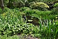
 Hoveton Hall Gardens Lake.JPG 2 304 × 1 728 ; 1,8 Mio
-
 Hoveton Hall Gardens Spider Garden.JPG 2 304 × 1 728 ; 1,76 Mio
-
 Hoveton Hall Gardens Vegetable Garden.JPG 2 304 × 1 728 ; 1,68 Mio
-

-
 Hoveton Hall Gardens, Drain flowing into the lake - geograph.org.uk - 6181445.jpg 5 643 × 3 762 ; 7,21 Mio
-
 Hoveton Hall Gardens, Gardener's Cottage in the Spider Garden - geograph.org.uk - 6178248.jpg 5 716 × 3 812 ; 7,17 Mio
-
 Hoveton Hall Gardens, Hostas in the Arboretum - geograph.org.uk - 6181433.jpg 6 050 × 4 033 ; 7,11 Mio
-
 Hoveton Hall Gardens, Lupins in the Spider Garden - geograph.org.uk - 6178263.jpg 6 341 × 4 228 ; 7,32 Mio
-
 Hoveton Hall Gardens, Passageway that leads to the Spider Garden - geograph.org.uk - 6178231.jpg 6 939 × 4 626 ; 7,8 Mio
-

-

-
 Hoveton Hall Gardens, Rhododendron in the Arboretum - geograph.org.uk - 6181439.jpg 6 078 × 4 052 ; 4,23 Mio
-
 Hoveton Hall Gardens, Rhododendrons in the Arboretum - geograph.org.uk - 6181435.jpg 6 049 × 4 031 ; 7,61 Mio
-
 Hoveton Hall Gardens, Spider Garden - geograph.org.uk - 6179372.jpg 6 223 × 4 148 ; 6,79 Mio
-
 Hoveton Hall Gardens, Spider Garden - geograph.org.uk - 6179391.jpg 6 347 × 4 231 ; 7,23 Mio
-
 Hoveton Hall Gardens, Spider Garden - geograph.org.uk - 6179400.jpg 6 629 × 4 419 ; 6,78 Mio
-
 Hoveton Hall Gardens, Spider Garden - geograph.org.uk - 6181420.jpg 6 799 × 4 532 ; 7,13 Mio
-
 Hoveton Hall Gardens, Spider Garden entrance - geograph.org.uk - 6181429.jpg 6 601 × 4 400 ; 7,68 Mio
-
 Hoveton Hall Gardens, Spider Garden, Abstract wooden sculpture - geograph.org.uk - 6179397.jpg 5 767 × 3 846 ; 6,65 Mio
-

-
 Hoveton Hall Gardens, Spider Garden, Fig tree - geograph.org.uk - 6179409.jpg 6 364 × 4 243 ; 7,63 Mio
-
 Hoveton Hall Gardens, Spider Garden, Four dog sculptures - geograph.org.uk - 6179382.jpg 6 142 × 4 094 ; 7,37 Mio
-
 Hoveton Hall Gardens, Spider Garden, Green beetle - geograph.org.uk - 6179403.jpg 4 275 × 2 850 ; 1,39 Mio
-
 Hoveton Hall Gardens, Spider Garden, Iris - geograph.org.uk - 6179394.jpg 5 978 × 3 985 ; 4,3 Mio
-
 Hoveton Hall Gardens, Spider Garden, Iris - geograph.org.uk - 6179395.jpg 5 840 × 3 894 ; 4,18 Mio
-
 Hoveton Hall Gardens, Spider Garden, Laburnum arch - geograph.org.uk - 6179407.jpg 6 199 × 4 132 ; 6,87 Mio
-
 Hoveton Hall Gardens, Spider Garden, Peony - geograph.org.uk - 6179360.jpg 6 627 × 4 418 ; 2,89 Mio
-
 Hoveton Hall Gardens, Spider Garden, Peony - geograph.org.uk - 6179392.jpg 5 582 × 3 722 ; 2,87 Mio
-
 Hoveton Hall Gardens, Spider Garden, Rose arch - geograph.org.uk - 6179404.jpg 6 491 × 4 327 ; 7,75 Mio
-
 Hoveton Hall Gardens, Spider Garden, Roses on the north wall - geograph.org.uk - 6179385.jpg 5 913 × 3 941 ; 6,67 Mio
-
 Hoveton Hall Gardens, Spider Garden, Sculpture - geograph.org.uk - 6179386.jpg 6 506 × 4 337 ; 6,78 Mio
-
-
 Hoveton Hall Gardens, Spider Garden, The Gardener's Cottage - geograph.org.uk - 6181426.jpg 5 968 × 3 978 ; 7,39 Mio
-

-
 Hoveton Hall Gardens, The Arboretum - geograph.org.uk - 6181447.jpg 5 826 × 3 884 ; 7,61 Mio
-
 Hoveton Hall Gardens, The Lake - geograph.org.uk - 6179347.jpg 6 199 × 4 132 ; 7,01 Mio
-
 Hoveton Hall Gardens, The Spider Garden - geograph.org.uk - 6178241.jpg 6 670 × 4 446 ; 6,96 Mio
-
 Hoveton Park - geograph.org.uk - 24663.jpg 480 × 640 ; 76 kio
-
 Hoveton Village Hall - geograph.org.uk - 5675228.jpg 1 000 × 662 ; 684 kio
-
 Hoveton ^ Wroxham station, Bure Valley NG Railway, 1997 - geograph.org.uk - 5661833.jpg 2 343 × 1 223 ; 2,41 Mio
-
 Hoveton ^ Wroxham Station, spring 2017 - geograph.org.uk - 5352445.jpg 640 × 480 ; 74 kio
-
 Hoveton ^ Wroxham, junction of Bure Valley NG Railway, 1997 - geograph.org.uk - 5661822.jpg 2 353 × 1 315 ; 2,15 Mio
-
 Hoveton, St. Peter's Church - geograph.org.uk - 6174017.jpg 6 589 × 4 393 ; 7,45 Mio
-
-
 Hoveton, St. Peter's Church, Northern aspect - geograph.org.uk - 6174058.jpg 7 127 × 4 751 ; 7,8 Mio
-
 Hoveton, St. Peter's Church, Northern aspect - geograph.org.uk - 6174059.jpg 5 833 × 3 887 ; 6,71 Mio
-
 Hoveton, St. Peter's Church, South eastern aspect - geograph.org.uk - 6174067.jpg 6 658 × 4 439 ; 7,17 Mio
-
 Hoveton, St. Peter's Church, South porch - geograph.org.uk - 6174069.jpg 3 665 × 5 497 ; 5,19 Mio
-
 Hoveton, St. Peter's Church, Southern aspect - geograph.org.uk - 6174022.jpg 6 404 × 4 269 ; 7,48 Mio
-

-
 Hoveton, St. Peter's Church, The nave - geograph.org.uk - 6174032.jpg 7 145 × 4 763 ; 5,66 Mio
-
 Hoveton, St. Peter's Church, The nave - geograph.org.uk - 6174037.jpg 7 499 × 4 999 ; 5,36 Mio
-
 Hoveton, St. Peter's Church, The south entrance and font - geograph.org.uk - 6174040.jpg 7 682 × 5 121 ; 5,06 Mio
-
 Hoveton, St. Peter's Church, The south wall - geograph.org.uk - 6174035.jpg 7 488 × 4 993 ; 4,82 Mio
-

-
 Hoveton, St. Peter's Church, Western aspect - geograph.org.uk - 6174052.jpg 6 935 × 4 623 ; 7,79 Mio
-
 Ice Cream Boat, River Bure - geograph.org.uk - 4735777.jpg 640 × 481 ; 505 kio
-
 Industrial Estate adjacent to the railway - geograph.org.uk - 2423910.jpg 3 888 × 2 592 ; 4,07 Mio
-
 Inlet off the River Bure - geograph.org.uk - 2469007.jpg 3 888 × 2 592 ; 5,73 Mio
-
 Inside St John, Hoveton (a) - geograph.org.uk - 5378738.jpg 480 × 640 ; 40 kio
-
 Inside St John, Hoveton (b) - geograph.org.uk - 5378739.jpg 640 × 480 ; 67 kio
-
 Inside St John, Hoveton (c) - geograph.org.uk - 5378740.jpg 480 × 640 ; 59 kio
-
 Inside St John, Hoveton (d) - geograph.org.uk - 5378741.jpg 640 × 480 ; 80 kio
-
 It's called Waveney Close - geograph.org.uk - 4557875.jpg 1 024 × 768 ; 278 kio
-
 Junction in Wroxham - geograph.org.uk - 3133777.jpg 640 × 480 ; 72 kio
-
 Junction of Marsh and Church Roads - geograph.org.uk - 5378972.jpg 640 × 480 ; 61 kio
-
 Kings Head sign - geograph.org.uk - 5541546.jpg 1 335 × 1 780 ; 722 kio
-
 Lamppost in Norwich Road - geograph.org.uk - 5378998.jpg 640 × 480 ; 77 kio
-
 Land Acquired Sign Beside A1151, Hoveton, Norfolk. - geograph.org.uk - 2880160.jpg 2 272 × 1 704 ; 1,63 Mio
-
 Landamores boat builders - geograph.org.uk - 2453586.jpg 3 888 × 2 592 ; 2,8 Mio
-
 Landamores boat builders - geograph.org.uk - 2462506.jpg 3 888 × 2 592 ; 4,11 Mio
-
 Long Lane past Long Covert - geograph.org.uk - 4171228.jpg 640 × 480 ; 269 kio
-
 Looking east-southeast in Horning Road West - geograph.org.uk - 5378699.jpg 640 × 480 ; 94 kio
-

-
 Looking north-northwest in Station Road - geograph.org.uk - 5379662.jpg 640 × 480 ; 66 kio


_-_geograph.org.uk_-_903612.jpg)


.jpg)


_-_geograph.org.uk_-_4760238.jpg)


_with_berries_-_geograph.org.uk_-_4171184.jpg)

_-_geograph.org.uk_-_5674443.jpg)


_through_Hoveton_-_geograph.org.uk_-_4364120.jpg)


_-_geograph.org.uk_-_4364121.jpg)


_-_geograph.org.uk_-_5378738.jpg)
_-_geograph.org.uk_-_5378739.jpg)
_-_geograph.org.uk_-_5378740.jpg)
_-_geograph.org.uk_-_5378741.jpg)


